Our first attempt in July at completing the winter Crossing may have been sabotaged by the weather, but our second attempt in August was the complete opposite – a bluebird day with beautiful views all the way across.
Length: 19.4km one-way trip, including a 1,196m change in elevation
Time taken: 9.5 hours
Difficulty: Difficult – in winter I would highly recommend guides for anyone inexperienced or unconfident in winter alpine conditions.
Facilities: There are toilets (without paper) peppered along the track, with the longest break being right in the middle of the tramp – check out the map on this brochure. Running and still water in the Park is not safe to drink due to the high levels of dissolved minerals from the volcanic rock it passes through – however up higher there’s usually plenty of freshly fallen snow to melt down.
– Important: This is a very exposed alpine tramp involving high fall/slide and avalanche risks, as well as very changeable weather conditions. Do not attempt if the weather isn’t favourable, if the avalanche risk is high, or if you are not confident in this kind of terrain. In winter, helmet, crampons and ice axe (and the knowledge to safely use them) are mandatory. –
If you haven’t already read the adventure that was our first attempt at a winter Crossing, check out my blog post here (which has more general details about the tramp). Otherwise read on!
Second attempt – August, Adventure Outdoors
Following our failed July attempt, Grace and I continued to keep an eye on the weather forecast; determined that our second winter attempt would be a bluebird day. After about a month of looking, I spied what I thought might be our weather window. Luckily Grace is the kind of friend that when you call on a Friday evening to ask if she wants to drive four hours the next day to do a nine hour hike, she says yes and starts packing.
Although we’d planned on attempting the Crossing on our own this time around, I arrived in National Park to find that the rental companies were uncomfortable renting out gear to non-guided individuals due to the moderate-high avalanche risk on parts of the route. My inexperience was coming in to play again, I’d been checking the weather forecast, but hadn’t been checking the avalanche advisory and after four days of snow the faces were loaded.
Grace and I both agreed that the safer decision was to go with a guiding company again – part of being a smart tramper is knowing your limits and listening to those with more experience. The locals recommended a different guiding company to the one we’d gone with on our first attempt; Adventure Outdoors. My investigations into renting gear had already accidentally led me to the doorstep of their boss, Sarah’s, house, which she luckily didn’t hold against me when Grace and I called her back to book in for the next day.
Vacancy signs are a rare sight in National Park over winter weekends, with the main North Island ski fields being so close. When I called around no-one had any free rooms; one kind motel owner said that Taupō (more than an hour’s drive away) would have the closest accomodation, and another offered me a basic tent site for $30+. So in the end Grace and I went with what had initially been our Plan A anyway, and stayed Saturday night on the Crossing itself; walking along the Crossing for about 25 minutes through the drizzly rain to the crowded Mangatepopo Hut.
Because of the fluffing around sorting out gear vs. guides, we set off later than planned and ended up having to go back to the carpark in the rain to grab my sleeping mats, as all the bunks were taken – I can now say that I know that particular patch of track very well, having gone over it five times in less than 24 hours!
After sunset and a fricking delicious dinner of lamb & wild mushroom risotto from Back Country Cuisine, the rain stopped and the clouds lifted, so Grace and I went for a brief walk up the valley using only the full moon to light our way (although we took our head torches just in case). It was magical; the light was so bright that we could see all the detail of the track and each other’s faces, as well as the stars overhead and mountains surrounding us. Although chilly, that walk was one of my favourite parts of the whole trip.
Sleeping on top of the benches in the common area was not the most comfortable night’s sleep; I think I got about 4 hours of shut-eye and Grace got less because she’d very kindly taken the shorter bench. Not ideal when you’re tackling a long hike the next day. On the plus side though, we didn’t have anyone snoring next to us!
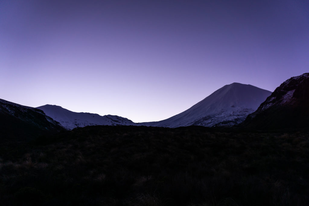
I got up at one point during the night to go to the long drop toilet outside the hut, and as I snuck quietly out the front door the view almost stopped in my tracks – Ngauruhoe was completely clear of cloud and lit up in all his magnificence by the full moon. That more than made up for the uncomfortable sleep.
The alarm went off at 6am, just before the horizon started lightening. After a quick breakfast and staring at the beautiful view and the changing light, we were back on the track to the carpark to drop off our overnight gear and wait for the guides.
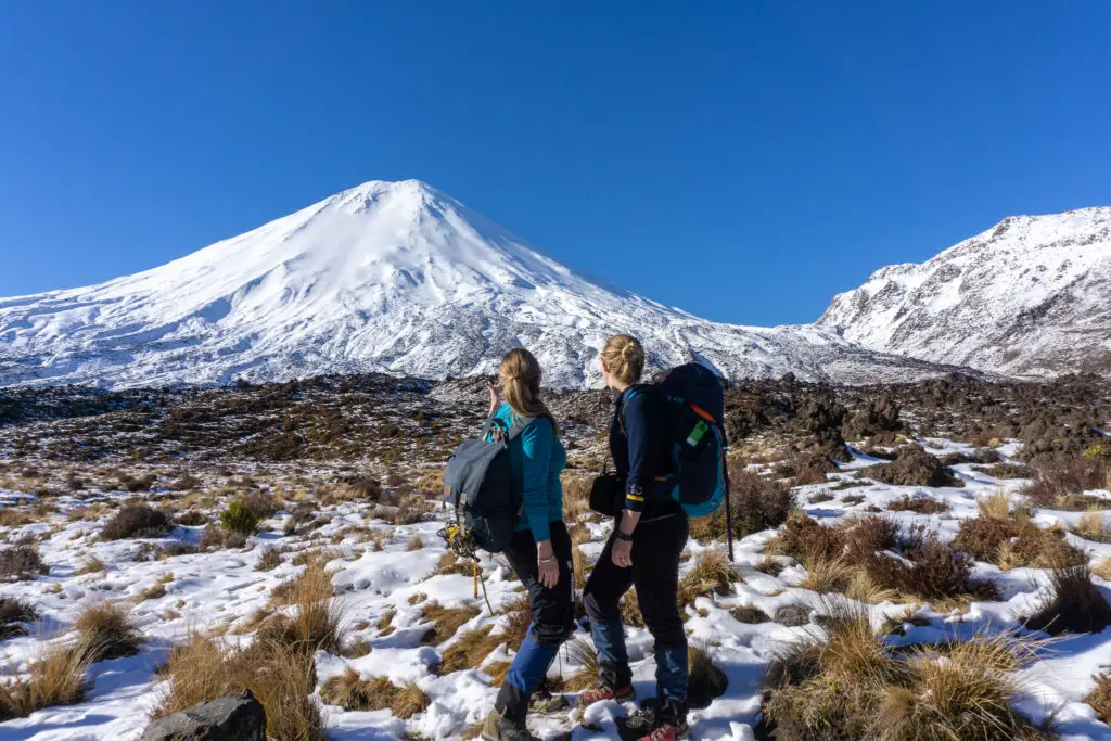
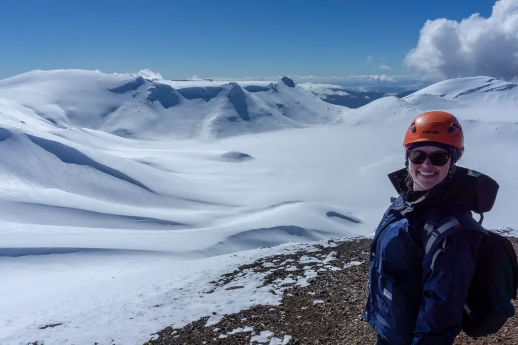
The guides had already been warned that there were two Kiwi girls coming along and wanting to learn some skills. We were split into smaller groups of about 5-6 people with a guide each. Sarah had paired us with Jah, who was super knowledgeable not only in terms of alpine skills, but also with regards to the terrain, geology, volcanology, fauna & flora, and Māori legends about the surrounding area.
The legend of Taranaki, Tongariro and Pihanga
According to legend, Taranaki and Tongariro; two warrior gods personified by mountains, fell in love with the beautiful forest-clad Pihanga, another nearby mountain. The two mountain gods fought for her affection in a fiery and explosive battle. During the fighting, Tongariro lost his head (some legends say he pulled it off to throw at Taranaki, others say Taranaki cut if off with a massive blow). Tongariro’s head fell into Lake Taupõ and is now known as Moututaiko Island.
At the end of the battle however, Taranaki was defeated and banished to the west. He left the other mountains, carving out a scar in the landscape as he went which filled with his tears to form the Whanganui River. Tongariro now stands in between Taranaki and Pihanga, forever blocking Taranaki’s view of his beloved (although some stories say he was comforted by, and eventually fell in love with, Pouakai; the mountain range that he now sits next to on the coast).
The full Crossing
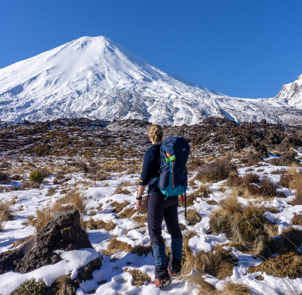
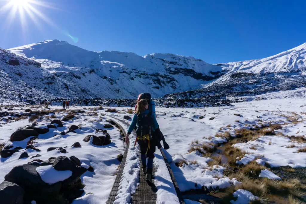
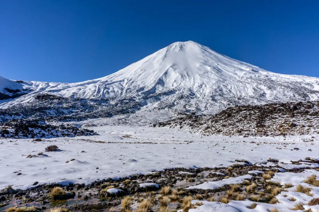
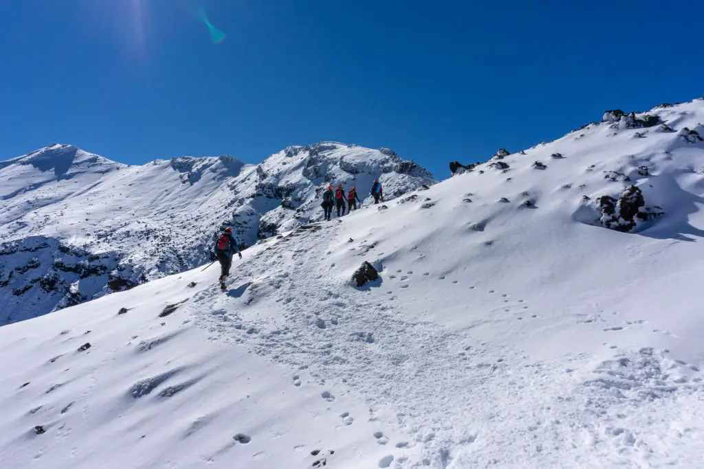
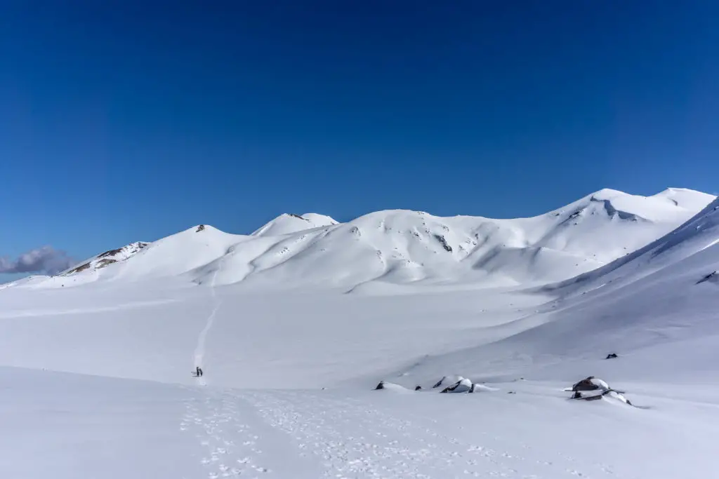
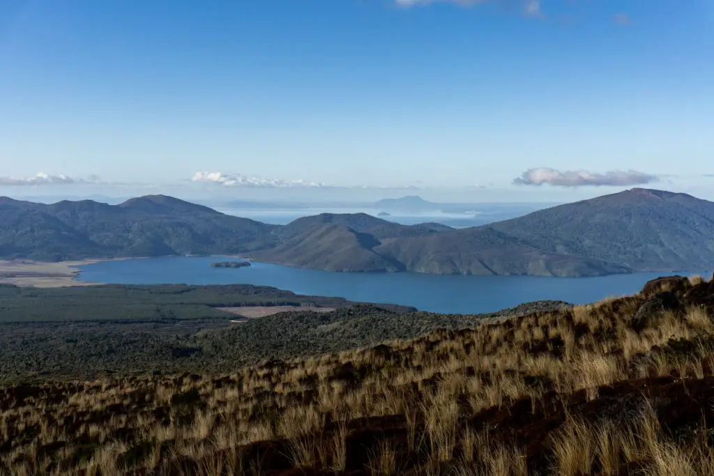
We walked along the same track up the Mangatepopo Valley as we had one month earlier, but this time around it felt like a completely different trip. With not a cloud in the sky, and absolutely no fog, I could see everything! Beautiful Ngauruhoe kept drawing my eyes like a magnet, as well as all the little details that had been hidden on our first trip. The snow was lower down too, and we were soon walking along the boardwalk which had been completely clear on our first attempt, but was now covered with ice and snow (thankfully the guides had already done the hard yards and cut a path through for us, so we didn’t have to even worry about sliding over on the compacted snow).
Before we knew it we’d already reached the bottom of the staircase, walking through what looked like small white sand-dunes, but were in reality frozen snow-covered tussocks. We took advantage of the last set of toilets for the next few hours, put on our crampons (much earlier than our last trip due to the amount of snow) and set off up the staircase.
I found going up the staircase much more challenging this time around, even though the conditions were anything but. The sun was out, which meant it was hotter, but because of the slide risk, we were instructed to wear gloves and long sleeves. Our guides told us numerous stories about people with bare arms falling and sliding down the side of the mountain, and grazing skin down to the bone from friction against the ice. So while it was a bit annoying to be covered up when I was already so hot from the sun and the effort of climbing up the stairs, it was a better alternative than risking injury!
Because the conditions were so much better, we also weren’t having to stop as often for the guide to cut away the ice on the stairs (the stairs weren’t even really visible in a lot of parts; completely covered with snow, which we could easily walk up with our crampons). So what had seemed like an easy ascent the first time around, was a lot more challenging this time, but we made it!
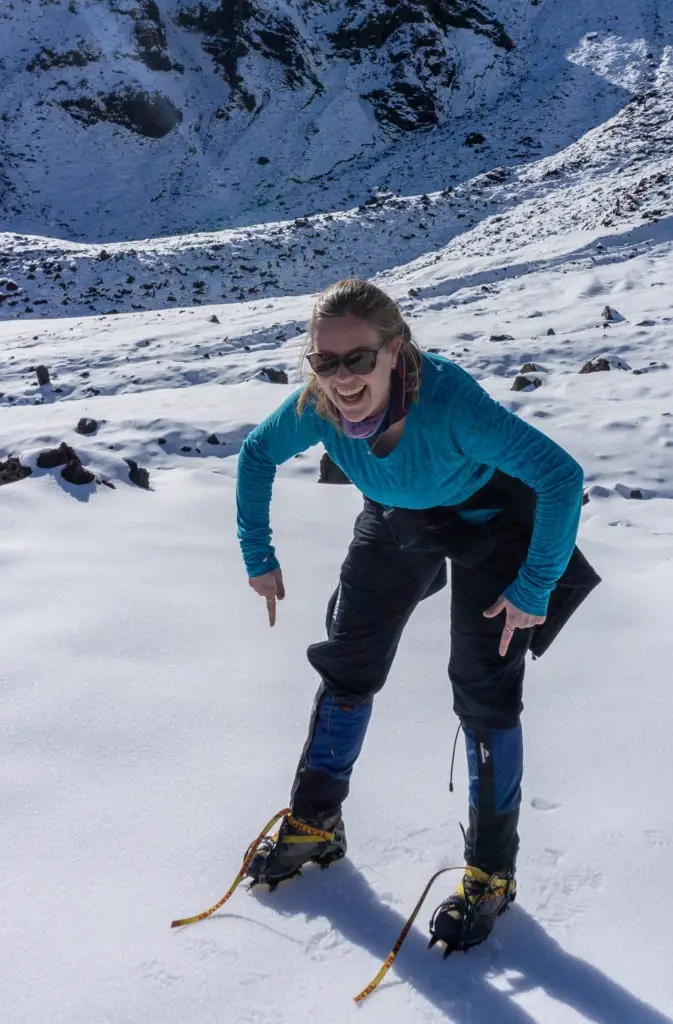
In South Crater, we met up with some of the other small groups and practiced self-arresting on a safe slope. The guides needed to see us complete three self-arrests before they would take us up Red Ridge. I was really impressed by Adventure Outdoor’s commitment to safety, and also willingness to teach the skills necessary to be safe while hiking in this kind of terrain.
We had a lot of fun sliding down the slope, flipping over and stopping with our ice axes, but didn’t have a lot of time to practice before it was time to go – we’d spent too long staring at the beautiful scenery on the way up and were behind schedule. We had to make it up to the top of Red Ridge; the highest point on the Crossing, before 1pm or we wouldn’t be able to make it all the way across with the limited winter daylight hours.
My legs were happy to be walking along the flat crater after the staircase, and it was amazing to be able to see the 360 degree views which I’d had to imagine from Grace’s descriptions on our last attempt, as we’d trekked through an icey blizzard. There was hardly anyone around other than our group, and I was so happy to be out experiencing the beautiful snow-covered volcanoes.
We reached the bottom of Red Ridge and started climbing up, again quite a lot harder than previously due to a much quicker pace and needing fewer stops. From here on out, it was new terrain for me, as this is where we’d had to turn around last time. The views down the side of the ridge were amazing, but now that I could actually see the views I was a bit sketched out that we’d come up here in such bad, windy conditions last time!
Climbing up Red Ridge was the only scary part of the whole trip, and I was beyond grateful for my crampons, which gave me confidence on the slick ice that covered parts of the ridge. There were a few places where I had to stop and wait on the guide to cut away some steps in the ice, and got vertigo when I looked down. In summer this part has a chain for people to hang on to, although that was only put in a few years ago and is buried under snow/ice in winter.
Halfway up we saw a couple coming down in sneakers, which seemed like a death wish. One slip and you were over the side. Our guide, Jah, very kindly enquired how they were doing and gave them some advice for the rest of the way down, but I guessed that deep down he was probably fed up with people putting themselves (and others) at risk by not being prepared for the conditions and not knowing their own skill level.
One of Jah’s stories about someone slipping and sustaining really horrendous ice burns had happened on this ridge; his group had been walking through the crater towards Red Ridge and had seen someone (not wearing crampons) slip off from high up and fall all the way down to the bottom of the crater.
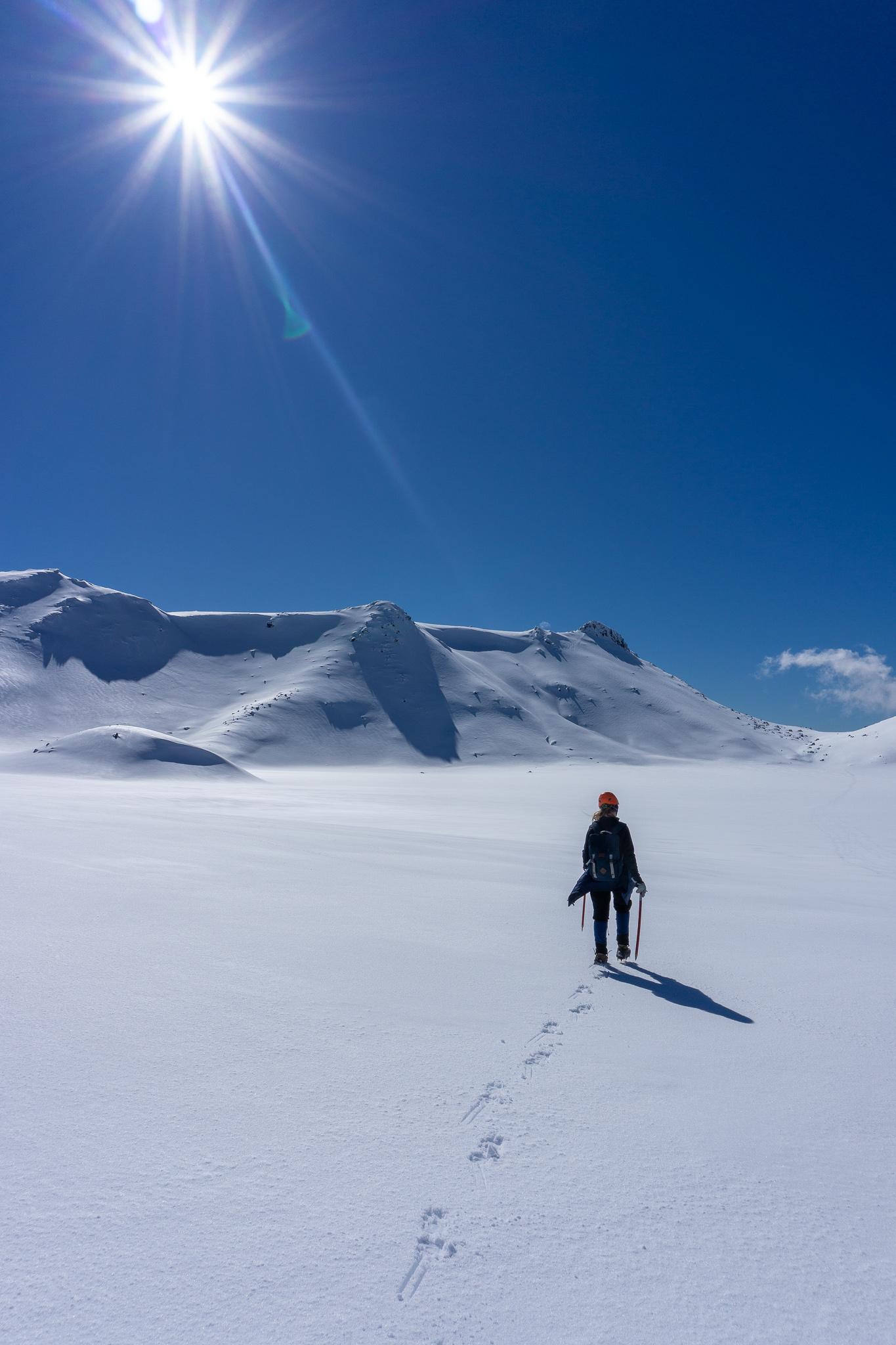
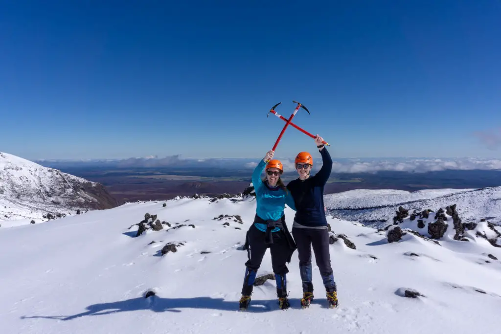
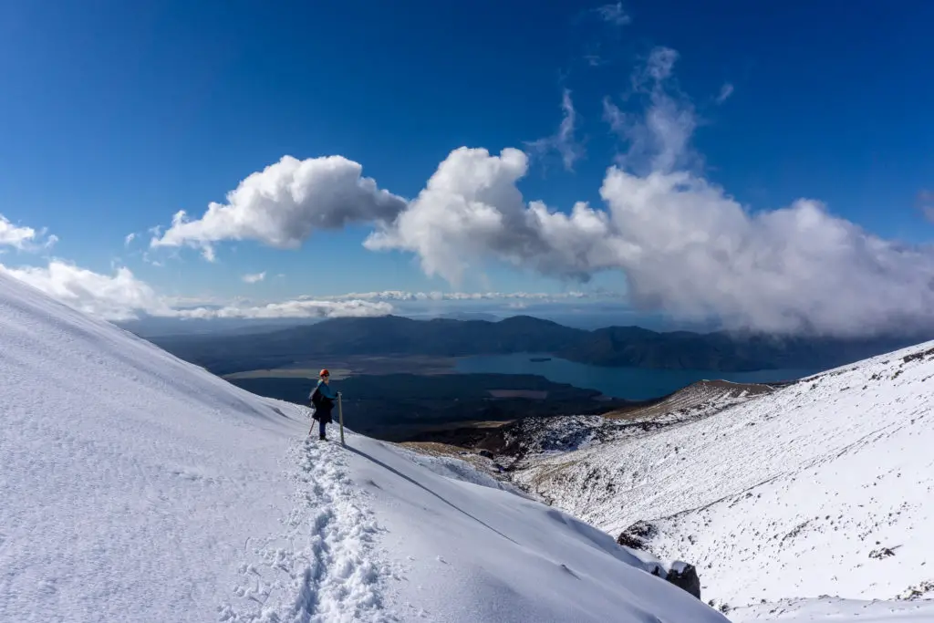
We all made it up safely to the false summit (where the above photo is taken) and then to the true top where we stopped for lunch. I’m assuming the couple going back the other way made it down safely as well, because we didn’t hear any helicopters. Just over the ‘summit’ on the northern side are some rocks heated by the volcano; they’d melted away all the snow around them and made for a fantastic spot to stop, soak up the warmth and eat a quick lunch. We’d made it to the top in time! And the guided group who’d gone on ahead had checked out the snow conditions on the northern part of the Crossing and said that we were a go – we were going to make it all the way across after all!
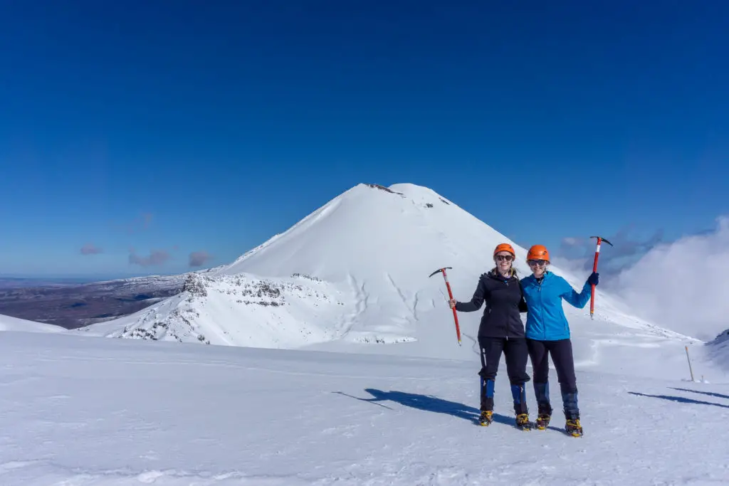
Unfortunately because of the snow, the beautiful Emerald Lakes were frozen over (they’re not warm, but have a pH of about 3-5), but the views were still magnificent! Grace showed me where the summer track normally goes, but we took a different route; heading straight down the first ridge line you can see in the photo to the left of Grace. The snow conditions were perfect for crampons, it felt like we were walking down a solid sand dune, and because of the crampons, I felt comfortable going down the steeper parts of the ridge.
We’d met up with another guided group from a different company at this point, and the lead guide had to tell one of his trampers off when the guy sat down to slide down the hill while wearing crampons. Our guides had already told us not to slide with them on, as you risk breaking your leg(s) if the crampons catch on the snow and instantly stop your descent (which is what had happened to Jah a few years ago; breaking both his legs simultaneously). Adventure Outdoors were living up to their promise to teach us lots of skills and safety awareness, often directly from the guides’ own experiences!

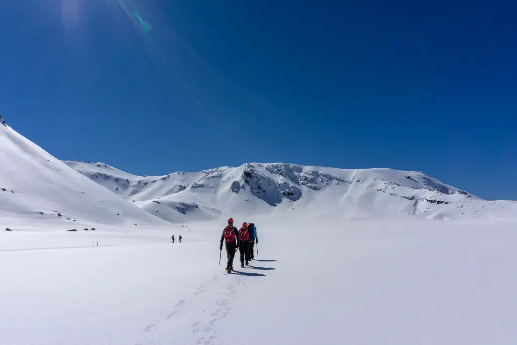
We headed through our last crater; North Crater, directly to the northern saddle, still with barely any clouds in the sky. We’d really lucked out with the weather! It felt like walking on a snowy moon, and made me excited to come back in summer (although not as excited when I think of the crowds of people that summer brings).
The small, easy climb up to the saddle marked one of the last climbs on the Crossing, and I were very thankful for this. I’d trained a bit in the lead up to our first attempt a month earlier, but had let the training lapse a little in the interim – and my legs were letting me know about it.
The walk from the saddle, was the part of the route which had the guides concerned about avalanche risk. According to Jah, one of the only avalanches to cause bodily harm on Tongariro came down through one of the gulleys that we were about to cross. Luckily the group in front of us had already cut a track through the snow, and also cut out a snow pit to check the snow layers for avalanche risk.
Because our guides knew that Grace and I wanted to learn as much as we could, they made sure to show us the snow pit and explain how it helped them judge whether the snow was safe enough to cross or not. They also gave us lots of little pieces of knowledge about avalanches, including that the majority of slab avalanches only occur on slopes with a 30 – 45 degree incline – basic information that all backcountry hikers, skiers or snowboarders should be aware of. (Click on the links for more avalanche safety info)
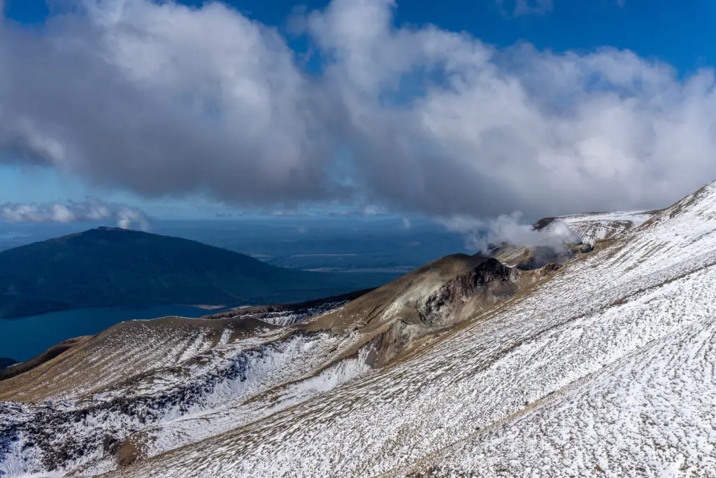
We slowly inched our way along the side of the mountain and around to the zig zags heading down towards Ketetahi Hut (which was the first toilet stop since putting on our crampons before the staircase up to South Crater). Ketetahi Hut is permanently closed following damage it sustained in the 2012 eruption, but was a nice spot to rest on the deck seating outside. Luckily no-one was in the hut at the time of the eruption, as boulders flew through the roof, damaging the common area and the bunk room.
My favourite quote from this article about the eruption is from a local who’d experienced the much larger Ruapehu eruption in 1995, and who said that the 2012 eruption was “like a big old giant who has woken up, farted, rolled over and gone back to sleep”.
The snow had started to get patchy the closer we got to the hut, and soon after leaving the hut and continuing the descent, the guides told us we could take off our crampons and helmets, and stow away our ice axes. I had a bad case of helmet hair, but it felt very nice for my scalp to have a breather, as well as not having heavy metal spikes attached to my boots.
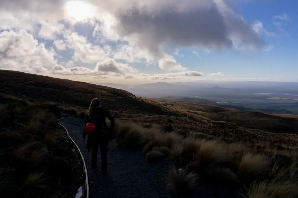
Although the views from this part of the track were stunning, particularly as the sun started to approach the horizon and light everything up with golden hues, Grace and I were exhausted after having been on the go from very early that morning with little sleep, and after having been tramping for 8 hours. I tried my best to take them in, but I almost enjoy looking back at the photos now more than I did looking at the view at the time, which is unusual for me! I really only had enough room left in me for the desire to stop walking, especially since the snowy, exciting part of the trip was over.
It took just under 2.5 hours from Ketetahi hut to get to the carpark, which was heart-breaking since the signs had informed us it would be 2 hours – Grace and I started expecting the carpark around every corner from 5.10pm but we didn’t arrive until 5.30pm; those extra 20 minutes were absolute killers. But when we arrived at the carpark it was to everyone from the guided groups who’d arrived before us cheering, and the guides offering us cold beer or lemonade.
Grace and I shared around some of our chocolate (we’d somehow managed to between us bring approximately 5 blocks of chocolate). We were the only Kiwis in the Adventure Outdoors group, so it felt good to be introducing them to Whitakers (no, I’m not sponsored, but yes, I would like to be – Whitakers if you’re reading this, get in touch, I think I’m almost definitely your biggest non-business consumer!). We waited for the rest of our group to arrive, chatting with our fellow trampers and guides, and looking through our photos, while stuffing our faces with the left-over chocolate we hadn’t manage to eat during the tramp.
We’d got up at 6am that morning, started from Mangatepopo carpark at 8am and arrived at Ketetahi carpark at 5.30pm; a massive day. My legs had slight tremors when I stood up to get in the van back to Mangatepopo carpark where we’d left my car, but thanks to all the chocolate (or stretching, or soaking in the spa) and despite the two hours’ drive home from National Park, I wasn’t actually too sore in the following days – I could even walk down stairs properly (after Mueller Hut, the last tramp I’d gone on with Grace, I’d had to cling to the handrail for a week going down stairs).
It was a very full day and an amazing adventure, that I was very grateful to be able to experience safely (thanks Adventure Outdoors!) with a lovely friend (thanks Grace!).
I can’t wait to return in the warmer months!
Safety
As always, please stay safe when you’re out exploring. Follow the Outdoor Safety Code:
- Choose the right trip for you (read my article on tramping safety, speak to DOC)
- Understand the weather (including avalanche advisory)
- Pack warm clothes and extra food (check out my post here about what gear you need to take). In winter you will need crampons, ice axe and helmet – and guides if you’re not experienced or confident.
- Share your plans and take ways to get help (have an emergency beacon on your person)
- Take care of yourself and each other
If you’re not feeling super confident then you can always get in touch with me here on the blog or on my Instagram. Or take a look at my Tramping 101 series which includes this post about how to stay safe in the outdoors.
Also don’t be a dick, check out my guide to New Zealand tramping etiquette.
Stay safe and get outside!