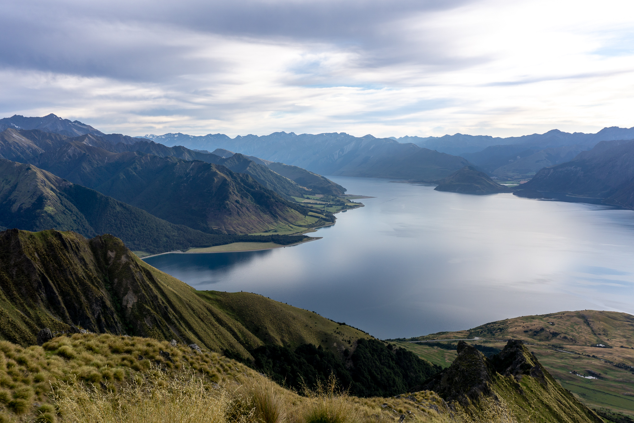
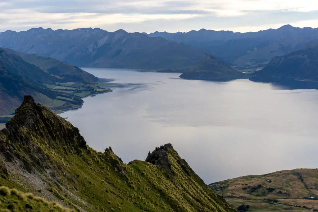
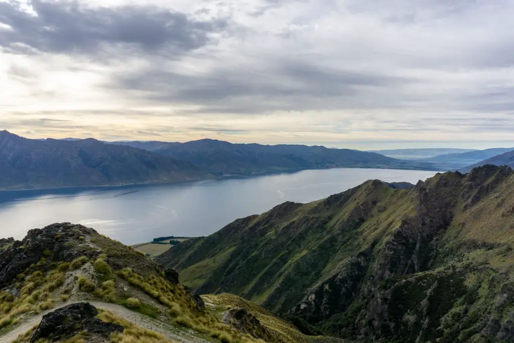
Isthmus Peak has beautiful views over both Lake Hawea and Wanaka (to for the unimaginative 4WD track up). It’s a fantastic alternative to the more popular Roy’s Peak closer to Wanaka.
Length: 16km return with ~1,000m elevation gain
Time taken: 6 hours
Difficulty: moderate (good level of fitness required to enjoy, but very easy track to follow)
Facilities: there is a feral port-a-loo at the lower carpark in summer (closest other public bathroom is in Hawea), but no other facilities, so make sure you take plenty of water and sunscreen.
– Note: Isthmus Peak Track is closed annually between 20 November – 20 December for fawning. The track crosses private farmland (and there can sometimes be hunters present) so please stick to the track. –
Why Isthmus Peak?
I’d been wanting to tackle Isthmus Peak for quite a while, but living in the North Island was making that a little difficult. It’s a very similar alternative to the extremely busy Roy’s Peak, if walking up a steep 4WD track with thousands of other people doesn’t appeal. Isthmus Peak has plenty of views to go around over both Lake Hawea and Lake Wanaka and isn’t quite as popular as Roy’s Peak (yet, give it time). It’s also mainly up a 4WD track so is well graded despite being all uphill (although a bit boring to walk up compared with a track).
How to get to the trailhead for Isthmus Peak?
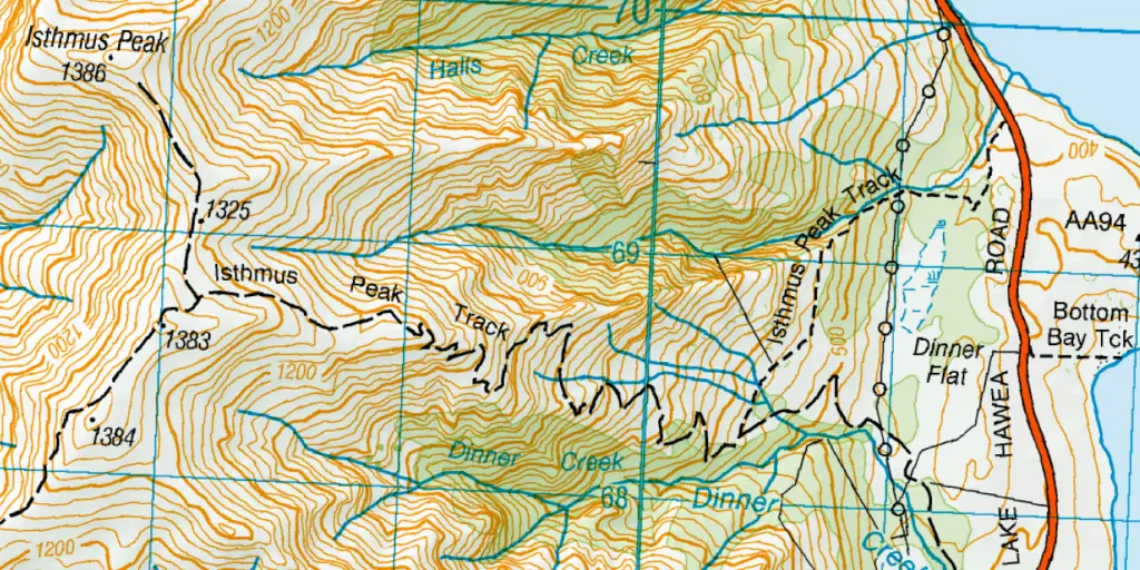
The trailhead for Isthmus Peak is located just below the isthmus (ha!) separating Lake Wanaka and Lake Hawea (also known as the Neck). Drive up SH6 from Hawea towards Makarora and the West Coast. After about 17km of driving alongside Lake Hawea (and passing a viewpoint on your right just over halfway along, which is well worth a stop), you’ll see the two parking areas on the right hand side of the road (which are handily marked on Google Maps).
The carparks come up quite quickly, and are easy to miss if you’re driving fast. The trailhead is between the two on the opposite side of the road from the lake – cross the road carefully in a sensible place as it can be a busy at times with fast traffic.
Hiking up Isthmus Peak
The alarm sounded at 3am on the first day of 2019. Instantly regretting the decisions that had led me to this point, I pulled aside the bed covers and got up. It was too late to back out now.
Dad and I drove towards Hawea, threading through the Cardrona Valley. We wound down our windows to listen to the music still pumping from the stage at R&A as we flew past; the festival goers were only just going to bed and we’d been up for almost an hour. We arrived at the trailhead for Isthmus Peak and I stood looking up at the peak I could barely make out against the still dark sky. It was going to be a climb.
The sign at the lower carpark points rather unhelpfully towards a steep bank, but Dad had done this walk twice before so knew to follow the marker poles halfway up to the other parking. A track sidles off from here up the hill through the long grass. It was still dark, so Dad had his head torch out while I trusted my (admittedly terrible) eyesight. The first 30 – 45 minutes is relatively steep going on a walking track that sidles alongside the farmer’s fence on the left and the gorge created by Stewart Creek on the right. The last part of this section is a small (but steep) scramble up a bit of a rocky face, before turning to the left and sidling along the hill to reach the start of the 4WD track.
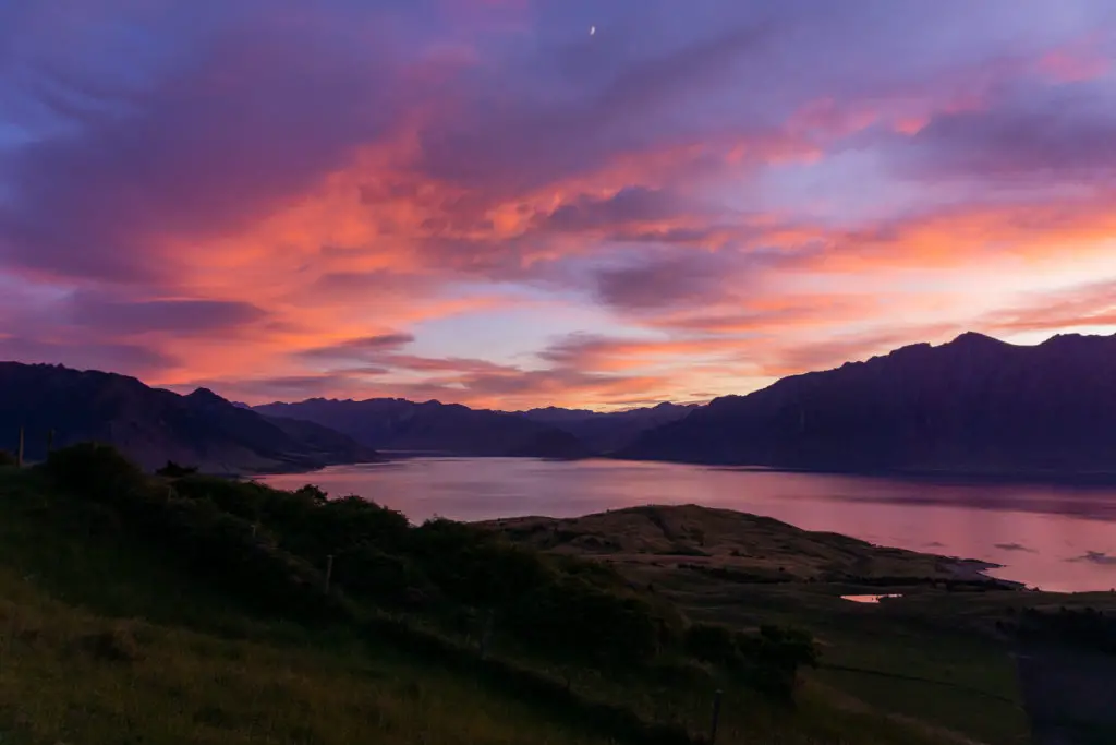
Sunrise
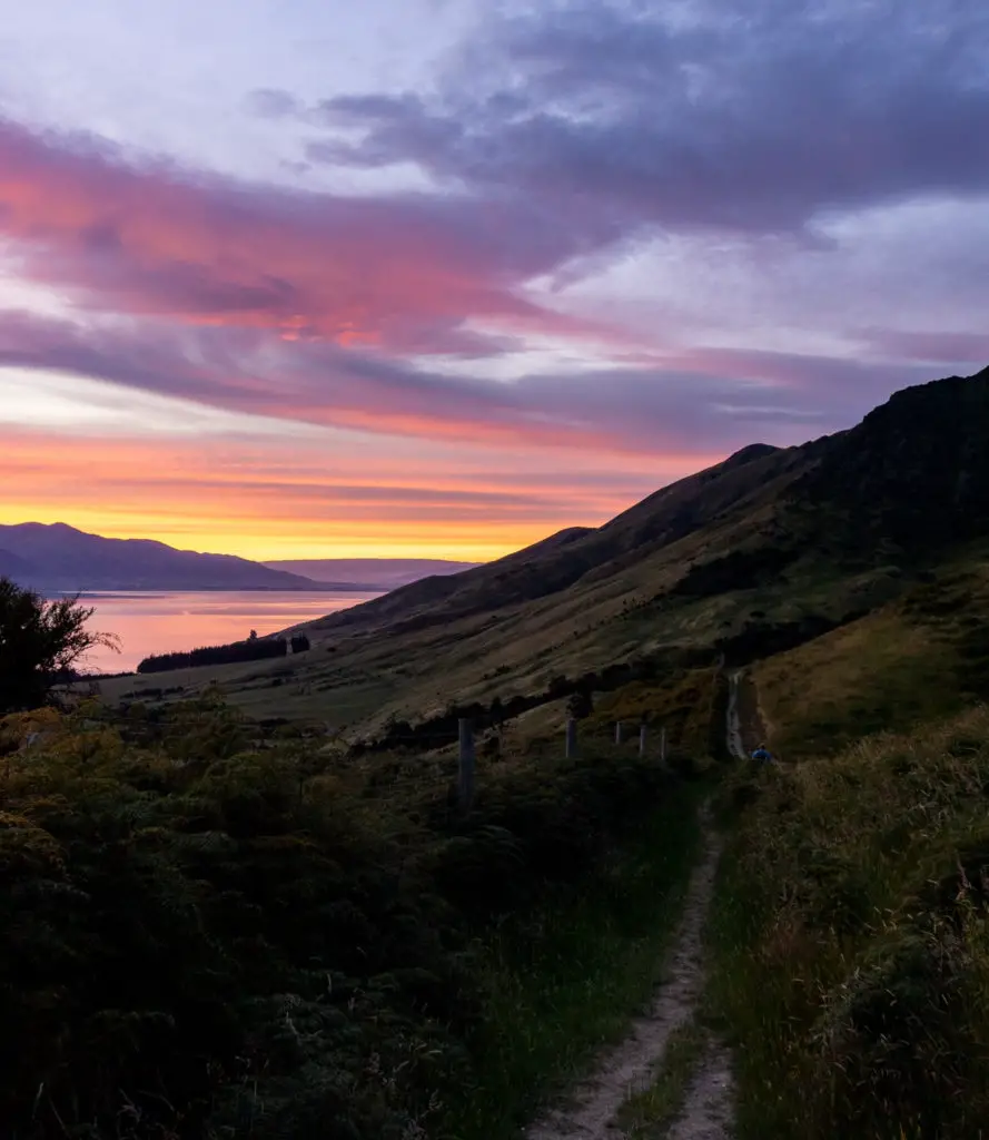
By the time we got to the flat path through paddocks linking the first steep section and the 4WD track, the sky had well and truely started to put on a show. I had a hard time keeping my eyes on the track. I stumbled a few times looking up at the colours.
Once across the relatively flat track over the paddocks, we reached some low scrub and the 4WD track. As this is farmer’s property, there is livestock and occasional hunting, so stick to the obvious track. The first few zig-zags were a struggle, and the glares from the resident sheep and adolescent lambs as I disturbed their rest didn’t help motivate.
Zig-zags
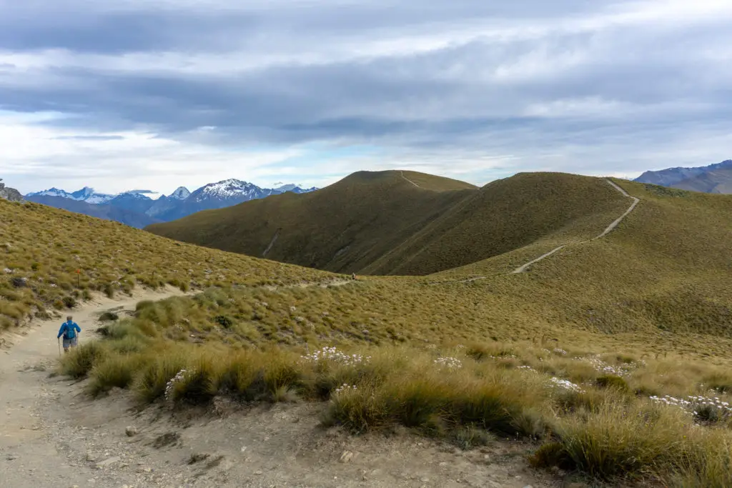
Around zig-zag numbers 3-4 the scrub gave way to grass and tussock, and I was really glad that the sun was only just rising. I could already feel the heat burning away the cool morning air. If you’re planning on hiking up Isthmus Peak in summer, start early! The basin the track climbs up faces directly east and so it would be a killer to attempt this in midday sun on a good day.
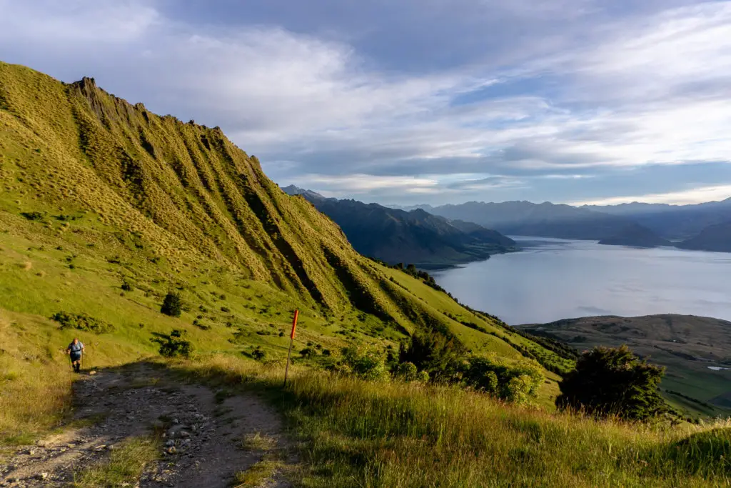
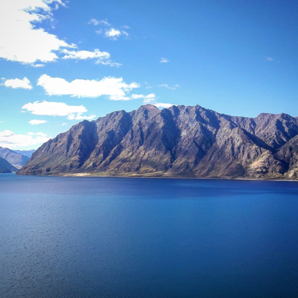
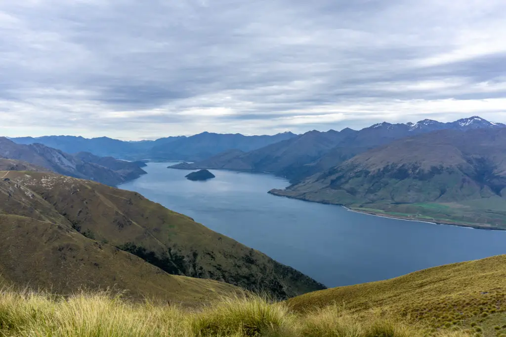
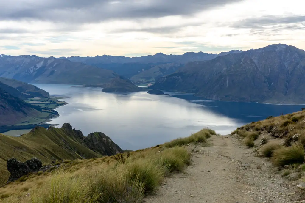
I counted the zig-zags on the way up. Anything to keep my mind off the climb. It wasn’t actually that steep most of the way (since 4WDs have to drive up the same track). It was just unrelentingly UP. The views over Lake Hawea were worth it already though. Even if you’re not wanting to go all the way to the summit of Isthmus Peak, walking up to get a clear view over Lake Hawea is worth it.
The road crosses back and forth up the hill, getting ever closer to the bluffs you can make out from the very bottom. We stopped for a sit-down rest between corners 12 and 13, slightly above the lower edges of the bluff. I felt smugly proud of getting up at 3am at this stage, already forgetting how horrible it had been to get myself out of bed. And not really dwelling on how much further there was to go and how I’d feel afterwards (surprisingly not that bad).
Getting there!
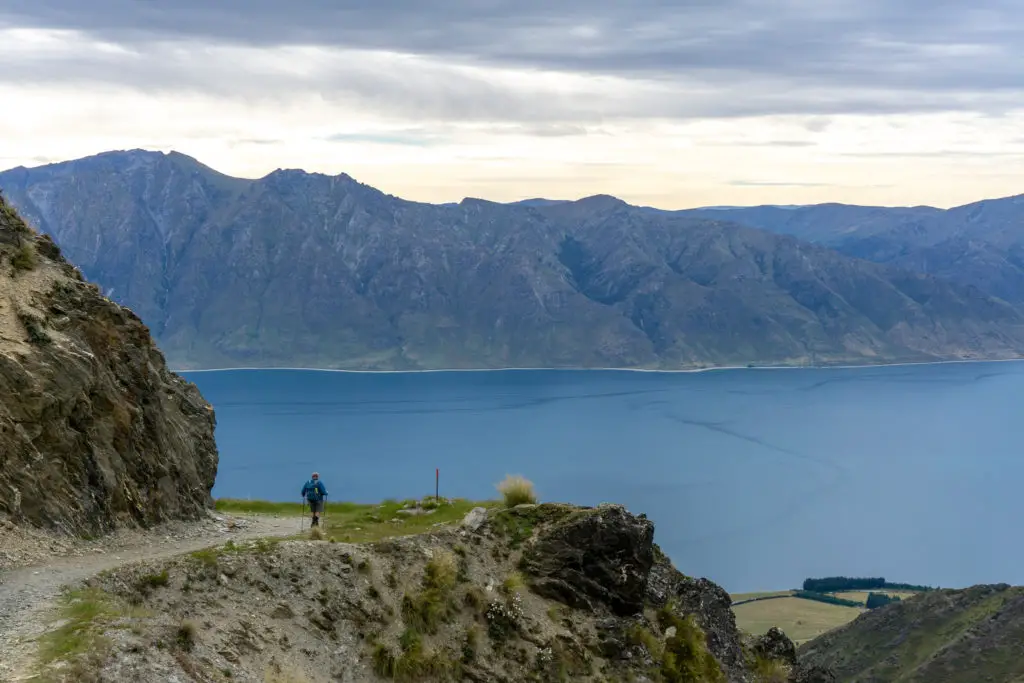
From zig-zag 13, the corners are tighter as you climb up to the ridge. We meet some a young group and then a couple coming down who must have seen the new year in on the summit. My smugness at getting up at 3am evaporated a little.
Zig-zag number 20 seen from above (you can make out the lower zig-zags to the right if you look carefully). We stopped just below and to the right.
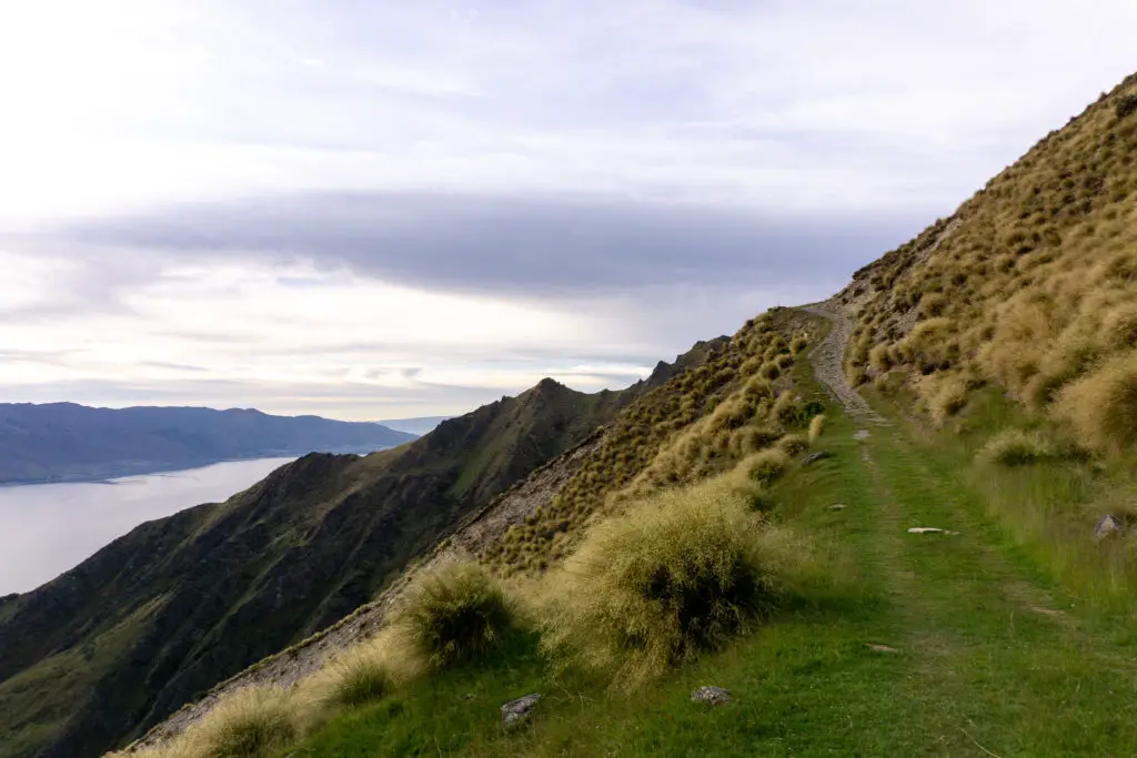
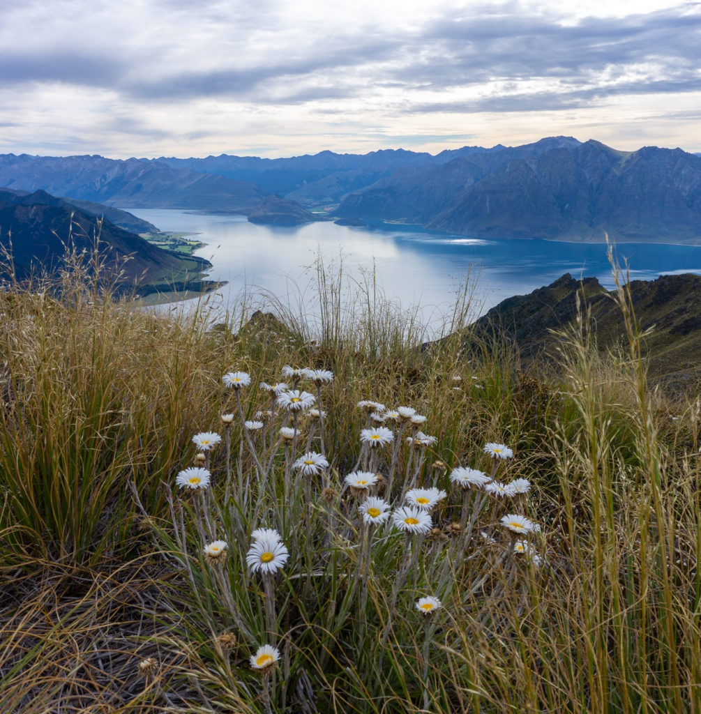
From here the track up Isthmus Peak continues on up the ridge, through a small grassy field and then continuing up through the tussocks.
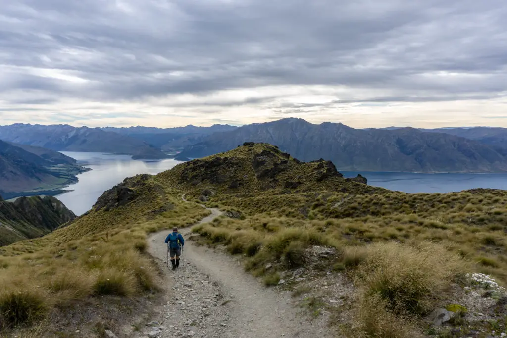
20-30 minutes walk up the ridge got us to the junction between Isthmus Peak track to the right/north, and the access track to Matatiaho Conservation area to the left/south.
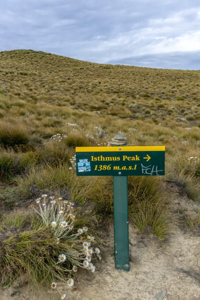
From there it was only another 20 minutes with two steep parts to get to the ‘top’ (it doesn’t feel much higher than this signpost).
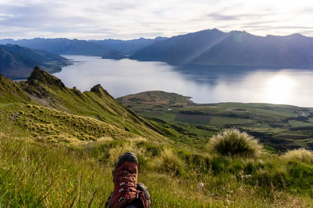
Isthmus Peak summit
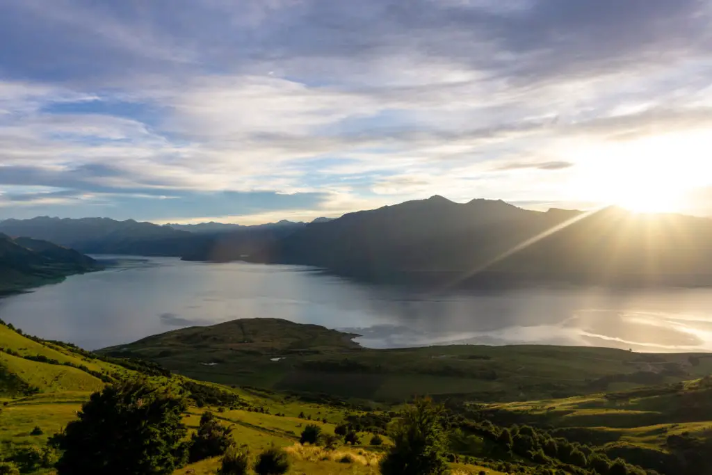
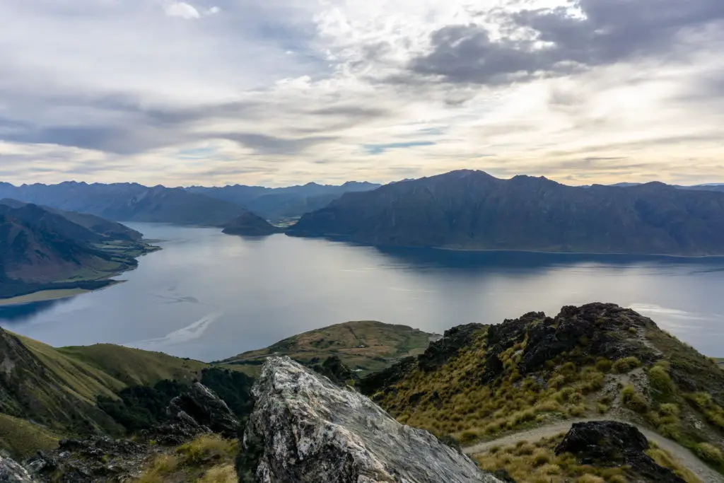
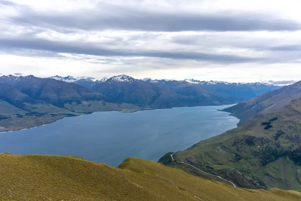
The clouds had come in as we had been climbing and the wind had risen; I didn’t have the bluebird still day that I’d hoped for (but which was realistically only really going to happen in the colder months, not summer). The views over Lake Wanaka were fantastic though, definitely rival to Roy’s Peak (although I’m only judging this from photos, have yet to tackle that one myself due to the crowds).
Dad and I stayed at the top for 20 or so minutes before starting the trip back down – I had a plane to catch that afternoon in Queenstown! The return went faster than the way up, and before too long we were tackling the relentless zig-zags on the hill facing Lake Hawea. Despite the weather, there were lots of people coming up on our way down, some of whom looked at us suspiciously for coming down when it was still so early in the morning. A lot of the people we passed were Kiwis, taking advantage of the time off work, and it was really encouraging to see so many out and about enjoying their own backyard.
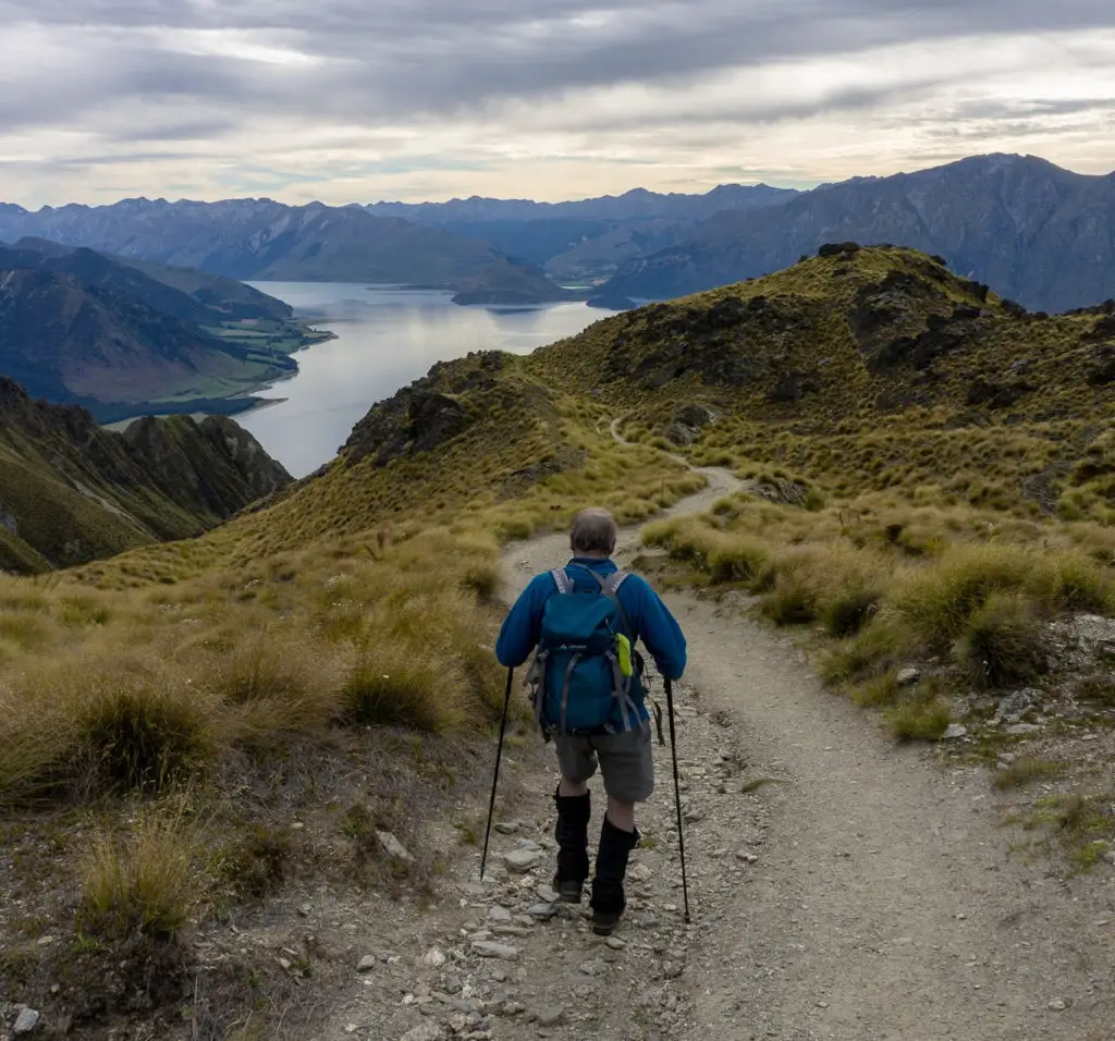
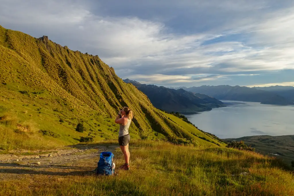
We made sure to continue to take regular breaks to rest the poor knees on the descent, while I followed Dad around like a paparazzi and took lots of photos.
A long descent
We stopped halfway down the zig-zags to have lunch. It was probably only 10.30am, but we’d already been up for over seven hours by that stage. We made it back to the carpark before midday. All up it had taken us about 6.5 hours with many breaks + lunch (although fitter people will be able to race up much quicker).
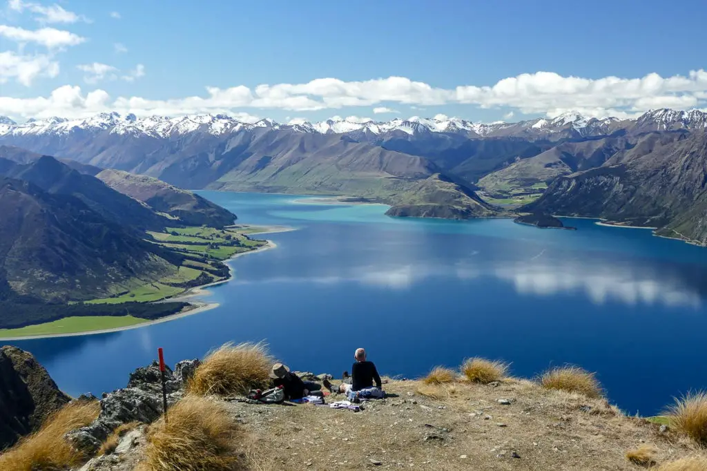
We piled back in to the car, drove through Hawea and back over the Crown Range, feeling very happy at what we’d accomplished on the first day of 2019. I made my flight out of Queenstown that afternoon with time enough to go have a soak my muscle in the pool beforehand. I’m really glad to have made it up Isthmus Peak (although might have to return on a bluebird day like the one below). Many more tramps around Queenstown are on my list, but they’ll just have to wait.
Safety
As always, please stay safe when you’re out exploring. Follow the Outdoor Safety Code:
- Choose the right trip for you (read my article on tramping safety, speak to DOC)
- Understand the weather
- Pack warm clothes and extra food (check out my post here about what gear you need to take)
- Share your plans and take ways to get help (have an emergency beacon on your person)
- Take care of yourself and each other
I went on this trip in summer with relatively good conditions. Keep this in mind when planning your own trip. Adverse weather (even in summer) will mean a much different adventure! You climb up very high, so even if it’s warm and sunny at lake level, the wind can be howling up the top with much colder temperatures + windchill.
If you’re not feeling super confident then you can always get in touch with me here on the blog or on my Instagram. Or take a look at my Tramping 101 series which includes this post about how to stay safe in the outdoors.
Also don’t be a dick, check out my guide to New Zealand tramping etiquette.
Stay safe and get outside!
Why do you tell people to stick to the track when you post several photos that are off the track?
Hi Robert. Thanks for your comment, and fair question. My advice to stick to the track was targeted at the private farmland, and I was under the impression that the tops were public conservation land, but upon checking I’ve realised this isn’t the case, so will take down those photos you’ve mentioned and will know better next time I visit. Thanks for the correction!
What an informative post! I’ve always thought Roys Peak was the go-to hike, but your insights on Isthmus Peak have definitely piqued my interest. The views sound amazing, and I appreciate the tips on the trail conditions. Can’t wait to check it out on my next adventure!