Ben Lomond is arguably Queenstown’s best day hike. It offers amazing 360° views over the Lake Wakatipu, Queenstown and the Remarkables.
Length: ~12km return, with either 940m (if you take the gondola up to the top of Bob’s Peak), or 1,400m elevation gain/descent from Queenstown.
Time taken: 5 hrs return from the top of the gondola, 7 hrs return from Queenstown
Difficulty: moderate
Facilities: the track starts either directly from Queenstown (next to the lower gondola building at the end of Brecon Street). Or you can start from the top gondola building on Bob’s Peak (under halfway up to the summit). The gondola building has a cafe and restaurant with water and toilets available. There are no other toilets or water sources from the gondola building up.
– Tip: Despite being close to Queenstown this is a hike you don’t want to underestimate. You need experience with snow and ice in winter months (and sometimes non-winter months, because, New Zealand). In summer, you will need sun protection and water; there’s little-to-no cover above the gondola. –
Mountain Safety Council have created a great video describing the Ben Lomond Track. Check it out:
Why the Ben Lomond track?
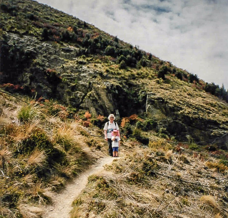
Ben Lomond is a special place for me and my family. My granddad built a small batch in the Queenstown camping ground sitting in Ben’s shadow (back before it became much more commercial). Many family holidays were spent climbing up the Tiki Trail to the top of the gondola, and then on to the saddle. Eventually, when I was older and my legs were long enough they carried me all the way up to the summit. Ben Lomond was the first “mountain” I ever climbed.
Nowadays, Ben Lomond is one of the places where my family goes to remember my grandparents. As part of this we joined the initiative to combat the spread of the invasive wildings. (Yes, just like the wildings in Game of Thrones … except they’re trees, not people) and have a family plot above the gondola. The wilding pines are a massive problem in Otago, especially around Queenstown. You can read more about it on the Wakatipu Wilding Conifer Control Group’s website (which has awesome interactive photos to show the spread of the pines). Or on the Otago Regional Council’s website. Our family go up often each year to tackle the wilding pines on our plot.
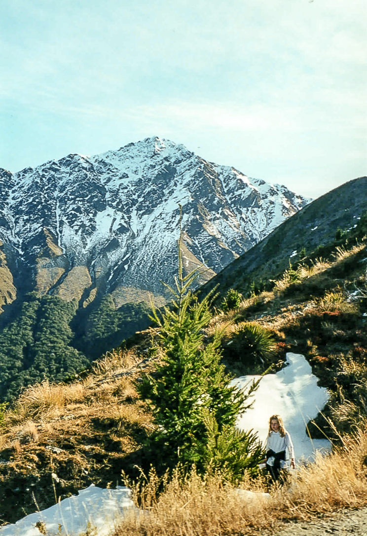
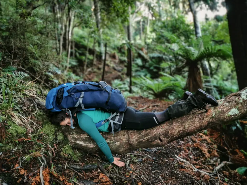
Long story short, we spend a bit of time around Ben Lomond. The photos in this blog post will reflect that, being taken on different trips, at different ages, and with different seasons/weather. (Also some will be crappy phone photos before phones could even take really good photos – sorry!).
How to get to the Ben Lomond trailhead?
This tramp is directly accessible from Queenstown – without driving, hooray! If you’re lazy like me, you can even take the gondola up and skip the first hour of steep uphill. (Many locals get an annual pass to cut down costs + it gives discounts at the bar). If you don’t want to take the gondola, then head up the Tiki Trail. This starts to the left of the base gondola building at the top of Brecon St, and heads around the edge of the cemetery). The Tiki Trail will lead you to either the top gondola building (if you turn off along the access road), or straight on towards the Ben Lomond track. It adds about an hour/hour and a half to the start of your trip.
IF YOU’RE LOOKING FOR OTHER AWESOME HIKES NEARBY THEN CHECK OUT THESE TRIPS:
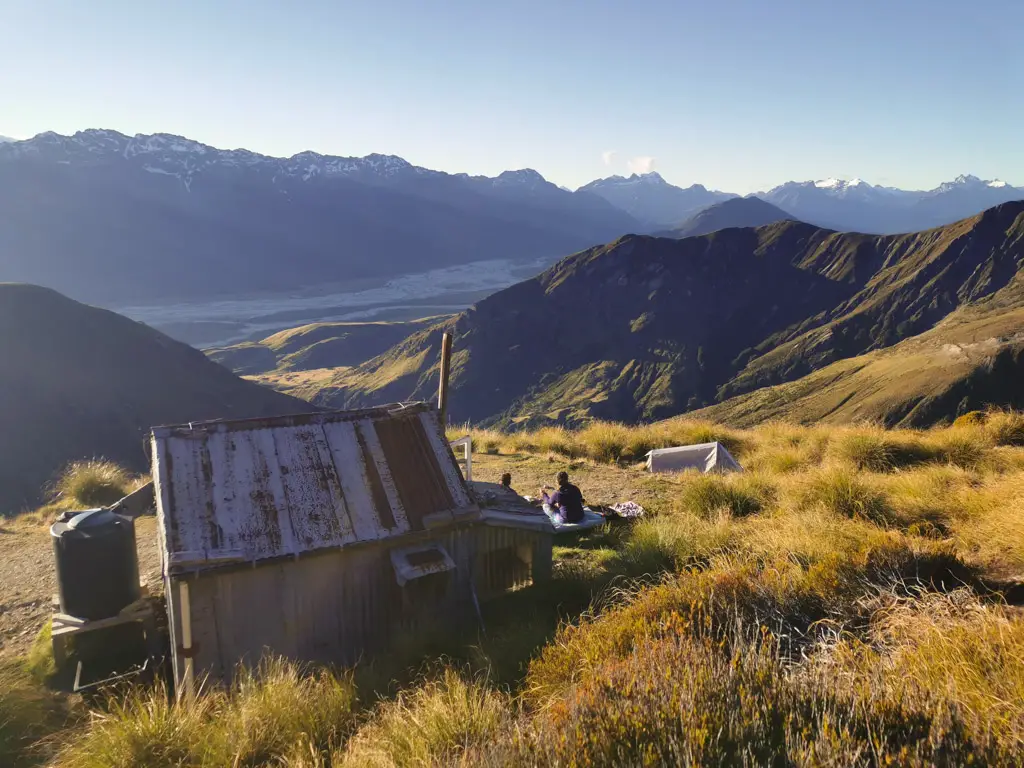
A cute little backcountry hut near Glenorchy with beautiful views.
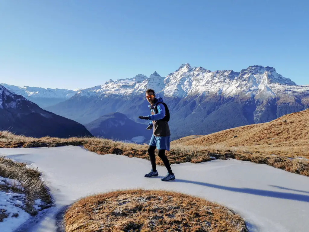
An awesome day-trip close to the Routeburn track but with better views and less people.
Ben Lomond: the hike
If you’ve taken the gondola up to the top building, go upstairs, use the facilities, make sure you’ve got enough water (and fill up/buy some if you don’t), then head outside. Follow the signs up the hill.
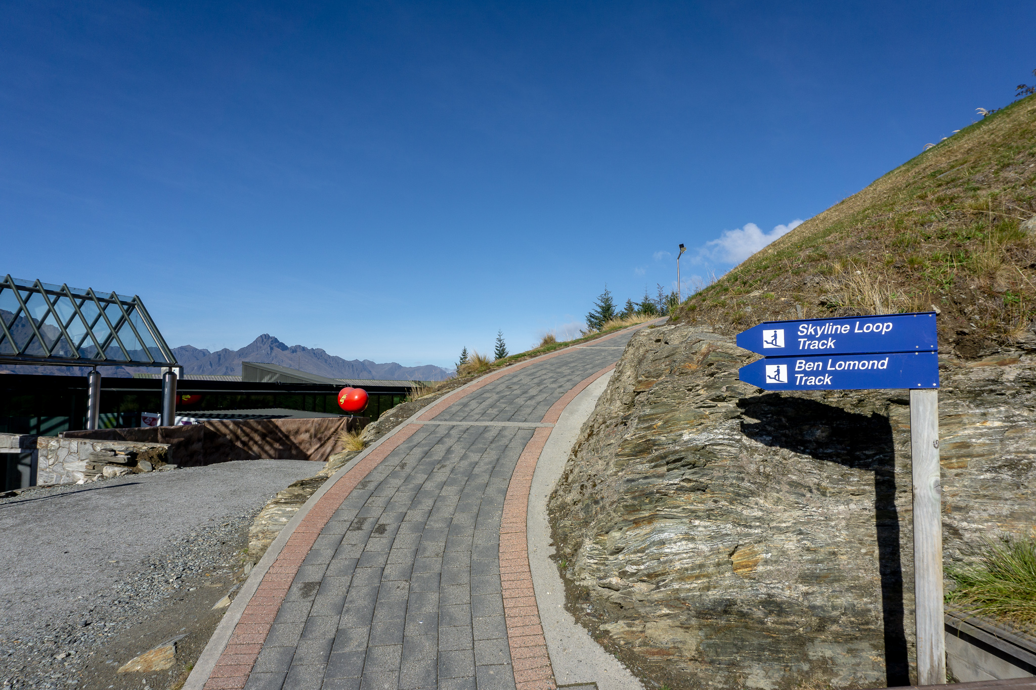
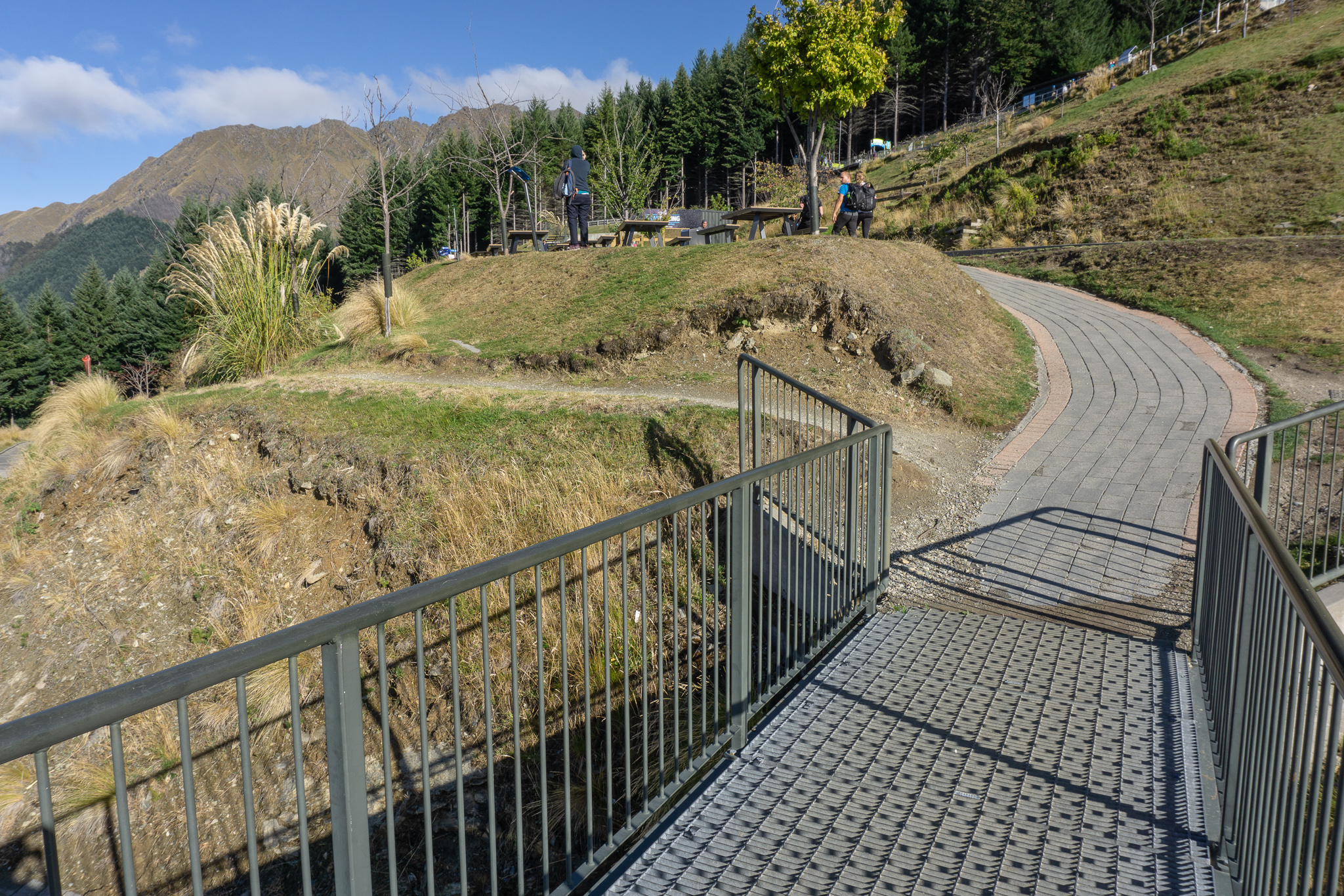
Following that shortcut should lead you to the top of the Skyline access road. Cross the road and into the pines, still following the signs.
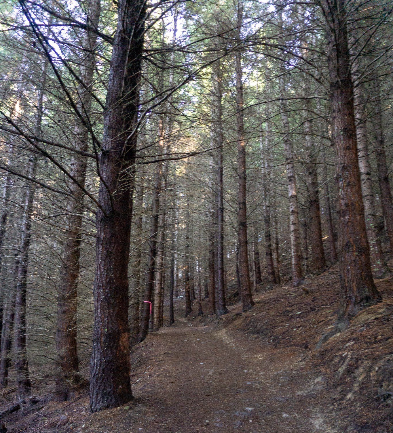
You’ll notice that under the pines, the path becomes instantly darker. The trees cut out all sunlight, and kill anything that would grow underneath. This includes our much shorter, slower growing native plants that can’t compete with these giants. If you listen, you won’t hear any of our native birds, since the pines offer nothing good for them either. As nice as the pine trees smell (and as nostalgic as it is for me, having walked through these woods often as a young kid), walking through the pines will show you exactly why they’re a menace in Central Otago and many other places in the South Island.
At the top of the surprisingly steep (but thankfully short) stint in the pines, you’ll reach a junction. Going up will take you back around to the gondola (via the takeoff spot for paraponters). While going straight ahead will take you out of the pines and down onto the Ben Lomond track.
Cherish the downhill. It’s all you got. Until you turn around at the summit and go all the way back down again.
There’s a short stretch of tussock before climbing back up to a small patch of native bush with beautiful layers of plants and trees, and the trills of native birds (laying it on too thick?). After the native bush (which is a good place to stop in the shade for a break in summer as that’s the only shade you’ll get from there on up), the track climbs steadily up the side of the hill before gaining the ridge.
If you hear what sounds like a person or child crying out in the valley below you, it’s more than likely wild goats bleating. One trip I swore someone had fallen and injured themselves down and was crying out for help. Nope, just a cute little goat kid. No idea how such a small animal make such a loud sound. If you’re rolling your eyes at how gullible I sound – watch this video. If you’re lucky you might even see some of the goats.
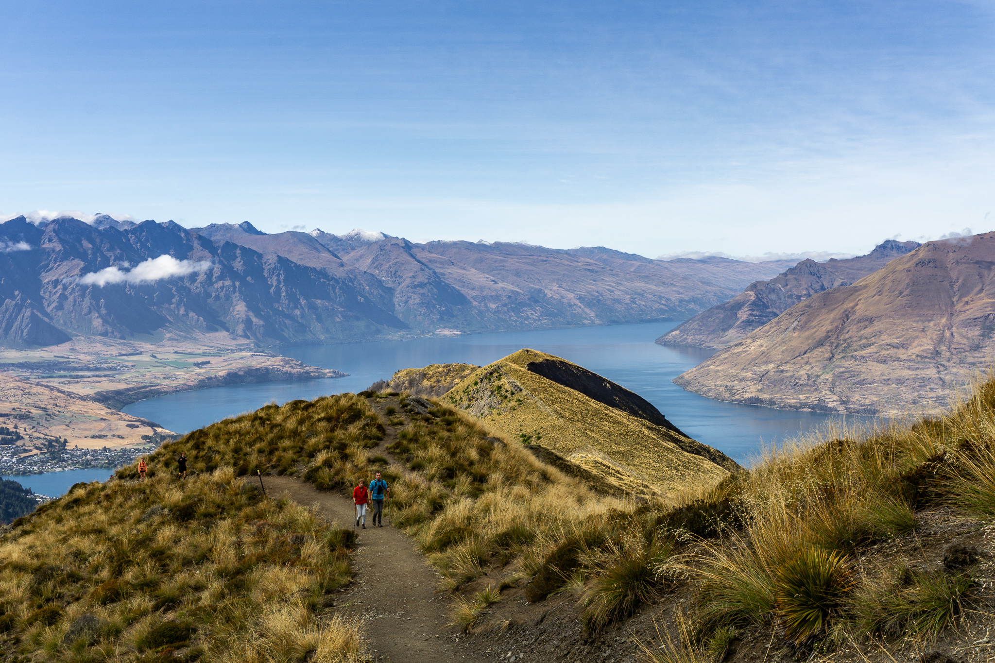
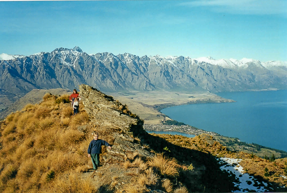
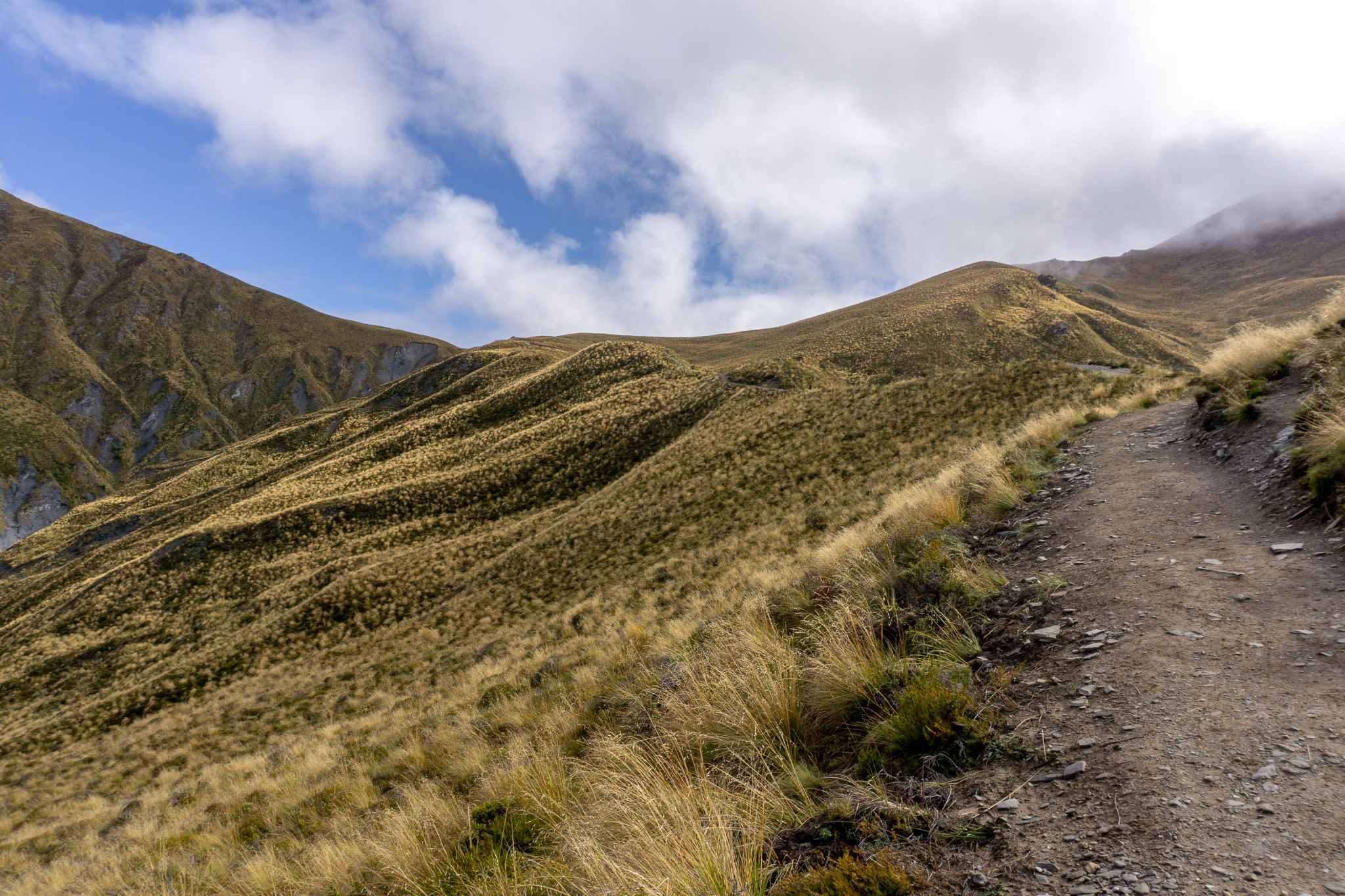
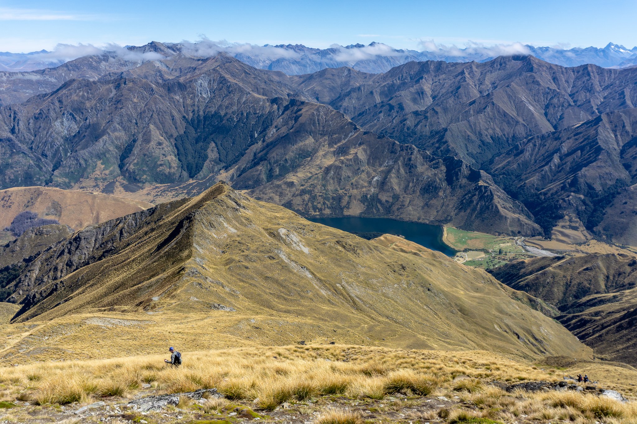
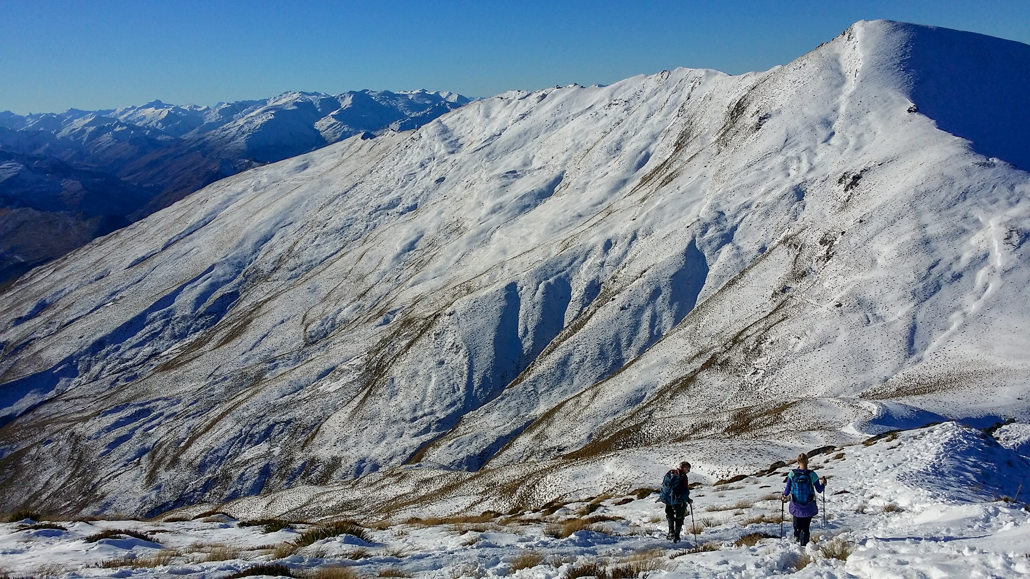
From here the track keeps climbing (sense the theme here), winding around the tops of small rises. Looking back along the ridge to Bob’s Peak gives you beautiful views over Lake Wakatipu and the Remarkables.
An hour and a half from leaving the gondola, you’ll arrive at the saddle between Ben Lomond (on the left) and Bowen Peak (on the right). Just below the saddle is the turn-off to Arthurs Point on the Moonlight track. I often stopped at the saddle as a little kid, not being big enough to make it all the way to the summit yet. Apologies for all the poor people I skipped past as a little kid, after my French Ridge experience I know how you feel. My bad.
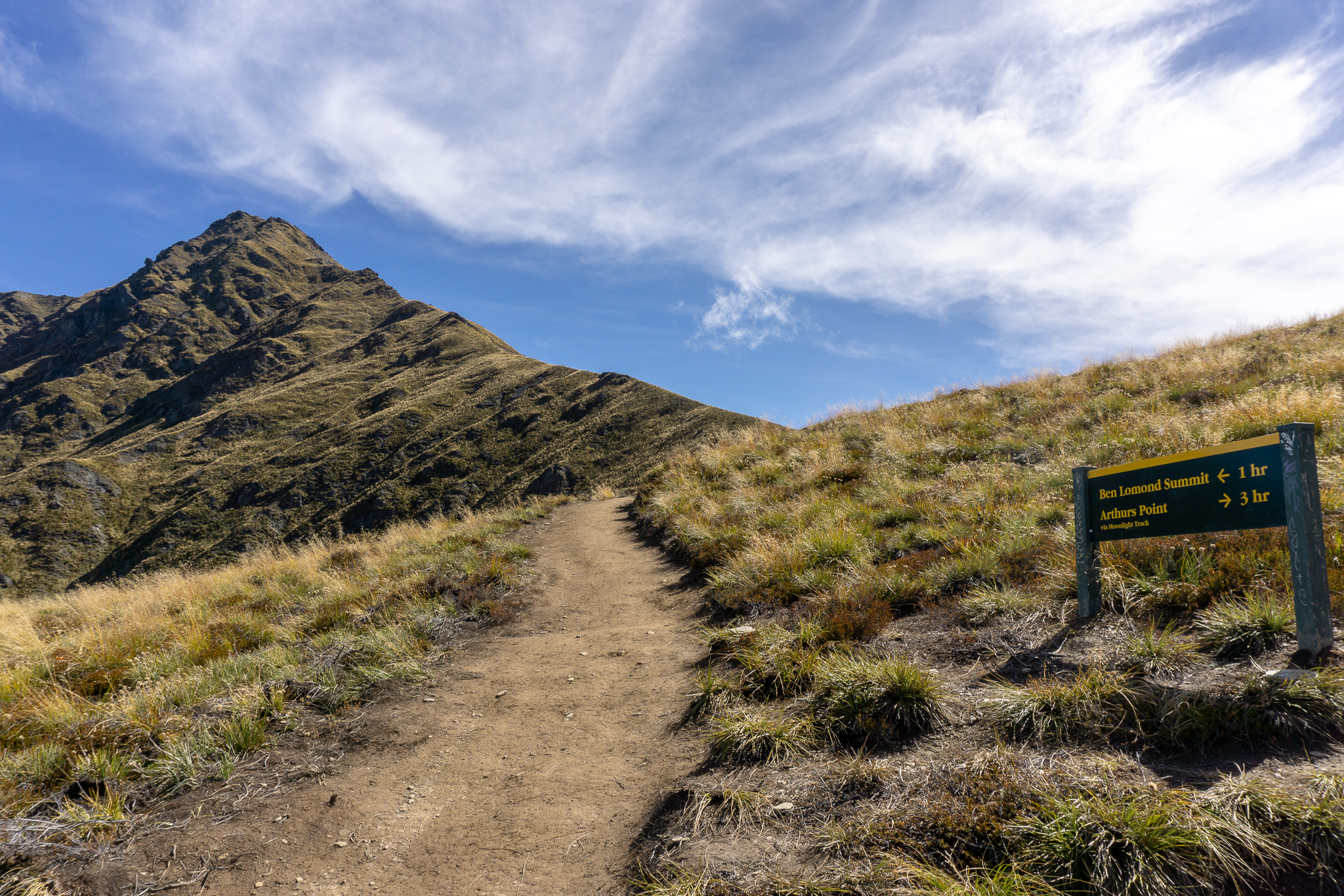
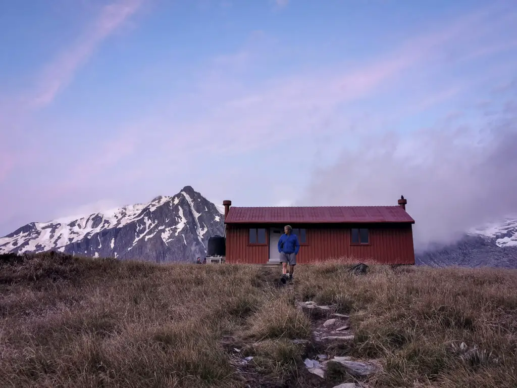
On the saddle you’ll find a very handily placed bench seat. It looks out over the gorgeous view into the Moonlight backcountry, as well as views down over Queenstown and across to the Remarkables. The bench wasn’t exactly placed there with permission. (Better to ask DOC’s forgiveness after you’ve already flown it up, right Cliff Broad?). But regardless of its slightly dodgy beginnings, it’s a beautiful spot for a seat (which DOC quickly realised, choosing to leave it up there rather than taking it down). I’ve had many family picnics at this seat – it truly is a beautiful spot.
On my most recent trip up Ben Lomond (when many of these photos were taken), I wore a singlet and shorts as I set off from the gondola at a leisurely 10am. (If you’re starting from Queenstown itself and taking the Tiki Trail then you don’t really want to leave it any later than that – I was cheating with taking the gondola up and down). It was cold under the pines, and started getting a little cloudy as I climbed up onto the ridge.
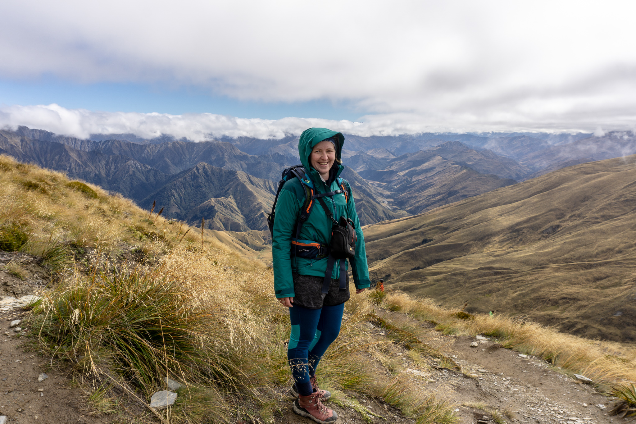
By the time I’d made it up to the saddle the sun was gone. And as I walked up onto the saddle itself, the full force of the building wind hit me. I’d checked the forecast and always pack more layers than I think I’ll need, so as the group of Spaniards that I’d been following in singlets and thin nylon leggings turned back around (smart decision), I joined a Swedish group getting changed and put on all of my layers including gloves and beanie.
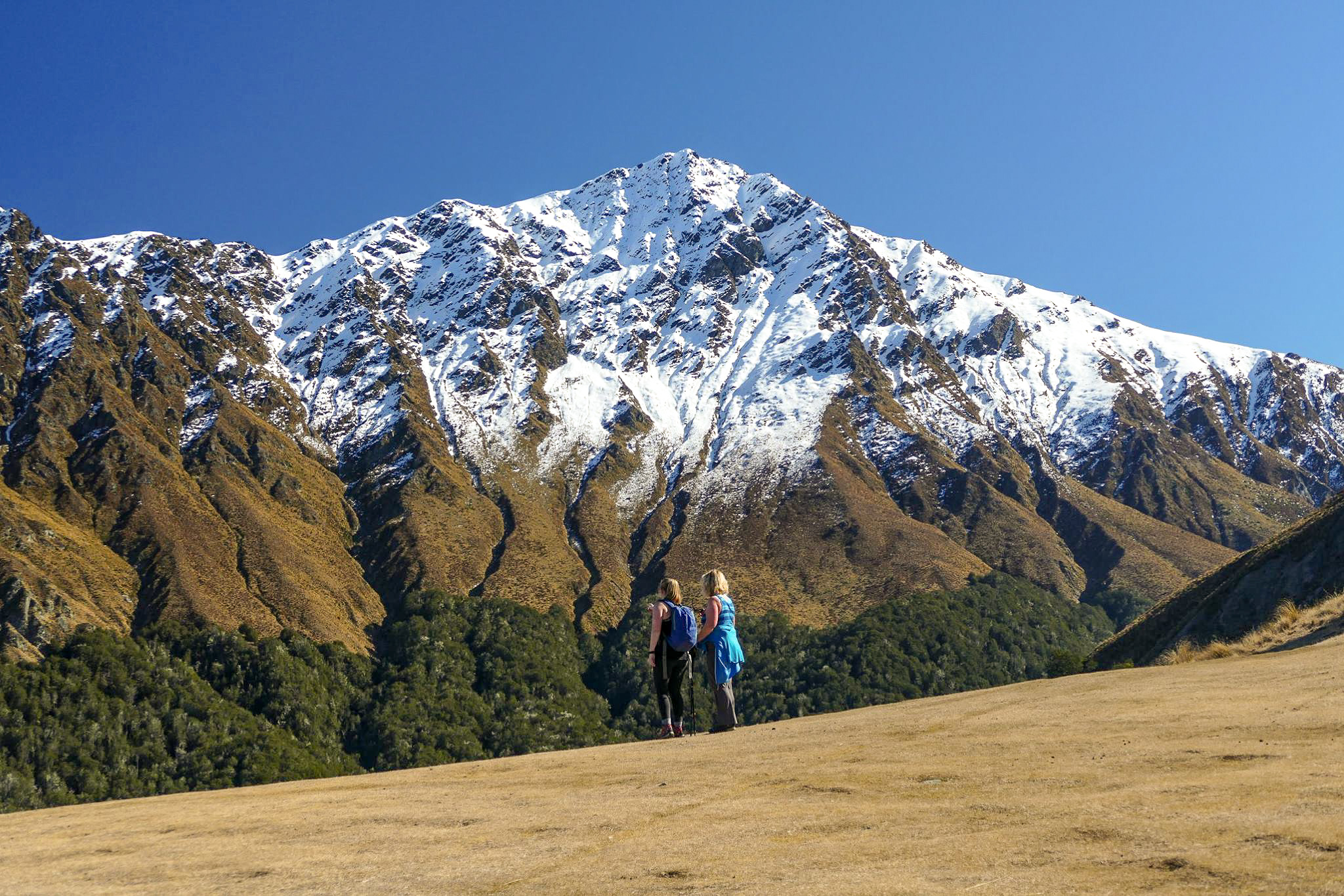
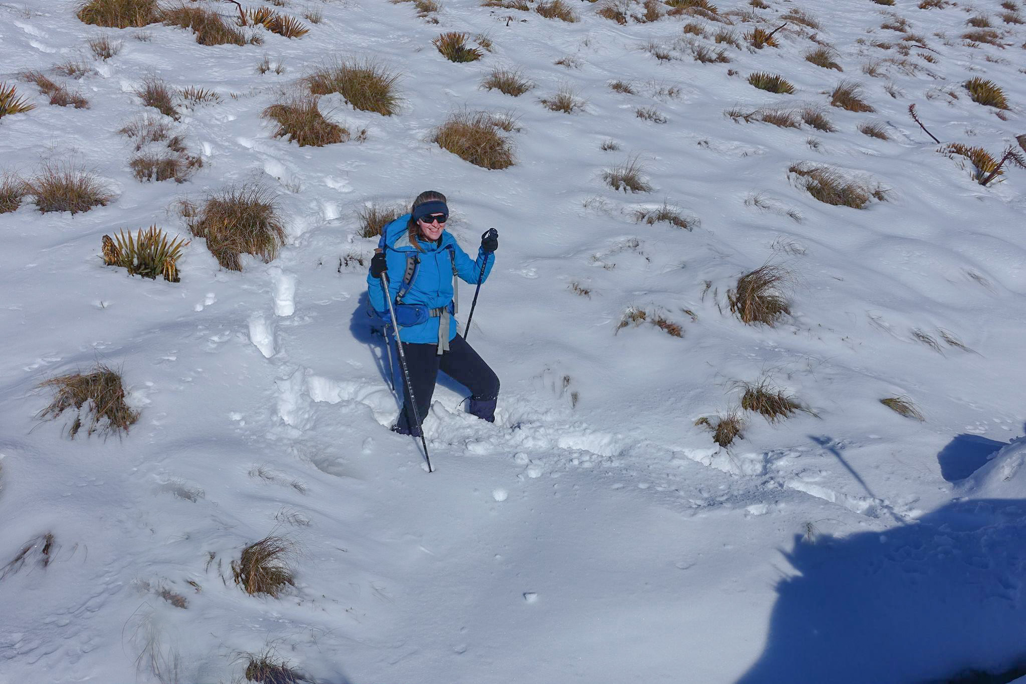
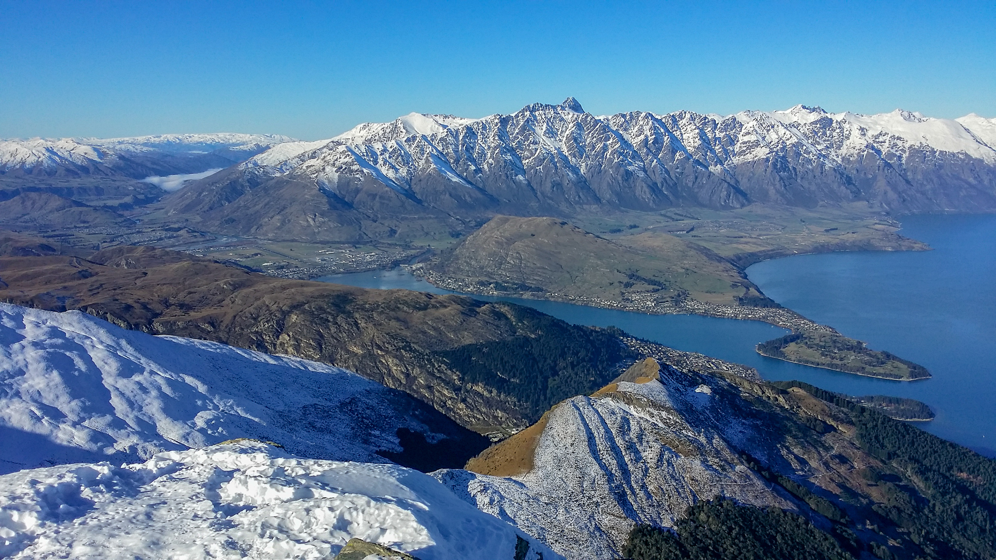
Despite its accessibility, Ben Lomond still sits at 1748m elevation and is prone to some crazy weather, even when down at ~300m Queenstown is experiencing sunshine on the same day. In winter, it’s often covered in snow and ice (as some of these pictures will show), but you can easily be caught out in the “warmer” months, and the weather in town isn’t a predictor for the weather you’ll find as you reach the saddle and onwards.
Up until the saddle the track is well-maintained. Recently it’s even received an upgrade; widening the path and putting in big steps, probably due to the increase in traffic Ben has been experiencing. From the saddle onwards however the track quickly goes from a wide, obvious footpath, to a windy gravel/mud path. It’s still pretty obvious for most trampers/hikers, although I’ve read that the extra traffic further up towards the summit has caused misleading tracks to appear which don’t go anywhere (or which end at cliff edges) – always remember the route you’ve taken, so you know how to get back!
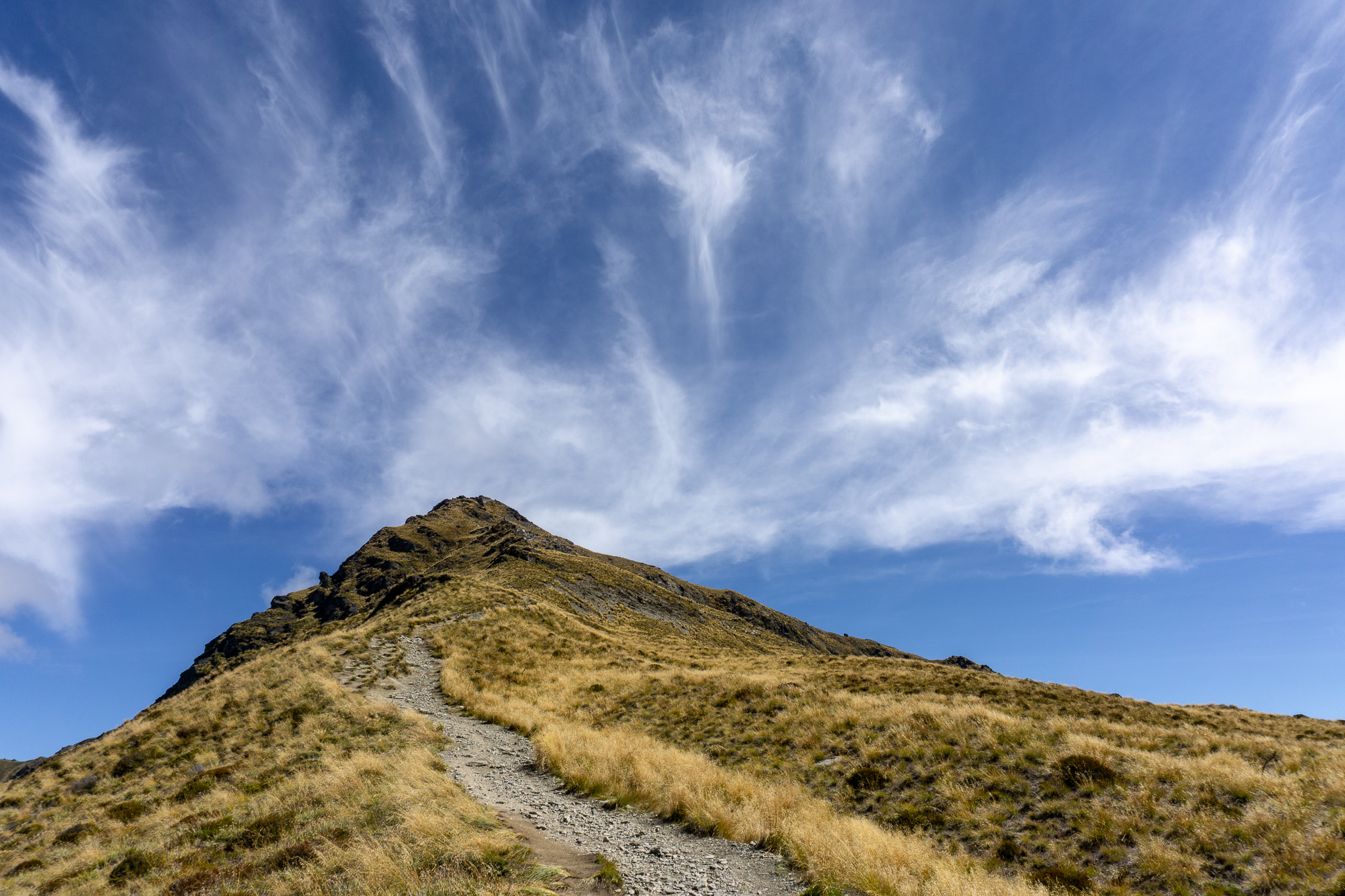
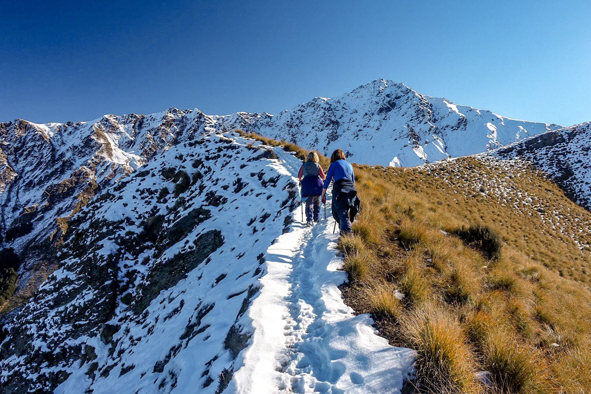
Although the summit looks deceptively close from the saddle, don’t be fooled – you’ve still got another 400m vertical to climb (don’t worry. You’ll definitely notice it).
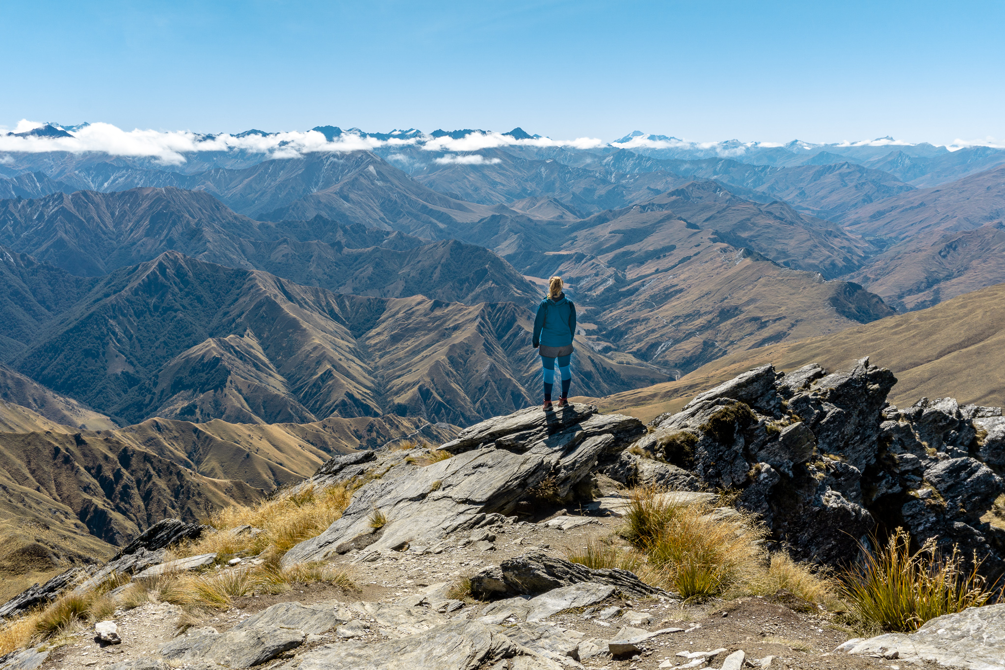
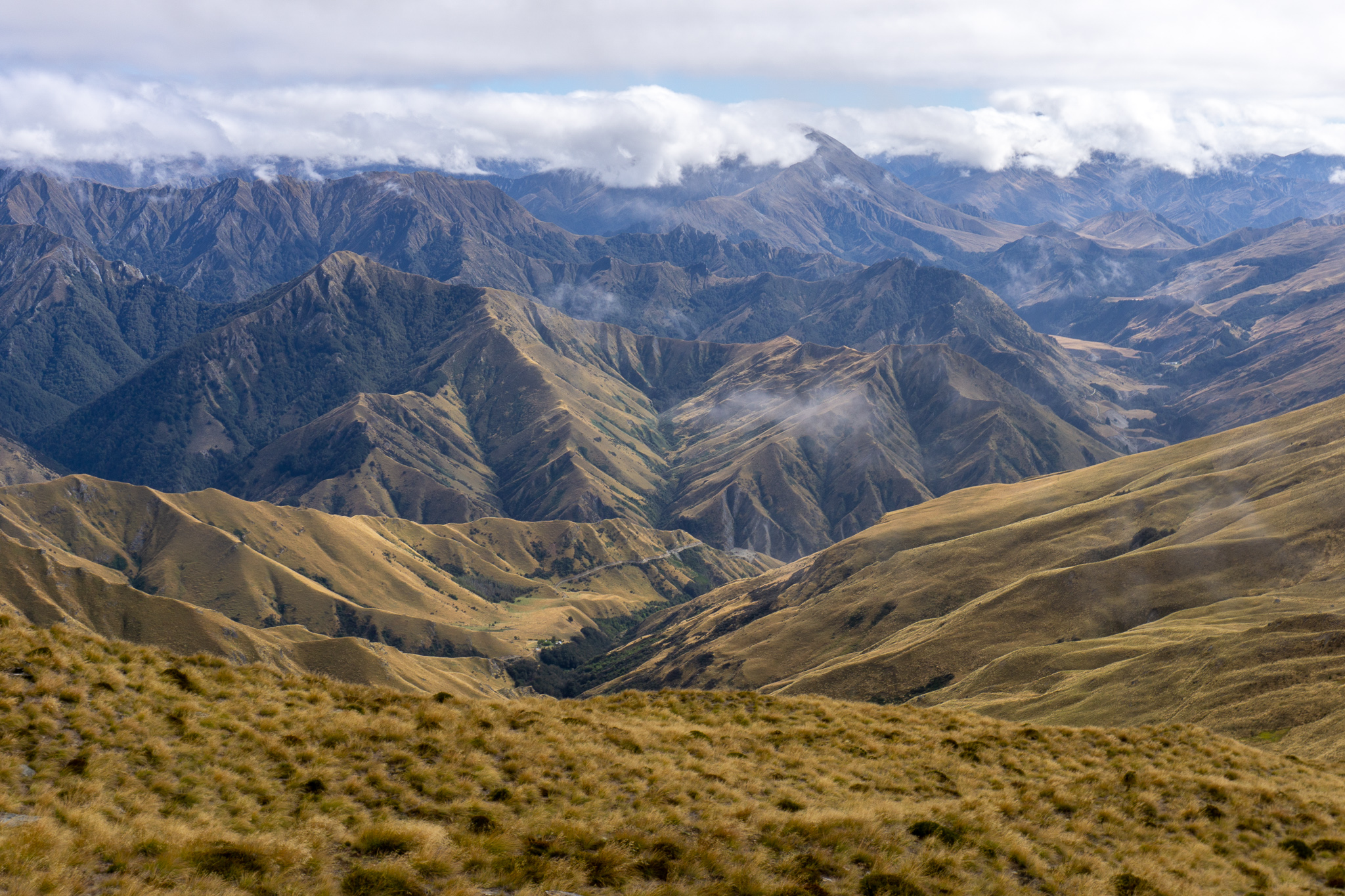
The track initially zig zags up the ridge above the saddle, before sidling around the north-facing slope. There are a few steeper parts with rocks to clamber up, but nothing too serious. Queenstown is hidden from view, but glimpses of the beautiful Moke Lake more than make up for it. After such a long time climbing, you’ll arrive at the summit without much warning; the track turns back to the east and then you’re there!
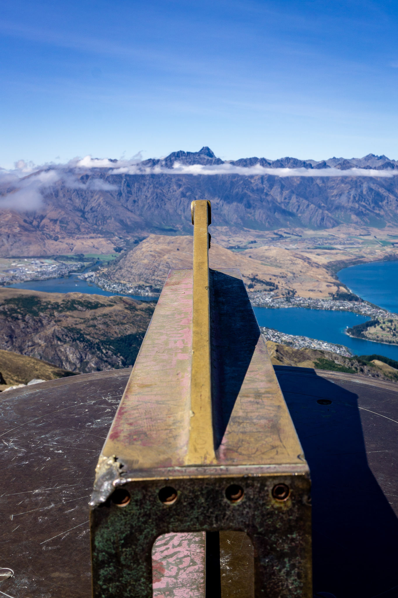
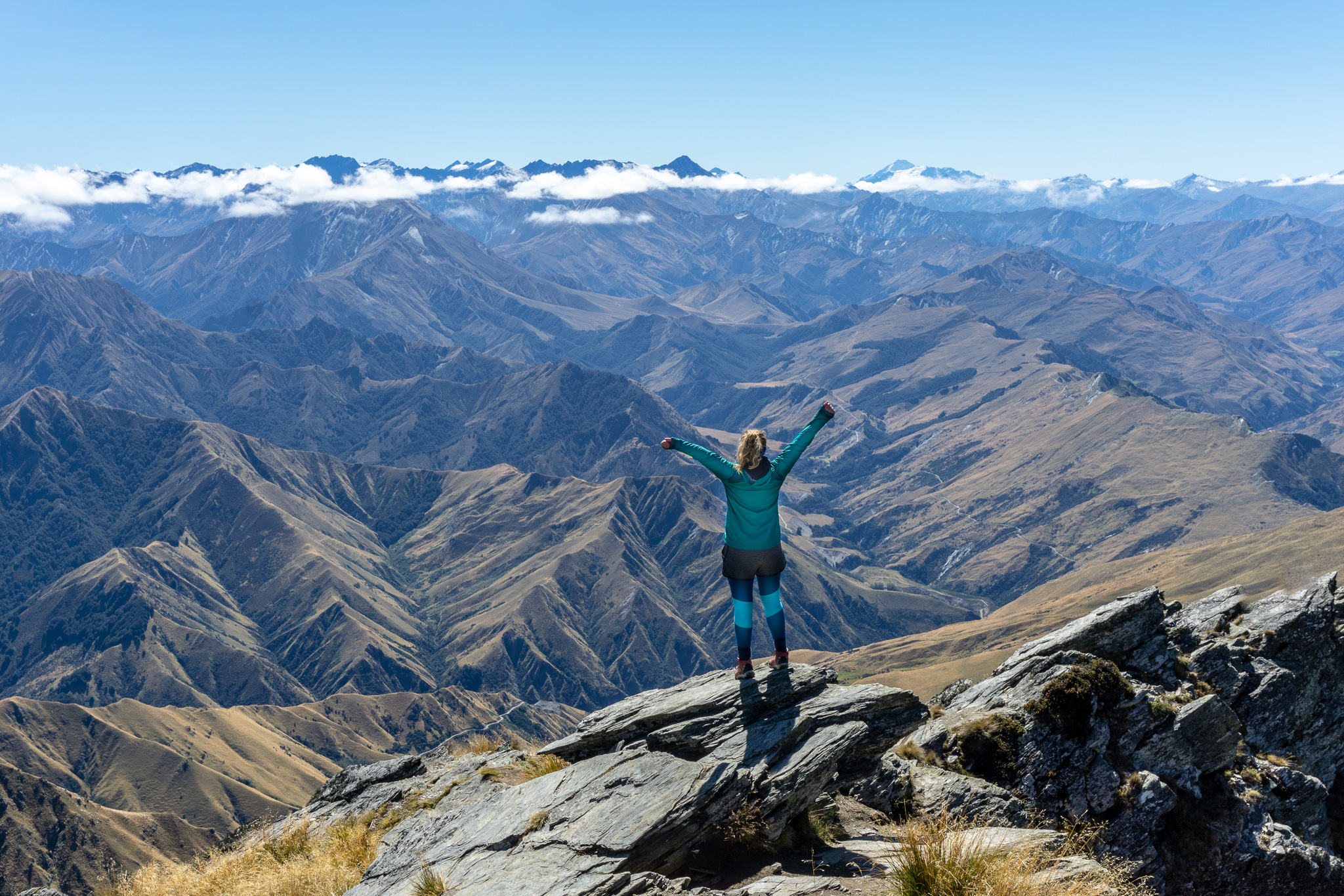
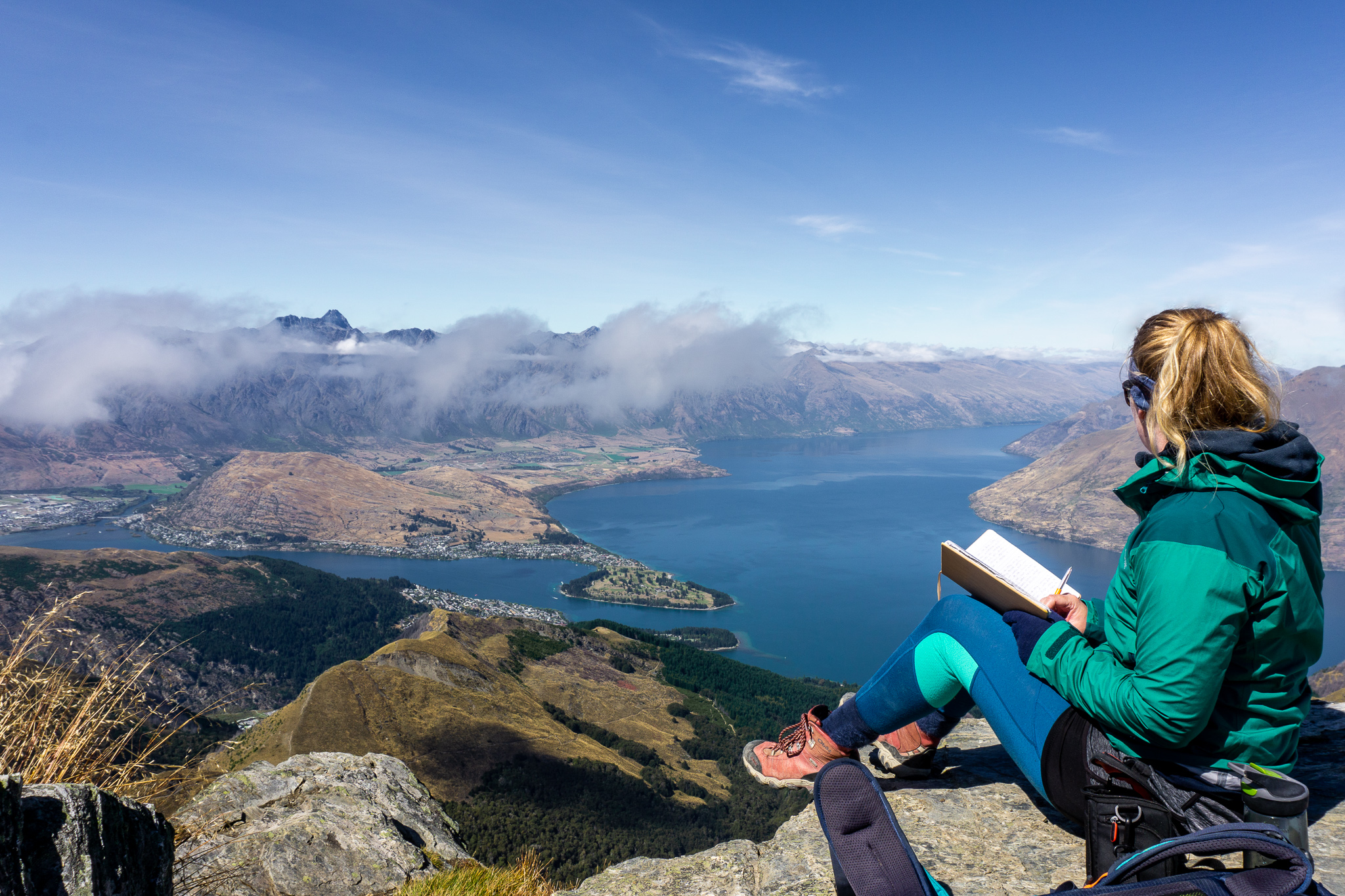
On a good day, the views from the summit are pure 360° goodness. Looking down into Moke Lake and Moonlight, across to Bowen Peak, Coronet Peak, Arrowtown and the Crown Range, around to the Remarkables, Queenstown, Lake Wakatipu, Cecil Peak, Walter Peak, Crichton Peak … The views are endless. In the 1960s, old landowner of Ben Lomond Station, Henry Barker, carried up loads of cement and rocks to create the rock cairn which highlights all of these landmarks.
The trip back down Ben Lomond is as simple as following your footsteps, however make sure you don’t leave it too late (or have warm clothes and a headlight + spare batteries), and go easy on your knees. I find going down almost harder than going up. Remember that gaining the summit is only just over halfway.
Also remember that if you hear someone screaming, make sure it’s not a goat before pulling your PLB. Just a tip.
There is an alternative route back to the gondola: once on the ridge below the saddle, instead of following the track and turning off the ridge, continue up and along the ridge until you climb down to the top of Bob’s Peak, where the paraponters take off. This isn’t a well-worn track and there are very steep drop-offs (definitely not suitable if there’s snow or ice), so if you’re new to the area or have difficulty finding your way without a track then I would recommend just going back the same way you came up. From there, follow the paraponters track down to the top of the gondola.
Ben Lomond is a great trip that sees many locals and tourists alike climb up it each year. It’s worth the effort and the views are stunning on a good day, just don’t underestimate the effort or the conditions. Treat yourself to some Patagonia icecream, a burger from Ferg, or a delicious taco from Taco Medic when you’re back down. You made it!
Safety
As always, please stay safe when you’re out exploring. Follow the Outdoor Safety Code:
- Choose the right trip for you (read my article, DOC website, read other blogs!)
- Understand the weather
- Pack warm clothes and extra food (including windproof and warm layers, regardless of how nice the day is when you set out – check out my post on what to taking tramping here)
- Share your plans and take ways to get help
- Take care of yourself and each other
Don’t underestimate this trip, although relatively straight-forward it’s still a trip into alpine areas – check the conditions and stay within your level of experience and comfort. Weather conditions will change your trip drastically. Ensure you know the weather forecast and adjust your plans (and the contents of your backpack) accordingly before setting out.
Stay safe and get outside!
Where to next?
LET ME KNOW WHAT YOU THINK! LEAVE ME A COMMENT OR MESSAGE ME OVER ON MY INSTAGRAM.
I love hearing from readers and helping them plan their own adventures!
Thank you for the detailed track description and insider information.
Thanks Pavel! Glad you liked the post