Green Lake Hut is one of Southland’s most picturesque huts, nestled on the shore of a beautiful lake with multiple access routes.
Length: various tracks to the hut; 6.8 – 11.5km
Elevation gain: 300m – 600m depending on the track / route
Time taken: overnight trip
Difficulty: easy from Borland Bivvy, moderate from Borland Saddle or Lake Monowai
Facilities: Green Lake Hut has 12 bunks, a fireplace, water and a long-drop toilet. It costs $5 per adult (1x blue hut ticket), and operates on a first-come, first-served basis.
Table of contents
How to get to the Green Lake Hut carpark
Map of Green Lake Hut tracks
Tramping to Green Lake Hut
Borland Tarn Tops Route
A more challenging trip to Green Lake Hut that involves some basic route-finding: 4.5 hours, 6.8km
Borland Bivvy Track
The most straight-forward and shortest way to reach Green Lake Hut: 3 hours, 6.8km
Lake Monowai Track
A longer track to reach Green Lake Hut; 6 hours, 11km
How to get to the Green Lake Hut carpark
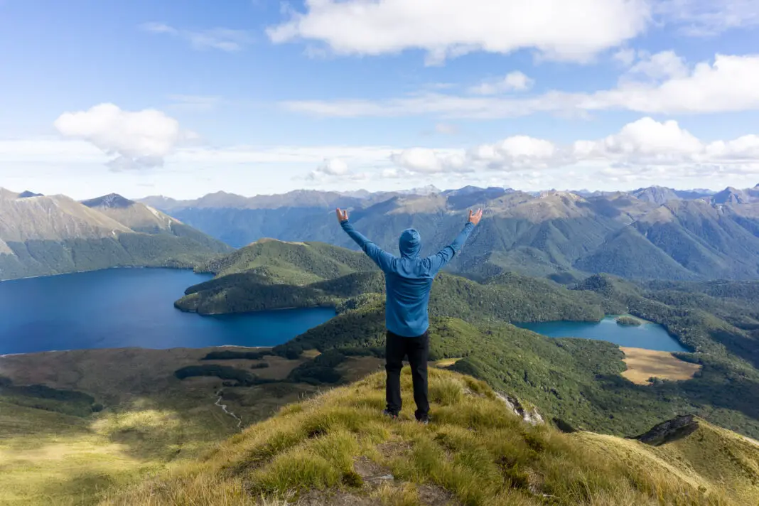
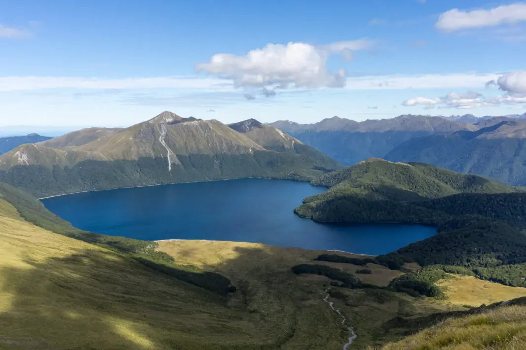
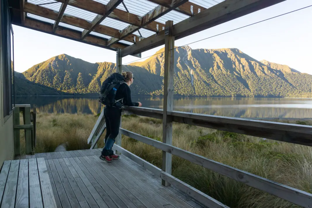
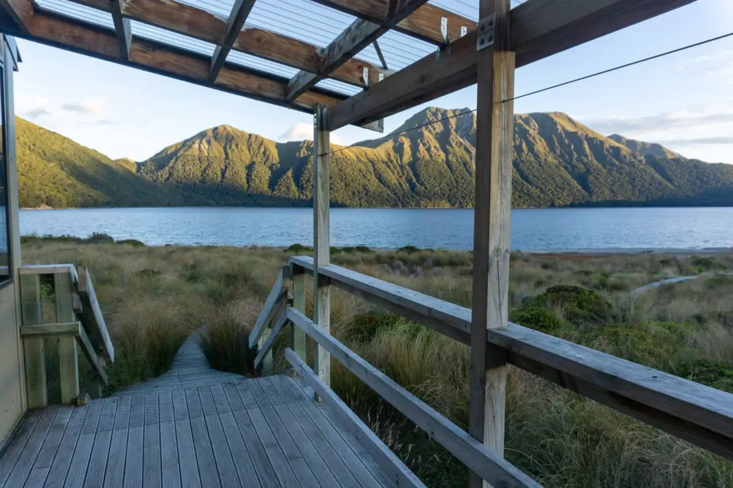
Green Lake sits in the Grebe Valley, between Borland Saddle and Lake Monowai in Southern Fiordland. The lake was formed by the largest landslide of its type in the world (about 12,000 years ago). Green Lake Hut sits on its shores with a beautiful view over the water towards the mountains.
There are actually several different ways to reach Green Lake Hut in Fiordland National Park, from various different access points (so various different carparks). The easiest is following a track from Borland Bivvy, while two more adventurous ways are from Borland Saddle over the tops, or taking the longer track from Lake Monowai.
To reach the Borland Road or Lake Monowai, take the Southern Scenic Route. The sign-posted turn-off to Lake Monowai is a 45 minute drive from Te Anau, or 1.5 hours from Invercargill.
The Borland Road (to access the track from Borland Bivvy and the route over the tops) closes over winter, being the second highest road in Southland (after the Nevis Road). It is gravel and is sometimes only suitable for 4-wheel drive vehicles depending on conditions. We’ve driven the road with a car in fine weather over summer without too many issues. But if in doubt, check with DOC on their website or by calling the local Visitor Centre.
If you’re looking for other awesome adventures in Southland, check out these trips:
Makarewa Falls
Southland’s highest waterfall (outside of Fiordland) is finally now able to be accessed by the public.
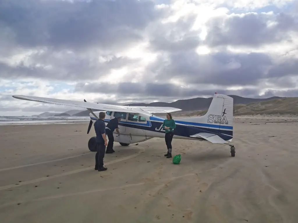
Mason Bay, Rakiura
Charter a plane from Invercargill airport and fly to the remote Mason Bay on Rakiura / Stewart Island to see kiwi in the wild.
Map of Green Lake Hut tracks
Tramping into Green Lake Hut
Borland Tarns Top Route – 4.5 hours, 6.8km, moderate (route-finding required)
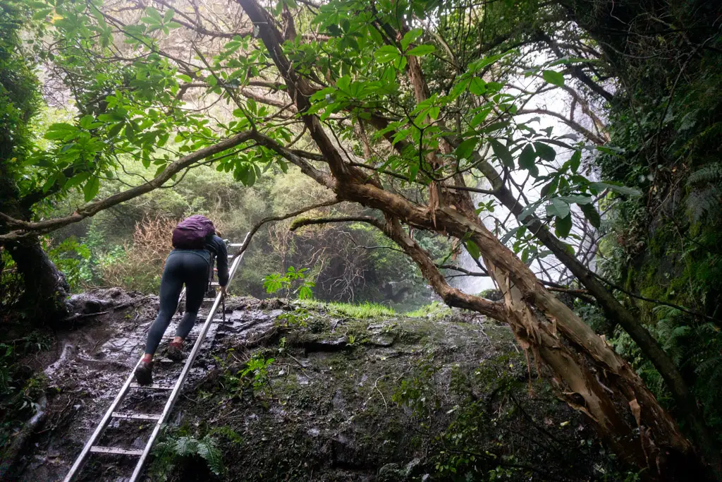
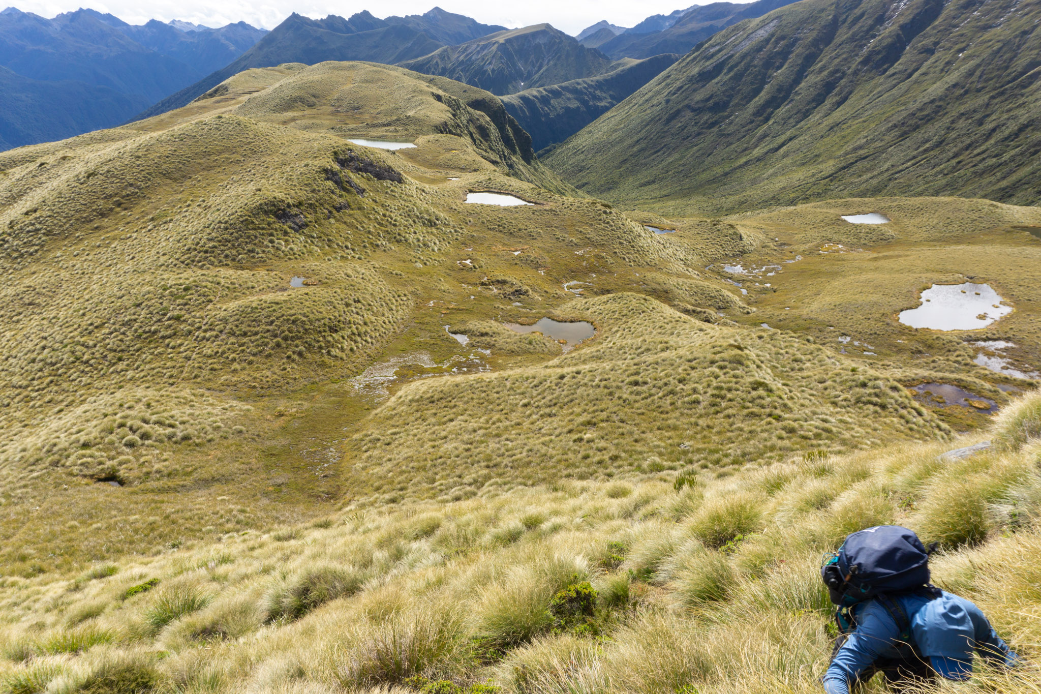
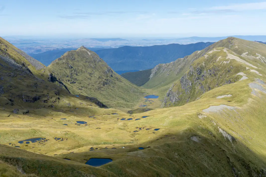
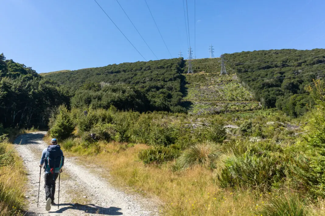
I’d previously been up to the top of Pt 1476 near Mt Burns for views over Green Lake, and on that trip I’d scoped out what looked like an easy route down to the hut (oh how tussocks can be deceiving!). So one summer’s day a year later, my husband Matt and I drove past Borland Lodge, following the road (and the powerlines) up to Borland Saddle. We parked at the saddle and followed the Mt Burns Tarns track up through goblin forest and then tussocks to reach the tarns.
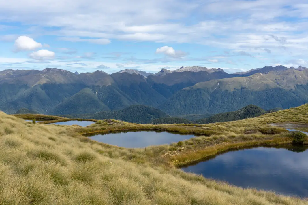
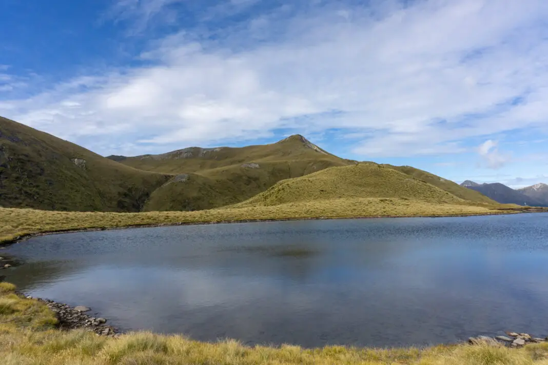
The tarns were gorgeous as always, and there were a handful of people enjoying the reflections (who probably wondered why we were carrying such large packs for an hour return walk). The tarns themselves are worth the drive, but Matt and I continued past them towards the highest point visible directly behind the tarns (Pt 1476, not Mt Burns as many people mistakenly think).
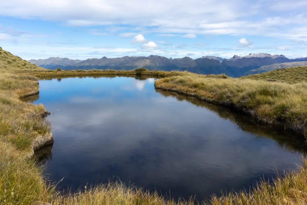
We stuck to worn pathways around the first few tarns to try and minimise our impact (it’s a pretty fragile alpine environment), but soon the paths petered out and we made our own way through the short tussock.
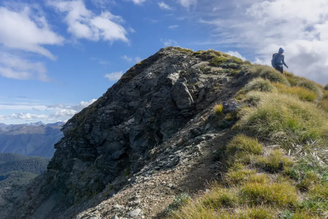
There was a short scramble up a tussock ridge just after the last tarn (read: pulling yourself up a vertical slope via tussocks and spaniards). But once back onto the ridge proper, it was easy to follow a worn path up to the summit. After a couple hours’ climbing from the carpark, we arrived at the top.
The descent
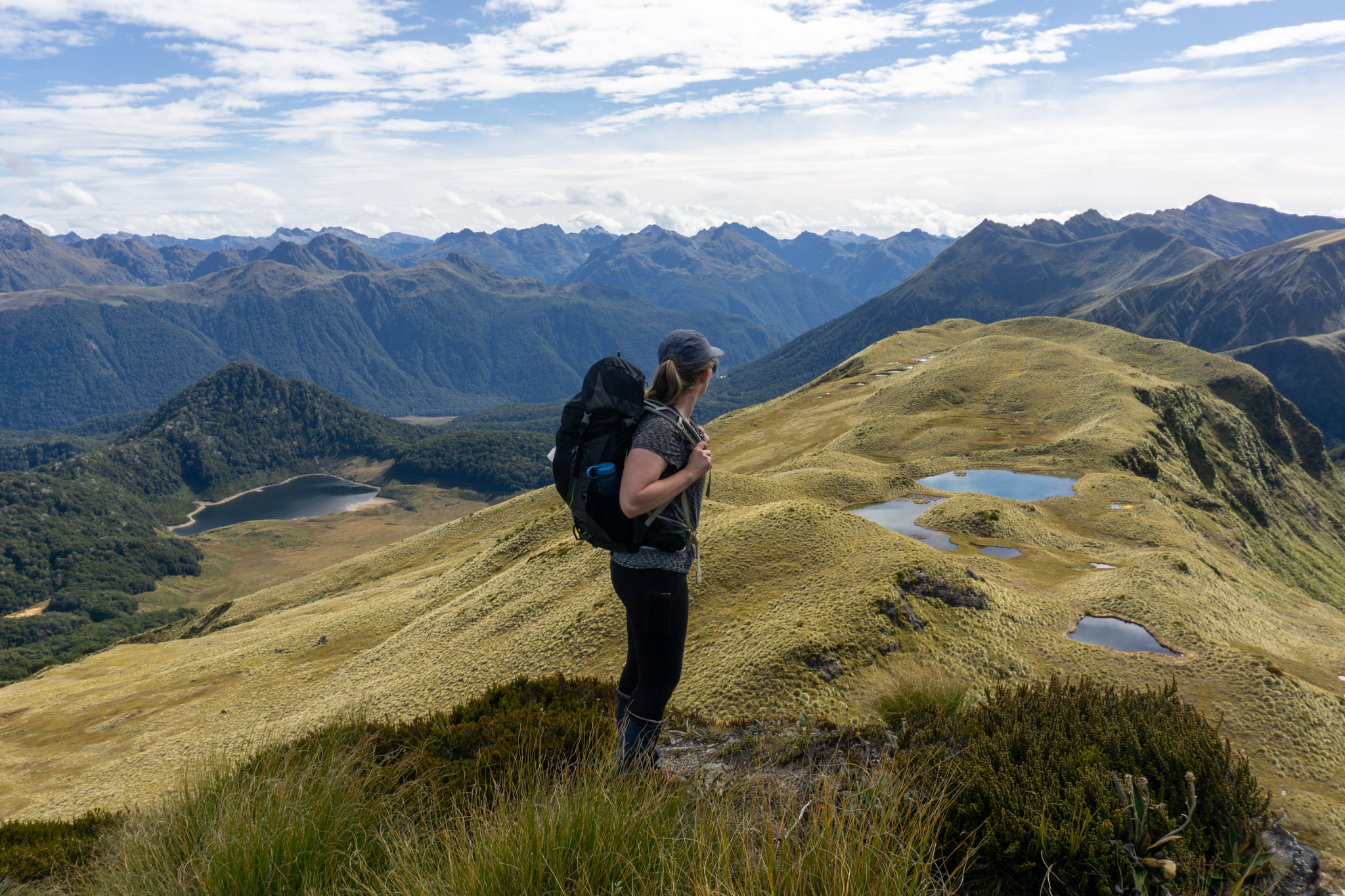
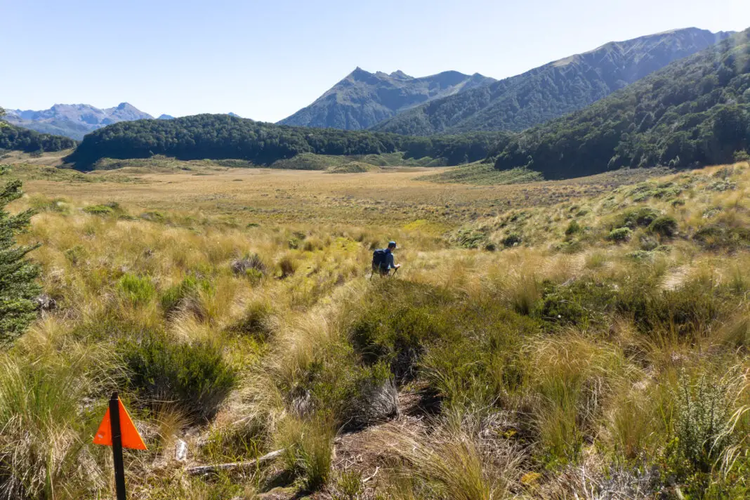
From the summit of Pr 1476 we had amazing views over Green Lake and the Grebe Valley. Matt and I stayed up there for a while, soaking in the sun, enjoying the views, and scoping out the route we would take. Then it was time to head down.
We followed our noses down the ridge, and then chose a chute to climb down. It was steep, but not scarily so. Once out of the chute, the going was less steep as we made our way down the wide tussock slope towards the lake.
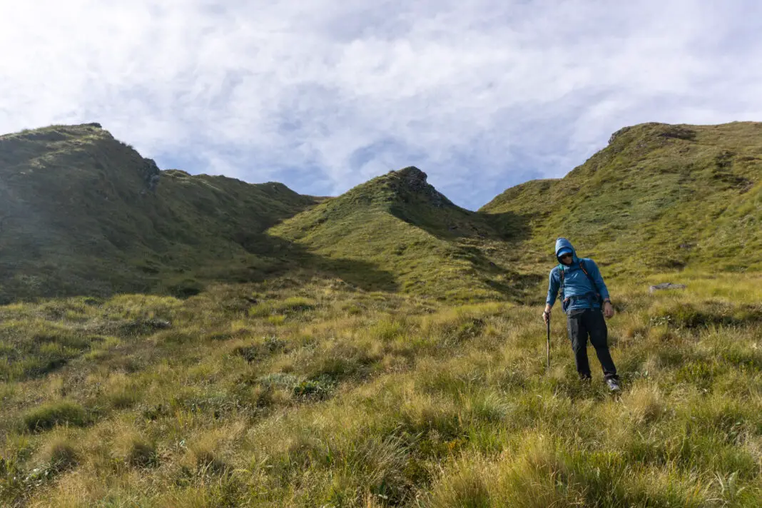
When we reached the tussocks flats that separated us from the lake, the going got a lot harder. It was difficult to see where you were putting your feet, and on top of this the ground was very uneven with surprise holes or tiny creek canyons that you couldn’t see until you were in them. Progress was slow and tiring. It took a deceptively long time to reach the lake shore. I think I now have tussock-induced PTSD. I’d never been happier to be on flat ground and be able to see my own feet. It was a glorious moment.
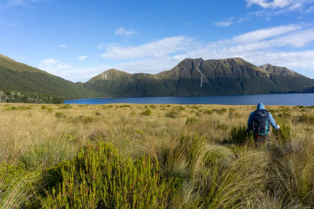
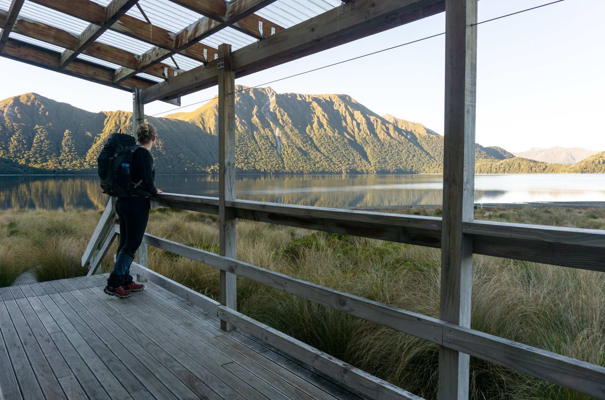
After reaching the lake shore, it was a quick few minutes’ walk to Green Lake Hut. There were already a group of loud Venturers from Te Anau and a solo woman to keep us company. The hut was nice and new, the sandflies not too veracious, and the lake and mountain views were incredible. I was in my happy place.
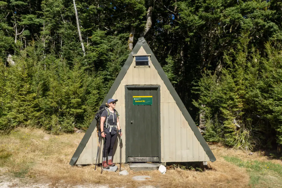
Borland Bivvy Track – 3 hours, 6.8km, easy
The next day we walked back out to Borland Road, this time on the much easier track to Borland Bivvy (although there were still enough tussock sections to induce flashbacks from the day before). Because most people reading this will be heading in to Green Lake Hut this way – I’ll write this section in the reverse of how we walked it, just to be really confusing.
The track from Borland Bivvy on Borland Road is the most straight forward way of reaching Green Lake Hut, although there are still some trickier sections for children or new trampers. Borland Bivvy is located on the Borland Road, a few minutes’ drive down from Borland Saddle. There isn’t great parking at the Bivvy, it’s best to park under the powerlines just up the road.
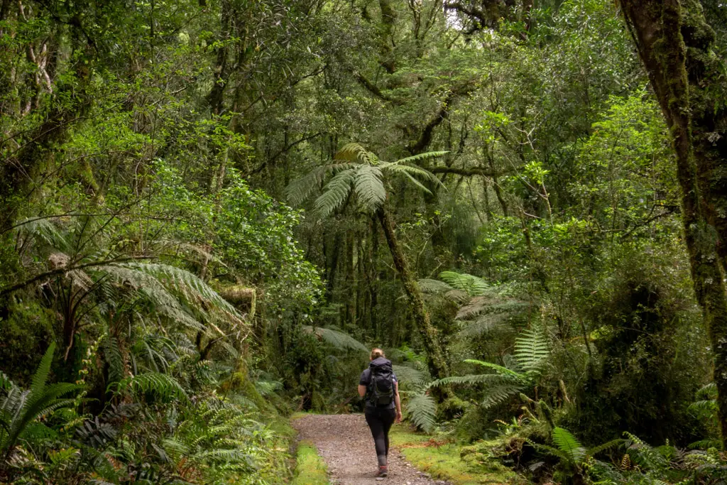
The track starts off in beautiful Fiordland forest, before descending to the first (of several) tussock flats. This flat wasn’t too boggy or wet when we went through in the middle of a very dry summer, but if you’re going during or after wet weather, be prepared for wet boots. If it is wet, don’t bother walking around the bogs – you’ll damage the ground and really there’s no point, you’re almost guaranteed to get wet feet further along the track anyway.
From the first flat it’s a short climb up into the forest, before a steep (and slippery, since it is the south side) descent to the next tussock flat. This flat is longer than the first, and the tussocks are about chest height on an average adult. If you’ve got children, this wouldn’t be the place to play hide and seek, as you’ll never find them again.
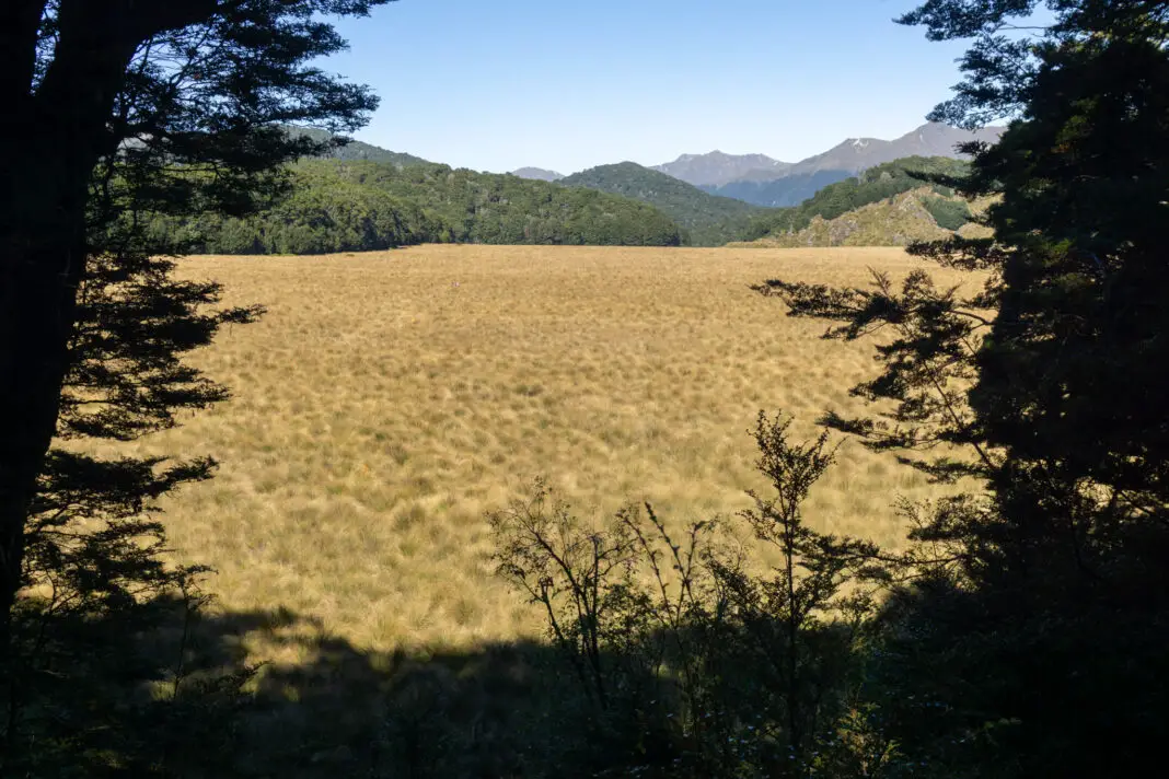
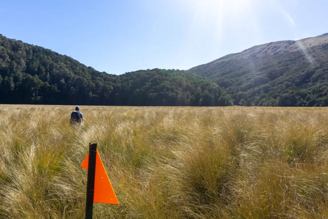
The orange trail markers don’t stand out very well in the orange-tinged tussock, so keep a careful eye out for them as you swim your way through the sea of tussocks. I found walking through the tussocks fun for the first five steps, and then flashbacks from the previous day started. It was slightly hellish. But in a Type II kind of way.
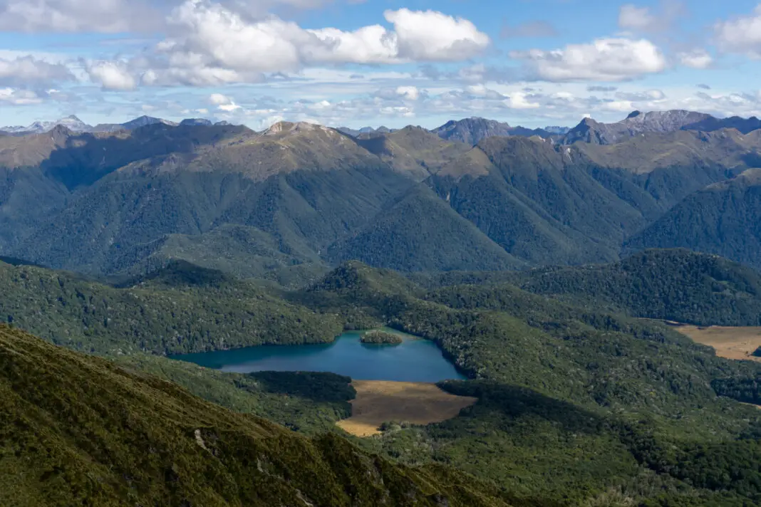
It can get a bit wet on the far side of the tussock flat, but again – if it’s bad, you probably already have wet feet anyway, so just embrace it. Once you’re out of the tussock flat, you’ll head back into the forest. There is a track junction on the right heading towards Clark Hut, while straight ahead is Green Lake Hut. We walked 20 minutes down the Clark Hut track as a detour to catch some pretty reflections in Island Lake (one of the many little lakes in the Grebe Valley). There were some lovely little campsites in amongst the trees, although I can only imagine past occupants would have been eaten alive by sandflies.
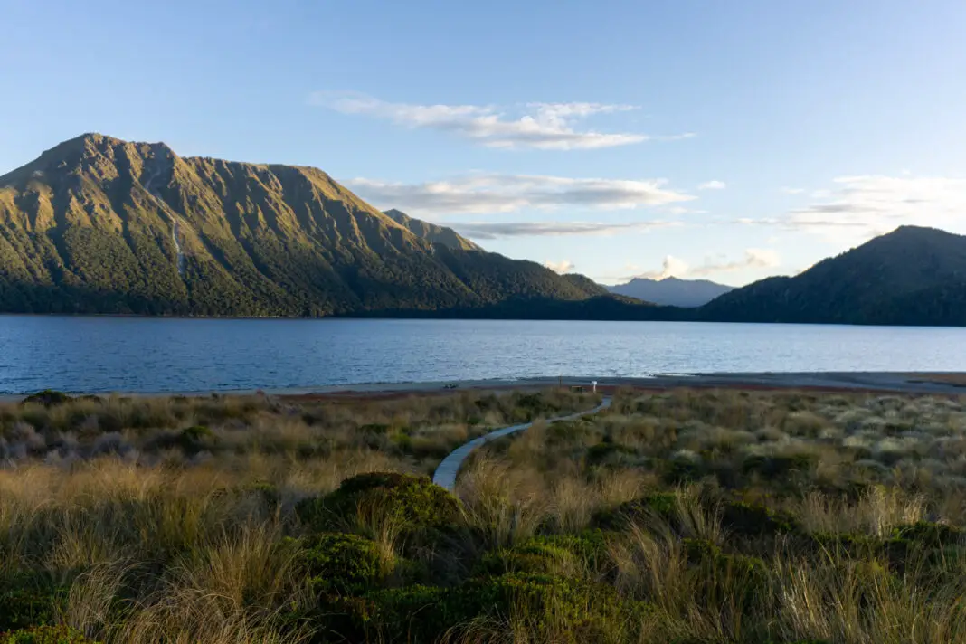
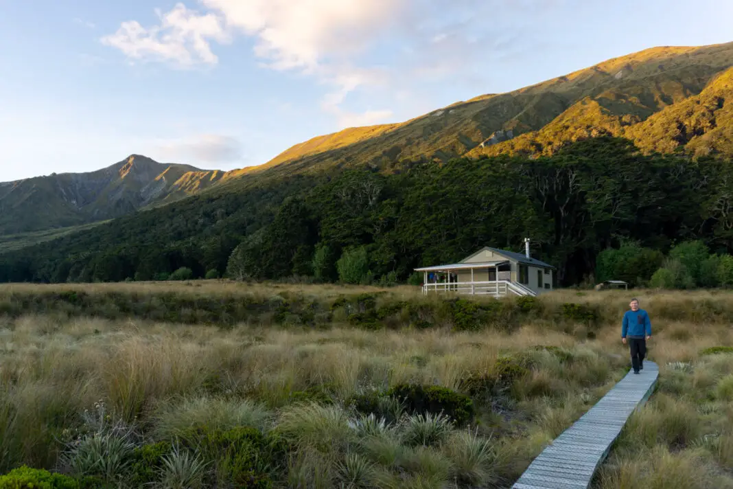
Not long after the track junction, the final uphill (and the steepest) begins. The track climbs just over 150m vertical through the forest, at times quite steeply. But the reward is that it eventually starts heading down towards the shores of Green Lake, and then it’s only a 20 minute walk to the hut! The views as you reach the lake shores are already gorgeous, and they only open up more as you walk along its edge.
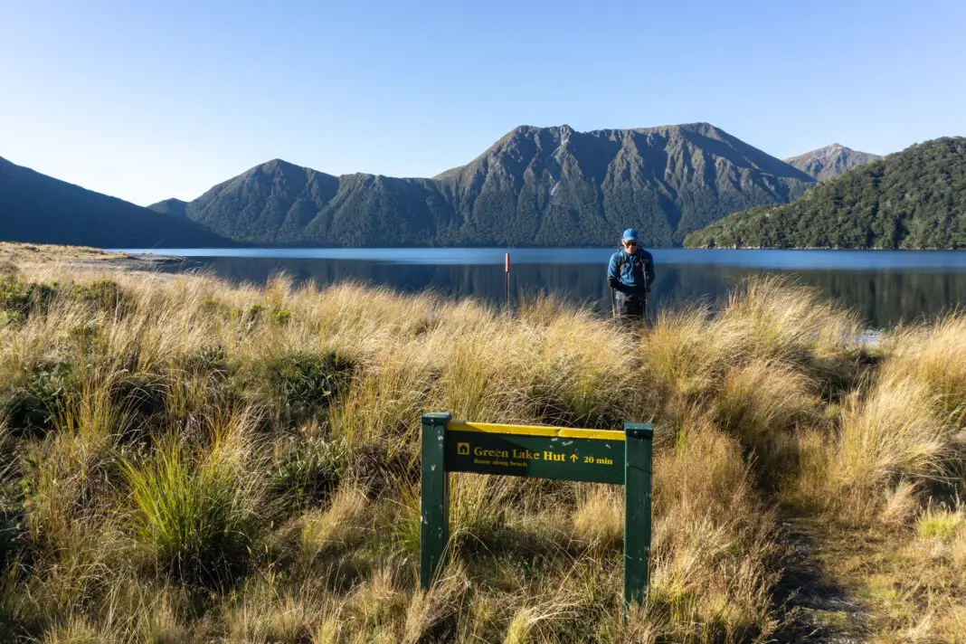
If the lake level is high, parts of the track around the lake edge may be underwater. You’d be able to walk through the tussock above the lake edge without much issue, it would just take a lot longer. The hut slowly comes into view as you round the lake, perfectly situated.
Lake Monowai Track – 6 hours, 11km, moderate
I am yet to complete this track to Green Lake Hut (although it’s definitely on my list), so I don’t have any details or photos to share. There’s a bit of information online on this track already, including this trip report by We Are Explorers. Or you can take my colleague’s trip report: “I cried and asked my friend to call a helicopter” (may or may not be paraphrasing, sorry Carol). Be aware that even though the track is only 11km, it’s a tough 11km with a lot of mud and often windfall.
Hopefully some day I can update this section with my own trip report! Comment below if you’ve walked into Green Lake Hut from Lake Monowai, and how you found the track – I’d be really interested to hear!
Safety
As always, please stay safe when you’re out exploring. Follow the Land Safety Code:
- Choose the right trip for you (do your research: read my article on tramping safety, talk to DOC)
- Understand the weather (this is an extremely hazardous tramp in adverse conditions)
- Pack warm clothes and extra food (including windproof and warm layers, regardless of how nice the day is when you set out. You check out my post on what to taking tramping here)
- Share your plans and take ways to get help (have an emergency beacon on your person)
- Take care of yourself and each other
If you have any questions about Green Lake Hut, please get in touch with me here on the blog or on my Instagram, I’d love to chat. Or you can take a look at my Tramping 101 series which includes this post about how to stay safe in the outdoors.
Stay safe and get outside!
Where to next?
LET ME KNOW WHAT YOU THINK! LEAVE ME A COMMENT OR MESSAGE ME OVER ON MY INSTAGRAM.
I love hearing from readers and helping them plan their own adventures!
Hey! I loved reading through your blog post just now. I did Lake Monowai to Green Lake overnight this weekend with a friend, and my goodness. You’re right when you say it is a tough 11km. I would also agree with your friend above, there were definitely a few tears shed in the last 1.5km down to the lake. This track has a lot of windfalls to navigate at the moment, along with knee deep mud in some spots, and lots of climbing and scrambling. There’s also a couple of small river crossings that would be a lot more challenging if it had been raining, but that I didn’t know we’re there until we met them. My body has definitely been well used on this track. Getting to the lake and setting up a tent, sitting on the shore and having a gin and tonic made it worth it though! Sarah
Definitely sounds like an adventure!! I’m still yet to do that track so thanks so much for adding that info! Glad the lake was worth it for you, and well done for carrying in a gin and tonic! Perfect end to your day.