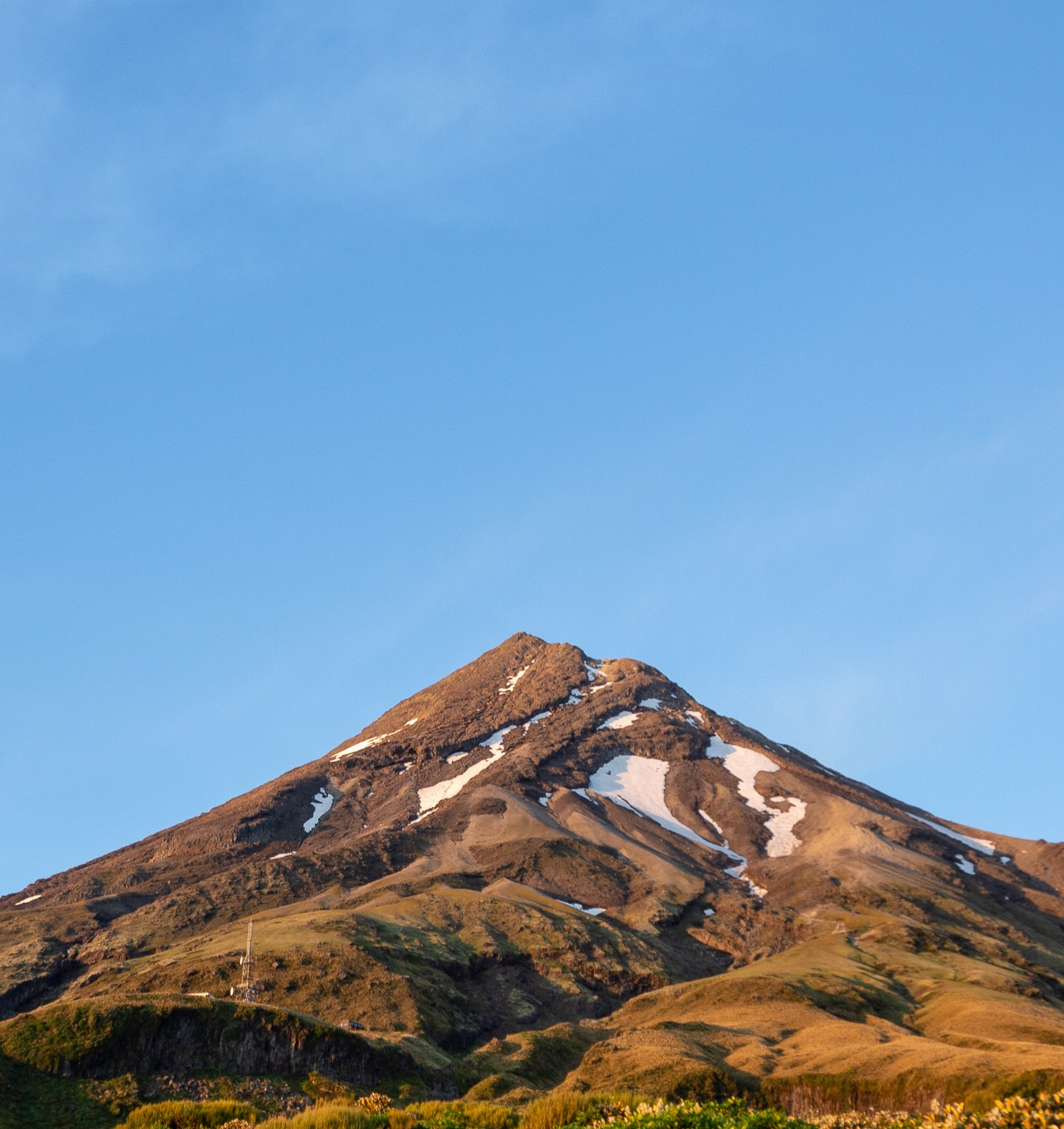
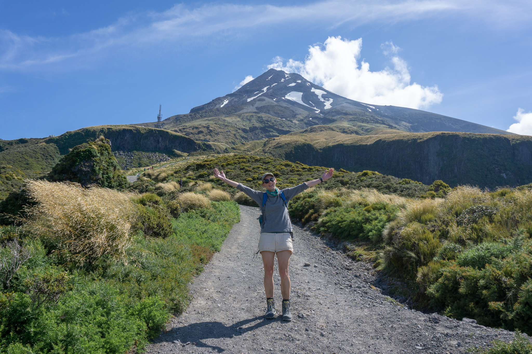
Climbing to the summit of Taranaki Maunga; New Zealand’s second highest volcano was one massive adventure. Scree slopes made up of sharp scoria, a snow-filled crater and amazing 360° views were all in a day’s work.
Length: 12.6km return with over 1,000m elevation gain (and descent)
Time taken: DOC says 8-10 hours for the Northern Summit Route. We took 10.5 hours + breaks. (Starting from Maketawa Hut and diverting back to grab our gear and continuing back to North Egmont Visitor Centre via Maketawa Track). Some people take as little as 6 hours – it really depends on your fitness.
Difficulty: difficult (this trip summary is for summer only)
Facilities: The trailhead at North Egmont Visitor Centre has 24-hour toilets, as well as a drinking fountain and intentions book. About a third of the way up the mountain, just below Kahurangi Lodge (NZAC), there is a long-drop toilet (with toilet paper when we were there, luxury!).
– Important: This is a summer only route description for climbing Taranaki Maunga. Taranaki is notorious for its changeable conditions. Do not take it lightly. Taranaki stands as the only high point for hundreds of kilometres around. (And as the only significant landmass for incoming weather from the west). The weather can change in just minutes, even in summer, and preparation is crucial. Many people have died on this mountain, take it seriously. –
Mountain Safety Council has created an amazing video detailing the Northern Summit Route up Taranaki. This is the most common route and the one we took. The video is very helpful and definitely worth checking out!
Why climb Taranaki?
When I climbed up to Syme Hut on Fanthams Peak, I’d stared up at Taranaki’s summit, wondering if I would ever make it up there. Fast forward two weeks later and there I was, looking down at Fanthams Peak, from a much higher height than Taranaki’s summit had seemed from Syme Hut!
Taranaki is the second highest mountain in the North Island after Mt Ruapehu. I’d wanted to climb Taranaki for a while. With a great weather forecast for Wellington Anniversary weekend, which was also my colleague and friend, Rebecca’s last weekend in the North Island before she abandoned me for the south – it was time!
How to get to the trailhead for Taranaki’s Northern Summit Route
There are many different routes to climb to Taranaki’s summit. However the easiest (and by far the most popular) is the Northern Summit Route. Neither myself nor Rebecca had climbed Taranaki, and we were relative novices for this kind of climb. So we decided to take the most straight forward route. Let’s be honest, we didn’t need to complicate the 1,000m+ scramble further.
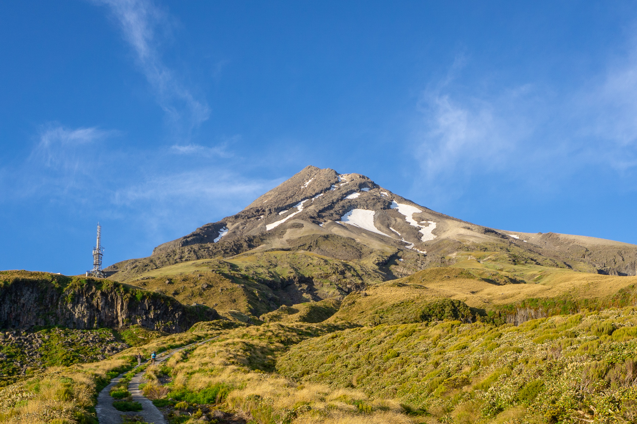
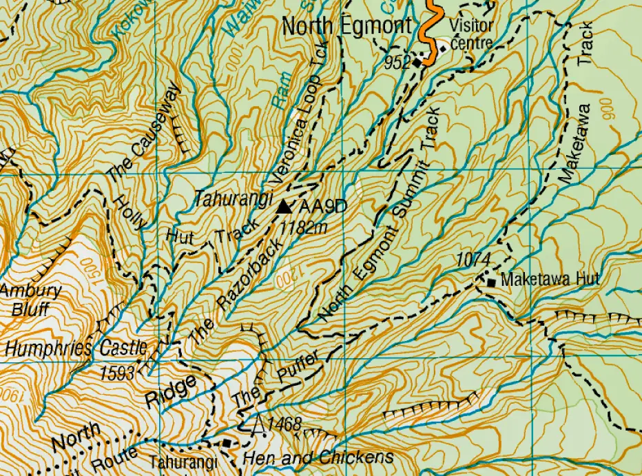
The route up North Ridge to Taranaki’s summit starts from the North Egmont Visitor Centre. The visitor centre is located at the end of Egmont Rd, accessed from SH3. It’s just over a half hour’s drive from New Plymouth (along a road that narrows and becomes ever more twisty, but is sealed all the way). The track leaves from the right of the visitor’s centre (when looking at the building). The trailhead is signposted.
Rebecca and I walked in to Maketawa Hut the evening before (slightly diverting off the northern route down to the hut). We got up early to summit Taranaki the next day.
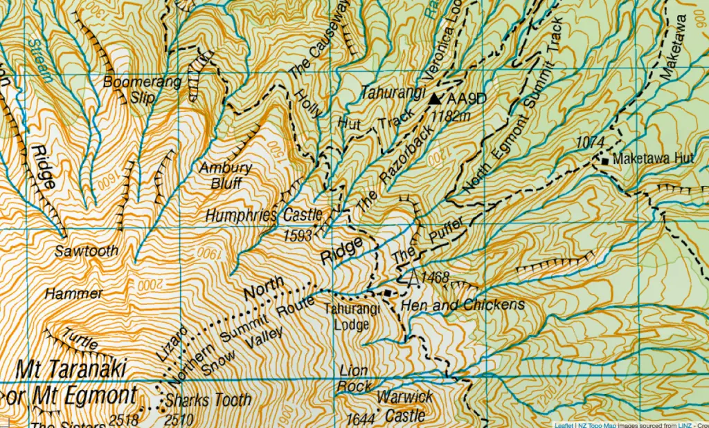
(Thanks Topomaps!)
Climbing Taranaki Maunga
Rebecca and I set out towards the maunga Friday evening after work from Whanganui. We arrived at North Egmont Visitor Centre just after 7pm. We didn’t have any trouble finding parks, but on busy weekends this can be an issue. You may have to park on the road if that’s the case. So plan to get there as early as you can.
We wrote our intentions in the visitor centre’s book. (We’d already advised our emergency contact of our route and when to expect us back). Then filled up our water bottles, hoisted our packs, and set off up the track. The tramp starts to the right of the visitor centre (when facing it). It crosses the road to lead up to the red Camphouse which sits at the very end of Egmont Road. Follow your nose and the signs.
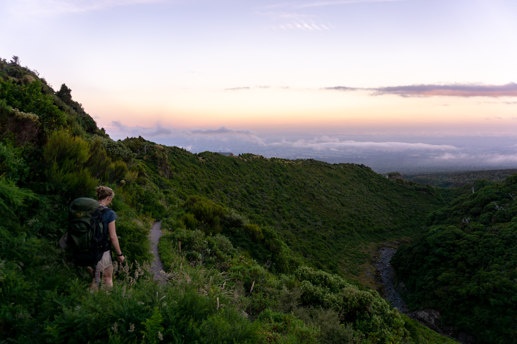
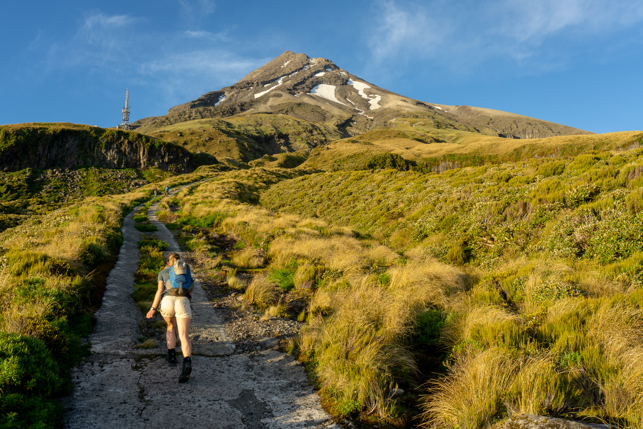
From the Camphouse (which you can book here), head through the wooden “kissing gate” (don’t even ask – if you can tell me how it received its name, please message). Then up the gravel / 4WD Translator Road. It’s steep in parts, but pretty well graded, through beautiful lush North Island forest. After about 45 minutes of walking, we reached a wide sweeping corner with the turn-off towards Maketawa Hut, our accomodation for the night, back down the ridge. We turned off the road and onto the track, putting Taranaki at our backs. Within 20 minutes we had arrived down at the hut.
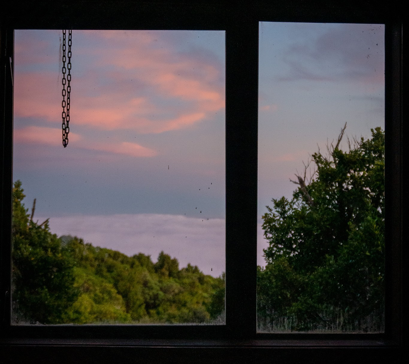
There were only two other people at the hut, a couple from Romania. So each group got their own “wing” or bunk room of the hut (which sleeps 16, 8 per room). Rebecca and I spent the evening playing cards and eating chocolate. I had my fingers crossed that we would wake up to a clear sky the next morning (always a potluck with Taranaki).
When I woke up it was still dark. But as I headed out to use the long-drop, I could see the outline of the maunga in the moonlight, clear of clouds, with pinpricks of lights moving up near the summit. They were the head-torches of the extremely early risers who’d reached the summit for sunrise. (When they passed us coming back down, I asked what time they’d started – 2am or earlier … ).
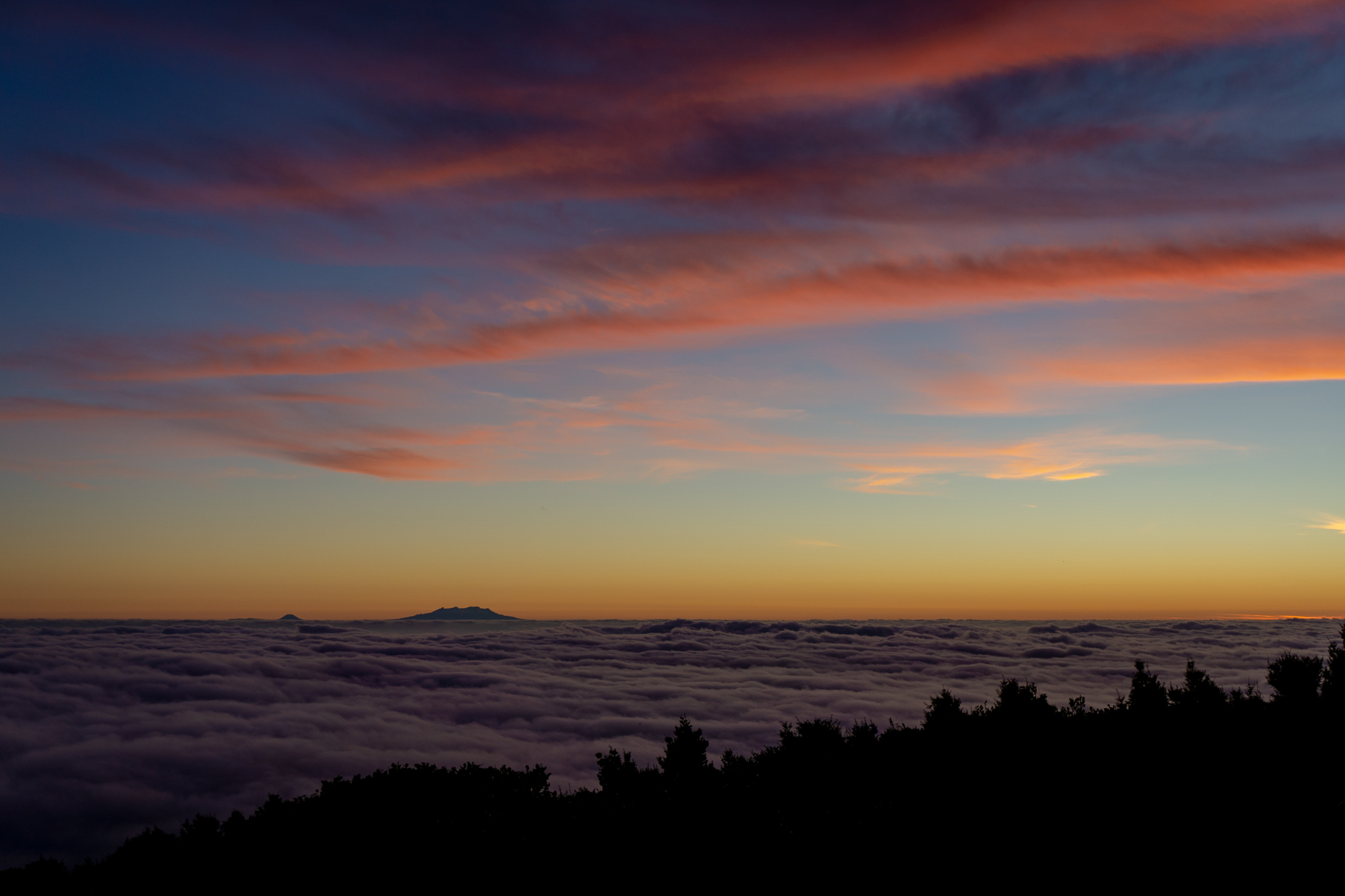
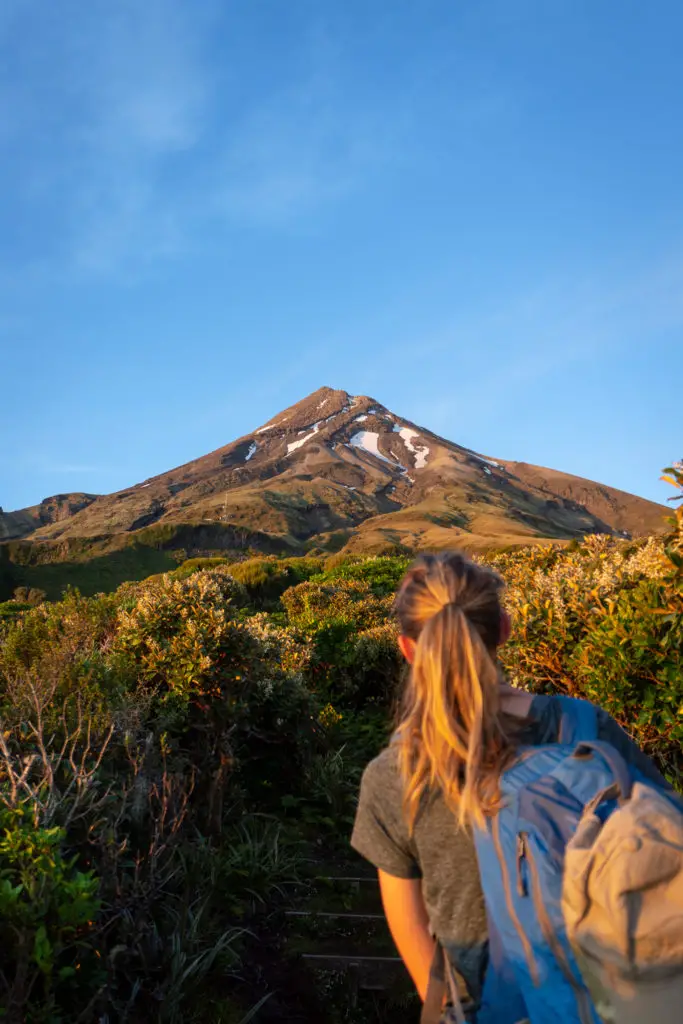
I shook Rebecca awake, who mumbled something barely comprehensible about kayaking down rapids. We quickly made up some breakfast while admiring the sea of clouds lapping at the hill below us. We left the hut about 6am just as the sun was threatening to peep over the horizon. (Slightly later than planned, but no longer needing to use our head torches). And we were off!
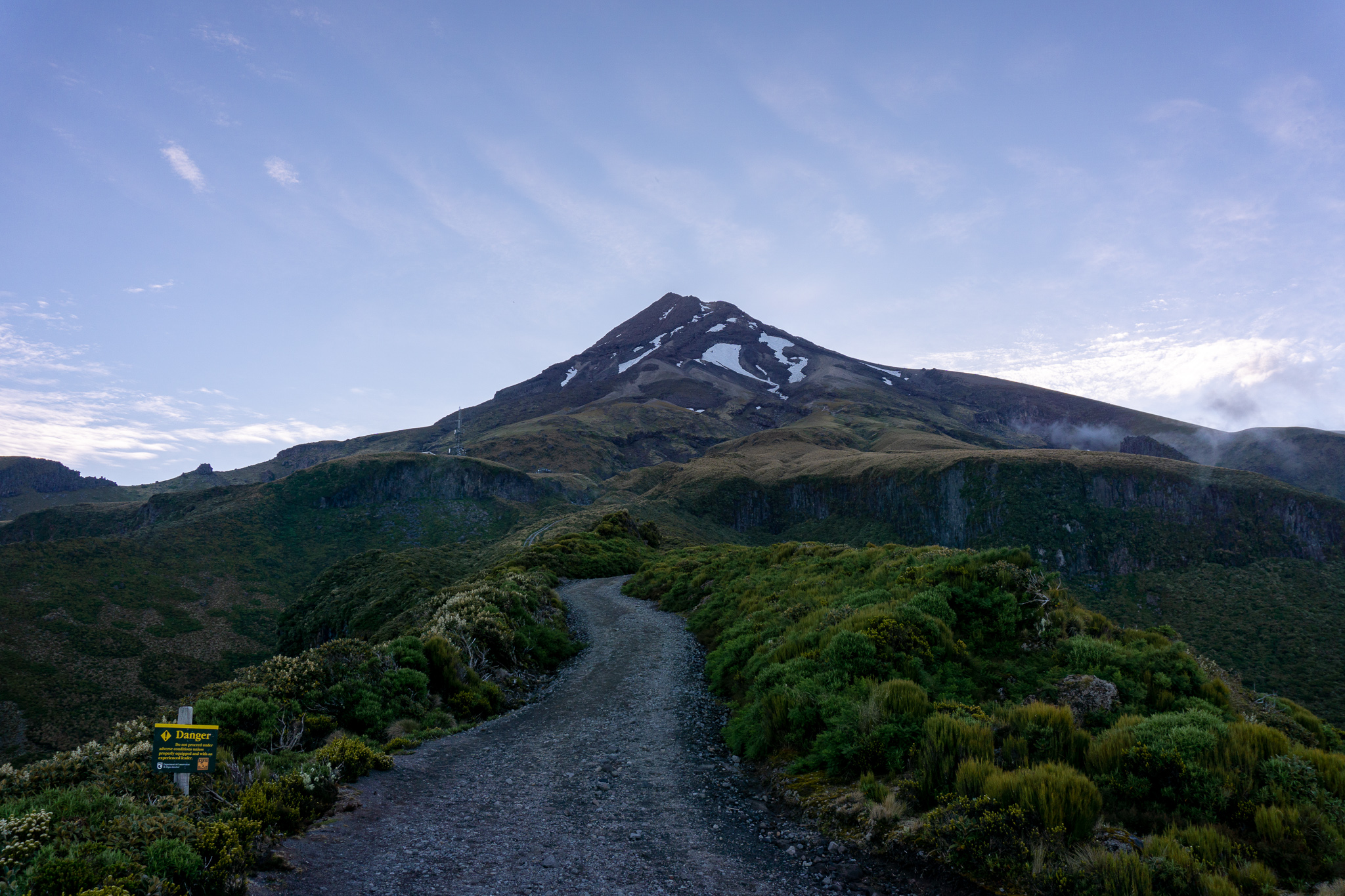
I couldn’t stop looking up at our goal in the soft dawn light. Taranaki’s summit. I didn’t really believe or understand that we were going to be climbing up there. That I would be sitting on the very top at lunchtime. It still looked so unreal and far away from the Maketawa Hut. When we reached Translator Road 20 minutes later, I didn’t feel like we were any closer. If anything it looked even more unassailable.
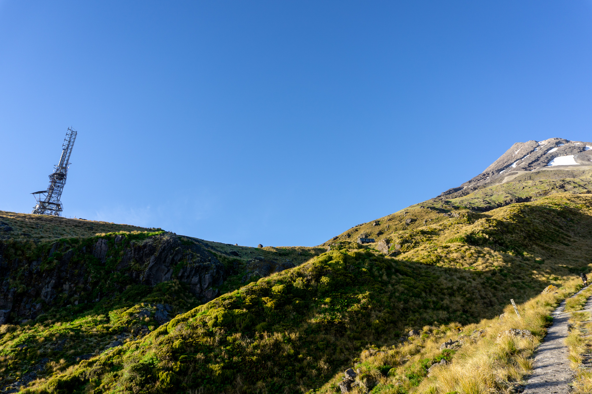
We walked up Translator Road and quickly reached the Puffer. The Puffer is a partly cemented portion of the road that runs almost all the way up to Kahurangi Lodge (NZAC). I quickly formed a love-hate relationship with the Puffer. It was steep, hard, boring, and never-ending. But it was also very efficient and you didn’t have to worry about where you put your feet. Rebecca developed a hate-hate relationship with it. We reached Kahurangi Lodge a bit over an hour from leaving Maketawa Hut. Our Romanian friends had passed us on the Puffer. They hadn’t been puffing.
We had a good break at Kahurangi Lodge. There is a toilet 100m below the lodge which we took advantage of, and benches outside the lodge where we had a break and munched down on some food (thanks OSM for the bars! They went down a treat). It felt like we’d walked a fair distance already, but we hadn’t even really begun the climb proper.
We walked past the tents of people camping at Kahurangi Lodge (which you couldn’t book when I checked, as the NZAC were doing renovations), past the sign pointing to far off Holly Hut and on to rocky Hongi Valley above the lodge. This was where it actually started to feel like we were climbing a mountain. Rather than just walking up a road to the summit.
The well-worn path hugged close to the cliffs on the left, before reaching the boulder field and crossing up and over to the cliffs on the other side. There were quite a few paths in the boulder field. But so long as you aim for the end of the right-hand cliffs, you’ll be heading the right way.
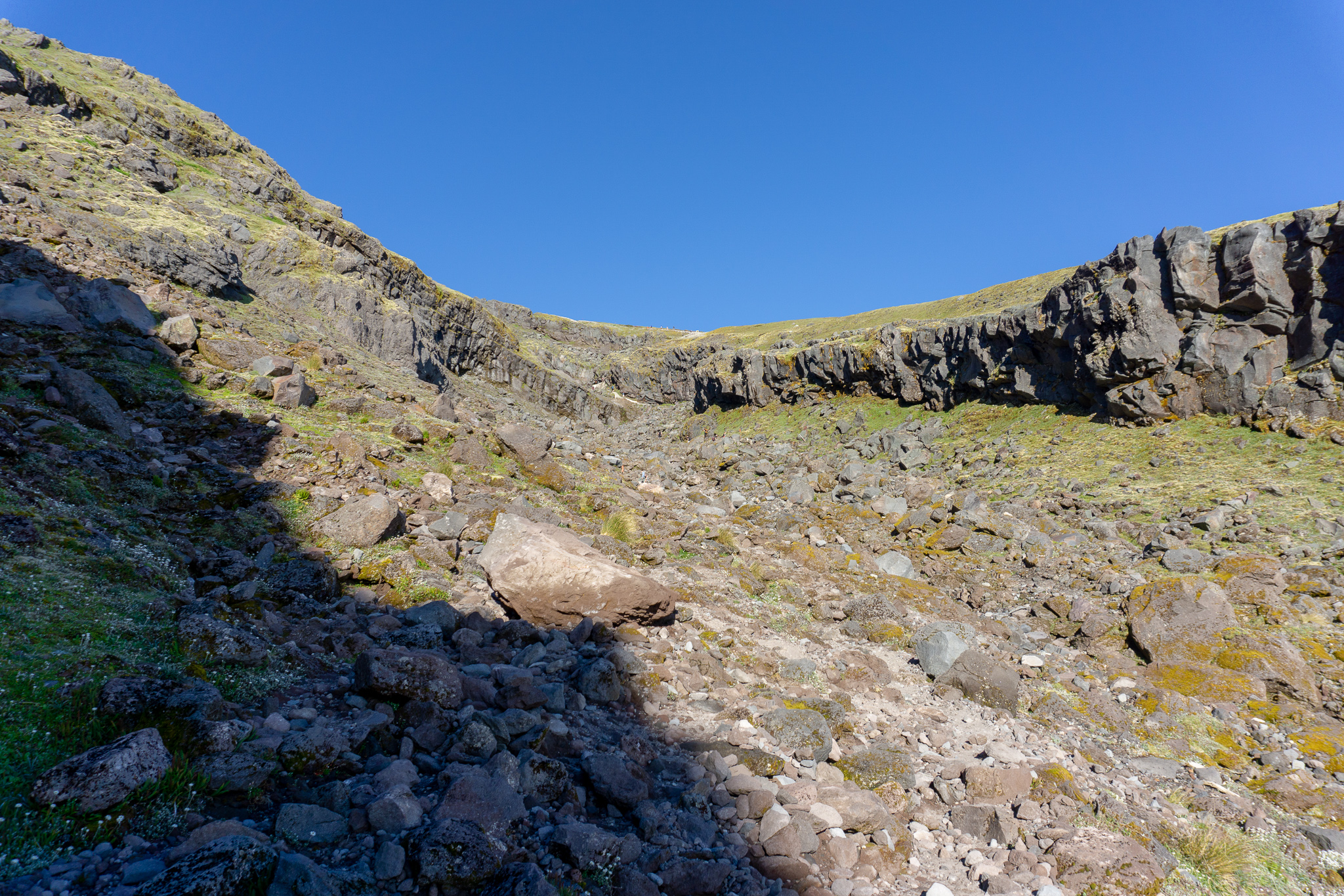
Under the cliffs (which almost looked fake because of their geometrical shapes), the steps started. Complete with a sign from good old ‘Bas’ warning us that this was a good check point (there had been another back at the start of the Puffer). The weather was still looking fantastic. Rebecca and I felt good, so we continued on after patting Bas on the head.
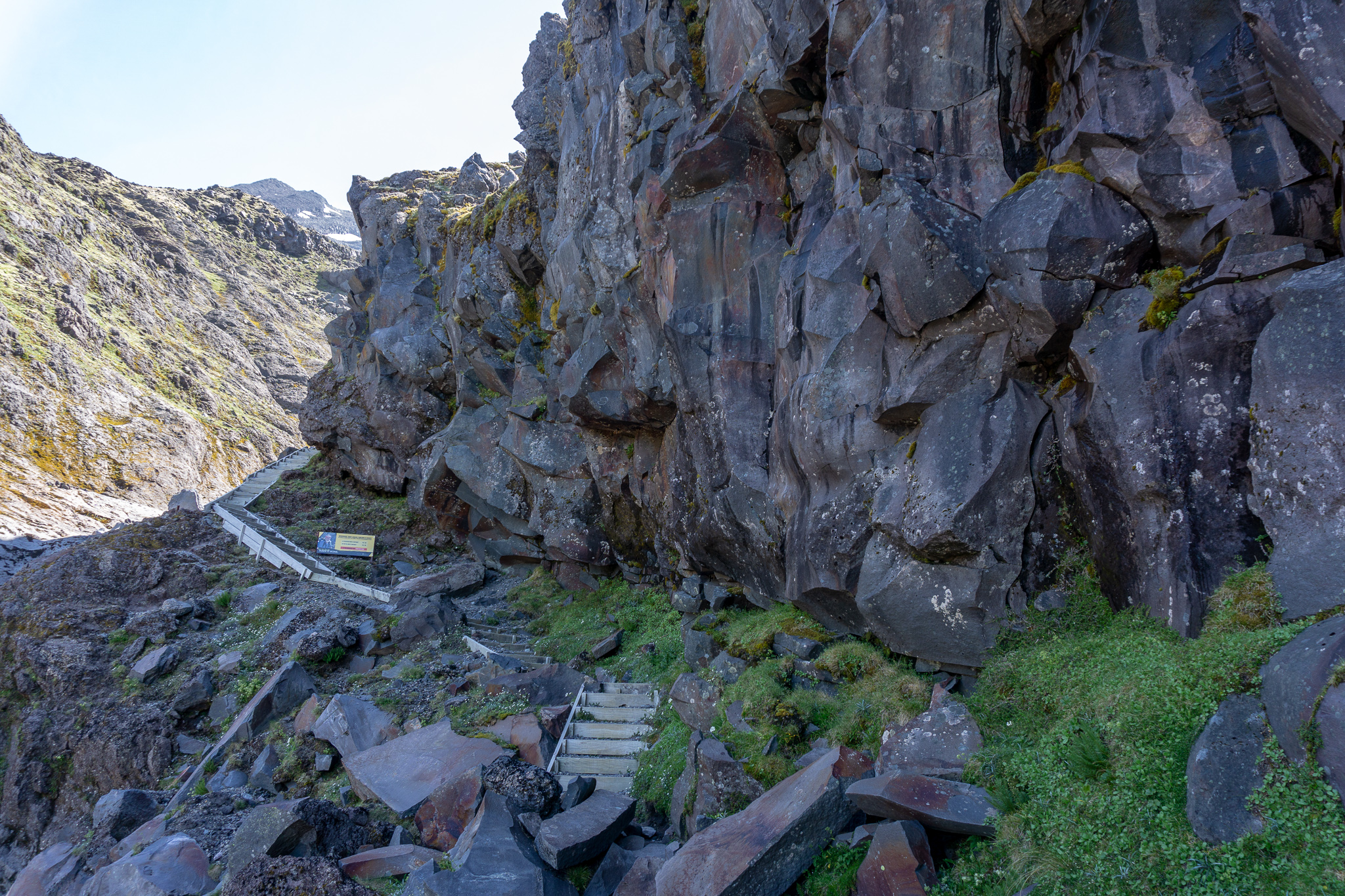
We climbed up the steps, and up some more. There weren’t any hand rails and the steps were steep and exposed. I was very glad it was a clear day, as they would be horrible and dangerous in windy conditions. For people with a bit of vertigo, the stairs might not be the best. But they’ll be a good indication of what you’ll face later on in the hike. So if you’re uncomfortable with them, you might want to reconsider going on.
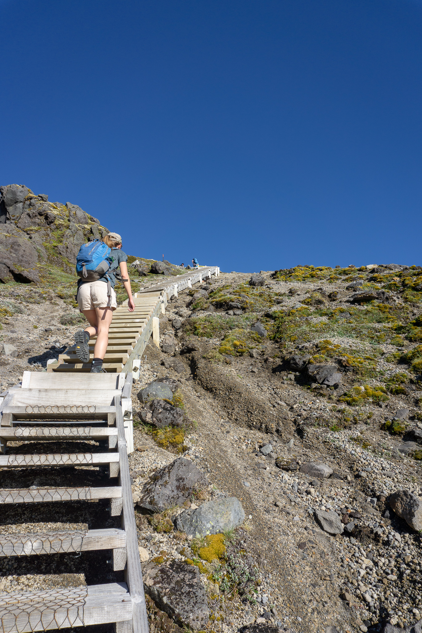
Eventually at the top of the stairs was the start of the scree, infamous on Taranaki.
An ode to scree: Scree, oh how I hate thee.
It actually wasn’t too bad to start with. There was quite a well worn track to follow that wasn’t too slippery or steep (early on in the summer season this might not be the case). This was where the first of the early-risers who’d already reached the summit and were on their way back down again, passed us. And they were running. Because that’s totally normal and not demoralising in any way.
After climbing up a steeper and rockier section (and having another chocolate and water break – very important), the slope got steeper and the scree less forgiving. Because that’s just what we were wanting at this stage. Thankfully Fanthams Peak had prepared me well. I didn’t find it as difficult as that trip. However my expectations going in were that it would be pretty horrendous. And it was only partly horrendous. So you know, take what I say with a grain of salt.
Passing other people who were struggling a bit more than myself (having probably never walked on volcanic scree before, or wearing really poor footwear choices) did make me feel like I was doing an ok job. (Am I a terrible person?)
There were quite a lot of people on the slope by this time. All up I would say there were probably a few hundred climbing the mountain. (It being the only clear weather day that whole week and also being a long weekend for the whole of the lower North Island). Quite a lot of them were actually Kiwis. This was surprisingly nice as normally I only ever hear foreign accents on our more popular walks. (Which is awesome, don’t get me wrong, it just makes me sad that Kiwis aren’t getting out and exploring their own country too).
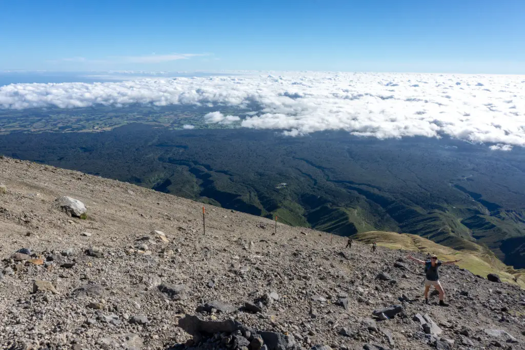
The steeper section of scree slope stretched on for quite a while – with some rocks in the distance with very small people sitting on them. It physically felt like we were walking towards the rocks, but were we really? Because they didn’t get any closer. Some of the people we passed looked like they were about to cry. I got that. I’ve been there. I offered my footsteps for them if it helped, which for some it did. This section was also made more difficult because we weren’t easily able to stop and rest due to the steepness and the unstable scree. We had to find a rock or a slightly less steep section before we could stop moving and not slide down the hillside on our butts.
Eventually we reached the rocks and had another sit-down break, while watching more people struggle on below us. We could see the Lizard (the next rocky section) from where we were sitting and hear a helicopter coming up from the plains. As we started along the track (which you can see in the below photo was actually a rough path and much less steep than the previous scree slope), the helicopter hovered over the ridge for a minute or so before flying around out of sight. Rebecca and I assumed it was on a training flight because of the windless conditions. But what we hadn’t seen was a paramedic jump out to treat someone on the ground.
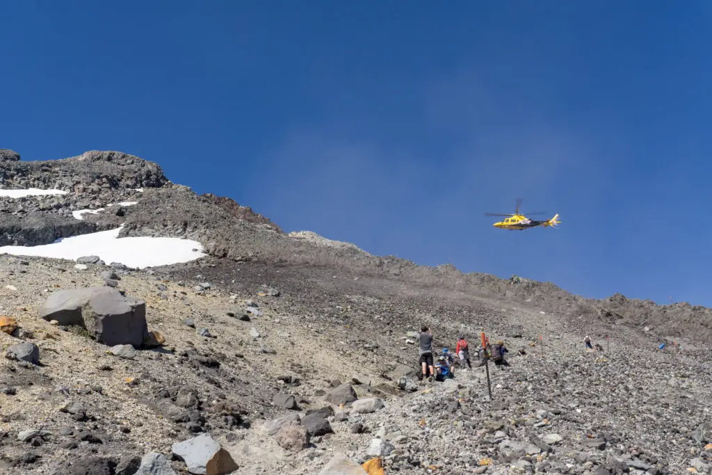
As we got closer, it became apparent that someone was injured. The paramedic called out in an extremely well-projected voice for everyone in the vicinity to crouch down and hold onto our gear, as the helicopter came in again. They winched up the injured tramper slowly, then the paramedic, before flying directly towards New Plymouth.
We learnt later when we were crossing the crater (spoiler alert: we got to the top!) that our Romanian friends had actually come across the injured person first on their way up. the man had been making his way back down from the summit by himself when he’d tripped and fallen on the rocky slope. He broke his collar bone, essentially immobilising his arm (this trip really requires that you not be in excruciating pain and have the use of all four limbs/prostheses).
The Romanian couple called LandSAR on their cellphone and within 45 minutes the helicopter had arrived and located them. But this was a clear day with barely any wind. And a very busy day with lots of people coming and going – perfect scenario for this poor guy. Just goes to show how quickly things can go wrong. And why you need a communication device (cellphone if you know you’ll have service, or a PLB) and emergency gear.
The Taranaki Community Rescue Helicopter does amazing work, at no cost to the patient. In 2018, (when it was uncertain whether or not Taranaki would even continue to have a dedicated “air ambulance”), the crew flew 199 life-changing missions. If you’d like to know more about their work, or would like to donate – check out their website here.
Rebecca and I watched the helicopter fly off, glad that we hadn’t fallen. And also glad the person had received pretty prompt rescue from the side of the North Island’s second highest mountain. I’d actually let people at work know that I was going to be attempting Taranaki summit. I now regretted jokingly telling my colleagues to watch out for any helicopter rescues (Rebecca and I both worked in a nearby hospital).
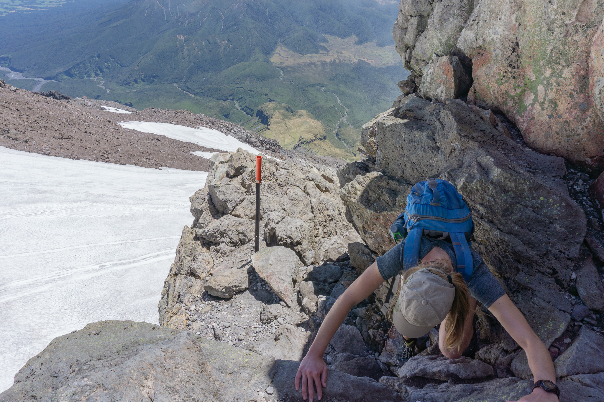
We reached the Lizard without mishap, about 3.5 hours after leaving Maketawa Hut. The tongue of rock called the Lizard marked the last section of our climb up to the crater. However it was far from the easiest. The Lizard is essentially rock climbing for beginners. For over an hour.
We sat and had some more food/chocolate at the foot of the Lizard, before setting off. There were plenty of well trodden “paths” up the rock. I use that term loosely because some of the “paths” just ended at the foot of a boulder that you had to climb up before rejoining the route again. But it was hard to follow the paths up. We kept losing one track and coming across another due to the steepness of the rock and having to clamber up small cliff faces.
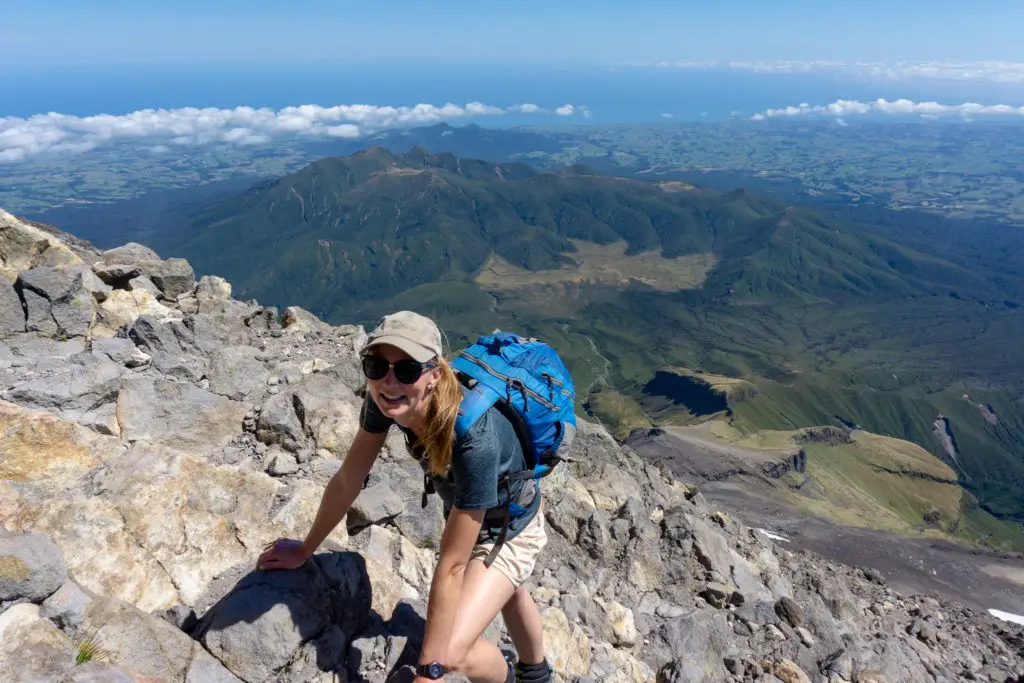
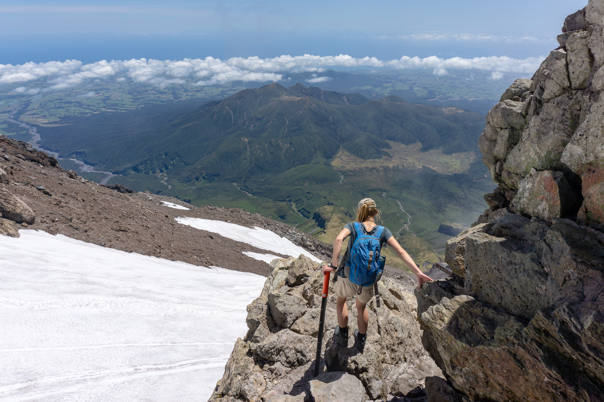
This was where tough gloves would have come in handy, by the end of the day I had a few cuts on my soft, office-worker hands. For those with a fear of heights, this wouldn’t be fun. Not only would the immediate climbing be hard – but you’re so high up (above 2000m) that even looking down onto the distant valleys and Ahukawakawa Swamp could be a bit dizzying.
I definitely underestimated the Lizard portion of the tramp. It took us over an hour to clamber up the 200 vertical metres, as we got steadily more and more fatigued. I felt like the ledge into the crater was just over that boulder, or just over the next rock face. But it wasn’t team.
It wasn’t.
I’m very happy I didn’t know that the orange marker poles were numbered. It would have been pretty soul crushing (sorry for telling you that … just don’t look until you’re coming back down). We kept being passed, and then passing, the same groups of people every ten minutes. It became a kind of running joke to politely gasp out “good morning” or “hello” each time, as though we hadn’t just seen each other clinging to a different rock.
After what seemed like a very long time, we could finally see where the Lizard narrowed. We knew that the Ledge (as I’d built it up in my head) was coming. The climb got a little bit steeper (apparently that was possible) and then we were onto the ledge! It wasn’t actually as bad as I had been expecting; although it had a bit of a drop to the snow on the right, it was actually quite wide and didn’t feel that exposed.

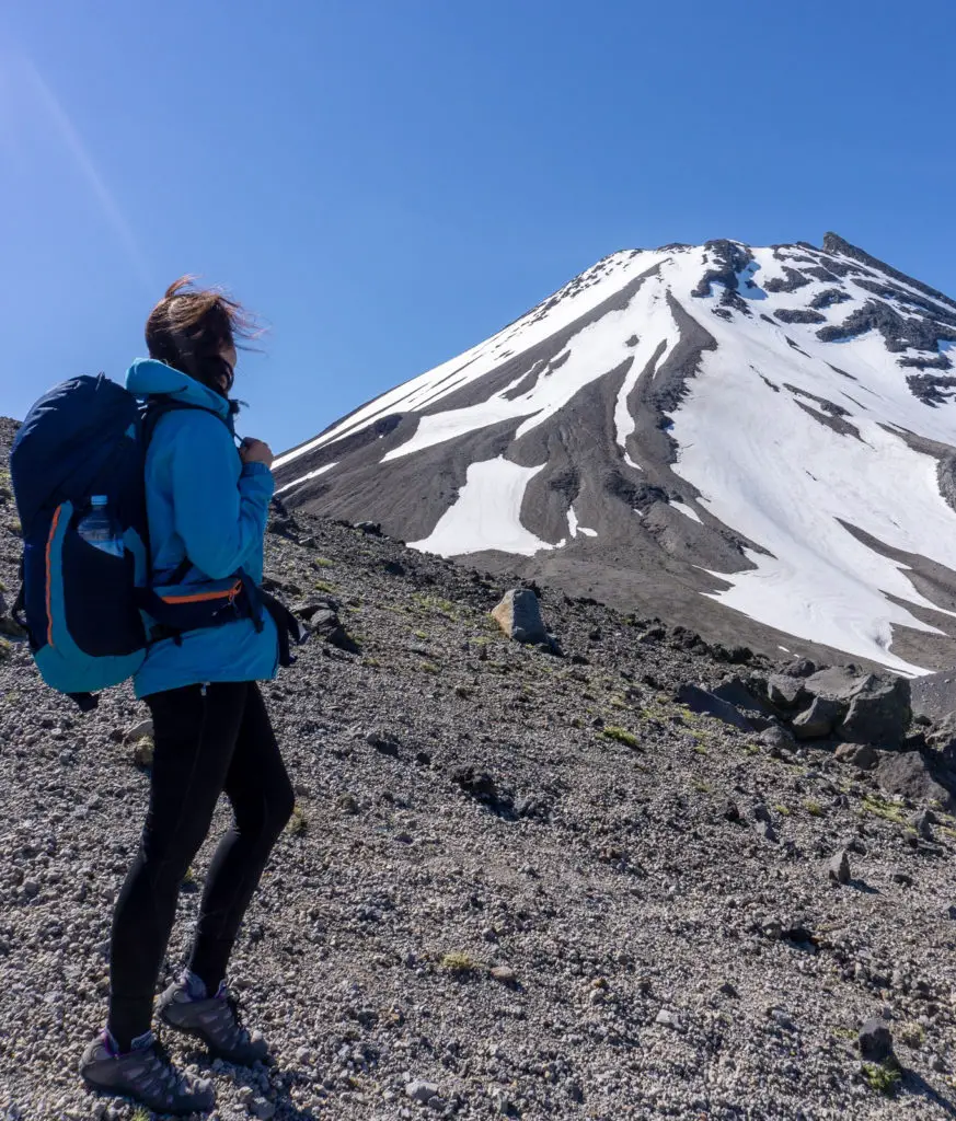
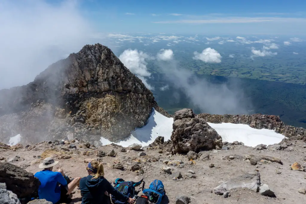
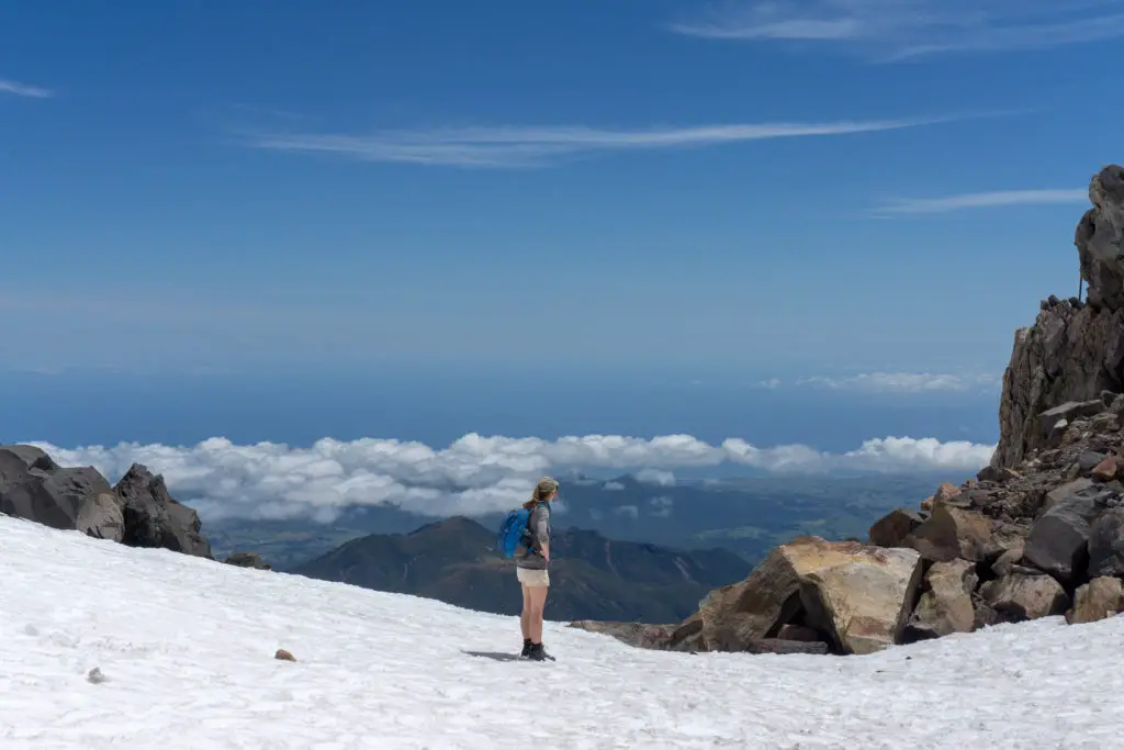
After scrambling along the rocky ledge for a minute, we got our first view into the crater. It was filled with snow (common even in summer), but no ice. It looked like a lot of fun after the rocky wall we’d just climbed up. We’d taken about an hour and a half to get to this point. But the top was only about 15 minutes from this view.
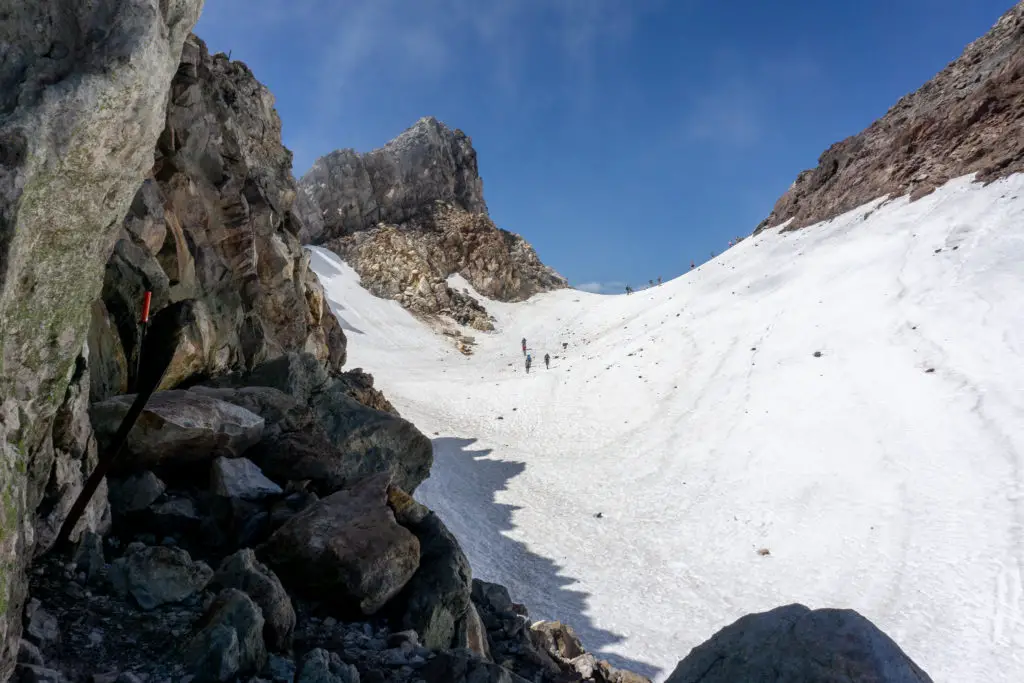
We jumped down into the snow, being careful of the icy rocks that were still frozen in the shade bordering the snow. The snow was soft, with a slight crunchy layer from being frozen overnight. We kicked steps up to the small saddle between Sharks Tooth on the left and the true summit on the right.
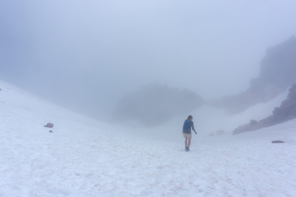
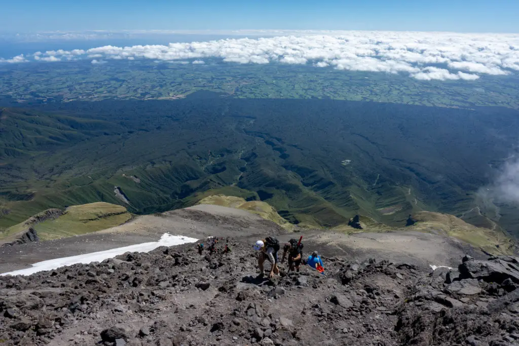
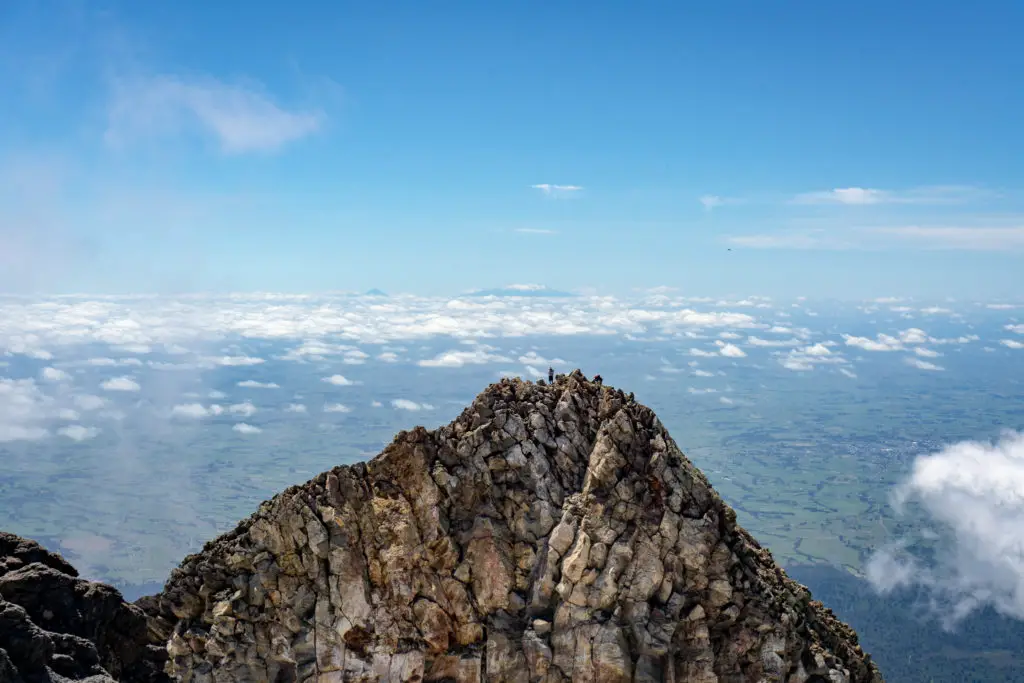
These photos were only taken about a minute apart, believe it or not. They show just how quickly the conditions can come in and change. (Particularly as up until this point in the climb you are unable to see any weather approaching from the west). The orange marker poles are there for a reason. But even with them you’d have to have good navigation skills and a calm head to make it back down in bad conditions.
The last 10 metres or so of snow between the saddle and the red scoria of the summit’s slope were quite steep. We had to watch out footing in the slippery snow. Luckily there had been quite a few people already up that day, so their sunken footprints made it a lot easier. If conditions are icy, you’d have to have crampons or walking poles and a real sense of determination to get up.
Once up into the red rocks and scoria, it was only about 5-10 minutes steep climb before we reached the summit!
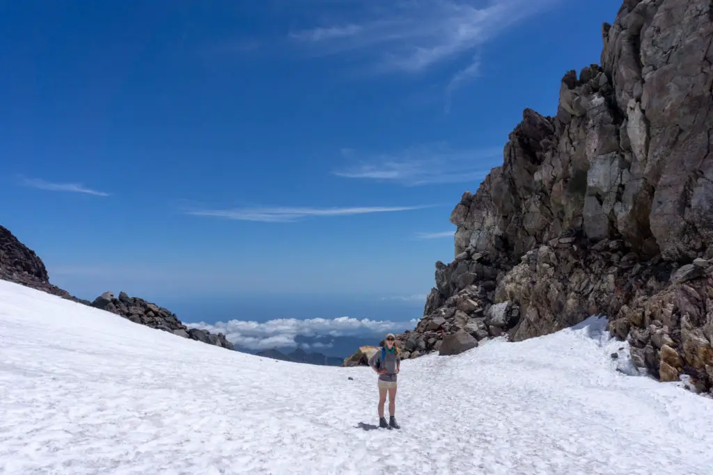
We rested at the top on the sheltered eastern side looking towards Sharks Tooth with not even a breeze, while a strong, biting wind swept along the exposed western side. We met some guys from a Wellington Meetup group and sat chatting with them for a while, eating our lunch. All up it had taken us about four and a half hours. We were stoked.
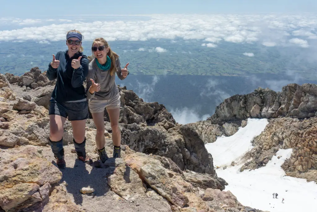
The 360° views were amazing and it felt ridiculously high, especially looking down onto Fanthams Peak or the Pouakai Range, both of which I’d climbed up before and which had seemed high at the time (talk about gaining some perspective). I felt really proud that we’d made it all the way – it had taken a lot of grit and determination. Each time a new group arrived on the summit a lot of people sitting down having lunch (us included) would clap or yell out congratulations.
Before long, my stomach was bursting with food and the flying bugs were driving me crazy (seriously, how do they survive up there? What are they? What do they do when there are no humans to dive-bomb??). We walked around a little more. I peeked down to Fanthams Peak far, far below (the summit had looked so deceptively close from Syme Hut!), before taking some more photos and heading back down the slippery red scoria to the snow. Getting up is only halfway. And the downhill is just as hard as the uphill, so keep that in mind as you’re going up.
PSA: don’t try to slide down snow with bare skin showing, it’s like sliding on burning cold sandpaper; as the Kiwi in stubbies found out when he slid down on his butt. And then loudly complained that he had first degree burns all over his legs and ass.
I don’t have a lot of photos on the way back down, primarily because my knees and descents aren’t great friends. More like resigned acquaintances. Plus I was tired and just wanted to focus on getting down.
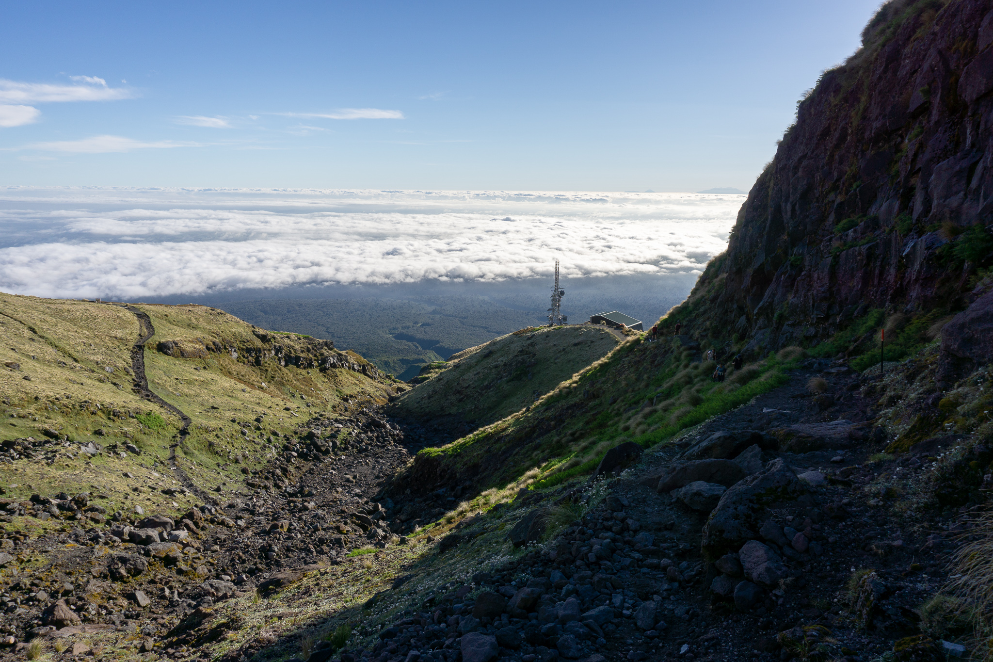
We went slow and took lots of breaks to ease the muscles and joints. Our Wellington Meetup friends left us at the end of the Lizard as we took a rest before tackling the downhill scree skiing. The scree went much more quickly down than it had up, as it often does. I was thankful of my gaiters keeping the sharp volcanic rocks out of my boots. It was even fun in parts, skiing down, although still quite hard on tired knees.
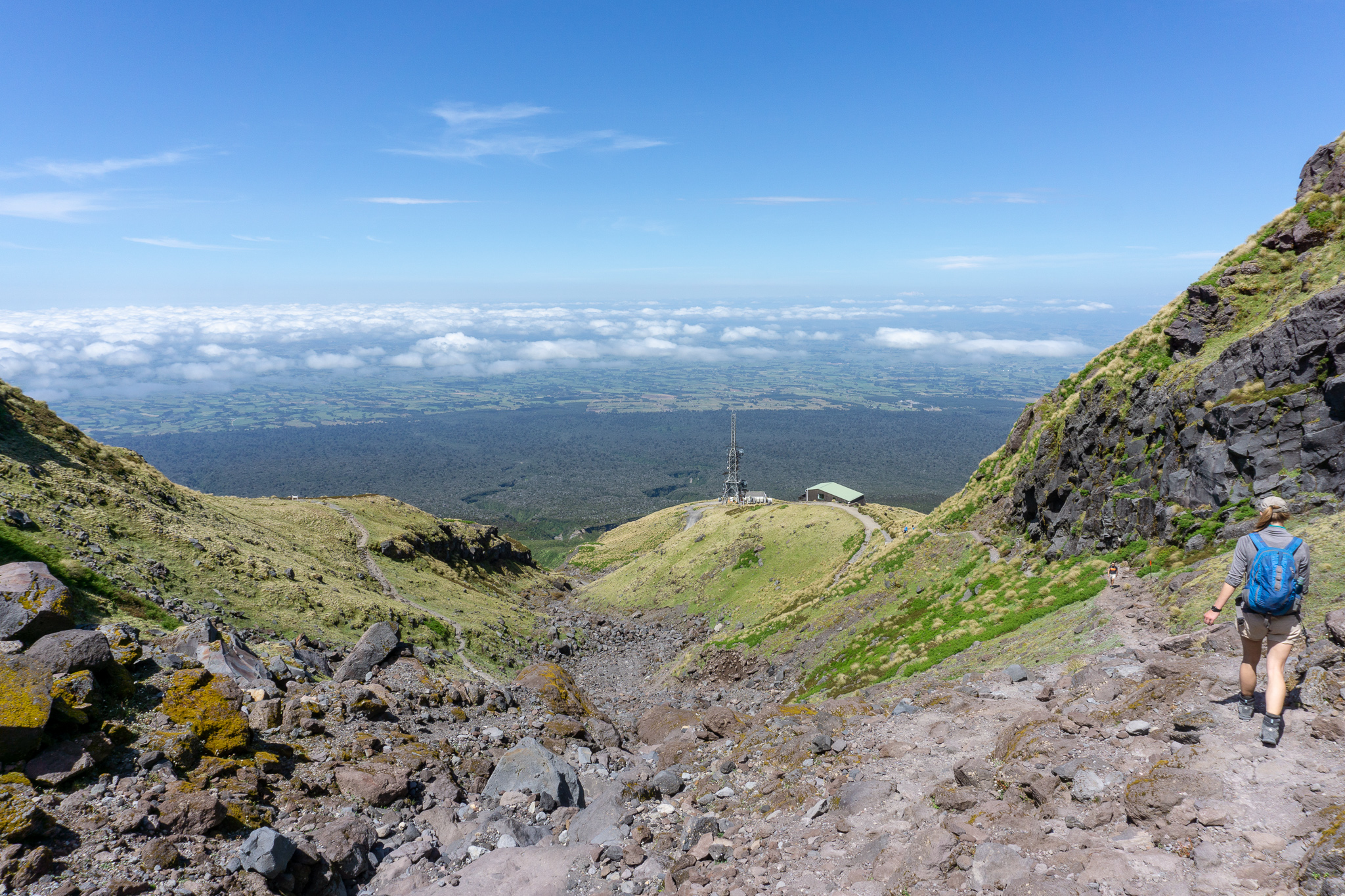
We had a sit down rest and toilet stop at Kahurangi Lodge, before heading back down the Puffer, which was painfully steep after a full day’s climbing. Rebecca ended up doing zig-zags to help with the steepness and joints, rather than walking straight down.
We took the turn-off back down to Maketawa Hut and had another long rest in the empty common room of the hut, before standing back up with groans and creaks. Rebecca toyed with the idea of just staying in the hut again overnight instead of facing the walk out, but decided against it. I’m sure the fact that Matt had picked up some ciders for us and they were waiting in the carpark for us had nothing to do with it. We collected our overnight gear and loaded up our larger packs for the walk out.
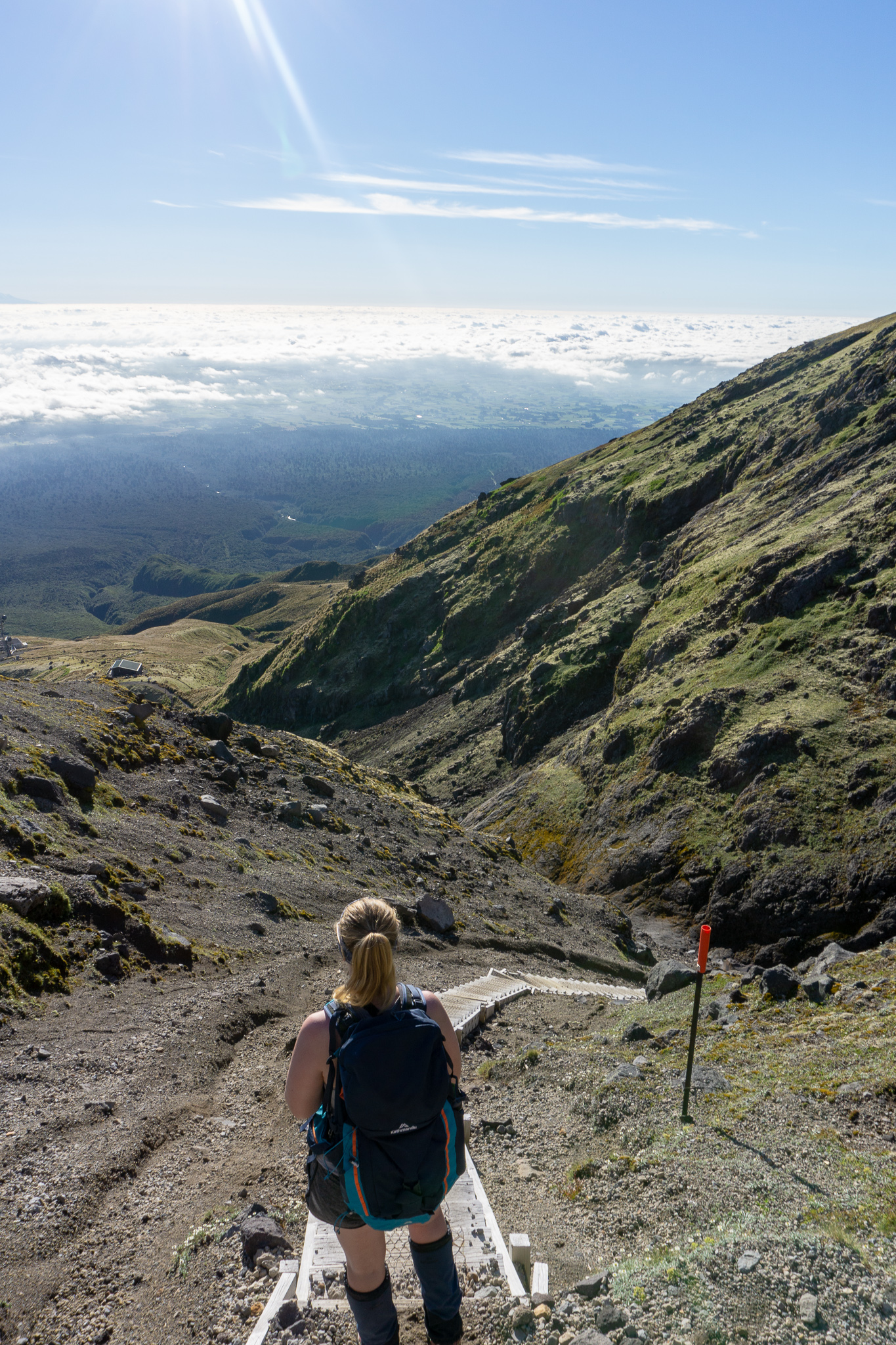
Instead of walking back up the ridge and out along Translator Road, the way we’d come in the night before (which probably would have been faster, but less interesting), we turned right from the hut and took Maketawa Track through the beautiful forest back to the North Egmont carpark. I didn’t take a single photo on this part of the trip. We’d been on the go for almost 10 hours by this point. I was completely exhausted, especially now I was carrying a heavier overnight pack.
It took just over an hour from Maketawa Hut to the carpark. But it felt like we were stuck in a time loop and would be walking until the end of time. It became hard to stop and rest, because I had to interrupt the walking cycle; my legs didn’t know anything other than putting one foot in front of the other. The two vertical ladders were interesting too, with full packs and trembling muscles.
Matt walked in to meet us from the carpark (we’d been in text contact on the descent updating him with our ETA, which was slightly later than we’d planned for). We met him about 30 minutes from the carpark. He kindly offered to take my pack, but I stupidly refused because a) I stubbornly wanted to complete the walk all by myself, and b) because although we’re married, there are some things (like back sweat) that you just don’t need to share with each other.
It was a massive relief to see the sign at the end of the track and walk into the carpark, almost 12 hours after we’d left Maketawa Hut that morning. The downhill from the crater felt like it took forever, and I was glad I’d kept some energy in reserve rather than spending it all on the way up. It was the longest day of tramping I’ve ever done, and for days afterwards I had to keep reminding myself that I’d actually stood on top of Taranaki’s summit. Each time I’d smile.
For anyone considering attempting the summit – please go well prepared in terms of knowledge and equipment. Do not attempt in bad conditions (rain, cloud/fog, or wind). With a reasonable level of fitness, a head for heights, and a lot of determination, it’s definitely challenging, but doable. If you have any questions, please get in touch either by commenting or via my Instagram – I’m always happy to chat.
Also: I would highly recommend a cold cider (and stretches) in the carpark afterwards.
Safety
As always, please stay safe when you’re out exploring. Follow the Outdoor Safety Code:
- Choose the right trip for you (read my article, talk to DOC, look at Topomaps, read other blogs!)
- Understand the weather (especially important when you’re heading up so high on a mountain that’s notorious for its changeable weather)
- Pack warm clothes and extra food (including windproof and warm layers, regardless of how nice the day is when you set out, as well as lots of water and food)
- Share your plans and take ways to get help (leave your intentions at North Egmont Visitor Centre)
- Take care of yourself and each other
Taranaki is not a mountain to be taken lightly. But for those willing to put the effort and preparation in, it’s well worth it!
Stay safe and get outside!
Love your description of the climb! I did this on 14th March 2020 which seems such a long time ago now. I found the lizard super challenging mentally, being so steep and exposed. I was super scared about coming back down which really spoiled my experience. Coming down was easy! I’m so annoyed with myself that I’m going to do it again at the end of the year so I can enjoy it more 🙂
Thanks Juliet! You’ll be pumped you managed to tackle the summit before lockdown!! Awesome you’re feeling more confident for the Lizard, just gotta take your time and believe in yourself! Hope you enjoy it more next time 🙂
Hi Alice, I really wish I had read this post before I attempted the climb! It is so detailed and I’m sure I would have found it super helpful. Yes I did notice the flying bugs — they’re hard to shake off and I think I ingested a few. I heard that they weren’t there a few years ago or at least not as many. I really do wonder how they survive up there!
Hi Sarah! Thanks for your comment and sorry you didn’t see this earlier! Hopefully I might have a few other trips you haven’t yet been on that might be helpful 🙂 And yeah, weird bugs right!