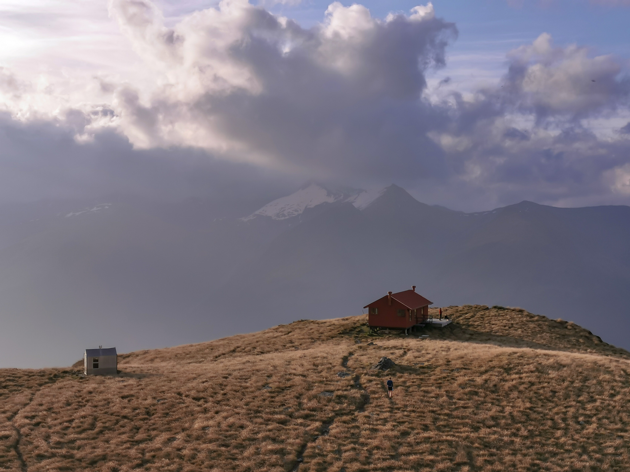
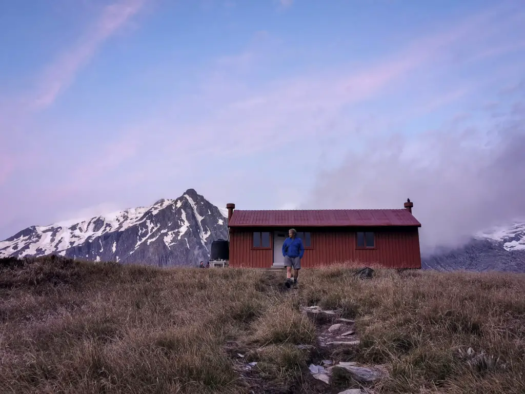
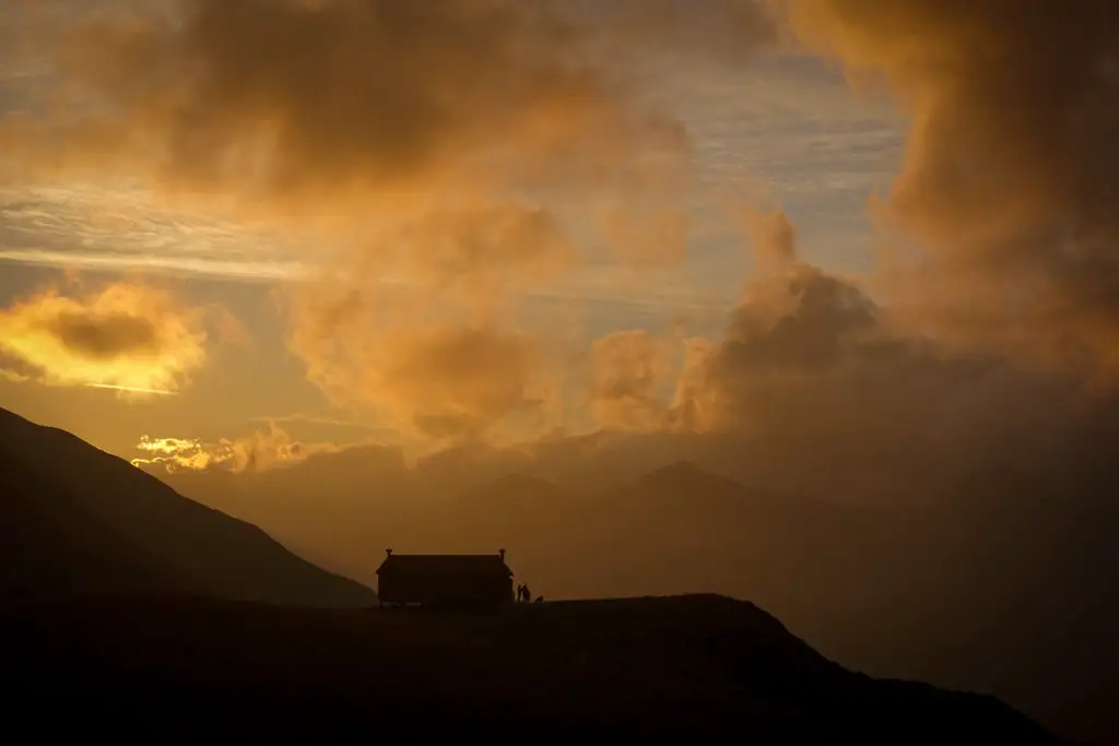
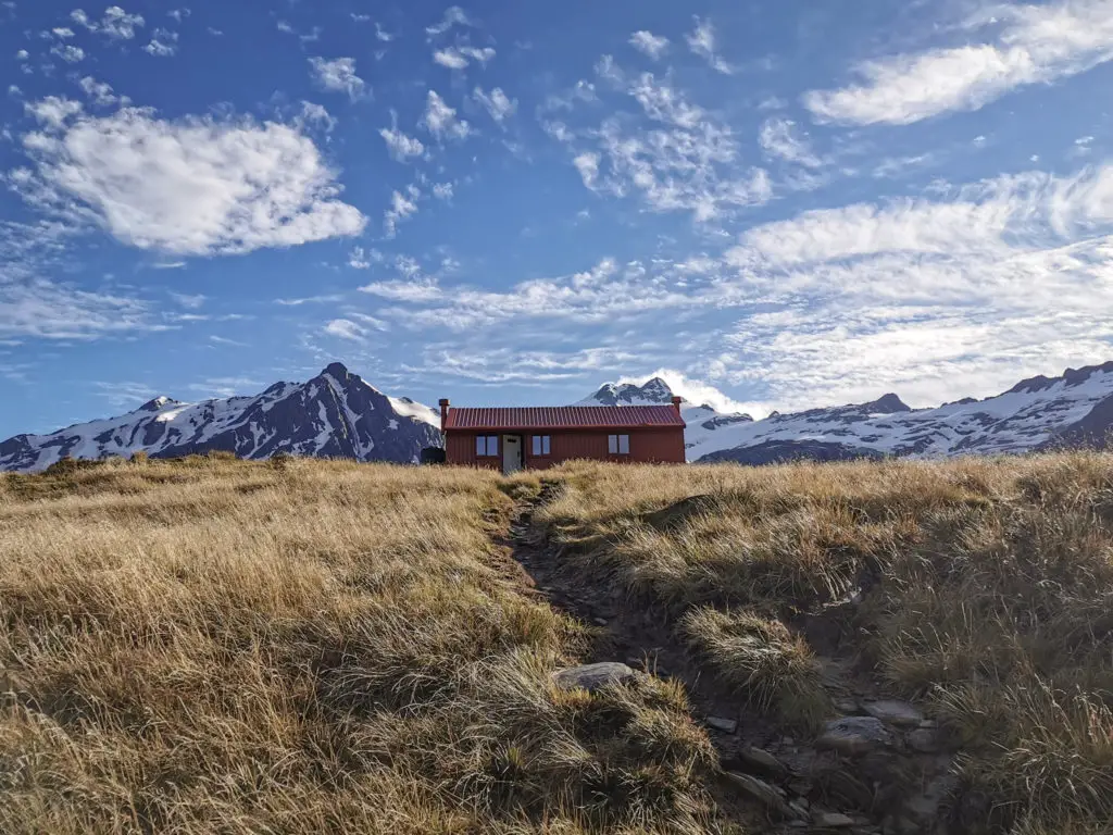
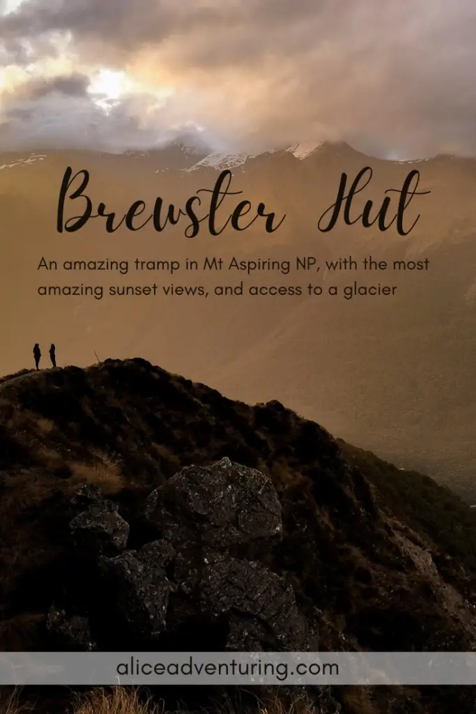
A steep climb to another beautifully situated red alpine hut. Brewster Hut has absolutely jaw-dropping sunset views, as well as access to the nearby Brewster Glacier, and Mt Armstrong.
Length: ~4.5km one-way with around 1000m elevation gain
Time taken: 3 – 4 hours up, 2 – 3 hours down
Difficulty: moderate – difficult
Facilities: There’s a small carpark at Fantail Falls. In summer this turns into a hectic parking situation involving campervans, trucks towing caravans, and vans driving on the right. No toilets at the carpark – the closest are at Blue Pools.
Brewster Hut is a 12 bunk alpine hut with one long-drop toilet and a water tank on the hut’s deck (no heating available). Tickets are $20 per person, and bookings are required in summer season (December to April). Otherwise for the rest of the year Brewster Hut operates on a first-come, first-served basis.
– Important: I tramped up to Brewster Hut in summer. Conditions will be dramatically different in winter, spring or autumn (but also some summer days as well!). Always check the forecast and go prepared for what conditions you’ll encounter. This includes the river crossing at the start and end of the tramp. –
Why Brewster Hut?
Because it’s gorgeous. Don’t even get me started about the sunsets.
Oh and the glacier.
It’s pretty guys. So pretty.
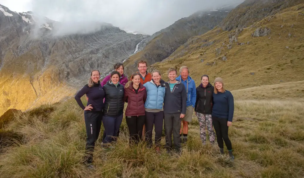
I wanted to do a cool trip around New Years. I’d been planning to get to Brewster Hut for quite some time. A few months out, I messaged my friend Grace, who I’d done Mueller and Tongariro with, asking what she thought. She was keen (of course), so we booked out all 12 bunks of Brewster Hut for two nights. We knew we could get a group of 10 other people together to adventure with us and have a fun time.
In the end we’d coerced 11 people into joining us. All of the people were connected to either myself or Grace (or both of us) in some way; high school friend, flatmate, work colleague, father, church buddy, cousin’s ex-boyfriend, etc., but most of them had never met each other before. What could go wrong?
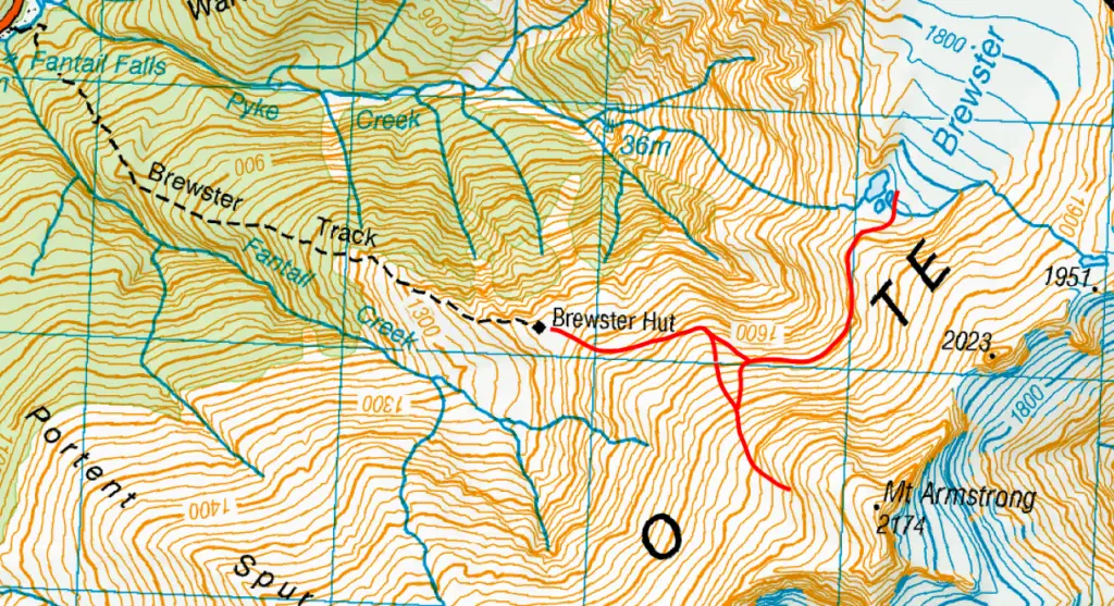
How to get to Brewster Hut trailhead
The trailhead for Brewster Hut starts from the Fantail Falls carpark on SH6 between the townships of Makarora and Haast, north of Haast Pass and the Blue Pools carpark. The carpark is just over an hour’s drive from Wanaka, and 45 minutes from Haast. In summer this small carpark is a tourist hotspot and extremely busy. Luckily the falls are only a two minute walk from the carpark, so vehicles are constantly coming and going.
Day One – river crossing, then up, up, up
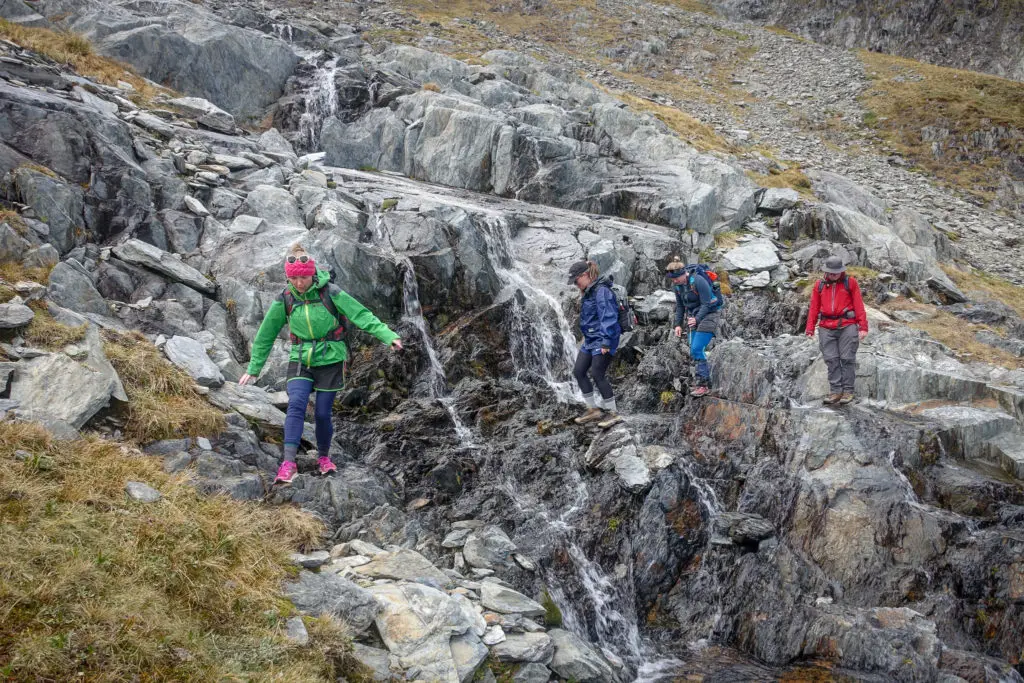
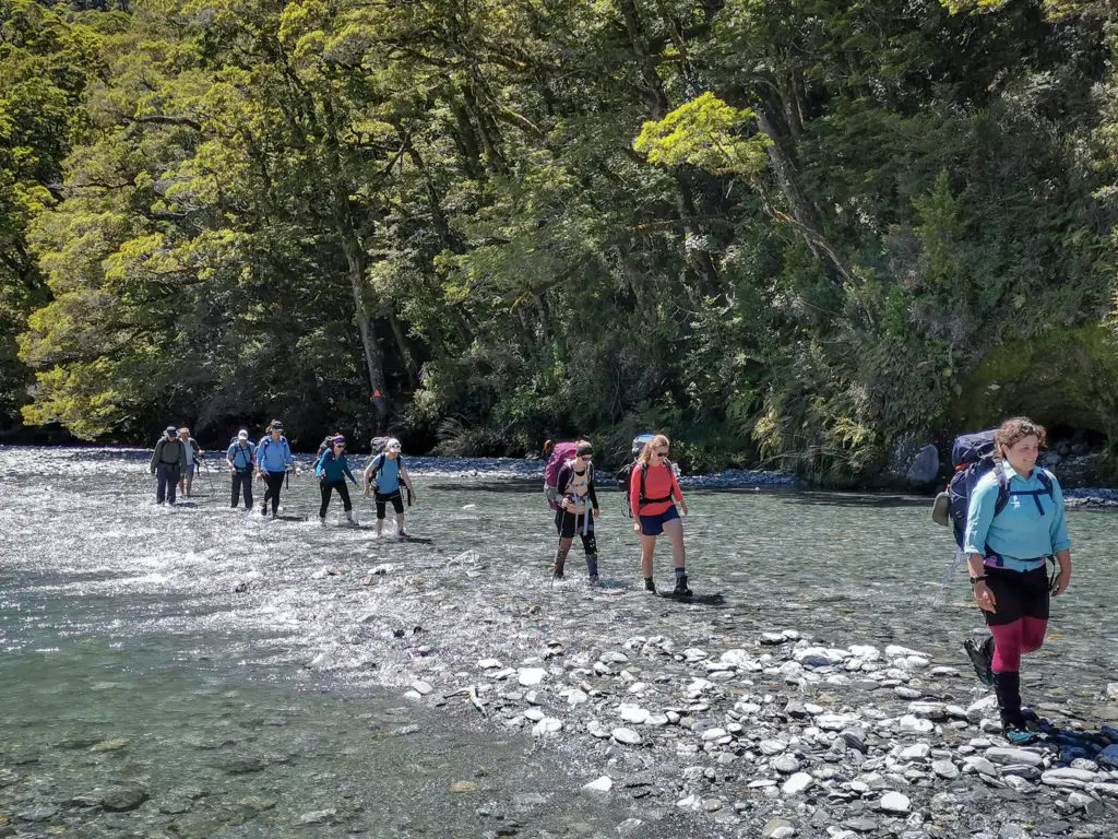
The very start of Brewster track crosses the Haast River. In fine weather this is normally a relatively uncomplicated and beautifully blue crossing to reach the massive orange triangle marking the trailhead. However the night before we were meant to be leaving on our trip, a heavy rain warning was issued for its headwaters. I called the group and delayed the start time by two hours, hoping that the rain would have stopped by daylight and the river level would start to lower by the time we arrived at midday.
However as we wound down the road from Haast Pass, I was peeking out the window at the river – and through the lush greenery I could see brown, rushing water. Not what I wanted to see. When Matt, Dad and I arrived at Fantail Falls carpark, it was to find the river well and truly still in flood, with poor visibility hiding unknown depths.
We placed a rock cairn at the water’s edge to measure how quickly it was descending. Jordan (who’d been waiting in the carpark for us, constantly worrying whether that self-contained van, or that campervan, or that ute, was going to scratch her poor car) played poohsticks to see how quickly the water was flowing. Walkable but quick.
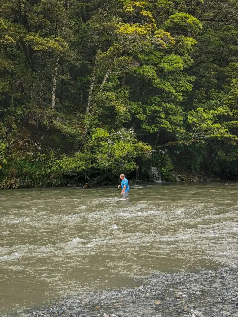
We sussed out the best place to cross; rapids showing shallower water, with a nice, safe run-off if we did get swept off our feet. Dad, who had the most experience when it came to river crossings (and who had intelligently brought river sandals), volunteered to test the depths and go across first. It was past his knees in places, and relatively fast flowing, but he made it across and back without mishap. He wasn’t however happy leading a group of people across that he didn’t know, especially since some of the group had very minimal tramping experience.
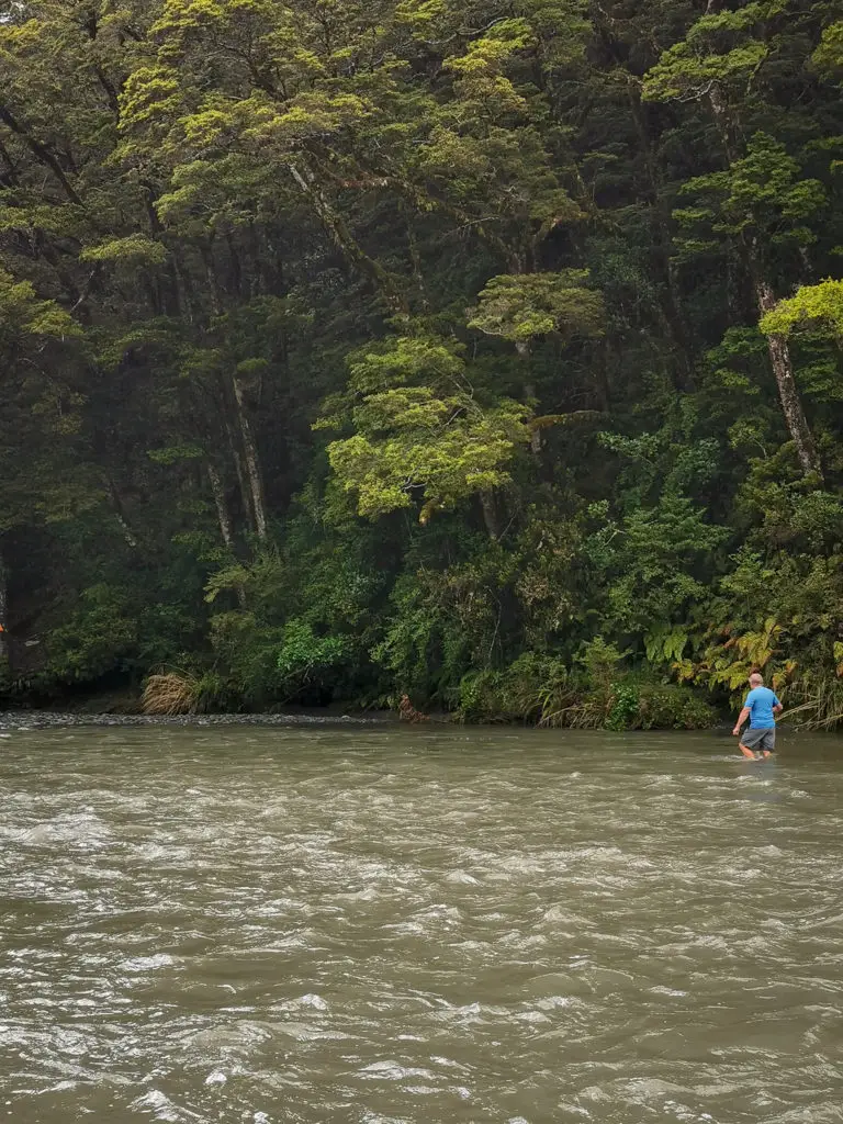
By this time Loren and Michael had arrived, and two sets of day walkers had gone across gingerly but safely, with us looking on as a sort of weird audience. We made intimate acquaintance with the many savage west coast sandflies, while waiting on Grace and her three friends, who I hadn’t met before. There was no cell service so any messages they might have sent us were lost in the ether. We waited. We waited. Jordan stressed out more about her poor car in the frantic carpark. She eventually moved it to a debateably safer park. We waited some more. I kept checking the river level. It was definitely lowering, the cairn getting further and further away from the river’s edge.
Finally we gave up. It was an hour after the adjusted start time and there was still no sign of Grace and her friends. Something had obviously held them up; a flat tyre? A car-crash on the Crown Range? If we didn’t leave soon, we wouldn’t be reaching Brewster Hut in time for dinner (with a nice safety margin before nightfall).
We got all our packs together and I wrote two notes for Grace, one in dust on the back window of our parked truck, and another to stick to the DOC sign for Brewster Hut and Fantail Falls. But just as I was halfway through removing my boots and socks to get ready for the crossing; one foot entirely bare for the sandflies to attack, Grace came sprinting out on the stony river bank yelling “we’re here!”. The Wanaka rodeo traffic had held them up at Albert Town for a whole hour (gotta love Central Otago traffic). I met Grace’s three friends; Rachelle, Siobhan and Charlotte, and after they organised themselves, we crossed the river! With all that waiting, the river level had lowered quite a bit. In the end we didn’t need the log that Dad had prepared for the crossing.
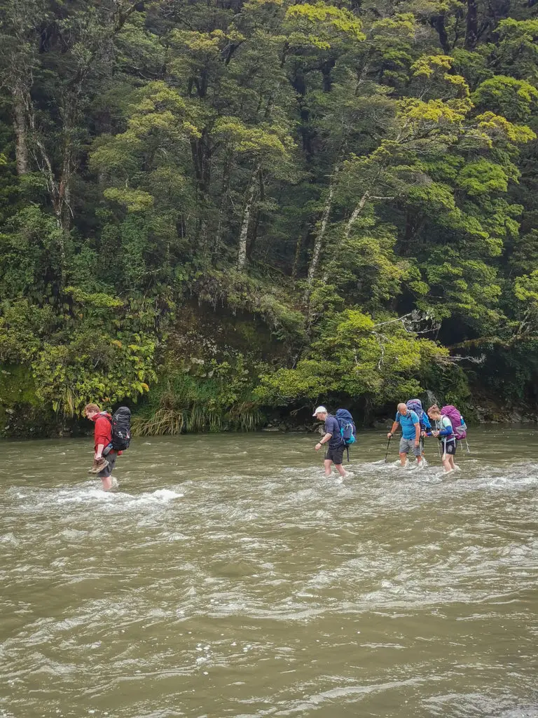
It was still difficult. We weren’t able to see the rocks on the bottom. We moved slowly to be entirely sure of our footing before taking the next step. But we all made it across without mishap. The water never got much above our knees, although its swirling was rather hypnotising and the flow was constantly trying to push us off balance. Having hiking poles helped a lot, although feeling the drag of the river on them was quite intimidating. Then came the next challenge.
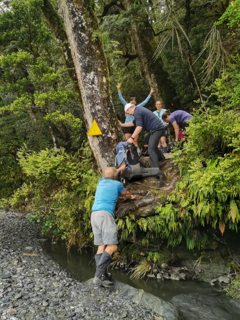
The bright triangle on the tree marking the start of the track was inconveniently situated above a large overhang that the river had cut out during past floods. Fortunately we found a much easier way up just a few metres downstream, and then it began.
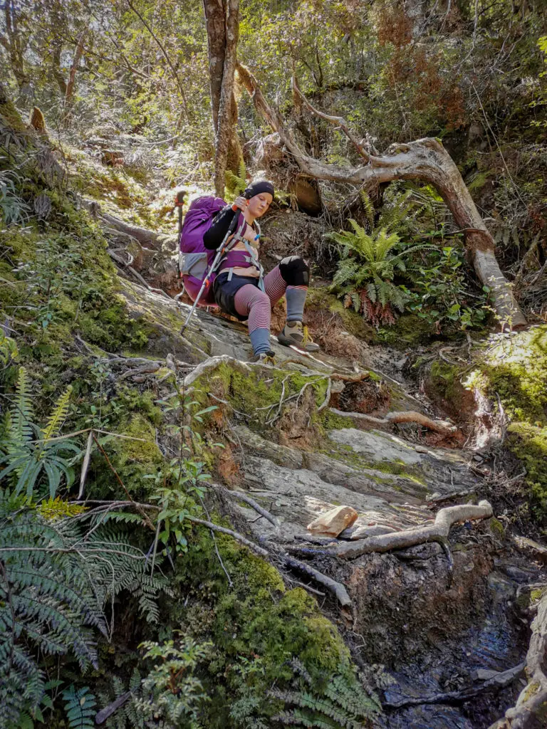
And by “it” I mean: constant, unrelenting, steep uphill over tree-roots, ferns, and mud.
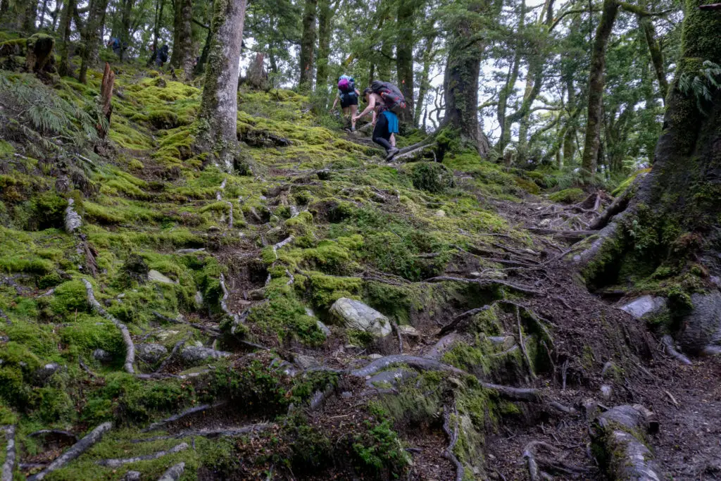
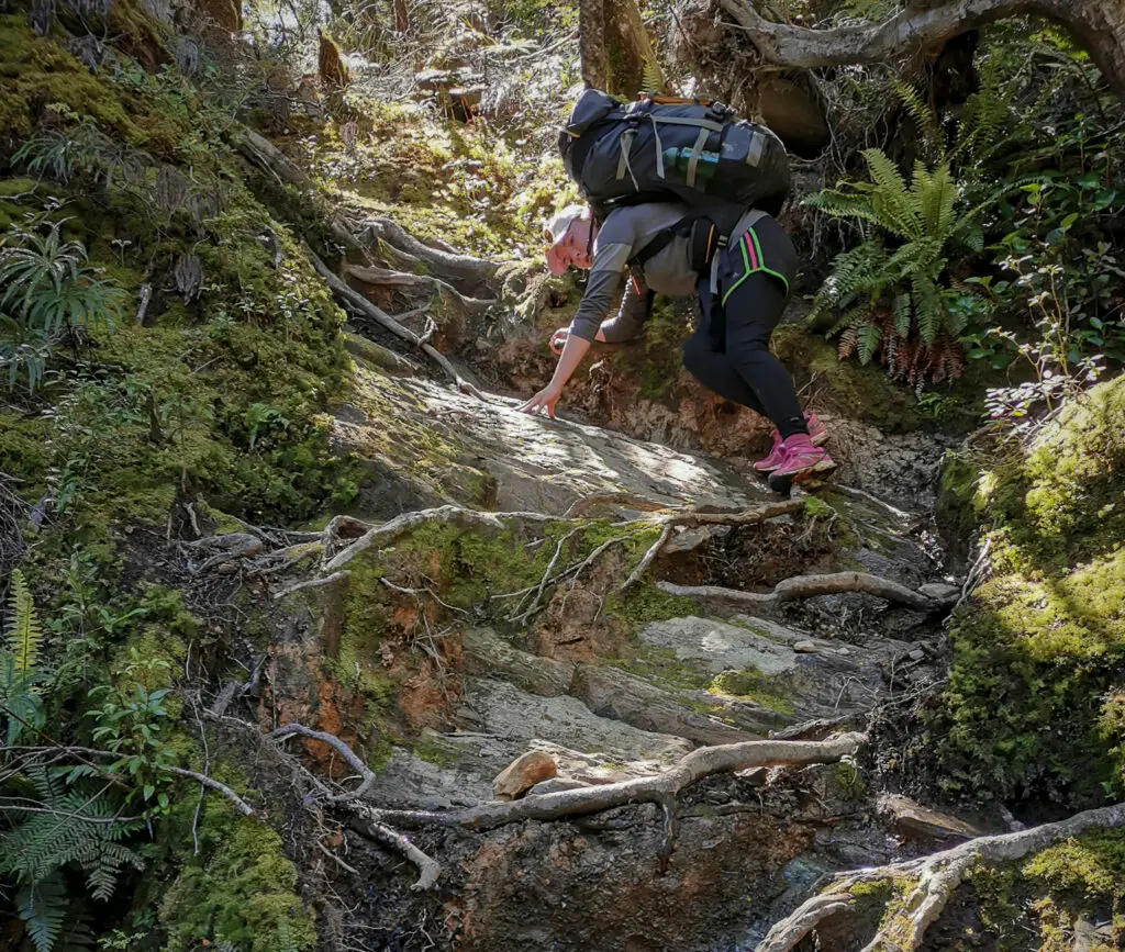
This track has only a few metres of flat terrain, and one metre of downhill. I mean I didn’t measure it precisely, but I feel like that’s pretty accurate – it is after all 1km of elevation gain over 4.5km of distance. That’s pretty crazy steep. One of the most emblematic quotes from the trip was “I didn’t realise my belly button could sweat that much!”
The hard thing about tramping in a group is not only managing the different levels of experience, but also the sometimes vast differences in fitness. I don’t think everyone had taken my warning about the track’s steepness to heart. Dad, as the fittest of the group (and oldest by about 30 years – don’t let age hold you back!), led from the front. I played Tail End Charlie – or as I renamed it, Ass End Alice. I have a gift with words, what can I say.
We took regular breaks as a group, allowing the ones who were struggling with the amount and the degree (sometimes 90°) of uphill, to catch up and have a rest (I’m not naming names, but if I were I’d have to include my own). This way we didn’t get too spread out. As a reminder, it pays to sit down when taking a break to rest your legs and feet, as well as fueling your body’s tank with food and fluid so it can keep on trucking uphill for you. I’d brought along my favourite guilty pleasure; one I hadn’t had tramping since doing the Kepler as a teenager, back when I could eat anything with absolutely no consequences. A tube of condensed milk – the perfect mix of pure fat and sugar.
You’ll either be reacting to that with an understanding head nod and guilty smile of your own, or recoiling, horrified, from the screen. If it’s the latter, then I’m very sorry you live an existence devoid of all happiness and joy. I hope we can still be friends.
The condensed milk got me through the uphill and boosted my energy and morale. I also forced it onto flagging friends, like it was some sort of gateway drug. I think it helped. They kept going, even if it was only so I wouldn’t force any more on them. So either way, it worked.
It was slow going but we got to the treeline. This was about the 2/3 mark of the track – normally only about 30 – 45 minutes walk left to Brewster Hut. The day walkers, who’d crossed the river with us as their audience, had already passed us on their way back down. One of them said that after the treeline the going got easier.
What. A. Blatant. Lie.
The going did NOT get easier. It got harder. Now there was only rocks and tussocks to pull ourselves uphill with, rather than helpful tree roots.
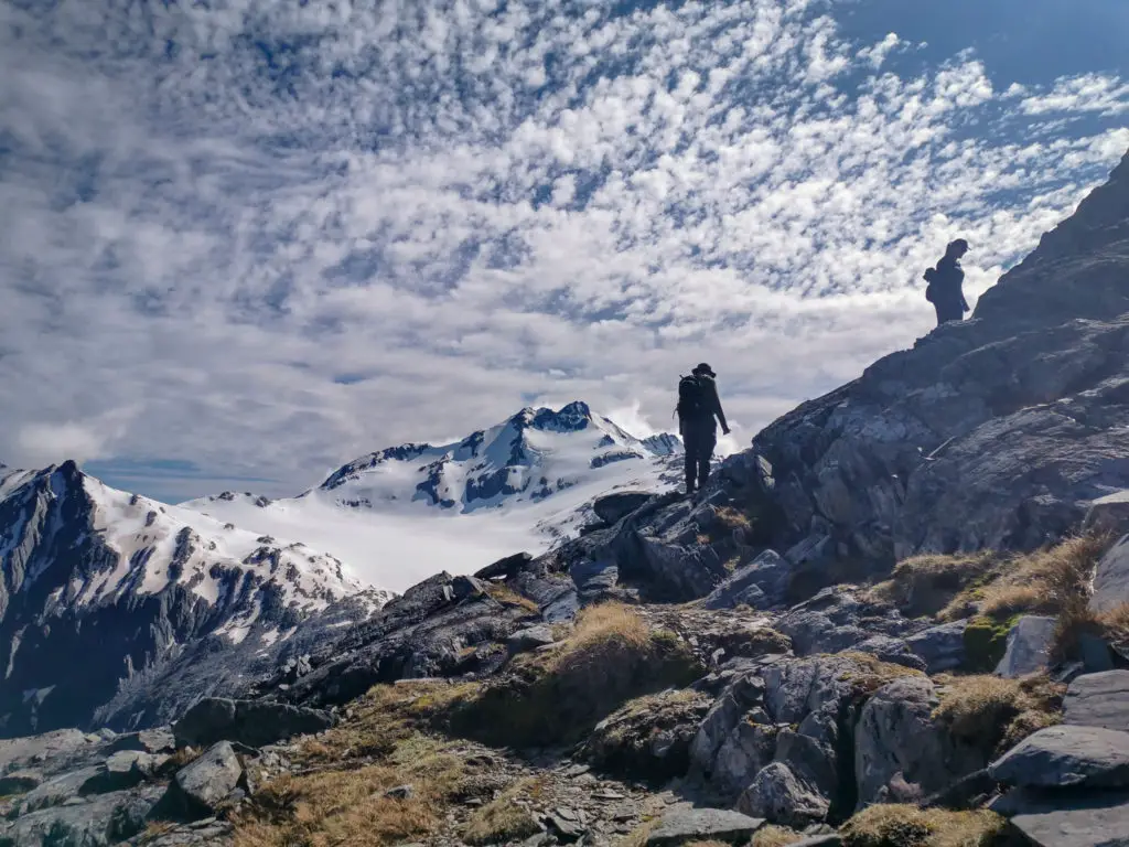
However after about 20 minutes of pure uphill from the bushline, eventually it did become slightly less steep. Once we caught back up with the rest of the group who were taking a break, the views started to distract us from the constant uphill battle.
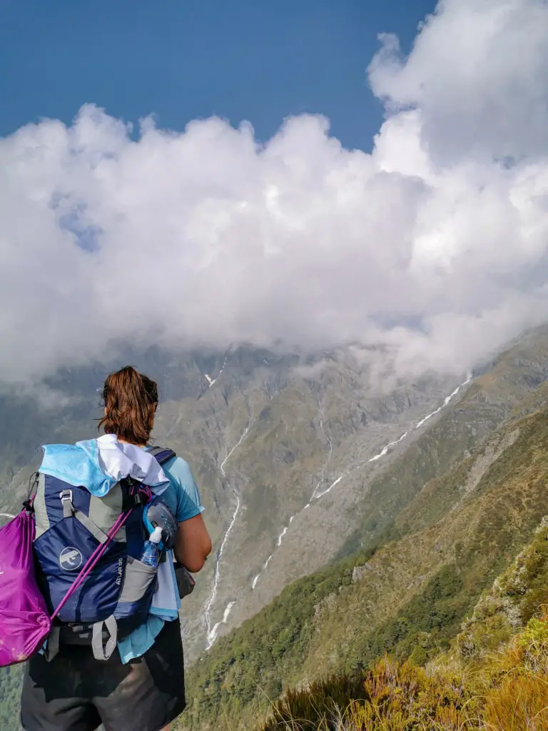
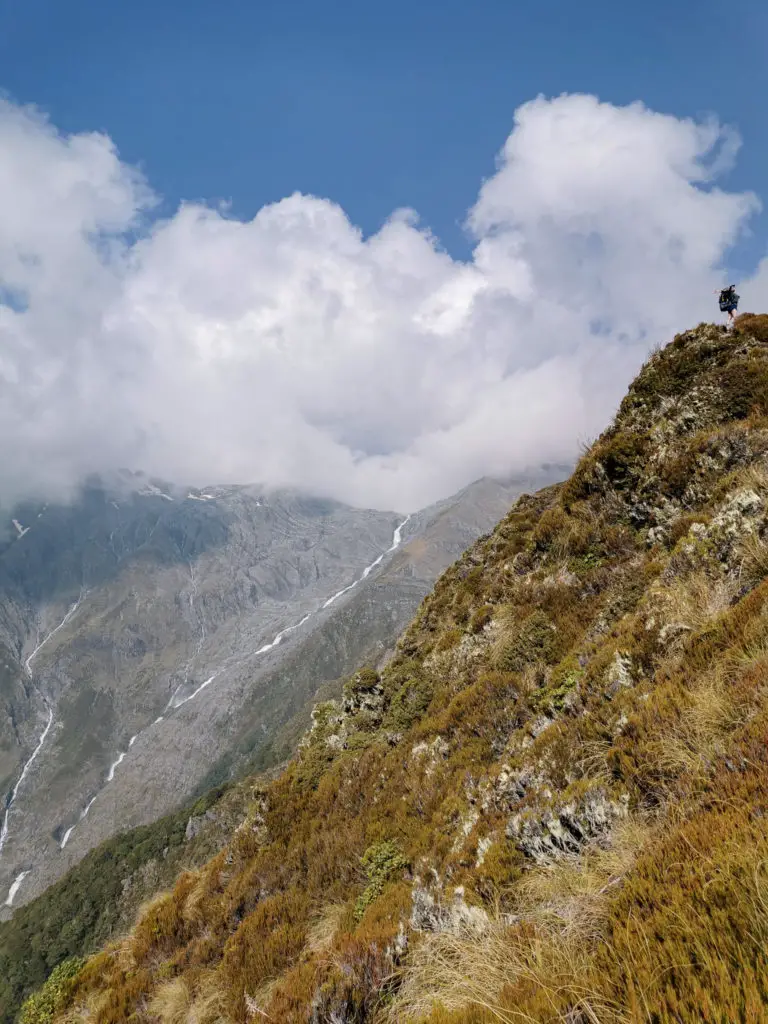
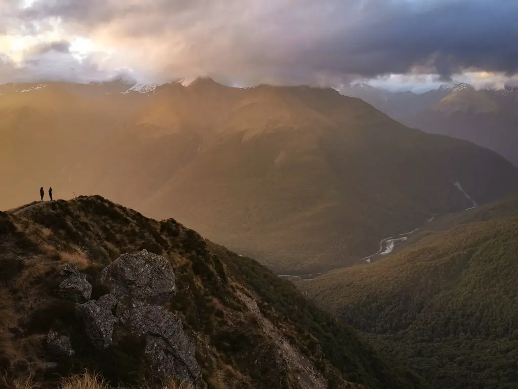
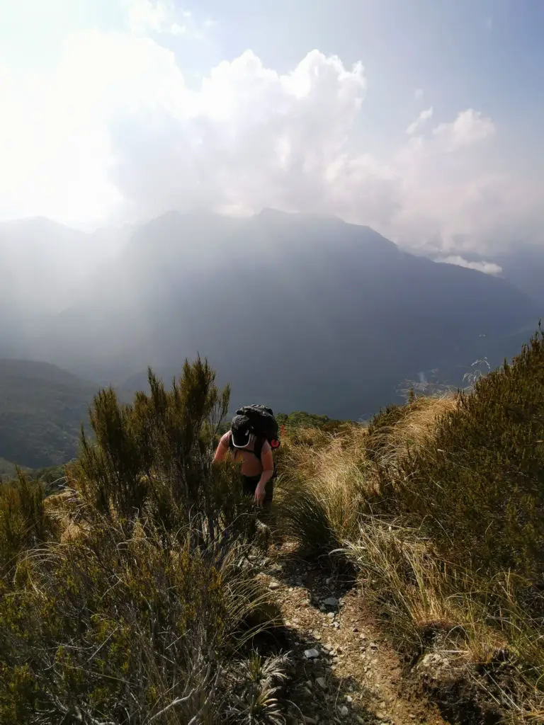
The track climbed up a narrowing ridge, with beautiful views (and drops) to either side. It was still steep, but with more reprieves and distracting views. Although they were slightly marred by the fact that the sky was still hazy with the smoke from the wildfires in Australia, over 2,000 km away.
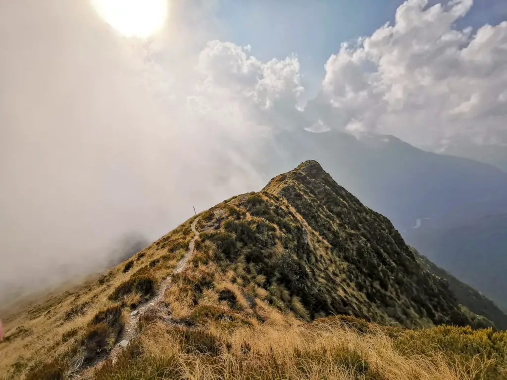
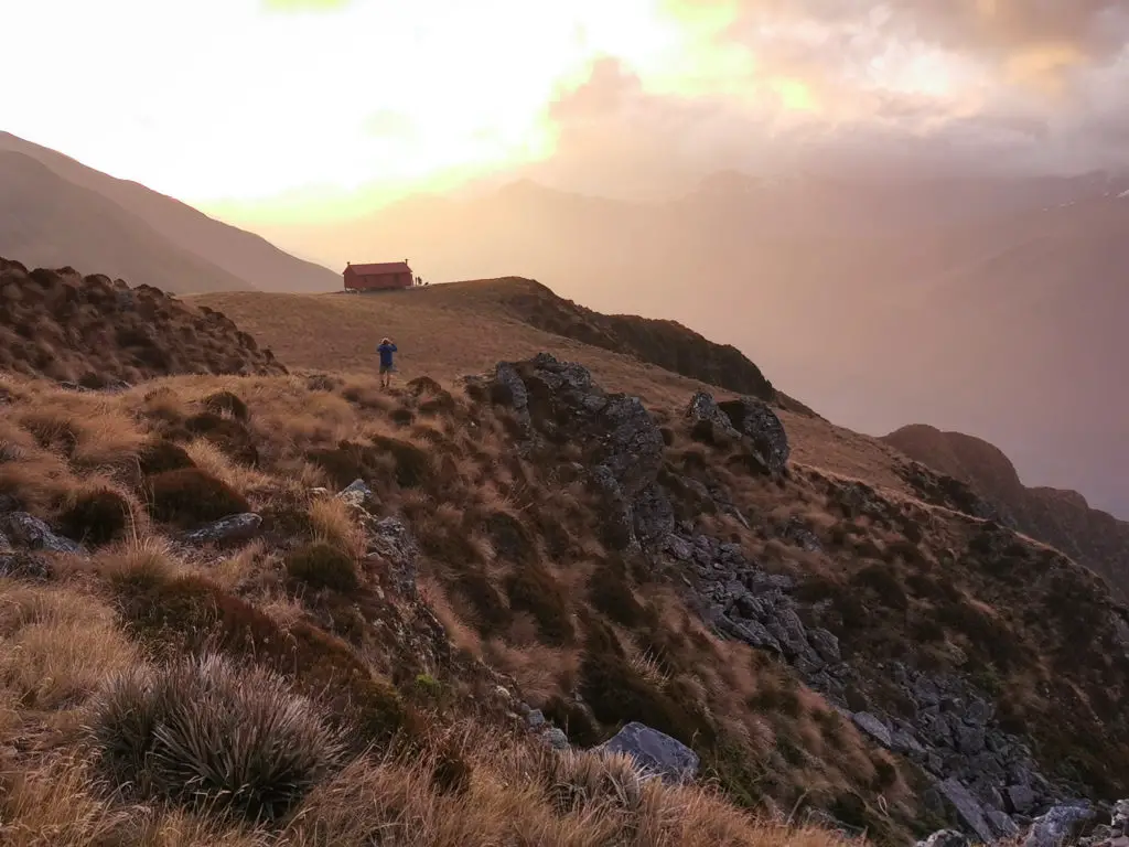
Finally, Jordan and I spotted the long-drop on the ridge above us. Much like it had for me on the track up to French Ridge Hut, this long-drop gave Jordan a spiritual awakening. We climbed up the last two false summits, to be greeted by cheering from Brewster Hut’s deck. We’d made it!
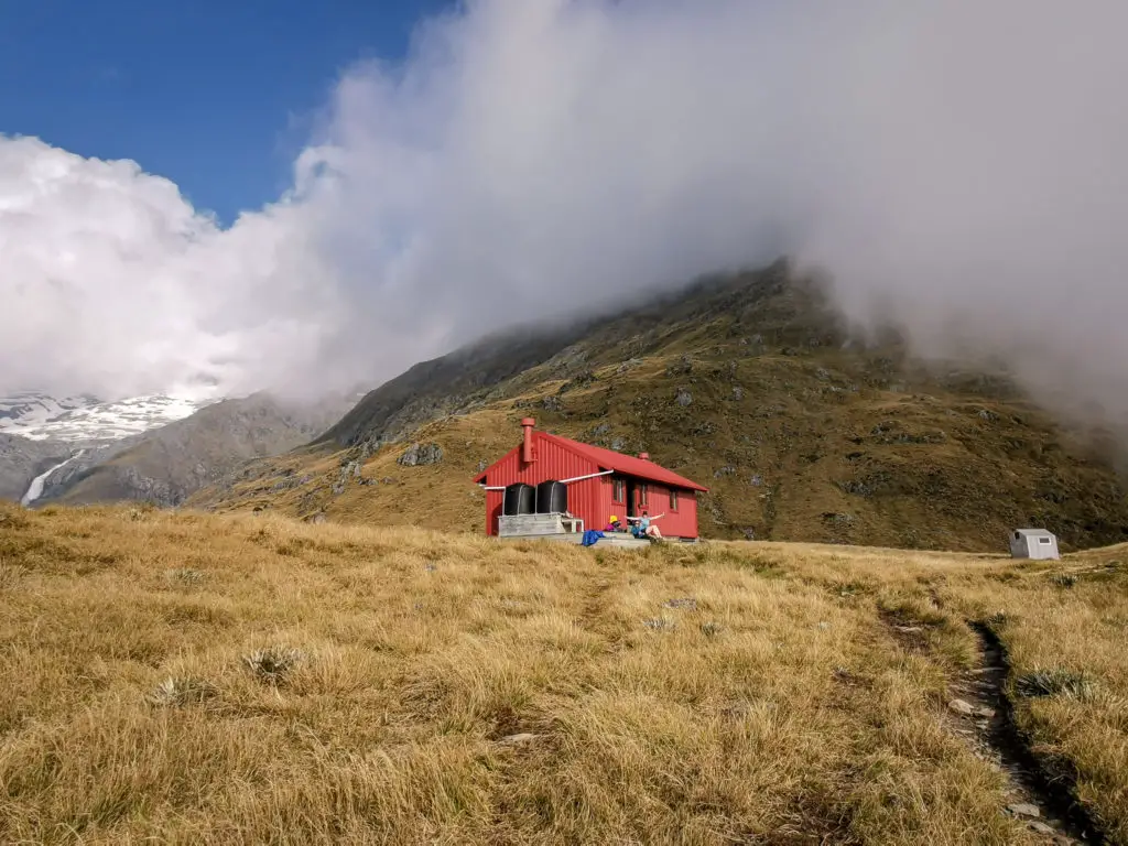
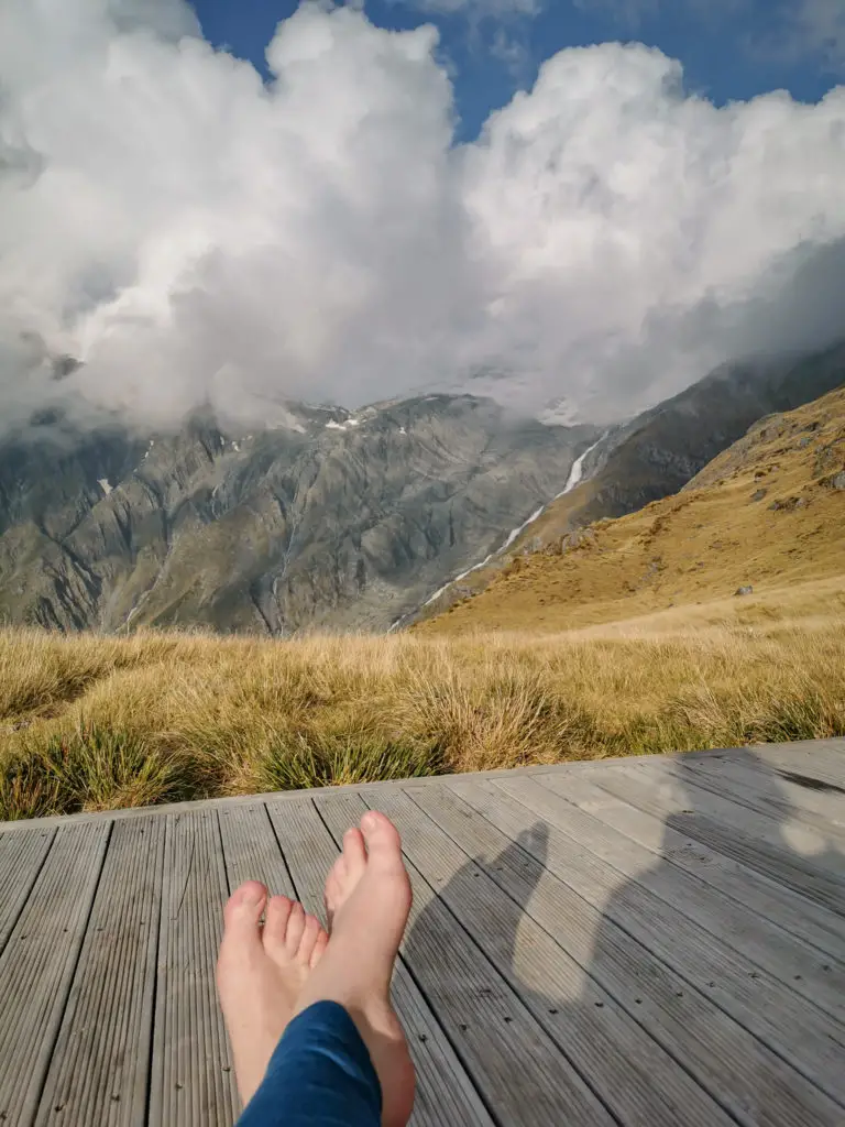
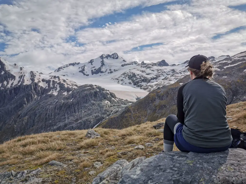
I immediately removed my socks and boots and lay on the deck of the hut, basking in the sun and admiring the beautiful, beautiful view. The roaring waterfall falling down from Brewster Glacier’s terminal lake filled my ears. The sun shone on my face. The breeze blew my damp hair out of my eyes. This little red hut was perfection.
We explored the immediate area surrounding Brewster Hut, including the beautiful long-drop and the cute / cramped wardens quarters (DOC wardens visit irregularly to check up on the hut and occupants), while we boiled some water. Boiling it didn’t take away the charcoal taste though – the water, just like the sky, had also been contaminated by the ash from the wildfires, washed off the hut’s roof.
Then it was dinner time! I usually lose my appetite when I’m doing relatively strenuous physical activity, but after a quick rest it had returned with a vengeance. Freeze dried food never tasted so good.
I don’t have any photos of the interior of the hut, apologies. It’s much the same as French Ridge Hut with one common room (no fire or heating), one bunk room (without the third height of bunks), and one wet room for gear.
Soon the real show started – sunset.
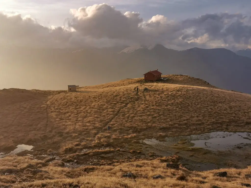
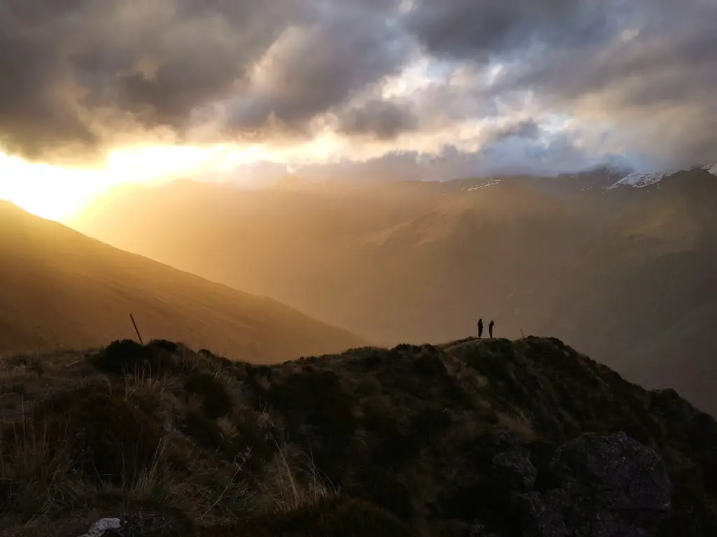
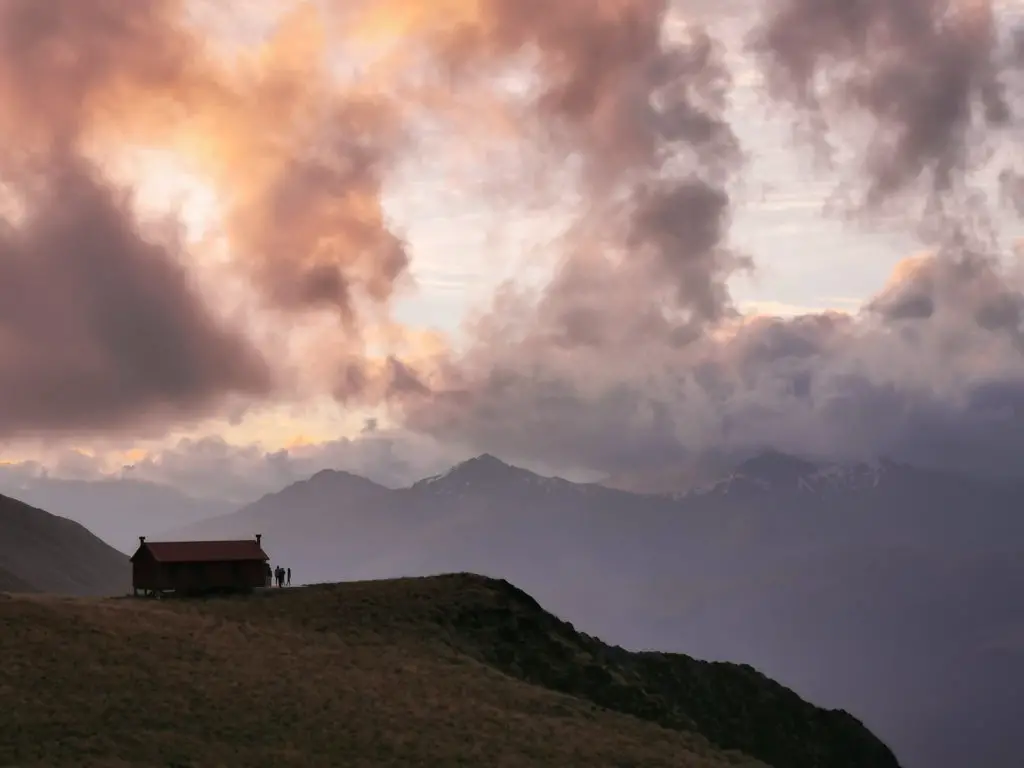
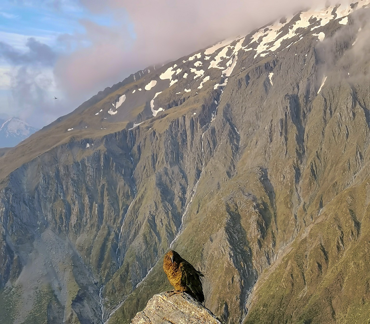
The light was unbelievable. I alternated between running around like crazy taking lots of shots, and standing in awe just trying to take it all in. It was was honestly one of the best alpine sunsets I’ve ever experienced. Just to make my night perfect, some kea (my favourite bird) came over to say hi. In a completely unrelated move, we made sure all of our gear was safely stored inside the hut.
Once it got dark and the temperature started to drop, we all went back to Brewster Hut – some to play games, me to write in my dairy, and others retired straight to the bunkroom, exhausted after the tramp up. Soon everyone was feeling the effort of the day, and it wasn’t long before we were all in bed, rustling in our sleeping bags.
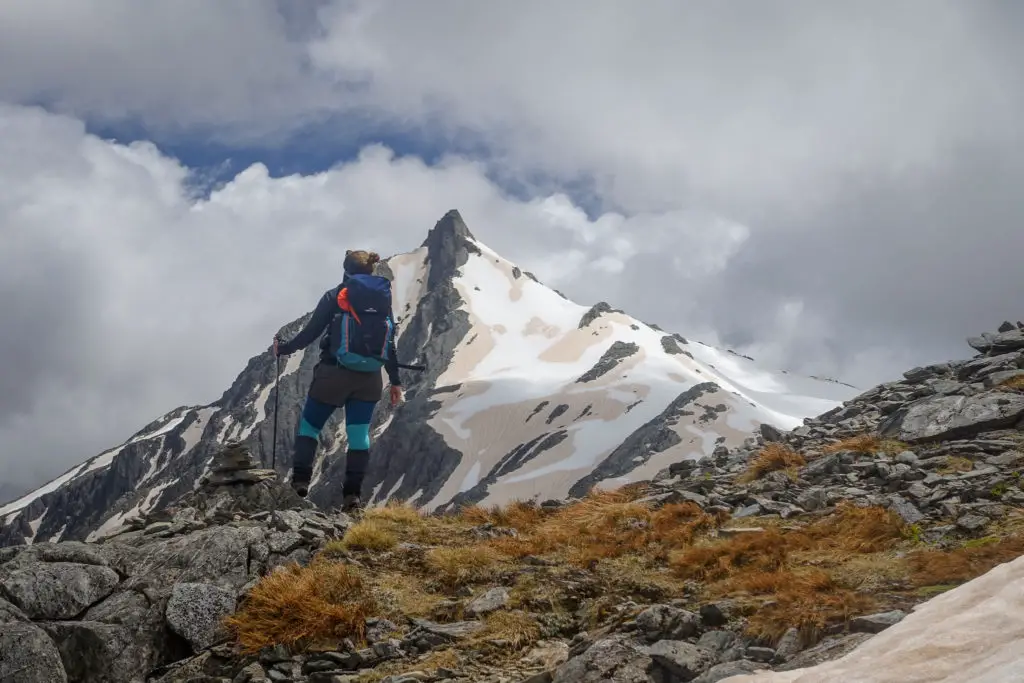
Day Two: Mt Armstrong & Brewster Glacier
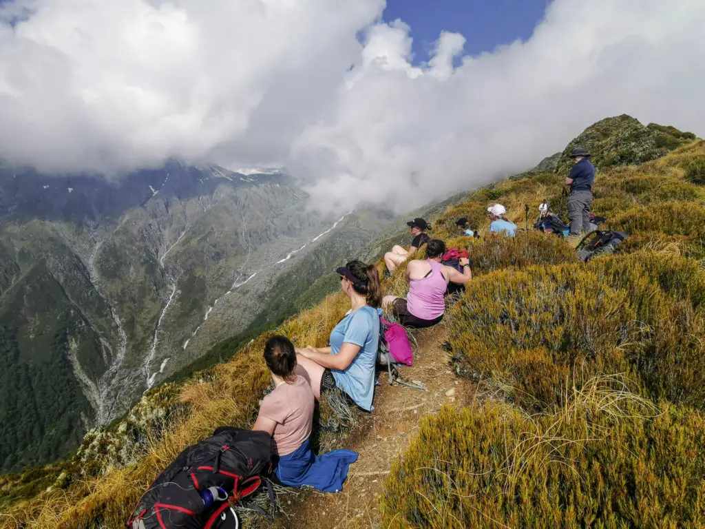
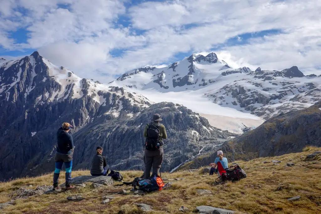
The next morning dawned bright and clear; a promising day for doing some of the side trips from Brewster Hut that I’d planned – namely Mt Armstrong, and Brewster Glacier. From my pre-trip research, the former was meant to be relatively straight forward (or rather, straight UP from the hut), while the latter trip to the glacier was a bit more sketchy, negotiating around a few bluffs and across steep scree sections. Michael, Siobhan, Grace, Dad, and myself were keen to get going. The five others elected to stay behind and have a relaxing hut day.
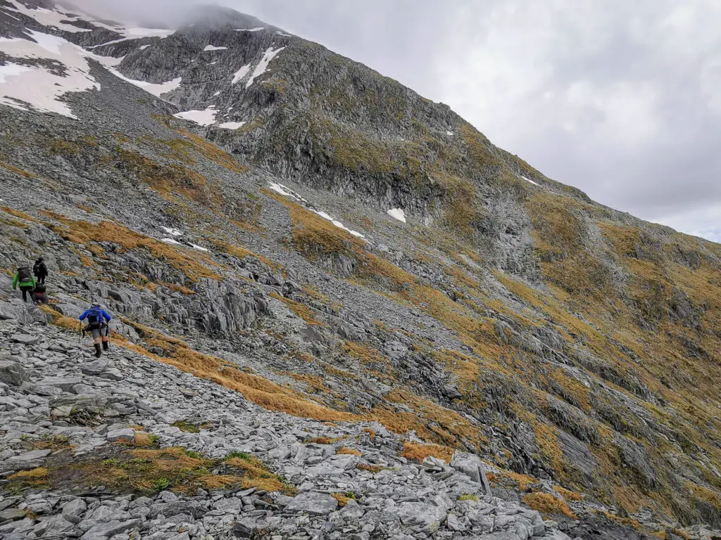
There were quite a few obvious paths up from the hut, so we chose one and followed it up for about an hour, getting amazing views over to Brewster glacier and its terminal lake. Coming across a small spring, we poured out our contaminated ash water from the hut tank, and refilled it with delicious snow melt goodness. At a little alpine meadow (or what passes for one in NZ), the path split in two. One path sidled along the ridge towards the glacier. The other heading straight up the ridge, presumably towards the out-of-sight summit of Mt Armstrong.
Unfortunately as we followed this second path up, it quickly became lost with many different routes and equally as many rock cairns. It seemed as though every single person who’d climbed Mt Armstrong had left a random rock cairn somewhere on the ridge, which made finding the best route very challenging. I’d never really understood why some people find rock cairns so annoying, having only found them to be helpful on previous trips, however this was just ridiculous. At one point I could spot four different rock cairns, all marking opposite ways up the slope.
We kept climbing up the ridge, angling slightly towards the right / south and away from the bluffs to the north. Eventually however we reached an impasse; crumbling unstable bluffs above us and hard, frozen snow slopes around us (coloured an orangey brown from the ash fall).
Dad went up a little further to kick some steps in the snow and see whether the summit was accessible. In the end he decided against it without crampons and ice axes. We could have backtracked down quite a way and climbed up a small gravel strip sitting further to the south, but then weren’t certain we’d be able to access the summit from the ridge saddle either. Or we could have backtracked the other way and climbed up some of the bluffy sections straight up from the hut, but the cloud had started to come and none of us were very interested in climbing. So instead we decided to call it quits on the summit and try for the glacier instead.
That evening, back at Brewster Hut, I read aloud a tramping misadventure from one of the hut’s tramping journals. I always find them morbidly fascinating / educational. The accident left the brother and sister trampers with a head injury and a multi-fractured pelvis, waiting in the winter wilderness for five days before being rescued, all because of a slip on exactly this type of snow on the south side of a ridge without crampons or ice axes. Always best to be cautious. Mt Armstrong was meant to be conquered one day, just not that day.
Onwards to the glacier! The trip that was meant to be harder compared to the piece of cake Armstrong. Great.
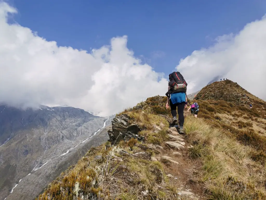
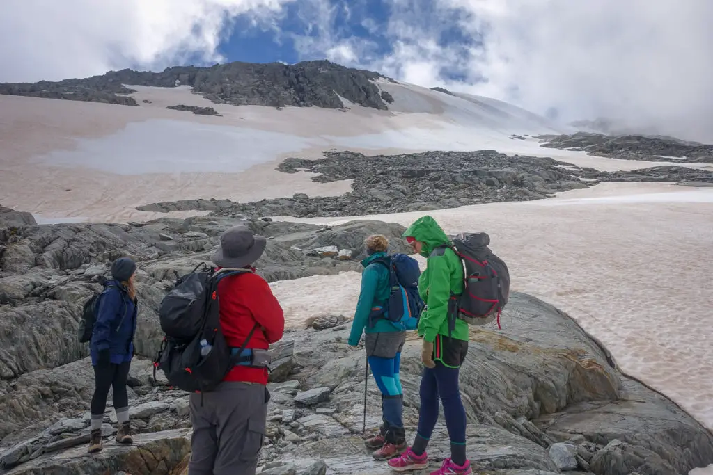
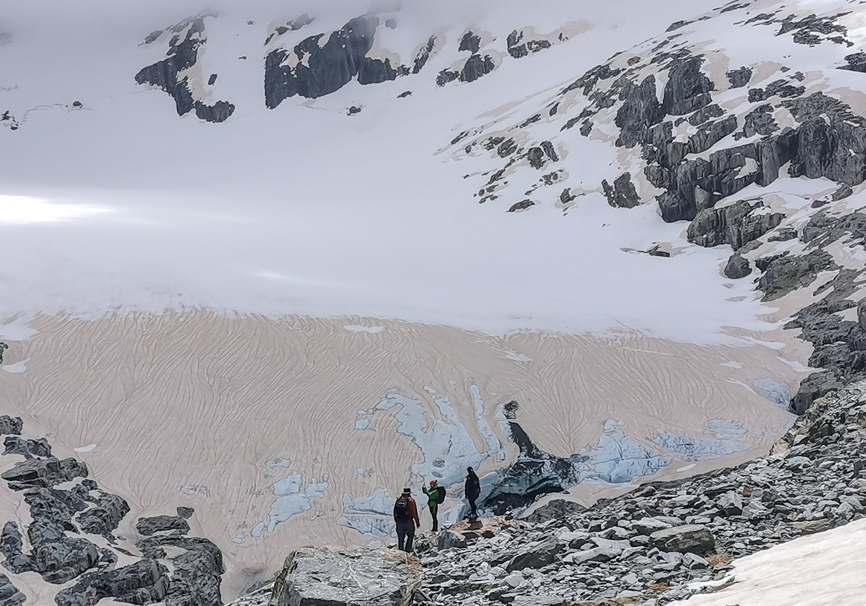
We descended back down the ridge, angling towards the north side. Then we scrambled down some sketchy scree to rejoin the route traversing across to the glacier. We stopped for some lunch and looked across the traverse. It looked vaguely intimidating, but doable.
We followed the route and the cairns (which were thankfully actually marking the route this time rather than just decorating the mountainside). This involved negotiating a few bluffs, patches of scree and little streams on our way.
It only took us about 30 minutes of scrambling (and not looking down at the valley far below) to get across to the ridgeline above the glacier, much shorter than I’d anticipated.
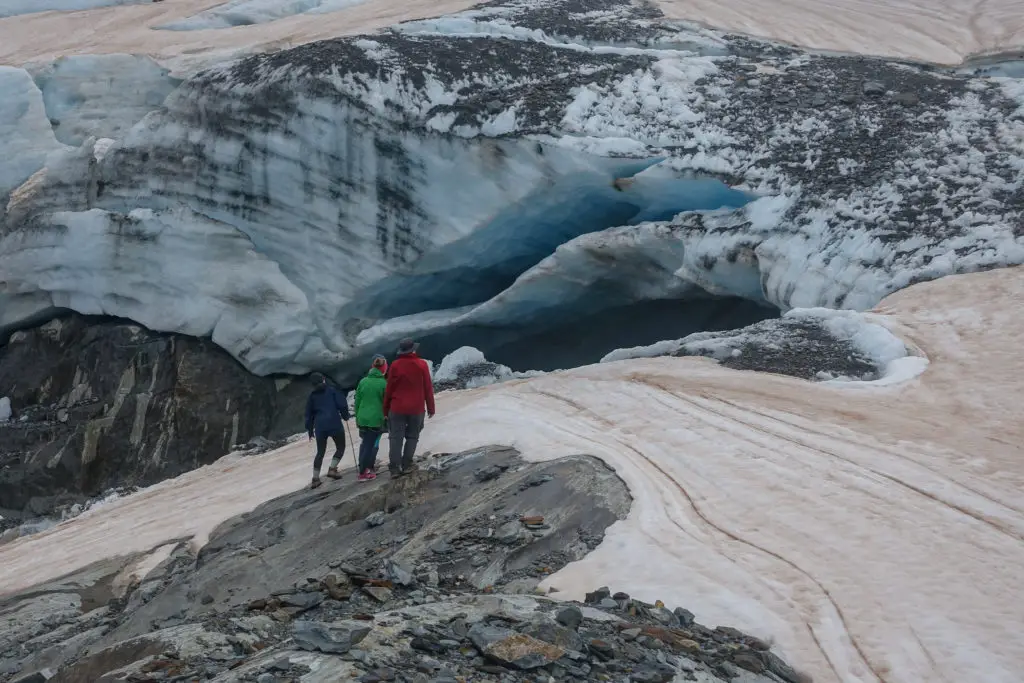
And the glacier was beautiful. Even with the ash, which made crazy swirling patterns on its surface after the recent rainfall.
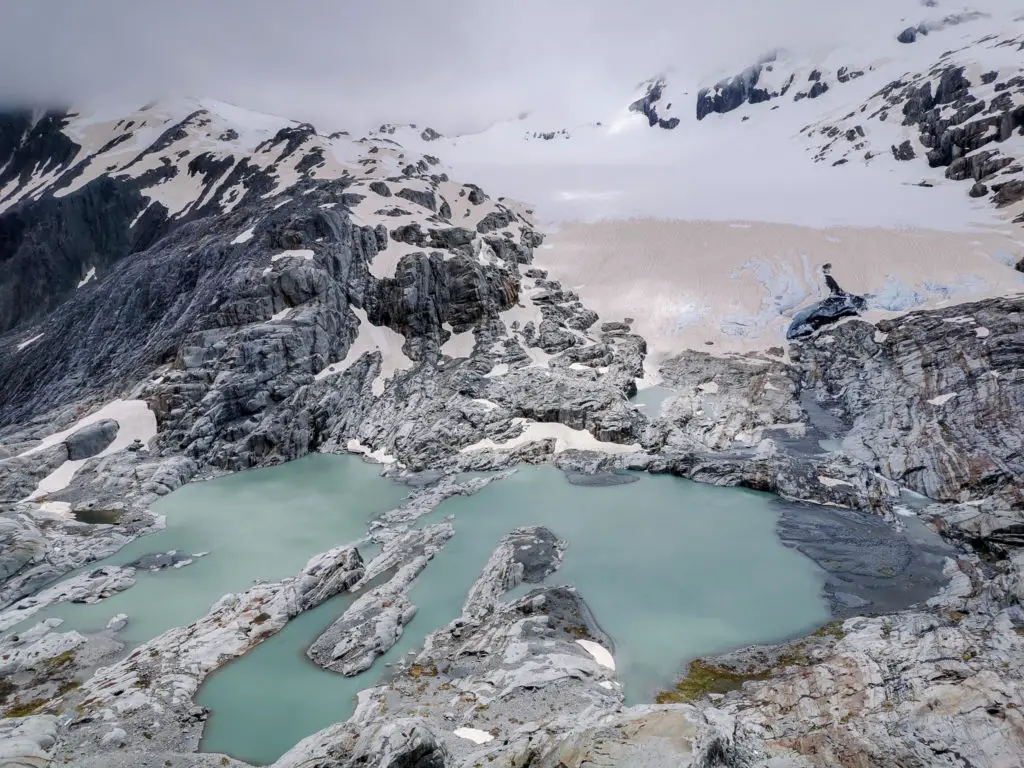
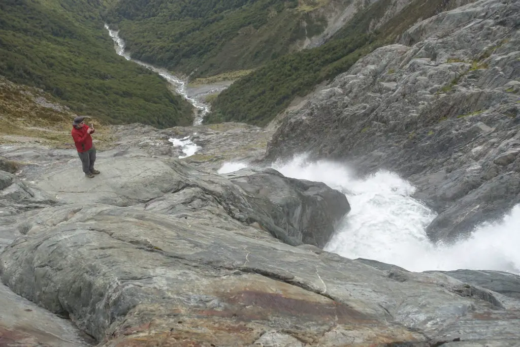
We sat at the viewpoint for a while, huddled in the rocks to shelter from the breeze. Eventually we decided to climb down to the lake and river. Dad spotted some more cairns off to the right, which took us down a sketchy route in between and around the bluffs (and sometimes what felt like just straight down them) to the river outlet. The rock that the retreating glacier had left behind looked like it used to flow like the water and was frozen into smooth waves – we walked across the undulating rock with little rock pools hiding frigid water all the way up to the ice cave, avoiding walking on the unstable snow and ice.
We explored for a little bit more, but a cold wind was getting up. I was starting to get tired. Michael and Dad went along the lake’s edge to visit the top of the waterfall we could see from the hut. Grace, Siobhan and I continued back up the same way we’d come down (which unusually felt sketchier on the way up compared to going down). The two men found a different way up following the rocky ridge straight up from the waterfall, while we waited sheltering from the wind by the viewpoint. Then it was back across and down to Brewster Hut.
One our way back, we passed a few people doing day walks to Mt Armstrong or Brewster Glacier (crazy people). We chatted about our experience of the conditions, and most decided to try for the glacier instead. We warned them about the steep drop offs and needing route finding to follow the cairns safely across – if you didn’t start on the right route from the get go, you’d end up potentially dangerously bluffed out very quickly.
Before too long though, we were back at the hut, being greeted by the rest of the group that we’d left behind. They all looked nice and refreshed after many naps, card games, and hot food (except for Rachelle who was bursting with energy and boredom, and regretting that she hadn’t been feeling well enough to come along that morning).
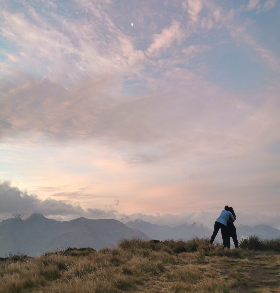
We cooked up our dinner and then watched another beautiful sunset, followed by Baileys-infused instant pudding and raucous card games.
Day Three – down and swimming
Our last morning at Brewster Hut was chilly (freezing level wasn’t much above our elevation overnight), but clear. We all packed up, tidied and swept the hut so it was just as clean as when we’d arrived. Then with once last long look, we were off!
The downhill was a lot easier on pretty much everyone I think, and we made much better time. Within 30 minutes we were already at the bush line. Then it was only another two hours including rest breaks before we were at the river. We passed a lot of people on the way up, many day walkers, but some who had also booked bunks in Brewster Hut.
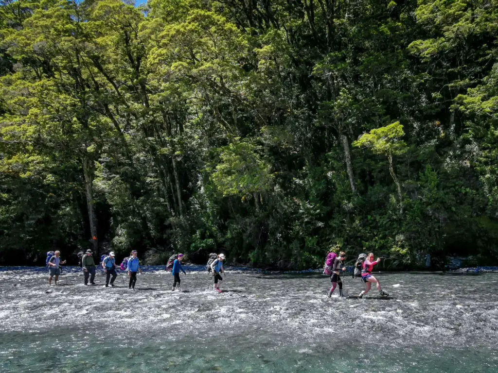
Before too long we could hear the vehicles on the road, then see the river, and then hear its gurgling. The water was insanely blue and clear, and much, much lower than when we’d crossed two days earlier. It made me fully appreciate how much the water level had risen with the rain. I rushed across first, barely even getting my gaiters wet let alone my merino tights, to take photos of the whole group crossing together.
Compared to the first crossing, it was a lot less interesting / much easier. The water only around ankle-height, barely any flow. You could actually see through the water to where you were putting your feet. I wouldn’t want to be coming down from the hut only to find the river in flood and impassable. If you’re doing this hike, always check the weather forecast and check in with DOC. You really don’t want to be stuck 50 metres from the carpark on the other side of an unsafe river …
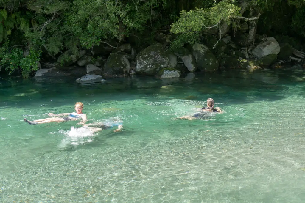
After three days of relatively strenuous tramping and no showers, I was ready for a swim, despite the water being bone-chillingly cold. Grace, Siobhan and I hopped in (although I was the only one who refused to put my head under (no brain freeze for me, thanks)). I think the tourists visiting Fantail Falls thought we were a bit insane. At least I felt less sticky and smelly, and, once my body had become completely numb from the cold, it was actually quite pleasant.
All up Brewster Hut was a fantastic trip that was everything I’d hoped it would be. Especially having looked forward to it for a few months. I think (hope) everyone had a great time. It was lovely getting to know some new trampers and spend time with old friends outdoors. Thanks DOC for the amazing hut!
Safety
As always, please stay safe when you’re out exploring. Follow the Outdoor Safety Code:
- Choose the right trip for you (read my article on tramping safety, talk to DOC)
- Understand the weather
- Pack warm clothes and extra food (check out my post here about what gear you need to take)
- Share your plans and take ways to get help (have an emergency beacon on your person)
- Take care of yourself and each other
Brewster Hut is a trip into alpine areas. Do not underestimate the conditions and stay within your level of experience and comfort. Weather conditions will change your trip drastically. Ensure you know the weather forecast and adjust your plans accordingly before setting out.
If you’re not feeling super confident then you can always get in touch with me here on the blog or on my Instagram. Or take a look at my Tramping 101 series which includes this post about how to stay safe in the outdoors.
Also don’t be a dick, check out my guide to New Zealand tramping etiquette.
Stay safe and get outside!
This is on my need to do list. Fantastic write up Alice thanks 💯😍🥰💞
Day two how long up to Mt Armstrong and Glacier do you remember please?
Hi Willy! Thanks for a great question! Apologies for not having put that info in there. Mt Armstrong without the snow and ice would take about 2-3 hours up depending on how quickly you find the correct route and maybe 1.5 hours down. The glacier from the hut would take about 3 hours return, depending on how long you take to explore. Definitely both doable in a day from the hut if you don’t miss the route, but would be pushing it to do both as a day trip from the river I think.
Wow! Brilliant writing and photos. Thank you! I will put this on my trip list 🙂
Thanks Sarah! Glad you liked it. Hope you get good weather for the trip! So worth it!!
Excellent writing and pictures! Felt like I was there every step of the way, and now, I am ready to go. You’re gonna wish you didn’t mention your version of “Trail end Charlie” cos now it’s stuck in my memory forever 😉
Haha I didn’t fully think that through did I
Hiya, excellent post! Added to my list, just wondering how you would compare to Mueller hut? Which one was more difficult tramp?
Hi Niamh! I think Mueller is slightly more technical in that there is scrambles up scree / rock, whereas Brewster is mostly just climbing up tree roots and then tussocky ridge travel (although equally as steep). But very similar in some ways! I’d find it hard to say which tramp was harder / easier to be honest! If you’ve done Mueller, you should be fine with Brewster so long as the weather forecast is suitable for that river crossing 🙂