If you want to get away from the hustle and bustle of busier tracks and experience mountain views and tarns in tranquility, then Sugarloaf Pass is the perfect choice.
Length: ~10km return with ~700m elevation gain
Time taken: 5 – 7 hours return
Difficulty: moderate
Facilities: Routeburn carpark at the trailhead has toilets and shelter.
Why Sugarloaf Pass?
With the weekend rolling round, where were our feet going to take us? I had planned on heading in to Falls Hut on the Routeburn for a night. When I called my Dad to ask if he wanted to join, he convinced me to wait until there was a bit more snow for Falls, and to do a nearby day walk instead – tramping up to Sugarloaf Pass (and above).
Sugarloaf Pass is off the beaten path of many tourists. This is despite it being a well-defined tramping track that branches off the Routeburn – one of the most popular walks in the country!
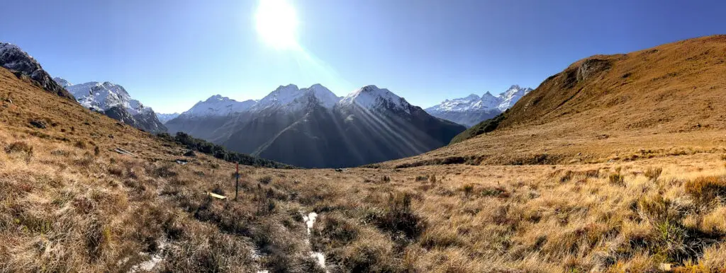
Thousands of people walk past the turn-off every year, yet not many will venture up the steep climb to the pass. And they should! The reward is amazing views of the surrounding peaks (best with a dusting of snow on them) and gorgeous tarns, hidden amongst the tussocks above the pass.
How to get to Sugarloaf Pass?
The track for Sugarloaf Pass starts from the same carpark as the Routeburn Great Walk. It’s a half hour drive from Glenorchy at the head of Lake Wakitipu, or an hour and a half from Queenstown. If you plug in “Routeburn Shelter” into Google Maps you’ll get the right directions, otherwise head out of Glenorchy on Mull Street (or turn right at the roundabout when coming in to town), then left onto Priory Road. After the Dart River bridge, turn right onto Routeburn Road and follow the gravel road all the way to the Shelter carpark.
The first ten minutes of the tramp are along the Routeburn Great Walk, before you reach the sign-posted turn off up to Sugarloaf Pass.
The tramp
We left a bit later in the morning than planned. Hypothetically this was to lessen the risk of ice on the roads, but also because we were just a bit slow to get going. The drive was beautiful with gorgeous morning light hitting the snowy mountains along Lake Wakatipu. We stopped in Glenorchy, but unfortunately the cafes were slow to open post-lockdown so no coffee was to be had.
We parked up in the Routeburn Shelter carpark along with a few frozen vans. The trees had a distinctly white tinge. I wondered why I wasn’t sitting warm in front of the fire at home. Craziness must run in the family. And be contagious, as my husband and my sister’s partner were coming along for the ride too.
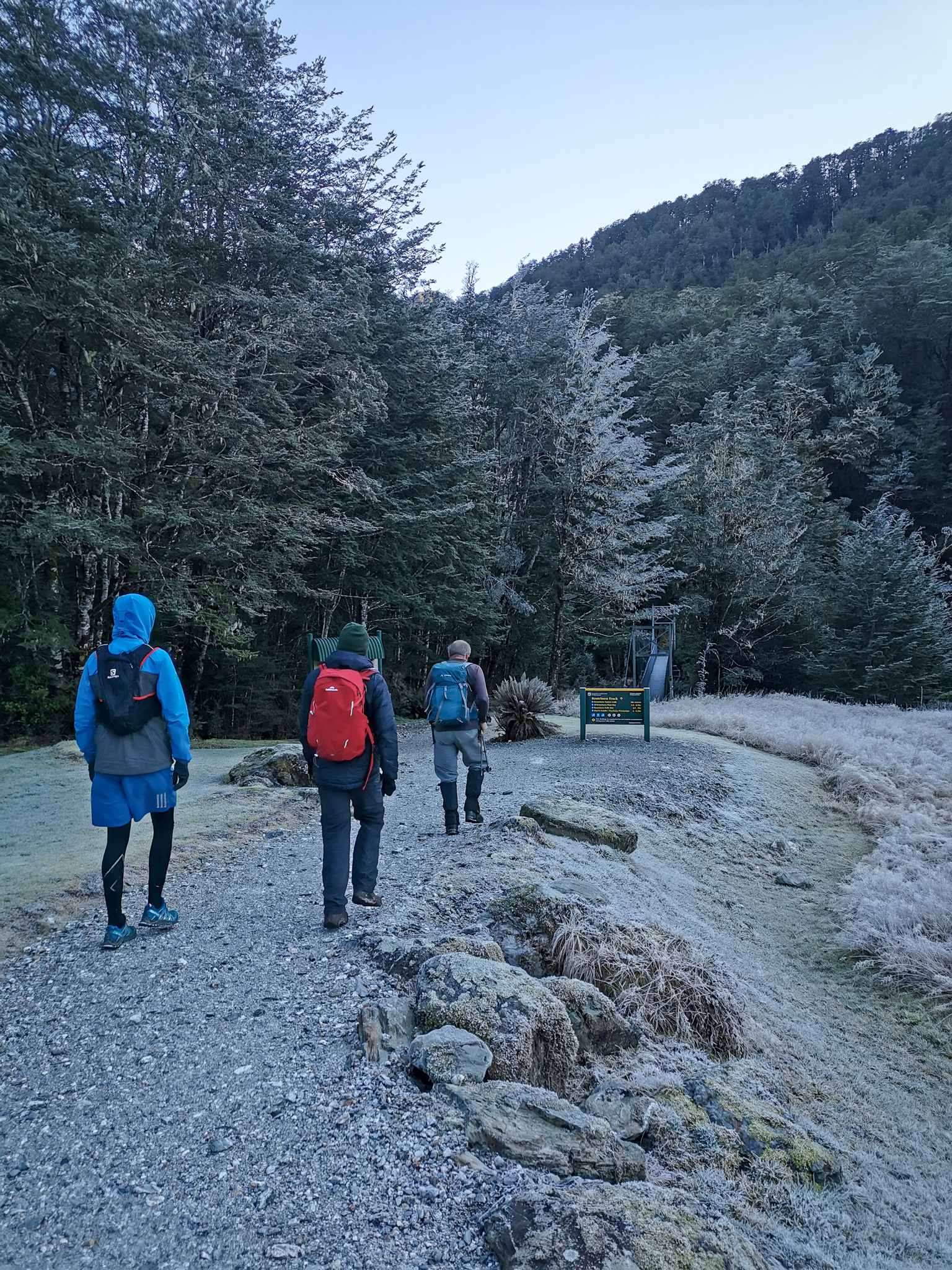
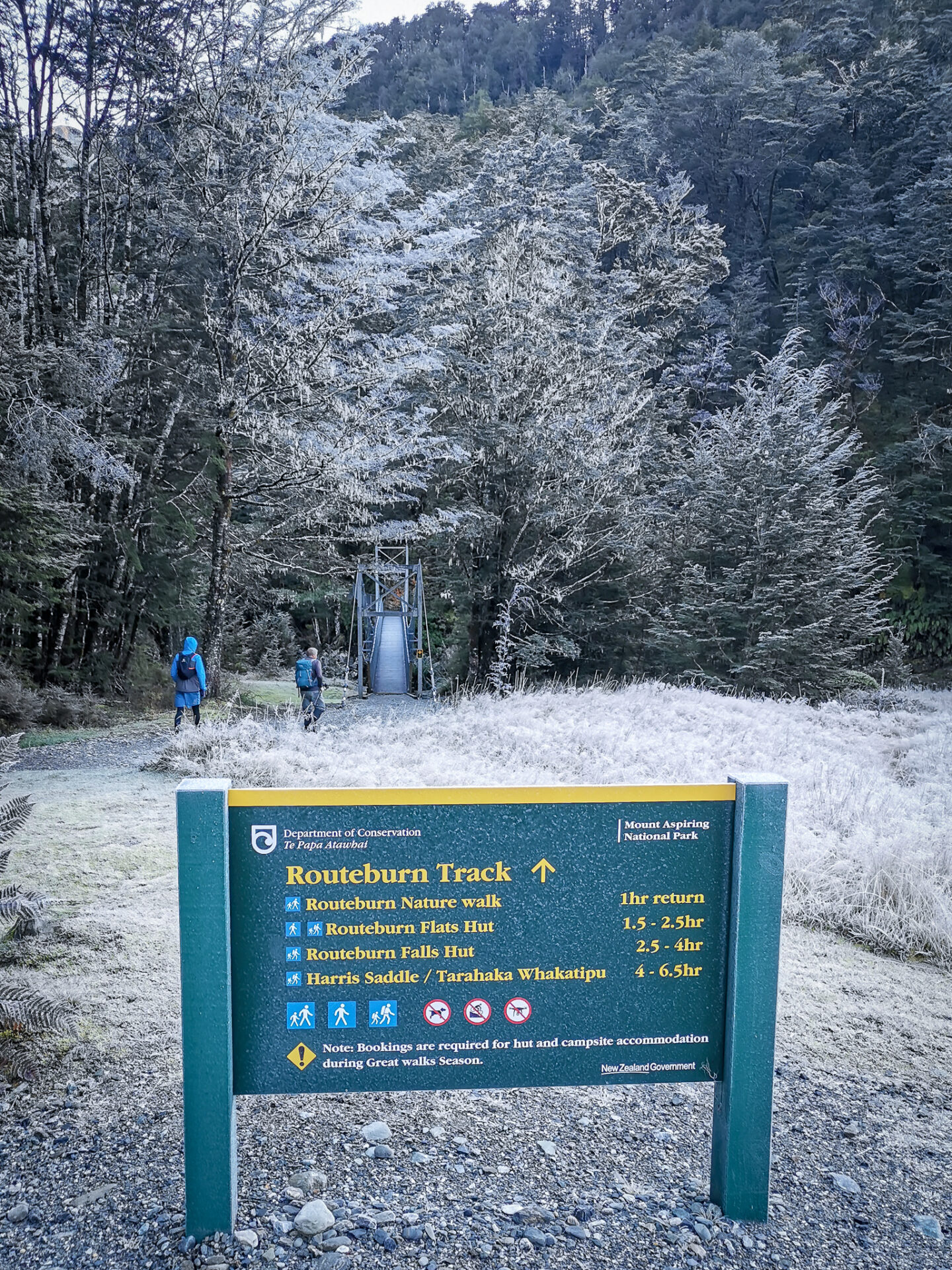
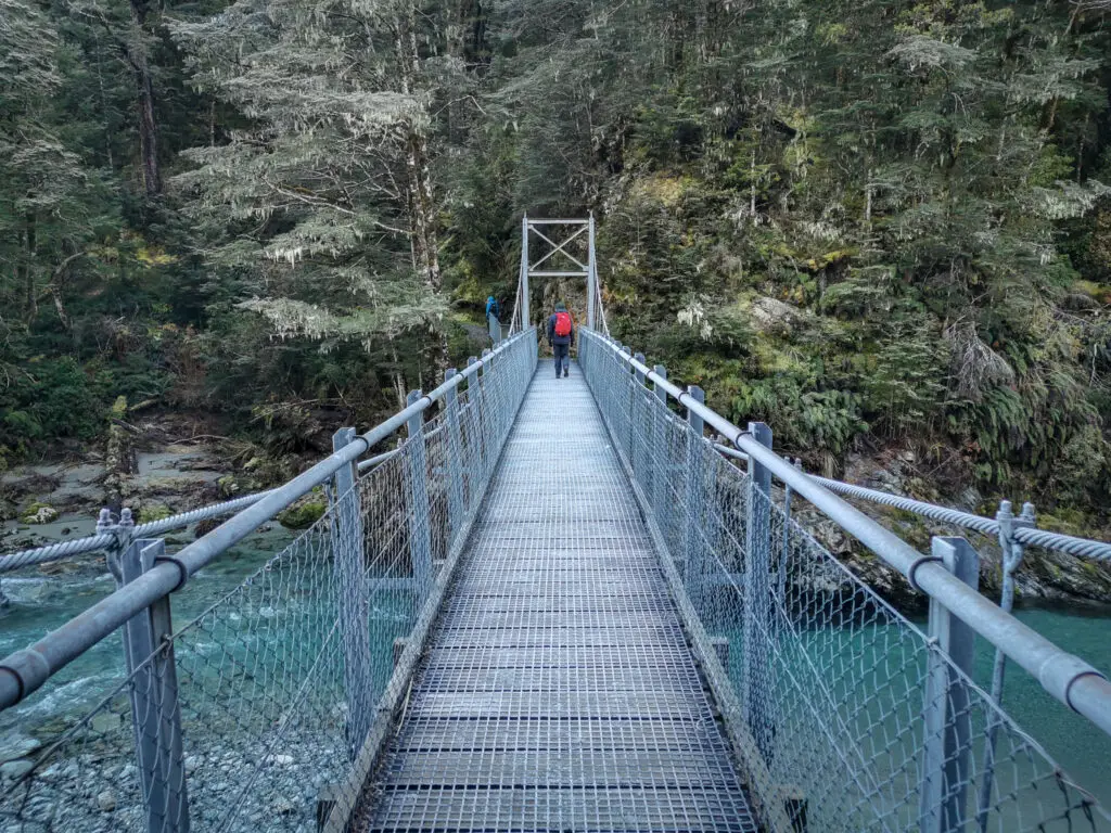
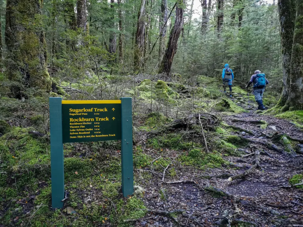
We crossed over the freezing blue Route Burn, slipping on the icy plastic of the swing bridge. Spoiler: it was still so frozen when we came back that I nearly ended up on my ass. The first ten minutes of the track are very easy. Walking along the Routeburn Great Walk is like walking along a gravel footpath. It was a nice warm-up before we reached the second intersection (the first being the short nature loop).
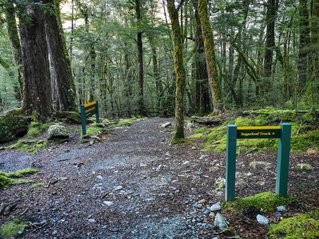
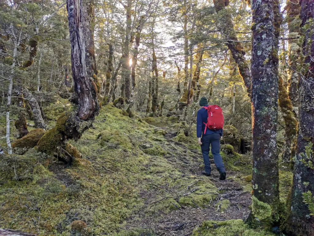
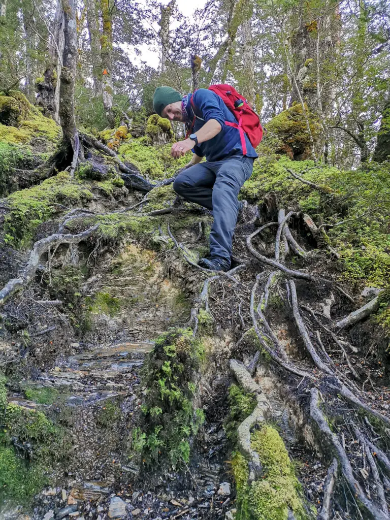
After turning to the right up the Rockburn / Sugarloaf Pass track, the track quality immediately changed. It became narrower, with no more gravel, just leaf litter and tree roots. But it was still relatively obvious and well-marked. The perfect tramping track!
We immediately started climbing up from the intersection. Scott and my Dad sprinted off, while Matt kept me company. We skirted around a bog and jumped over little creeks and puddles. The rocks and tree roots weren’t too slippery or frozen, but the air remained cold on the south side of the hills / mountains.
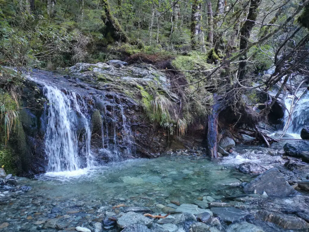
After almost an hour we reached the crossing over the Sugar Loaf Stream. It was quite washed out on the south-east side, so we carefully skirted around the slip and rocks to jump across. My boots are no longer that waterproof (mainly because I didn’t take good enough care of them) so it was a pretty chilly crossing.
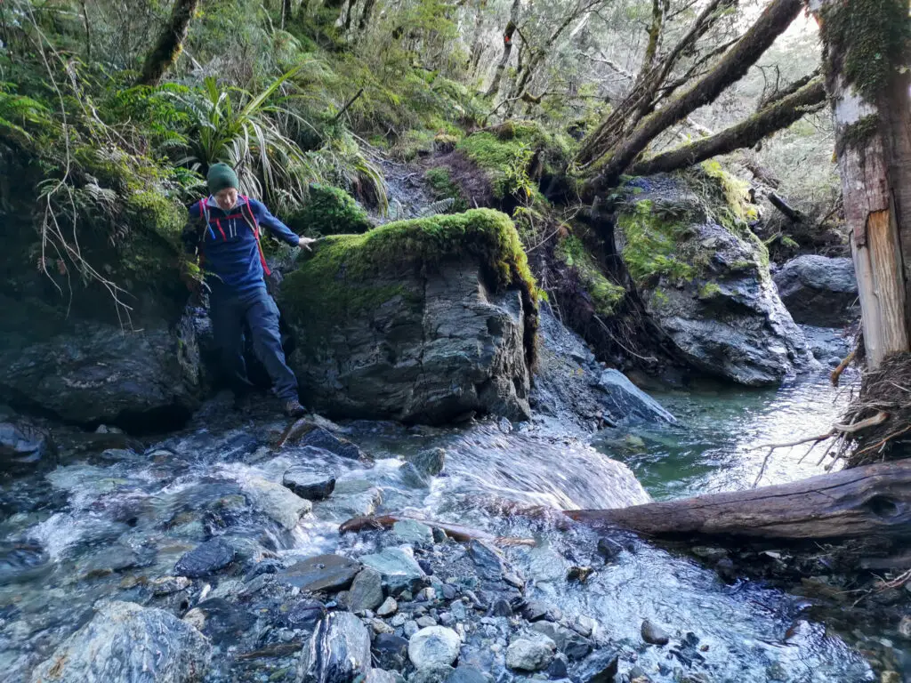
We stopped here for a sit-down break. Dad had visited here many years ago, when the waterfall we were next to had been much, much taller – floods had brought rocks down to completely fill in the stream.
After the stream crossing, the track became steadily steeper (yay) until we were climbing up ice-covered tree roots. I took little breaks to catch my breath, but the air was cold enough that I was strongly encouraged to keep these stops short.
Soon the sun started to appear, filtering through the branches. The ground slowly started to become less steep. I started to feel a little warmth in my bones. And then we hit the tree-line!
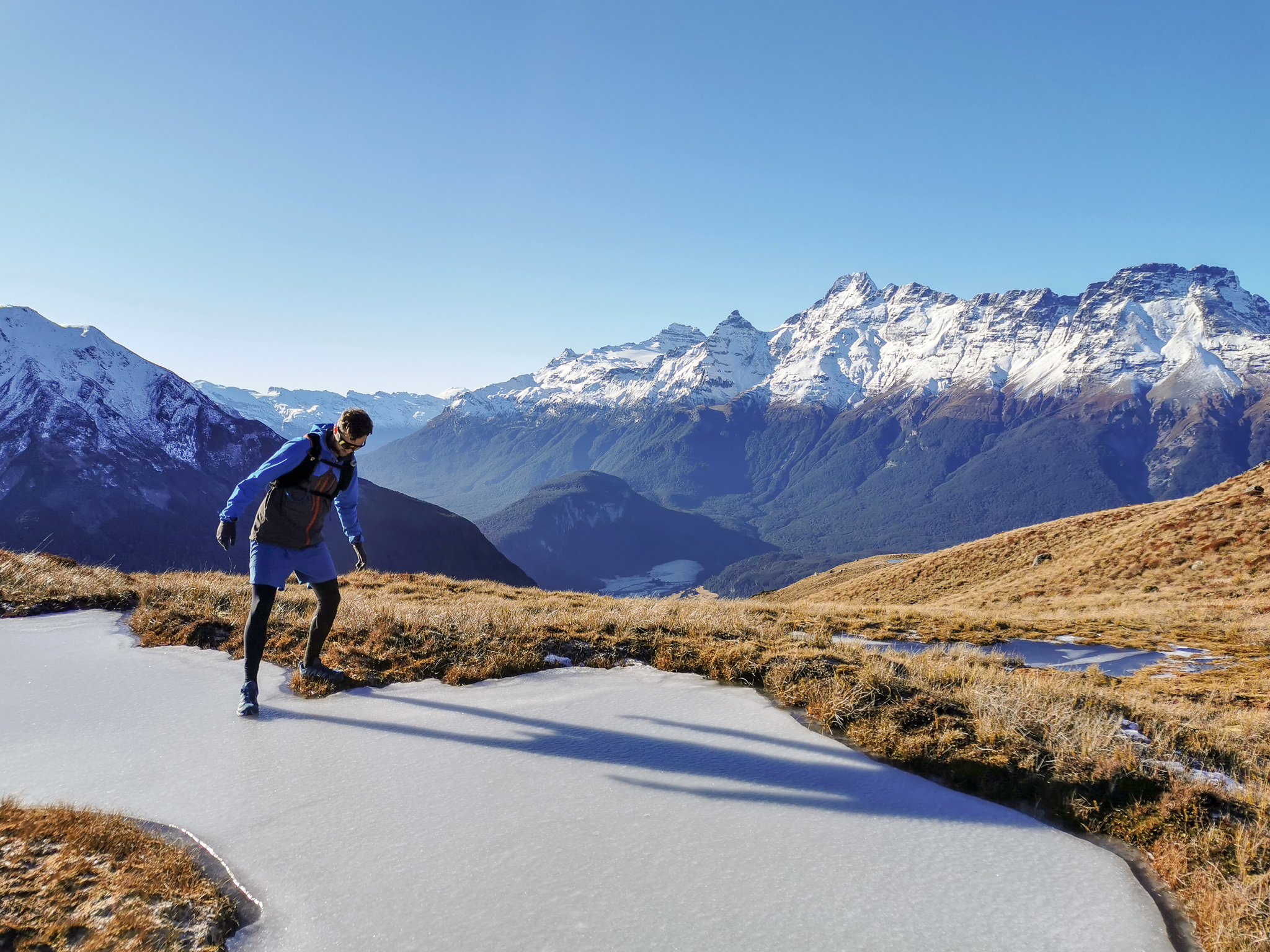
Here we stopped for another sit down break in the warmth of the sunlight. Mucho chocolate was consumed. Mainly by myself … Pretty much all by myself. I’d expected the track to become easier above the treelike, but instead the icy tree roots were replaced by just straight ice. And I hadn’t brought my ice-skates. Whoops.
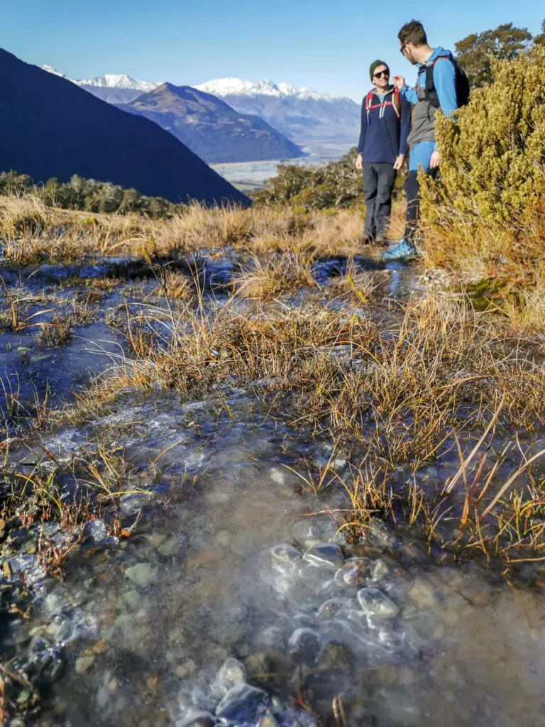
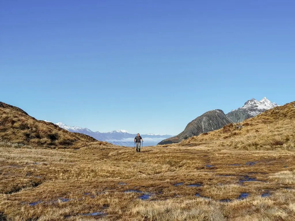
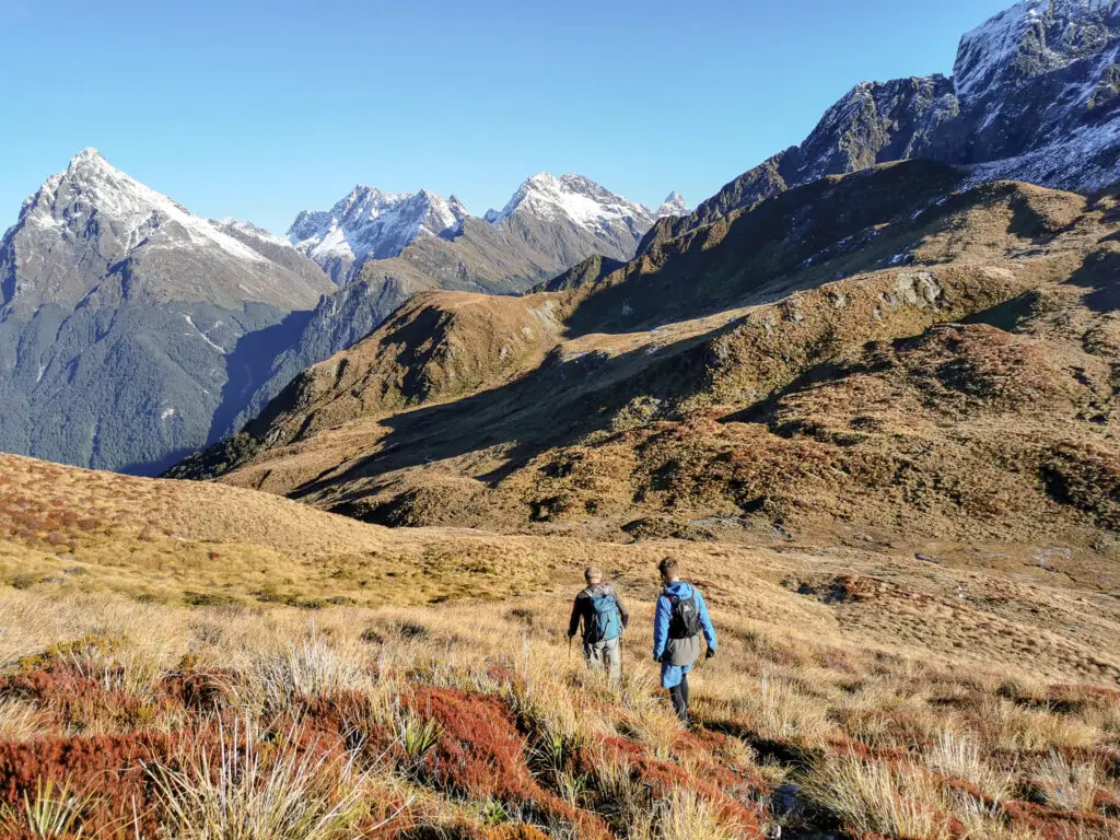
We climbed up the steep little ridge immediately after the treeline, doing our best not to let out feet slide out from under us. Once over the little ridge, the gradient became less steep and we had more room among the tussocks to avoid the icy gravel as we continued our way up to the pass.
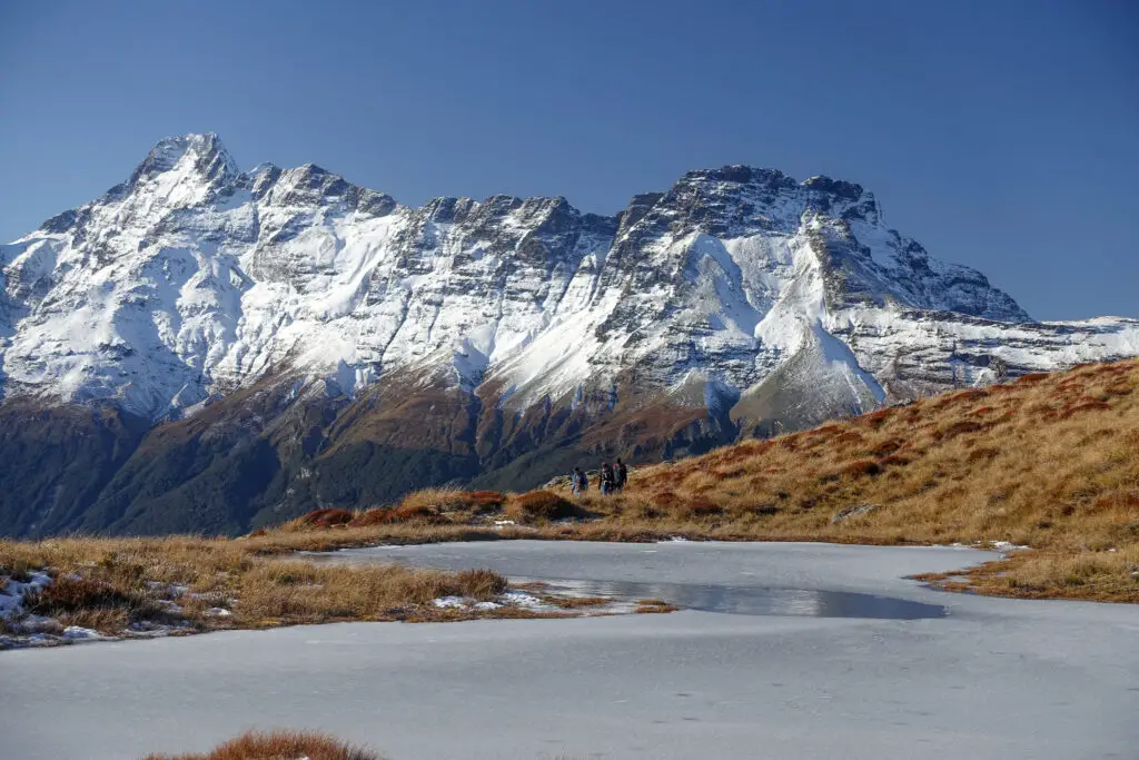
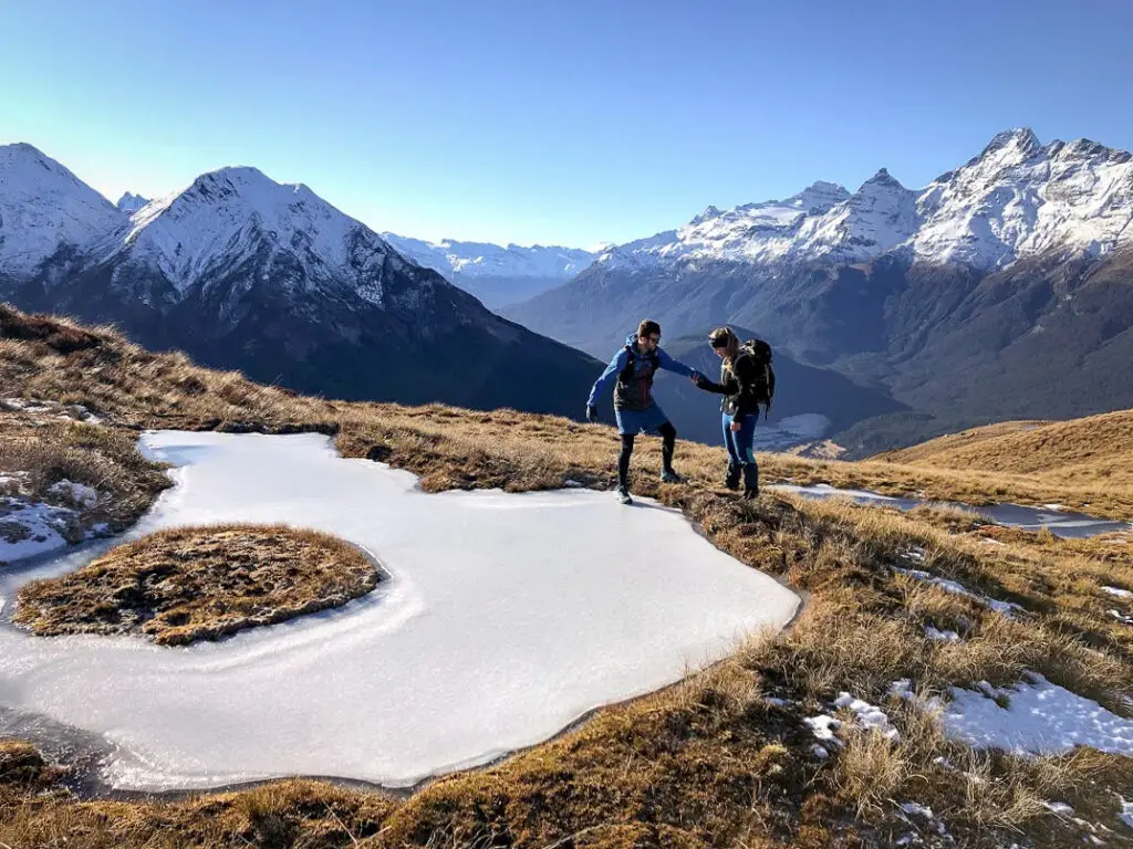
There were a few false ridges; the ones where you think “it’s just over that hill”. However it wasn’t too long before we were in the pass proper. And boy what a pass – so flat, with views on either side.
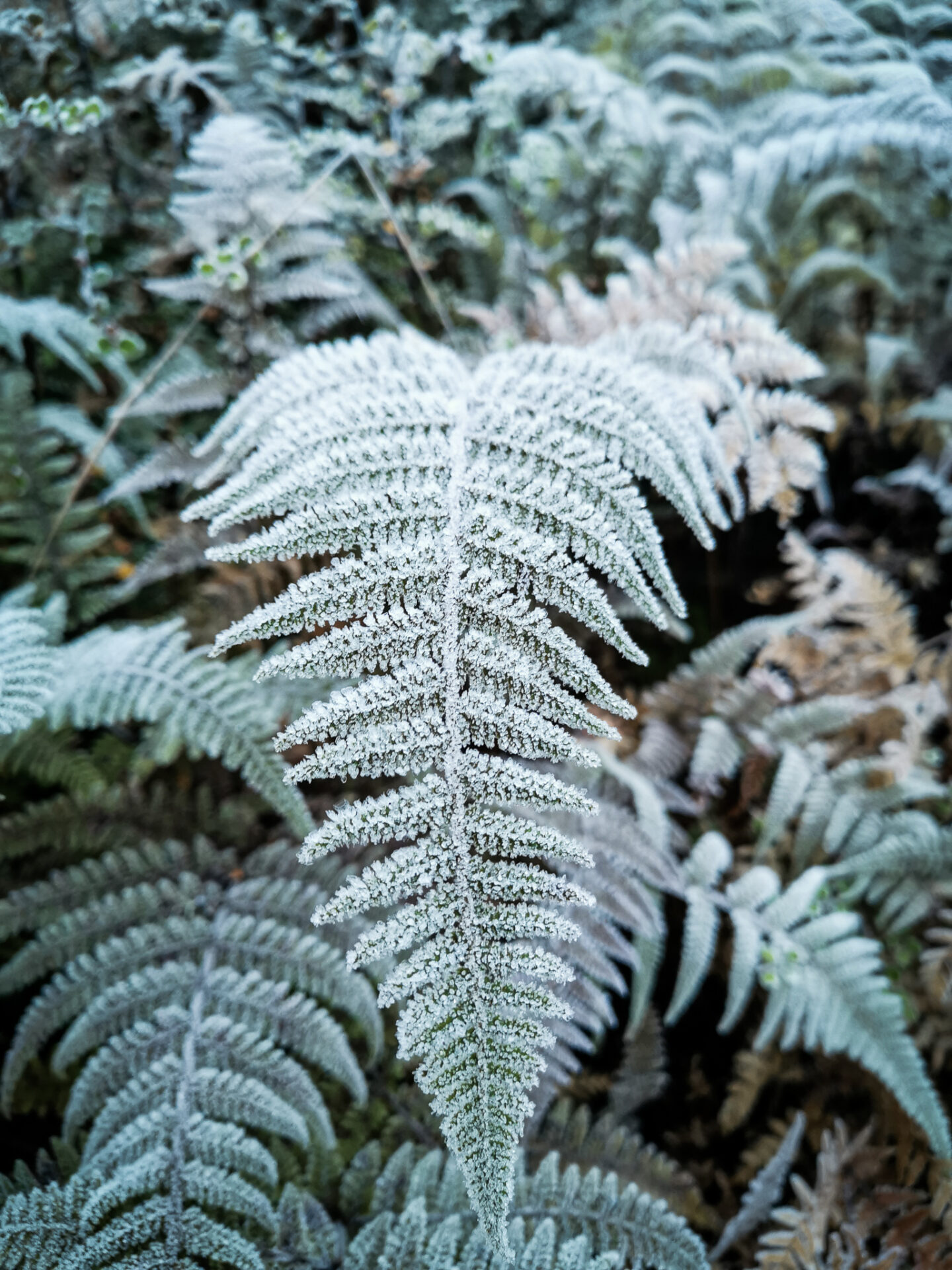
In summer I imagine it would be rather boggy (read: your boots would not forgive you). But with everything being frozen we could skip over all the puddles very easily and play with the ice.
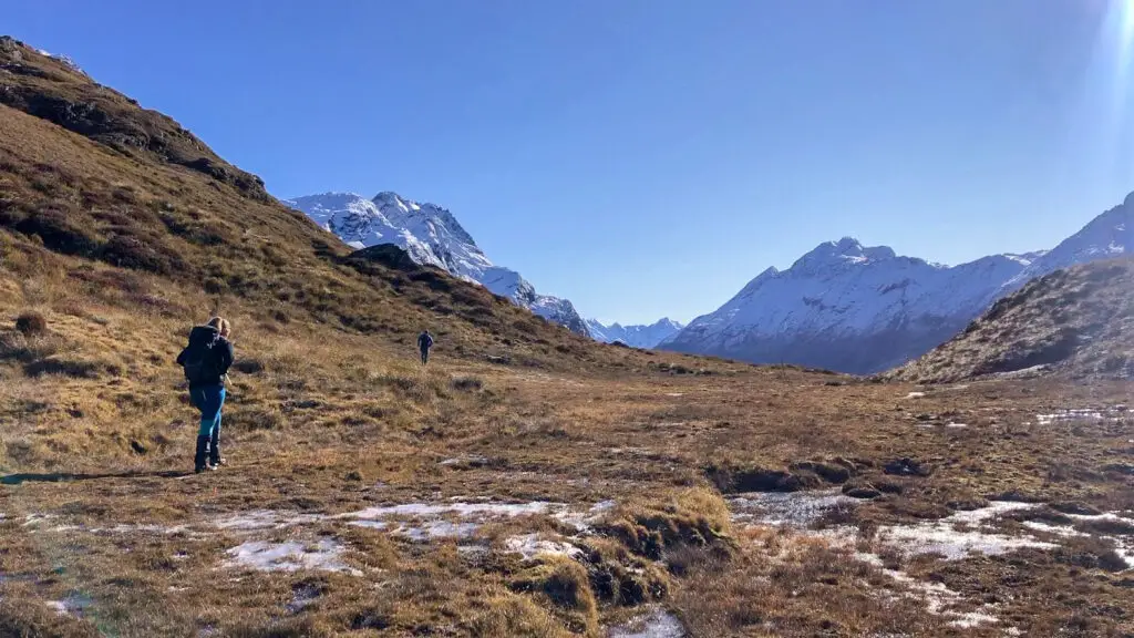
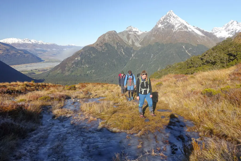
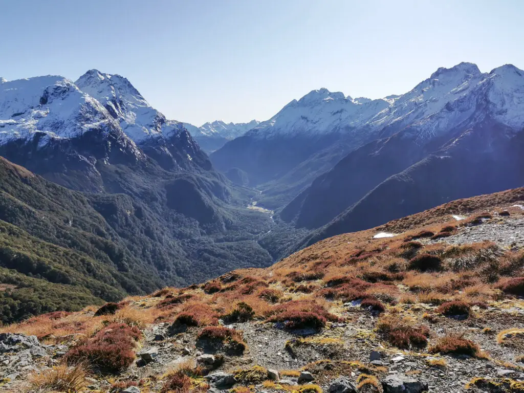
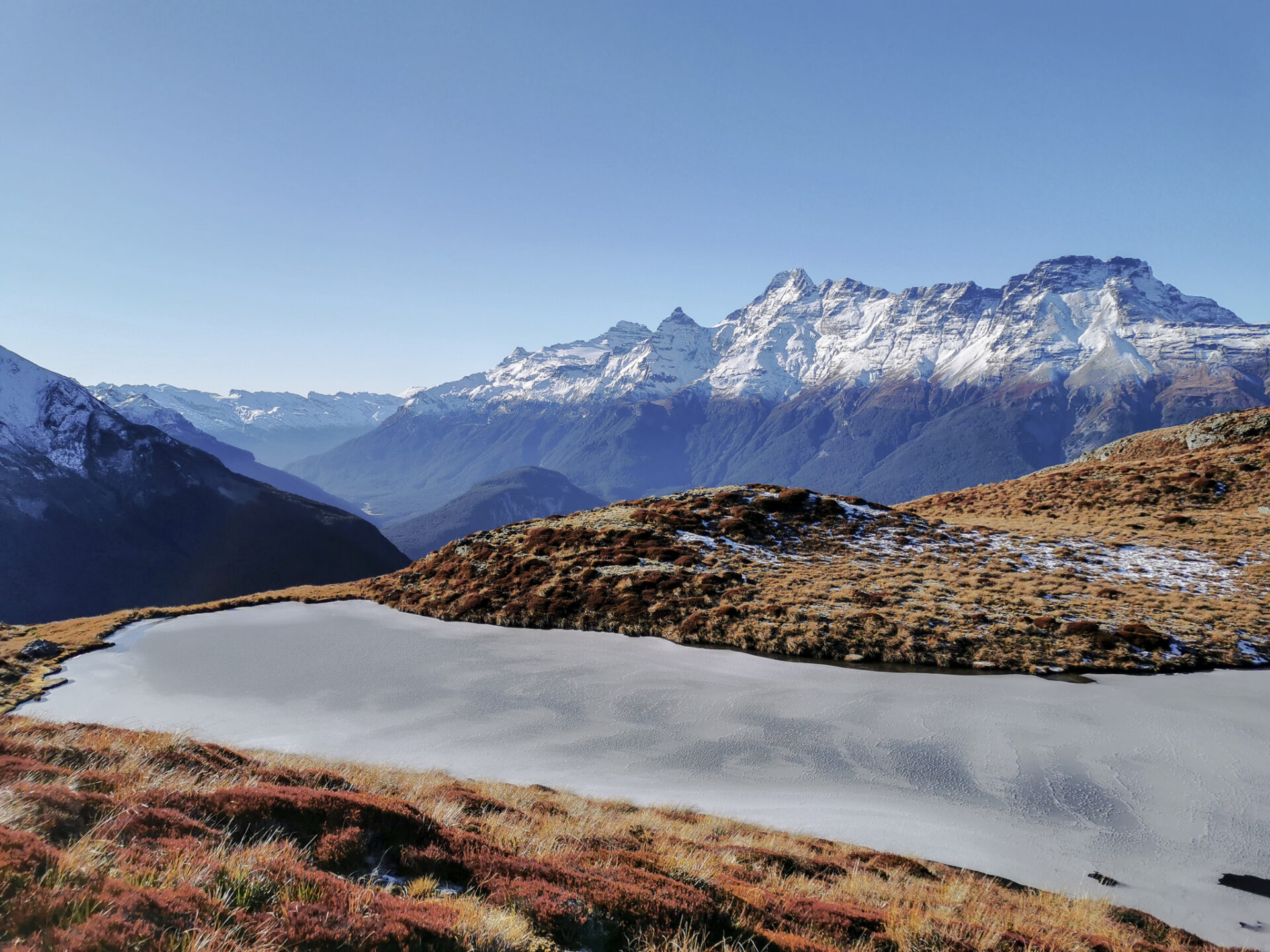
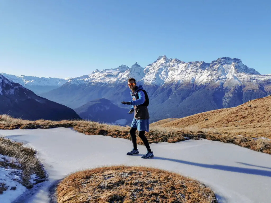
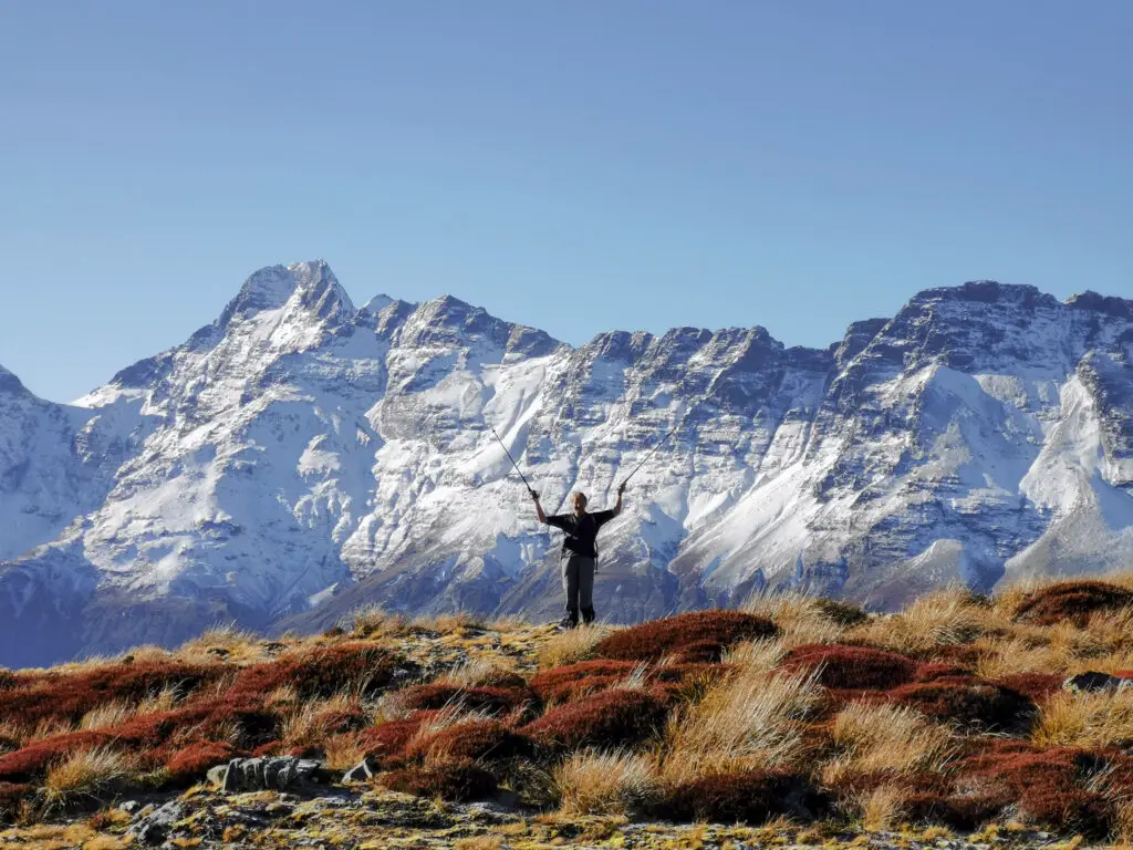
Instead of following the track back down the other side of the pass into the Rockburn valley, we headed straight up the tussocky slope to the east. Less than 30 minutes later, we were on the top. And wow. The views.
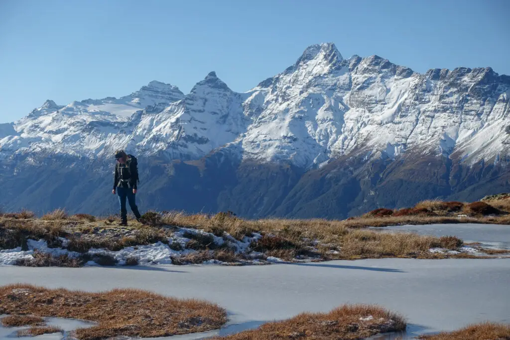
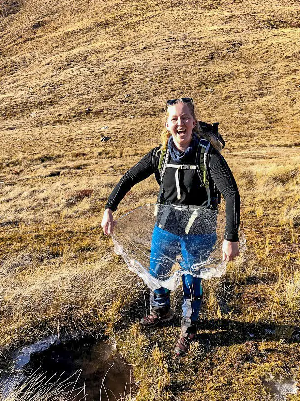
We had lunch up on top, soaking in the sun, snow, and sights, just above a series of beautiful little frozen tarns. After lunch I pushed us on to reach the larger tarn that I could see on the map, and as we crested the ridge we saw it had an infinity pool at either end (partly frozen). Beyond gorgeous.
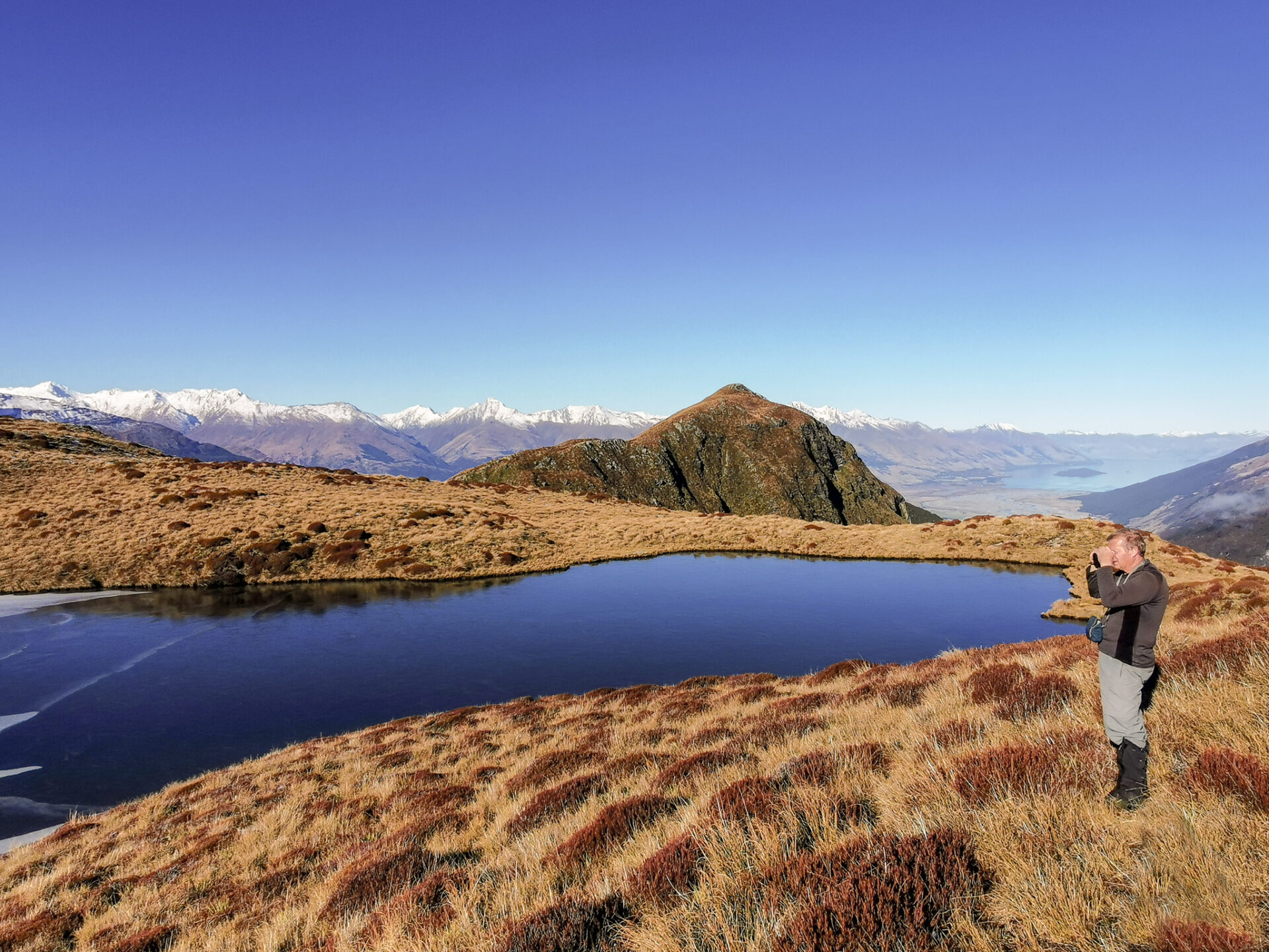
It was getting later on in the day, and we still had a cold and slippery descent ahead of us. So it was with reluctance that we turned our back on the tarns and gorgeous views, and headed back down. But not until Scott and I had skated around the frozen tarns.
The steep tussock slope leading to the treeline was much easier coming down than it had been on the way up. Instead of following the icy track, we picked a better route in the frozen tussocks. Once in the trees, the tree roots seemed determined to trip me up (probably just Treebeard having a laugh) and were still slippery. It was slow going, but eventually we reached the stream crossing, and then the intersection with the Routeburn track. The descent wasn’t a lot faster than the climb, just because of how much attention we had to pay in order to not slip over.
By the time we’d reached the turn-off, my mind was already 10 minutes ahead at the carpark. But as we rounded a corner of the track we came across something that hadn’t been there before. A tree from high up the bank had fallen and slid down the mossy bank and across the path, hitting it with enough speed to split in two. It had been a still, clear day. The Ents must have been on the hunt for the Ent wives. Either that or someone from one of the Final Destination movies had walked past. Only two logical conclusions.
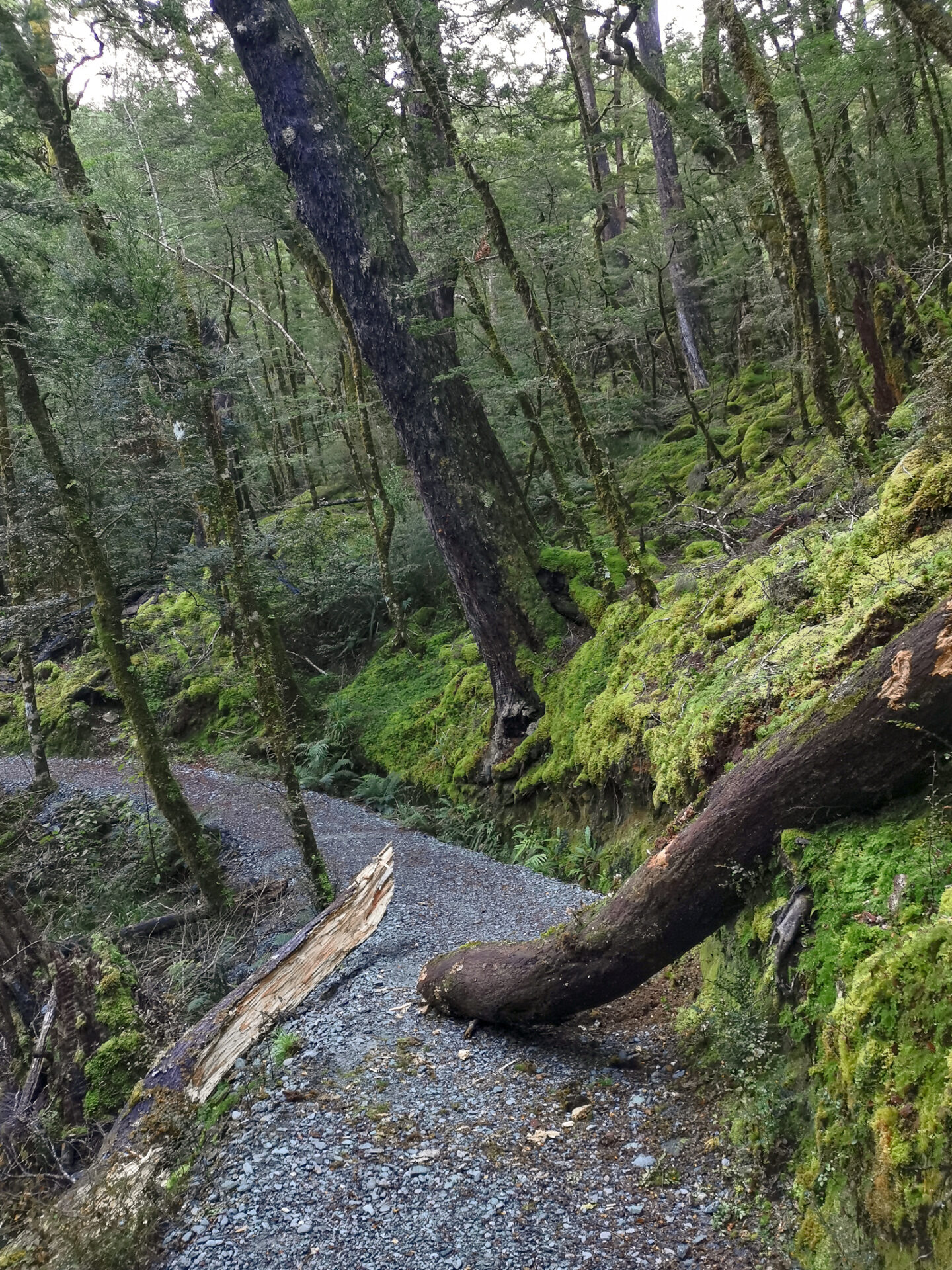
We walked around the fallen tree (me looking suspiciously about, eyeing up any other trees that were about to just up and come for us) and came to the swing bridge marking the end of the trip. I almost slipped backwards onto my ass – forgetting how slippery the plastic matting DOC puts down for better grip gets when it’s frozen (ironically). When we arrived back to the truck it was to find the windscreen had frozen … at 4pm in the afternoon. The Routeburn shelter is a chilly place in winter!
Sugarloaf Pass is such a fantastic and easily accessible spot. It seems very overlooked (not necessarily a bad thing?). I’d love to go back and camp in summer. Anyone with me?
There are also some side trips you can do from the pass. For example, you can make the trip into a loop by following the track down into the Rockburn Valley and around past Lake Sylvan, and then walking up the road to the shelter. This wasn’t an option for us because a) the daylight hours were too short in winter (it’s a big trip), and b) at that time the Lake Sylvan swing bridge was non-existent due to the February 2020 flooding. This bridge has since been re-opened.
Safety
As always, please stay safe when you’re out exploring. Follow the Outdoor Safety Code:
- Choose the right trip for you (read my article on tramping safety, talk to DOC)
- Understand the weather (this can be a pretty exposed trip above the treeline in bad weather, and in winter the track under the trees barely sees the sun so gets very icy)
- Pack warm clothes and extra food (check out my post here about what gear you need to take)
- Share your plans and take ways to get help (have an emergency beacon on your person)
- Take care of yourself and each other
If you’re not feeling super confident then you can always get in touch with me here on the blog or on my Instagram. Or take a look at my Tramping 101 series which includes this post about how to stay safe in the outdoors.
Also don’t be a dick, check out my guide to New Zealand tramping etiquette.
Stay safe and get outside!
Great reading Alice. I tino ātaahua ngā tirohanga (view).
Kia ora mo tena! Thanks, they certainly are.
That’s a great read Alice. You are very thorough and incorporate many excellent details. Thank you for taking the time.
Thanks so much for commenting Kathy! Makes my day 🙂 Glad you found it helpful!
Hey Alice, great and informative post as always! Do you have any recommendations for emergency beacons (what brand and where to purchase?) 🙂
I’ve got a KTI PLB (the fluorescent yellow/green one) which I’ve fortunately not had to use, other than popping in my pack/pocket most trips. I like it because it’s battery lasts 10 years, whereas many others last 5 or 7 years. You can’t easily replace the battery to my knowledge and have to buy an expensive device again, so it’s definitely worth considering battery life. I’ve heard a lot of good things about Garmin inReach as well (prior to their hack), although it requires a subscription. Is that helpful? Wilderness has some good articles on this topic too 🙂
Hey Alice, thanks so much for the great read! I’m planning to do the same route the coming weekend! Just checking the tarns are at the top of Sugarloaf I suppose? Cheers!
Hey Harrison! Yes the tarns are near Sugarloaf, they’re a bit higher up than the actual pass – you have to climb up for another 100m or so. I’ll flick you an email with them circled on the topomap 🙂
It’ll be pretty icy like it was for us, hope you get some great weather for it!
Hey Alice- Great write up. What month was this? Headed there in early May and want to know the level of cold to pack for.
Frank
This was early June in 2020, so a while ago now! It was rather chilly, especially as you’re not in the sun for most of the walk up in the forest.