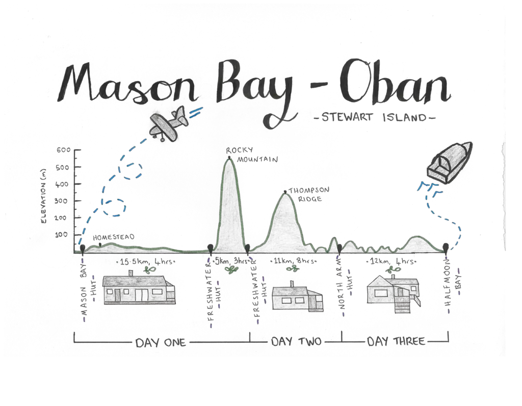
Fly into Mason Bay and enjoy tramping a stunning part of the North Western Circuit on Stewart Island / Rakiura National Park, with many chances to see kiwi in the wild!
Length: 45km
Time taken: 3 days
Difficulty: easy – moderate
Facilities: Mason Bay Hut: 20 bunk hut with running water, fire and long-drop toilets. First come, first served with a standard hut ticket (blue / $5). Flights landing on the beach (20 minutes from hut) from Invercargill and Oban with Stewart Island Flights.
Freshwater Hut: 16 bunk hut with running water, fire and long-drop toilet. Also first come, first served with a standard hut ticket. Water taxi to/from Oban right across the river from the hut with Rakiura Charters.
North Arm Hut: a Great Walk hut with 24 bunks, running water, fire and long drop toilets. Bookable all year round (book here); $24 in season (October – April), out of season $22.
– Important: parts of the track can be flooded year round (notably the swamp between Mason and Freshwater Huts, as well as the streams between Freshwater and North Arm Huts. Mud will also be present year round regardless of recent rain levels. Be prepared to lose your boots in the swamps of despair. –
Why this tramp?
Stewart Island is an amazing part of New Zealand – lush forests, beautiful bays, amazing wildlife, and more tramping tracks than roads. Paradise!
I’d visited Stewart Island a few times before with my family. One of my favourite trips was out to Mason Bay on the west coast of the island. It was amazing, but I wasn’t quite able to enjoy it as much as I would have liked (I was recovering from a severe bout of glandular fever / mono). While everyone else was out looking for kiwi at night, I stayed behind at the hut, recovering from the walk. As I sat listening to the bird calls in the distance and wishing I could join in, two kiwi came right up to the deck I was sitting on! That special moment stayed with me. It was something I’d been searching to recreate.
When Queen’s Birthday weekend rolled around and the weather looked promising, it was a goer! Three days before, I rustled up my adventure buddies – Matt and Lauren, chartered a plane, booked the huts, and we started prepping for a three+ day adventure. It was on.
How to get to Stewart Island
You can’t drive to Stewart Island (surprise surprise), so how do you get there?
- Real Journeys runs the ferry between Bluff and Oban. It currently (as of June 2020) costs $89 per person.
- Stewart Island Flights run flights between Invercargill and Oban for $130 per person. They also offer charter flights landing on various beaches around the island, including Mason Bay.
- There are also water taxi options between Oban and various places around the island with Rakiura Charters and Aihe Eco Charters.
Day 1: Flying to Mason Bay and searching for kiwi on Stewart Island
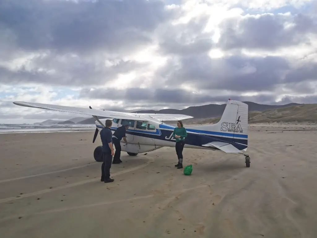
Lauren’s lovely sister dropped us and our packs off at Invercargill airport on Saturday morning. We checked in at the Stewart Island Flights desk, full of nerves and excitement. It felt very weird and fancy to see our flight listed on the departures board as “Charter” (even if it is a common route for Stewart Island Flights). It was also interesting to see the weight of our packs, something I don’t always measure. Each pack was around 14kg, and by the time we got back to civilisation in four days they’d be down to almost 10kg. Food is life.

Before long we were being ushered through the back doors of the terminal and then out onto the tarmac. I excitedly took photos of what I thought was our small plane (a 10-seater Britten Norman Islander), until our pilot, Raymond, continued walking around to a much smaller plane that had been hidden (a 5-seater Cessna 185). We piled in (Lauren accidentally opening the emergency hatch in the process, reassuring), and then we were off down the grass runway!
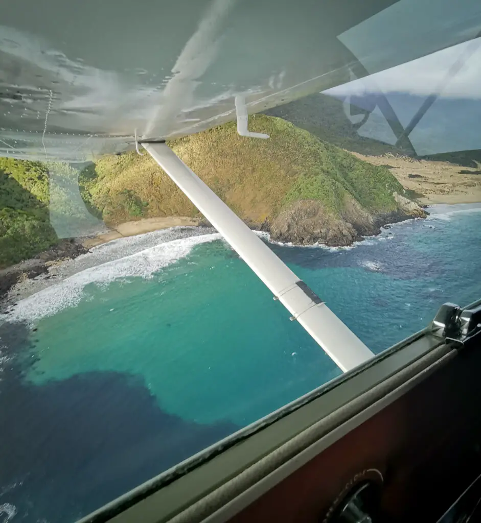
It was a beautiful flight around the northern beaches and then down to Mason Bay on the west coast of Rakiura / Stewart Island. Raymond even gave us the roller coaster experience of flying down to check out Smoky Beach; flying only 1 metre over the sand and waves at what felt like 150km/h. Amazing!

All too soon though we were flying past Ruggedy and arriving at Mason Bay. A fly over just to be sure the runway / beach was clear of debris, then a ridiculously smooth landing on the beach (seriously, it was softer than landing on tarmac).
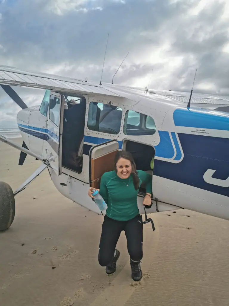
We grabbed all our gear, and then waved goodbye to Raymond, who’d been an awesome pilot. The plane got smaller and smaller until it flew out of sight. And then it was just the three of us, standing alone on a beautiful beach in the middle of nowhere. I felt rather small, looking out at the waves and knowing that it was just open ocean until South America.
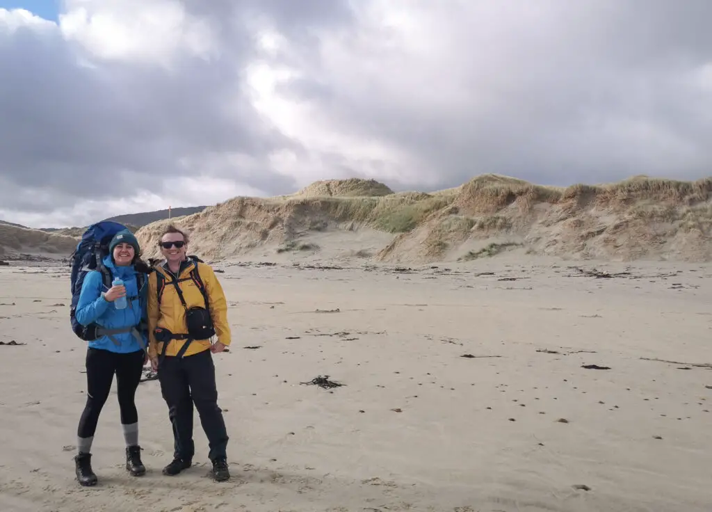
We popped on our rain jackets to protect from the wind, and heaved our packs onto our shoulders. That’s when Lauren realised her pack was falling apart. Great omen.
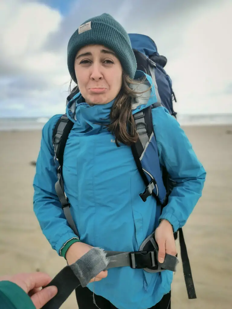
It was extremely disappointing (but lucky for Lauren and her pack) that we found a considerable amount of rubbish from the fishing industry on the beach, including good lightweight rope.
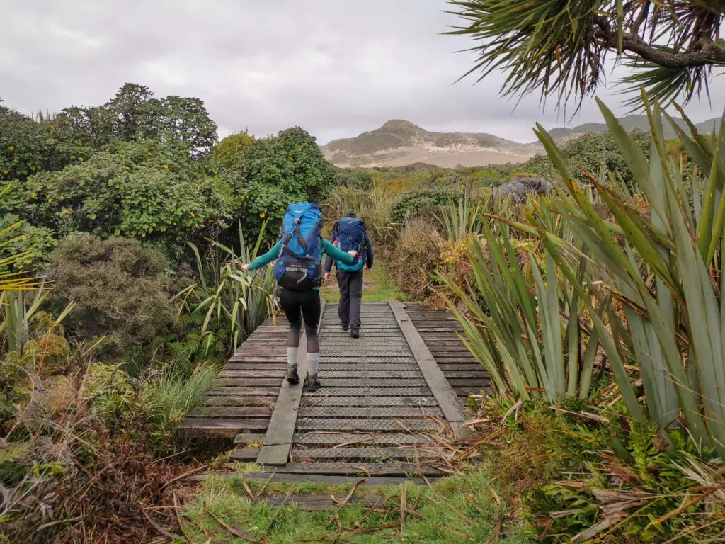
We’d landed right next to Duck Creek, so we followed it up until it intersected with the track (which Raymond had recommended, in order to avoid climbing up and over the dunes). This meant we ended up on the true right of the creek, while the track was on the other side. There were a few footprints on this side of the creek and I knew we’d eventually join up with the track (and keep our feet dry) if we followed its course upstream. However it took us 10 minutes to realise that wasn’t going to happen. After a bit of laughter, we ended up having to cross the stream twice instead – once to get back on the track and then once again at the marked crossing.


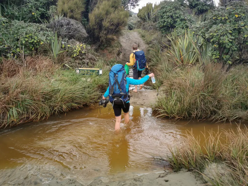
So in the end we made the first 20 minutes of our four day trip a lot more complicated than it should have been, but we made it to Mason Bay Hut!
To my surprise we were all alone. The Intentions Book had only a few visitors listed since lockdown had been lifted. Luxury!
We spent the afternoon visiting the old Homestead, 30 minutes up the track from the hut, and exploring the extensive dune system next to the hut. The area has a pretty unique history that I unfortunately don’t have space to get into here, but if you want to know more here are some of the links:
- Info on DOC website
- Marram grass conservation efforts
- Stuff article about the last farmers in the area
- How to find and identify ambergris
- Whale strandings on the beach
I’m always happy to chat, so reach out if you’ve got any questions or would like to know more! It’s such a cool place.


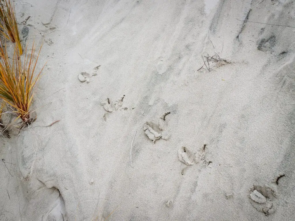
We had a delicious dinner of fresh pasta and veggies (the benefit of not having to carry the food in on our backs), before heading out to search for kiwi. Hearing and spotting kiwi is a highlight of tramping on Stewart Island. We heard quite a few of them between the hut and the homestead – they’re ridiculously loud both when calling and when moving around in the bush. When Lauren and I went out again a bit later (Matt’s back was too sore from all the sneaking), we heard one really close to the track. Our patience paid off and it wandered out onto the track in front of us, completely undisturbed by our presence. It was Lauren’s first sighting of a real kiwi and my second, but it wouldn’t be our last on this trip. (I didn’t get any photos sorry and enjoyed the moment instead).
Day 2: Tramping Mason Bay Hut to Freshwater Hut + Rocky Mountain side-trip on Stewart Island
Mason Bay Hut – Freshwater Hut: 15.5km, 4 hours
Rocky Mountain side-trip from Freshwater Hut: 5km, 3 hours return
The next morning we left a bit later than planned (thanks to cooking up delicious, delicious pancakes for breakfast). We stayed quiet walking along the road to the Homestead just in case there were any kiwi staying up late. We heard one really close to us, but it didn’t pop out onto the track.

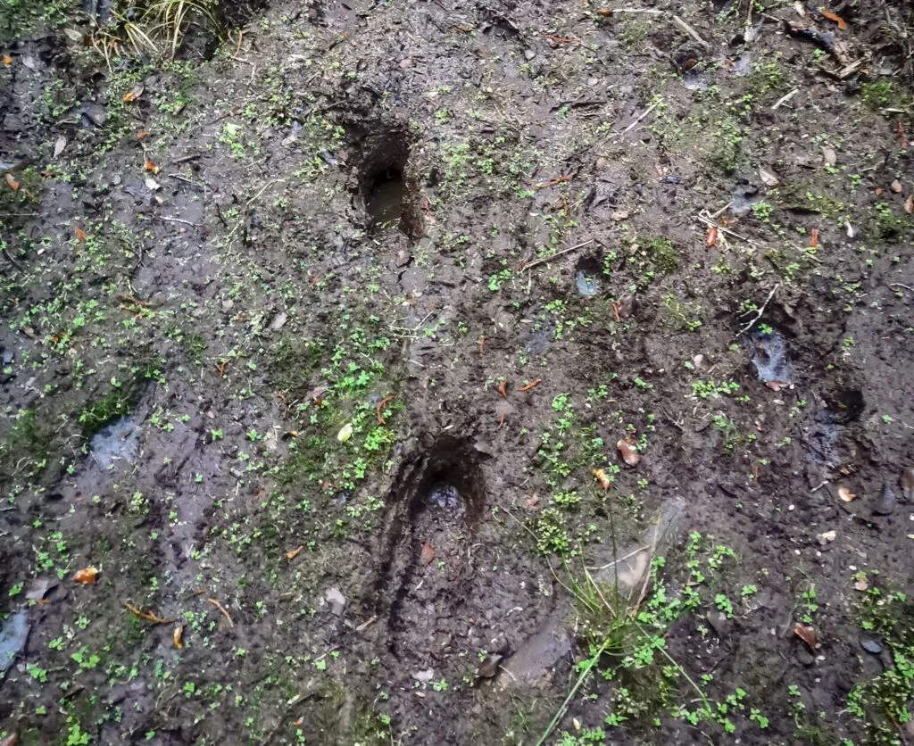
After passing by the Homestead and old wool-shed, the mud that tramping in Stewart Island is so infamous for made an early appearance.

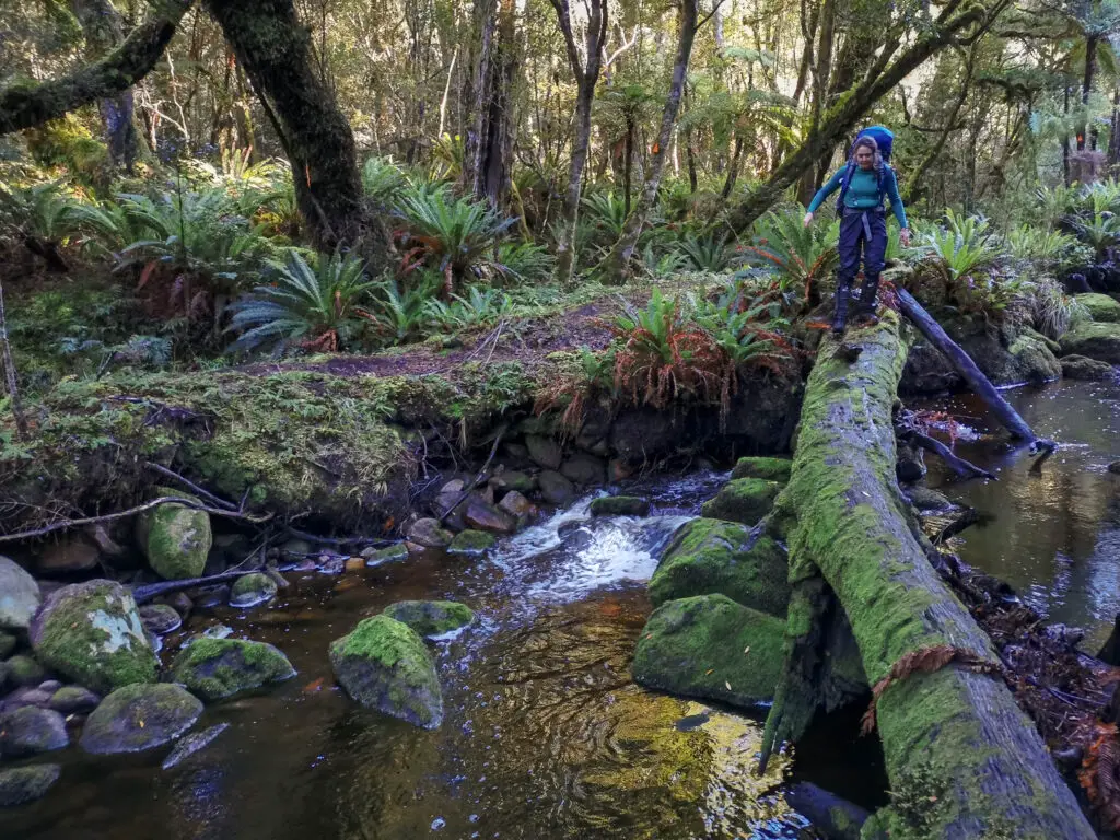
At times there were small bridges or boardwalk, but more often than not these were far too short and we had to jump over bogs to reach them. Once past Lower Island Hill, we reached the proper boardwalk stretching off into the distance. It was a relief to be above the mud!
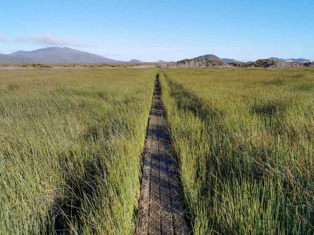
After the long boardwalk, we followed Scott Burn along its manmade channel. At either side there were prominent DOC signs to warn about the flooding risk for this part of the track. I imagine this whole day would be dangerous during and after rain.


It was on this part of the track that we saw our first humans; a father taking his 13-year old son on his first big hunting trip (6 days between Ruggedy and Freshwater). They recounted their adventures to us later that evening at Freshwater Hut (like kiwi and deer wandering into their camps), before catching a water taxi out the next morning.
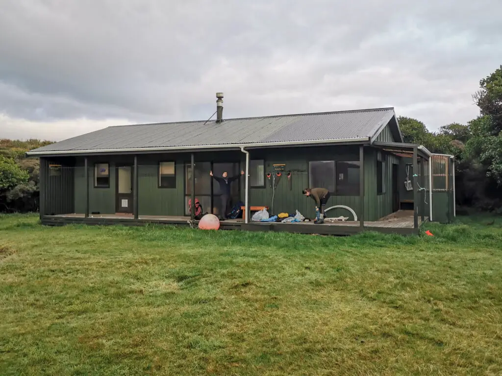
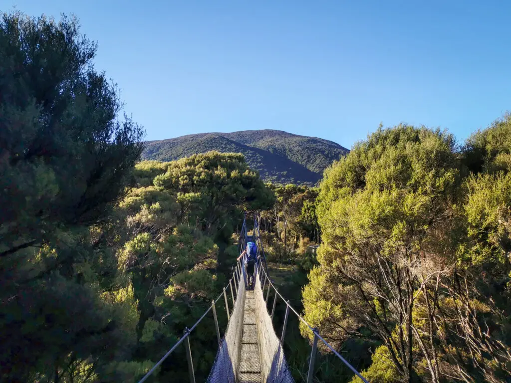
There was more mud waiting for us after crossing Scott Burn, and my feet were getting sore from carrying a pack post-lockdown. But eventually we saw the swing bridge over Freshwater River! We had arrived at the hut.
The plan had been to climb up Rocky Mountain that afternoon; a 3 hour side trip from the hut. But by the time we were ready to head off it was already 2pm. (I blame the pancakes.) I hesitated, knowing that we didn’t have a lot of daylight left and that my legs would hate me. But the alternative was to sit around at the hut for the whole afternoon. I scribbled a quick note to the hunters that we’d passed earlier telling them where we’d gone and when we expected to be back (and that we were carrying head torches and a beacon, the case of the missing Tasman trampers in the front of my thoughts). And we were off.
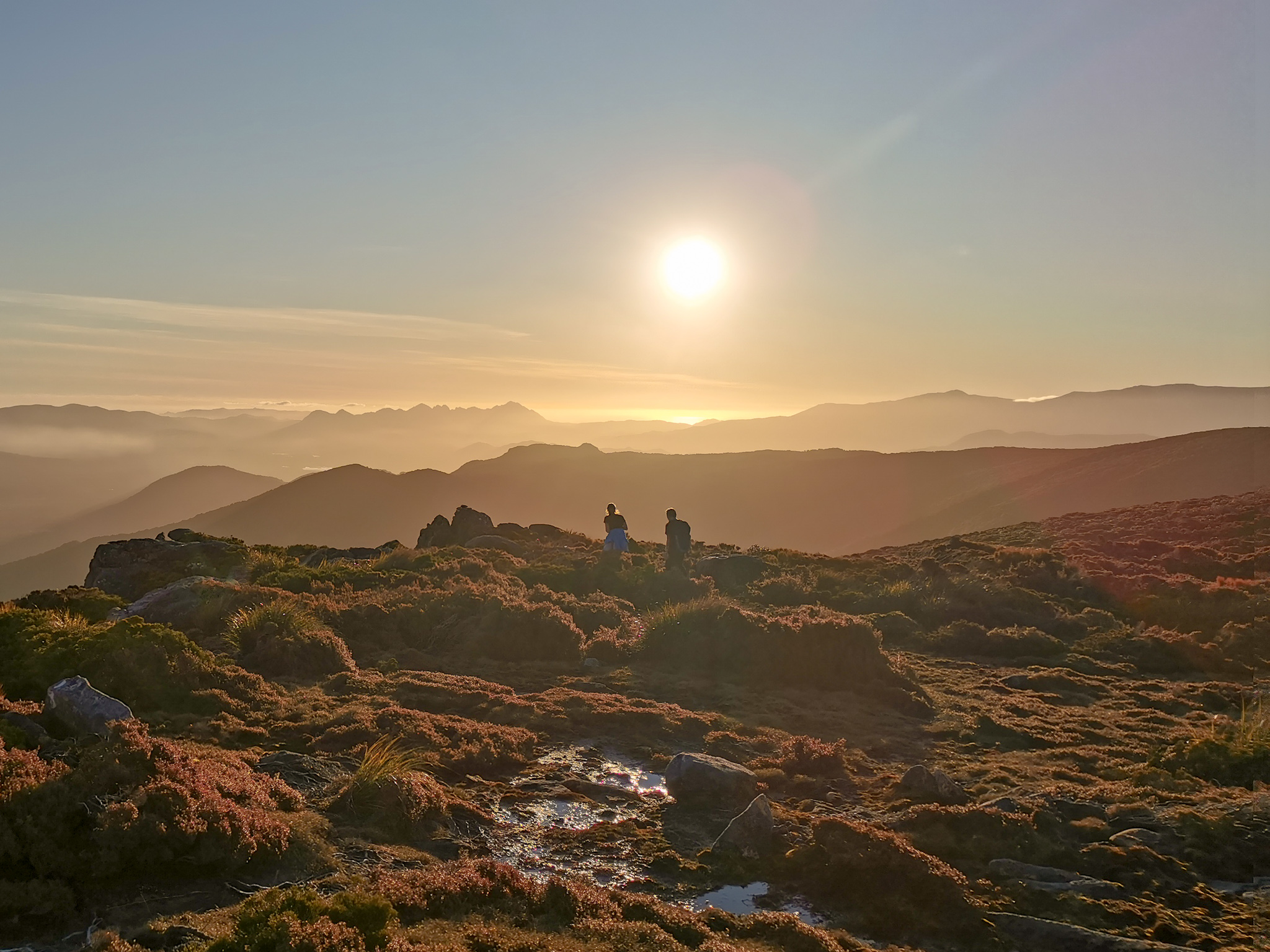
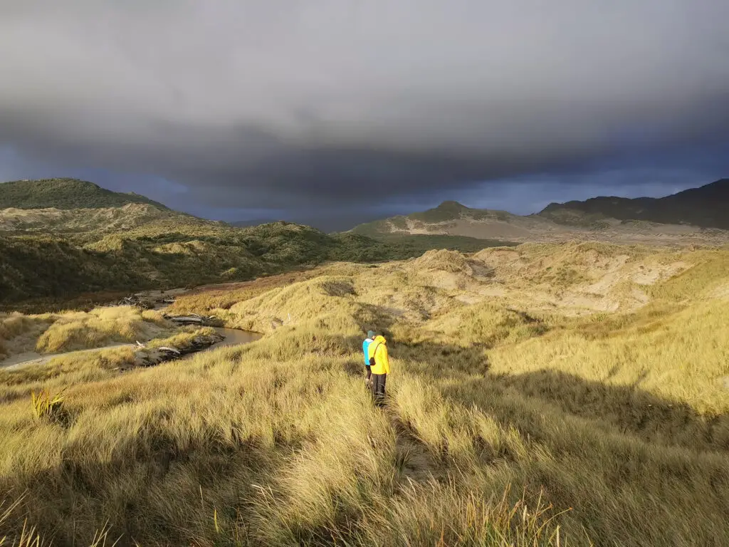
We raced sunset up to the top of the mountain. The track was surprisingly well worn and we got up there in just over an hour. It was worth it.

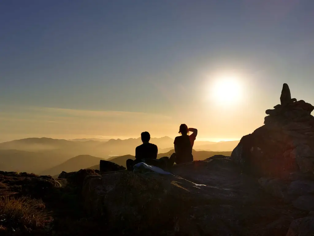
I even had patchy cell service at the top (with Spark, Matt and Lauren didn’t with Vodafone), so I FaceTimed my parents to show them the view, and checked the weather forecast. It was absolutely gorgeous and such a stunning way to end our first day walking.
Matt eventually urged us to start moving as the sun continued to dip closer to the horizon. We grabbed some fresh water from a stream on our way down to drink, and soon reached the junction with the main track. Although we weren’t bothering to be quiet, a kiwi popped out on to the track in front of Lauren just before we reached the hut!
We arrived to the hut just as it was getting full dark to find that the hunters had arrived and lit a fire. So cosy. It was a nice evening spent chatting and filling them in on the past week’s events (the two missing Tasman trampers had been found – alive!, still zero new cases of COVID-19 each day, and Simon Bridges had been ousted as leader of the National Party). They showed me their Garmin In-Reach and it looked pretty fricking cool. Maybe when I have to update my PLB I’ll get myself one of those.
Day 3: Tramping Freshwater Hut to North Arm Hut on Stewart Island
11km, 8 long hours
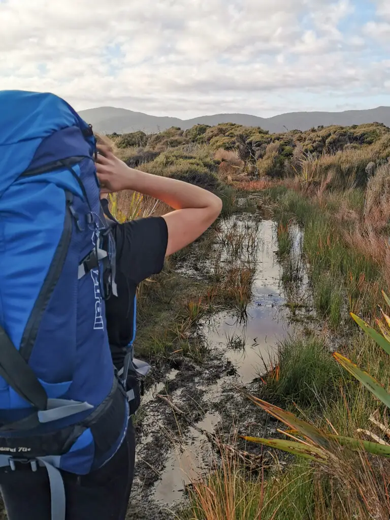
We woke up refreshed and ready for a long day. The sign said 6 – 7 hours, but I expected it to take us at least that – tramping on Stewart Island is like that. From the intentions book it sounded as though a lot of people skipped over this section of the North West Circuit and caught a water taxi from Freshwater back to Oban.
We left as soon as it was light enough, chilly though it was (the long drop door was frosted shut). I wanted to maximise the daylight hours so that we weren’t stressed about getting to North Arm before it got dark. In the back of my mind was also some worry about the stream crossing after Thomson Ridge. The first I’d heard of it was a warning sign at Freshwater Hut; on topomaps it was bridged, and there hadn’t been any warning on DOC’s website that I’d seen. Oh well, we’d cross that bridge when we came to it (or not).

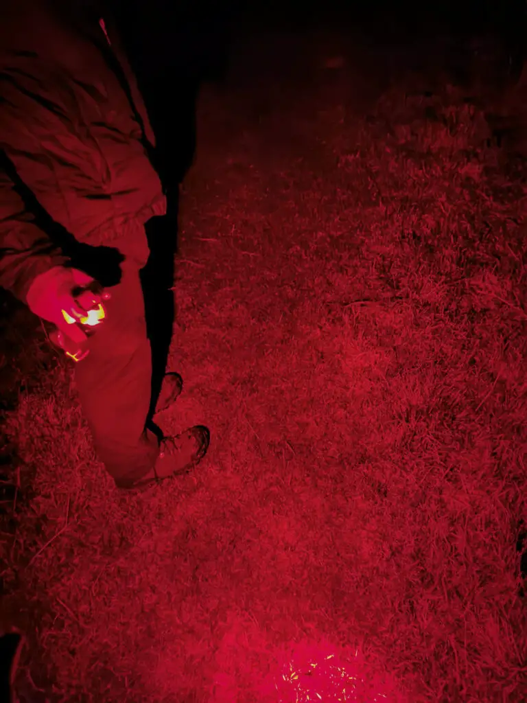
The first part of the track was relatively flat with ups and downs out of streams, and a lot of mud. There was low fog, which lent a mystical feeling to the forest. At one point a bunch of ferns next to the track rustled frantically, but the kiwi never came into sight. Lauren did spot one further along, about an hour after the sun had fully risen, but it dashed quickly away realising it was up way past its bedtime. The only other sound we heard was the water taxi roaring up the river to collect the two hunters. Otherwise it was just us and the forest.


All too soon the uphill climb began. I’d heard bad things about Thomson Ridge, but all up it wasn’t too challenging. But maybe that’s just the rosy glow of hindsight while I sit here on the couch in front of a roaring fire. I think we were lucky that it hadn’t rained much the week prior to our visit. We ended up climbing up a small stream with pockets of 30cm deep mud (rather than up a roaring waterfall, and mud that could swallow a tramper + pack).
We had a quick break at the top, looking down at the inversion layer of clouds hovering over the valley we’d travelled yesterday (although the view was severely compromised by the trees, I was very glad we’d gone up Rocky Mountain the day before). Then it was down the other side, which somehow managed to be even steeper than the way up. I was glad for my walking pole which helped me negotiate the rocks, mud and tree roots.
As we got closer to sea level again, we started hearing the sound of running water. My nerves intensified, how bad was this stream crossing going to be? It sounded deep and fast moving. Surely it couldn’t be that bad? It was a stream rather than a river after all.
The stream came into sight. It didn’t look that scary at all, just an inconvenience. Soon enough a very serendipitously placed log came into view, fully across the stream. It looked as though most people had crossed here, but we kept walking down the track to see how far away the bridge had been (maybe 50m). I marked the bridge site on my topomap just to be sure that we wouldn’t get lost on the other side (although I needn’t have bothered, the foot traffic made it very obvious), and then it was crossing time!

All in all it was an extremely easy crossing that I shouldn’t have been stressing about. Although I was once again thankful it hadn’t been raining. We had lunch at this point, and congratulated ourselves on making it to (what we thought) was at least the half way point to North Arm Hut. Oh how naive we were.
The next several hours were rather hellish. At first we were distracted by the beautiful views out to the North Arm of Patterson Inlet.

But soon even they couldn’t make us forget our sore feet and aching legs. My pack had never felt this heavy. The mud was taking its toll. And the stupid track kept going up and down, up and down. Lauren even fell into one of the streams next to a lovely waterfall.

We took a lot of sit-down rests. I ate a lot of chocolate. Drank a lot of water. I even finished the last of my tube of condensed milk (greatest tramping food ever, hands down). It was with much relief that we saw North Arm Hut sitting across from us, lit up by the setting sun. Lauren sped off, but I didn’t have any energy left. It took another 20 minutes (longest of my life) to reach the hut. I’d never seen a more glorious sight.

There was only one guy sharing the entire hut with us, a Frenchman. We played Kings and Assholes (Président en français) and chatted until it was time to go to bed. My knees weren’t happy with me, but otherwise I was very content.
Day 4: North Arm Hut – Oban, Halfmoon Bay
12km, 4 hours
We were once again up before dawn, heating up our oats and looking out the windows at the cloudy sky. The forecast rain was starting to arrive. We said au revoir to our French buddy who was heading to Port William, and then started off on our last leg to Oban.
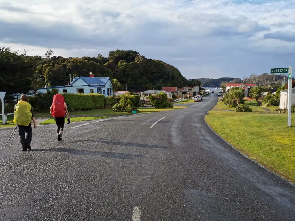
The difference in track quality was striking. We were now on tramping part of the Rakiura Great Walk, and you could tell. It felt like a gravel footpath compared to the muddy mess we’d struggled through previously. Helped along by the track, rest, and lighter packs, we made amazing time compared to the day before. Despite the threatening rain, things seemed a lot more positive.
There were several interesting historical points along the way, and at one point we even saw a seal trying to snooze in the water next to the track. It drizzled on and off, but never really rained.
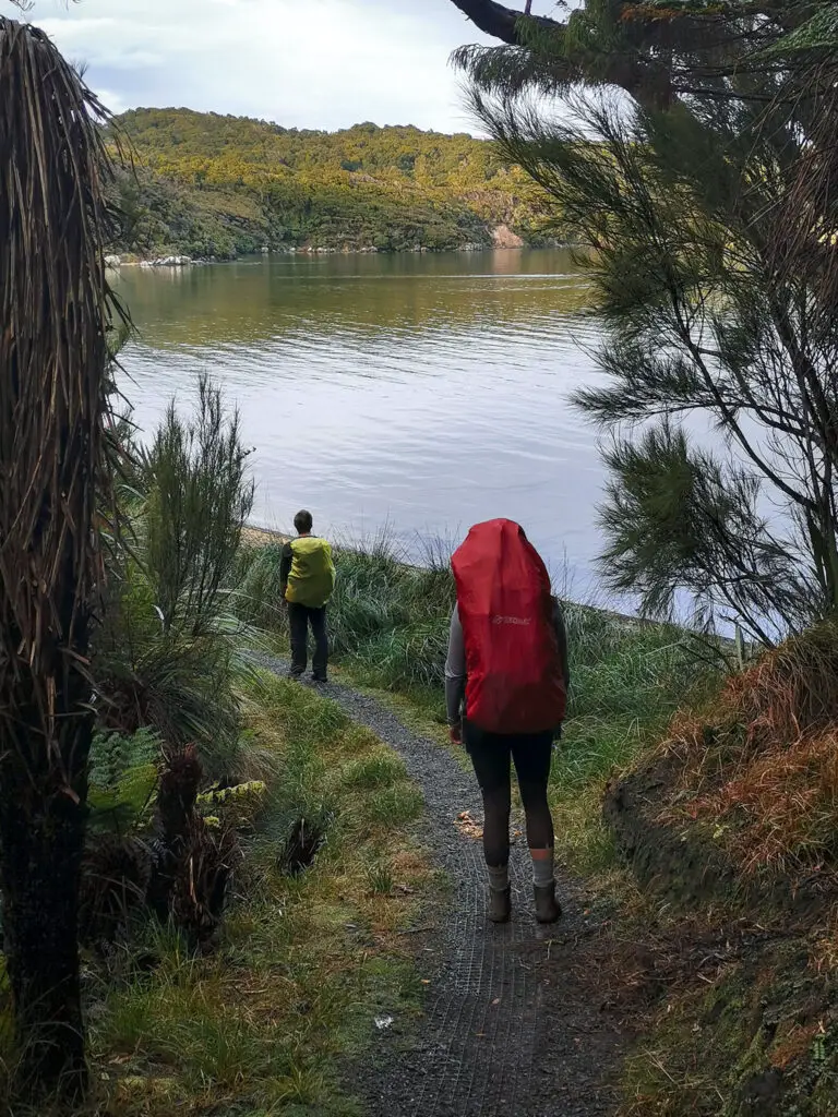
The track crosses land held by the Rakiura Maori Land Trust (many thanks for allowing access!), before reaching Kaipipi Bay. From there the track follows the old road, making for extremely easy travel.

We passed two more people (running total for the whole trip = 5). Then before we knew it we were at the turn off for the Ryans Creek Track! We chose not to take the lovely diversion walking along the coast to Golden Bay, opting for the quickest way to the pub. We turned left, and quickly arrived at the carpark for the Fern Gully Track and the end of the Rakiura Great Walk.
From Fern Gully trailhead it was a hop skip and a jump down Main Road to the South Sea Hotel.

I felt bad unloading my pack, muddy gaiters and boots in the foyer of the hotel, but the staff were lovely and soon we had delicious plates of hot food in front of us. Thanks to social distancing nobody was even bothered by our 4-day perfume!
After an amazing lunch, Matt and Lauren wandered around Halfmoon Bay, while I did some work. All too soon it was time to board our return flight. I somehow scored the front seat next to out pilot, Cam! It was a beautiful flight with the sun setting over the sea. An awesome end to an awesome trip.
If you want to know more about the gear I took on this trip, have a read of this blog post or leave a question in the comments. We also experimented with some different food on this trip including lots of home baking! I’ll be writing up a post soon about tramping food, so keep your eyes peeled. As always, reach out if you’ve got any questions! Always happy to chat.
Safety
As always, please stay safe when you’re out exploring. Follow the Outdoor Safety Code:
- Choose the right trip for you (read my article on tramping safety, speak to DOC)
- Understand the weather (conditions change notoriously quickly on Taranaki)
- Pack warm clothes and extra food (check out my post here about what gear you need to take)
- Share your plans and take ways to get help (have an emergency beacon on your person)
- Take care of yourself and each other
This is a trip can be impassable in bad weather, particularly rain. It can be very dangerous crossing streams or rivers that are in flood. Mud can make track times a lot longer than expected, so allow extra time.
If you’re not feeling super confident then you can always get in touch with me here on the blog or on my Instagram. Or take a look at my Tramping 101 series which includes this post about how to stay safe in the outdoors.
Also don’t be a dick, check out my guide to New Zealand tramping etiquette.
Stay safe and get outside!

Great information, I hope to do this hike sometime in the future, what time of the year is best to do this great hike preferably less rain and mud
Hi Samantha! I’m not an expert on Stewart Island but like the rest of New Zealand there are no guarantees when it comes to the weather, it can rain heavily (and have mud) regardless of the season. The pilots we flew with mentioned they prefer late autumn / winter as the weather is often more settled with less people. There were certainly less sandflies and mosquitos when we were there, and I wasn’t bothered by the cold. However we did have to contend with reduced daylight hours, which wouldn’t be an issue in summer. So I guess you have to pick your dates and cross your fingers! Sorry that’s probably note very helpful!
Hi,
Thanks for such an informative read, we are thinking to do this walk soon!
Just wondering, were the gaitors a must, a lifesaver or an afterthought? Anything you would have taken if you were to re-do the hike? And clothing wise, would it be more smart to pack shorts or pants, we are going in late spring.
Thanks alot 🙂
Thanks Maddy! 🙂 On most trips I personally can’t do without my gaiters. They’re not a “must” but they’re certainly a lifesaver when it comes to keeping leaf litter and mud out of your boots. If you’ve used them before and liked them, then definitely bring them along. But if you haven’t, or don’t own any, it’s not necessary to buy them just for this trip.
There’s not much extra I would have taken. Just don’t forget sandfly repellant. And lots of chocolate 🙂
For clothes I’d take shorts, long merino tights, windproof over-trou and fleece pants. All about the layers baby! You might have some days where you’ll be super warm, or days where there’s horizontal rain and sleet, or one day with all of that and more – hard to tell with New Zealand weather, regardless of the season.
Hi,
Thanks for that great story. I visited Stewart Island in 1919. We did the Rakiura Track and visited Mason Bay. It is really a great place?..and we planned to come back to this beautiful island.
Your story is written so nice….it brought back some good memories.
Ohhh ….and that mud…..okay, meanwhile we can laugh about it….. but we had some very bad words for it while fighting through ……
Merry Xmas from Germany
Barbara
Danke Barbara for your lovely comment! I’m glad you liked my write up. Mason Bay is such a great place, I hope you get to visit again some time soon!
I’m not sure if I’m happy or scared now having found this post….
All booked to repeat your journey in January. I think my friends have sucked me in. No-one told me about mud!!!
Our flight lands at Mason Bay at 6:40am (thanks tides…) so I guess that first day at Mason Bay Hut will be a great rest day. While hiding from Sandflies presumably.
Thanks for a great write-up.
Thanks for the comment and reaching out over Instagram. I hope you have the best trip! Keep me posted
Just finished this exact hiking adventure with my partner except we had a night at South sea to finish off the trip (Ulver Island visit the next day). Your blog was very helpful reading it prior our trip and now on return. Freshwater to North-arm was rather Hellish! But satisfying on completion. That is a very nice hut (North-Arm).
Our plan ride in was not as smooth as yours but still awesome. Very muddy the whole way except North-Arm to Oban.
Thanks for the comment Stu! That sounds like the perfect end to your adventure. I’m glad we weren’t the only ones to find Freshwater to North Arm awful haha, thought it might have just been out post-lockdown tramping fitness rather than the actual track. We’re looking at doing the Southern Circuit next, can’t wait to go back to Rakiura (even though it sounds as though the mud might be worse …).
What did you use to cook considering you can’t take gas cylinders on the plane?
We were able to take gas on the plane after discussion with the pilot, so could just use our normal gas cooker.