Angels Landing is the most popular hike in Zion National Park, so named because an explorer exclaimed that only angels could land there. The views over the canyon are beautiful, but they’re only part of what draws in the crowds. The journey itself is one-of-a-kind – the later section of track winds up a knife-edge fin of rock with 1000ft drops on either side, and is certainly not for the faint-hearted, or those with a dislike of heights!
Length: 8km return (5 miles round-trip) with about 460m (1,500 ft) of elevation gain
Time taken: 3.5 hours, although your fitness and the number of other people on the trail with play a large part in how long it takes you (our time going back down the narrow part of the trail was doubled, due to having to wait for people coming up to pass). 3-5 hours is an average time.
Difficulty: until Scouts Lookout, this is a relatively easy, paved (but steep) hike. The route from Scouts Lookout onwards is difficult, mainly because of the height, climbing and other people.
Facilities: Toilets and potable water are available at The Grotto, next to the trailhead. There are toilets at Scouts Lookout, but no water.
– Angels Landing is not an easy hike, despite its not so scary length or elevation gain, and should not be underestimated. According to the National Park Service, eight people have fallen from the trail and died since 2004, the most recent being a 13-year old girl in February this year (2018). The hike should not be attempted in bad weather (snow, ice or thunder storms), or by young children, dogs, or those with a fear of heights. This is not the trail to face your fears on – there are plenty of other beautiful walks in Zion to explore. But if you are well prepared, fit and have good balance, this is an amazingly fun trip! Thousands of people hike it every year for the beautiful views and the exhilarating climb –
Why this hike?
The most popular hikes in Zion National Park are Angels Landing and the Narrows. Since it was October, the water was quite chilly for hiking the Narrows, and my sister and I knew that Angels Landing was our first choice. It’s a relatively short walk, but with an amazing pay-off, plus the heart-racing journey there is half the fun! We’d seen pictures and we couldn’t wait to start our US trip off the right way, by checking off a bucket list hike.
Angels Landing was however, definitely NOT my husband Matt’s first choice. He knew that with his rocky relationship with heights, Angels Landing would be a stressful experience – and if you’re not going to enjoy a hike, why do it? He and my parents instead opted to climb to Observation Point as an alternative (my parents had been lucky to hike both Angels Landing and the Narrows four years prior, so were keen to go somewhere new).
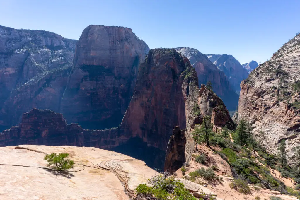
If you don’t like heights, then the later part of Angels Landing probably won’t be a fun time. Observation Point is a great alternative, and is actually a longer climb with a higher elevation (so better views over Angels Landing and the valley below). Matt will be helping write a blog post about that hike soon, which I’ll link here for anyone interested.
How to get there
From Las Vegas, a common starting point for many tourists, it takes about three hours to drive to Springdale; the gateway to Zion National Park. If you’re driving in from the east (from Bryce Canyon, Grand Canyon, etc.) then you’ll get to go through the Zion-Mt Carmel tunnel, which is an amazingly scenic drive.
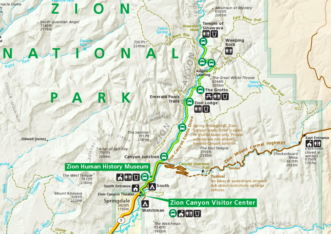
We camped the night in Springdale, catching up with some of Mum’s old friends from Salt Lake City, who then kindly drove us into the park the next morning. For most of the year the Scenic Drive through the canyon is closed to private traffic, so it’s worth just catching the free shuttle from Springdale and then hopping on the Park shuttle (also free) once inside the Park.
A permit to enter Zion National Park in 2019 cost $20 per person or $35 per car, both valid for seven consecutive days. We bought the $80 National Parks annual pass, since Zion was the first of many Parks we were hoping to visit on our road trip.
The park shuttle departs from the Park entrance / Visitor Centre every 10 or so minutes, with the first shuttle bus leaving at 7am – check out the current schedule here. If you’re wanting to avoid the crowds that plague Angels Landing later in the day, you’ll want to catch a shuttle as early as possible. Hop off at The Grotto, the fifth stop on the shuttle route (about a 20 minute trip), which is where the trailhead for Angels Landing is (on the other side of the road from the shuttle stop and toilets). Your journey is about to begin!
The climb
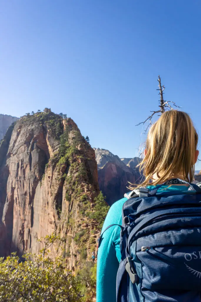
Heather and I started off as the sun was just starting to illuminate the very tops of the soaring red cliffs far above us. We crossed the north fork of the Virgin River, whose powerful waters not only carved out the massive canyon, but now currently supply moisture for the lush valley floor. The track ambled alongside the river for 5-10 minutes at a pretty flat gradient, which was a nice warm-up for morning muscles. Before long however, we started to slowly climb upwards and then reached the first set of (many) switchbacks cut into the cliff wall.
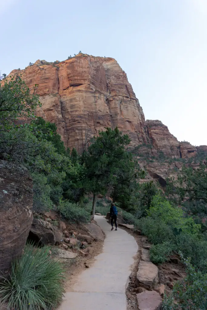
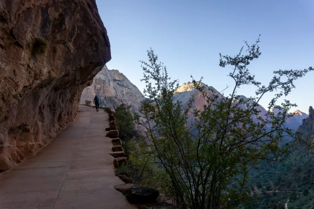
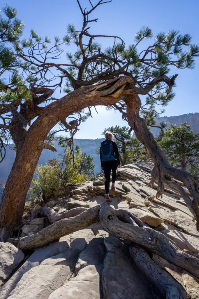
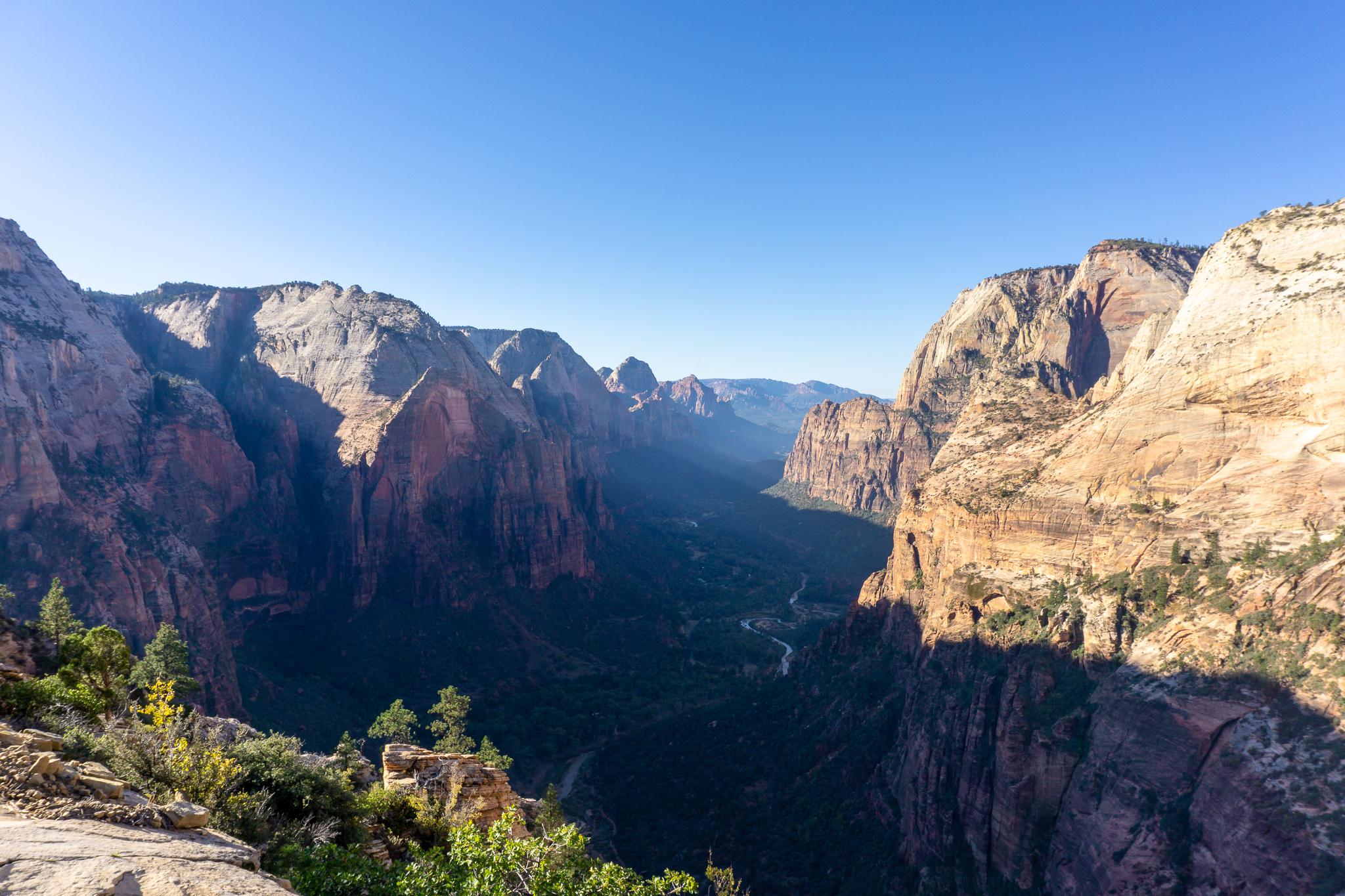
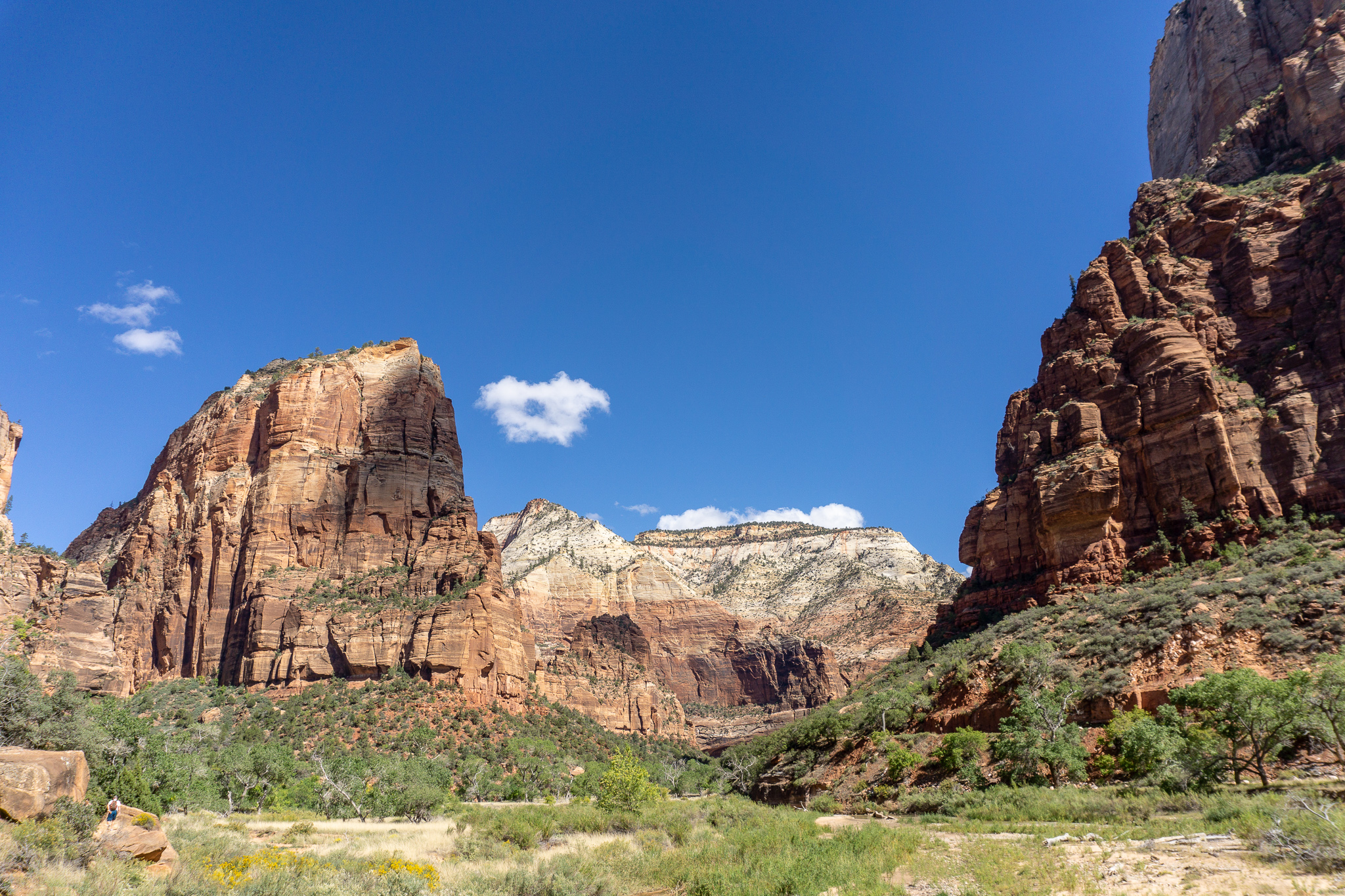
The views from the top of the first set of switchbacks were already amazing over the valley, which was still shrouded in dim morning light as the sun continued its march down the canyon walls, reaching out ever so slowly to the green of the canyon floor. From there we turned to put the valley at our backs and entered into Refrigerator Canyon (so named because it receives barely any sunlight day-round and often has a cool breeze blowing through it, a welcome relief during summer months!). This was pleasantly flat for a few minutes, before more switchbacks appeared. Soon Walter’s Wiggles were apparent – a series of 21 tight switchbacks climbing up out of Refrigerator Canyon and onto the plateau of Scouts Lookout.
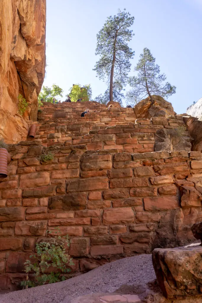
The steep switchbacks allow for a dramatic increase in elevation to climb out of Refrigerator Canyon to Scouts Lookout, with a gradient that is accessible to most hikers. They were designed by Walter Ruesch; the first custodian of the park in 1926.
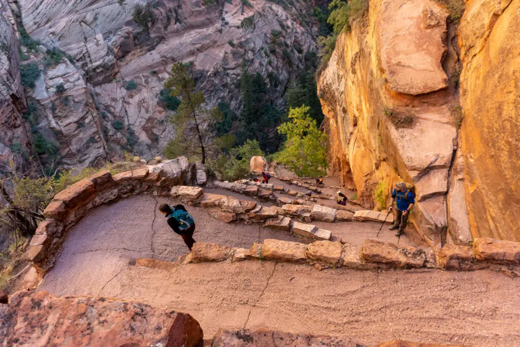
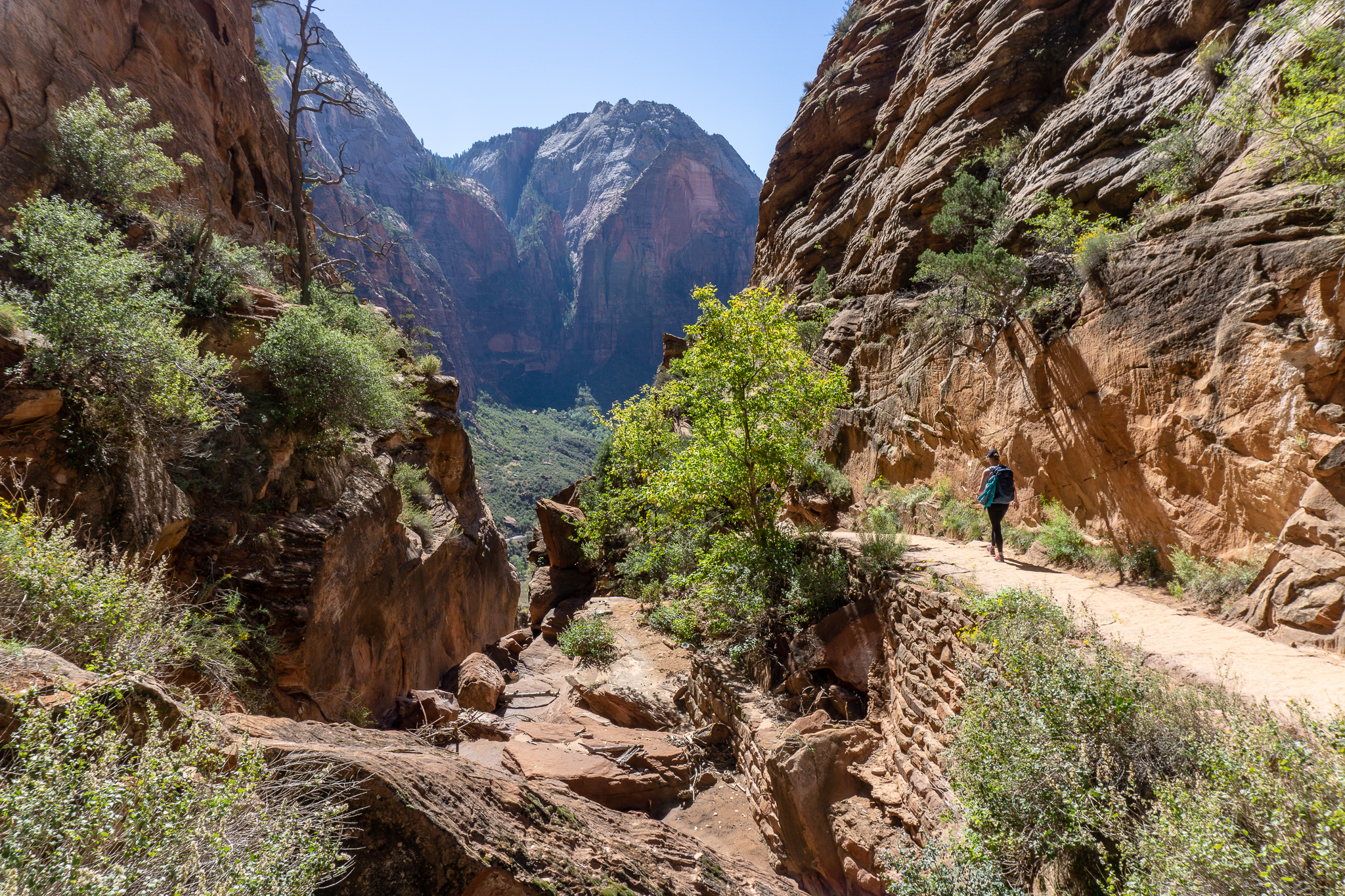
Scouts Lookout is often a turn-around point for those not wanting to adventure further along the narrow ridge. The Lookout has beautiful views across to Observation Point and over the valley, although it doesn’t quite have the 360° views that you get from going further. When Heather and I arrived, there were already a few people waiting for some of their party members to complete the return trip along the ridge. Not wanting to wait on more people to come up behind us, we continued on.

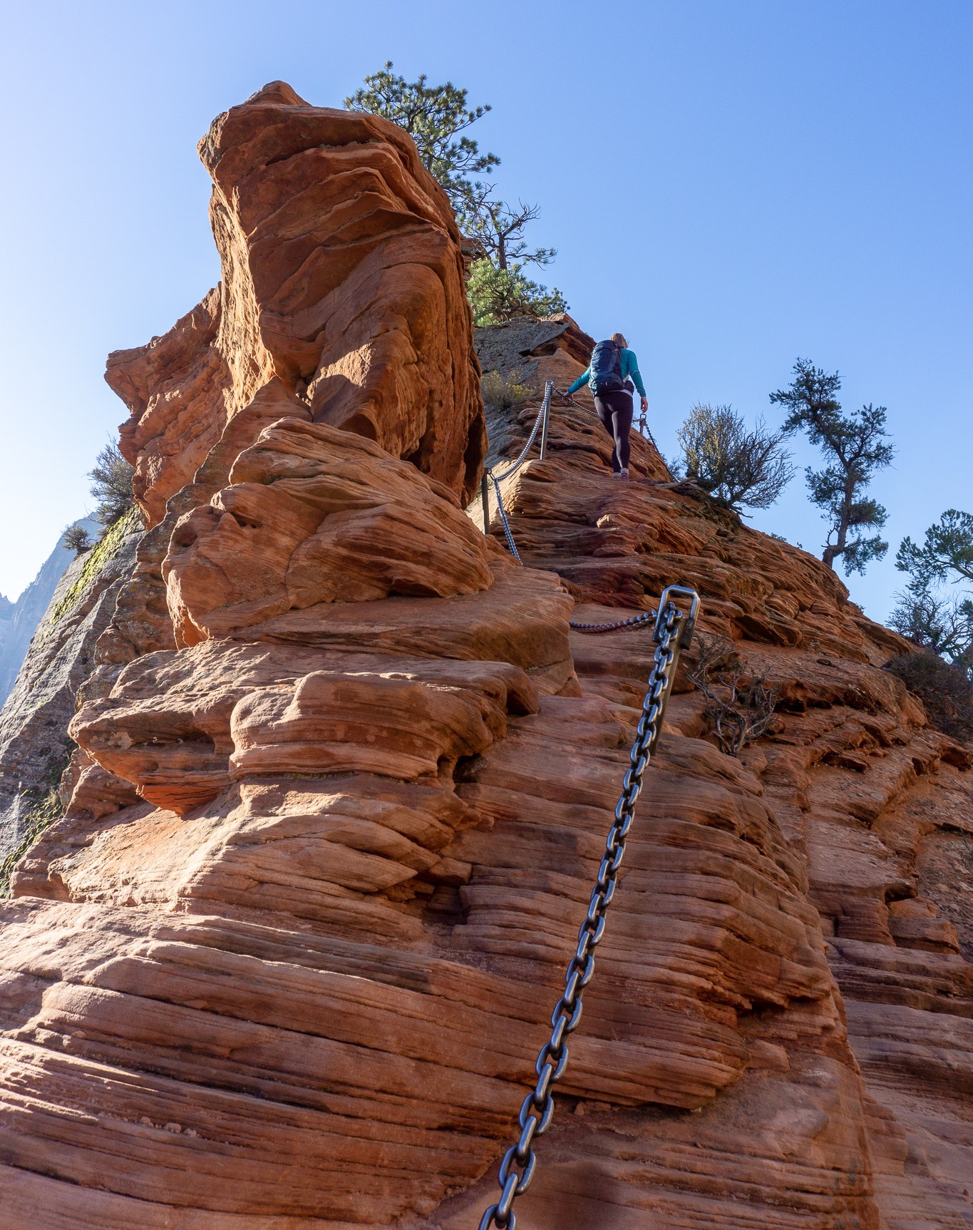
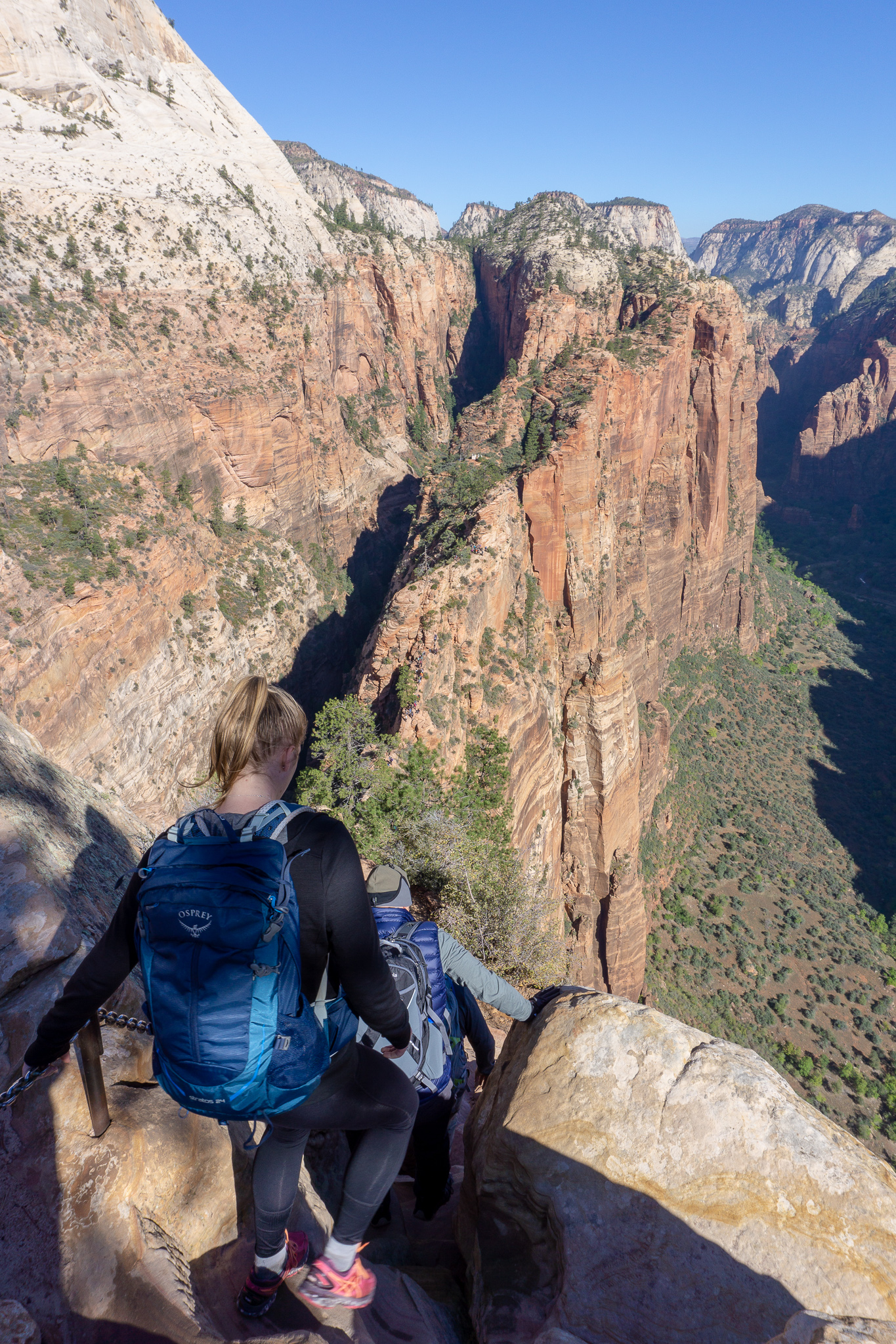
The good thing about the Hogsback (the scary part of the walk) is that you’ll know right away whether this is something for you, or whether it’s really not. The route from Scouts Lookout is instantly more challenging in terms of footing, and very quickly narrows with drops on either side. I unfortunately don’t have a lot of photos from this section, as I needed both hands free for holding on to the chains and climbing (there was a lot more scrambling and climbing than I was expecting). There are however some great videos online that showcase the Hogsback. This short video shows the narrow sections only (just over two minutes) – and the creators also have a great blog post with good photos that you can find here.
This longer video is of the whole Hogsback up and down (45 minutes) – it’s a great video, but I wouldn’t recommend hiking this trail in winter with snow and ice like he does. While it looks quite scary on film, the only time I was really freaked out during the whole trail was at a scramble very early on (which you can see here), as you have to step quite far into space with just the chain to hold on to. The rest of the time I was pretty comfortable and at no point was I freaked out enough to get an adrenaline rush, even when crossing over the famous ‘bridge’ (starting here in the video). I respect heights and don’t love being right on the edge of a cliff, but I’m not afraid of them and have hiked around drop-offs before. So your reaction to this trail will boil down to your previous experience and your general reaction to heights.

I hiked in tramping boots, because I wanted the extra grip, while my sister hiked in good quality sneakers. The Navajo sandstone that you’re walking on along the Hogsback has been smoothed by the passage of time and people, and can become very slippery underfoot when it has sand or dust sitting on top of it. We passed a woman coming down barefoot while clinging to the chain – her worn sneakers were too smooth to get a purchase on the rock, and she’d kept slipping (although she did say her feet were so cold that she could no longer feel them, so I’m not sure if bare feet would be that much of an improvement). On the other hand, we also passed a guy who was walking carefree along the edge, like a mountain goat, without even looking at the chain.


There was a bit more physical climbing than I was expecting for an elevation gain of 460m, and my upper body was sore the next day (as well as my legs) as I’d used my arms and core quite a lot to swing myself around obstacles on the Hogsback. After passing the Widow’s Tree (just after the Bridge) and continuing the climb up with slightly less exposure than the flat section of the ridge, we finally made it up to the plateau at the top of Angels Landing. It took us about 25-30 minutes to scramble up from Scouts Lookout to the top.
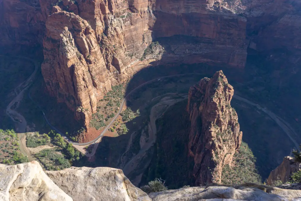
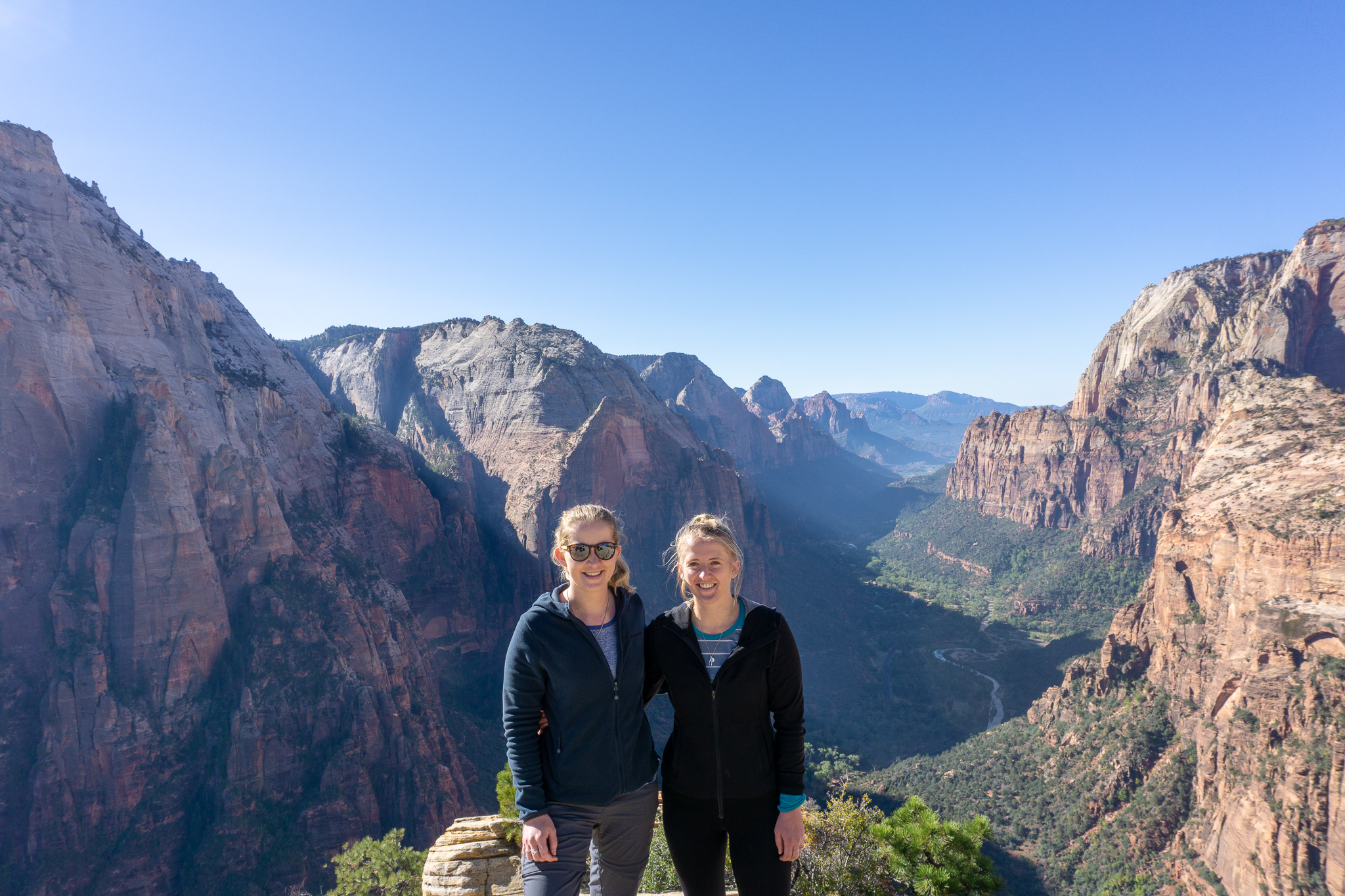
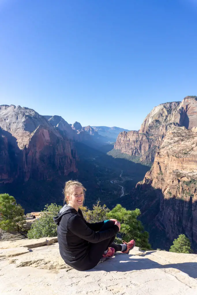
When we arrived at the top, there were already a few groups of people milling about. Luckily it’s quite wide on top and I didn’t feel at all cramped (which is really not what you want when you’re 1000ft above the valley floor with steep drop offs all around). The valley was still in a lot of shadow, so while it looked beautiful to the naked eye, it wasn’t the best for photos (or the photos that I’m competent enough to take). So Heather and I settled in to wait and soak in the views on some sloping rock just below the summit, out of the breeze.
Soon some very friendly (Heather would say they were too friendly) squirrels / chipmunks (since we don’t have these animals in New Zealand I couldn’t tell the difference) came over to make sure that we didn’t have any food that we wanted to share, or that they could sneakily steal. Heather didn’t want to make friends with the small animals, despite their insistence, and came up with a theory that some of the falls on Angels Landing must have been from people running away from the squirrels. We sadly found out why the squirrels were so friendly later that afternoon, when we hiked towards the entrance to the Narrows and saw people feeding them on multiple occasions. Don’t feed the wildlife people! It’s that simple.
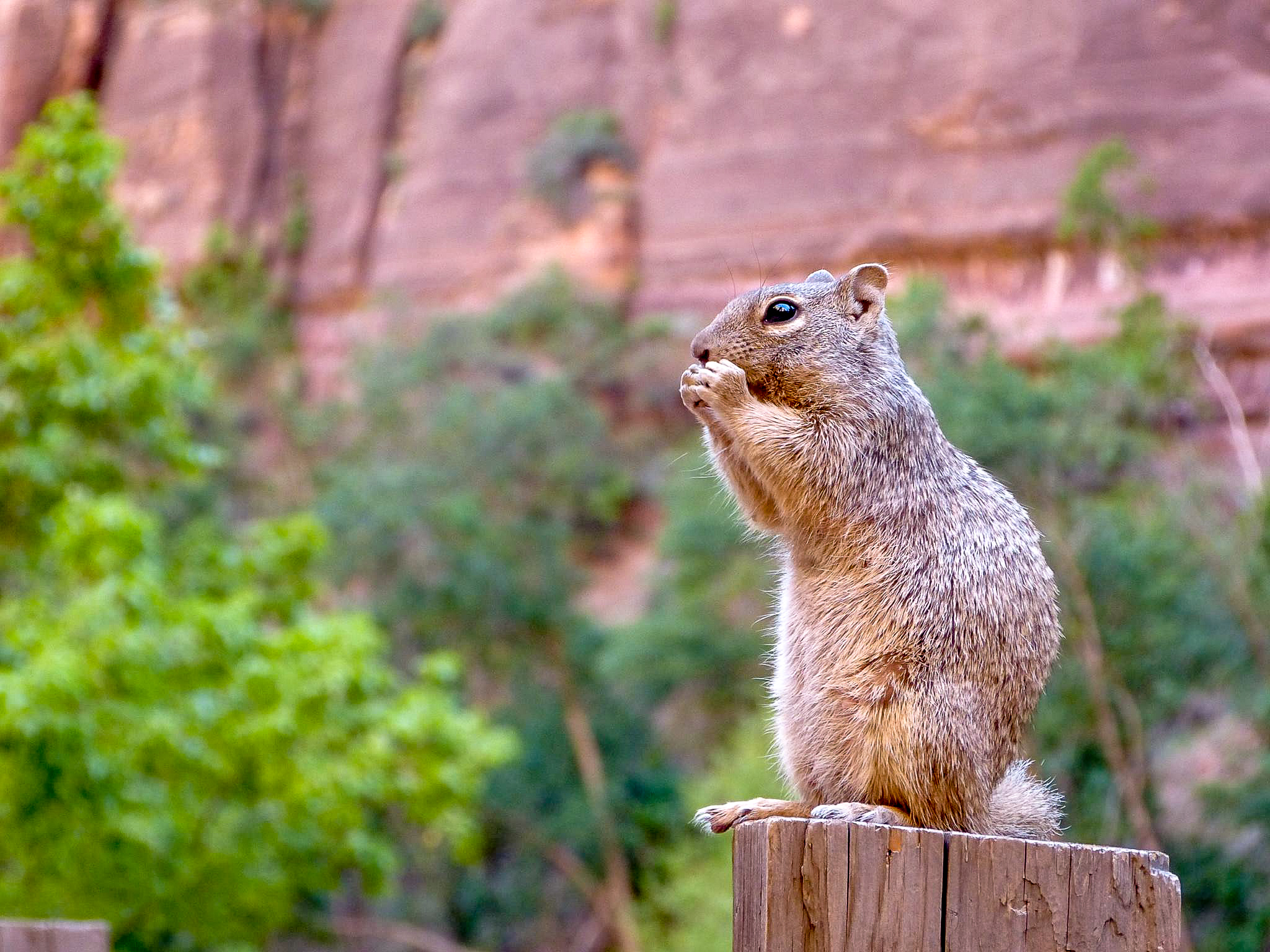
We sat and waited at the top for about 30 minutes, but Heather forbade me from getting any food out in case it would attract more squirrels. The view was mesmerising. I think I fell in love with Zion a little bit while sitting on the top of Angels Landing and I was sad that we were only able to spend one full day here.
Too soon it was time to head back down. As we climbed back up the sloping rock we’d been resting on, we realised how many people had made it to the top. It was definitely time to go before the track got any busier.
We climbed down in a line of people, passed by a continuous stream of people on their way up. It was definitely more stressful going down because of all the people (although there were some stretches where we were alone). Often we’d have to wait in less than ideal perches, waiting for the people coming up to pass us before we could continue going down. At one point I heard yelling behind me and a grunt of pain as someone fell hard onto the rock, maybe from rushing to not hold others up, or just from having to pass someone in an odd position. We left the top around 9.30am and it took us an hour to get down, double the time it had taken us to climb up. I honestly can’t imagine what this track would be like in the height of summer, but it must be stressful.
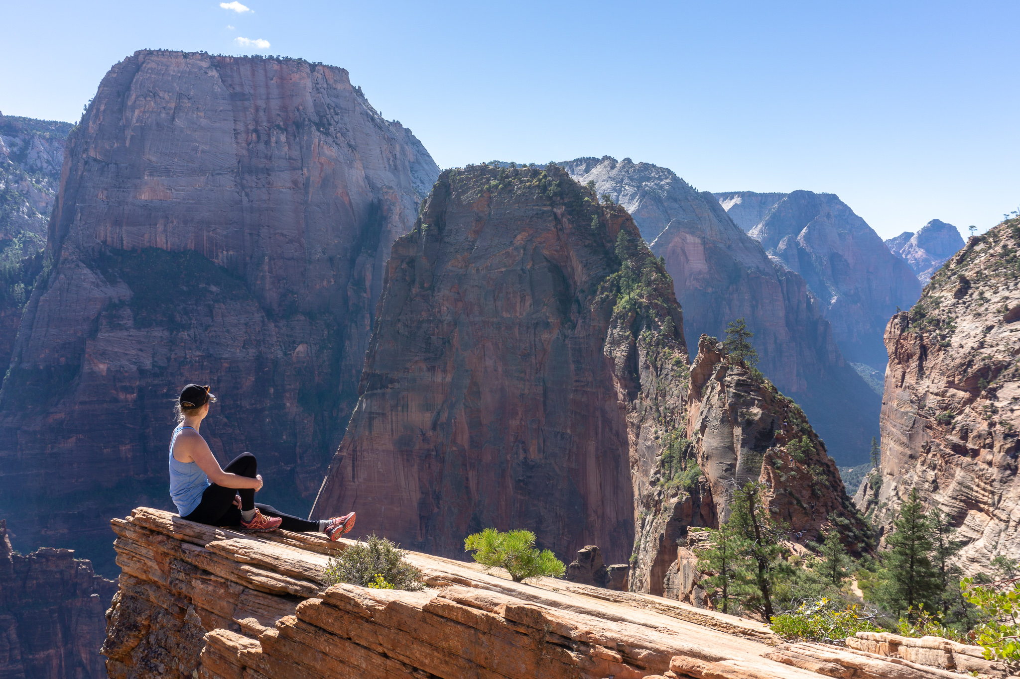
The very last stretch before the relative safety of Scouts Lookout took longer, since it was single file and there was a very long line of people waiting to come up. When we finally reached flat ground it was swarming with people, so Heather and I hiked further along West Rim trail to find a nice, quiet spot above Scouts Lookout for an early lunch. We choose a spot with a beautiful view back towards Angels Landing, where Heather sat atop a sketchy cliff that Mum (if she had been hiking with us) would not have approved of. 10/10 would recommend this dining experience.
The way back down passed very quickly, and we were soon back in the refreshing coolness of Refrigerator Canyon, a relief from the relentless sun. There were a lot of people making their way up past us, and Heather and I were both thankful for the early morning start (although I hadn’t been when my alarm had sounded that morning).


Before I knew it we were crossing the bridge over the Virgin River, looking back up at Angels Landing. I’m not quite sure whose insane idea it was to put a public hike up to the top of that rock pillar, but I’m glad they did. This kind of hike just wouldn’t be possible in New Zealand (at least not as a public hike maintained by DOC), so not only was the terrain very different and interesting, the adventure was too. Zion National Park is definitely one that I hope I can return to some day and spend some more time exploring.
Safety
As always, please stay safe when you’re out exploring. Follow the Outdoor Safety Code:
- Choose the right trip for you (read my article on tramping safety)
- Understand the weather (don’t attempt this hike in stormy or snowy/icy conditions)
- Pack warm clothes and extra food (plus sunscreen and lots of water, especially if you’re starting late)
- Share your plans and take ways to get help (have an emergency beacon on your person)
- Take care of yourself and each other
Finally, please follow the Leave No Trace principles. Pack out what you carry in, don’t interfere with the wildlife (don’t feed the squirrels!) and don’t build cairns (at no point would you need them on this trail, plus the National Park Service considers them a mild form of vandalism).
If you’re not feeling super confident then you can always get in touch with me here on the blog or on my Instagram. Or take a look at my Tramping 101 series which includes this post about how to stay safe in the outdoors.
Stay safe and get outside!
