This day-walk to Tama Lakes and Taranaki Falls is a beautiful alternative to the Tongariro Crossing. The well-maintained track swings past the impressive Taranaki Falls, before taking you between two of Tongariro National Park’s active volcanoes; Ruapehu and Ngauruhoe, to reach the two lakes (sitting in craters left over from old vent explosions).
Length: 17km return, but relatively flat until the last climb to Upper Tama
Time taken: 2hr return to Taranaki Falls, 6hr return (with modified route) to Tama Lakes
Difficulty: Easy grade most of the way, but long. Very exposed in bad weather, especially by the lakes.
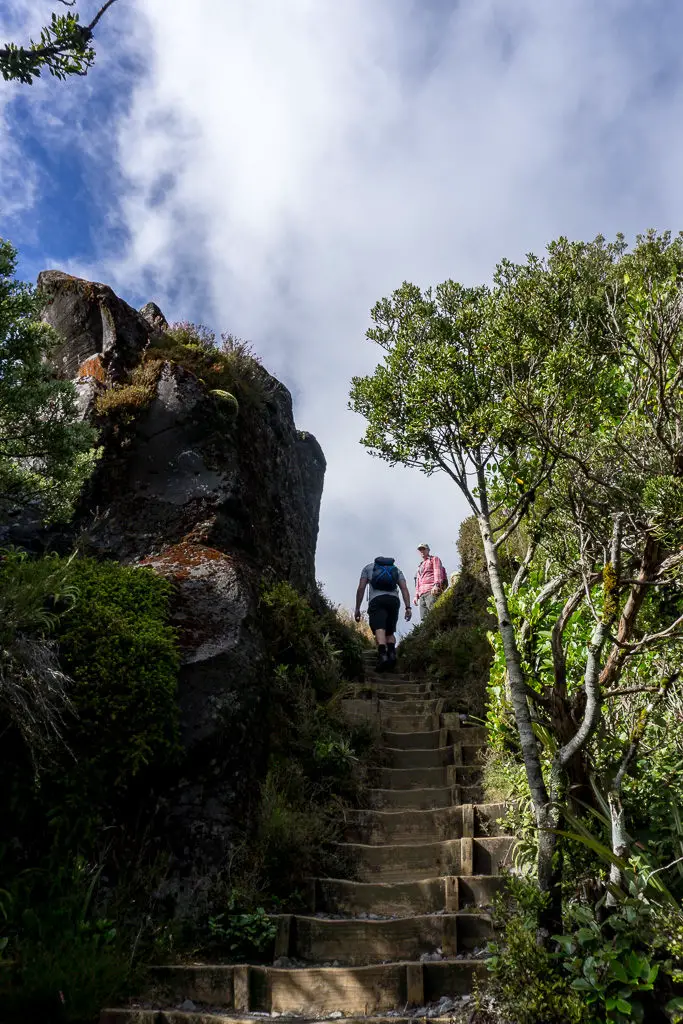
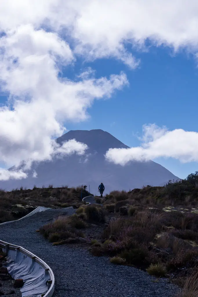
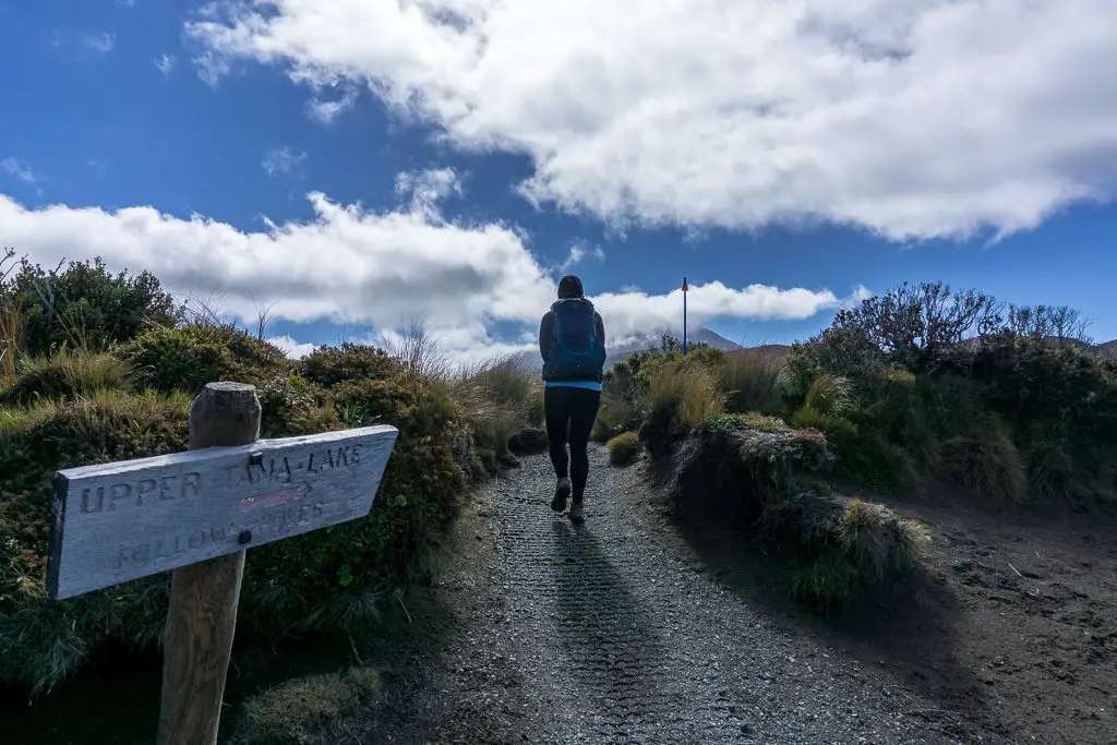
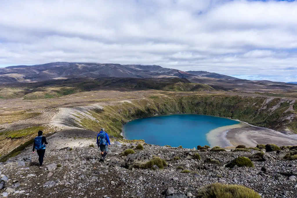
Facilities: Track departs from Whakapapa Village where there are cafes, public toilets and a visitor centre. There is a small rock-wall shelter on the ridge by Upper Tama Lake (mid-left in above photo).
– Important: Both of these walks are in proximity of active volcanoes. Check DOC and Geonet for current alerts before setting out. If you hear the alert siren while out in the park, get out of the valleys. These can be lahar pathways. –
Why Tama Lakes / Taranaki Falls?
My first Easter in the North Island was spent with my family in Tongariro National Park, exploring my new backyard and eating copious amounts of chocolate. Tongariro is one of New Zealand’s most-visited parks and it’s easy to see why; with its unique volcanic landscapes and easy accessibility. Easter weekend is a busy period on top of the normal crowds. We’d already decided to save the Tongariro Crossing for another time. Queueing to scramble up and down scree slopes isn’t really our thing.
With some quick research, we settled on the Tama Lakes trail as a nice alternative. This track is south of Ngauruhoe and the Crossing, and much flatter. (Which my legs were screaming for after climbing up Ruapehu two days prior!). It has an impressive waterfall at the start, views over to two of the Park’s volcanoes, and a pair of lakes at the end. What more could you ask for?
Our tramping party was just myself, my husband; Matt, my sister; Heather, and my Dad (my Mum was in a moon boot from a previous tramping misadventure – sorry Mum!). We got up early on the Sunday, scoffed down some chocolate (or maybe that was just me) and were out the door a little later than anticipated (screw you, daylight savings).
How to get to Tama Lakes / Taranaki Falls
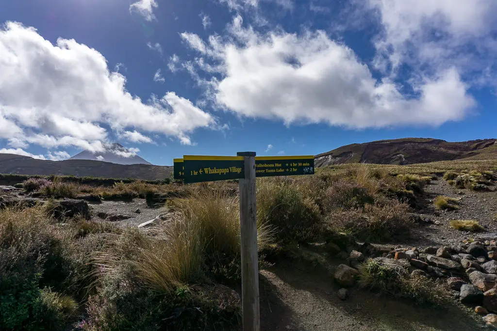
The trailhead for this walk is shared between Tama Lakes, Taranaki Falls and the Tongariro Northern Circuit. The track starts directly from within Whakapapa Village in Tongariro National Park, which is handy! Find a park somewhere in the village with more than a 120min limit. This can be a challenge in peak season – get there early. Then head to Ngauruhoe Terrace, directly behind the famous Chateau.
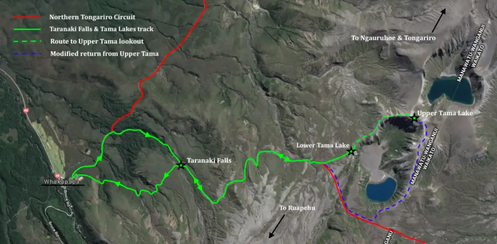
Walk along Ngauruhoe Terrace. Look for the DOC signage for Taranaki Falls, as this is the first part of the Tama Lakes tramp. We started our day on the lower loop track and returned in the afternoon via the upper track, as marked by the arrows on map below.
The tramp – Taranaki Falls
As you can see from the map (or at least I hope you can!), the first part of the walk to Tama Lakes is shared with the Taranaki Falls loop. This loop is a lovely family-friendly walk. Or one to do if the weather isn’t too good, since it is significantly longer to get to Tama Lakes from the falls. We saw lots of young families on our walk, which always makes me happy!
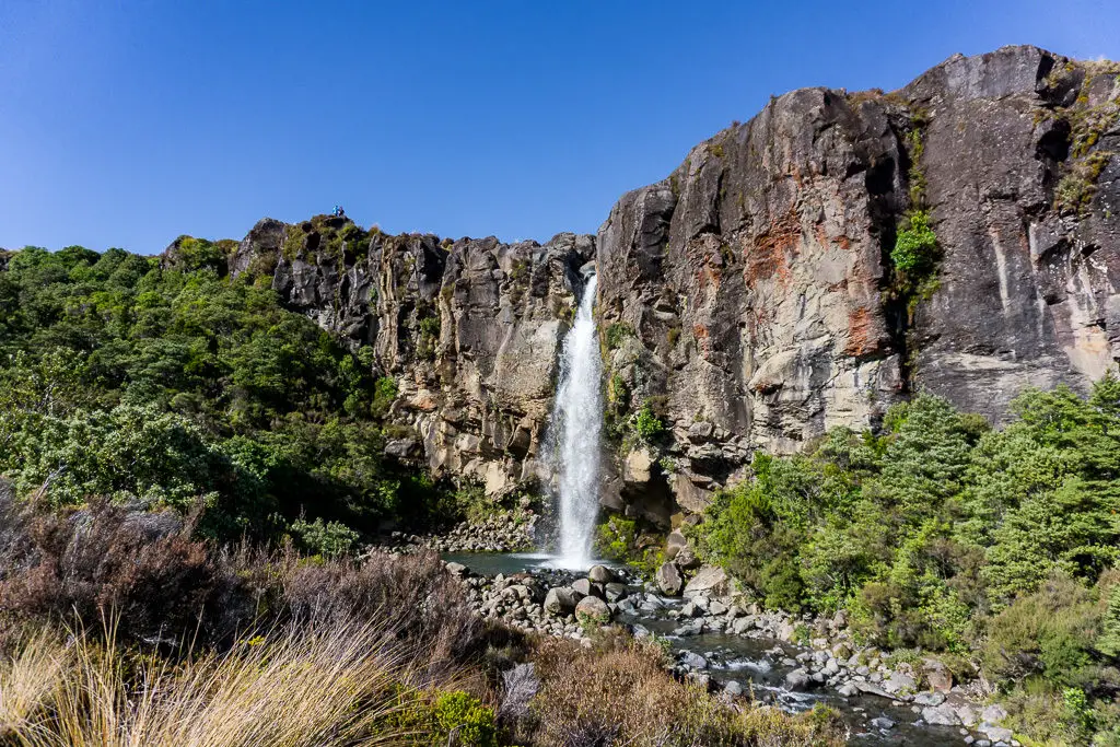
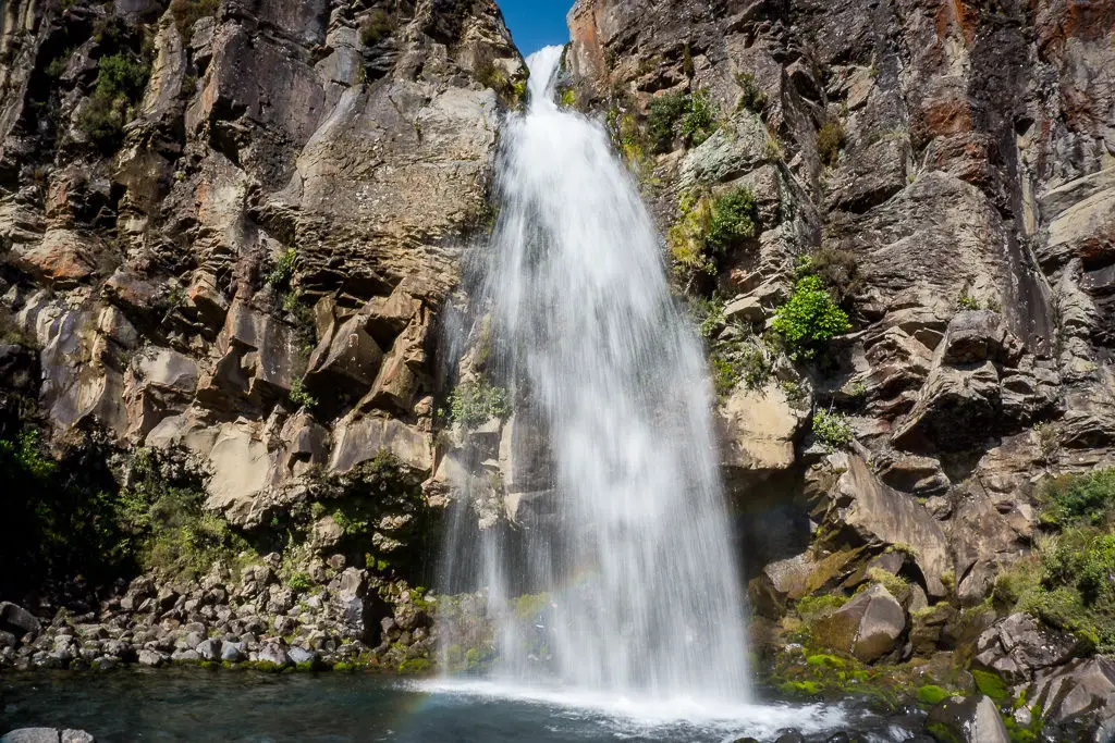
You have two options to get to Taranaki Falls. Either take the lower track (the first trailhead on the left as you walk up Ngauruhoe Terrace in the Village). Or the upper track (at the end of Ngauruhoe Terrace). I would recommend starting on the lower track as this is slightly longer (your feet will want you to take the shorter one coming back, trust me). And because it takes you directly below the falls. These are best viewed in the morning light rather than in the afternoon. Also of note; the lower track can be a bit muddy in wet weather, while the top track is drier. But if you have tramping boots it won’t be a problem.
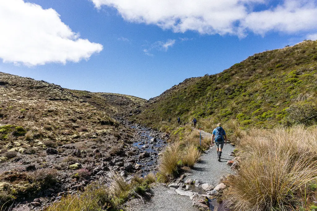
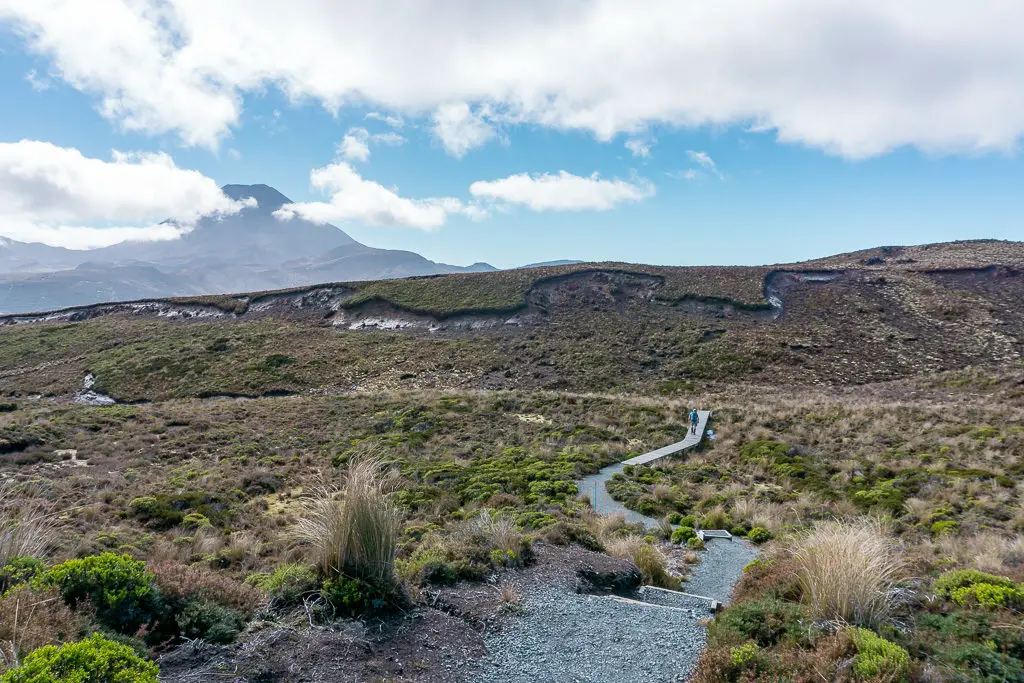
Both the upper and the lower tracks cross alpine grasslands, beech forest, streams and ancient lava flows from Mt Ruapehu that have transformed the volcanic landscape. They both take just a little under an hour. On a perfectly clear day (not guaranteed) you’ll even have beautiful views to Ngauruhoe and Ruapehu.
The falls themselves are very pretty and some of the most impressive in the park (although not the highest). From the lower track we scrambled down a small trail to the base of the falls to take our photos. Even with the sun, the spray of the water was bone-chilling. But that didn’t stop Heather from venturing behind them, or two guys from taking a dip in the pool! The things you do for the gram.
The tramp – Tama Lakes
Matt turned around at Taranaki Falls to rejoin Mum (and the second car, we hadn’t left them stranded) at the Chateau, as he wasn’t feeling very well. Heather, Dad and I continued onwards to Tama Lakes.
The signpost above Taranaki Falls says 2hrs to Tama Lakes, but don’t be deceived. It only took us about an hour to reach Lower Tama from here even with my slow Easter chocolate-laden body. I expected the track to degenerate a little from the turn-off, but the standard is maintained throughout up until the last climb to Upper Tama (which is technically a route only).
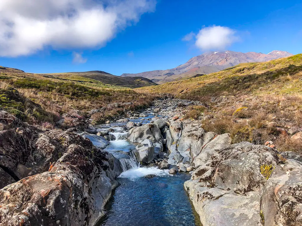
Although there is little elevation gain, this track isn’t completely flat; almost continuously climbing up small ridges and down into gulleys – but still much easier than the Crossing. There is one unbridged stream, which was no problem with my waterproof boots (they’re one of my favourite things ever). But we watched other people in sneakers gingerly hop across the stones.
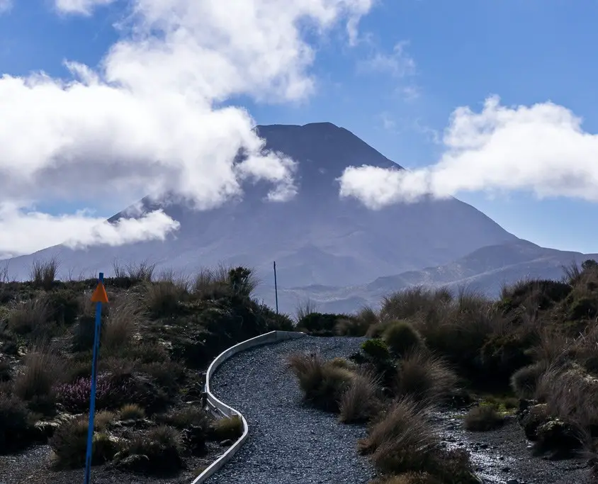
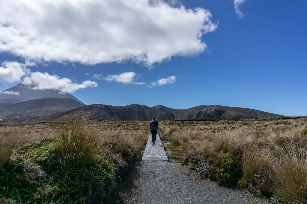
As we walked the plateau views really open up. Walking through landscape that has been so obviously shaped by the volcanoes on the horizon is a pretty cool experience. We had left it a little late, so by the time we were really getting beautiful glimpses across to Ngauruhoe, she was starting to cloak herself in cloud, as is often the case.
Not long after crossing the stream, you’ll come to a turn-off on the right to Waihohonu Hut. This is part of the Northern Tongariro Circuit (the track condition makes it really obvious to stay on the Tama Lakes track. I think this is purposely done as the track is much better once out of sight of the Tama Lakes walkway). After this turn-off it’s only a few minutes to the lookout over Lower Tama.
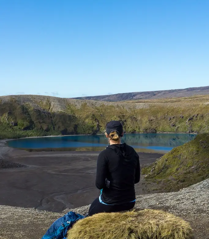
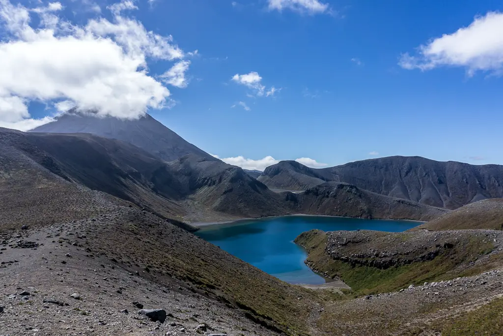
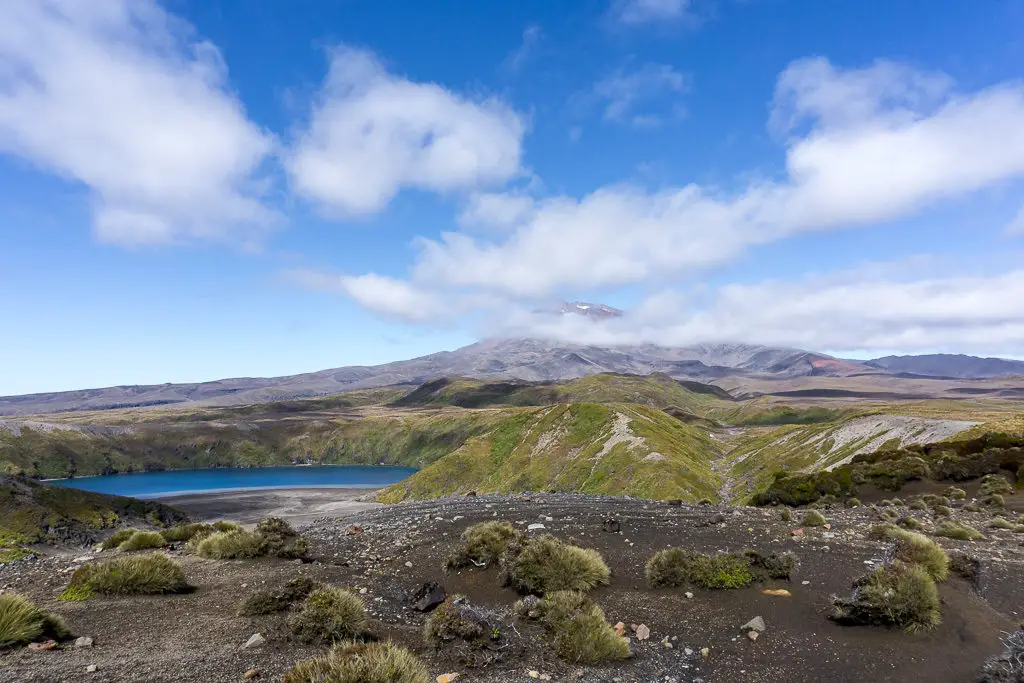
The colour of Lower Tama was amazing. As were the little grassy seats that nature had so kindly left for us at the lookout. Even though I’d gotten pretty warm and regretted wearing long thermals on the walk in, the wind had started to pick up when we had arrived. I was thankful for them and my windproof jacket – the wind chill was cooling us off very quickly. I’ve seen photos of people getting an insane lean on here, so if it’s at all windy on the walk in, expect it to be far worse once you reach the lakes.
After spending some time overlooking Lower Tama (and offering to take group photos for people – I can’t help it, it’s an ingrained reflex), we headed up the ridge to gain a view of Upper Tama. A minute or so on from the official lookout was a better viewpoint over Lower Tama, so even if you’re not going further it would be worth walking just a few more steps for a better view.
DOC says that the way to Upper Tama is technically a route only, but at Easter (towards the end of the summer season) a well-trodden track had formed in the scree for us to follow (to compliment the poled markers and impressive stone cairns). This is the only real steep section of the walk so in wind it could be a bit more difficult staying upright, but otherwise is a straight-forward scramble up the wide ridge. There are some steep drop-offs at points, but nothing too scary. It should only take 20-30 minutes from Lower Tama to get to the top-most viewpoint.
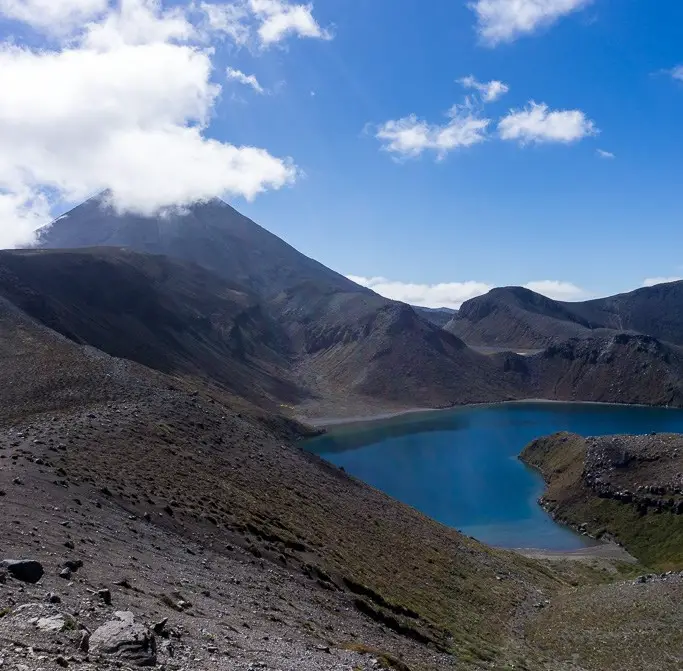
Upper Tama is just as beautiful and impressive as its sibling, with Ngauruhoe rising in the background. We had lunch at the viewpoint, hoping for the clouds to clear but as you can see from the photo, they didn’t. I really want to return when Ngauruhoe’s summit is visible, perhaps in winter or autumn when there’s a dusting (or more) of snow on the slopes.
Dad was a bit sick of other people by this stage (it was Easter in Tongariro National Park, enough said), so we decided to change up our return journey. Instead of retracing our footsteps and returning back down the ridge (which is the recommended route), we decided to avoid other parties and try to circumnavigate Lower Tama instead.
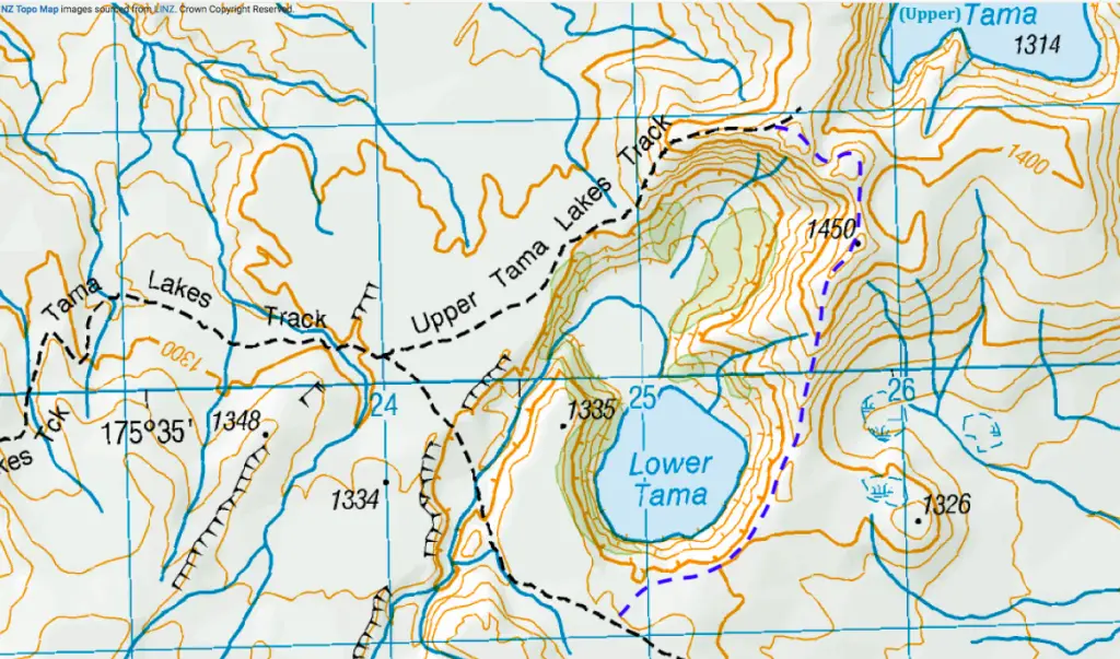
This ended up being a relatively easy route, although it was longer than returning back the same way (by about 40 minutes give or take). There were a few lonely cairns and footprints (both human and deer), so we weren’t the first to take it. However on a windy day you would be extremely exposed with absolutely no cover, likely the reason why there isn’t a proper track around the lower lake. Coming down this way meant we got some more beautiful views over Lower Tama from a different perspective, and on a clear day you would be looking across to Ruapehu.
After putting the lake behind us and crossing through some low scrub, we rejoined the track to Waihohonu Hut. We had a rest after climbing up from a stream crossing (another unbridged one), and as we were sitting we heard a siren going off in the distance. Almost comically, all three of us looked at each other for a second, then without speaking automatically looked to the volcanoes on either side. No obvious explosions. We weren’t in any of the valleys where lahars might run down. After listening a little longer we decided it must be the local volunteer fire brigade siren, but I definitely kept a closer eye on Ruapehu as we continued our walk back to Whakapapa Village. Nothing like a nice reminder that you’re in an active volcanic zone!
By the time we made it back to the Village none of the volcanoes had exploded and my feet were aching – as nice and well-maintained as the track was, the hard-packed gravel didn’t go easy on my feet and joints. That last hour from Taranaki Falls seemed to take forever, so Heather and I passed the time by day-dreaming of milkshakes, which were subsequently ordered from the Chateau (the side cafe lets in the riffraff). All up it was a slightly longer trip than anticipated, but I definitely want to go back again with (just the right amount of) wintery views.
Safety
As always, please stay safe when you’re out exploring. Follow the Outdoor Safety Code:
- Choose the right trip for you (read my article on tramping safety, talk to DOC)
- Understand the weather (if it’s going to be really windy or stormy, this is not the track to do)
- Pack warm clothes and extra food (including windproof clothing, regardless of how calm or warm it is in Whakapapa Village. Check out my post here about what gear you need to take)
- Share your plans and take ways to get help (have an emergency beacon on your person)
- Take care of yourself and each other
This track can be really exposed in bad weather, so know the weather forecast and take appropriate gear – it never hurts to be over-prepared!
If you’re not feeling super confident then you can always get in touch with me here on the blog or on my Instagram. Or take a look at my Tramping 101 series which includes this post about how to stay safe in the outdoors.
Also don’t be a dick, check out my guide to New Zealand tramping etiquette.
Stay safe and get outside!
Great post! Thanks for sharing – inspired me to head out and hike this track!
Thanks Zav! Hope you enjoy it 🙂