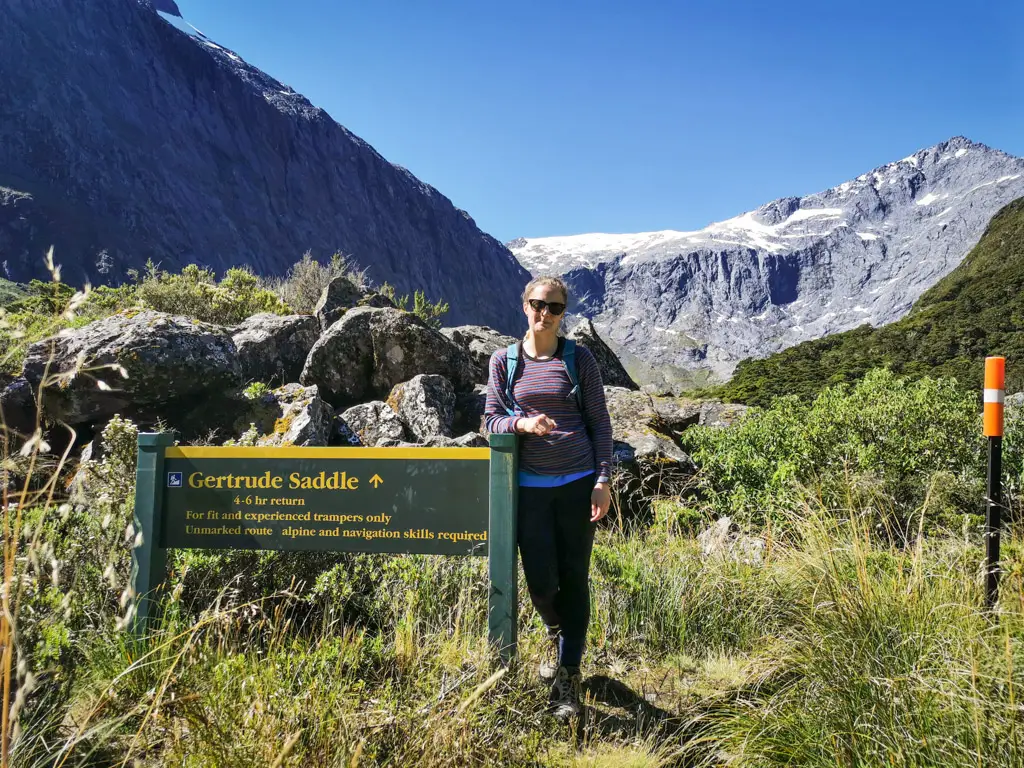
Arguably the best day hike in Fiordland National Park, Gertrude Saddle rewards you with beautiful views towards Milford Sound and the Tasman Sea.
Length: 7km return with around 600m elevation gain
Time taken: 4-6 hours return
Difficulty: Medium
Facilities: Homer Hut is a NZAC hut at the trailhead. We used public toilets at the Divide (trailhead for the Routeburn Track). No toilets or shelter along the route.
– Know before you go: Gertrude Saddle is classified by DOC as an “expert route”. You should not take it lightly. There have been numerous deaths on this route. Good weather (no rain), and back-country / off-track experience is necessary. You need to follow the route exactly in places and cross the stream in the correct spot, otherwise you will risk becoming bluffed out or worse. Several avalanche paths cross this track. Do not plan to hike up Gertrude Saddle in the winter or early spring. These avalanches can sometimes take out the orange triangles marking the track. Make sure you are confident with route-finding, and carry a map. –
The Mountain Safety Council have a great video on Gertrude Saddle:
You can also use this web-cam view of the Gertrude Valley to check weather, but know that it can change suddenly and that the camera doesn’t show weather that might be building on the western side of the saddle.
Why Gertrude Saddle?
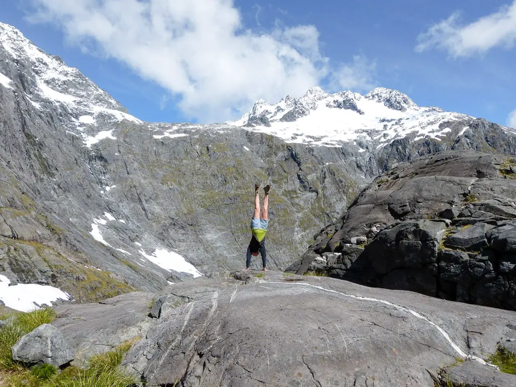
I mean, look at this view.
That should answer your question. Or provoke a better question; why not?
How to get to the Gertrude Valley
The Gertrude Saddle trailhead is accessed from the Te Anau – Milford Road (State Highway 94). It’s a 75 minute windy drive from Te Anau, or a 20 minute equally windy drive from Milford Sound. If you’re driving from Te Anau, the signpost for the carpark is just before the Homer Tunnel, on the right-hand side of the road. The road down to the carpark is gravel and can be full of pot-holes, so go slowly if you’re driving a low car.
The Gertrude Valley and Saddle were named (for the newly arrived Europeans) by engineer Robert West Holmes in 1890 during explorations of the area scoping out what would later become the Homer Tunnel – the first road access linking Milford Sound and Te Anau (fully opened in 1953). His wife, Gertrude, accompanied him on the difficult trip and obviously got permanent bragging rights. She was probably hiking in a massive dress though, so fair enough.
If you’re looking for other nearby adventures, check these out:
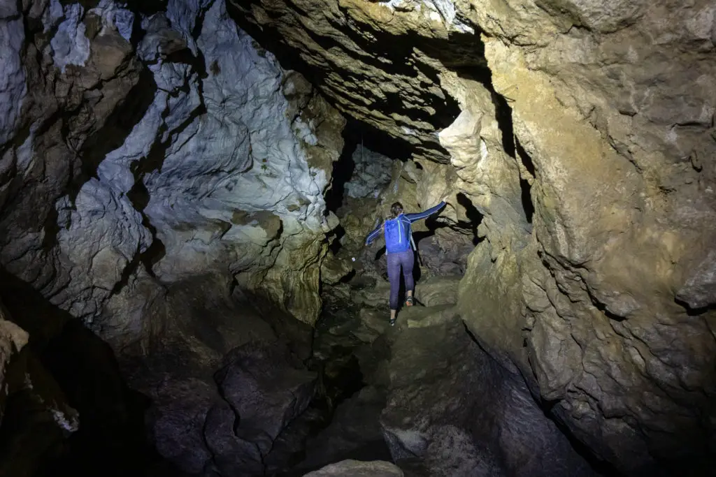
An awesome underground caving adventure (free and self-guided!) between Te Anau and Invercargill.
Get away from the hustle and bustle of busier tracks and experience mountain views and tarns in tranquility.
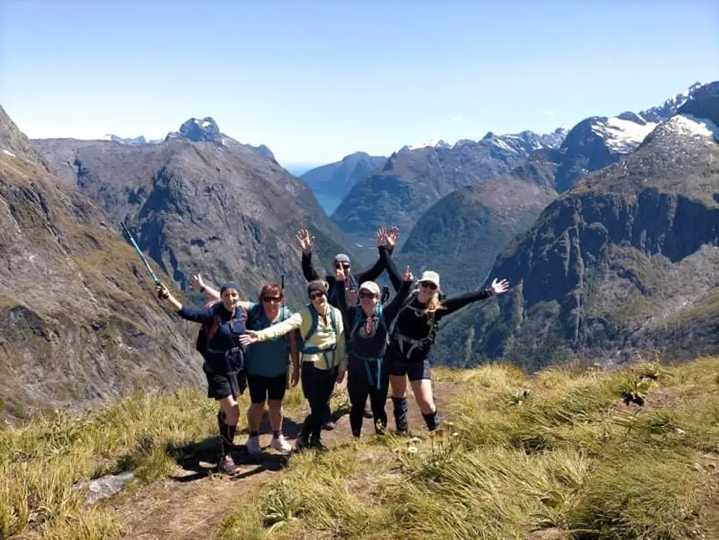
The Group
I’ve hiked up to Gertrude Saddle several times, having grown up only a few hours’ drive away. But the last time I remember would have been back as a university student. So it had been a good while! (It was very depressing for me having the realisation that in this instance “a good while” means “almost a decade” *shudder*).
One of my friends, Loren, briefly mentioned Gertrude Saddle during a conversation earlier in the week. I latched on to the mention (this trip had been on my ‘adventure wishlist’ last year before COVID interrupted everything) and promptly invited myself along (sorry, not sorry Loren). My husband, Matt, was completing the Milford Track that week with some workmates and would be coming out on the same day we planned for Gertrude – perfect timing!
I was introduced to the group on Friday night in Te Anau by playing a not-safe-for-work edition of “Name the Emoji”. What an introduction! Simone, Kay, Allison and Pete were all a bit older than myself and Loren. They’d just come off the Milford Track themselves a week earlier. Like Loren, they hadn’t tackled anything really off-track and alpine. But they were all keen as beans – once they’d finished looking up questionable terms in Urban Dictionary.
Hiking Gertrude Saddle
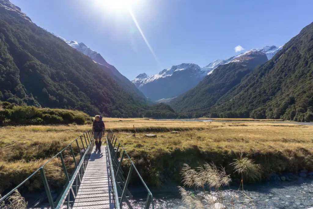
We left Te Anau around 8.30am, and arrived at the trailhead just before 10am, after stopping at the Divide for a toilet break. There wasn’t a cloud in the sky, although the air was still nippy. We’d completely lucked out with the weather. This was the kind of day you dreamed about for tackling Gertrude Saddle!
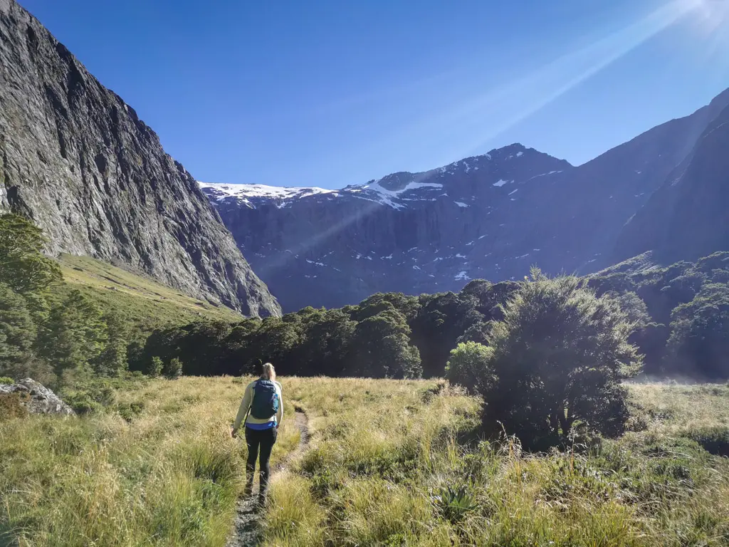
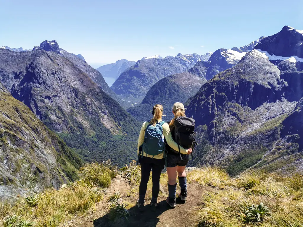
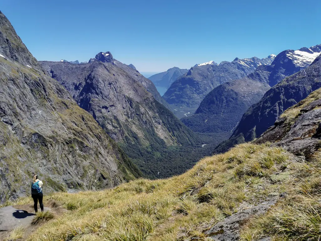
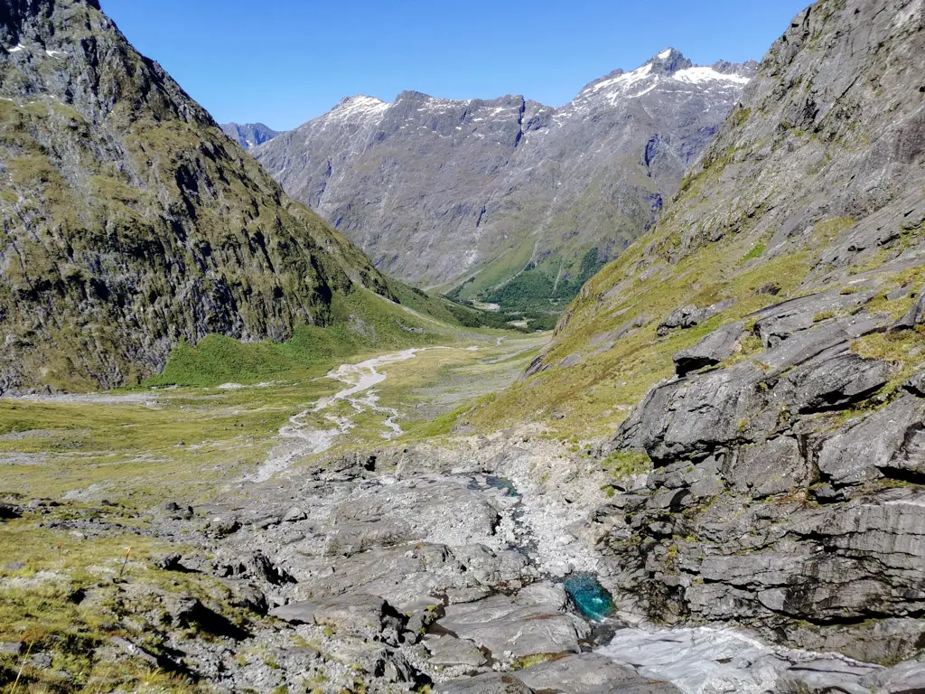
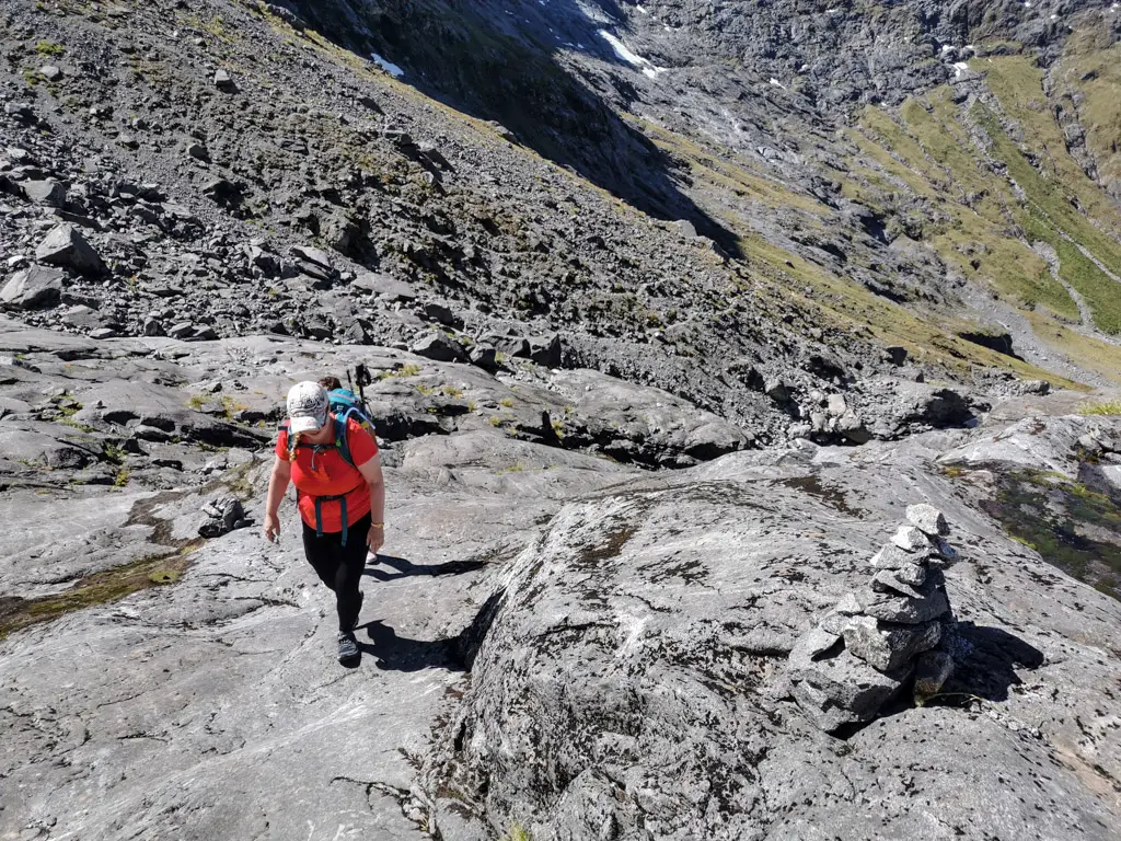
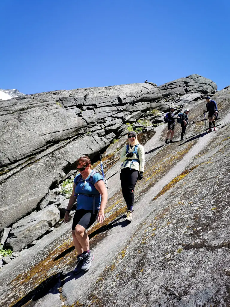
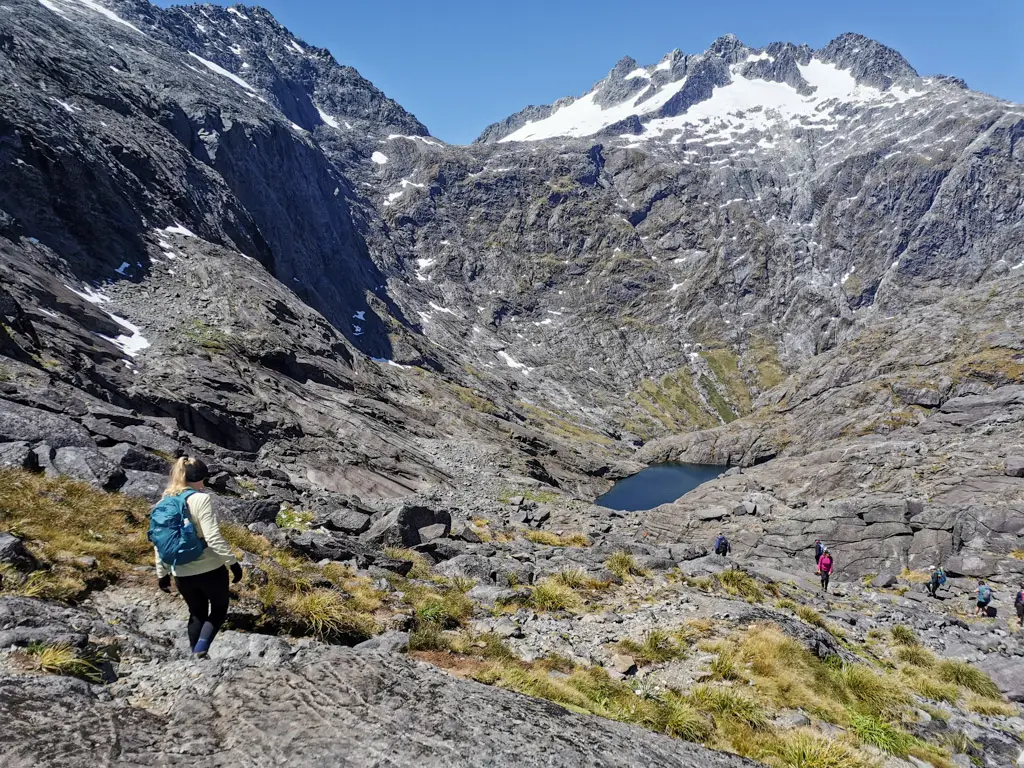
The Gertrude Valley
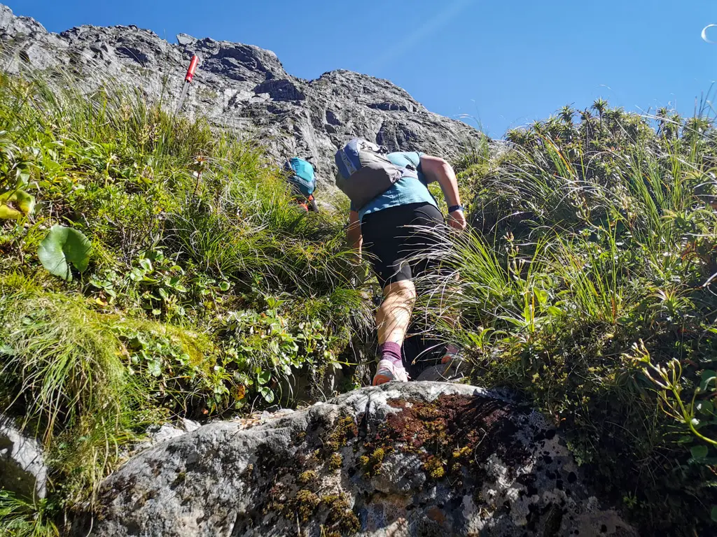
The first third of the route meanders its way up towards the head of the valley. After rainy weather, this part could be a bit wet as it involves a few “river” crossings which are completely dry in good weather, other than one permanently bridged stream. The route is well marked with orange triangles (so long as you’re looking out for them) and, in summer, with foot traffic. After scrambling over some rocks, there’s a very short bush section before you’re in the valley proper. Then the views really start. As if you weren’t satisfied already!
Looking up towards the head of the valley there are towering cliffs, waterfalls and clinging ice/snow. And the views are only going to get better!
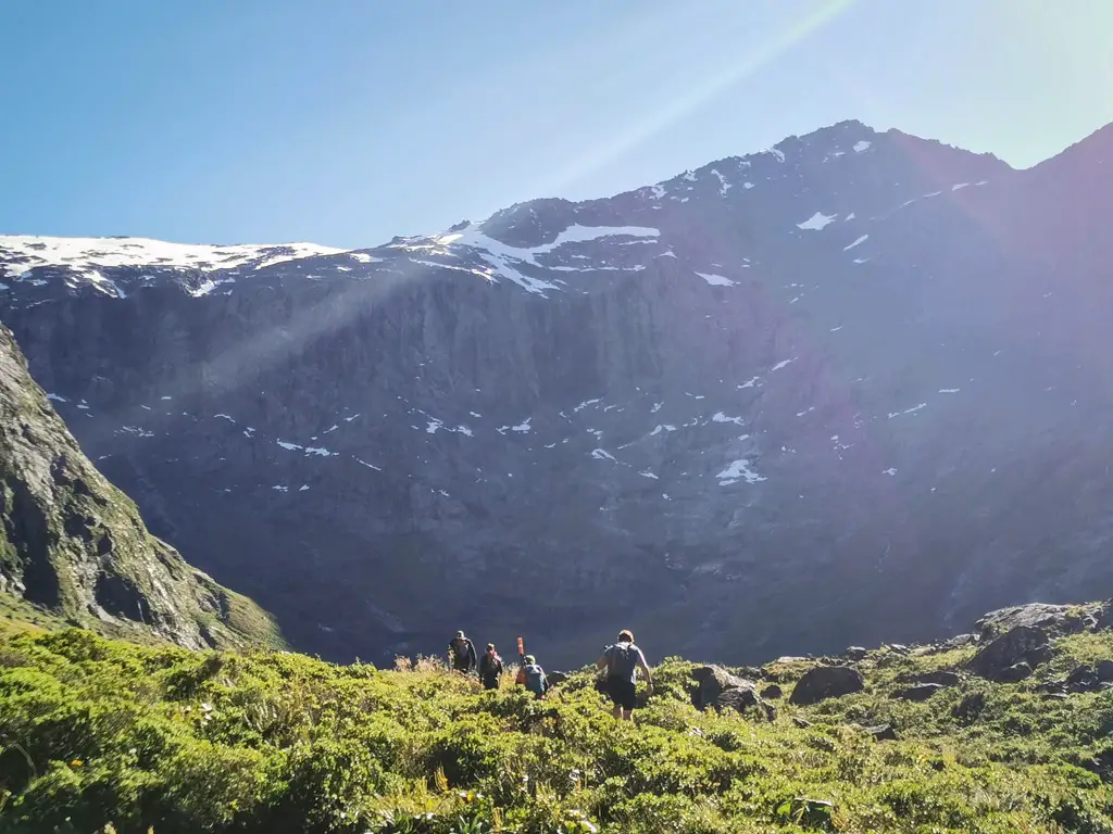
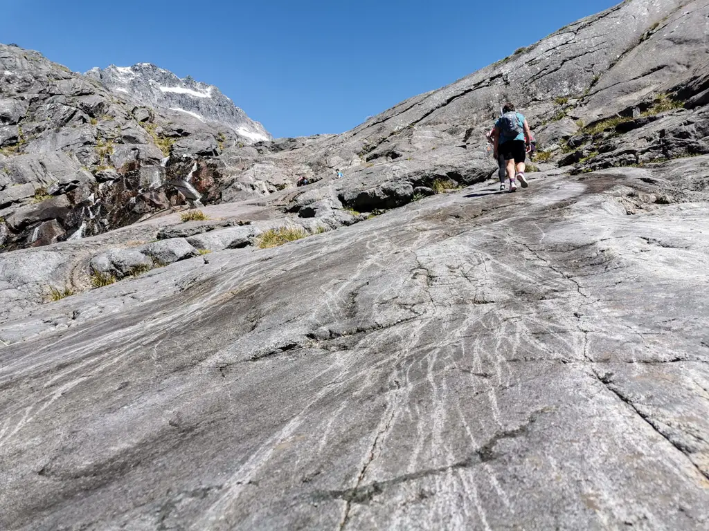
After almost an hour of walking, we reached the start of the uphill section. And it doesn’t pull its punches! It’s straight up from the get go, with big steps up rocks and dirt. I was glad we were tackling this early in the day, before the heat really started to build.
The track in this section was very easy to follow, and we soon arrived at the stream crossing. There was a large sign and orange triangle marking the correct place to cross (i.e. one of the only places with no waterfalls), which was new since my last visit.
DOC was pressured following past fatalities on the route to make it easier to follow. It definitely is more clearly marked than when I last visited. The crossing in dry conditions is easy; a hop, skip and a jump over rocks and boulders with no risk of wet feet. However during or after wet weather, this could be much trickier or even impassable.
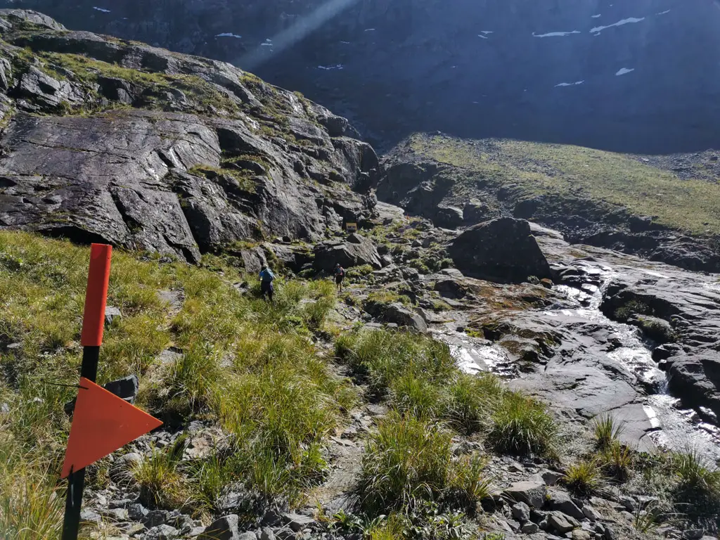
Once you have crossed the stream, look back and memorise what this spot looks like. This is where you need to cross again on your way back down, but could be easily missed if you’re not looking out for it. Several people have died because they keep going down the true left of the stream and didn’t cross here on their way back down.
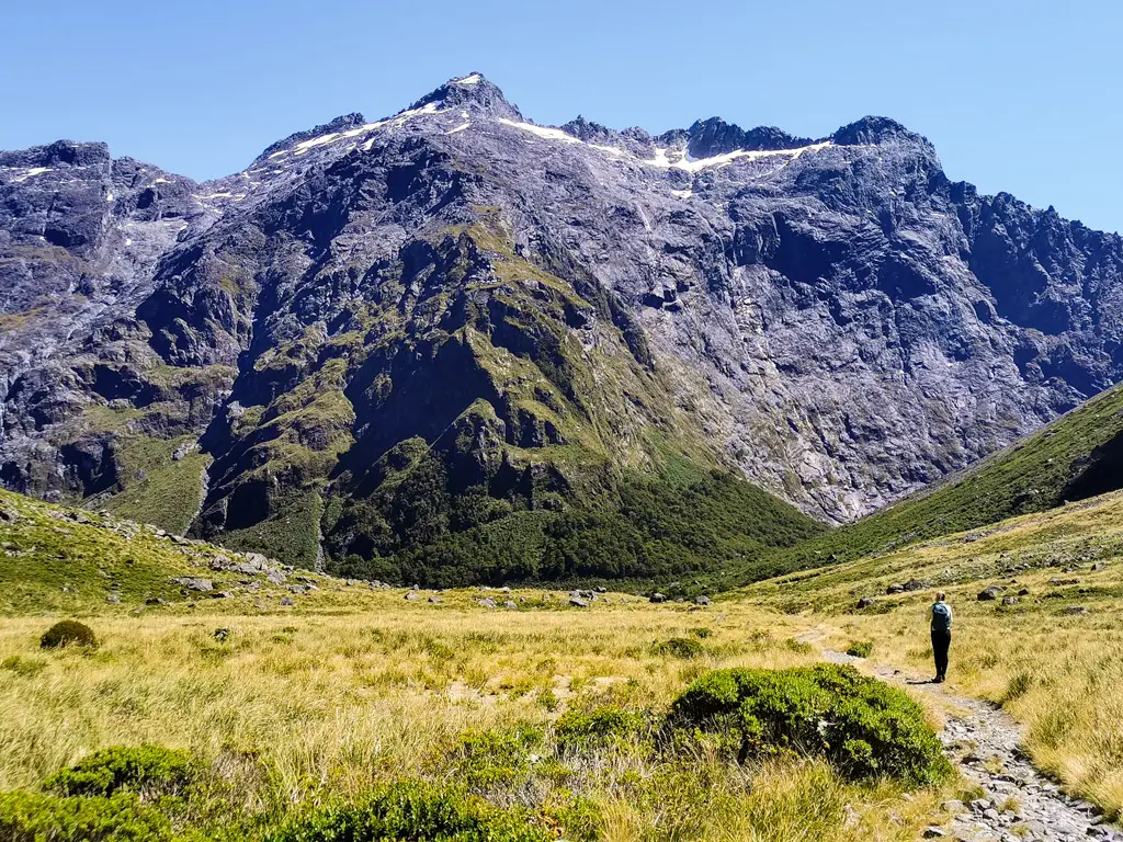
Immediately following the stream crossing, the route starts climbing steeply again. This climb is on loose gravel and rocks, which can be a bit tricky underfoot for anyone who’s only walked on well-formed tracks before. It shouldn’t be a problem for experienced trampers.
Following our noses and the orange triangles led us slowly up towards the slabs of rock. Once we reached these, the travel was much easier than the slippery gravel.
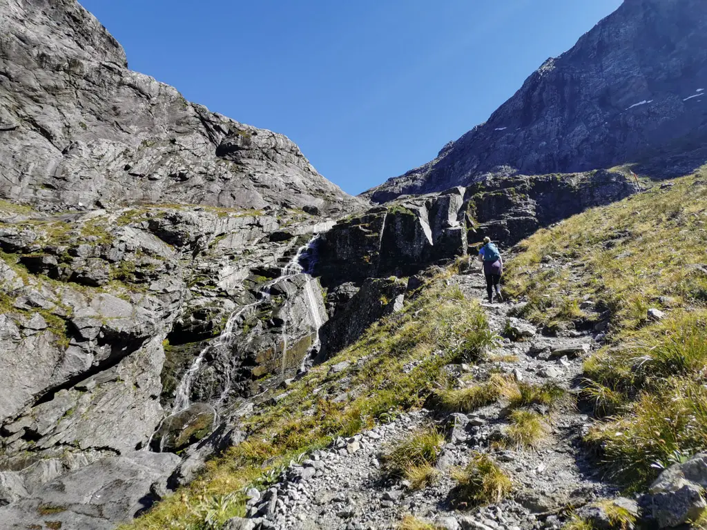
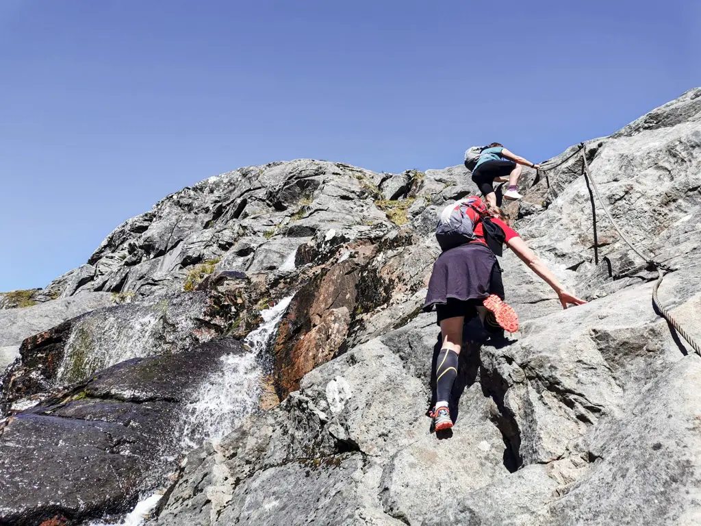
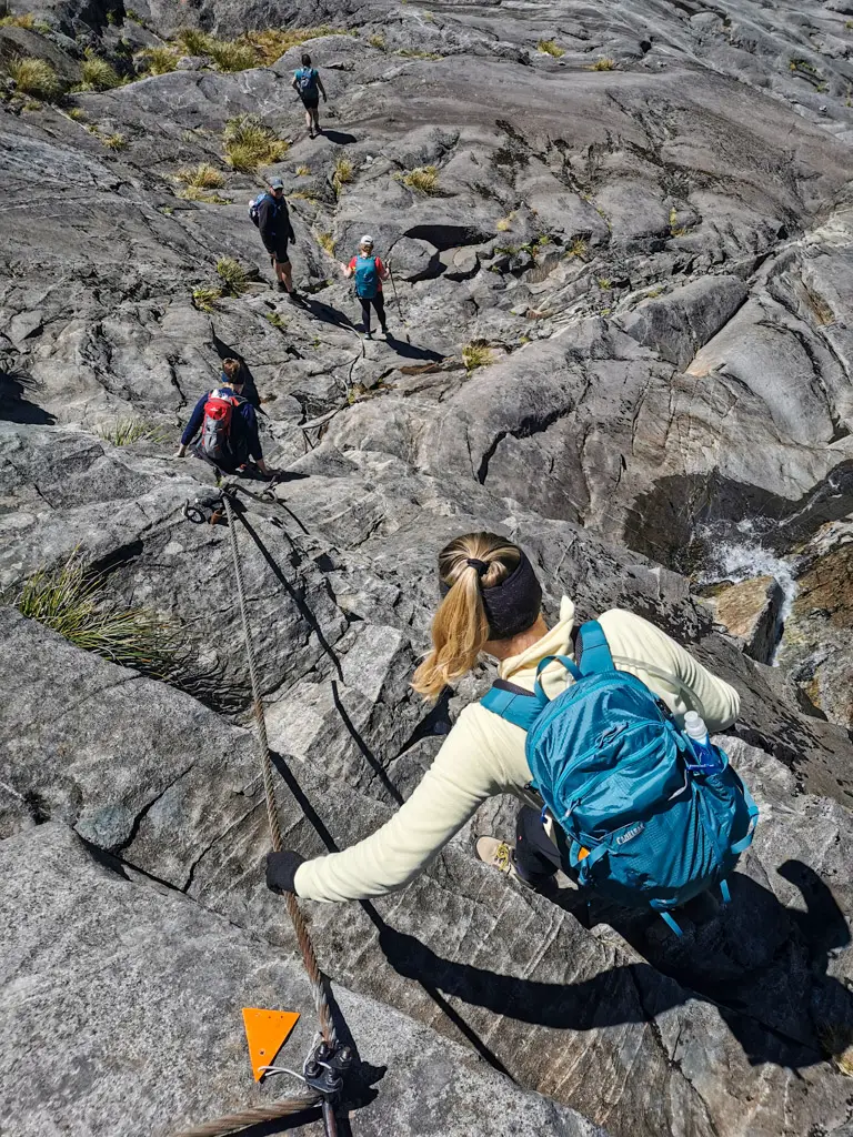
The Waterfall Section
Two hours from the carpark, and we’d reached the waterfall section. The rest of the group had dreaded this section, after studying up the Mountain Safety Council’s video on Gertrude Saddle and watching people climb up the wire rope. And although it looks intimidating and requires a bit of concentration, everyone managed it with ease.
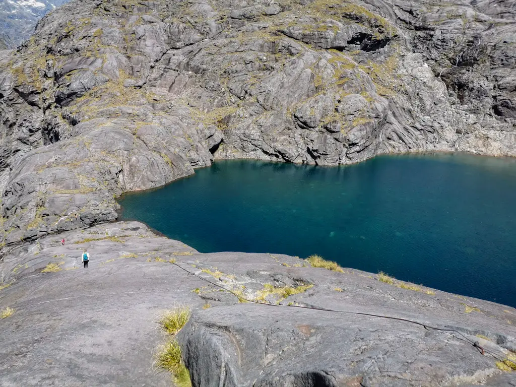
Black Lake
At the top of the little waterfall, sits the gorgeous Black Lake. We stopped here for a short break, before heading on up the steeper rock slabs, aiming to have lunch on the saddle.
Climbing above Black Lake to Gertrude Saddle
The wind picked up however, so instead of having lunch at the saddle, we hunkered down in a slightly sheltered spot at the top of the slabs above Black Lake. It was a beautiful spot to have lunch, lovely views over the lake and down towards Gertrude Valley. The next part was relatively straight forward, just traversing across rock slabs above the lake, until we reached the ‘boulder mine field’.
Early in the season, or after snow fall, snow is likely to have filled the area above Black Lake. If you don’t have experience in this type of terrain or the correct gear, then don’t cross. Turn back and enjoy the view of Black Lake instead, and come back another time once the snow has thawed.
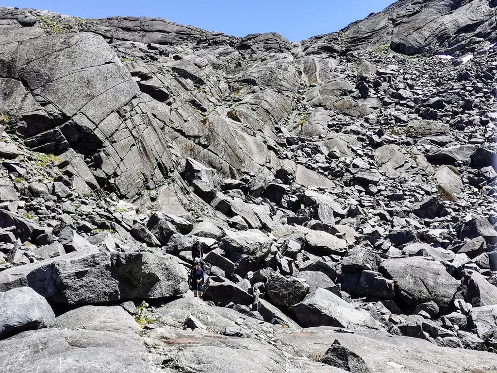
The small boulder field was fun to negotiate and didn’t take too long. We stuck to the left in the above photo, but I don’t think there’s really a right or wrong route. And whichever way you go there will be scrambling!
Once through the boulders, it’s more climbing up steep rock slabs before you’re suddenly on the saddle!
Gertrude Saddle
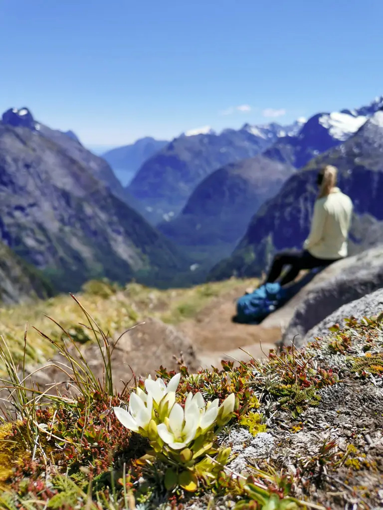
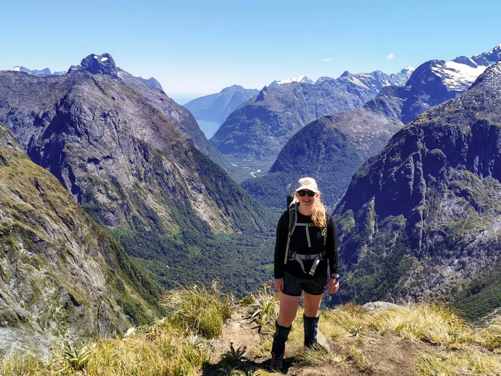
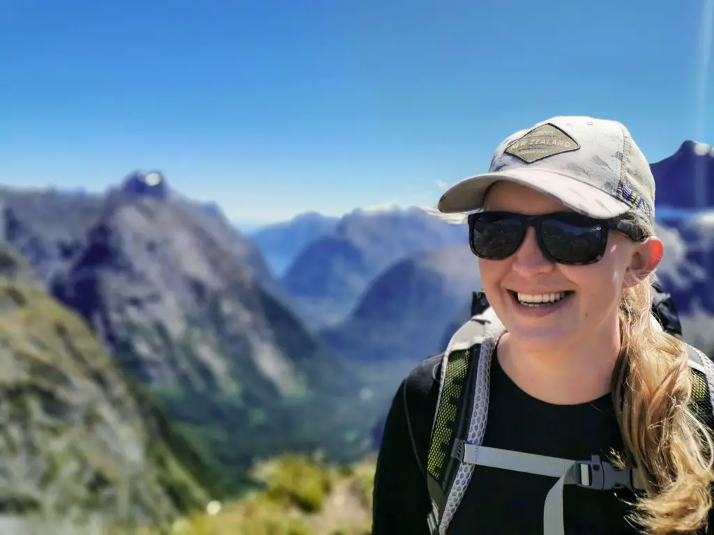
Once up the last few rock slabs, we were suddenly on the saddle! And the views!! Wow, those views.
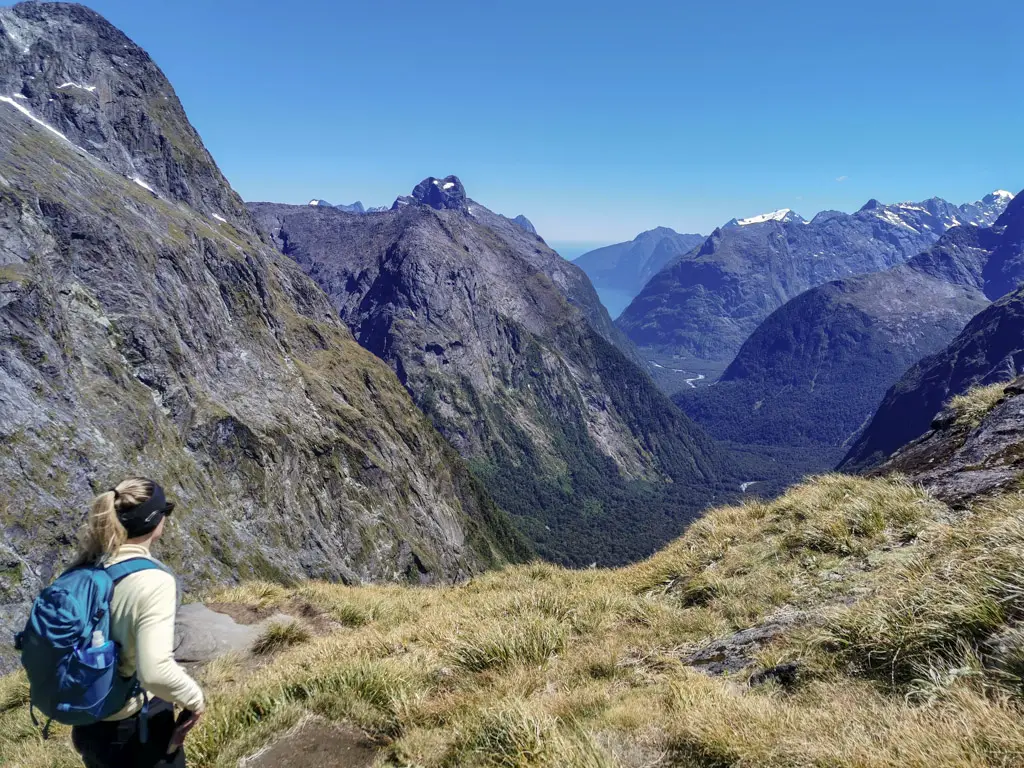
There is a reason people keep coming back to this spot. It is magical.
We hung around for quite a while on top of the saddle, taking in the views and marvelling in the fantastic weather we’d been granted. We could see down the Gulliver Valley, out to Milford Sound and even to the Tasman Sea. I didn’t know it at the time, but my friend Penzy (a badass who helped me with my How to get fit for tramping and stay that way article) was climbing Mitre Peak that same day! I could have waved across the valley and fiord to her on top of the iconic peak.
To the north-eastern side sits the towering Barrier Knob, high above the saddle. Dad had mentioned wanting to climb the peak later in this year’s season. It looked rather intimidating from the saddle, and still had some snow on the ridgeline.
We didn’t explore further from the saddle this time around, but on other trips I’ve explored along the south-western side which has another gorgeous tarn (which feeds Black Lake). There also used to be the wreckage of a Cesna which tragically crashed in 2002, but I think the debris has since been removed.
The drop on the other side of Gertrude Saddle is a sheer 700m+, so we were careful not to get too close to the edge. The same couldn’t be said for some of the others who were sharing the view with us.
There were a few other people on the saddle, making the most of the beautiful day. Some seemed very lovely, like the group of French expats who I got to practice my french with. While others seemed to be tempting fate (mainly the girl who decided to balance on a rock right at the edge of the sheer cliff face. In the breeze. On one leg. You know, for the gram).
Please be smart people and put your safety before your social media! It gave us all mini heart attacks. People have fallen before (including young William Quill in 1890, for whom Lake Quill at the top of Sutherland Falls along the Milford Track is named). It’s not the kind of fall you can recover from.
Before too long though, it was time to head back down. Loren and I had to get back into cell service at the designated time to contact my emergency contact (my Mum) and let her know we were out safely (there isn’t any cell service until Te Anau Downs and even then it’s patchy), while the others were spending the night in Milford Sound.
As always, the climb down seemed (and was) a lot quicker than the way up. Nobody had any trouble with the waterfall section, and we made sure to cross the stream at the correct spot.
Less than two hours from the saddle and we were back down at the bridged stream near the start of the track. It had taken us about three hours including breaks to scramble up – so a five hour trip total (not including a big break at the top).
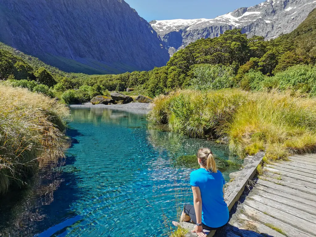
It was such a nice day, and walking in the trapped heat of the valley I’d been dreaming of swimming in the cool crystal water at the end of the route. However once I was there, putting my bare feet in soon tempered that idea. The water was more than mere cold. It was pure pain.
However the longer Loren and I waited for the rest of the group to catch up, the more I was tempted, despite the fact the water seemed to want me to die of hypothermia. In the end, with the encouragement of one of my french friends from up on the saddle, I hopped in to the water not once, but twice. (The second time was after the rest of the group had arrived in an attempt to encourage them to get in too. This was met with varying levels of success, since none of them had lost enough of their marbles).
It was very invigorating to say the least. I may have questioned my sanity. And learnt some new French swear words from my friend. But my muscles felt amazing afterwards, and I wasn’t a sweaty mess of the ride back to Te Anau.
After snap freezing my entire body, it was time to say goodbye to the lovely Gertrude Valley, and drive back to Te Anau to meet up with Matt and hear about his Milford Track adventures.
It was so lovely hiking with new people, and seeing them push their boundaries in terrain they’d never experienced before. And Gertrude Saddle is absolutely gorgeous. Perhaps I’ll be up there again later in the season to tackle Barrier Knob. Gulp. Perhaps.
Safety
As always, please stay safe when you’re out exploring. Follow the Outdoor Safety Code:
- Choose the right trip for you (read my article, talk to DOC, look at Topomaps, read other blogs!)
- Understand the weather (this would be an extremely dangerous hike in adverse conditions)
- Pack warm clothes and extra food (including windproof and warm layers, regardless of how nice the day is when you set out. You check out my post on what to taking tramping here)
- Share your plans and take ways to get help (have an emergency beacon on your person)
- Take care of yourself and each other
If you’re not feeling super confident then you can always get in touch with me here on the blog or on my Instagram. Or take a look at my Tramping 101 series which includes this post about how to stay safe in the outdoors.
Stay safe and get outside!
Where to next?
Let me know what you think! Leave me a comment or message me over on my Instagram.
I love hearing from readers and helping them plan their own adventures!
Really enjoyed reading this and great photos:)
Thanks Monique! Hope it was helpful for your planning and that you can get up there one day 🙂
Such a well-put-together record of this climb. You have the knack of just enough narrative and well-chosen pics. I felt like I was there (and wishing I was) as I followed the vid.
Many thanks for sharing this.
Thanks so much Roger! That’s a lovely comment 🙂