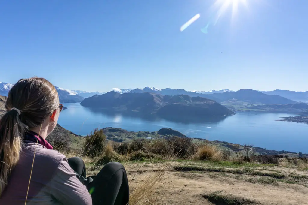
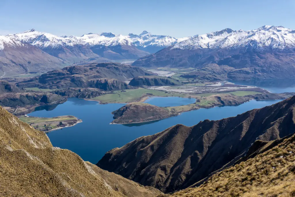
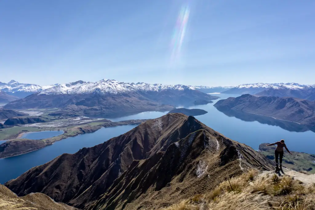
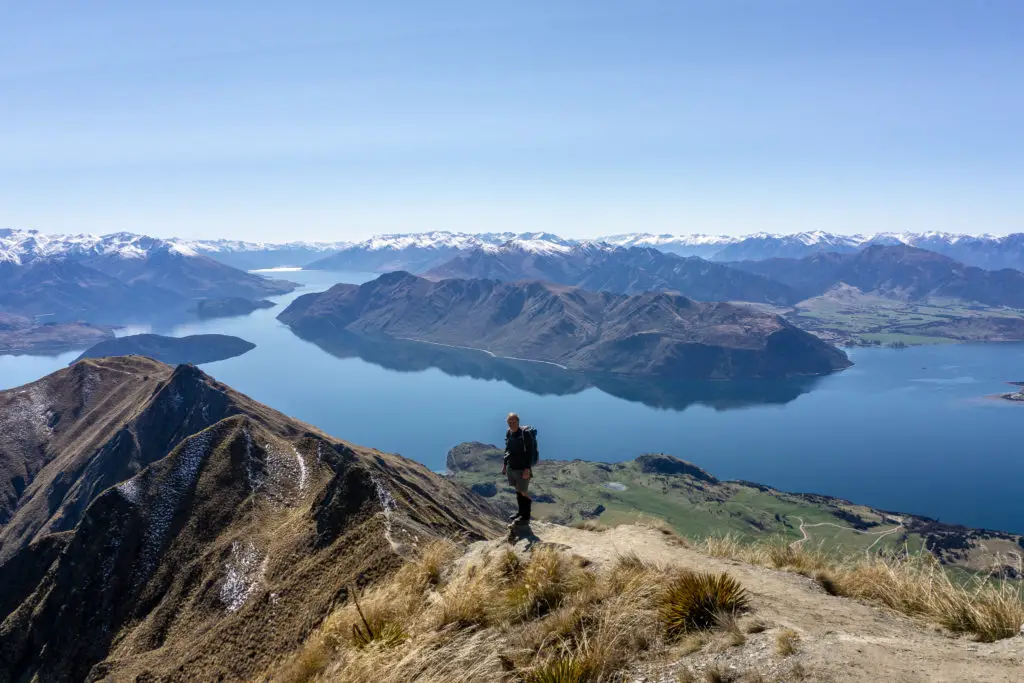
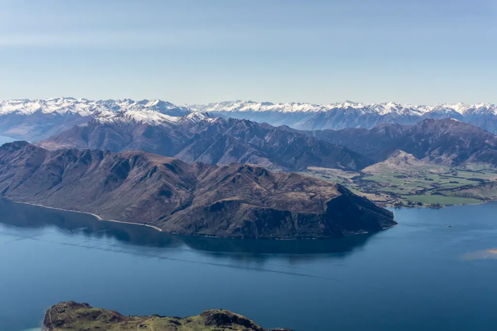
Roys Peak is one of the most popular hikes in the country, with beautiful views over Lake Wanaka and the surrounding mountains, including Mt Aspiring.
Length: 16km return with over 1200m elevation gain (& descent)
Time taken: 5-8 hours return carpark-summit. Times will differ drastically depending on fitness and amount of time taking in the view. To the viewpoint only, it’s about 3-4 hours return.
Difficulty: easy (if you’re fit), hard (if you’re not)
Facilities: There is a long-drop toilet at the carpark, and another at the popular viewpoint, half an hour below the summit. There is virtually no shade from the sun for the entirety of the track, and no safe drinking water. The carpark fills up very quickly in peak season, so get in early. There is a $2 donation for track entry.
– Important: Although social media may make it seem like Roys Peak is a walk in the park, for the unexperienced it’s not. It’s unrelenting uphill in the sun all the way up to the peak with potentially wildly different weather conditions. Dress appropriately. Allow enough time. Take adequate gear/food/water.
The track is over private property and is closed 1 October – 10 November each year for lambing.
This trip is extremely popular year round, but especially in summer. –
Why this tramp?
I mean, have you not seen “the” shot on Instagram?
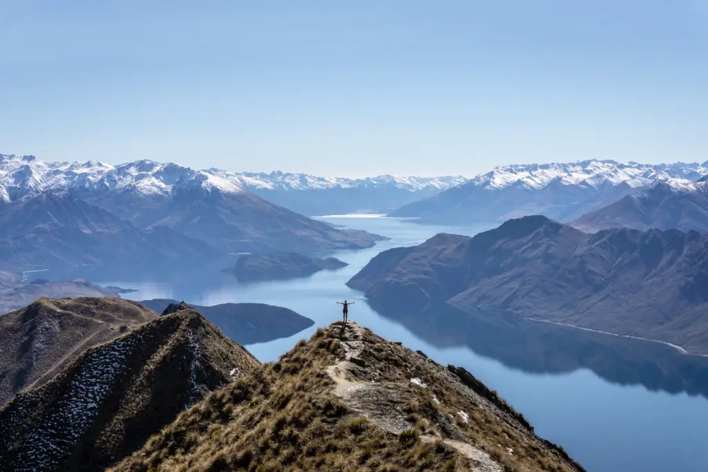
That shot is the reason why most of the 75,000 people walked the track last year. Compared with 8,000 people tramping the Milford Track; the most well-known of New Zealand’s Great Walks that now sells out an hour after ticket sales open for the season …
Roys Peak has its fair share of controversy. There are endless opinions on the Internet around how Instragram and social media are ruining the wilderness. And how Roys Peak is the epitome of this, despite the fact it’s a ‘horrible’, ‘boring’ walk (like these articles here, here and here).
I wanted to see for myself what all the fuss was about, but did so cautiously. I chose a weekday, in winter, knowing full well that I’d definitely hate the experience in peak summer season.
How to get to the trailhead for Roys Peak
The trailhead for Roys Peak is 10 minutes’ drive from Wanaka, along Mt Aspiring Road towards Glendhu Bay, Treble Cone and the Matukituki with its beautiful walks. If you don’t have a vehicle, there are plenty of shuttle buses around. Or you can even walk there right from Wanaka (although the walk is long enough for most people without adding the extra 6km to and from Wanaka) or hitchhike. Get in early if you want a carpark. It fills up very quickly in summer. You’ll also want to get in early because the valley faces north-east and is a sun trap. You’ll be roasting if you leave it until later in the day in summer.
Hiking Roys Peak
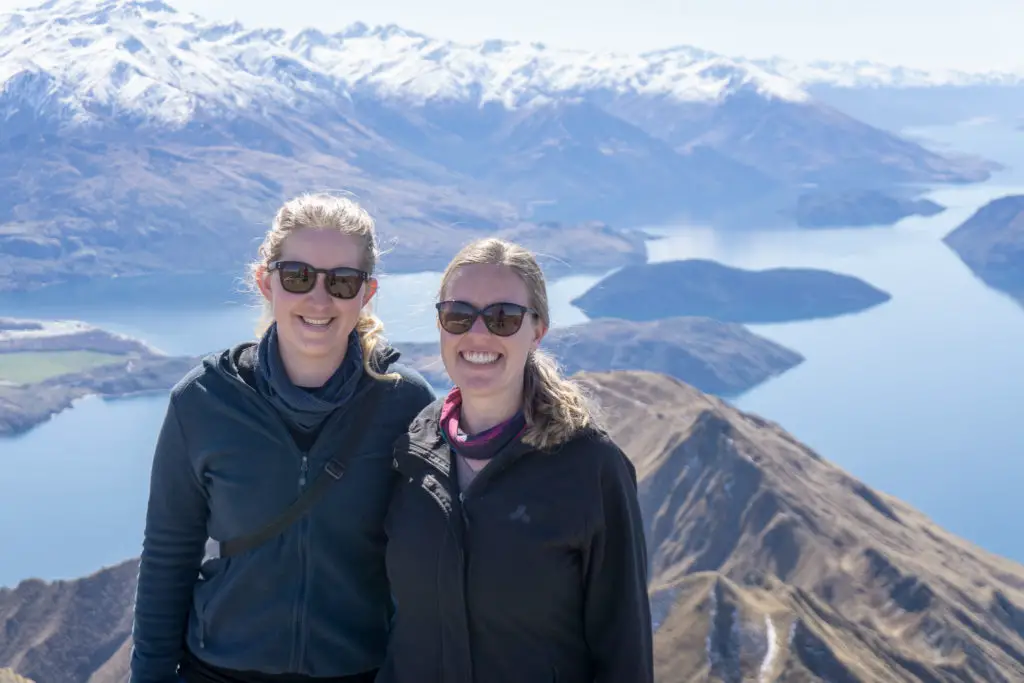
After spending most of the winter relentlessly checking MetService for a fine weather day that coincided with one of my days off, the stars aligned. I sent my friend Grace a text (thanks for always being up for last minute adventures Grace!). I picked up her and my Dad (who’d already completed the walk twice in that month for various reasons, including guiding with a NZ guiding company). It was on!
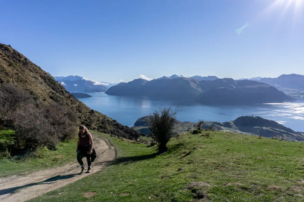
We were on the trail at 8.30am, not having wanted to get up any earlier but definitely not wanting to start much later. It worked out quite well. We missed the people heading up for sunrise (which I hear is amazing), but were too early for many of the more relaxed walkers who set off later in the morning.
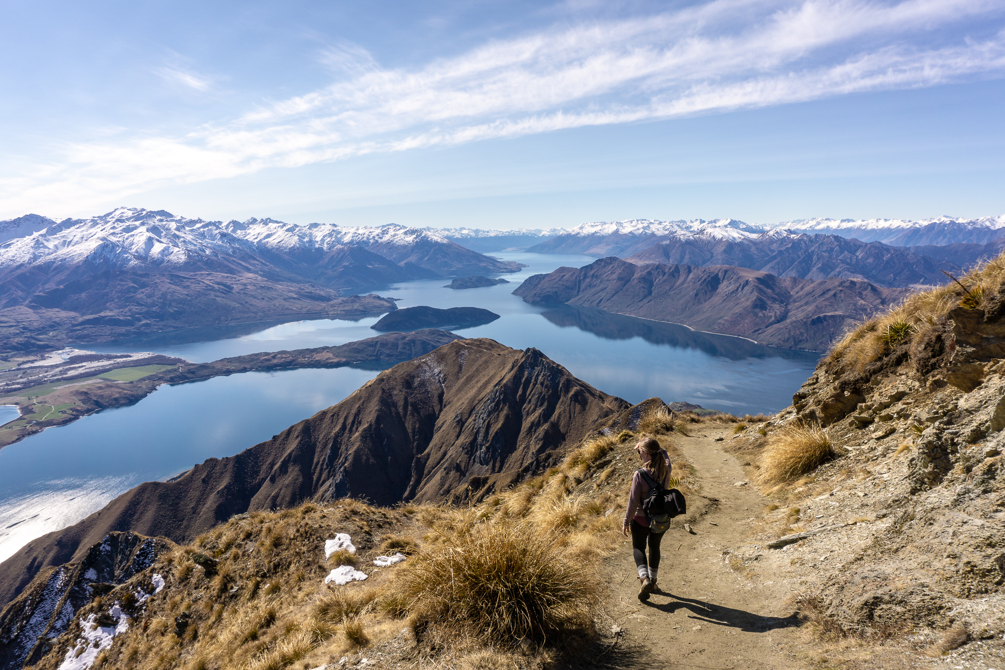
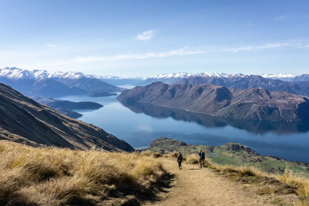
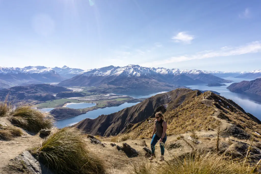
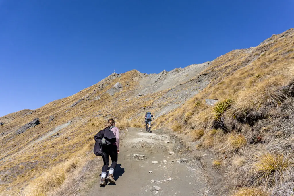
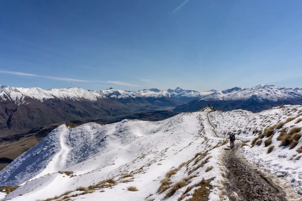
I will admit that the track itself is rather boring. A 4WD farm track zigzagging endlessly up the hill to the distant summit – which is dishearteningly visible the entire time. I’ve heard and read a lot of complaints about how tedious the walk is. And don’t get me wrong – it is. But damn that boring farm track is efficient! It certainly feels like you’re climbing uphill, but at no point was it so steep that I had to stop for a long breather. It definitely didn’t feel like we’d climbed over 1200m from the carpark. I guess I’m used to tramping tracks rather than roads.
The steepest part was actually near the start of the track (not counting the corner short-cuts further up). After about 30 minutes walking up the steeper section from the carpark we reached the gravesite of one of the old farmers of Glendhu Station; Wallis Alan Scaife 1887-1965. The grave sits in a fenced off area including a picnic table and a tree. This is one of the only places for shade on the entire track.
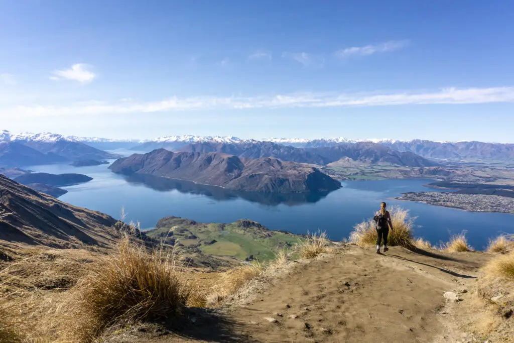
From there, the track zigzagged up the hill, with the summit in view the entire time. For a lot of people this could probably be very demoralising! So … just don’t look up I guess? Hope for low cloud? It’s kind of unavoidable. But you’ll make it!
We had some paragliders with packed parachutes on their backs pass us about halfway up (slightly shameful to be passed by such heavy alliteration). A few of them flew from the summit before the wind changed, and we stopped to watch them whistle by. I’d previously seen a video of speed flying from what I’d mistakenly thought was Roys Peak, but watching it back it looks more like Treble Cone – pretty crazy awesome though, you should give it a watch.
I normally go into detail about the actual track in most of my trip reports, but this track is incredibly straight-forward and boring. I don’t want to write about it. It would be really dull to read. So here is my shortened version peppered with a sprinkling of photos and a pinch of interesting info:
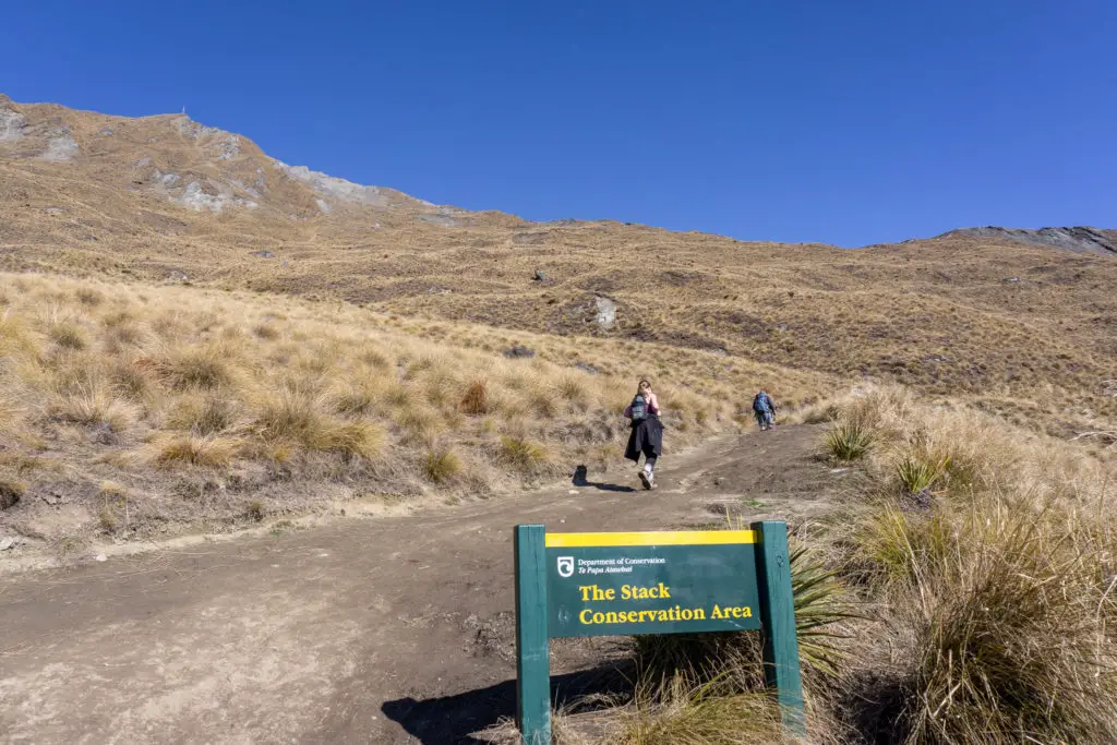
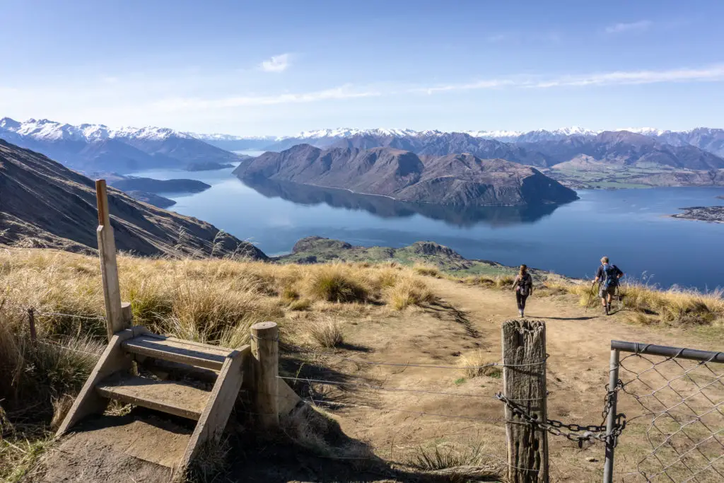
Stack Conservation Area
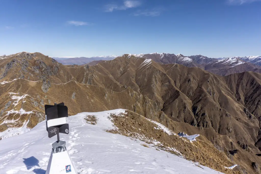
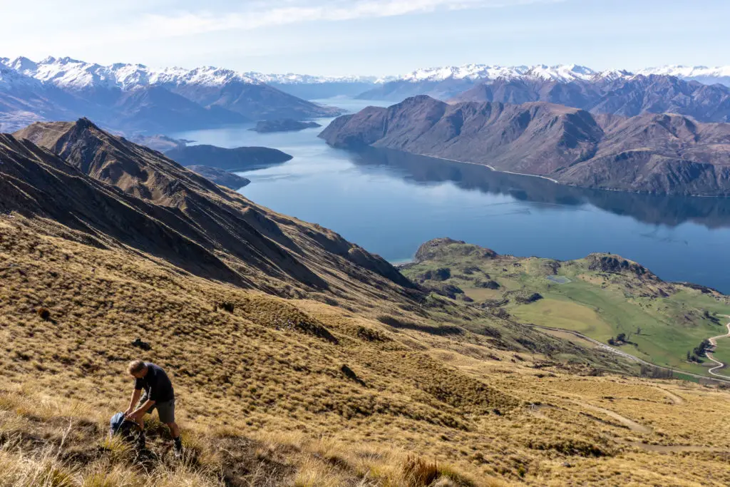
It took us about two hours of zigzagging from the carpark to reach the gate into the Stack Conservation Area (pictured above). This marks the farm boundary, and then it was another 20 – 30 minutes up to the lookout point and toilet. From the lookout it took us another 30 minutes to reach the summit (so 3 hours total). Just like any track going up into alpine areas, the conditions can change drastically from the sheltered valley to the exposed ridges. But luckily for us there was barely even a breath of wind.
Unlike the nearby glacier, Roys Peak was not actually named by early Europeans explorers and farmers after Rob Roy MacGregor; the Scottish version of Robin Hood – it was actually the initial surveyor John Roy who named the station “Roy’s Run” in the 1850s and farmed it before selling it to the larger station.
I’ve been unable to find the Te Reo name for the peak sadly – let me know if you know of it! It surely would have had one prior to Europeans arriving since Wanaka was a strategic place for Maori – they had a summer settlement including a pā nearby. It was a meeting of routes for gathering pounamu (greenstone) on the west coast, and moa hunting. There was even a wānanga (school, place of learning) which is where some people think Wanaka got its name (‘ng’ is changed to ‘k’ in the southern mita (dialect) of Te Reo).
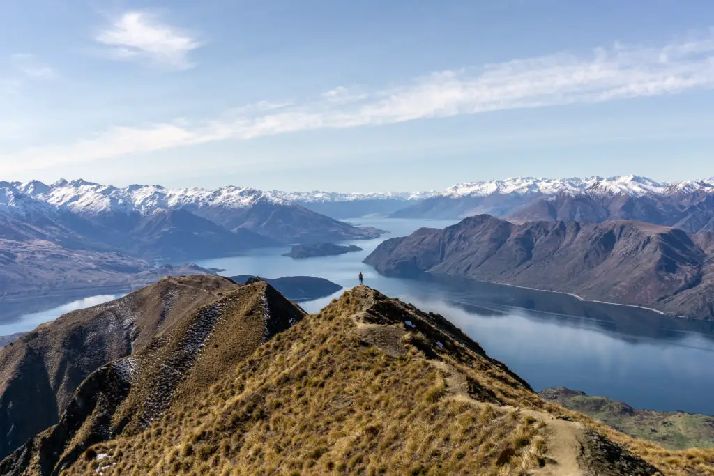
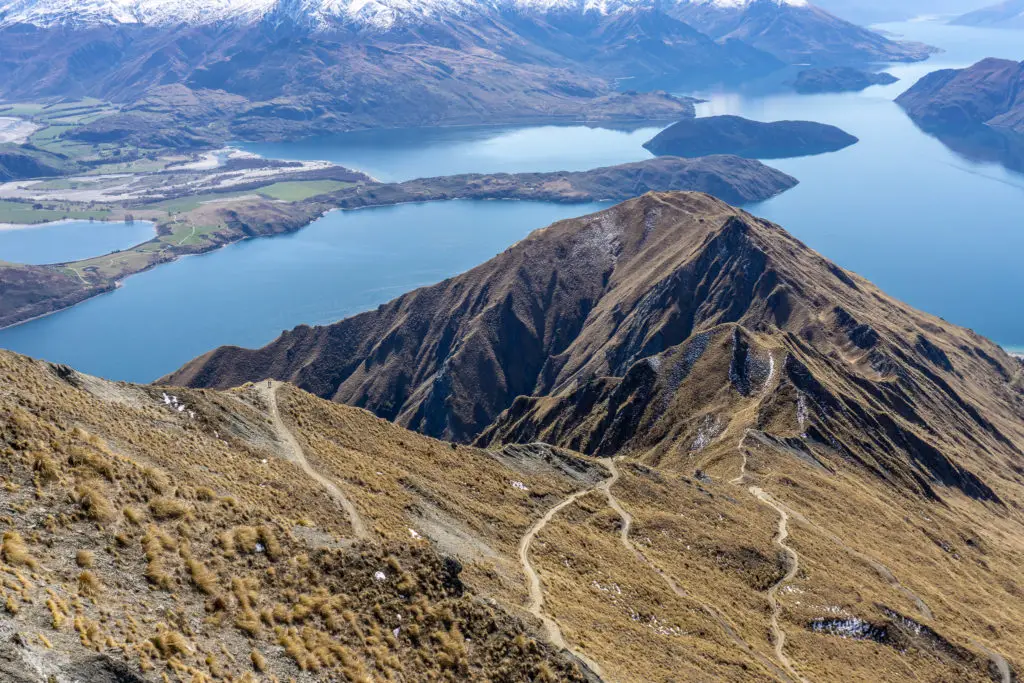
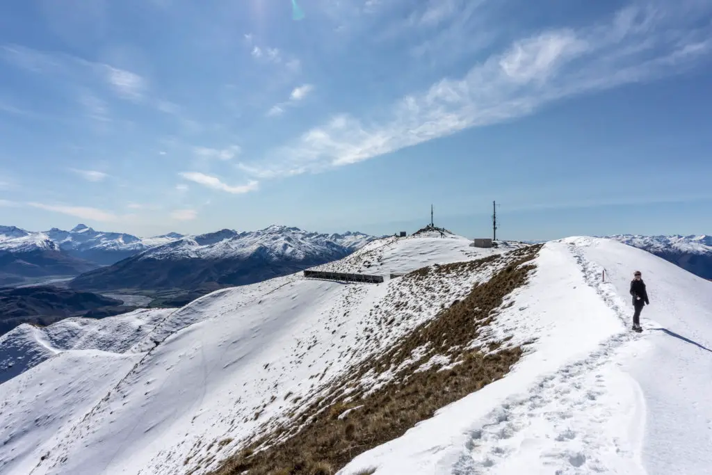
We came across some ankle-deep snow above the lookout when the track turns to the south face, right before the summit. It was also rather muddy here as you can see in the photo. Dad let me know the track can often be muddier further down in winter and early spring as well. So wearing boots rather than sneakers is a good idea at that time of year, even though the terrain isn’t rough.
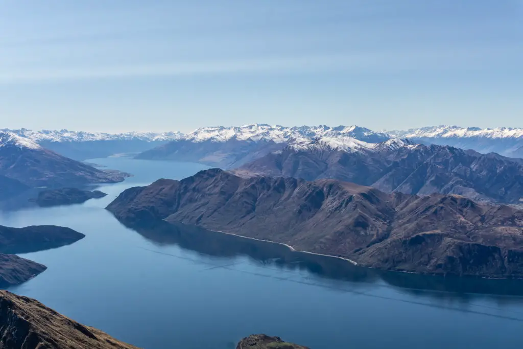
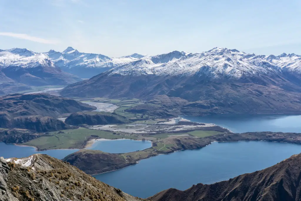
From the top we could see some of the different climatic zones that mark New Zealand’s crazy weather conditions. The main divide with Mt Aspiring has an average of 5-7 metres of rainfall annually.
Let that sink in.
5-7 METRES.
Then compare that to ~40km away in Wanaka, which only has 600-700mm of rain, and then ~30km south-east of Wanaka is Cromwell where there’s only 400mm of precipitation, which technically makes it a semi-arid desert. Crazy! Thank NIWA and Dad for helping me nerd out on this kind of thing!
From the top we could also see part of the Te Araroa trail that runs the breadth of the country from Cape Reinga to Bluff. From Hunter Station just out of sight at Hawea, then down to Wanaka, around the lake to Glendhu Bay, and then up the Motatapu.
At the top we considered climbing across to Mt Alpha to make the trip more interesting, but the southern face was filled in with pretty steep, icy snow. We had no gaiters, crampons or ice axes. Plus it would have added quite a lot of time to the trip that we hadn’t planned for. So we decided in the end to just go back down the same way.
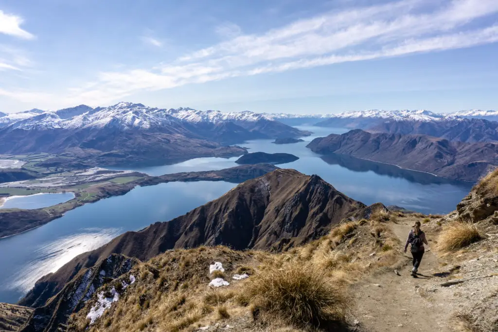
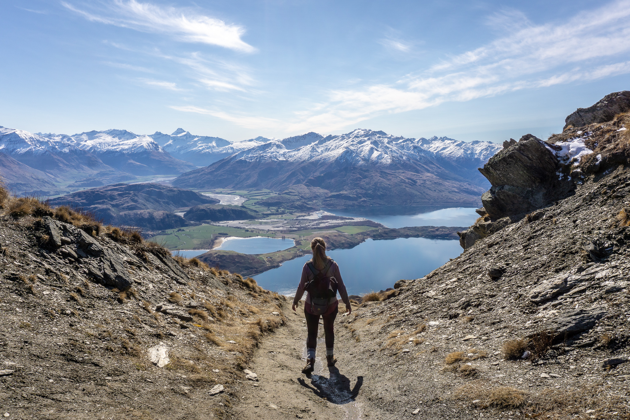
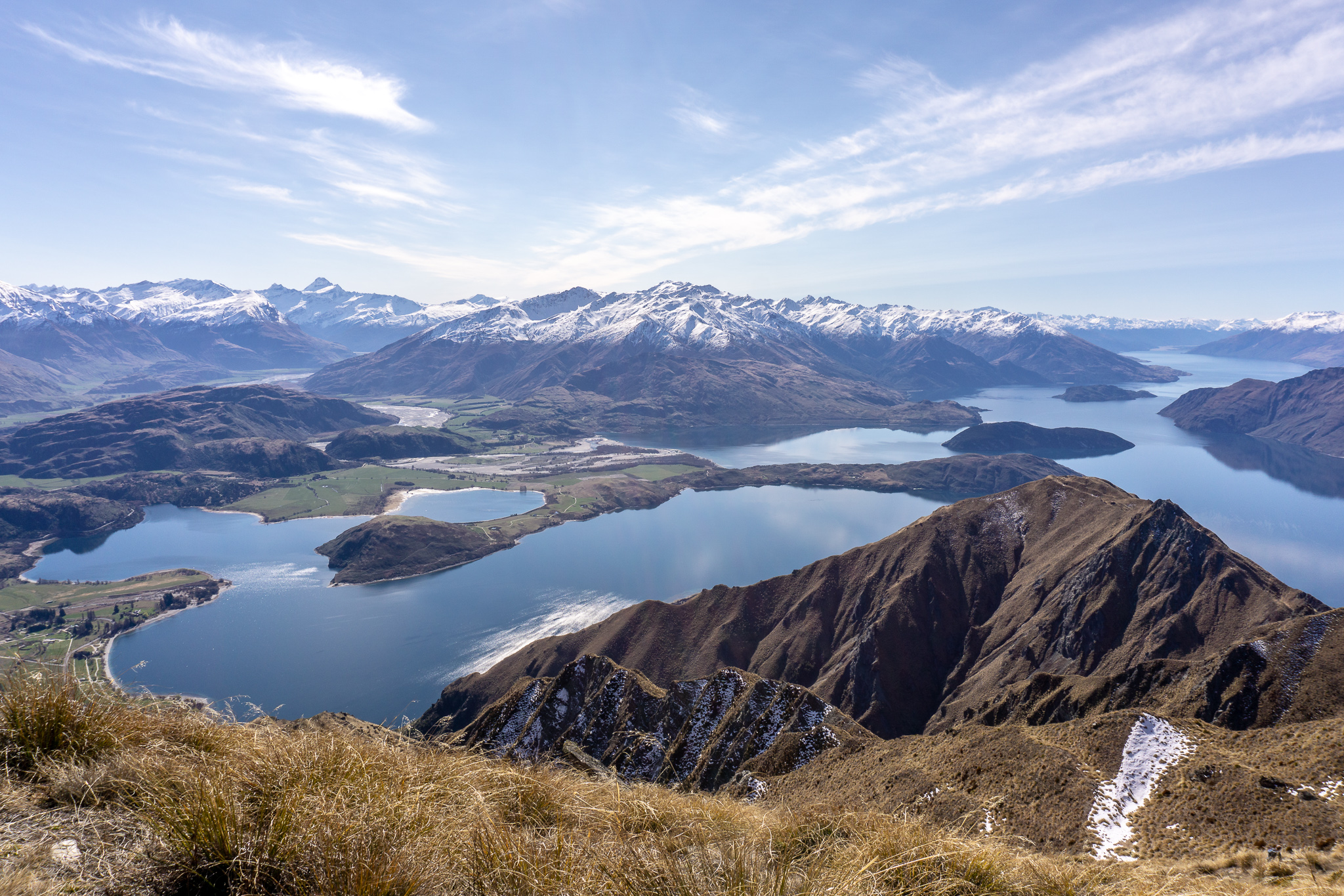
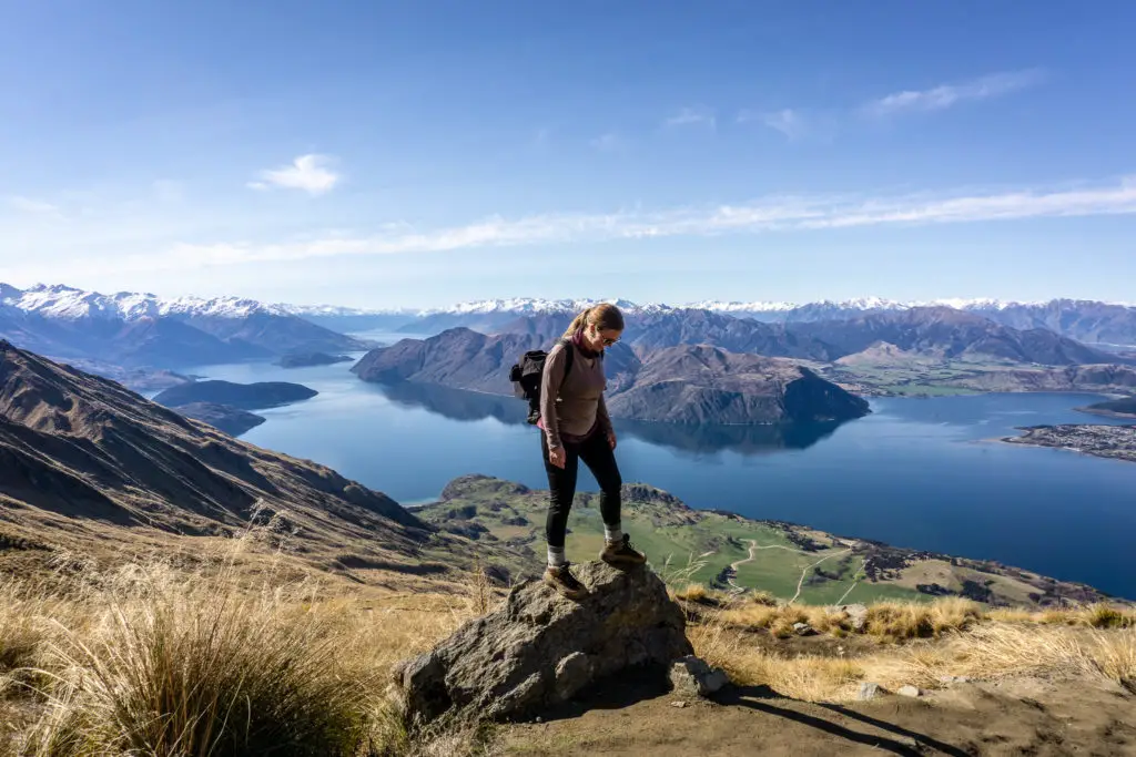
All up, Roys Peak was pretty fricking spectacular.
I enjoyed the beautiful views of snow-capped peaks reflecting into the lake, as well as the ease of the climb. It’s a boring track, no doubt, with a continuous view of the summit. I would definitely not want to be walking it with tons of people.
But on a calm winter’s day, it was a beautiful outing with my Dad and friend. I can see why lots of people are drawn to drag themselves up the hill. I honestly don’t mind having one track that’s insanely, out-of-proportion busy (and is built for that), if it means that the rest of the tracks in the area stay relatively quiet.
It seems like a lot of people seem to get this sense of ownership to land that they visit frequently for outdoor activities, like tramping, which is understandable (even though they don’t actually “own” the land). However this sense of ownership is not really fair to visitors, when the “locals” start getting protective and angry with people visiting “their” spots. It can come off as a little entitled. If we’re allowed to go tramping in our beautiful outdoors, why can’t other people? And those other people who aren’t as experienced – isn’t it better that they stick with popular, accessible walks like Roys Peak, where they’re less likely to run into trouble?
I don’t believe social media has “ruined” our outdoors. That feels to me like saying: it was fine when it was just us that went there, but now that more people want to enjoy it, we don’t want to share. And I’m talking here in particular about Roys Peak, which is already a road cut into the hillside. Not the Tongariro Crossing, an alpine adventure where people are often drastically underprepared and likely get into trouble (which is an entirely different kettle of fish).
There are certainly issues surrounding social media, visitor’s treatment of the land (how hard are the Leave No Trace principles people??) and the management of facilities, access, etc. But I think social media, despite its evils, has had a positive impact in terms of encouraging more people to get out and enjoy the outdoors, and helping them connect with others who are likeminded, and also educating them around how to safely and respectfully enjoy the outdoors.
But that’s just my two cents, what do you think?
Safety
As always, please stay safe when you’re out exploring. Follow the Outdoor Safety Code:
- Choose the right trip for you (read my article on tramping safety, speak to DOC)
- Understand the weather
- Pack warm clothes and extra food (check out my post here about what gear you need to take)
- Share your plans and take ways to get help (have an emergency beacon on your person)
- Take care of yourself and each other
Don’t underestimate Roys Peak. Although a relatively straight-forward trip, the track still heads into alpine areas. Check the conditions and stay within your level of experience and comfort. Weather conditions will change your trip drastically. Ensure you know the weather forecast. Adjust your plans (and the contents of your backpack) accordingly before setting out.
If you’re not feeling super confident then you can always get in touch with me here on the blog or on my Instagram. Or take a look at my Tramping 101 series which includes this post about how to stay safe in the outdoors.
Also don’t be a dick, check out my guide to New Zealand tramping etiquette.
Stay safe and get outside!
Could you get a more perfect day for it! So stunning! Re social media I agree with what you said about beginners doing the more popular walks- a good way to keep safe when there’s more people to help if necessary. For me personally, if anything it’s made me less keen to travel to popular spots and more likely to explore somewhere quieter.. Although I must say I’d love to do Roy’s Peak sometime haha!
Exactly! It took me a few years to get the timing right for Roy’s Peak as I was often only in the area in summer when I knew there would be crowds of people. But it was worth it! Hopefully you get to explore some quiet places soon