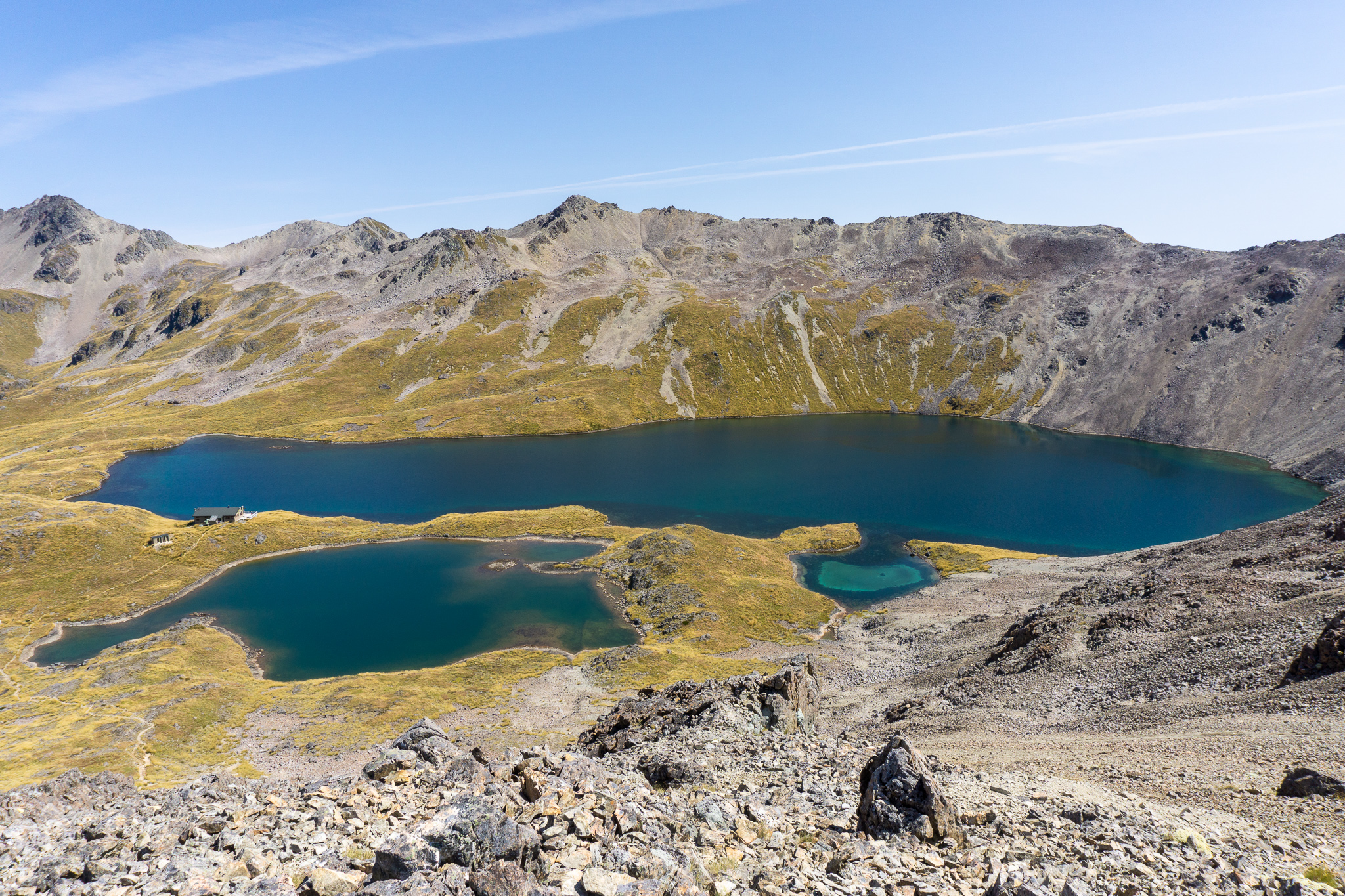
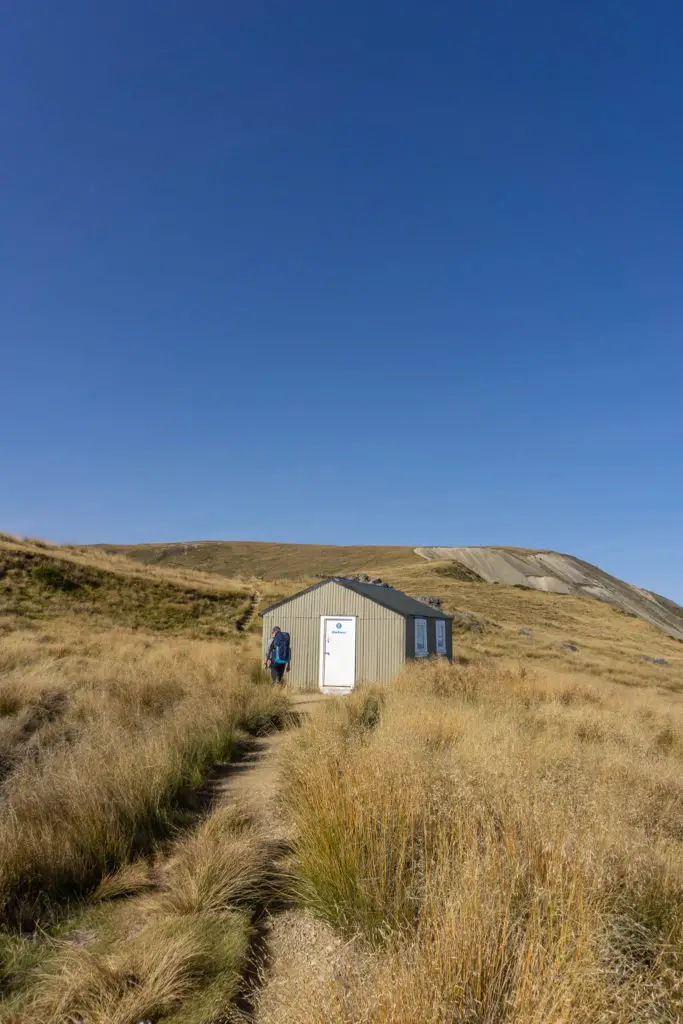
Lake Angelus has to be one of the most picturesque settings for a DOC hut in all of New Zealand. Crystal clear sparkling water, impressive rocky peaks and hot chocolates on the deck – that’s luxury accomodation right there.
Length: 11.2 – 12.2km (depending on the route) with ~900m elevation gain
Time taken: 6 hours to Lake Angelus via Robert Ridge, overnight at Angelus Hut, then 6 hours return via Speargrass Route
Difficulty: moderate (in summer)
Facilities: long-drop toilet at carpark. Angelus Hut: 28 bunk beds, bookings required in peak season (November – April) & public holidays. Fire, running water, long drops toilets. DOC campsite available next to lake (also needs to be booked during peak season).
– Important: This is a summer only route description. Robert Ridge route in particular is very exposed and at relatively high elevation, so even in summer bad weather would make this dangerous. In autumn, winter and spring the conditions are very different and ice/snow make the routes impassable without the proper skills, experience and equipment. –
I’ve popped a gear list at the bottom of this post, for anyone interested in what we took for an overnight trip.
Why Lake Angelus?
I used to work with American tertiary exchange students who would often travel around New Zealand during their semesters abroad. It was kind of like having spies who travelled all around the country, hunting down amazing spots to visit.
One of the many places they helped put on my radar was Lake Angelus; an overnight trip in Nelson Lakes. For a few of them it was their favourite hike in New Zealand. It took me many years however to have enough spare time to reach it and a good enough weather window to make it worthwhile. But it was worth waiting for.
It was the first hike Matt and I did in the South Island after living in the North Island for a year. It made my heart sing to be back in the mountain ranges of the south. The trek in to Lake Angelus is beautiful, and the setting itself is just amazing.
How to get to the trailhead for Lake Angelus
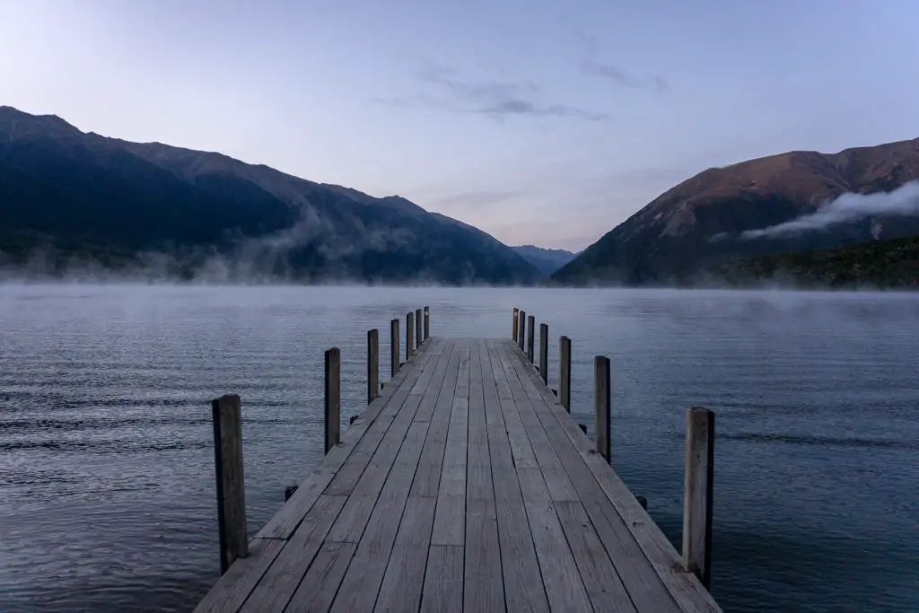
St Arnaud is the closet town to the trailhead, 1.5 hours away from Blenheim west along SH63, or 5 hours from Christchurch through Lewis Pass. St Arnaud is certainly not what you’d call a bustling metropolis, even by New Zealand standards. It’s nestled on the shores of Lake Rotoiti and has a petrol station (though you’d find cheaper fuel in bigger centres like Blenheim), a small general store for essentials, as well as a few places for dining and lots of holiday accomodation. Matt and I stayed at the Travers Sabine Lodge backpacker style, but there’s a whole range available from campsites to luxury accomodation.
There are plenty of hikes accessible from St Arnaud, so if you’re in the area definitely check them out. Included in these hikes are the several approaches to Lake Angelus. We opted not to take the Cascade route as it seemed more technical and infinitely more steep (and starts from a different point than the other two). Instead we took the popular Robert Ridge route on the way in, and because of bad weather, took the less exposed Speargrass route back out again to the same carpark.
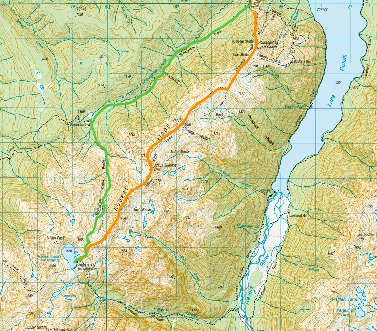
To reach the carpark for Robert Ridge and Speargrass routes to Lake Angelus, head left/west out of the township along SH63 for about 2km, then turn left onto Mt Robert Rd. Drive to the end of the road (which turns to gravel partway along) until you reach the Pinchgut carpark (there is a lower carpark for day walkers, keep driving until you’ve reached the main carpark for overnighters with a toilet and the end of the road).
Robert Ridge route
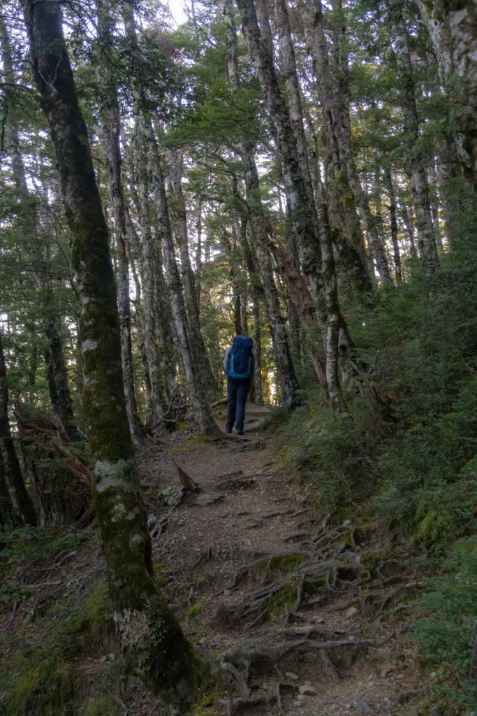
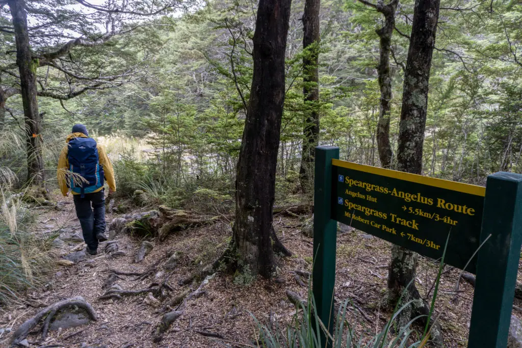
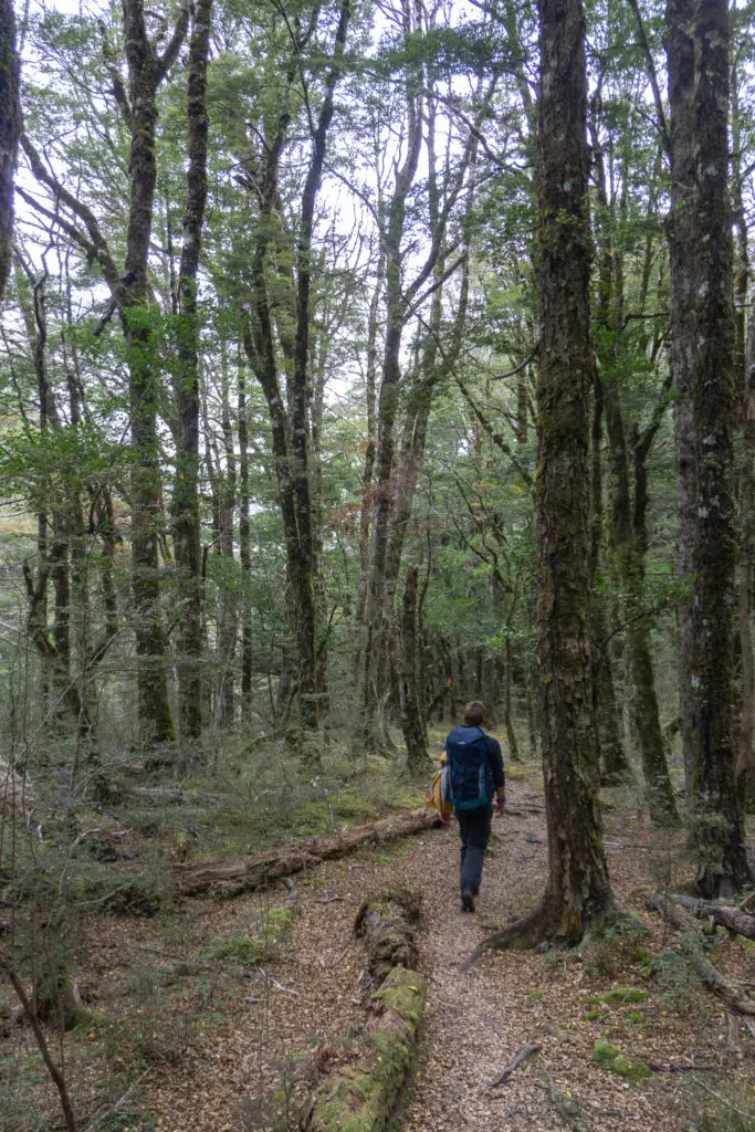
We started off before sunrise from the carpark, hoping to get some of the climb underway before the sun came up and made us pay in sweat for each metre climbed. The turnoff to Speargrass Track was just a few metres from the carpark. We continued past and soon started to climb relatively steadily up Pinchgut Track leading to Robert Ridge. Within a few minutes we were out of the beech forest and onto the tussocked slopes of Pourangahau / Mt Robert.
The bush-line on the side of Mt Robert that faces St Arnaud is abnormally low, due to a fire in 1887 that destroyed the native beech forest, as well as subsequent grazing, which has left the mountain very prone to erosion (there are photos at the local DOC visitor centre showing the passage of erosion over time). The trees are slowly returning, but the track still mainly meanders through tussocks with little shade.
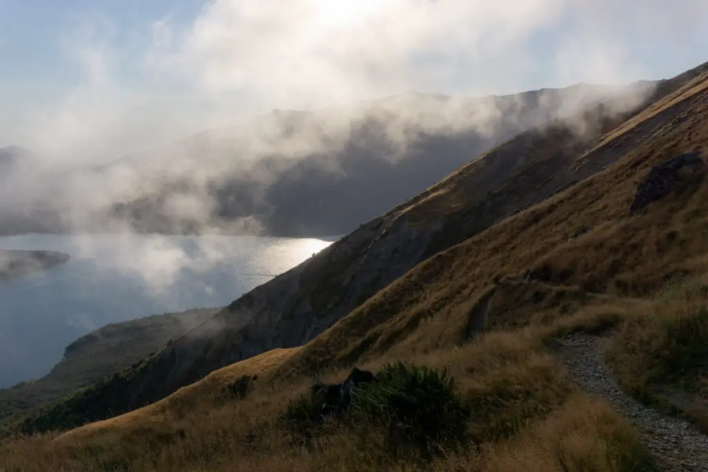
We zigzagged up the hill, as the sun rose and started to burn off the few clouds that were still lingering above the lake. The beautiful views of Lake Rotoiti and surrounding hills helped to take my mind off the steep climb, and we made sure to take a lot of breaks. I didn’t want to burn out by pushing the first hour too quickly; the majority of the elevation gain is done in this first climb up to the aptly named Relax Shelter (because from then you can “relax”?).
The last section of the climb up the face of Mt Robert is back into the bush, which was a relief with the sun starting to shine more intensely. I would definitely recommend starting early, as I wouldn’t relish climbing the steep north-facing exposed section with the sun already up.
Matt and I somehow missed Bushedge Shelter below the top of Mt Robert (is it still there?). We took some photos at the top of Mt Robert instead, and then pushed on to Relax Shelter, sitting above the true bush-line in the tussocks.
It took us about two hours from leaving the carpark to reach Relax Shelter, ~600m vertical climb, definitely not speeding. We had a sit down rest at Relax, closing the door to avoid the inquisitive bumble bee that kept trying to land on my blue merino tights. It felt like half of my chocolate was already eaten (because it was).
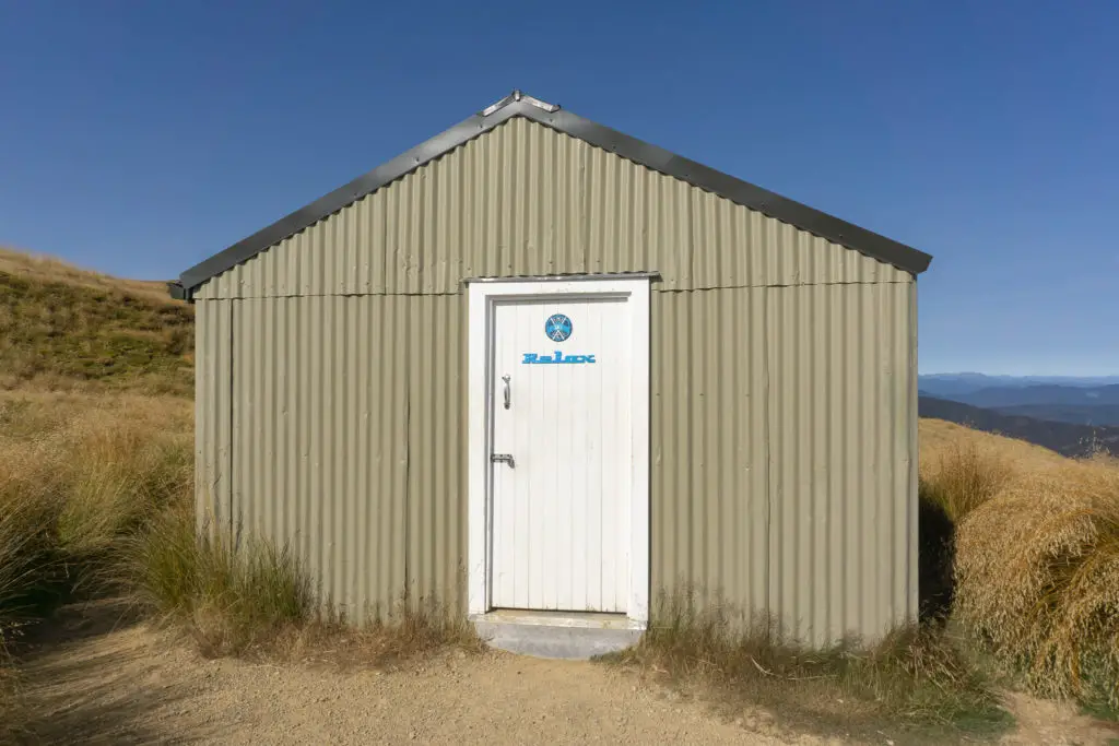

After relaxing at the shelter (see what I did there?), I ducked off into some rocks away from the track for a quick pee stop, having hoped there might be a long drop at the shelter. There aren’t any toilet facilities along this route (unless you go up the longer Paddy’s Track to Bushline Hut on the East face of Mt Robert and then rejoin Pinchgut just above Relax Shelter, and even then it’s still hours to Lake Angelus). So remember to dispose of your waste following the Leave No Trace principles.
We hadn’t seen anyone on the trail yet, so as we trekked along and up the ridge from Relax and the turn-off to Paddy’s Track, it felt like we were really alone in the wilderness. I looked across at the snow capped mountain ranges and felt my heart sing. It was so good to be back in the South Island. I hadn’t realised how much I’d been aching for the scenery until I was back.
We climbed steadily up from Relax Shelter, and soon spotted the first person of the day on the skyline behind us; a lady hiking all the way to Lake Angelus and back again in one day (there was another younger guy who passed us a bit later on doing the whole thing). More and more people are hiking distances like that in a day with little gear (most people aren’t able to carry much weight when doing such long distances quickly), which always makes the cautious part of me worry. I like to err on the side of being over-prepared (especially with chocolate supplies), but then I pay the cost of that with the weight of my pack.
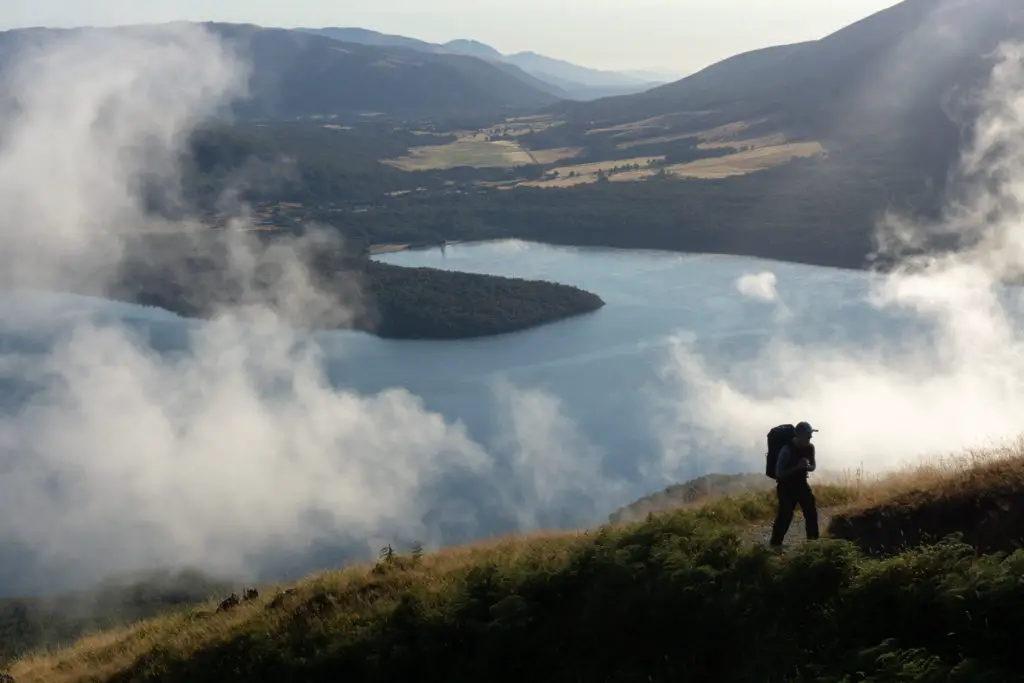
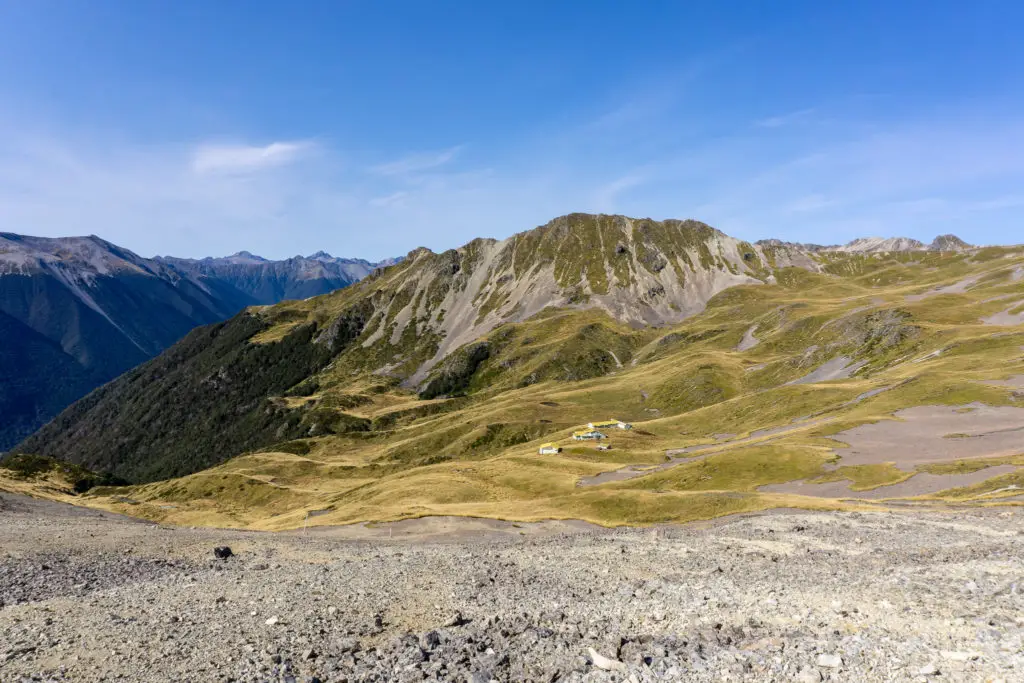
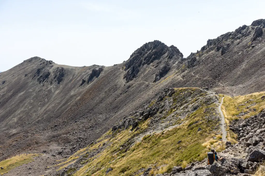
At the top of the short climb from Relax Shelter, we reached the first of many ridge traverses around beautiful alpine basins. This first basin had a smattering of buildings dotting its slopes, the remnants of an old ski field that’s sadly no longer operational (but not because rowing across Lake Rotoiti and then climbing up the mountain in darkness to reach it for every single ski trip was too difficult, oh no, it was apparently the lack of snow in recent years that was the issue. Skiers are a special kind of crazy).
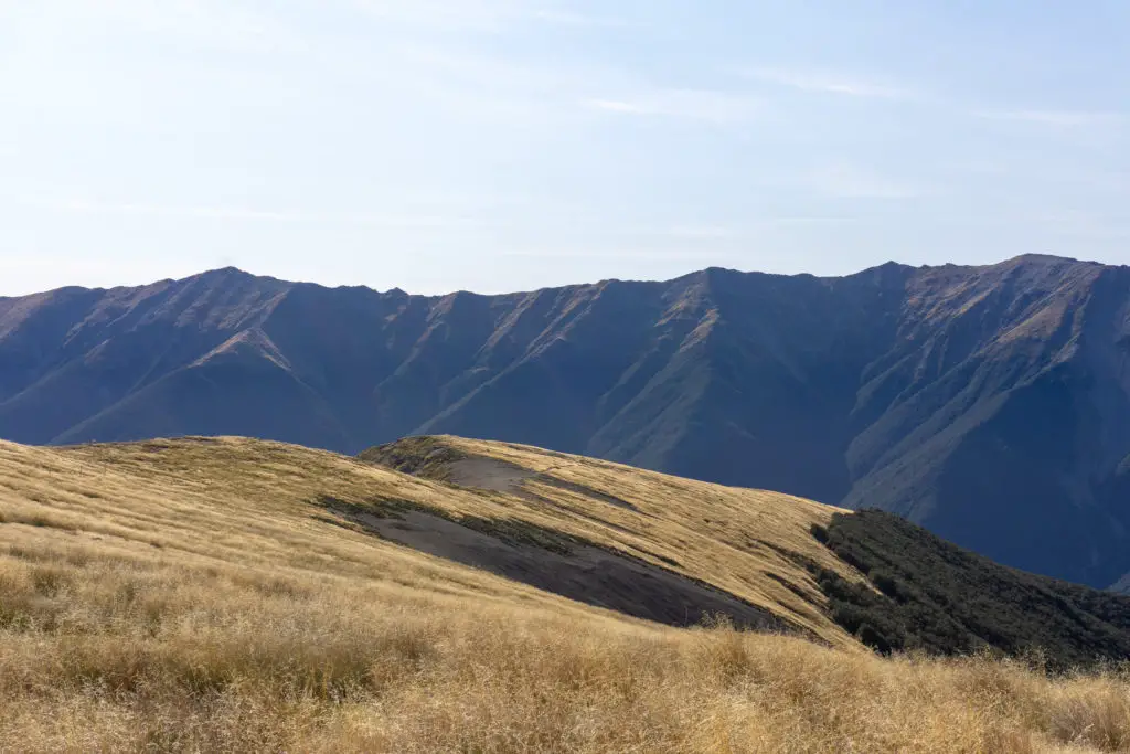
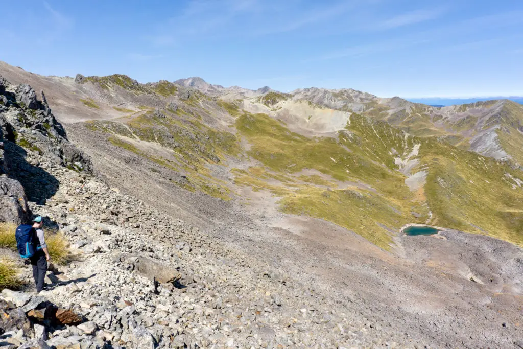
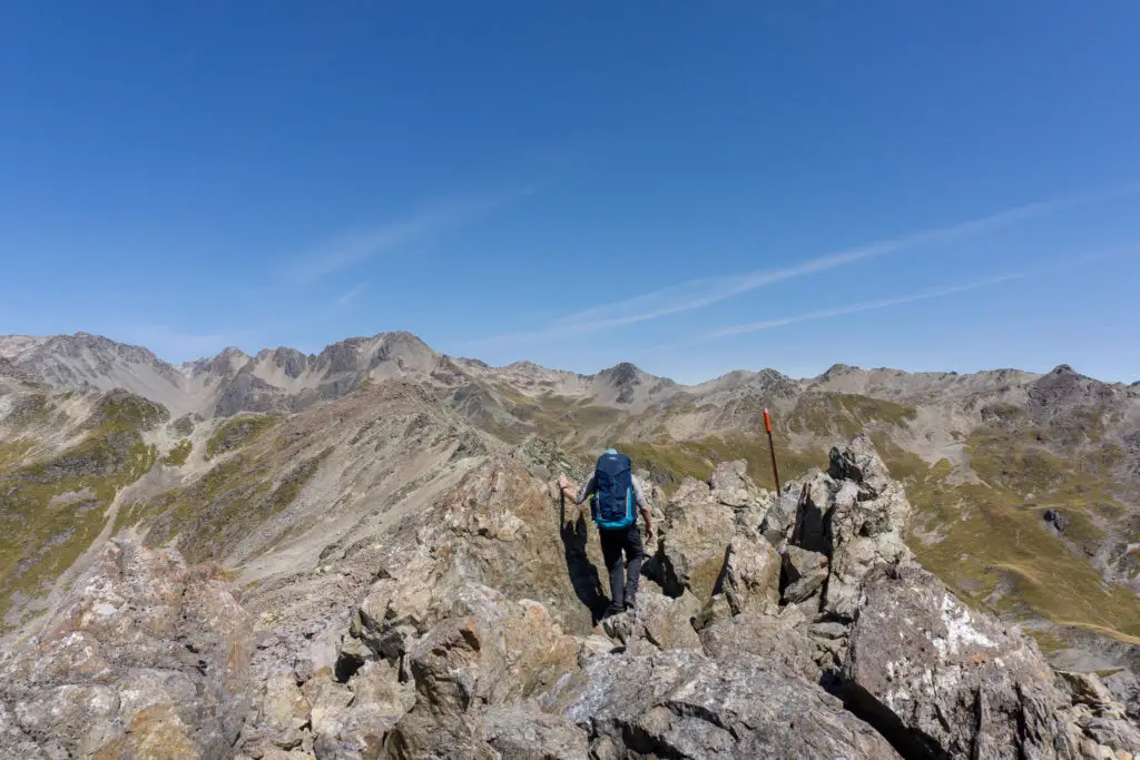
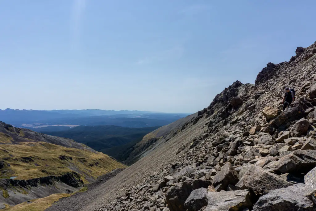
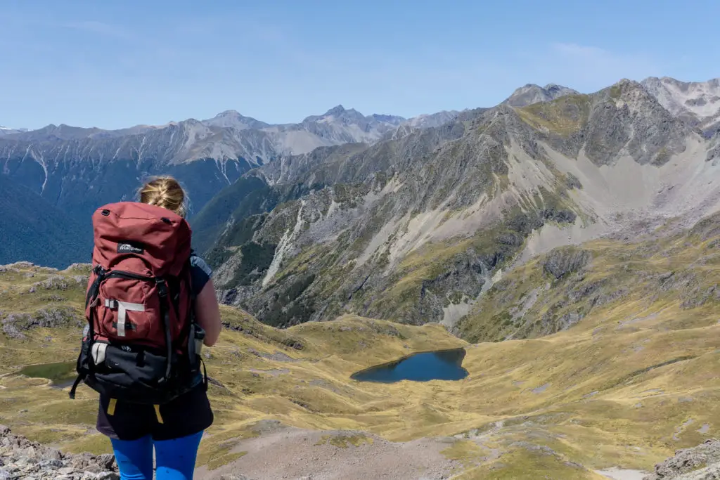
As you can see from the photos, the ridge was pretty flat and wide, with little exposure in terms of heights, however it would be extremely exposed in any type of bad weather, especially wind. Even in the sun it had started to get pretty warm, with no shade or water, so in either summer or winter you have to go prepared (especially as in New Zealand, summer can turn into winter in a matter of minutes, just to keep things exciting).
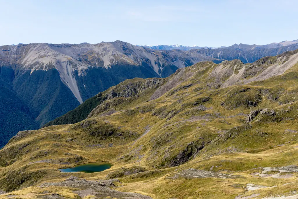
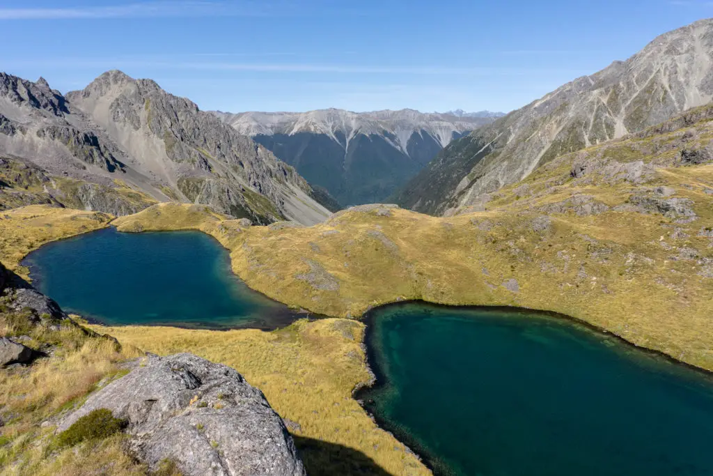
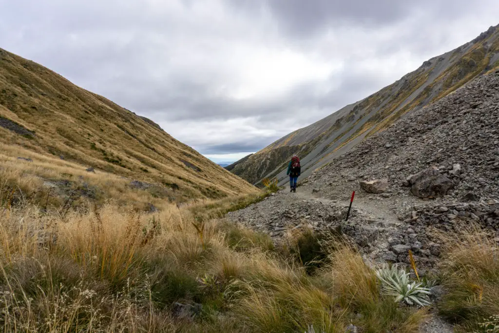
There were a total of about five basins that we walked around on Robert Ridge before reaching the junction with Speargrass route (unhelpfully Topomaps has some of them numbered on their map, but not all). All of the basins had beautiful views, it really felt like we were walking on top of the world. Some even had beautiful alpine tarns as surprise jewels.
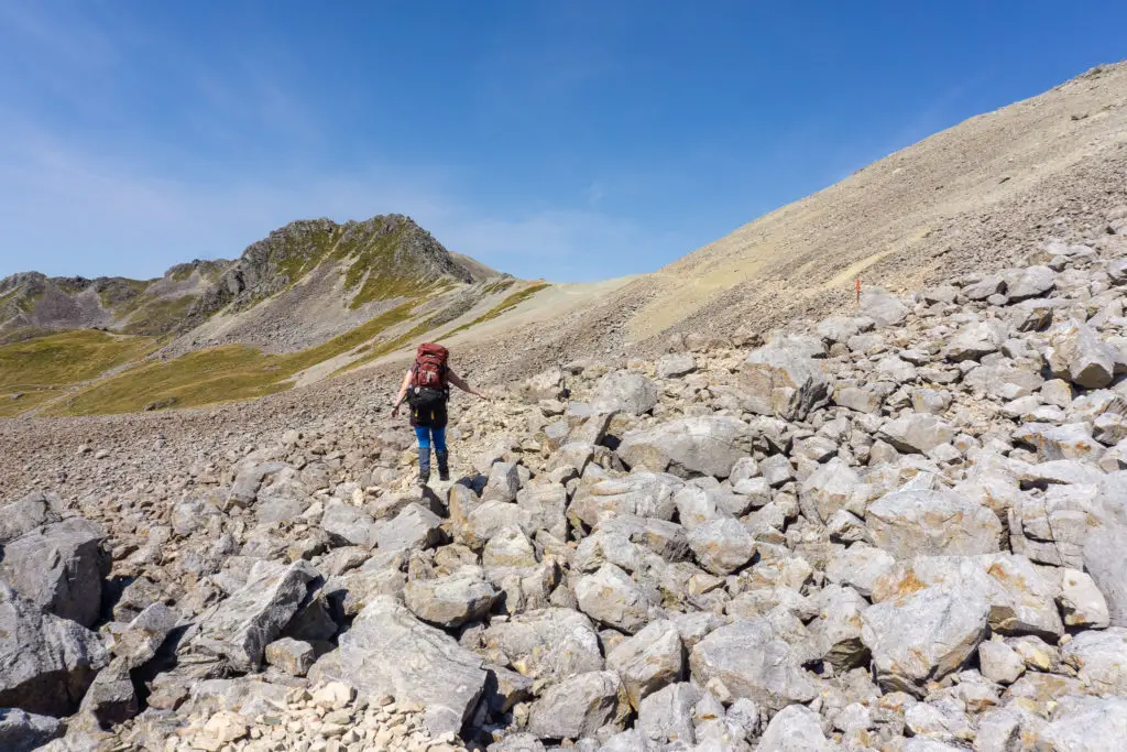
The second basin after the ski field had a loose rocky section as the track dropped below the ridge-line, but nothing too extreme. The orange marker poles were easy to spot and since it was late February, the summer traffic had worn an easily visible path in the scree. It was just a matter of watching your footing and looking ahead to make sure you didn’t wander too far off the marked route, although it was obvious in clear weather where the route went.
The third basin (and the first one on our right/to the west) was where the route started to get a bit more interesting. The path meandered steeply down to avoid steep bluffs, with some loose rock, but nothing too extreme here either, before evening back out onto flatter terrain.
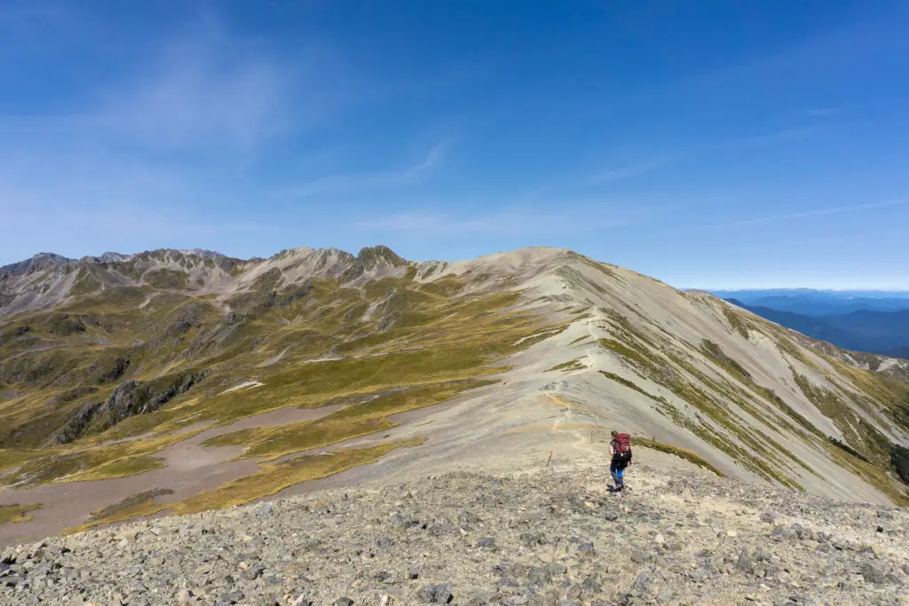
The fourth basin was the largest, and it felt like walking along it took the longest time (all about the distance and totally not about how much I wanted to get to the hut already). The first part was much like the rest of the ridge walking we’d already done, however soon the ridge became much narrower and the route started to veer off the ridge-line as it became impossible to walk along the top safely and easily.
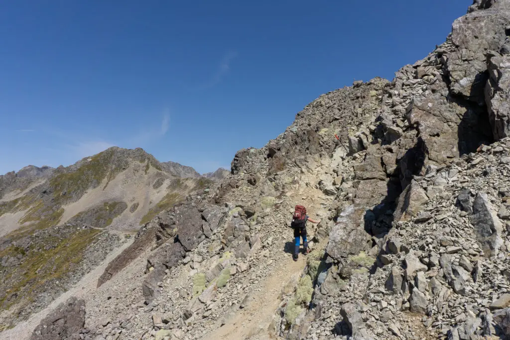
There was a bit of scrambling that was a bit exciting, and then we were back onto the ridge top again for a few moments, before dropping off to the right/west.
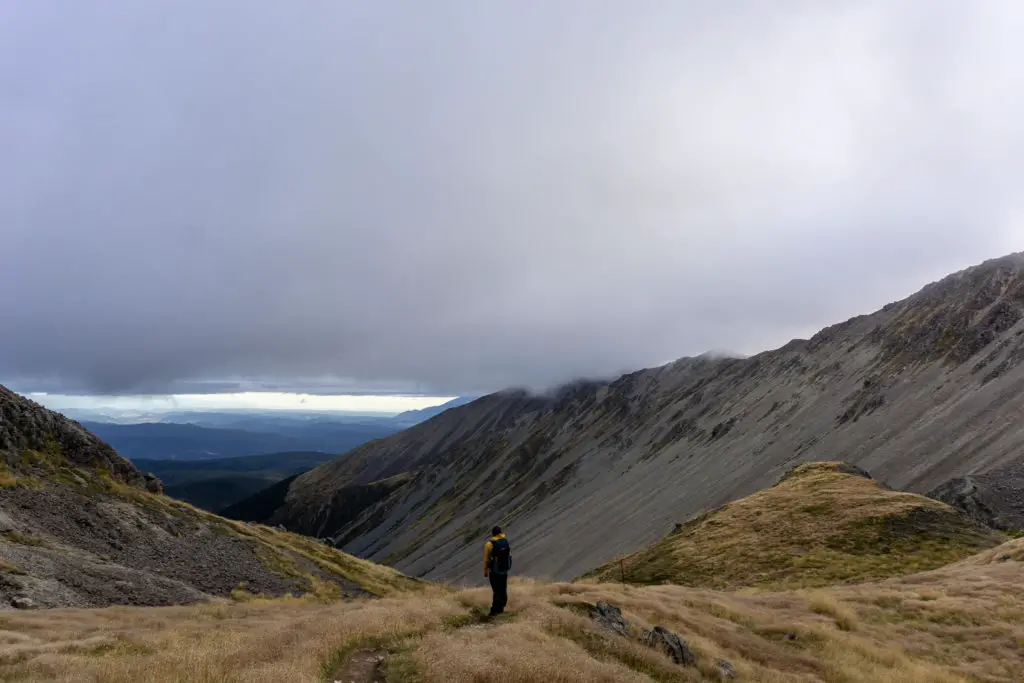
At this point it felt like Lake Angelus might be around the next bend or just over the next ridge. But it wasn’t. The scenery was still beautiful, but in every hike you reach the point where you just want to reach the damn hut already. Happily at this point we weren’t too far away, and we could distract ourselves by looking down into the valley below to spy the route we would be following the next day along Speargrass creek.
After dropping onto the right/west side of the ridge, another longer and steeper boulder field stood between us and the junction with Speargrass route. We picked our route carefully and took our time, as we didn’t want fatigued legs or ankles to step onto an unstable rock. This part and the preceding part of the tramp would be quite sketchy in snow and ice I can imagine, with a very steep and long drop-off to the valley below.
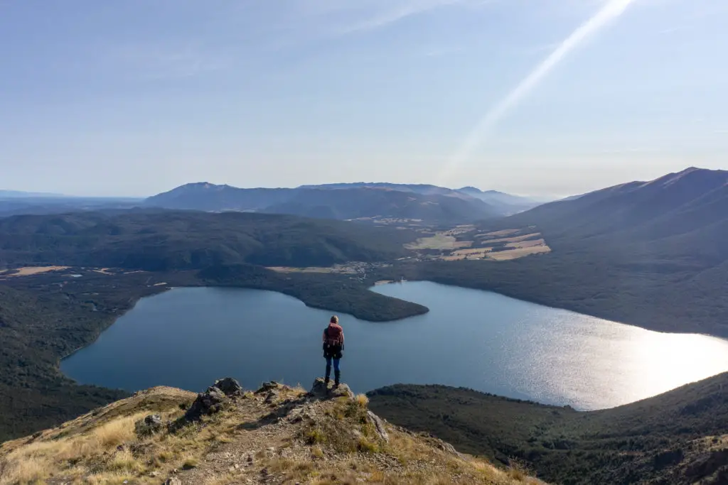
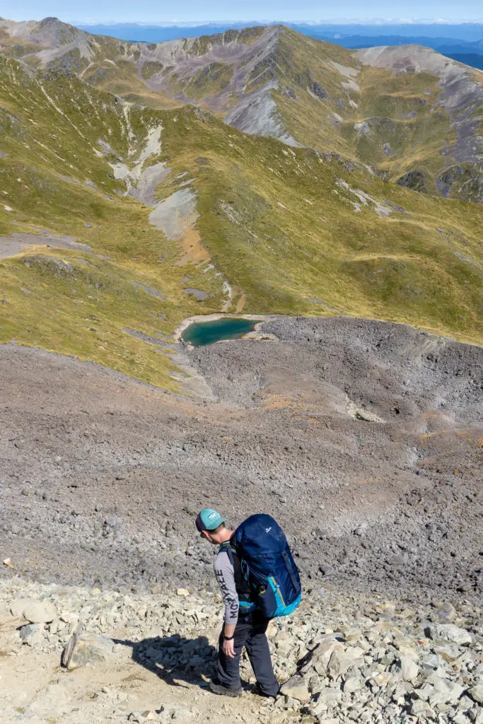
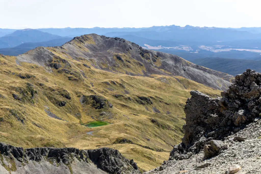
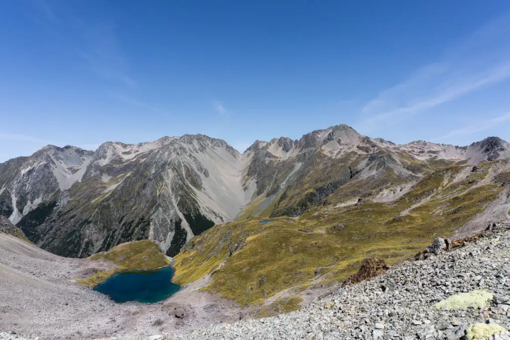
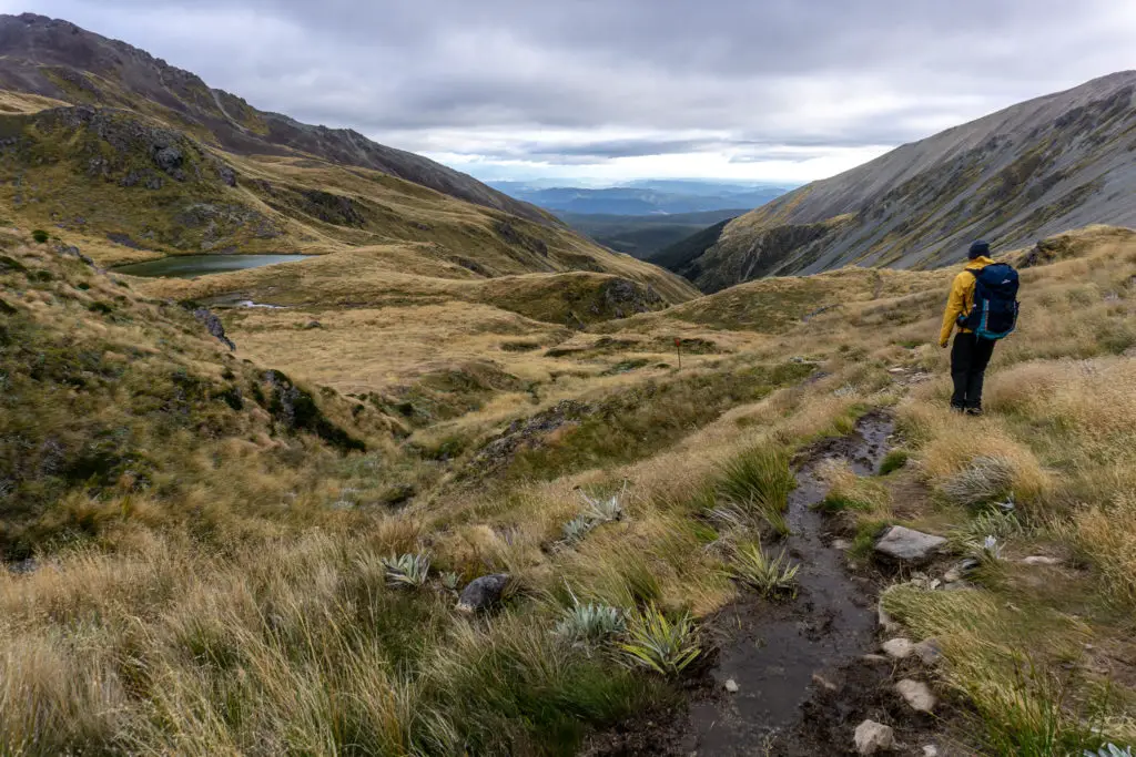
After we popped out of the rocks and back onto a lower ridge, the last and smallest basin on our left opened up to a beautiful blue tarn. Matt asked me if that was Lake Angelus, and I had to smile as I replied it wasn’t – I knew he’d be in for a surprise when he finally saw the lake that (I hoped) was just over the next ridge.
We soon passed the route leading off to our right down to Speargrass Hut, which we would take the next day back to the carpark. I knew from religiously checking the Topomap app on my phone that climbing the ridge in front of us should give us our first view of Lake Angelus, and then it should be a relatively quick climb down to the lake and hut. But then I saw a sign that seemed specifically placed to destroy trampers’ spirits, reading: “Lake Angelus – 30 minutes”. At this point we’d been walking (with quite a few breaks) for about six hours already, how could it be another 30 minutes? Had I misread the map that drastically?
Thankfully a five minute climb from that sign got us to the top of the ridge and revealed Lake Angelus in all its beauty. From the top of the ridge it was only a matter of following the marker poles along the ridge to our left and then scrambling down the slope. All up it only took about 15 minutes from the sign. DOC times, am I right? (Although I guess overall we were almost spot on with six hours to the hut).
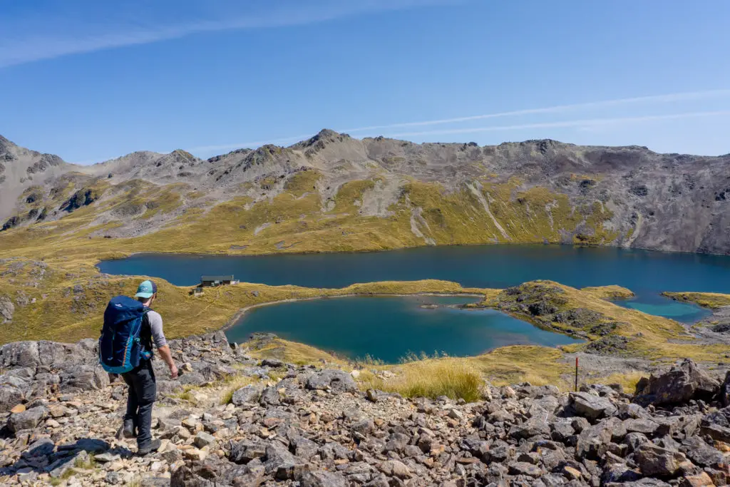
We’d set off early, so there were only a few other trampers already at the hut when we arrived; an Australian couple from Tasmania who were spending two nights and had climbed up Mt Angelus that morning, and another couple who’d hiked up and over from Hopeless Hut (what a name!). We claimed two bunk beds and talked with the others for a while (one of the things I love about tramping is the interesting chats with friendly people), while more and more people arrived.
Soon I was ready to do some exploring so we headed out to visit the nearby Hinapouri Tarns (along the route to Mt Angelus). Unfortunately, after walking for over six hours to get to the hut, Matt promptly slipped on the dry tussocks approximately ten steps from the hut and severely bruised his tailbone, poor guy. As the Australian couple could tell us (being chiropractors), the tailbone is an attachment point for many muscles in the back and leg, which twinged every time Matt was climbing, descending, walking straight, lying down, or sitting. He didn’t come all the way out to the viewpoint to Hinapouri Tarns, but he did go far enough at least to get a view while waiting for me to come back. Then it was back to the hut for dinner and sunset.
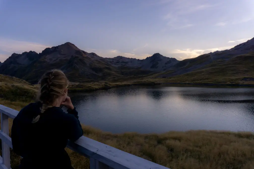
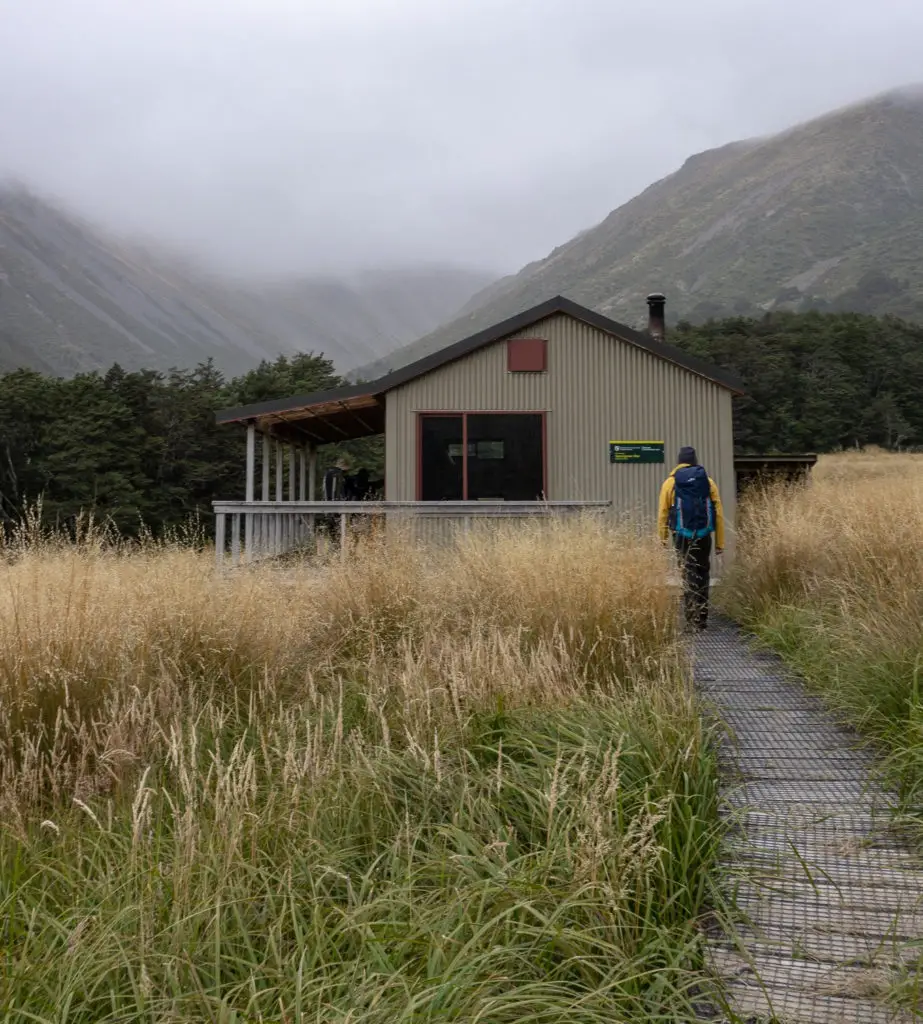
We cooked up our yummy freeze-dried meal for dinner, watched the sun go down from the expansive deck that wraps around the south and west sides of the hut, then played cards by lantern light, chatting with the other trampers, until we got sleepy enough for bed. The hut was completely booked out (not uncommon seeing as it’s the most popular hut in the Nelson Lakes area) so it was quite noisy and warm. Luckily we’d brought ear plugs, which we used to good effect.
Speargrass route
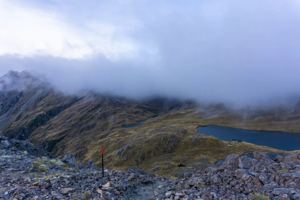
We woke early the next morning to the forecasted low cloud, dulling the weak pre-dawn light, and swirling around the hut, blocking our view of the lake that was literally on our doorstep. We quietly got up and had some breakfast (porridge for me, breakfast biscuits for Matt), staring mesmerised at the different shapes and patterns the cloud made as it flowed past the windows of the hut. The weather didn’t look like it was clearing, only making itself comfortable, so we grabbed our gear out of the bunk room as quietly as we could and started to bundle it carefully into our packs in the common area.
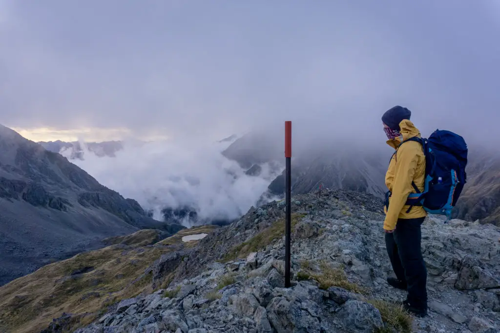
We hit the track before 7.30am, wanting to get well and truly on our way before the rain that was meant to be arriving from midday. Once we got up onto the ridge above the lake, Matt and I were quite happy to have made the decision to head out via Speargrass Route rather than back along Robert Ridge the way we’d come in. Speargrass was much more sheltered, although with unbridged stream crossings, and the last few hours of Speargrass was through bush rather than along the tops. The wind was picking at our packs and clothes on the ridge, and nasty looking clouds were coming in from the south over the mountains. It was time to leave.

At the “30 minutes to Lake Angelus” junction, we turned left and headed down the valley towards Speargrass Hut, after watching the foggy clouds literally streaming past us over the saddle and disappearing down into the valley. It was a relief to get out of the wind below the ridge and take off our warmer layers. We saw a few people from below heading along the Robert Ridge route, and I didn’t envy them a six-hour trip with little shelter from the wind.
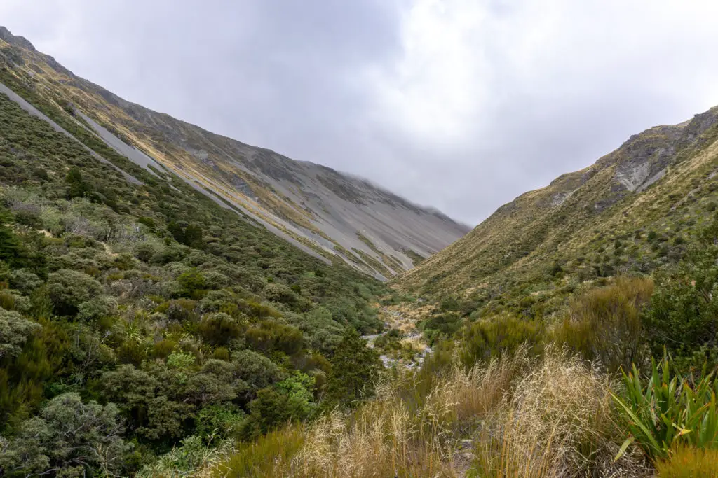
The valley was quite beautiful and rugged, especially with the low clouds creating an artificial ceiling. Once again, it felt like we were the only people around for miles. There were orange-tipped poles roughly marking the route, but we followed the worn path through the tussocks more than anything. The light kept changing between orange and blue tinges depending on the cloud layers streaming over the saddle, so the atmosphere oscillated between summer sunrise to cold winter morning every few seconds.
The track meandered its way through the tussocks on the left hand side of the wide valley, before it narrowed somewhat and descended steeply on the true right of a small waterfall. It was quite boggy in this area, and a bit slippery, despite not having had much rain this season, so I can only imagine that in winter or after rain, this wouldn’t be the most fun climbing up or down.
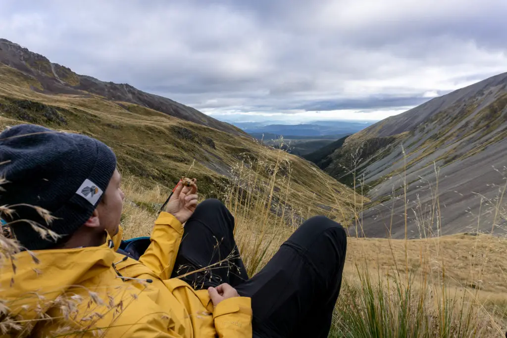
Below the waterfall we sat for a quick rest out of the wind and a bite to eat. My phone vibrated in the pack (I’d been using it to take photos), we had cell service again somehow in the valley. I checked Facebook to make sure the world as we knew it hadn’t ended while we were away (millennial, I know), then promptly turned it on to flight mode.
As we continued to descend, the valley floor narrowed until it was essentially just the stream. There was a short steep scree scramble just before we reached the stream proper, involving hands and butts for stabilisation.
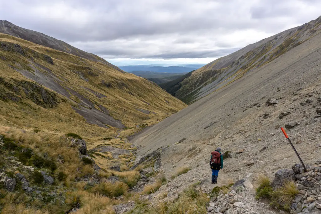
Soon the track was meandering next to the stream, crossing it numerous times. We easily kept our boots dry with the early crossings. But the stream got steadily larger until we were forced to stop and investigate which rocks we wanted to hop onto before crossing.
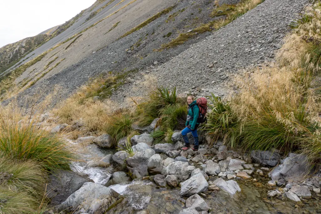
The older couple we’d played cards with the night before soon caught up to us. We stood contemplating the incoming rain with them for a few minutes, before agreeing to catch them up at Speargrass Hut for lunch. I envied the lady’s poles, which would have made rock hopping and stream crossings a tad easier.
We continued to follow the path marked by orange-tipped poles, which lower down were essentially fully in the stream bed – not great if it was flooding. The last two stream crossings were more interesting again. I managed to get across with dry boots by picking my rocks carefully and stepping quickly. Matt unfortunately did not, and the last crossing he gave up altogether on having dry feet and just waded across.
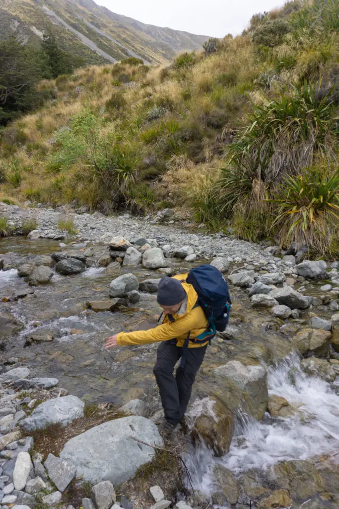
I was so busy taking photos of Matt’s disastrous crossings that I left my beloved beanie behind at one of the stops. Hopefully someone else picked it up and gave it a good home. After these crossings we climbed up out of the stream bed and into the bush. It made it feel like we were really close to the hut, but in reality it was still another 20-30 minutes from this point.
The first spits of rain were just starting to patter on our rain jackets as we reached the sign heralding the junction with Speargrass Track (rather than the route we’d been on). Instead of turning right and continuing on to the carpark straight away, we turned left and climbed five minutes up to the hut for a sit down rest out of the shower.
The couple who’d passed us were already settled in making lunch and hot drinks. We joined them for a very early lunch (10am) as we knew we wouldn’t likely stop on the way back out to the carpark long enough to eat a decent meal, especially with more rain forecast. The shower didn’t stay however, and while it wasn’t clear skies, it was no longer raining. Matt and I used the facilities, before heading back out again, leaving the older couple to hang out at the hut.
We popped back down to the junction with the track and the route up to Lake Angelus, and crossed the stream – this time on a bridge, to Matt’s delight.
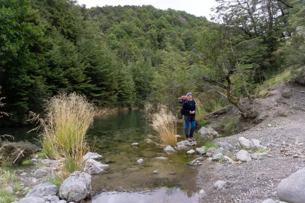
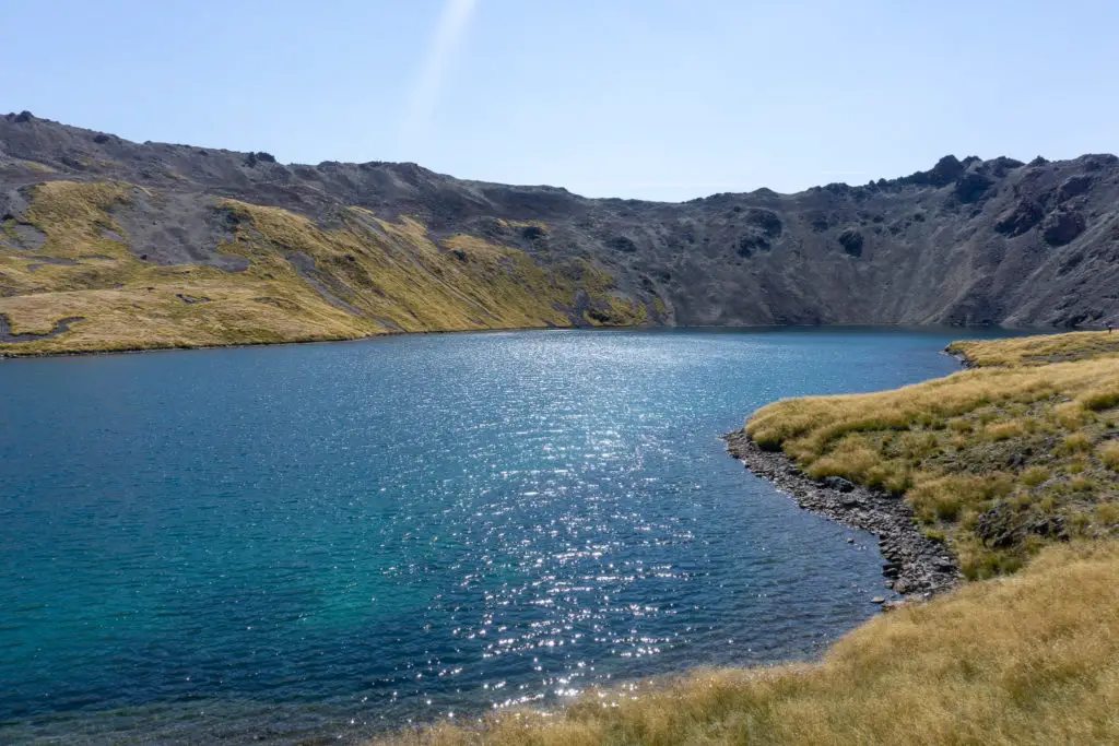
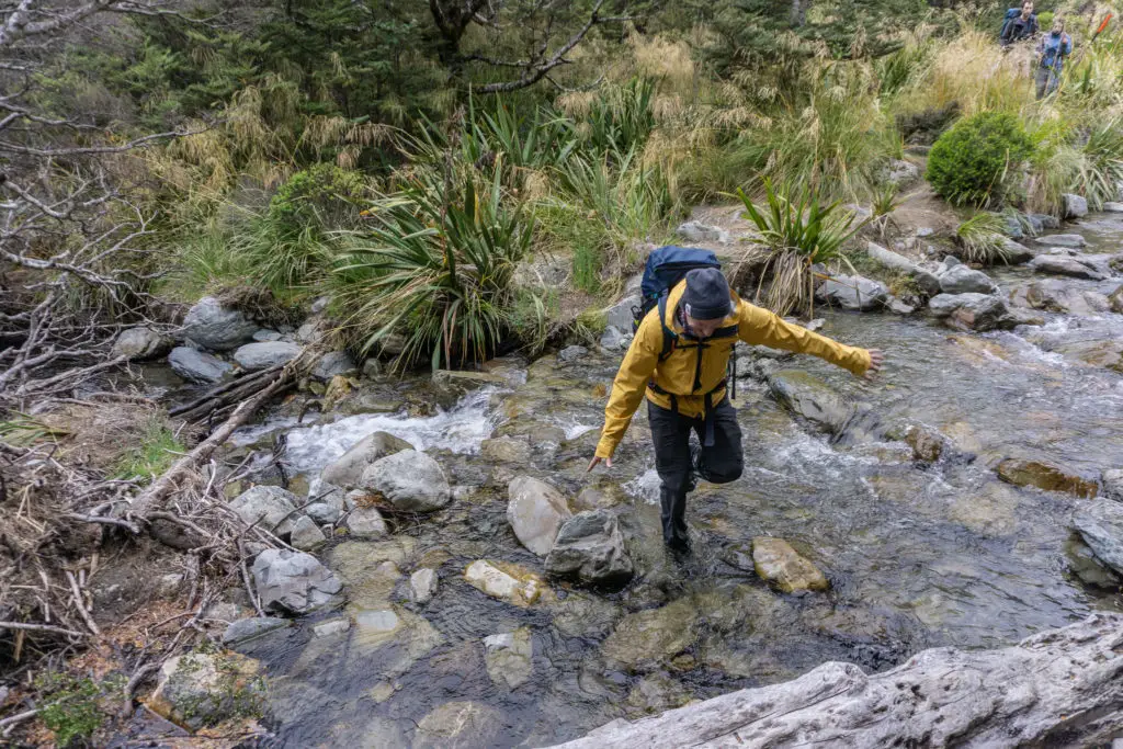
The track was well-formed now with only one optional river crossing (pictured below) that we took and still managed to keep our boots dry (so I’m not sure if I can really call it a “river” crossing). The track meandered through the beautiful beach forest, staying mostly level for the first half hour or so and traversing across the slope, before descending back down to Speargrass Creek. We walked along Speargrass Creek for what seemed like forever (reality: probably only 40 minutes), before reaching the flood diversion & stream crossing. Since the stream wasn’t high, we didn’t opt for the steep detour up and around the slip, and instead hopped across the stream and back again with well-placed rocks to keep our feet dry (Matt didn’t fall in this time, bonus!).

The profile map on the DOC website would have you believe that the last hour of Speargrass Track has a very minimal ascent on the way out. I’m here to tell you that’s a disgusting untruth. The last climb is roughly 100m of elevation gain in an hour. It is definitely noticeable.
Luckily the couple we’d left back at Speargrass Hut had warned us (they’d stayed the night before Lake Angelus at Speargrass Hut from the carpark). So we knew that once the track left the stream, we were in for an hour of uphill again. Not the most fun to finish on!
We almost didn’t spot the carpark until we stumbled into it, joining up the Pinchgut Track a few metres before. All up it had taken almost six hours to reach the carpark, with a good break at Speargrass Hut (about 3 hours from Lake Angelus to Speargrass Hut, and just over 2.5 hours from Speargrass Hut to the carpark).
Gear List
Clothes:
- 1x warm beanie (RIP beanie)
- 1x wind- and water-proof parka/jacket
- 1x warm fleece
- 1x long sleeved merino top
- 2x moisture wicking singlets/t-shirts
- 1x sports bra
- 1x pair of warm gloves
- 2x underwear
- 1x merino tights
- 1x shorts
- 1x fleece pants (for the hut, and an emergency layer)
- 1x windproof overtrou
- 2x warm, thick socks
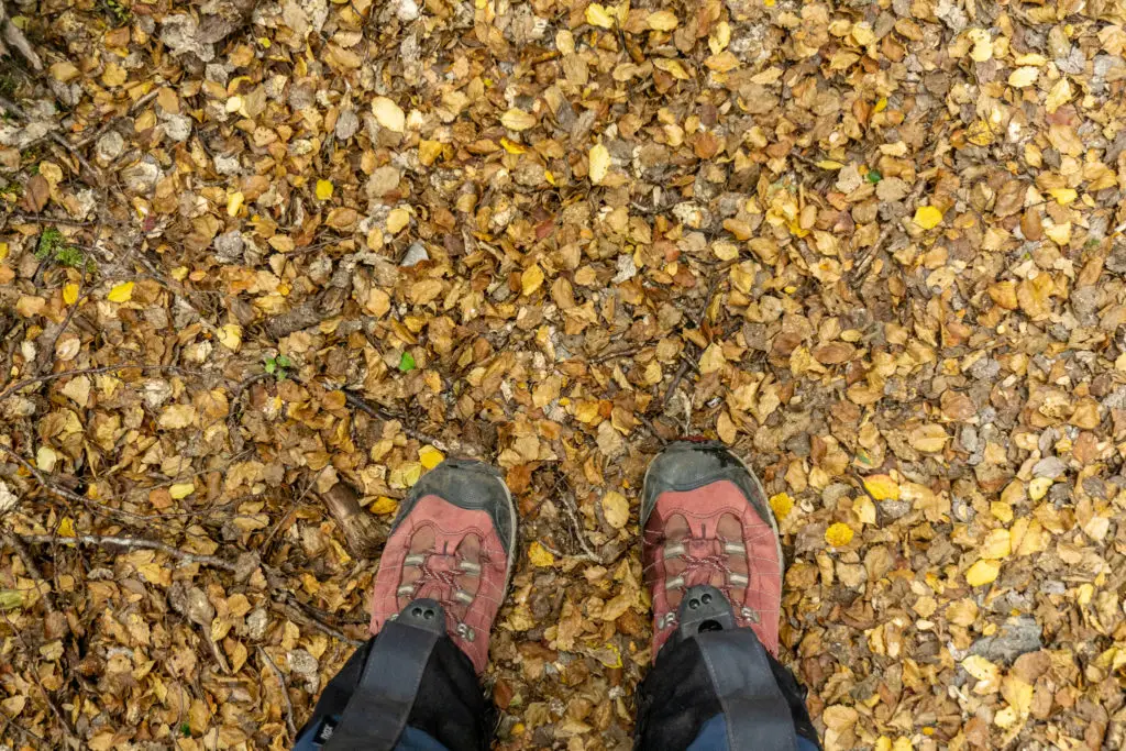
- 1x pair of sturdy, waterproof boots
It’s important to have a few good layers and to know how to use them to stay warm, but not overheated (and sweaty).
Food:
- 2x dehydrated meals from Back Country Cuisine (for dinner + one emergency one)
- Crackers + soft cheese mix for lunches (Matt also brought some salami to go with his)
- Lots of chocolate, OSM bars, honey roasted peanuts, more chocolate, and fruit puree pouches for snacks
- Porridge + milk powder for breakfast
I always take more food than I think I need in case I get stuck and need to spend an extra night out than planned.
Gear:
- Pack
- Gaiters (helpful for keeping loose rocks out of my boots along Robert Ridge, and the wet tussocks off my legs on the way back down Speargrass) – plus can you really call yourself a Kiwi tramper if you’re not wearing the gaiters + shorts combo?
- Sleeping bag + liner (liners are much easier to wash than sleeping bags)
- Gas stove + billy + matches
- Bowl and spork each
- Headtorches + collapsible solar lantern for the hut
- Earplugs for the hut (indispensable)
- First aid kit with emergency blanket
- PLB
Safety
As always, please stay safe when you’re out exploring. Follow the Land Safety Code:
- Choose the right trip for you (read my article on tramping safety, speak to DOC)
- Understand the weather (especially important when you’re heading up into such exposed terrain for a long period of time)
- Pack warm clothes and extra food (including windproof and warm layers, regardless of how nice the day is when you set out, as well as lots of water and food. Check out my post here about what gear you need to take)
- Share your plans and take ways to get help (have an emergency beacon on your person and leave your intentions at the St Arnaud Visitor Centre)
- Take care of yourself and each other
This is only a walk in the park if you’re adequately prepared, in terms of both fitness and gear! If you’re not feeling super confident then you can always get in touch with me here on the blog or on my Instagram. Or take a look at my Tramping 101 series which includes this post about how to stay safe in the outdoors.
Also don’t be a dick, check out my guide to New Zealand tramping etiquette.
Stay safe and get outside!
Were planning our trip to the hut soon & this blog has been amazing to read through and prepare for the little things we didn’t expect. Thank you!
It’s an amazing trip, have the best time! If you have any questions don’t hesitate to get in touch. And don’t forget to check in with the DOC visitor centre on your way past.