Emily Pass is a rewarding but challenging side trip / alternative route on the Routeburn Track spanning some of the best scenery in Fiordland and Mt Aspiring National Parks.
Start: Routeburn Shelter, trailhead of the Routeburn Track near Glenorchy
End: Lake Mackenzie Hut on the Routeburn Track
Length: 15km with 1,300m elevation gain / 700m loss
Difficulty: difficult
Time taken: will be entirely dependent on fitness and experience due to the steep ascent and route-finding. We took 9 hours total (including breaks) for the ascent to Emily Pass and 4 hrs for the descent to Lake Mackenzie, split over two days. Fitter people who are used to travel over rough ground and snow slopes would be a lot faster and could complete this in a day.
Facilities: long-drop toilets at the trailhead, as well as on the way to Routeburn Flats Hut. Both Routeburn Flats and Lake Mackenzie Huts have toilets, water, a fire, and bunk beds. During the summer Great Walks season (October – April) the huts have flushing toilets and cooking gas + burners, but require online bookings.
– Important: this is a backcountry route that involves route-finding, as well as scrambles up near vertical rock faces and only slightly less vertical slopes of snow grass. Snow and ice can be present on the south face of Emily Pass well into late summer, depending on the conditions. Appropriate gear (e.g. crampons and ice axe) and backcountry experience is essential to safely complete this route. –
How to get to the trailhead for Emily Pass?
The trailhead for Emily Pass is shared with the Routeburn Track; either at the Routeburn Shelter, near Glenorchy, or the Divide on the Milford Road. The Routeburn Shelter is a half hour drive from Glenorchy at the head of Lake Wakatipu, or an hour and a half drive from Queenstown. The Divide is on the Milford Road, about an hour’s drive from Te Anau.
Here are some other nearby adventures you might like:
Hike the “finest walk in the world” through the depths of Fiordland National Park. Here is my step by step guide with everything you need to know about the Milford Track.
Get away from the hustle and bustle of busier tracks in Mt Aspiring National Park and experience mountain views and tarns in tranquility, right off the Routeburn Track.
Which direction to climb Emily Pass?
The recommended direction of travel over Emily Pass is north to south (Routeburn Flats – Lake Mackenzie). This is because it is easier to climb up the steeper north side of Emily Pass (Routeburn valley side), rather than climb down.
Why climb over Emily Pass?
At the start of November, my husband, Matt, and I had taken a week off from our jobs to escape the world and go tramping. Our friends Hamish and Ashley suggested going together on a trip over Emily Pass; a backcountry route off the popular Routeburn Track. It meant we could do the Routeburn Track as a loop rather than a one-way trip, solving the transport issue. Plus there were meant to be gorgeous views from the pass. But it was definitely going to be a challenge (at least for me).
I did some research and found two helpful websites – routeguides and tramper. I also spoke to my mum, who had been over Emily Pass before I was born. She maintains that she has a fear of heights, and didn’t remember anything too sketchy about the climb. But after my experience, I would like to contest her definition of “heights” and “sketchy”.
I was nervous about doing a trip that would likely be amongst my most challenging tramps. But after chatting with Hamish (an experienced tramper and ski patroller), and looking at recent photos of the snowline (as well as the Harris Saddle webcam), I thought it was doable for me.
Due to the prolonged lockdown in Auckland, there were a lot of booking cancellations on the Routeburn Track, so we managed to score tickets to Lake Mackenzie and Routeburn Flats campsites just a few days out from the weekend (not that we ended up using them, *face palm*). It was on!
Emily Pass Route Guide
N.B. I use the standard terms “true right” and “true left” in this guide when referring to rivers and creeks. These indicate the side of the river when looking downstream.
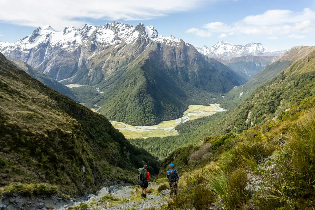
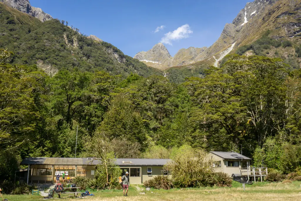
Our trip started with mandatory coffees and snacks from Mrs Woolly’s in Glenorchy, where we met Hamish and Ashley. Once fuelled up, we drove to the Routeburn Shelter and walked a quick two hours along the Routeburn Track to Routeburn Flats Hut.
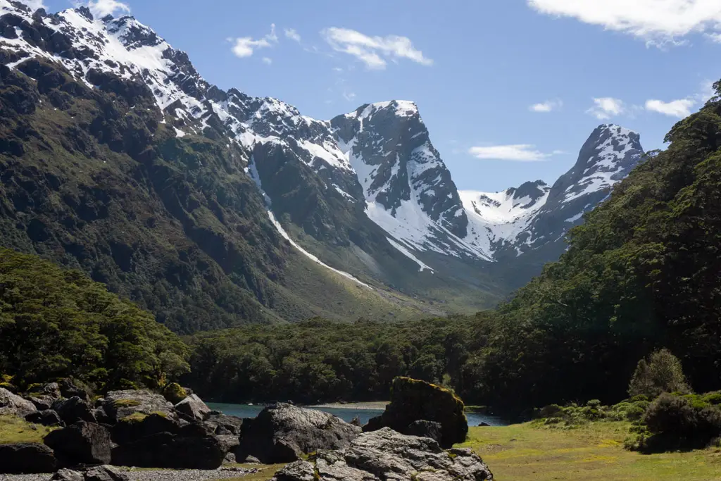
We’d started out a little later than planned, so ended up having lunch at the hut. We sat at the picnic table by the river, looking up at Emily Peak high above us and pointing out where we thought the route might be. It looked very far away and steep. I’d had a knot in my stomach since we’d decided to tackle this route. Part nervous-excited. Part nervous-terrified.
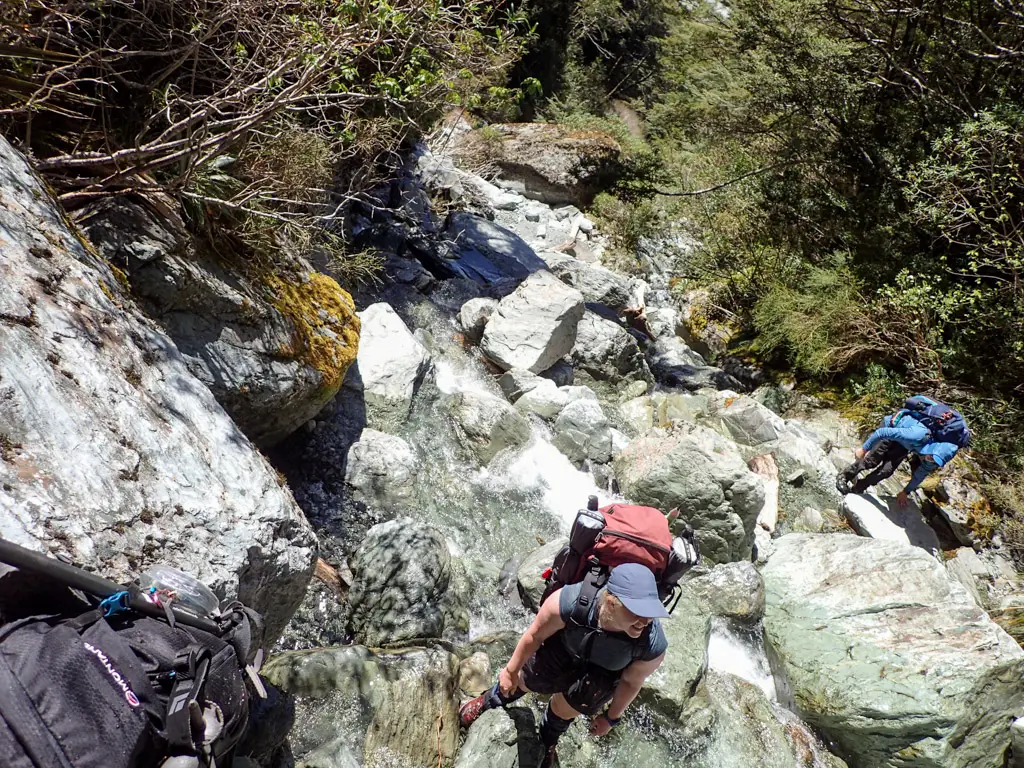
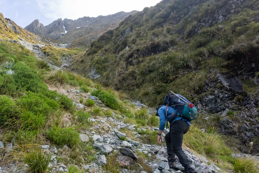
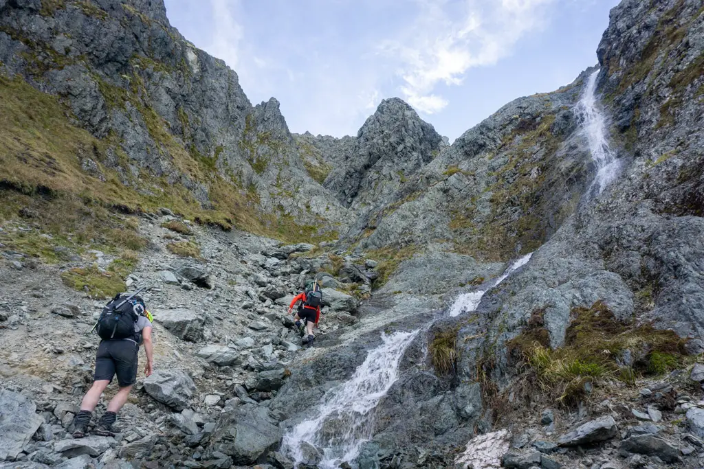
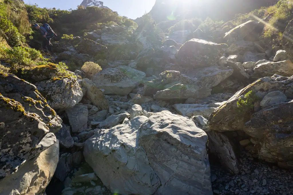
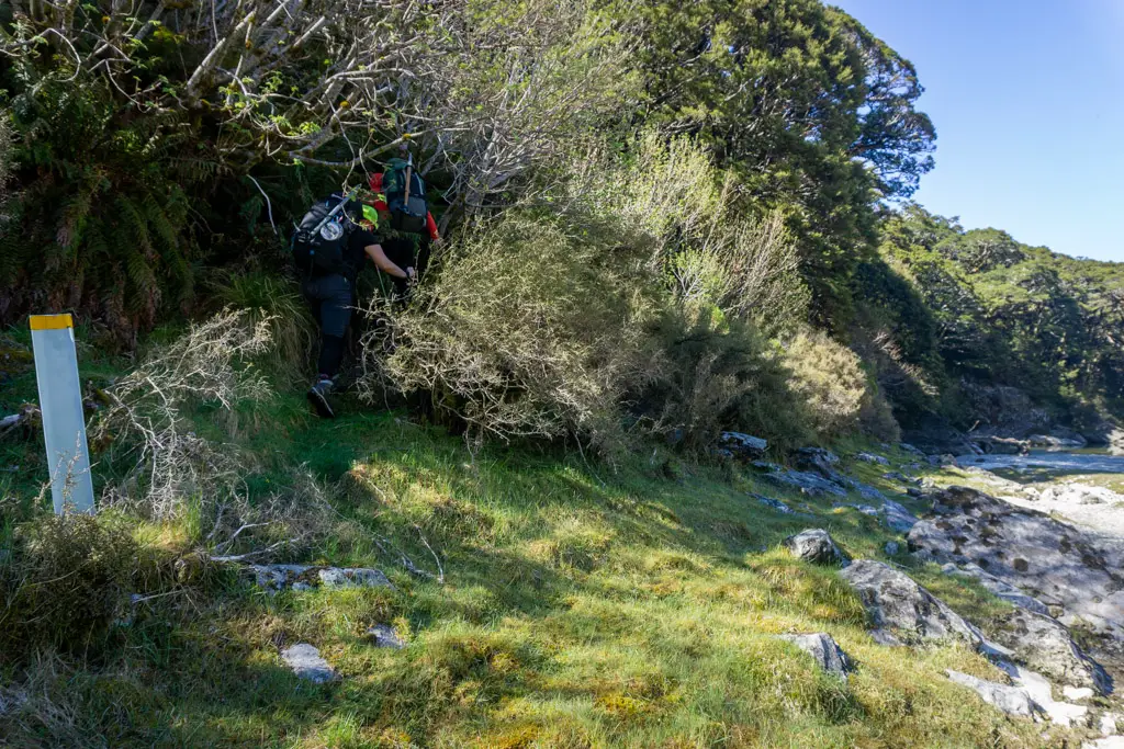
The route over Emily Pass starts from the Emily Creek bridge, which is halfway along the uphill between Routeburn Falls and Routeburn Flats Huts. It then follows the stream up, pretty much directly in the water, climbing up steep boulders and avoiding short waterfalls and pools.
The first start
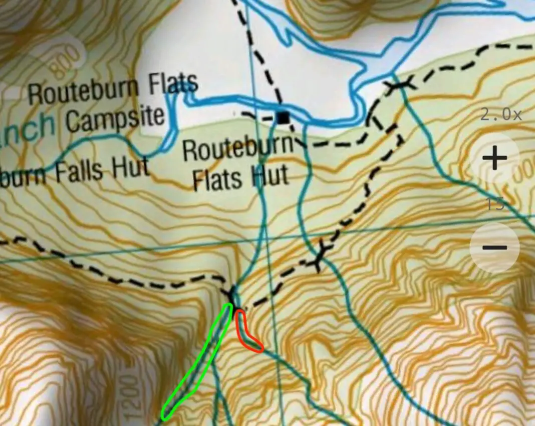
Our problem was locating which stream was Emily Creek. On my topomap app, there were two bridges between the huts (pictured below). So when we arrived at the second bridge, we automatically assumed it was Emily Creek.
Spoiler: it wasn’t Emily Creek.
But that didn’t stop us from bushbashing up the creek bank through bushlaywer and very steep terrain for about 40 minutes, until we realised our mistake (read: looked up and tried to recall if the guide had mentioned anything about a 20m+ high waterfall we had to climb up. No, no I didn’t think it had).
You can see the steep contours on the topomap at 1000 – 1100m elevation. Ain’t no way we were making it up that. By the time we popped back out onto the Routeburn Track (which felt like a highway after the bush we’d been through), my legs were cut to shreds and we’d wasted an hour’s daylight. A fantastic start.
We discussed the merits of continuing versus heading back to the car and trying again another day (considering it was now 1pm and we hadn’t even found the correct route). But all of us voted to keep going and at least find Emily Creek for future trips.
Continuing up the track from the second bridge, we found another bridge hidden immediately around the next corner of the track. I felt cheated. Hamish, who had climbed up Emily Pass years ago, felt strongly that this was Emily Creek. Finally! Some success and certainty.
The second start
Ha, or so we thought.
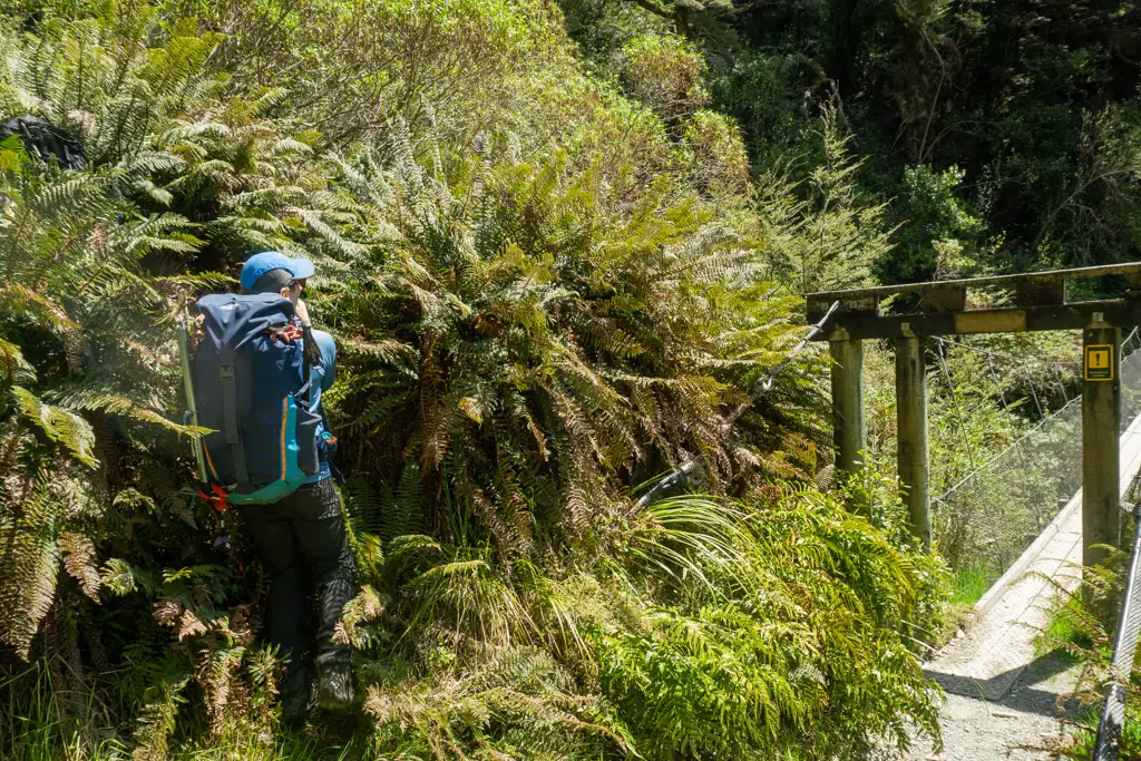
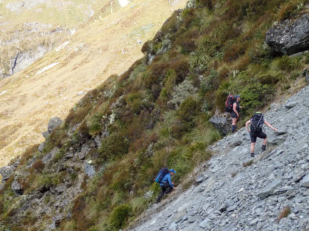
I watched as Hamish, Ashley and Matt were one by one swallowed by the curtain of ferns on the true right bank. The ferns were so tall they reached over our heads, but we quickly popped out of them and into the stream bed.
The route guides I’d studiously poured over before the trip had obviously been written prior to the 2020 flooding in Fiordland (the ones that had taken out Howden Hut on the Routeburn Track). The guides recommended sticking to the true left of the stream. But we found the going easier on the true right, which was our mistake. At some point, and I’m not entirely sure when, we realised we were in the wrong stream.
Again.
I wish I was kidding.
Travelling up the true right of the stream, we’d missed the branch coming in from the true left. This was the stream we were meant to follow, but which wasn’t specifically mentioned in the guides (since we were meant to be travelling up that side anyway).
Luckily, Hamish had caught this mistake early enough (read: before we reached the inevitable cliffs and waterfalls). We could bushbash up and over the bank through some relatively steep terrain, and drop down into the correct stream branch, rather than having to retrace our steps yet again.
We had another discussion about continuing, as well as if we continued what our trigger points would be for turning around. But we were feeling good despite the false starts, so we kept going.
The third (and final) start
Once you’re on the correct route, you’d expect the going to get easier, right?
Well, in the case of Emily Pass, you’d be wrong.
But, on the positive side, at least we were finally in the correct place. We continued to climb directly up the stream, which no longer had much flowing water, just lots of boulders. At one point, I thought I heard a voice above me – which normally wouldn’t be odd, but when you’ve said goodbye to civilisation hours prior, you don’t really expect to hear voices. And then we saw movement above us, coming in our direction.
Two men with calves like giant avocados and skis strapped to their packs were clambering down the boulders high above us. I thought they were a little mad – I still don’t know how they managed to climb down with skis on their packs stretching down to the knees. And I think they thought we were crazy, because we still had so far to go given how late in the afternoon it already was (4pm by that stage I think).
They giant calf men had walked up from the Divide, made some tracks on snow on the south side of Emily Peak, and were walking out to Glenorchy. You know, just a completely normal trip. It made us seem like sane people.
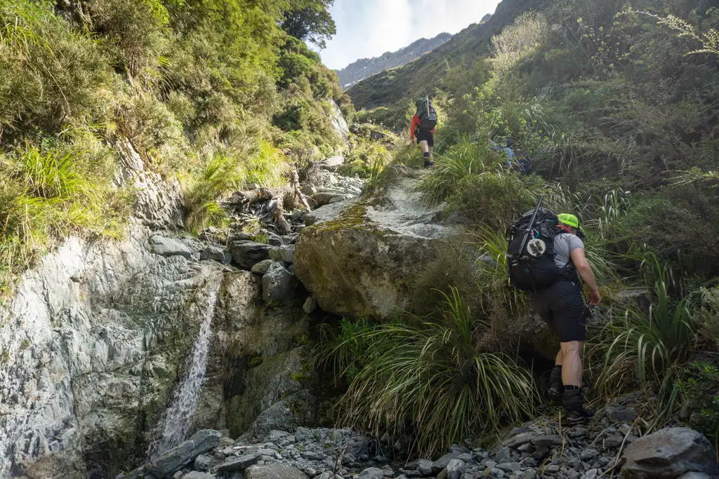
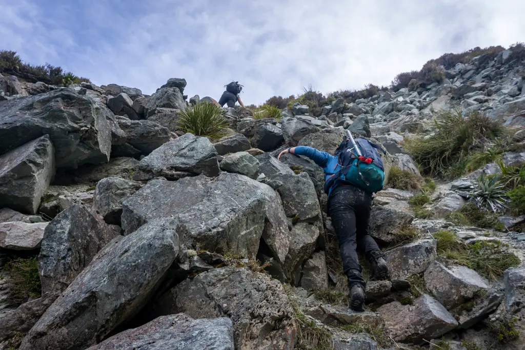
Steep scrambles
We continued to climb up the creek as it got steeper and steeper. The route guide we were following said to exit Emily Creek by climbing up a steep slip at around the 1200m contour mark, above the treeline.
I would hazard a guess that this guide was also written pre-2020 floods.
The slip (which is still active) was ridiculously steep. We climbed up as best we could. At one point Matt sent a small boulder rocketing down the slope below us. The boulder got up so much speed that it hit a bluff far below and shot up several metres into the air before hitting the far side of the stream bank. This wasn’t a spot you wanted to be climbing up if there was anyone below you (the giant calf men had well and truly gone, no homicides were committed on this trip).
I’ve since read some other guides that suggested that once above the treeline it’s easier to traverse across the tussocks to your left (true right of the stream) and gain the basin. I can’t say whether this would have been easier, but surely anything would have been better than what we did.
We did eventually succeed in climbing up the vertical scree and boulders. But it wasn’t what I’d call a fun time.
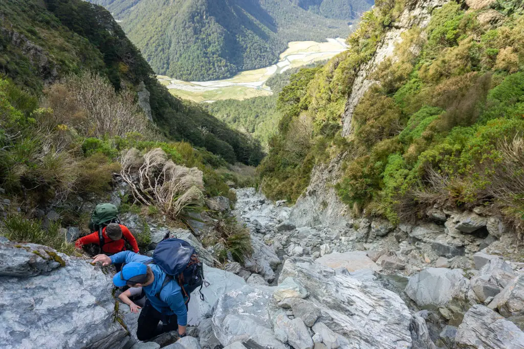
Emily Basin
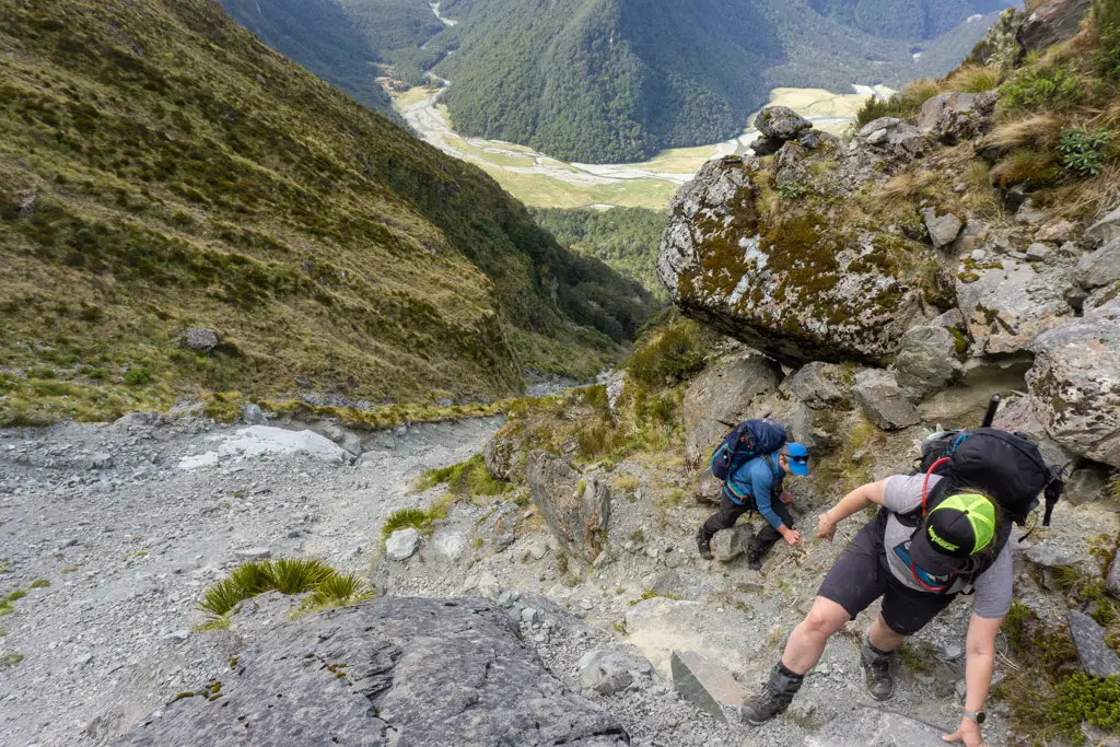
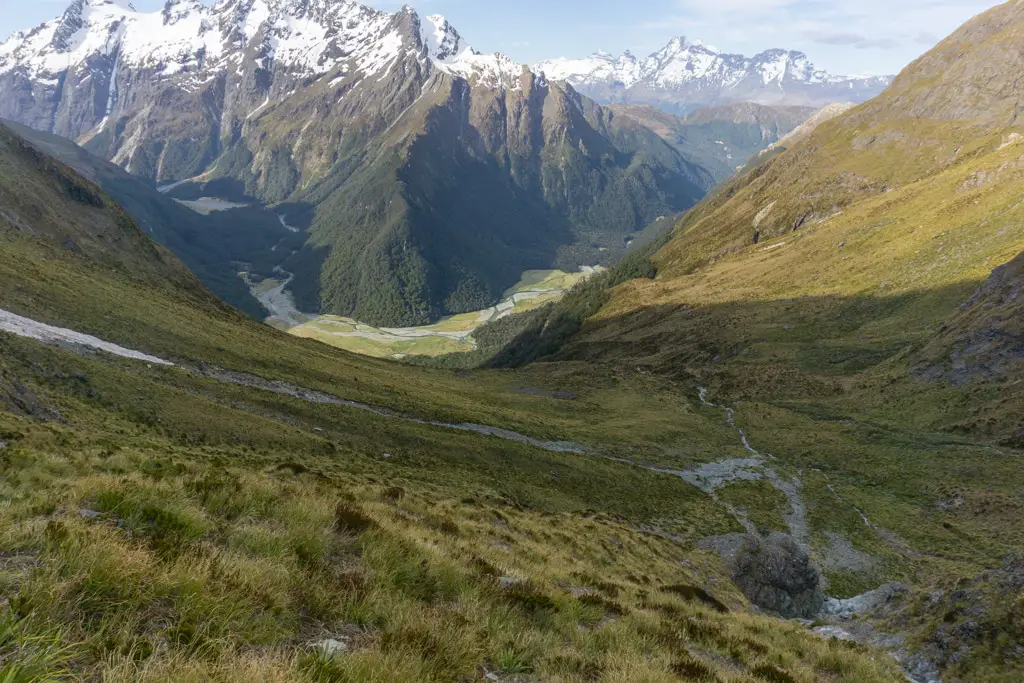
Once we climbed up over the crumbling edge of the slip, we were greeted with a beautiful tussocked basin; the hanging valley below Emily Peak. We had a good rest here and took in the views, looking down at Routeburn Flats. We discussed camping here in the valley (as it was already 4.30pm), but there didn’t look to be any flat campsites jumping out at us, and we were keen to continue on.
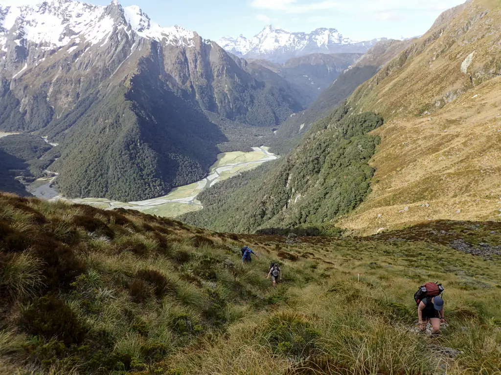
Eventually it was time to get up and going. We traversed across the basin, aiming for a waterfall coming out of some cliffs. Hamish took us quite high up until we were skirting the bluffs on the true left of the waterfall, and this helped us miss some more scrambly climbing.
Then it was time for the really fun (Type II) part.
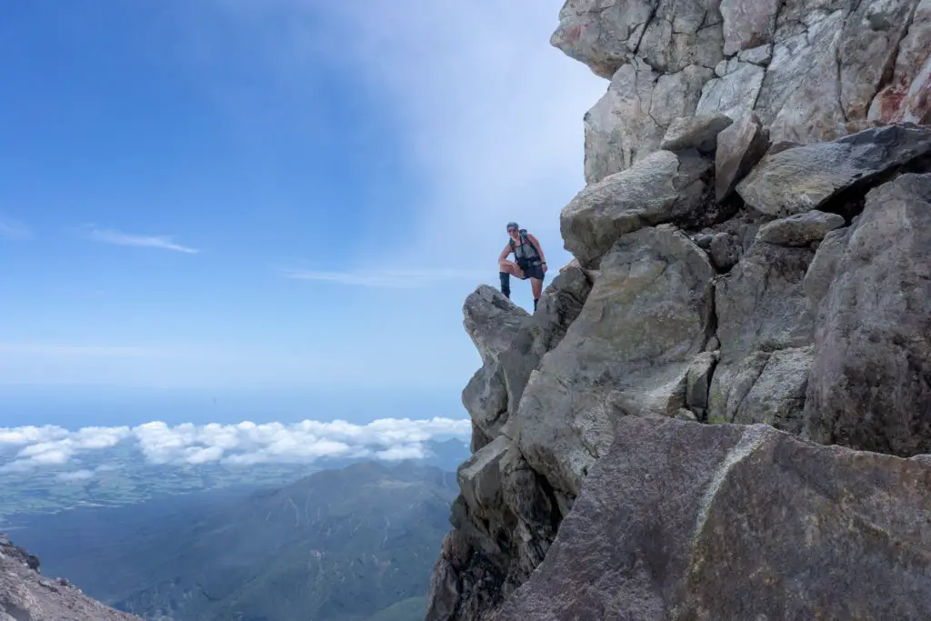
The crux
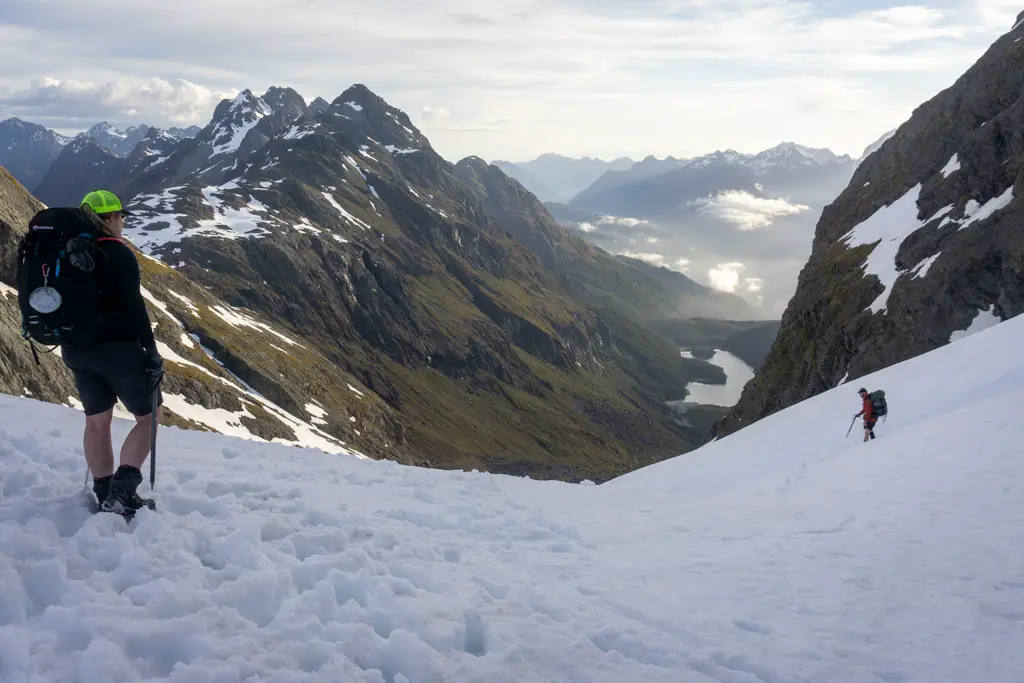
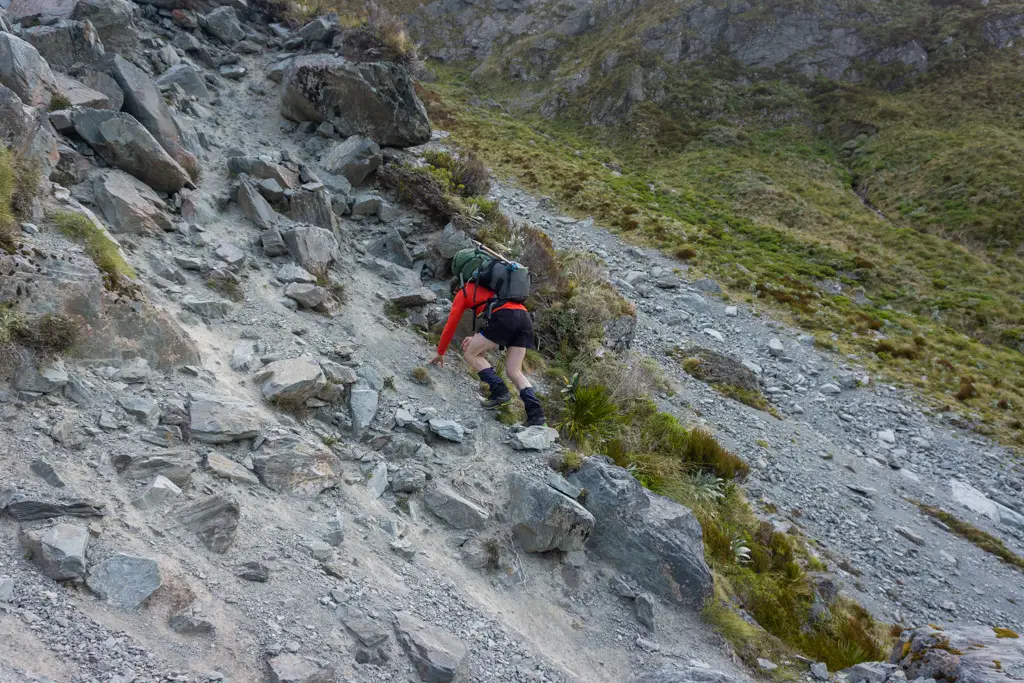
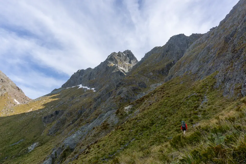
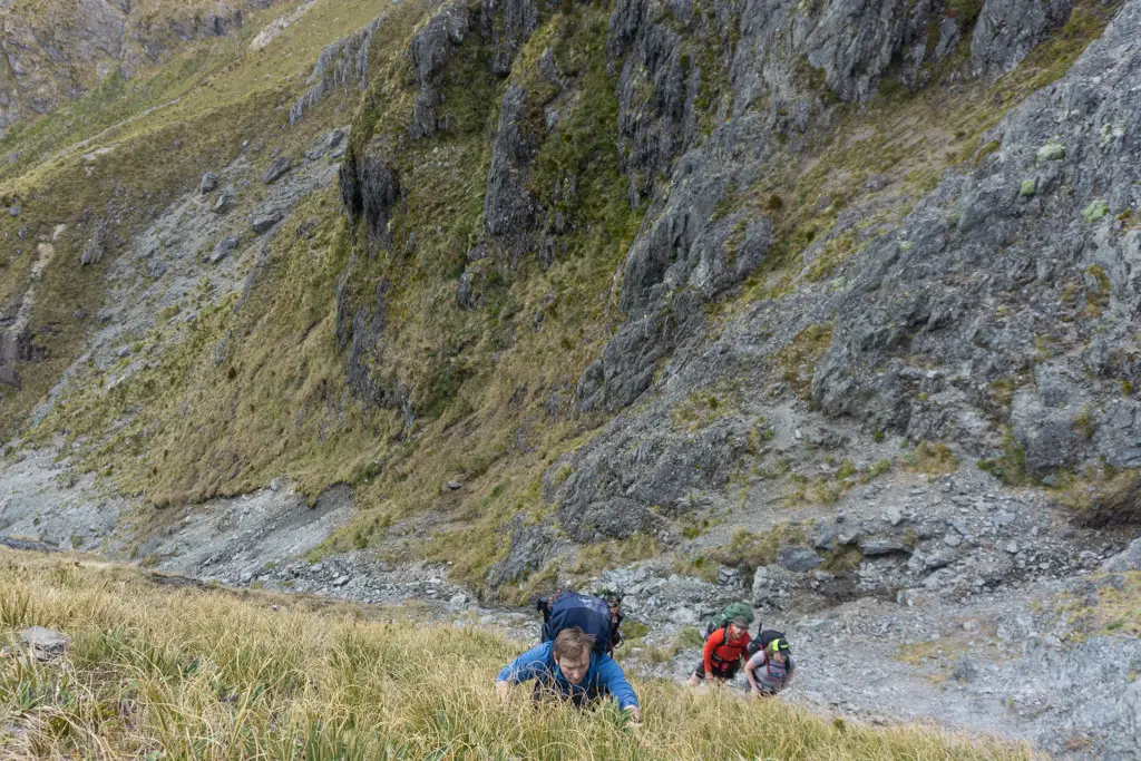
We climbed around below the bluffs, before reaching the stream coming down from Emily Pass. By this point we were at the 1400m elevation mark, having already climbed 1000m from the carpark. I was tired. Exactly how you want to be feeling when approaching the hardest part of the trip. The part you’ve been dreading and excited for all at once.
The small stream was pretty unstable to climb up, so we took care to not be directly below each other, in case another boulder tried to make a leap for freedom. We quickly reached a near vertical rock face – the crux of the route; the waterfall climb.
I went first, with the others yelling out helpful and encouraging advice. The rock had many lips and grooves, so despite being mossy it wasn’t at all technical to climb (although it would be another story entirely in wet or icy conditions). The hardest part was the top of my tramping pack forcing my head down so I couldn’t easily look ahead for handholds.
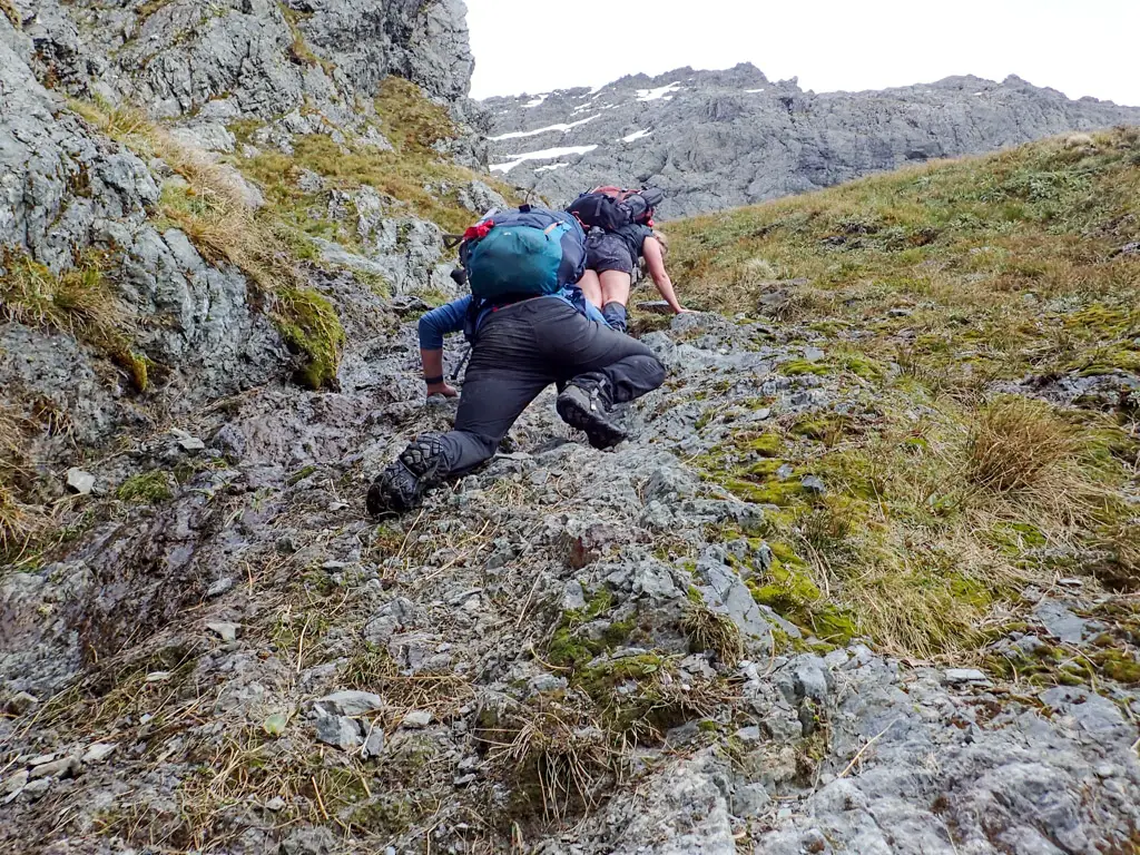
I reached the snow grass slopes above the waterfall, but these were disappointedly just as steep as the rock face. It took me another minute or so of climbing (albeit with better handholds) before I felt comfortable pausing and helping Matt climb up behind me.
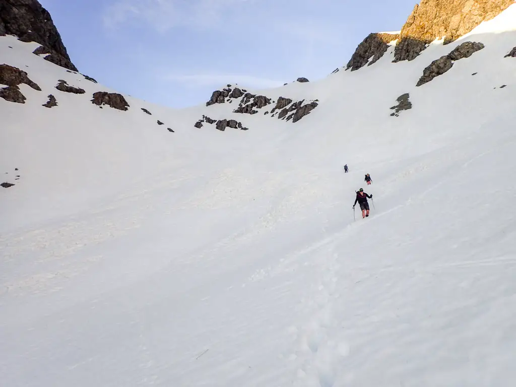
It was then meant to be a “quick” push up the snow grass slopes to the pass. But these slopes were pretty fricking steep – every step felt like it was a metre straight up. And my fatigue meant I was stopping every few minutes to catch my breath. It took us 20-30 minutes to reach the top.
Emily Pass
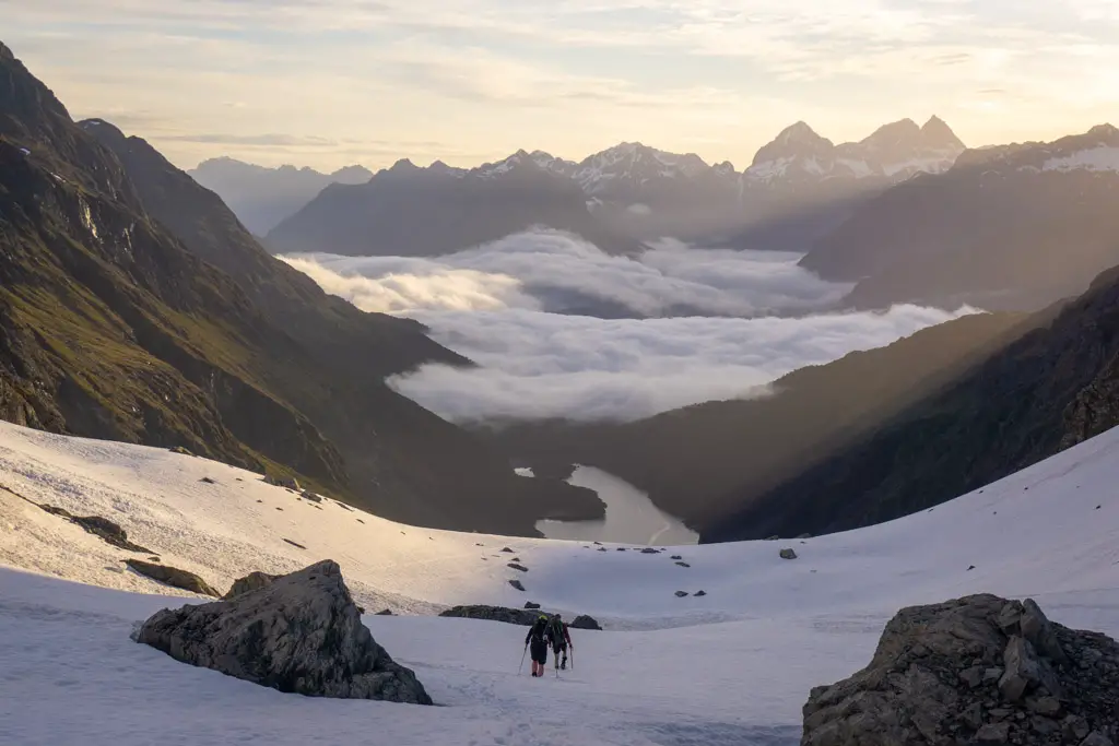
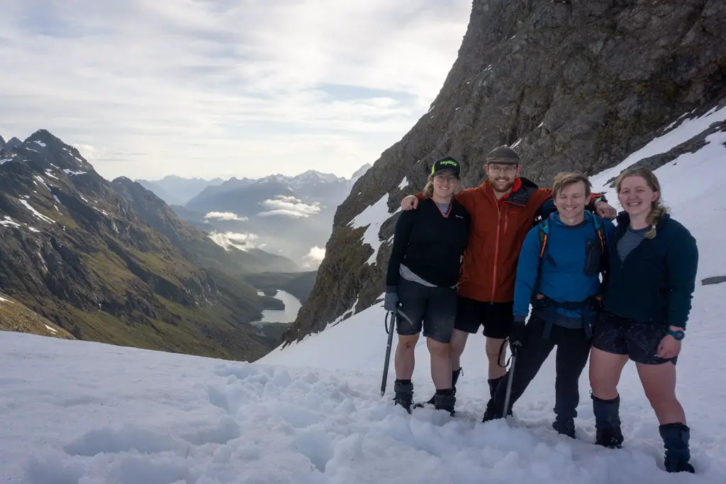
But then we finally popped out onto Emily Pass! It was 7.30pm.
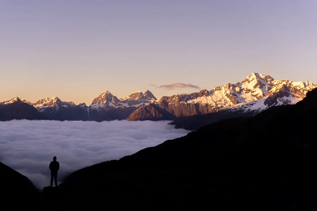
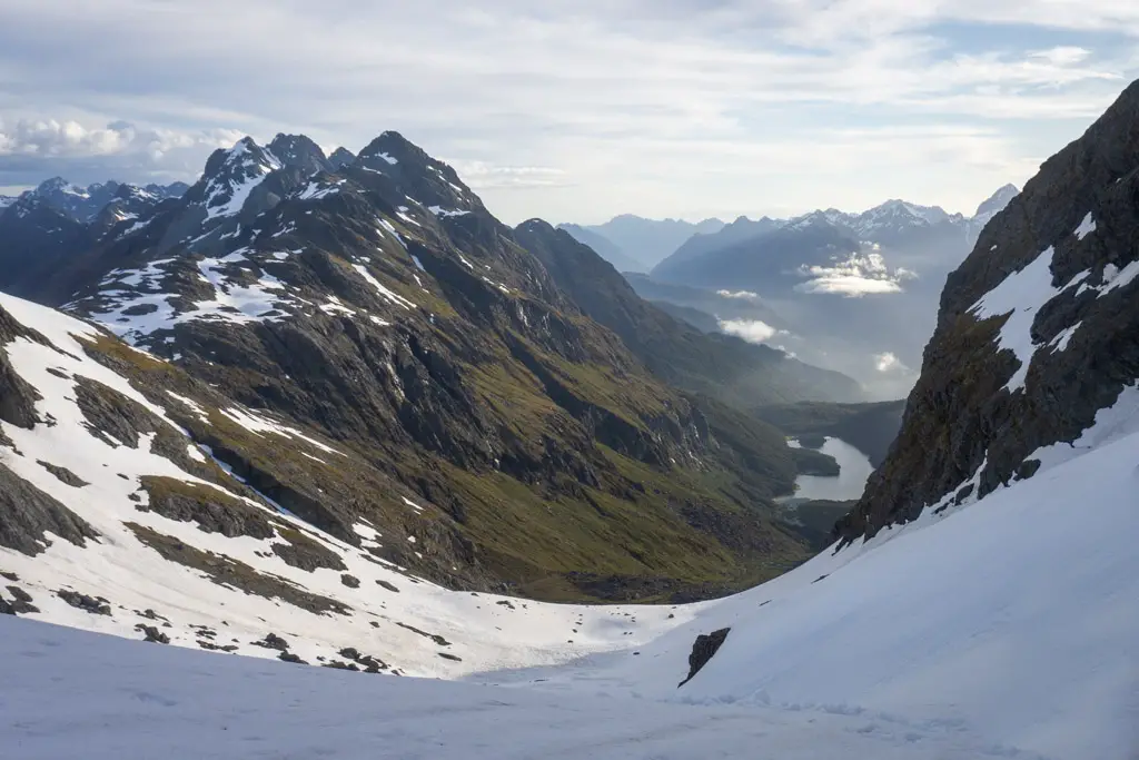
There was snow covering the pass, the first real snow other than avalanche debris we’d seen up close all trip. The snowy slopes stretched down far below us on the other side of the pass towards Lake Mackenzie. We posed for photos, took in our last views of the Routeburn Valley and then turned to start making our way down the other side of Emily Pass towards Lake Mackenzie.
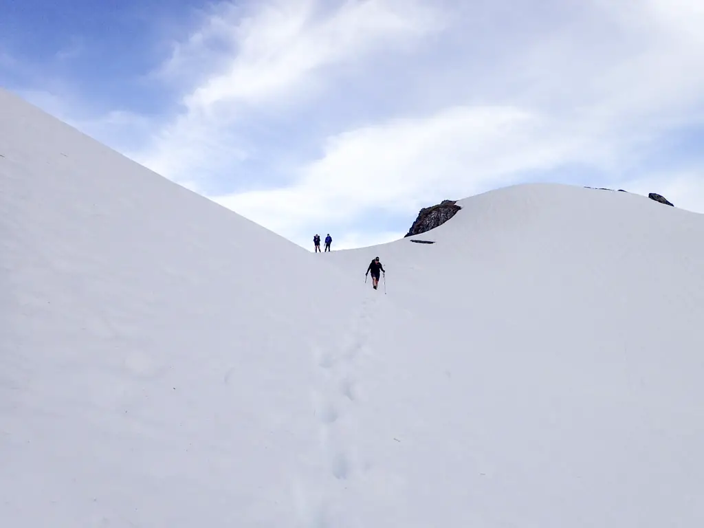
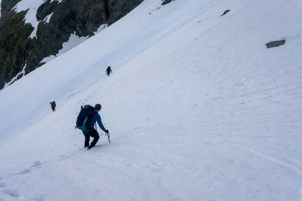
Hamish is a ski patroller, so he took point on the safety aspect of assessing the snow pack and where to climb down. We followed his footsteps, spaced out, wearing gloves and carrying our ice axes, and zig zagged down the slope behind him.
The descent
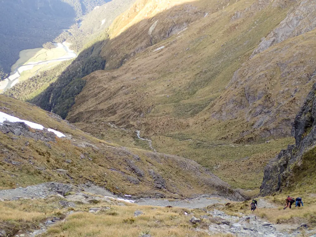
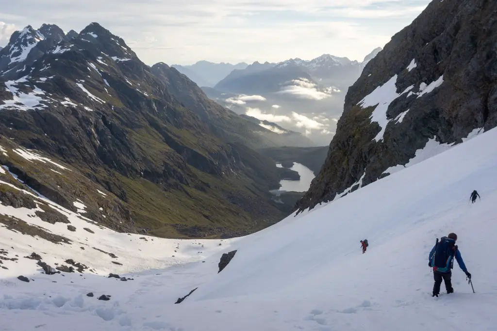
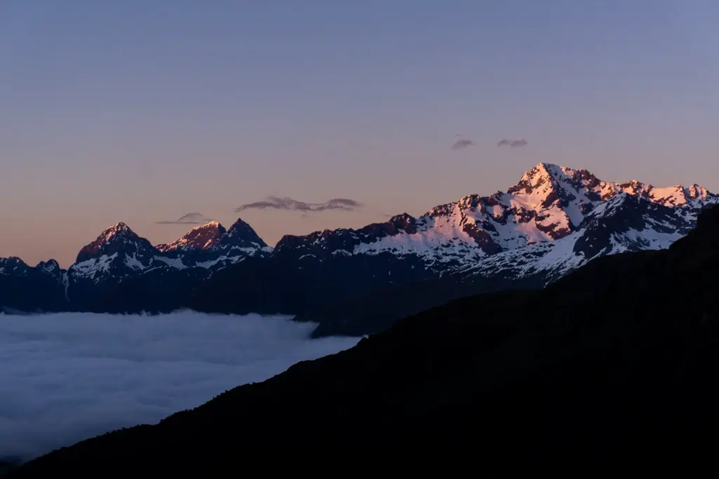
The snow was very slushy this late in the day, but it was a lot easier to walk down than scree or boulders, which were hiding beneath the snow. And the views of the Mackenzie Valley were absolutely gorgeous, especially as the sun started to dip towards the horizon. The light started to soften, and an inversion layer started to creep in.
We negotiated a series of steep slopes and flat basins on the way down the south side of Emily Pass. At times my steps would sink into the snow above my knees and my boots would become stuck, but other than that it was relatively easy travel.
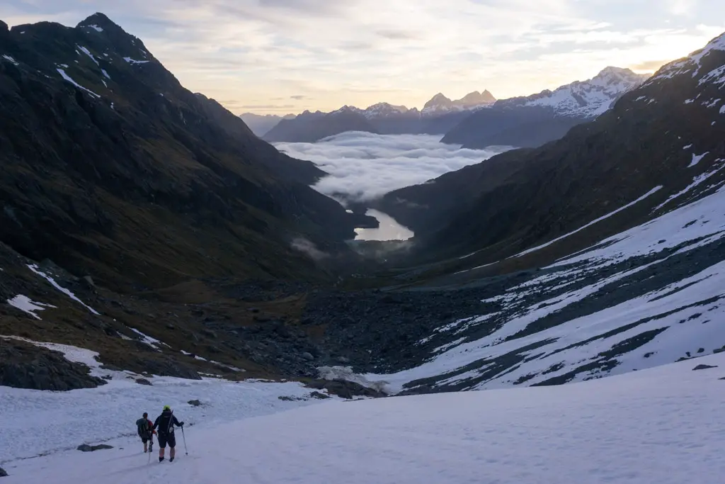
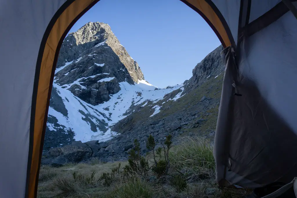
After a particularly steep slope, we reached the end of the snow at the 1240m mark and descended onto a large flat terrace. It was 9pm and the sun was starting to set. Hamish let his family know where we were camping via his In-Reach.
We’d chatted previously about setting up out tents on one of the snow basins we’d passed through, but Matt and I didn’t have the appropriate gear for camping directly on snow. So Hamish went on ahead and found an amazing campsite in this basin. Flat, level ground, running water, no sandflies, and views over Lake Mackenzie. It meant not using our campsite down at the lake that we’d booked and paid for, but what more could you ask for?
We’d been on the go for 11 hours. Setting up camp and cooking dinner passed in an exhausted blur. I think I accidentally ate my dinner with my back to everyone. I don’t even remember what it was. Not long after that I was in the tent, asleep.
Lake Mackenzie
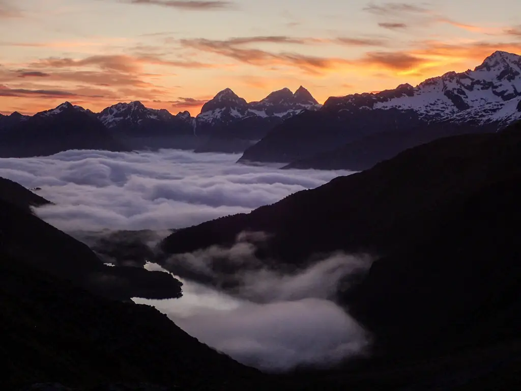
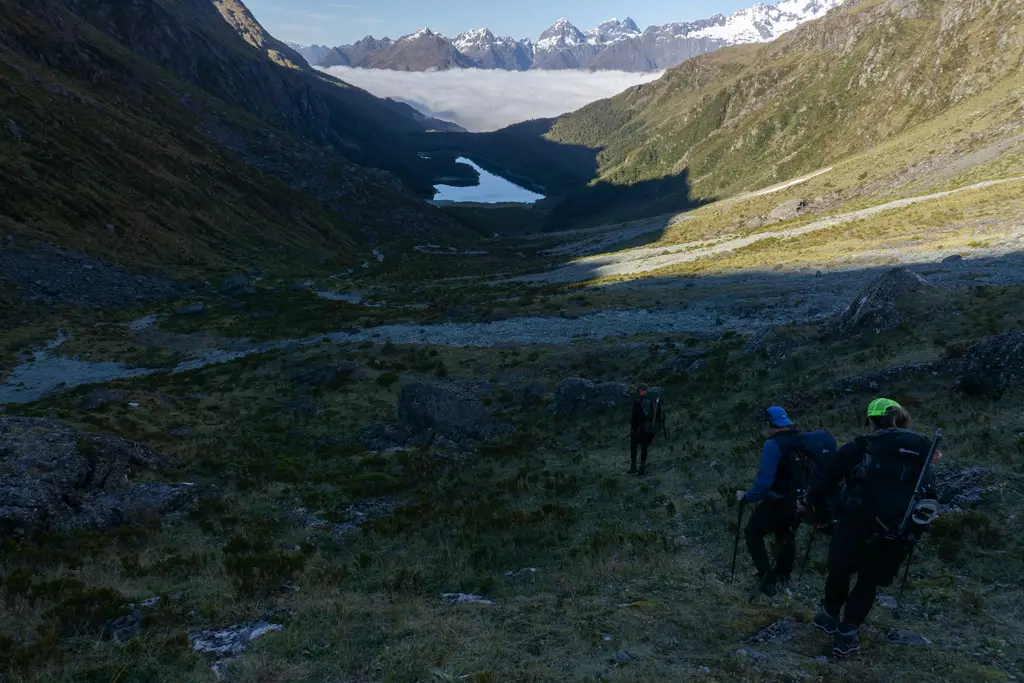
I got up for sunrise the next day. It was an absolute stunner with an inversion layer of clouds sitting over Lake Mackenzie.
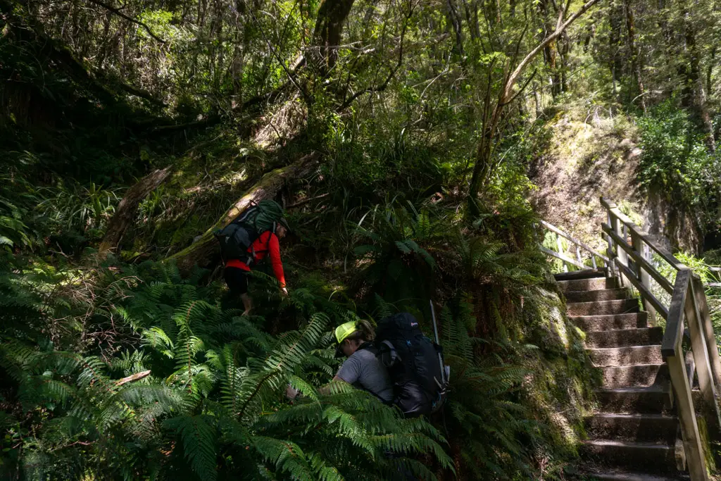
Once we’d had breakfast and broken camp, it was time to head off again for the little bit of the trip we hadn’t managed the day before. We followed a trapping line down the valley from our camp, and then followed the stream down to the head of the lake.
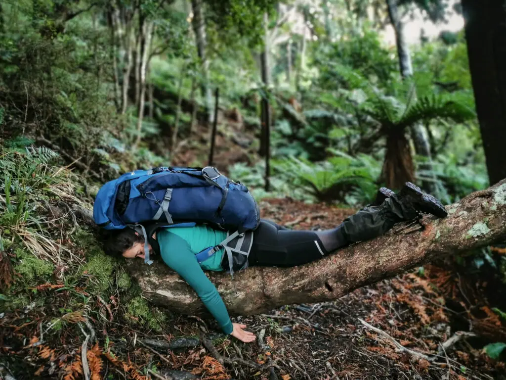
The slight bush bash through low scrub to get to the head of the lake was the last thing my cut up legs wanted. It felt like the scrub was made up of little mafia bushes trying to get information from me via torture.
But then we were at the track! Or well, a severely overgrown track. I’m guessing DOC don’t maintain it because they don’t want to encourage people to explore up-lake from the hut and campsite. We pushed our way through to Split Rock, and from then it was an easy few minutes’ walk to Mackenzie Hut.
We’d made it! Back to civilisation with flushing toilets and everything!
It was then just a matter of walking all the way back to the carpark along the Routeburn Track (with a side trip to Valley of the Trolls, which I’ll be writing about next!).
I was challenged, inspired, educated and awed by our trip over Emily Pass.
I won’t lie and say I loved every minute (looking at you, steep slip out of Emily Creek and slushy snow that kept trapping my feet). But overall it was a trip I’m really proud of.
A massive thank you has to go out to Ashley and Hamish, without whom we would definitely have not been attempting this trip. Here’s to more trips together in the future!
Safety
As always, please stay safe when you’re out exploring. Follow the Outdoor Safety Code:
- Choose the right trip for you (read my article, read other blogs!)
- Understand the weather
- Pack warm clothes and extra food
- Share your plans and take ways to get help
- Take care of yourself and each other
This is not a trip to undertake lightly without appropriate gear, experience and weather. Feel free to comment or message me over on Instagram if you have any questions.
Stay safe and get outside!
Where to next?
LET ME KNOW WHAT YOU THINK! LEAVE ME A COMMENT OR MESSAGE ME OVER ON MY INSTAGRAM.
I love hearing from readers and helping them plan their own adventures!
Hi Alice, very interesting reading about your Emily Pass trip. Most impressed and great photos, though I didn’t see any chocolate. Four of us university students did the same trip but from the other direction in May 1977. It was hard going but we came down the north side through the forest. It didn’t occur to us to look at a route guide, but we made it down OK.
I will read some of your other posts, as they are well written and about some of the many beautiful places to visit in NZ. Thanks for your efforts.
Cheers, Markus.
Thanks for much Markus for your kind comment! Going the other way over Emily Pass would certainly have been an adventure. Did you go down Emily Stream, or make your way down one of the ridges? I imagine the terrain has changed slightly with recent floods, etc. My mum had done that Pass too with OUTC and it sounded a bit different than when she did climbed over (also probably around the same time you did it!). And never fear, it goes without saying that much chocolate was consumed on this (and every other) trip!