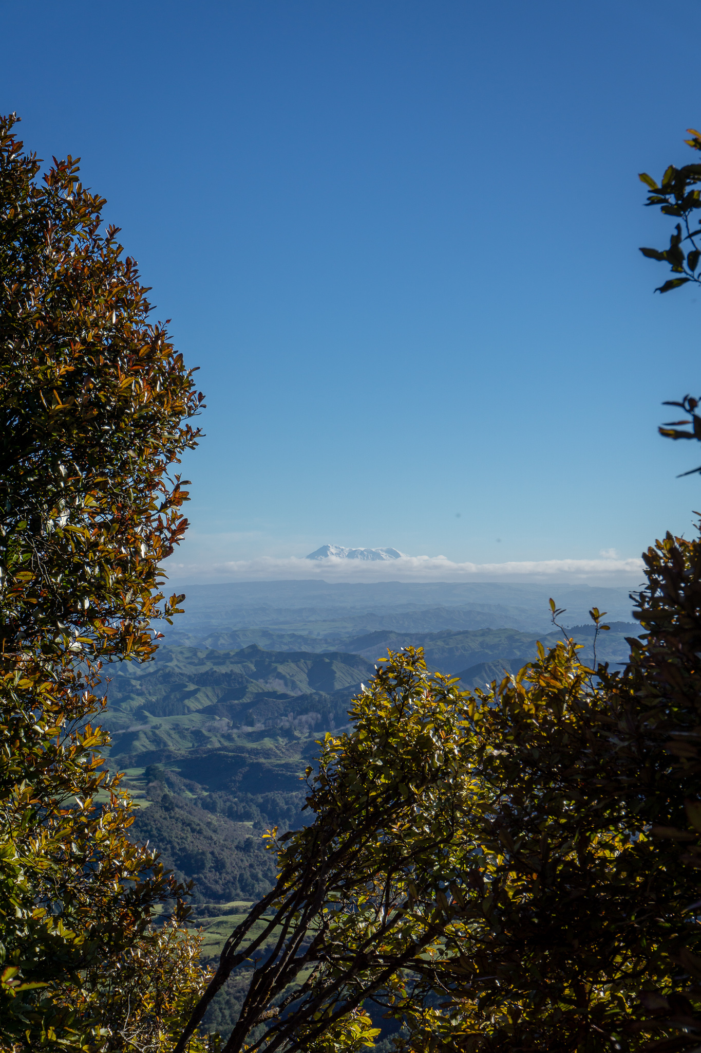
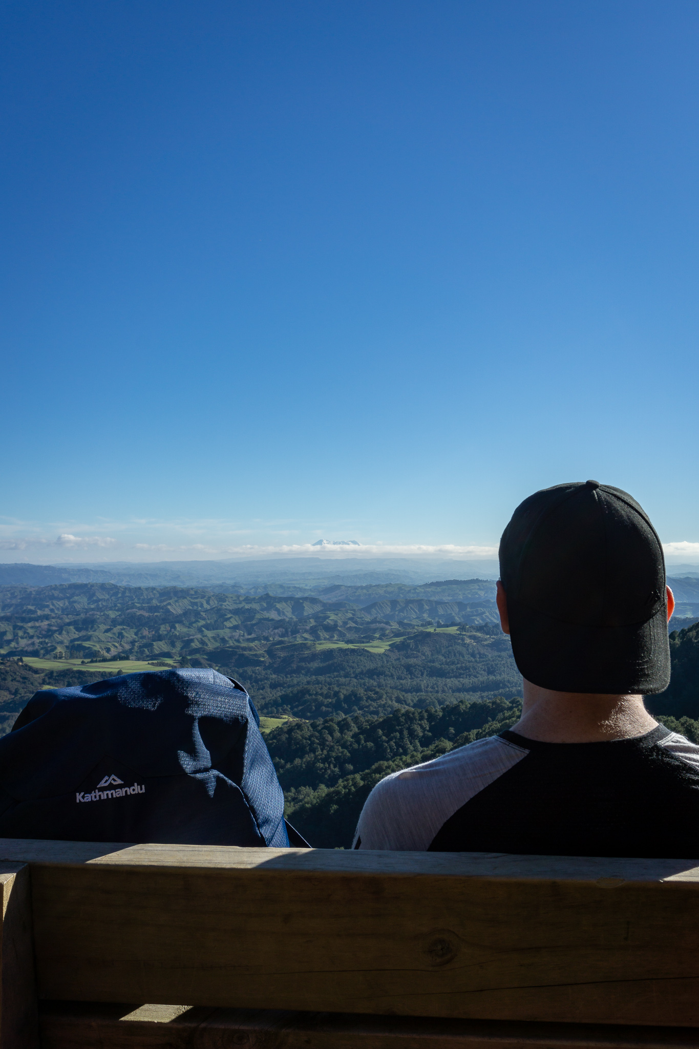
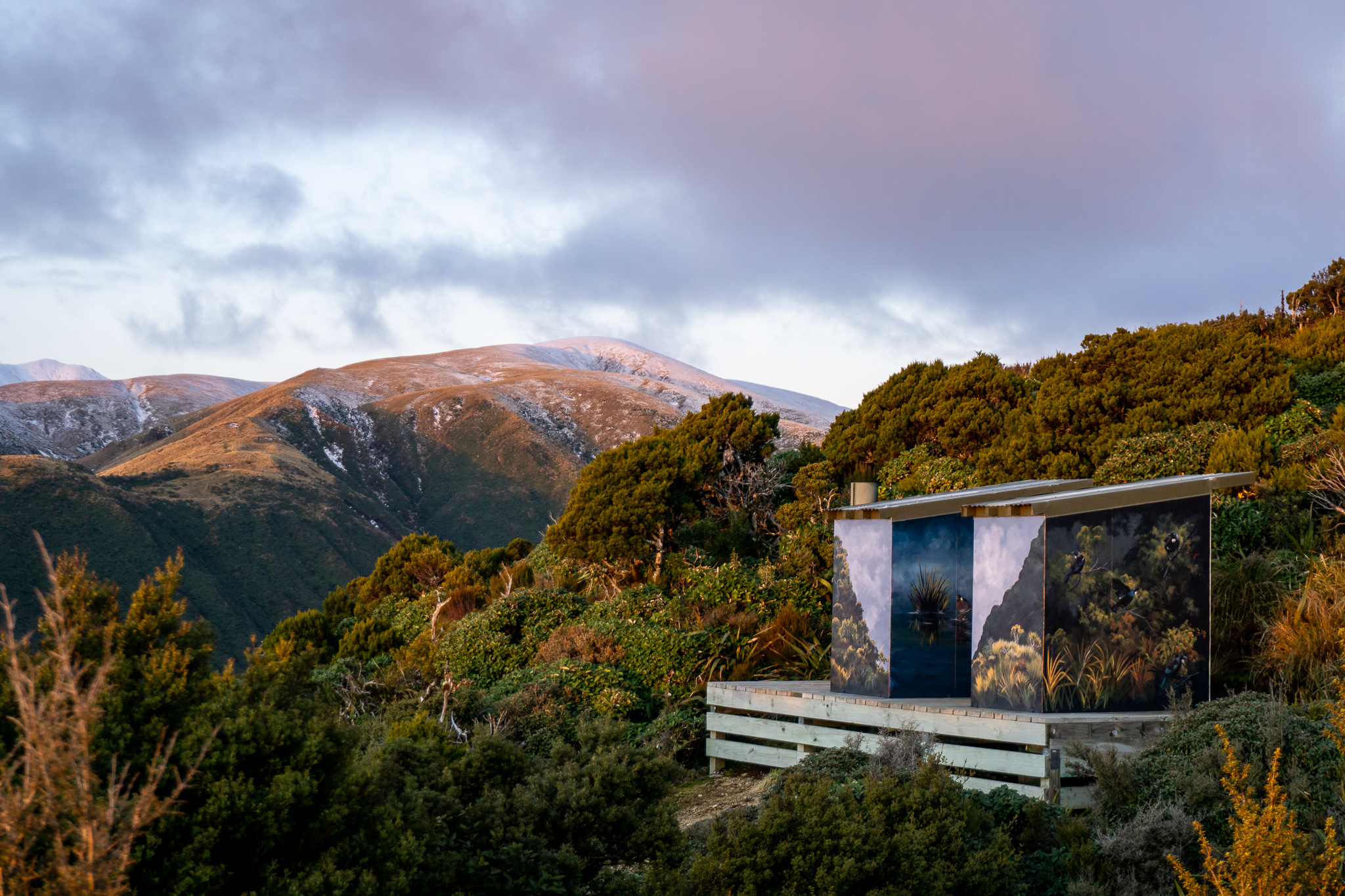
Rangiwahia Hut is one of the most popular walks in the Ruahines. It’s only a two hour walk up, with a picturesque bridge, views over the rolling hills to Ruapehu & Taranaki. (As well as the most beautifully painted long-drops I have ever seen.)
Length: about 4km return to the hut, including a 500m climb
Time taken: 2hrs to the hut (an extra 3-4 hours return to Mangahuia)
Difficulty: Easy
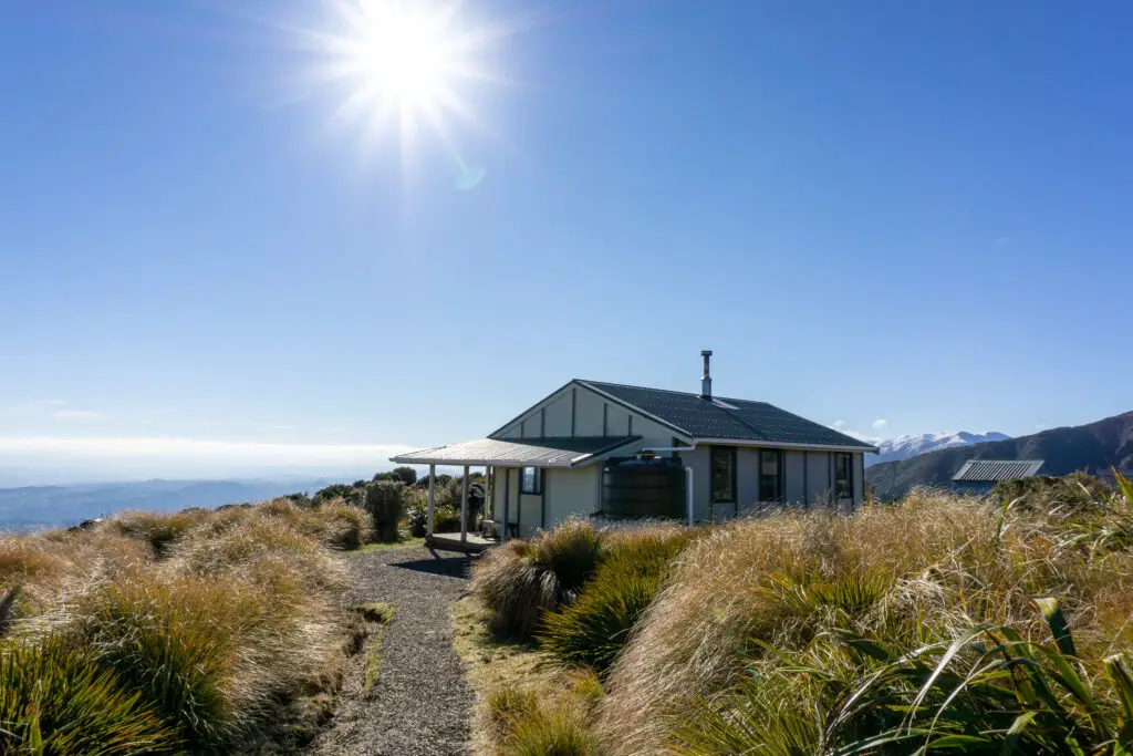
Facilities: There is a long-drop toilet in the lower carpark. Rangiwahia Hut is a serviced DOC hut ($15 per person). Beds need to be booked November – April, but otherwise are on a first-come, first-served basis. Rangiwahia Hut is a popular, so get there early on weekends. Rangiwahia Hut has an external water tap (although it tasted so strongly of charcoal, that we avoided drinking it), 13 bunk beds, wood burner + fire wood, and two long drops.
Why choose this trip?
Having recently moved to the North Island, there are still so many places that I hadn’t yet explored. The Ruahines, a mountain range north of Palmerston North, were one of those. One of my high school friends living in Palmerston North was keen to get back out tramping. (Now that her legs had almost forgiven her for the Hump Ridge track almost a decade ago). She suggested Rangiwahia Hut; one of the more popular tramps in the range. It was the photos of the beautiful bridge that really sold me though. As well as the knowledge that Rangiwahia Hut sat above the tree-line facing west and would hopefully have beautiful sunset views.
Rangiwahia Hut vs. Deadman’s Loop
There are two ways to get to Rangiwahia Hut – either an easy two hour walk on a well-formed track. Or the more challenging Deadman’s Loop to Mangahuia; the ‘peak’ (1583m) above the hut (which sits at 1327m). I automatically wanted to tackle Deadman’s Loop. But this was a seven – nine hour tramp through tussock, compared with an easy two hour walk on a track. I wasn’t sure whether my fitness was up for that, let alone my friend Jordan’s (being her first tramp in almost ten years).
On top of this, when I called up Palmerston North DOC they couldn’t advise me of snow conditions on the range (which made me realise I’d been spoiled by DOC centres in the South Island). Not being a local, I didn’t really know what to expect for July. In the end, we decided the safest and smartest option was to head up the easy way on the track. Have lunch at Rangiwahia Hut. Drop our packs and then head up the ridge and see how far we got. This meant that we still had the chance to get up to Mangahuia. But if we had to turn back – we would be turning back to head down to the nearby hut. Rather than having to head all the way back to the carpark through tussock (and then driving back to Palmerston North).
How to get to the trailhead for Rangiwahia Hut?
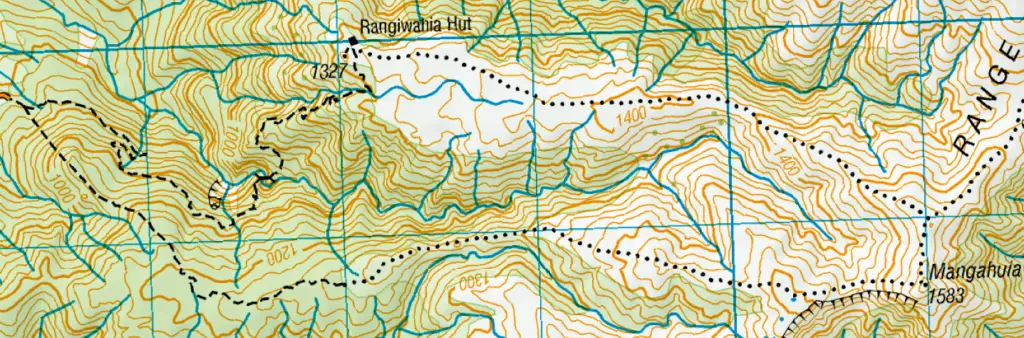
Both Rangiwahia track and Deadman’s Loop start from the same carpark off Renfrew Road. The carpark is about an hour and a half’s drive north of Palmerston North on windy but paved roads. Turn on to Renfrew Road (which is gravel). Continue driving through farmland until you see a gate on your left with a DOC sign for Ruahine Forest Park at the end of the road (if you keep going you’ll end up in the farmer’s yards). Follow this up until you reach the lower carpark (with long drop). Then park in the upper carpark to begin the track up to Rangiwahia Hut.
Tramping up to Rangiwahia Hut
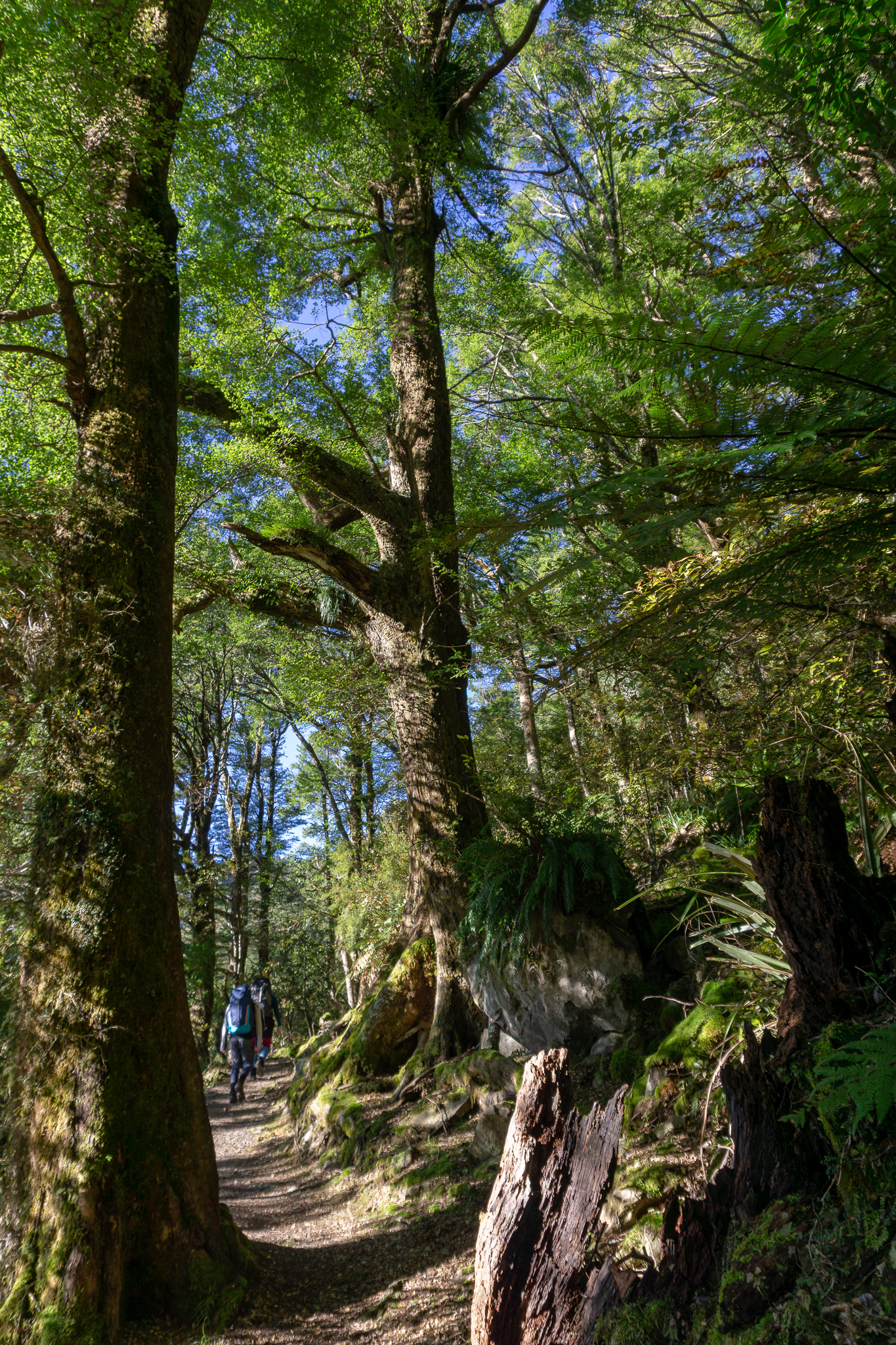
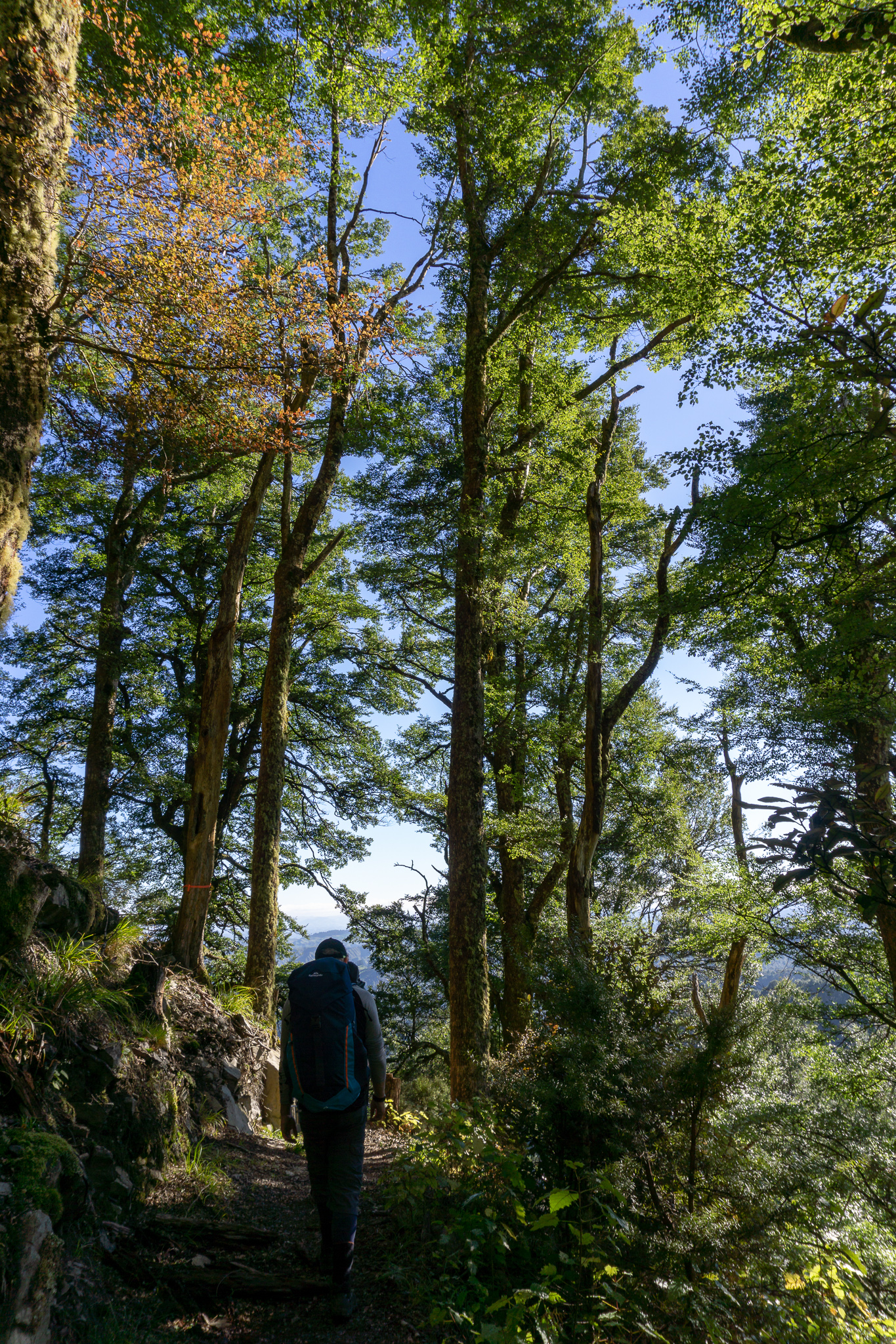
At the track entrance there was a sign with a map as well as the turn-off to Deadman’s Loop. We followed the obvious track zigzagging up from the carpark through the bush. It was quite steep initially, before levelling off to a nicer gradient. The bush was lovely, filled with birdsong and filtered morning sunlight (although when we were coming down the next day it was blowing a gale and debris was flying across the track). As we got higher, tantalising views across the plains started to peek through the trees.
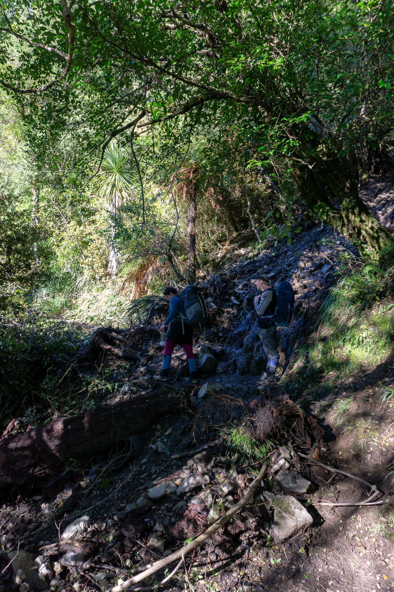
A large, old slip had taken out part of the original track. The new track climbed up and around the large slip, with a perfectly placed seat at the top to look out over the (naturally) cleared view. As we slogged up the track to the seat, I knew that we’d definitely made the right decision choosing this track instead of Deadman’s Loop. I hadn’t hiked with more than a day-pack on my back in a while – the extra weight was definitely making a difference. It wouldn’t have been fun lugging my pack through tussock and up over the tops. Despite Deadman’s Loop being a much more exciting trip. The views were not disappointing though. We stopped for quite a while at the top of the slip to catch our breath, take in the views and snap some photos. When we’d set off in the morning there was some low clouds hanging over the rolling hills, but these were slowly lifting, with Ruapehu standing proudly above them in the distance.
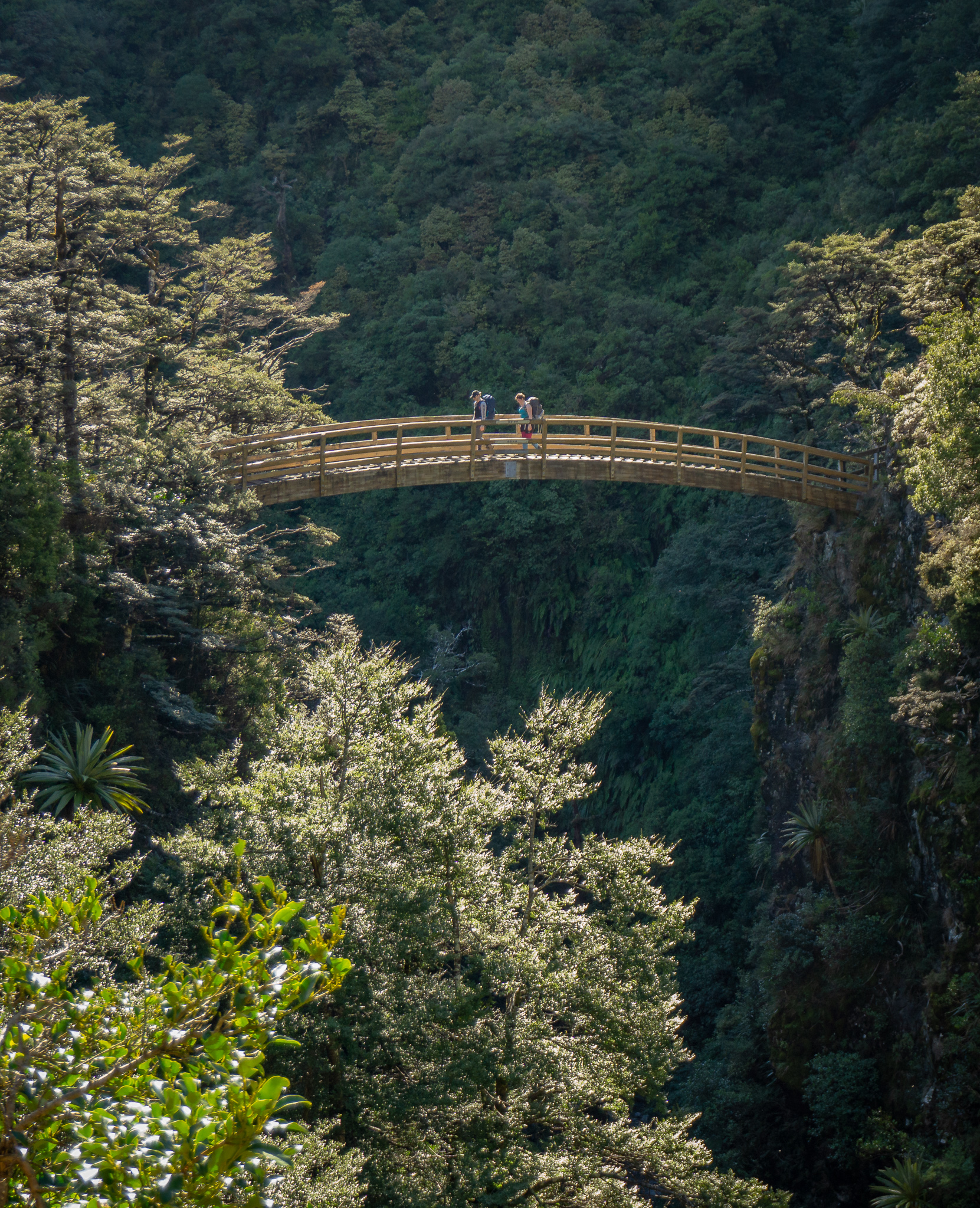
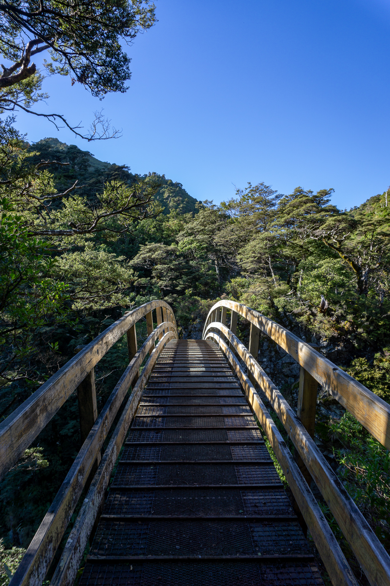
After the top of the slip, we started to drop back down again to meet the other side of the old track, with some stairs thrown in for good measure. Heading down also meant getting closer to the beautiful arched bridge, which was opened by Helen Clark in 1988 when she was the Minister for Conservation. This is about the halfway point time-wise (although there is much more of a climb still left to do). A lot of families use this as their turn-around point after picnicking at the bridge. I’d seen a few pictures of the unusually picturesque bridge beforehand, which was one of the reasons why I’d wanted to hike the track in the first place. But the gorge that the bridge crosses is also pretty impressive and photos don’t really do it justice. The sun was just in the wrong place for photos, peeking up over the ridgeline and causing glare. But it lit the gorge beautifully to the naked eye.
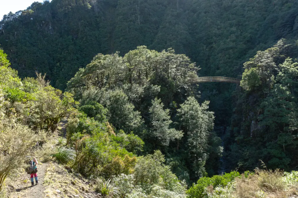
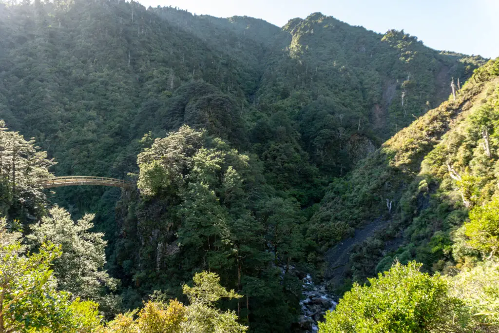
The approach to the bridge from the carpark side is quite narrow. It felt almost like the terrain had been designed to hold a bridge over the river at precisely that spot. There were two points of rock jutting out from the steep hill sides on either side. The bridge is quite high above the river. The wood creaks as you cross over it, which Matt was most definitely not a fan of. But it’s certainly a unique bridge by New Zealand tramping standards. Well worth the hour-ish walk out to it alone. Even if you don’t plan on going further (although leaving slightly later in the morning will mean warmer sunlight for picnics).
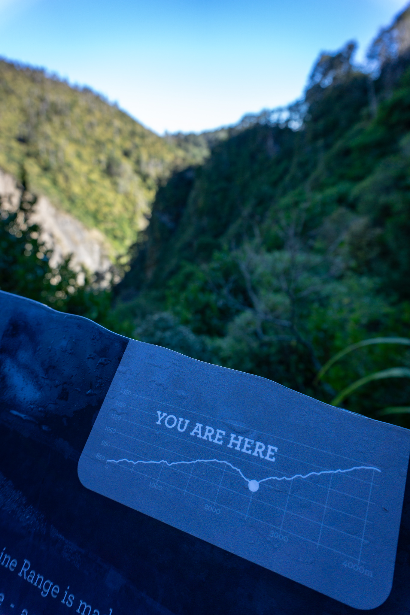
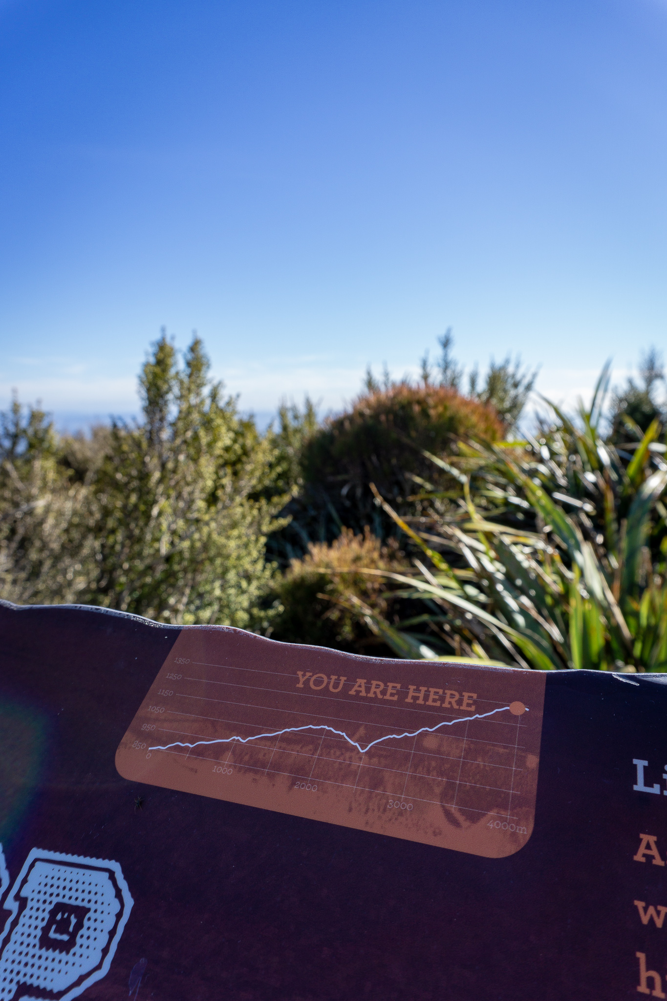
We gobbled down some snacks and chocolate (which is in its own food category and not to be confused with mere snacks). Then headed off to the excited shouts from children behind us who’d caught sight of the bridge. It was straight uphill with steps, (always what you want after a break), as we climbed up and away from the rocky outcrop the bridge had connected to. There was a lovely sign after the stairs (pictured below) with an elevation profile and a dot showing where we were, which was awesome! I’d never seen a sign like that on a track before; it was great to know what was ahead relative to what we’d already walked. When we reached the hut there was a matching sign (just in case there was any doubt we’d reached our destination).
The track continued to wind across and up the hillside, with a steeper gradient than on the other side of the bridge. Eventually we passed around the ‘corner’ of the hillside and out of sight of the track on the other side of the valley. The climb up continued. Jordan and I both were ready to reach the hut well before we actually did (which goes to show how bad my fitness was considering it was less than two hours in!). We climbed up out of the trees, across another (more recent looking) slip that had been stabilised by DOC (thank you!) and around a rather small but lovely waterfall, before reaching the hut about 5-10 minutes after leaving the trees behind.
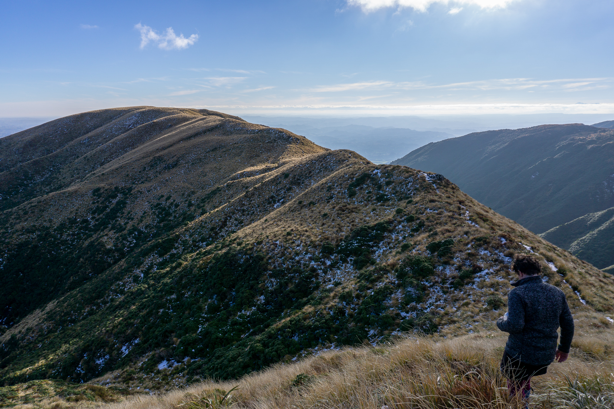
The best feeling when tramping, other than taking your boots off at the end of the day, has to be taking your pack off at the hut. We ate lunch at the picnic tables outside the hut, where we were joined by the family we’d heard down on the bridge (who were just coming up to the hut for lunch before heading back down). There were two packs in one of the twin bunk spaces, but no-one else, so we dumped our packs onto mattresses in the other bunk space, repacked Matt’s lighter pack with snacks and warm gear, before heading out again along the wide tussocked ridge behind the hut (the end of the route we would have been taking if we’d chosen Deadman’s Loop).
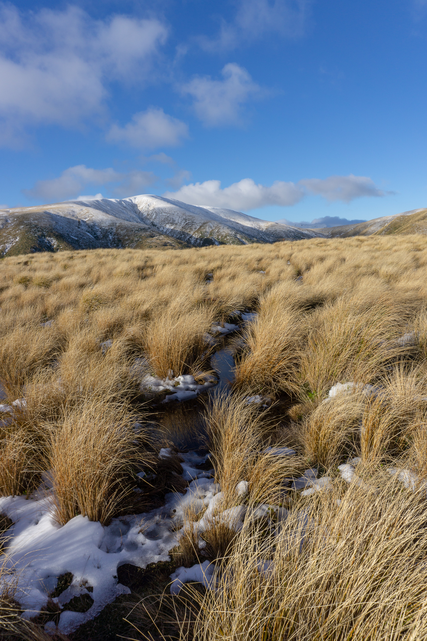
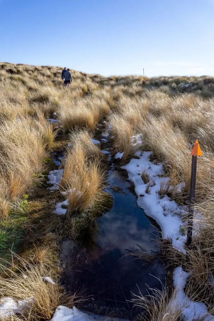
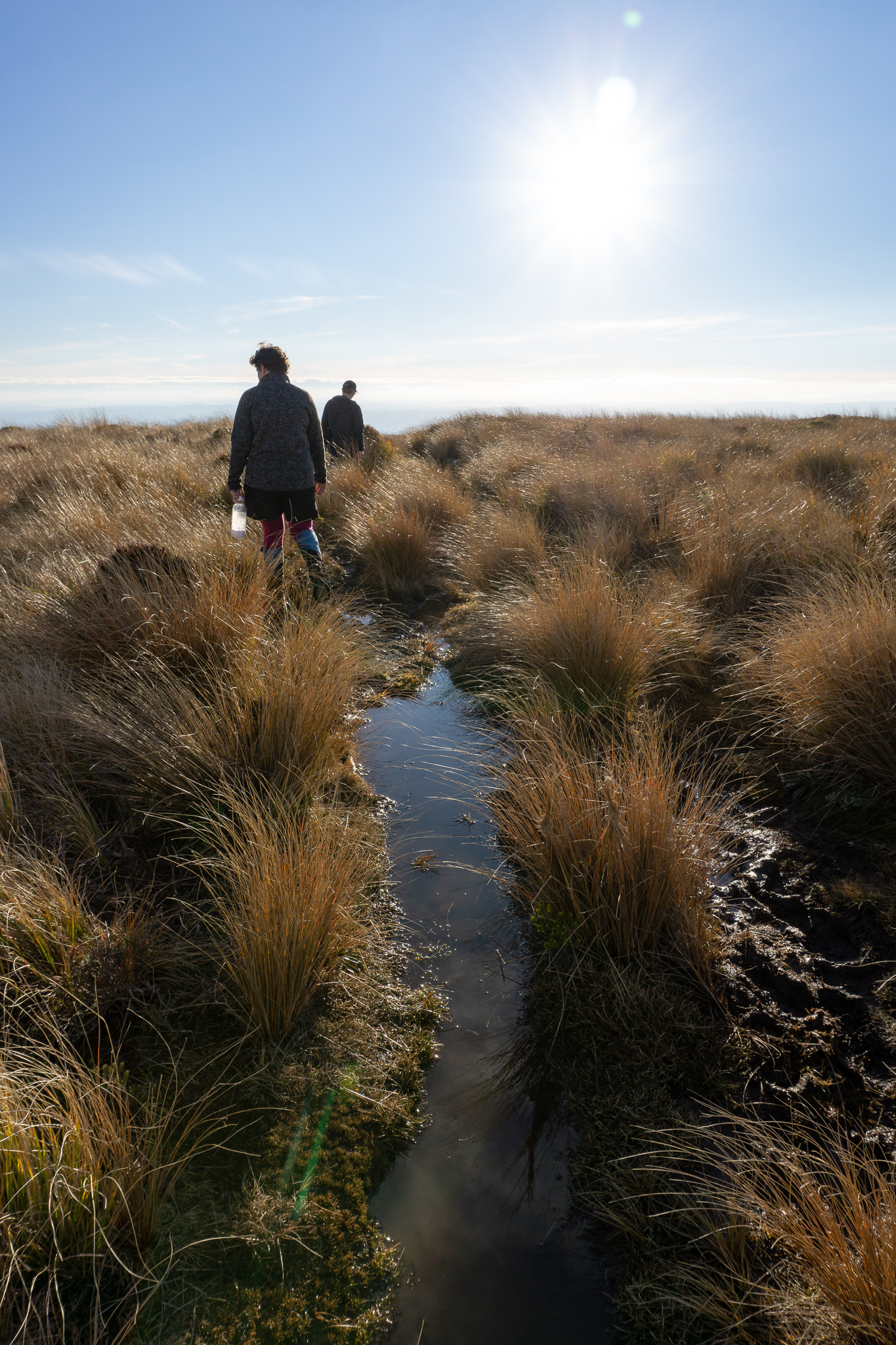
There was a very good track to start with away from the hut, but it quickly turned into a ditch, which then turned into a muddy bog. Most of the walk up from then on was done off the marked route, making a track of our own through the tussocks, while keeping relatively close to the markers (although the route is pretty obvious; heading up the ridge). The ridge is quite wide near the hut and feels more like a sloping tussock field, but it slowly narrows until at times you’re walking along a proper ridge with slopes on either side. This was the point at which we encountered the first patches of snow (which had been compacted by previous trampers into slippery ice), so we went slowly and watched our footing.

The hills around looked a bit like Christmas pudding dusted with icing sugar. Or maybe that was my stomach talking. Very pretty though. To go with this lovely vista, was the sound of gunfire from hunters down in the valley; the owners of the packs that had been left in the hut. Being a South Islander, I was used to a lot of my tramps being in National Parks, so it was odd to hear shots that sounded so close (although in reality they would have been quite far down in the valley). It was even odder when two trampers turned up later that afternoon in the hut with a dog in tow! (He slept on the top bunk with his Mum, which was adorable, and didn’t make a peep).
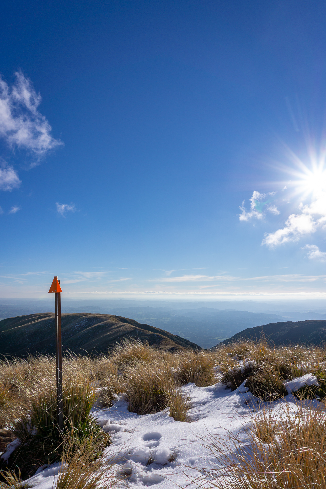
Matt and Jordan were getting quite tired, and it was going to take a bit of time and mental concentration to get back down to the hut without assing over on all of the ice and mud. I kept going for a little longer after they’d stopped, scrambling up to the third highest point before the ridgeline and Mangahuia. I looked longingly at the peak, before turning around and sliding back down to Matt and Jordan.
It felt like it took longer going back down than the way up, mainly because of the slow going with the ice and mud. We passed a family playing in the first spot of snow, throwing snowballs at each other with more energy than I felt.
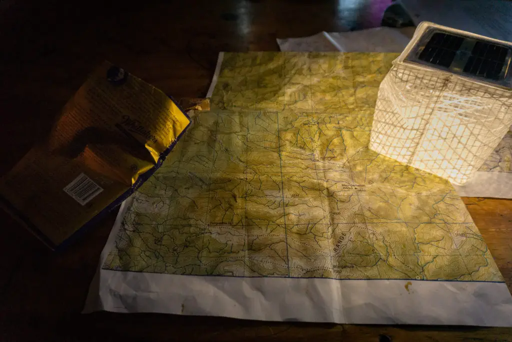
Once at the hut, we cooked up our yummy and well-deserved Back Country Cuisine freeze-dried meals (pro tip: in order to make the texture perfect, measure out the water properly and mix it together in a pot so nothing gets stuck in corners of the bag), and some Whitakers chocolate for dessert.
We chatted with the other people in the hut, including the family we’d seen playing in the snow earlier. They’d come back to New Zealand from several years in France with two young kids in tow, so I got to use my rusty French with them, which was a nice treat! Matt played card games with the two kids, while I wrote in my diary and Jordan supervised the fire that she’d magically managed to stoke in the wood burner with damp wood. A group of university students from Wellington arrived just as the sun was setting, with the idea of coming up here to get high / drop acid. Luckily they saw the family with the two small kids, so turned around and went back down again (they were at least prepared enough with head lamps, even though one guy’s pack mainly consisted of a bursting garbage bag taped to the outside).
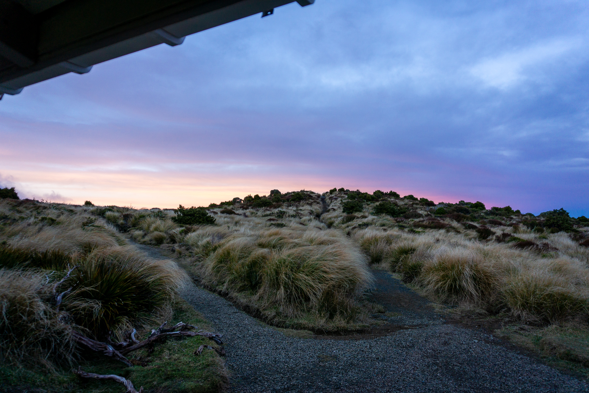
We watched the beautiful sunset from the hut – it was perfectly positioned to catch the rays setting over the rolling hills far below us. The hunters that we’d heard down in the valley arrived after the sun had set, with half a deer on their backs (which the two Frenchified Kiwi kids were fascinated by), cracked open some beers and started cooking their own Back Country Cuisine meals.
We woke up early the next morning to the hut shaking so much it felt like a small continuous earthquake – it sounded and felt like the forecasted wind had turned gale force. When we woke up enough to go outside to the (beautifully painted) toilets we didn’t get blown away, but it still wasn’t pleasant.
We packed up slowly, hoping that the wind would die down, but knowing that it wouldn’t. At one point a helicopter bag (for transporting materials) blew past the hut like a ghost before getting caught in some of the brush. For a surreal instant I thought it was a flying tent and wondered who was camping in this weather. Jordan and Matt managed to wrangle it back to the hut in the wind as I stood in the doorway in my socks yelling encouragement that they probably couldn’t hear.
The water at the hut had been thoroughly tainted by charcoal (the hut had debated the night before as to whether it had been strained through charcoal to purify it, or whether the rain water caught on the roof had been polluted by the smoke coming from the chimney), but we’d luckily brought up enough water with us to head back down (if you’d read my trip report of Crater Lake you’ll notice I’d learnt my lesson and was overcompensating). The walk back down was much quicker than the way up, although we had to occasionally dodge flying branches.
Rangiwahia Hut was a beautiful, relatively easy (if you’re fitter than me) walk, and I’d love to go back another time taking Deadman’s Loop!
Safety
As always, please stay safe when you’re out exploring. Follow the Outdoor Safety Code:
- Choose the right trip for you (read my article on tramping safety, talk to DOC)
- Understand the weather
- Pack warm clothes and extra food
- Share your plans and take ways to get help (have an emergency beacon on your person)
- Take care of yourself and each other
If you’re not feeling super confident then you can always get in touch with me here on the blog or on my Instagram. Or take a look at my Tramping 101 series which includes this post about how to stay safe in the outdoors.
Stay safe and get outside!