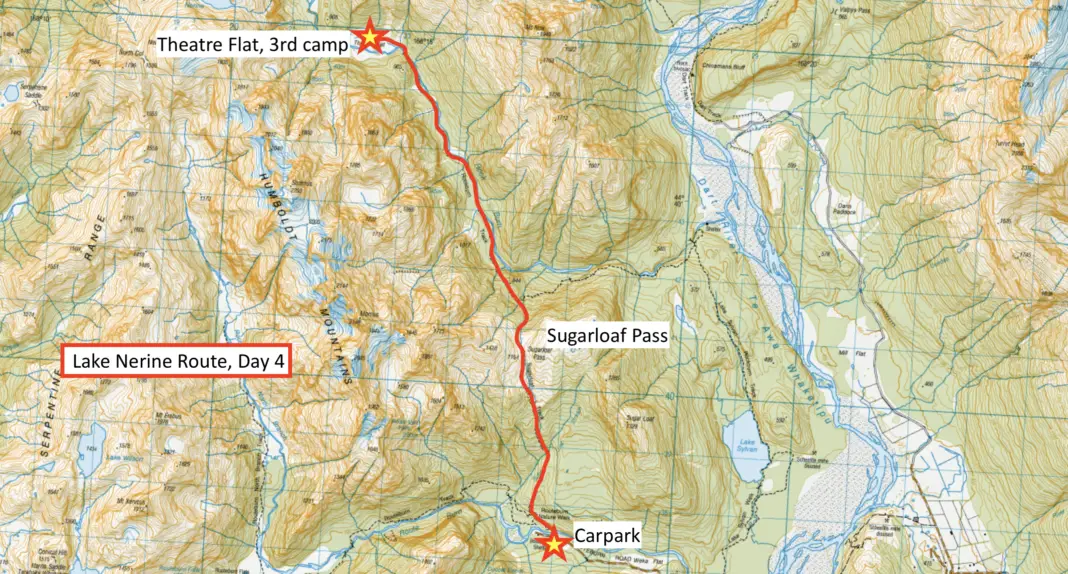
Lake Nerine is a gorgeous alpine lake hidden in Mt Aspiring National Park between the Routeburn and Rockburn Valleys. It offers those with appropriate backcountry skills an amazing trip over three alpine passes; North Col, Park Pass and Sugarloaf Pass.
Start & End: Routeburn Shelter, trailhead of the Routeburn Track near Glenorchy
Length: approximately 44.5km with 2,700m cumulative elevation gain / loss
Difficulty: difficult
Time taken: 4 days, but could be completed in 3 depending on fitness and route-finding skills.
Facilities: long-drop toilets at the trailhead, as well as on the track to Routeburn Flats Hut. Flats Hut has toilets, water, a fire, and bunk beds. During the summer Great Walks season (October – April) it has flushing toilets and cooking gas + burners, but requires online bookings.
– Important: this is a backcountry route that involves route-finding in steep terrain. Snow and ice can be present well into late summer, and low cloud/fog can make route-finding difficult. Appropriate backcountry experience is essential to safely complete this route. –
Table of contents
How do I get to the trailhead for the Lake Nerine circuit?
The circuit we took is a complete loop, with the first and last 10 minutes being the same part of the Routeburn Track. The trailhead for our route to Lake Nerine was the Routeburn Shelter, which is a half hour drive from Glenorchy at the head of Lake Wakatipu, or an hour and a half drive from Queenstown.
IF YOU’RE LOOKING FOR OTHER ADVENTURES IN MT ASPIRING NATIONAL PARK NEAR THE ROUTEBURN TRACK, CHECK OUT THESE TRIPS:
A side trip off the Routeburn Track, this is a challenging route connecting Routeburn Flats and Lake Mackenzie.
Another side trip off the Routeburn Track, this is one of my absolute favourite spots in all of New Zealand.
Lake Nerine Circuit Guide
Getting to Lake Nerine involves all types of tramping; from strolling along Great Walk footpaths, to route-finding your way across steep tussock slopes. As such, the route I’m describing isn’t the definitive route, but it’s one that my husband Matt and I had a lot of fun completing with our friends Hamish and Ashley. Hopefully you can use this guide to help with your own planning of some epic backcountry adventures!
For context, we completed this route at the very beginning of January 2022 – the start of a dry summer. I’ve included topomaps of each section with our approximate route marked. Do not rely on these maps for route-finding, they are intended as a guide only.
Day 1: Routeburn North Branch
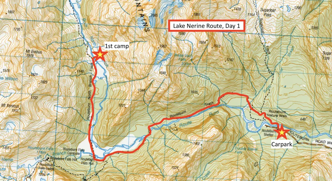
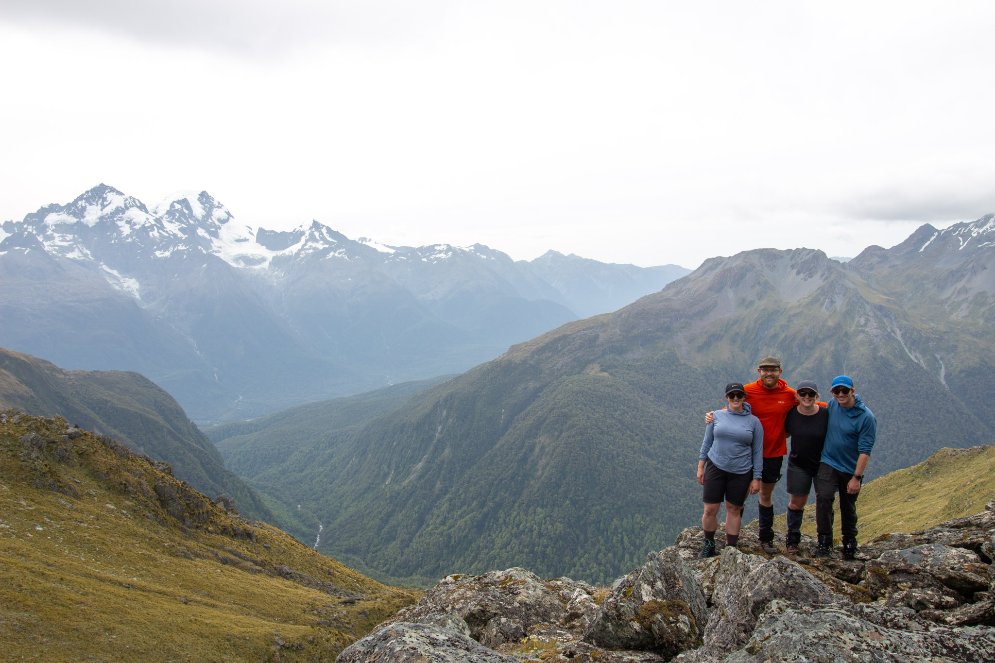
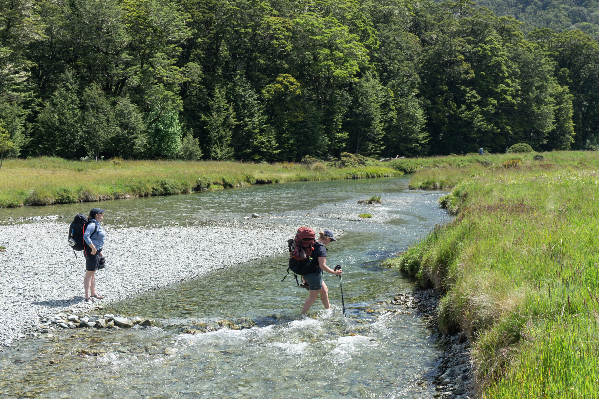
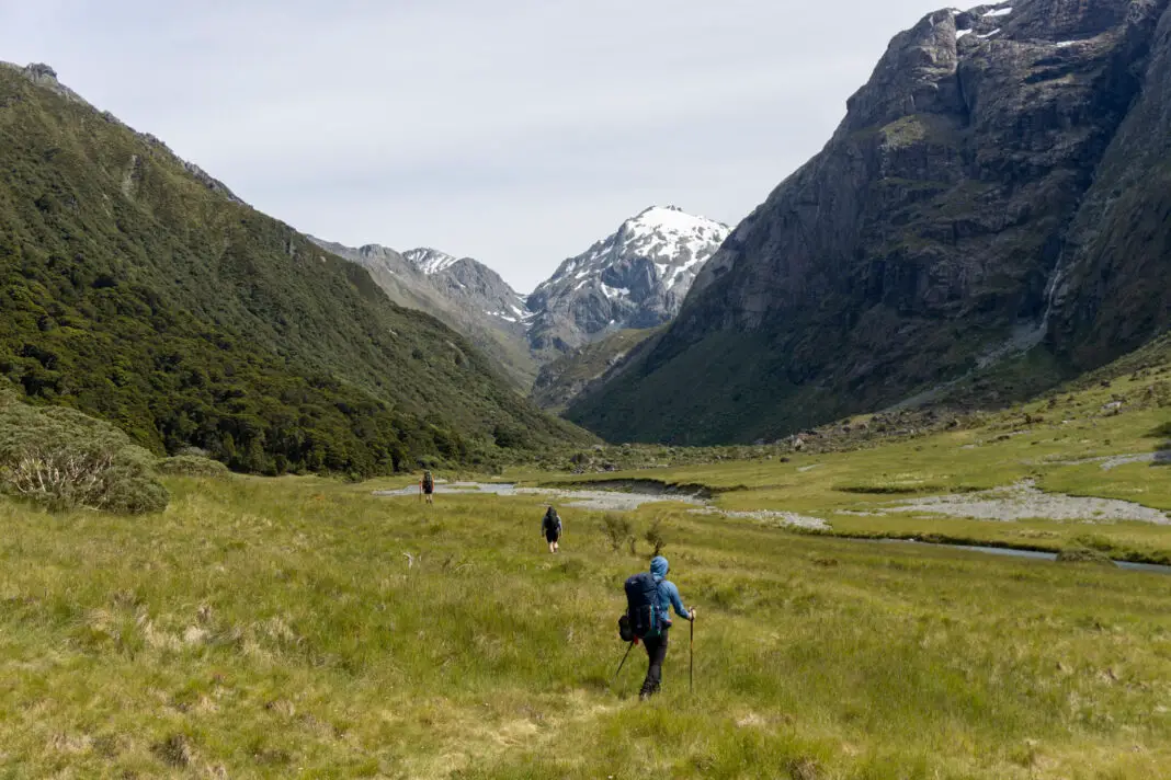
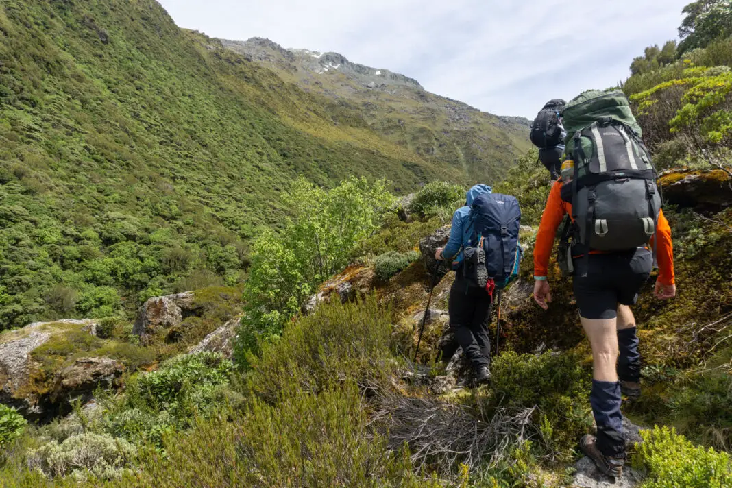
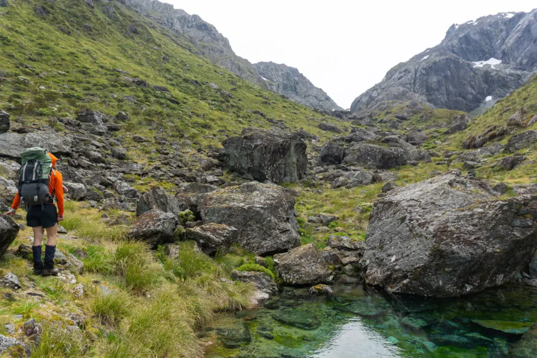
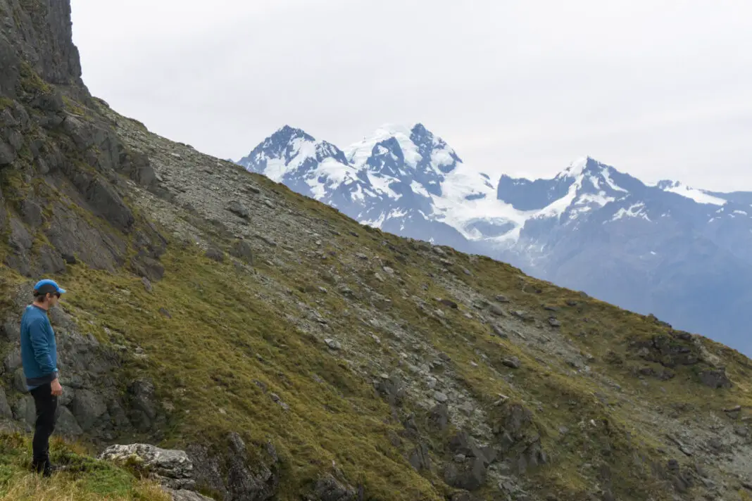
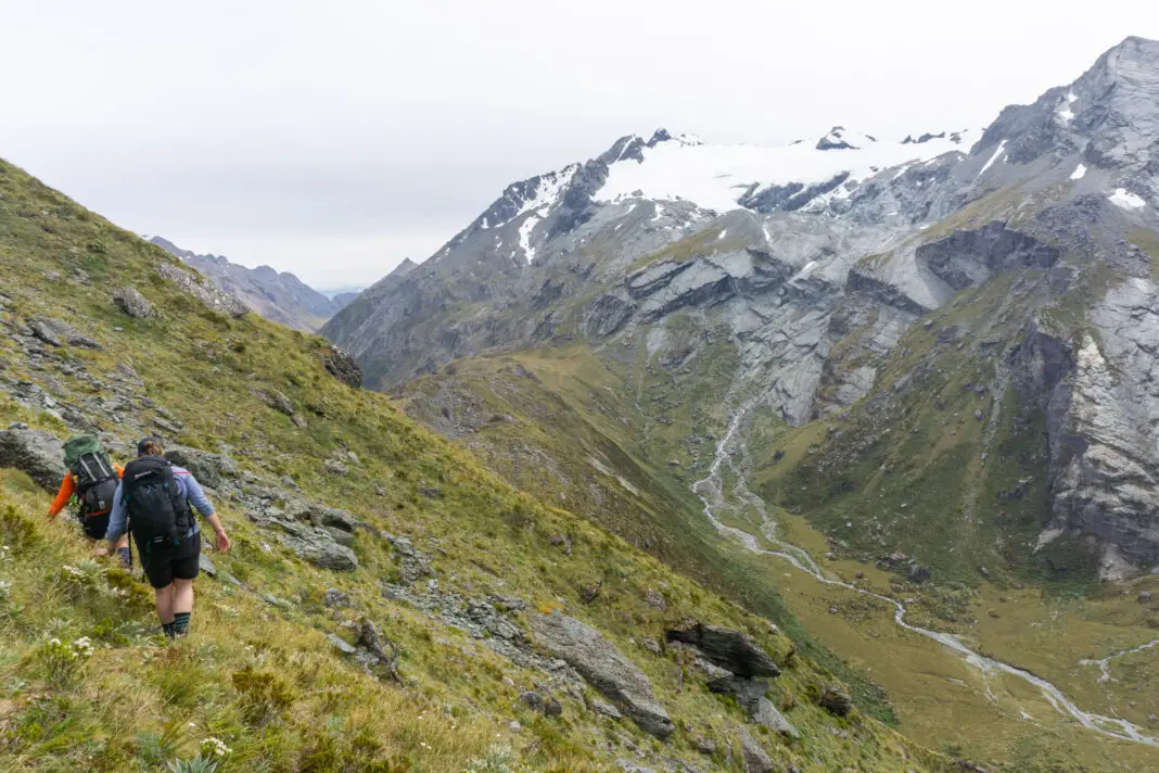
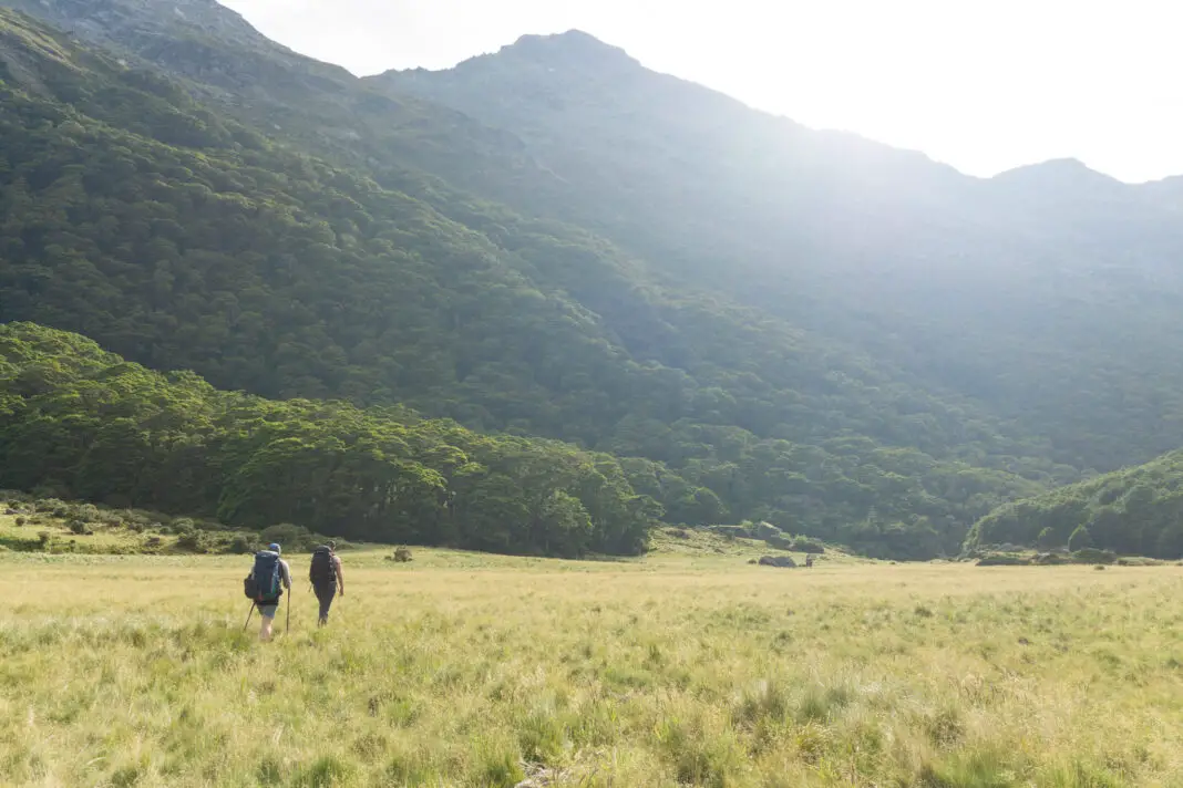
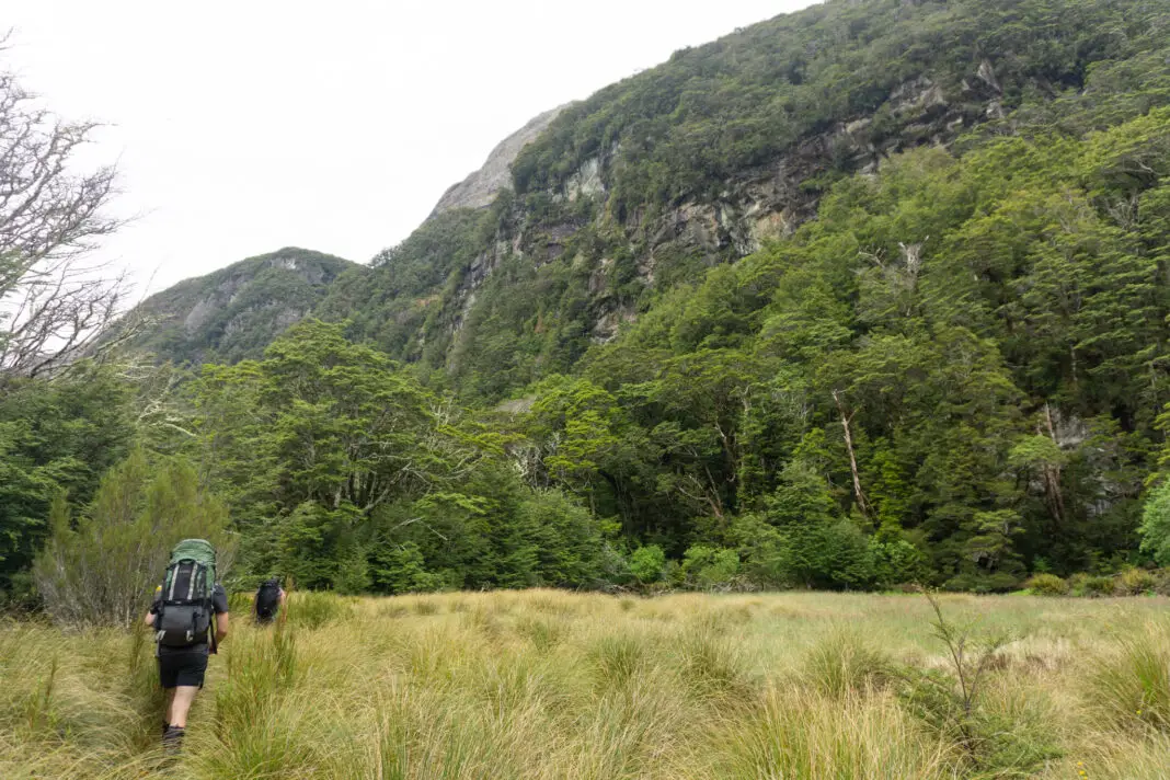
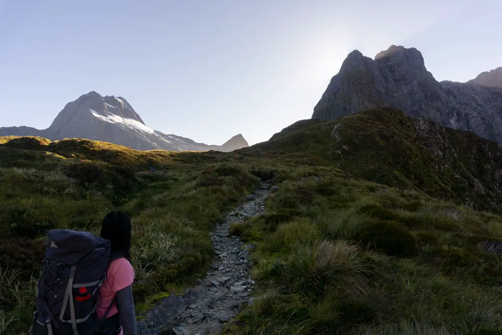
We met in Glenorchy for a very leisurely lunch, before heading to the Routeburn Shelter carpark. The first almost two hours was powering up the Routeburn Track from the carpark to Routeburn Flats Hut. From here we set off in a direction I’d only ever looked towards. Instead of continuing on the Routeburn Track, we crossed the small creek next to Routeburn Flats Hut, and followed the worn path through the long grass up the North Branch of the Routeburn.
Routeburn North Branch
Once we’d crossed the flats and the mountains had once again closed in high above us, the going got a little boggy, even in the middle of summer. Being day one of a four day trip, most of us opted to take our boots off in order to cross the little streams, even though it was slow work and bone-chillingly cold. But dry boots were worth it in my opinion!
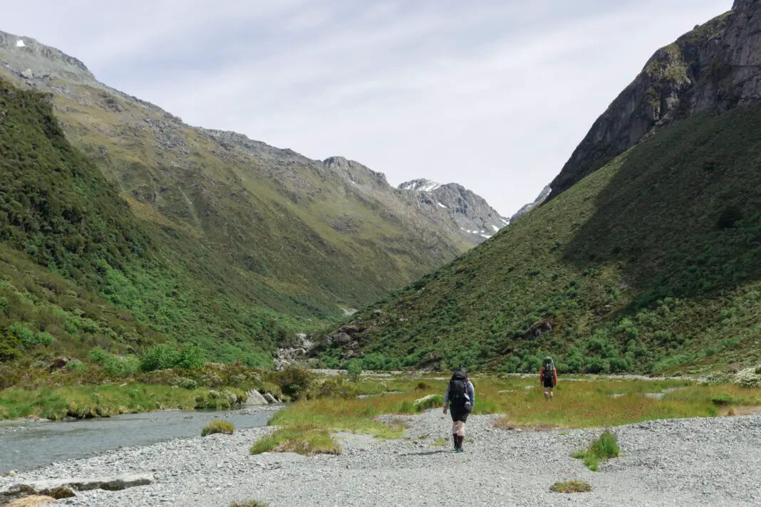
When we’d made it through the slightly boggy area, we started climbing up through forest, with a maintained track! Someone had recently come and chopped all the ferns on either side of the path, which was a welcome sight and made for very easy going. We reached the edge of the bush, and descended down to the next clearing, skirting to the left around the edge of a small tarn.
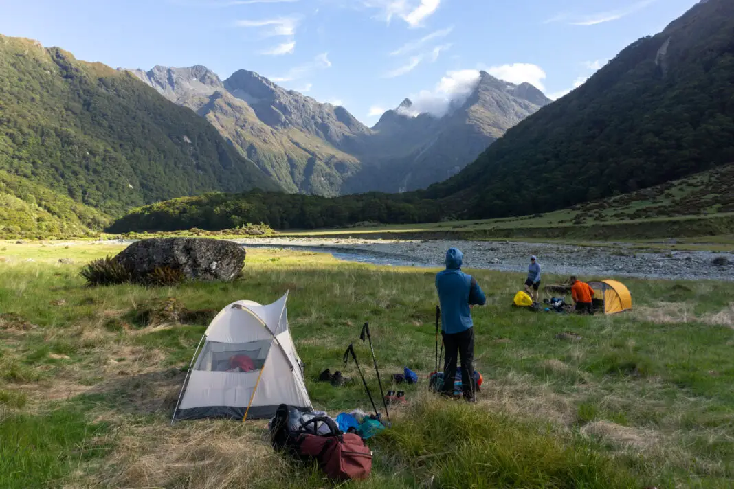
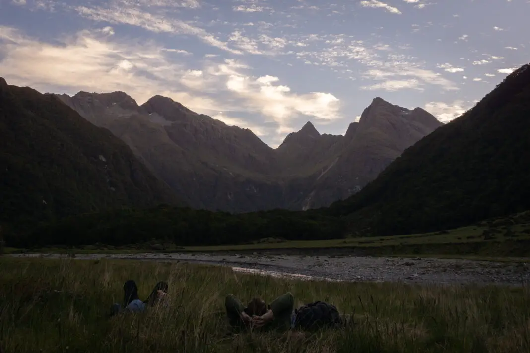
From the little tarn on the bush edge we crossed grass flats on a worn track back towards the river. From here we started looking for a nice camp site, which Hamish found on the other side of the river (true left). The river was low enough at that time of year that it wasn’t even above our knees to cross. Still freezing though!
It had taken us about an hour and a half from Routeburn Flats Hut to our campsite (so about 3.5 hours total from the carpark). We set up camp for our first night, and enjoyed burritos with a mixture of fresh and home-dehydrated ingredients. Delicious! The sandflies weren’t too bad, and the sunset was gorgeous. It had been an easy first day. I went to bed with a mixture of excitement and nervousness for what was yet to come.
Day 2: North Col to Lake Nerine
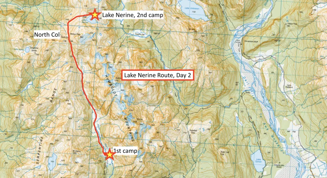
The next day dawned with high cloud, creating a slight cover from the sun, but dismal conditions for photos. We packed up camp, crossed back over the river (much harder in the chill morning air with cold muscles!) and set off up the worn track.
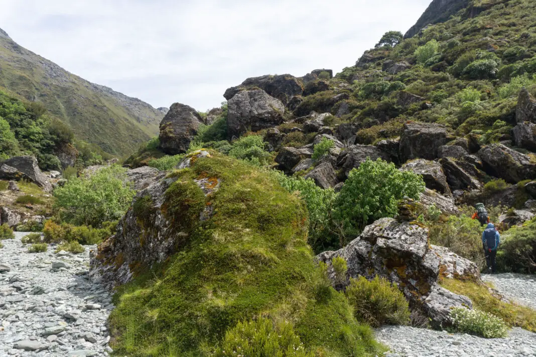
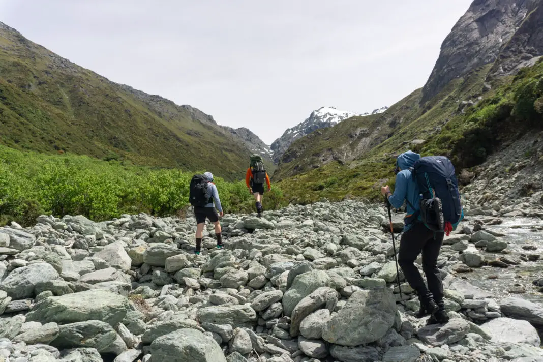
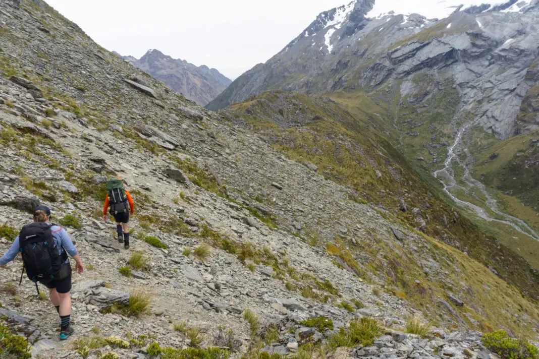
The track we were following petered out just before the large flat area seen on the map, which turns out to be a boulder field. We tried following some worn tracks up and over the large boulders, before quickly deciding to give up and just walk up the river itself, sticking to the true left side to avoid the boulders.
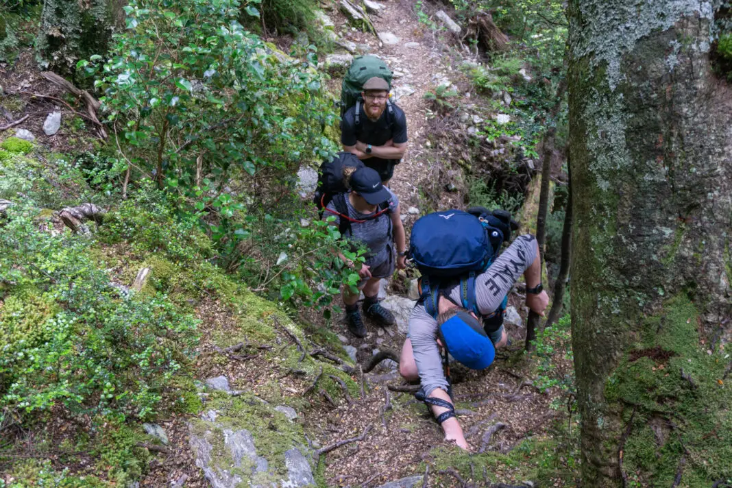
Once past the boulders on our left, we entered gravel river flats briefly, before an even bigger and steeper boulder field greeted us. The river disappeared steeply up the boulders, with no evidence of a track. Somehow Hamish found a path – perhaps an old trapping line, or maybe just the worn path that’s a bit hidden? – again to the true left of the river. It was still a bit of a bush bash up through the steep scrub, sometimes pulling ourselves up by plant fronds, but much easier on a semi-formed route.
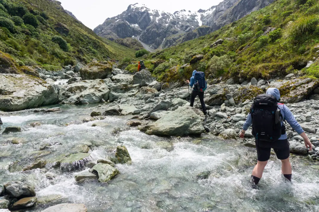
Once we’d popped out from the scrub into the river again, we stopped for lunch – looking up towards our goal; North Col. The next section was mostly boulder hopping in the river, with occasional forays up the true left bank if there was a steeper section.
It was somewhere around here that Ashley realised one of her tent shoes was missing from the side of her pack. It must have fallen off at some point between our camp and the upper reaches of the North Branch, but we didn’t know where. Ashley sadly gave it up for dead.
North Col
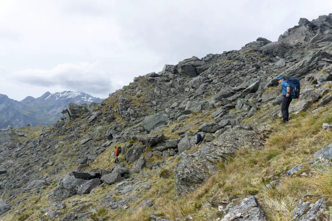
Eventually we reached our “turn-off” from the North Branch, which had been steadily shrinking the higher we climbed up it. The river turned to the right / east slightly, while we needed to continue climbing directly up towards North Col. We crossed over the North Branch one last time, before starting the steep climb up the gut to the col. There were cairns here and there, and even a few little tracks in places, but the going was mostly obvious – North Col dominated the horizon once we climbed up a bit further.
The going got steeper and steeper as we climbed up. The last section before the col proper was spent negotiating steep, eroded slips before climbing up slushy snow slopes to the top. North Col was surprisingly large and flat (obvious when you look on a topomap, just not the picture I had in my head) with a few places to camp in calm weather (although I imagine it would be horrendously windy quite easily).
The traverse
We stopped for a good break amongst the large boulders on North Col, while we looked across the slope to our right to find a good line to traverse. There are apparently two ways to tackle this next section. The first is to maintain the same elevation as North Col, and then climb down to Lake Nerine.
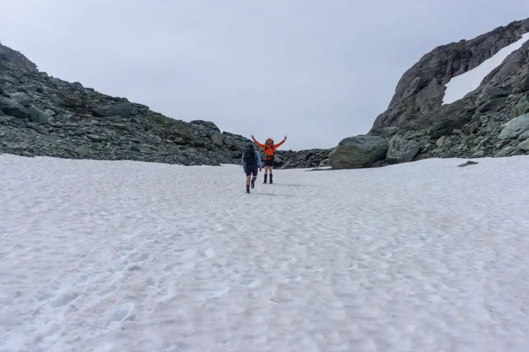
The second (and more straight-forward) is to drop down slowly to just over 1400m, which has some flat areas that are easy going. Most of the tracks / cairns that we could spot went this way, which is what we followed.
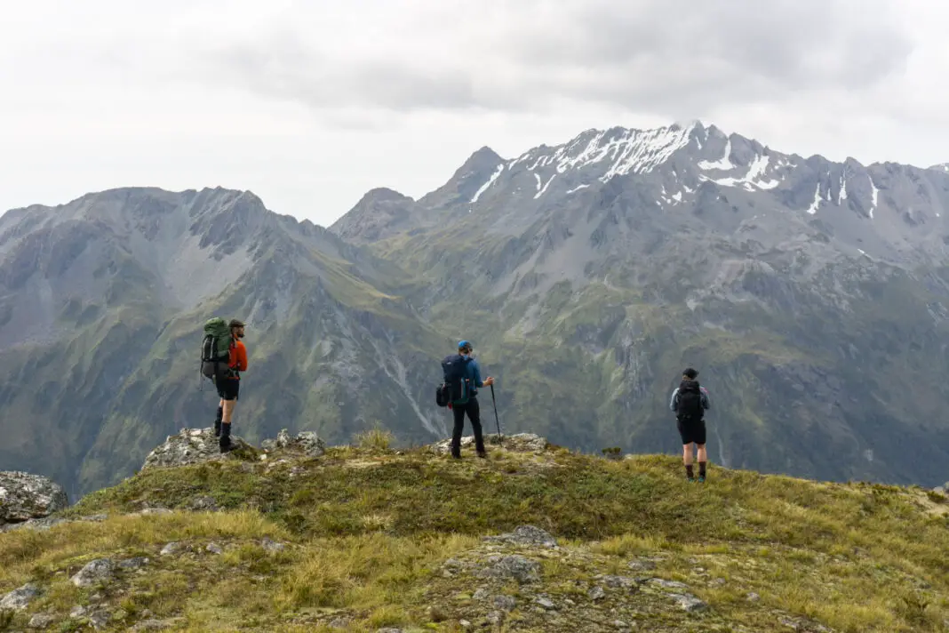
We reached a few flattish terraces, that would have likely held water if the weather hadn’t been so dry. Then it was a steep climb up to the top of the ridge, where we gained our first view of Lake Nerine itself.
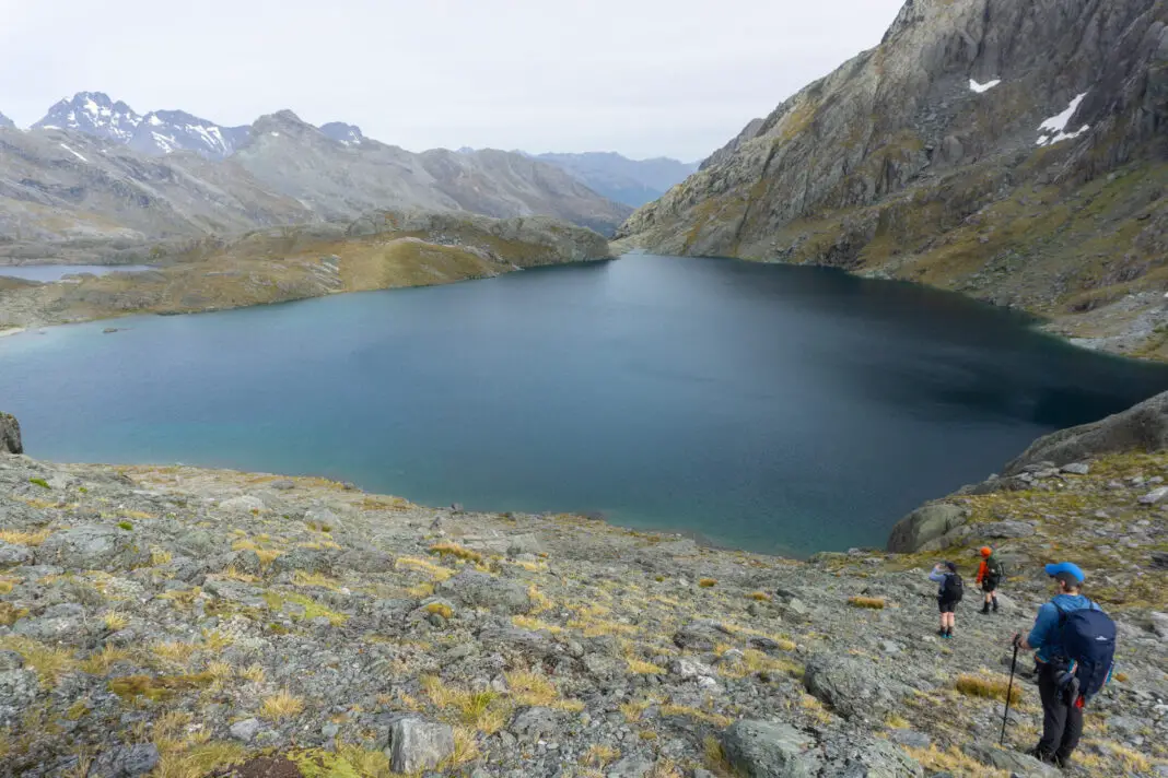
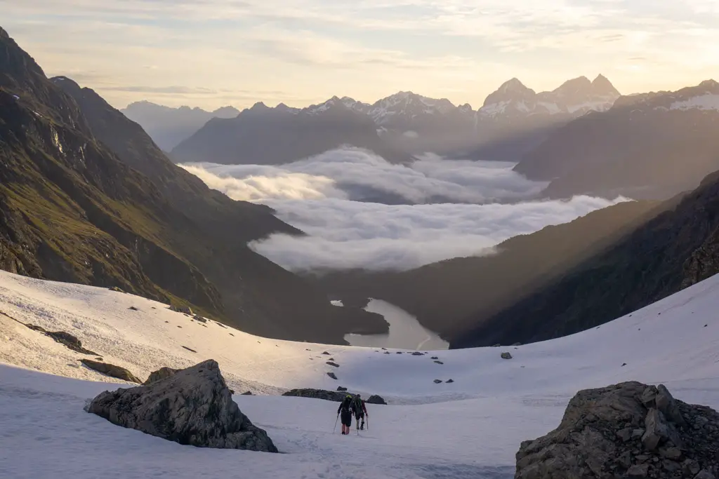
Lake Nerine
Lake Nerine was gorgeous, but by this stage I was pretty exhausted. It had been a long day! We climbed down the rocky slope to the edge of the lake, and then circled around the lake to the north to find a good campsite.
There were already six tents that we could see set up on the lake shore and amongst the rocky outcrops. Not quite the solitude I’d been expecting, but there was plenty of space that it didn’t seem crowded, and most were hidden away.
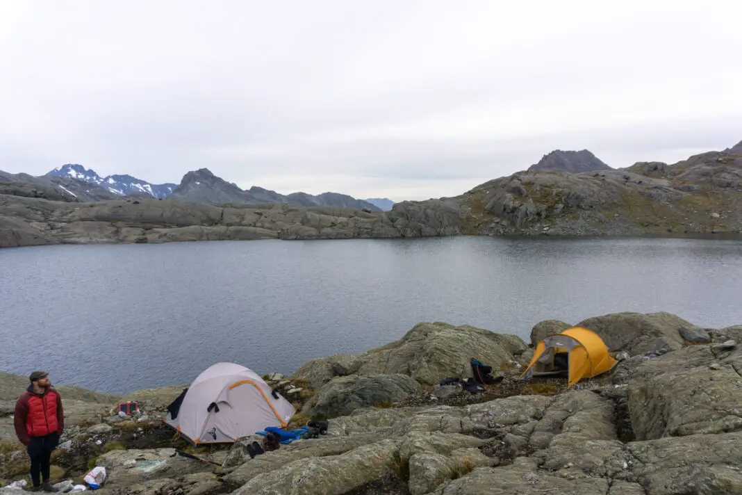
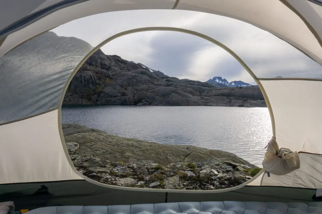
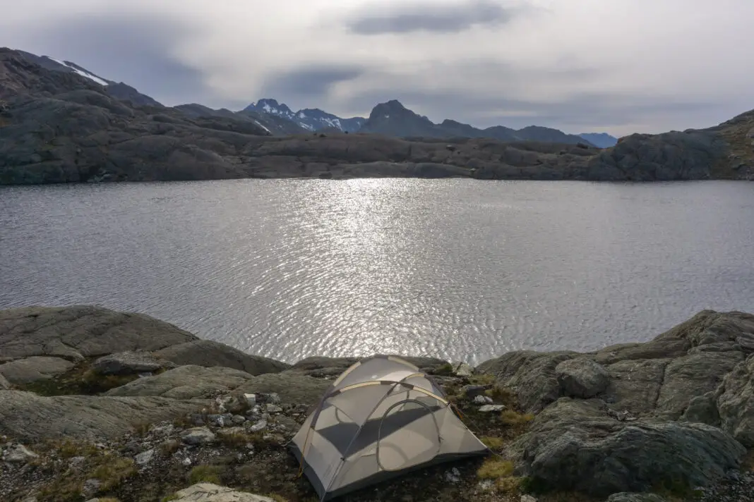
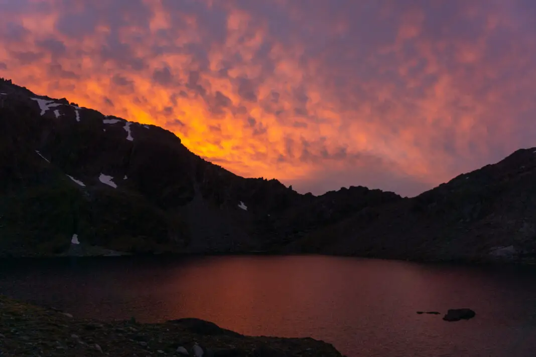
We found a nice site next to the tarn to the north of Lake Nerine, and set up camp amongst the rocks. Dinner consisted of delicious home-dehydrated spaghetti bolognaise. Once fuelled with pasta, my energy miraculously returned (I obviously hadn’t been fuelling myself sufficiently during the day), and I ran around all of the rocks as the sun put on a crazy show as it set.
Day 3: Lake Nerine to Park Pass & Theatre Flat
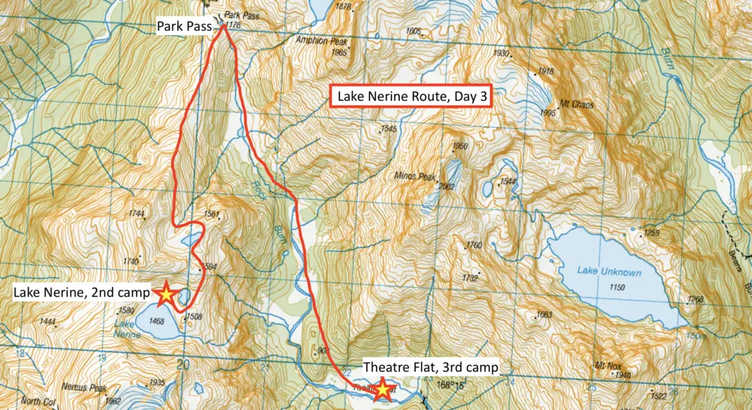
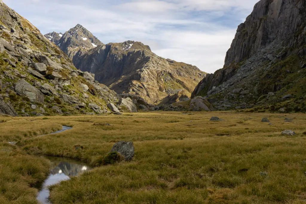
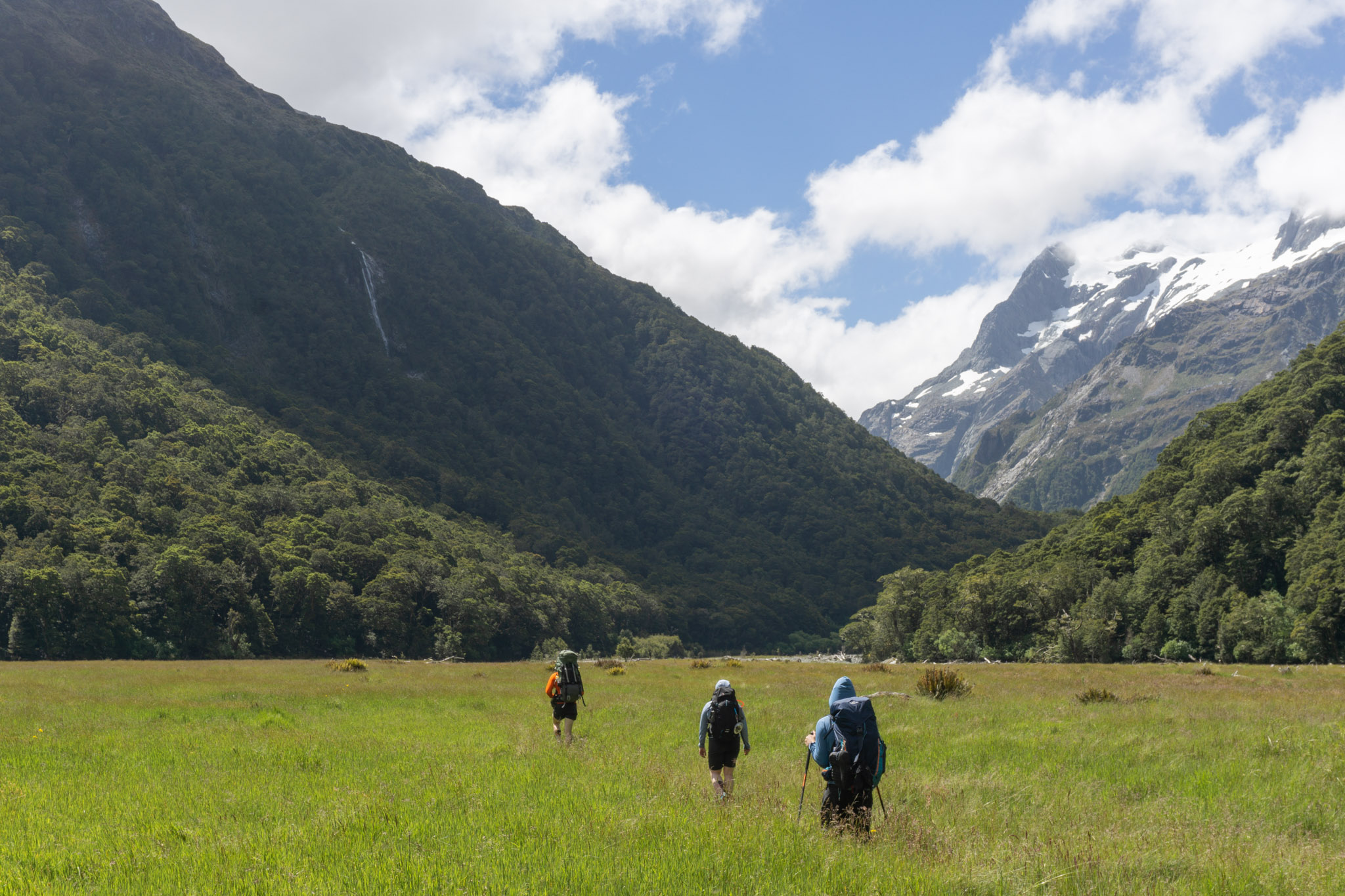
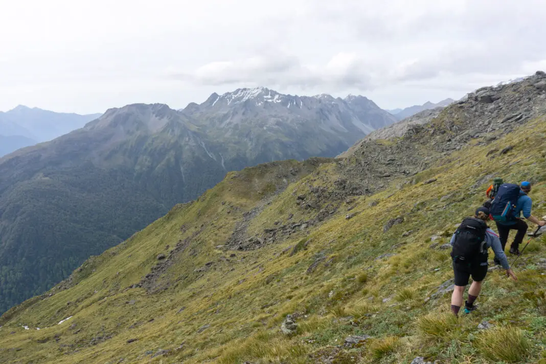
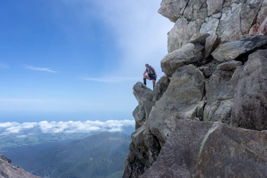
We woke up to similar conditions on our third day – overcast but warm. We packed up camp and walked around our tarn, saying goodbye to Lake Nerine as we went. It looked as though you could have climbed directly up from the head of the tarn (if you didn’t mind scrambling). However, we opted to take the easier route around to the right traversing around Pt 1594, and trying to be careful to not get bluffed out. In the end we just climbed up rock slabs to the top of Pt 1594, as this was easier than trying to find a route around the increasingly steeper terrain.

From the top of Pt 1594 there were cairns to help show us the route down. We climbed down from the saddle to another beautiful tarn. We circled around its edge, which was easy going.
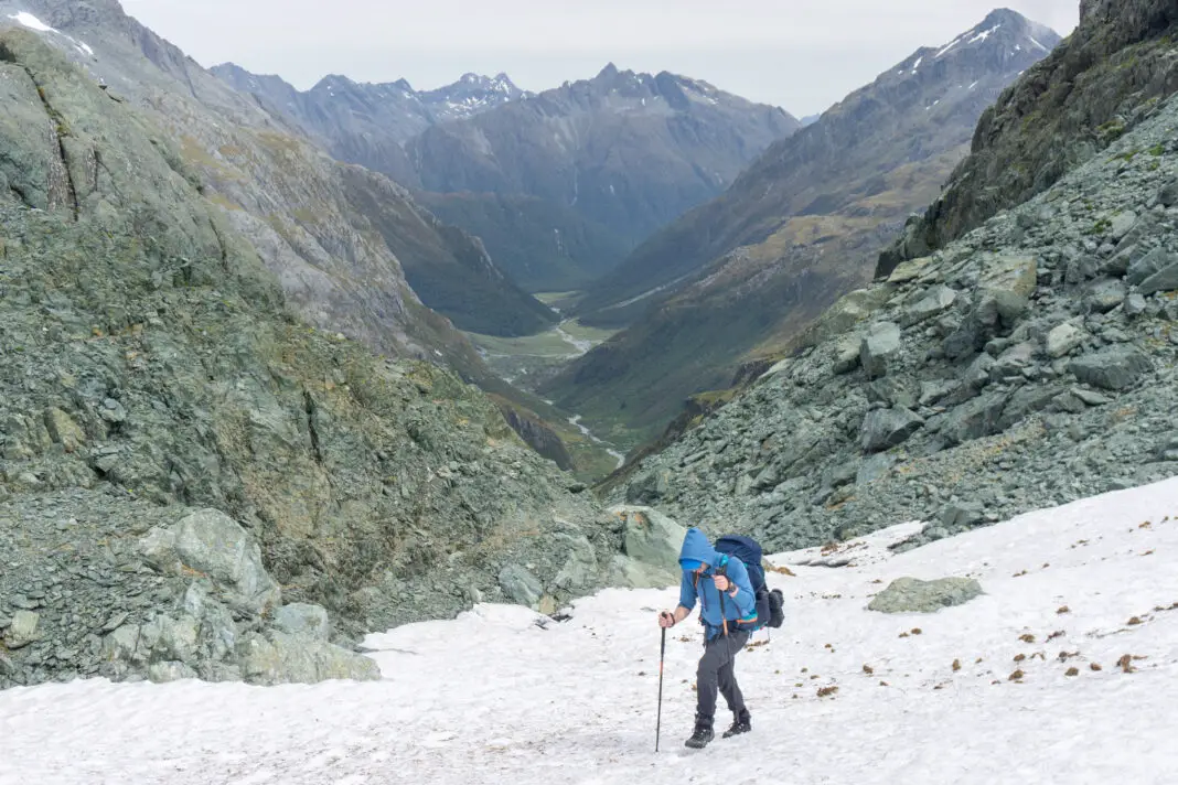
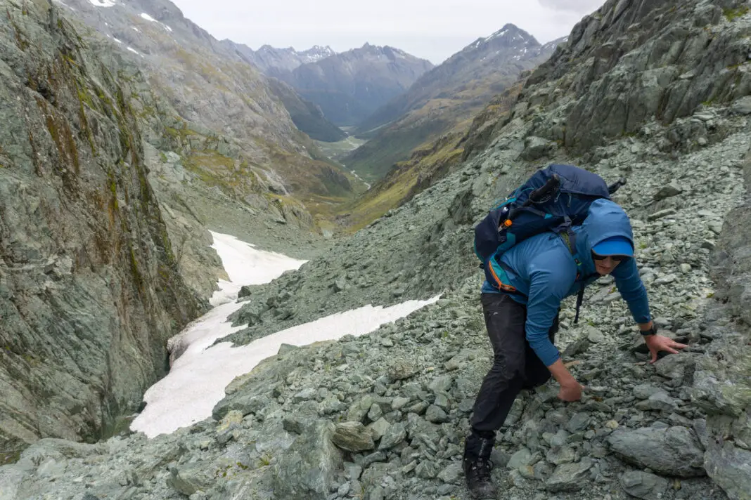
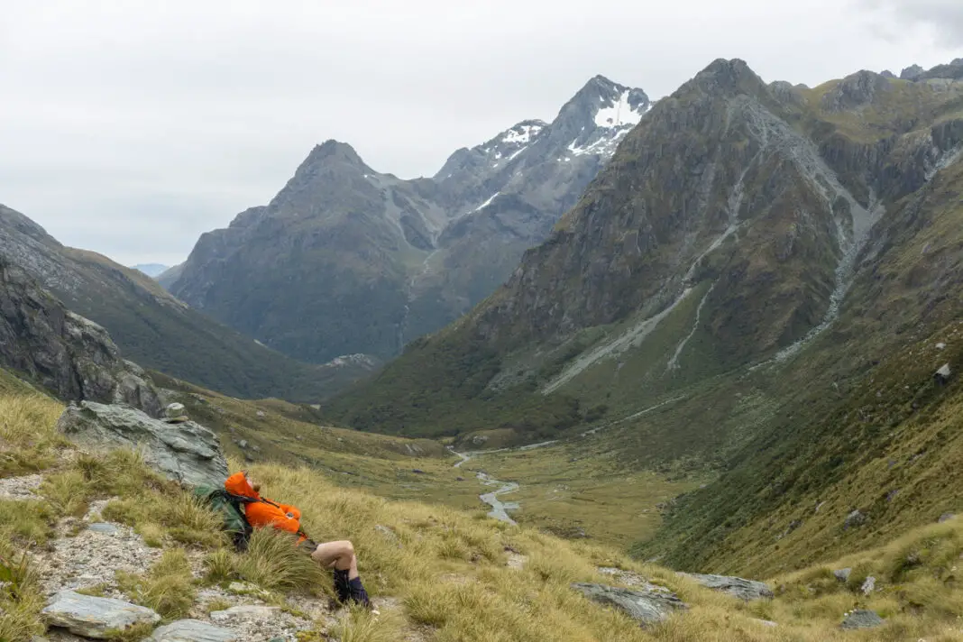
While looking ahead for the route, it was easy to think that we would be climbing along the ridge in front of us (leading to Pt 1561), but the actual traverse to Park Pass is much further to the west than my brain expected. In low cloud or fog, route-finding even on this section could prove quite tricky.
Once around the tarn, there was a steep climb down into a creek at its outlet. It took us a bit of time to find the best route down and across the creek, before we could start the traverse towards Park Pass. Dropping too low in this section would be dangerous due to cliffs, if needed it would be better to stay high and take the longer route around the stream right next to the tarn.
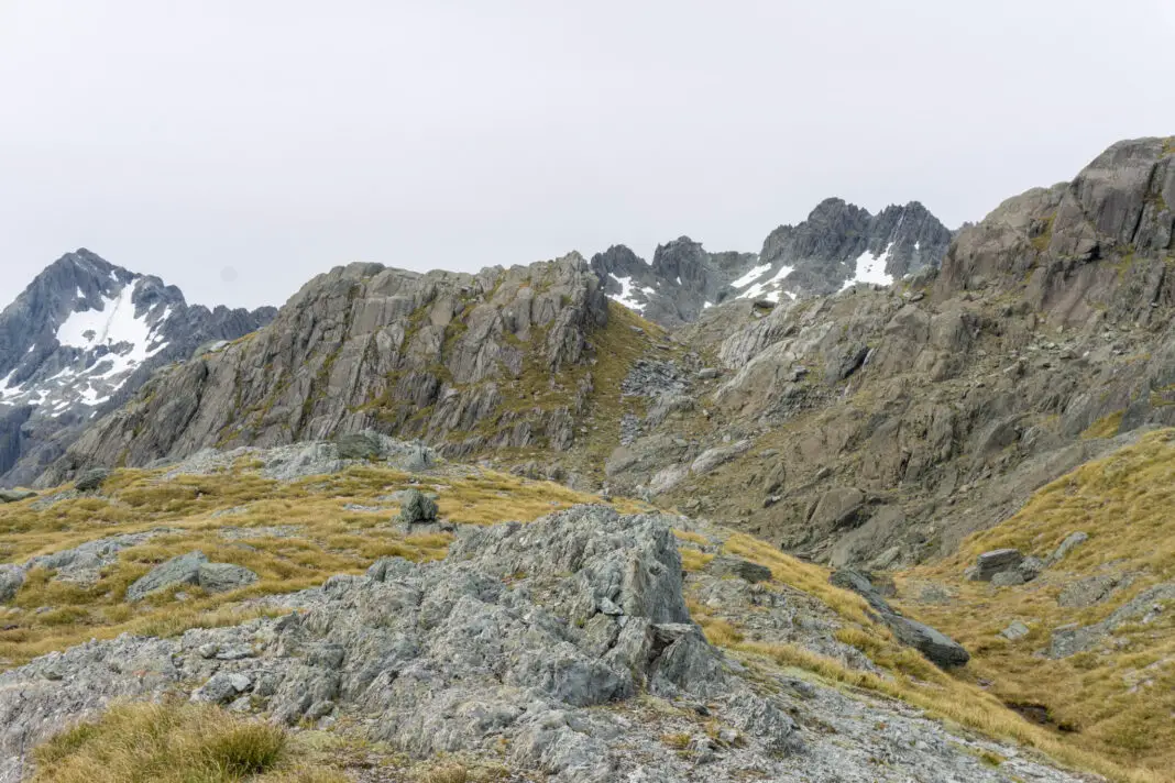
The traverse
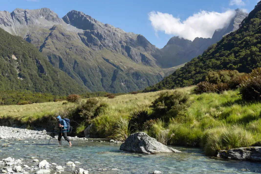
The traverse towards Park Pass was across ridiculously steep terrain (to me at least). I didn’t take many photos. I didn’t want to risk dropping my camera and needed both hands on my poles. There were a few places where we could stop comfortably along the way, but most of the time it felt safer to keep moving.
In some places there was a rough track and some cairns, which we tried to follow. But at other times this petered out, or there were multiple tracks, so we tried to pick the best route. In wet weather or snow, the tussocks would be dangerously slippery – they were bad enough in the dry!
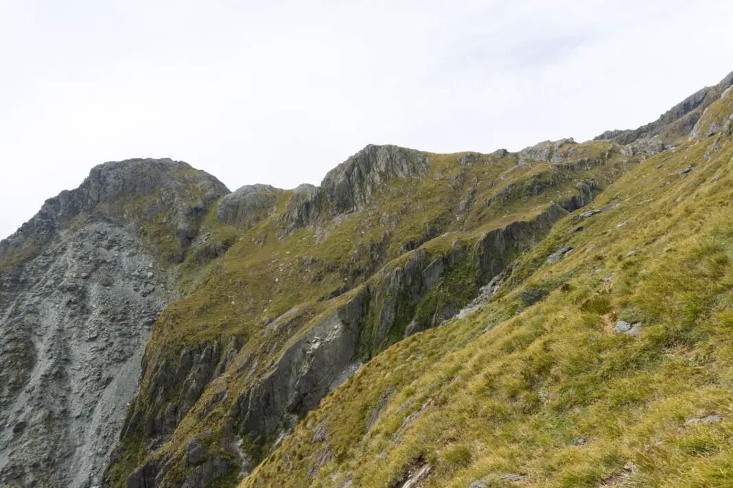
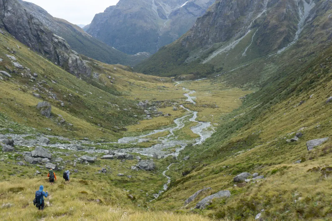
The traverse slowly descended, as you can see in the above photo. We ended up reaching the ridge leading to Park Pass at about 1250m, where there was a bit of a terrace, having started at the creek at about 1520m. That afternoon, once we were safely down in the valley below Park Pass looking back up at where we’d come, we saw two trampers on the traverse dropping far too low, too soon. It gets really bluffy and sketchy lower down, and we saw with relief that they re-traced their steps to climb back up, before starting the traverse again.
There were a few slips along the route, which Matt definitely didn’t like. (I wasn’t the biggest fan of either, if I’m honest). Photos don’t really do justice to how steep it was. Or how slippery the snow grass was underfoot. There was a lot of hanging on to vegetation and trusting my poles, for me at least.
Park Pass
We had a quick lunch once we reached the terrace on the ridge, basking in the sun. Then it was relatively straight forward travel along the ridge to Park Pass. When we circled around some small tarns on the pass, we found a track of all things! It felt a bit foreign to see a worn path after having traversed absolute wilderness for the past two days. It felt like a highway, even though it was actually pretty rough.
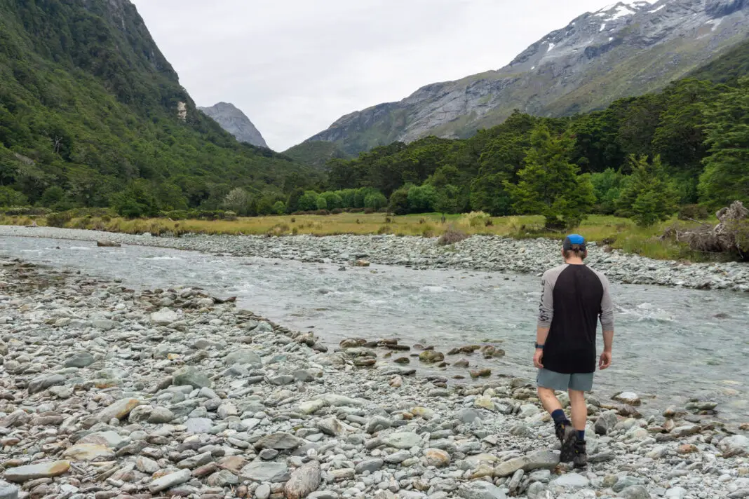
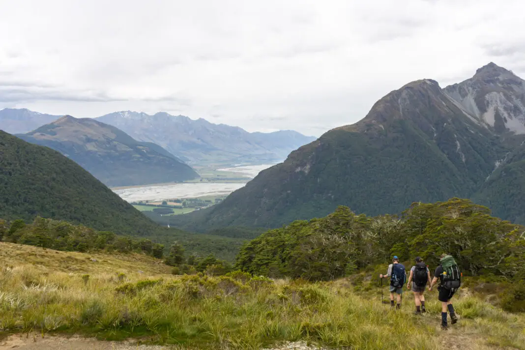
We followed the path down Park Pass into the Rockburn Valley. From here my memory isn’t as good – I was exhausted! We following a mixture of paths and our noses through tussock flats and forest. Eventually we reached a steep uphill (in between Pt 908 and the hillside proper) in the forest before descending to Theatre Flat.
Hamish found us a great campsite that was well established. We fought sandflies, took a dip in the river and cooked up a much needed meal. It had been a long day, and I slept very well.
Day 4: Theatre Flat to Sugarloaf Pass
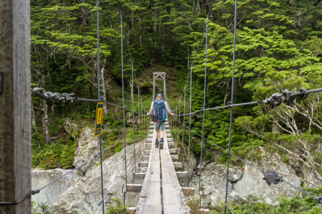
The next day was a relatively straightforward tramp along the Rockburn Track – a luxury after what we’d been through the previous two days. We pushed through damp tussock to the swing-bridge over the Rockburn River, and then followed the track.
There were a few washouts or unbridged creeks to cross at times, but Ashley, Matt and I had given up on dry feet by this stage. Hamish performed acrobatics on logs across streams to avoid getting his boots wet.
Sugarloaf Pass
We turned right at the track junction of Sugarloaf Pass and Lake Sylvan, and started climbing more steeply again. There were a few places with significant tree-fall that were a fun obstacle course to clamber over, but other than that and the steep terrain it was relatively simple going.
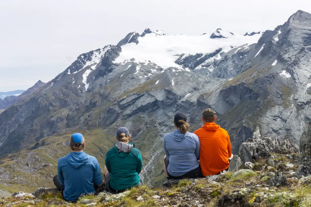
Eventually we topped out on the wide and spacious Sugarloaf Pass. This was now familiar terrain for me, having been up here in winter the year before from the other side. I’ve written in more detail about that trip here, so won’t write too much about the trip down.
We arrived onto the highway that is the Routeburn Track, walking ten minutes to the carpark. Ashley was wondering whether, by some miracle, someone could have found her missing sandal from Day 2 in the North Branch of the Routeburn, and left it at the carpark. We didn’t have much hope, but when she approached the sign after the last bridge, she let out a massive whoop. Her sandal was there! Somehow someone had managed to find it in the middle of the wilderness and bring it all the way back out. A very kind soul. Ashley was stoked.
We dropped our gear at our cars, and took a quick (by necessity due to the temperature) dip in the Routeburn. It felt so good to wash off the sweat and muck of the past few days. I think the tourists arriving for day walks along the Routeburn thought we were a bit crazy. But it was a great way to finish a fantastic trip!
Safety
As always, please stay safe when you’re out exploring. Follow the Outdoor Safety Code:
- Choose the right trip for you (read my article, read other blogs!)
- Understand the weather
- Pack warm clothes and extra food
- Share your plans and take ways to get help
- Take care of yourself and each other
Stay safe and get outside!
Where to next?
LET ME KNOW WHAT YOU THINK! LEAVE ME A COMMENT OR MESSAGE ME OVER ON MY INSTAGRAM.
I love hearing from readers and helping them plan their own adventures!
Great review of a great trip, that I have down twice before.
Thank you! Did you go the same direction, clockwise too?
Hi Alice,
How many hours did Yoy hike from Lake Nerine to Park Pass?
Hi Sue – that portion took us just under five hours including a sit-down lunch break, but I’m not the speediest tramper so that’s probably a pretty average time. Could be a lot faster, or a lot slower if visibility was poor or you took a while with route-finding.
Hi Alice! I live your blog posts and am.about to do this route next weekend:)
1) how long were your day 2 and 3? (I am a slow hiker too so I go with conservative calculations;)
2) any chance you’d share your exact Topomap route with me in case you recorded it? I hear so often that the path up from North Branch towards North Col (the first section) is a really bad Bush bashing, thorny scramble and that there is a better and a not-so-good route from Lake Nerine to Park Pass)..so having the Topomap route is always a bonus!
Thanks in advance for your reply! 💚🙏
Hi Brita! Sorry this might come too late for you, apologies I’ve only just come back online after a break over Christmas/NYs. I’ve gone back and double checked my watch data – took us about 7 hours from where we camped in North Branch over North Col to Lake Nerine. Then from Lake Nerine to Theatre Flat on day 3 I’m not sure how long it took us because my watch died sadly! But I think it was a tad longer than day 2 from memory? Although it was three years ago now! We weren’t motoring that’s for sure haha.
I’ll draw a rough route on a topomap and email it to you 🙂 The way up North Branch to North Col I didn’t find too bad – there’s one section that would be a bit gnarly (where the river goes through a bit of a gorge/drop) but we found an old trapping route on the true left (on the right of the river as you travel upstream) which wasn’t too bad! And it’s not a long section. I’ll send through the email shortly!