The tallest waterfall in lowland Southland was long known only to local farmers and hunters, but Makarewa Falls is now no longer a secret! Here’s all you need to know about the Makarewa Falls Track to see the waterfall with your own eyes.
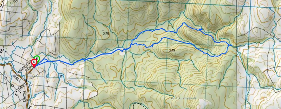
Length: 16km return
Time taken: 6 hours return
Difficulty: moderate – route-finding required / rough trail
Facilities: none. The closest public toilets are in Winton (20 minute drive from trailhead).
– Important: There have been several LandSAR callouts on this track –
One in 2024 and the other in 2025. I’ve been in recently (end of 2025) with the Southland Tramping Club and LandSAR to add more orange markers to the track. But please do not underestimate the terrain, weather, how long the track will take, and how easy it is to get lost in the open bush.
Why choose Makarewa Falls?
I’d heard rumours of a new tramping track being developed by the Winton Rotary Club deep in the Hokonui Hills. The talk was that the track lead to the tallest waterfall in Southland outside Fiordland; Makarewa Falls. And despite growing up less than an hour’s drive from the Hokonuis, I’d somehow never heard about it! Of course as soon as I knew there was an amazing waterfall in Southland I hadn’t yet seen, I needed to rectify that fact. But it took two goes to actually successfully see Makarewa Falls with my own eyes.
How do I get to the Makarewa Falls trailhead?
The Makarewa Falls Track is accessed at the end of Mandeville Road, off Hall Road in the Hokonui Hills. It’s about 20 minutes’ drive from Winton through Browns on gravel roads. Or 45 minutes’ drive from Invercargill. It has now been signposted from Browns.
Map of Makarewa Falls Track
If you’re looking for other adventures in Southland, check out these trips:
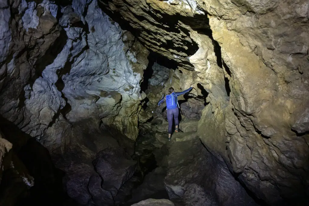
Another local Southland secret, check out this free unguided underground adventure!
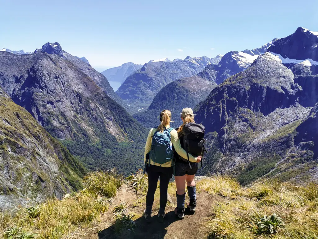
In my opinion, this is one of the best day hikes in New Zealand – deep in the heart of Fiordland National Park.
Makarewa Falls Track, Take One: The Failure
My interest in this trip had been piqued by one of my Instagram friends; the lovely Gill Swinton. She’d messaged me during the first 2020 lockdown telling me about a ridiculous waterfall that nobody was talking about or visiting, not an hour’s drive from my house. So once lockdown lifted, and armed with literally no information other than a road name and a general idea of how long it might take, I dragged my husband, Matt, and our friend Lauren out past Winton to explore.
This was in July 2020. So the track wasn’t officially open, nor did it have any DOC signage. We rocked up to the end of a muddy gravel road, after having travelled down several successively more flooded gravel roads in the middle of nowhere. I really wasn’t convinced we were in the right place.
We backtracked and called in at a local farmhouse to double check. The lady of the house (properly attired in full Hunting & Fishing camo) kindly advised us we were indeed in the correct spot. She also recommended sticking to the paper road access to the Hokonui Forest Conservation Area, or risk being prosecuted for trespassing by one of the nearby farmers who despised poachers. I felt like my puffer jacket, plaited blonde pigtails, sneakers, and Lululemon tights screamed “townie” rather than hunter, but I thanked her for the helpful advice. At least I knew we were in the right place!
So we got lost …
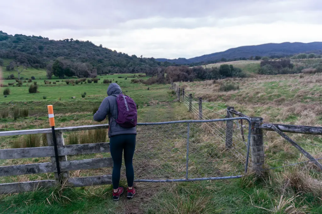
We changed into proper tramping gear at the “carpark” (read: muddy patch of grass), then set off …
… and promptly became lost. We’d automatically following the farming track to the right, instead of the invisible paper road down the left-hand fence-line (which now has signage to point you in the correct direction).
Lauren, Matt and I probably walked for a few minutes before realising we weren’t going in the right direction. We then walked for several more minutes hoping to see some signage. All the while looking around anxiously for the poacher-hating farmer – who in my imagination would appear on the brow of a hill carrying a gun, with several vicious dogs twining around his legs.
Eventually we turned around and walked back to the gate. Looking around more thoroughly from the gate, we spied some orange markers along the fence-line, at right angles to the track we’d taken. Off we set again, this time with slightly less enthusiasm, but slightly more confidence.
On the right track
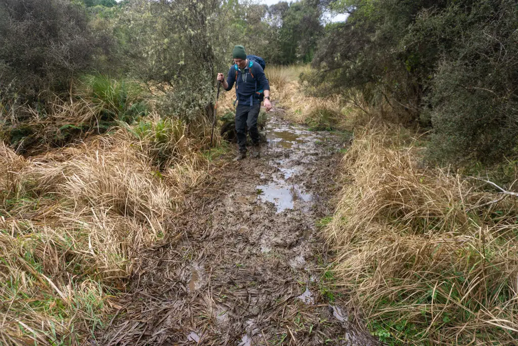
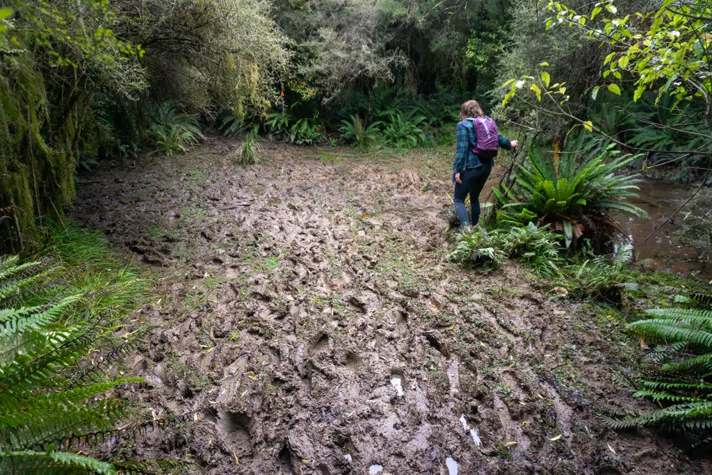
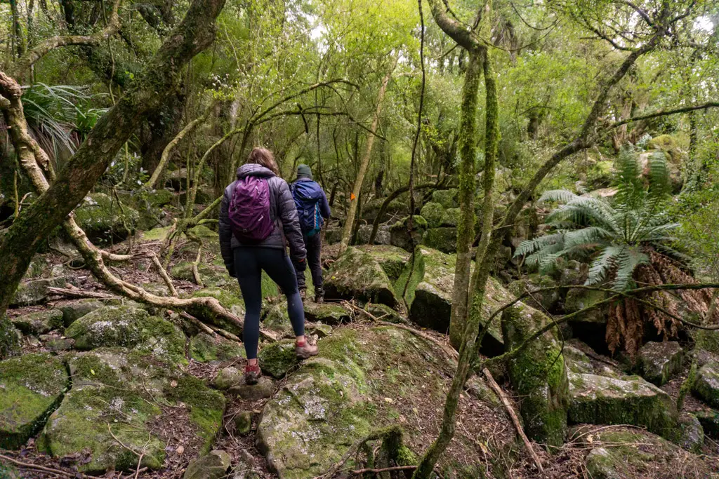
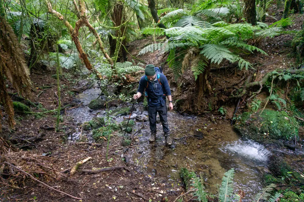
Once we’d found the orange markers sitting above the fence posts, it was easy work to follow them through the paddocks and two gates (carefully closing them behind us – always leave farm gates the way you found them). The last “paddock” was extremely boggy. Despite my waterproof boots, mud soaked through to my socks and feet before we even reached the entrance to the bush.
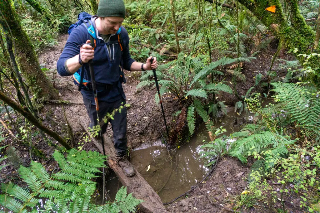
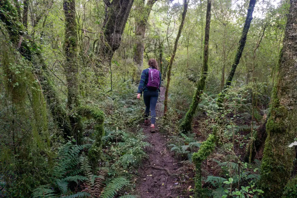
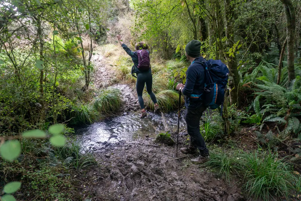
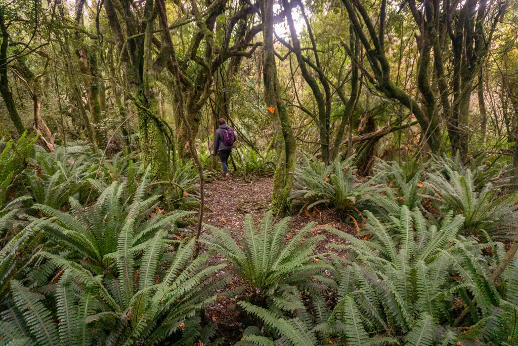
Once in the wooded Conservation Area, the muddy track narrowed but was still very obvious in this section through the bush. Several times we had to jump over little tributary creeks, rushing to join the stream that we could hear trickling through the trees even when we couldn’t see it (the stream is in turn a tributary of the Makarewa River).
Mud, mud, mud
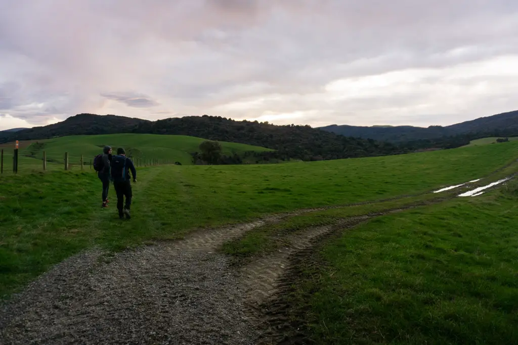
Eventually, the track opened up again into a long, clear valley, with wooded hills rising on either side. We followed the orange markers along the clearing (and through an extra bush patch) for almost 30 minutes. It wasn’t that it was a long distance. More that it was hard work navigating the easiest way through the many swimming holes disguised as muddy bogs.
This is not a track to worry about keeping your feet dry.
After about an hour’s total walking from the car (with a brief up and down section), we reached the loop track junction. There was no proper signage, just two large orange markers. So we arbitrarily took the right-hand fork heading up the hill.
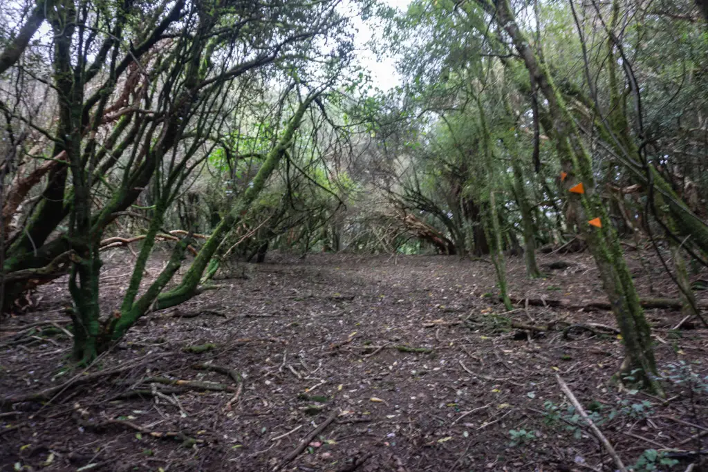
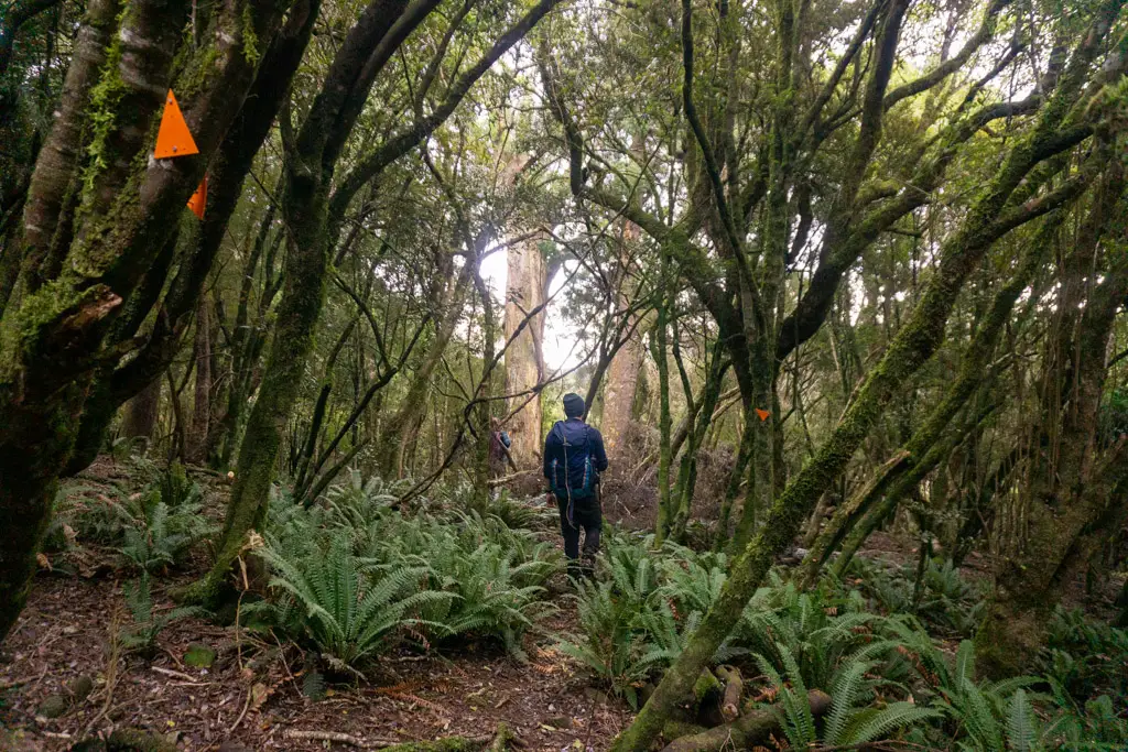
The track entered the bush as it climbed up the side of the hill, and then traversed along it. The bush here is very open, and it’s very easy to lose your way if you don’t pay attention to the orange triangles. This is where the two recent LandSAR callouts were.
Are we there yet?
I’d turned on the tracking on my Topomaps app, but still had no clue where the falls exactly were. At least I knew we were on the right track, thanks to the Winton Rotary Club and the many hours they spent attaching hundreds of orange markers to trees (and as of 2025, the Southland Tramping Club attaching a hundreds more).
We traversed around the side of the hill for what felt like forever. There was lots of roughed up ground from (I’m assuming) wild pigs, and at one point I thought I even smelt one of them, but didn’t see or hear any animals other than birds.
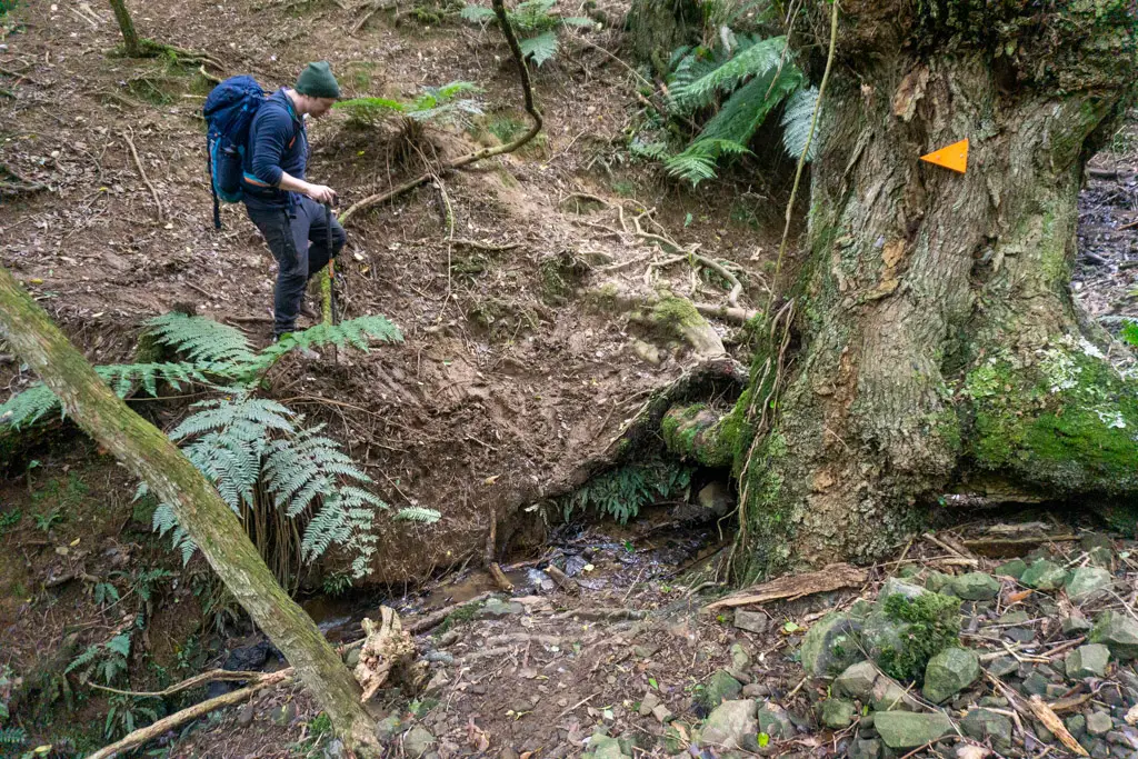
After the traverse, which had started to wreck my ankles, we then descended into a small valley and jumped across a small creek. The track then continued upstream of the creek on the very muddy south-side of the hill, before crossing back over the same creek again.
I started to worry about how long this was taking us. I checked the topomap. Still no nearby section that looked as though it could feasibly hide a 24 m waterfall. How much further were the falls going to be? At this point we’d already been walking for close to two hours. The sun was going to set in another four hours. I didn’t want to worry the lovely farmer we’d asked directions from when she didn’t see our car drive back past. Plus it gets dark much more quickly in the bush than it does in the open. I allowed us another half hour’s walking.
The track then started to climb more steeply, and then more steeply again. After another 20 minutes, I decided to call it. We couldn’t even hear any streams at this point, let alone a waterfall. And it looked as though we were walking away from any nearby streams.
Time to turn around
With no idea of how much further it would be (although with the vague feeling it would be just around the next bend), we decided to turn back around and trudge back the way we’d come. Makarewa Falls had defeated us.
And yes, as we later learned, it was just around the next bend (pretty much).
Makarewa Falls Track, Take Two: The Success
A year later almost to the day (a complete coincidence), Lauren, Matt and I set off again to finally find the elusive Makarewa Falls. By this time, there had been a grand opening for the Makarewa Falls Track. (Complete with the district mayor getting lost on his way to the event, proving the Winton Rotary’s point that there wasn’t enough road signage).
There were already a truck parked up when we arrived, which obviously belonged to hunters. There was also new DOC signage, so no acts of trespassing were committed this time around. We set off on the right track, with baseless hopes that it would be less muddy this time around.
Our hopes did not bear fruit.
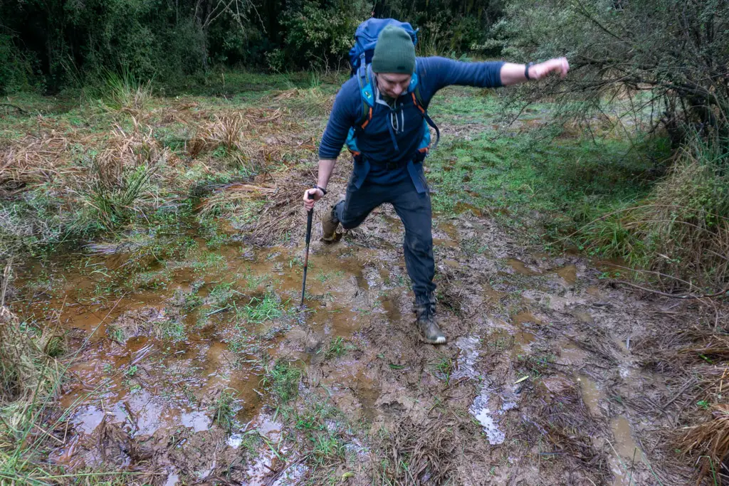
It was just as muddy as we remembered from the previous year, if not worse. There had been more foot traffic since the track’s grand opening, which had widened some of the bogs as people tried to walk around them. Our feet didn’t stay dry for long.
The falls loop
We reached the loop track junction after about an hour. There was some new DOC signage telling us it would take almost four hours to complete the loop. We took the right hand track again, wanting to see how close we’d been to Makarewa Falls when we turned around last time.
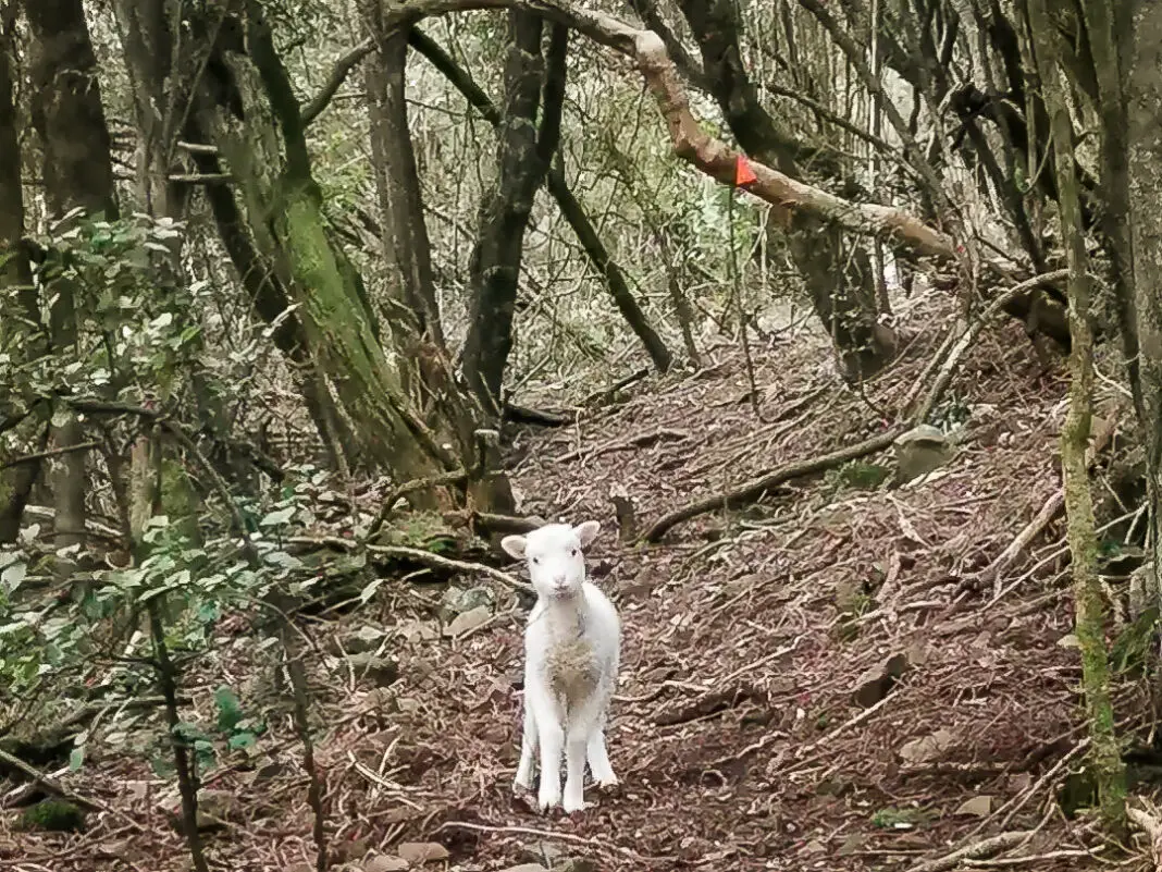
The track was much the same as I remembered. This time while I didn’t smell any pigs, but I did hear what sounded like a lamb calling out for its mum. And as I rounded the corner during the hill traverse, what did I see but a blindingly white lamb running towards me! One of the wild Hokonui merinos perhaps? (Although to be honest it looked more Romney to this farmer’s daughter). It came within two metres of me before it realised I wasn’t its mum and scampered back down the track. Very surreal. And very cute.
We continued walking, crossed the little creek twice, and then climbed back up the hill, past where we’d turned back last year. And then within 15 minutes, we reached the sign for the short Makarewa Falls turnoff. We’d been that close. Sigh.
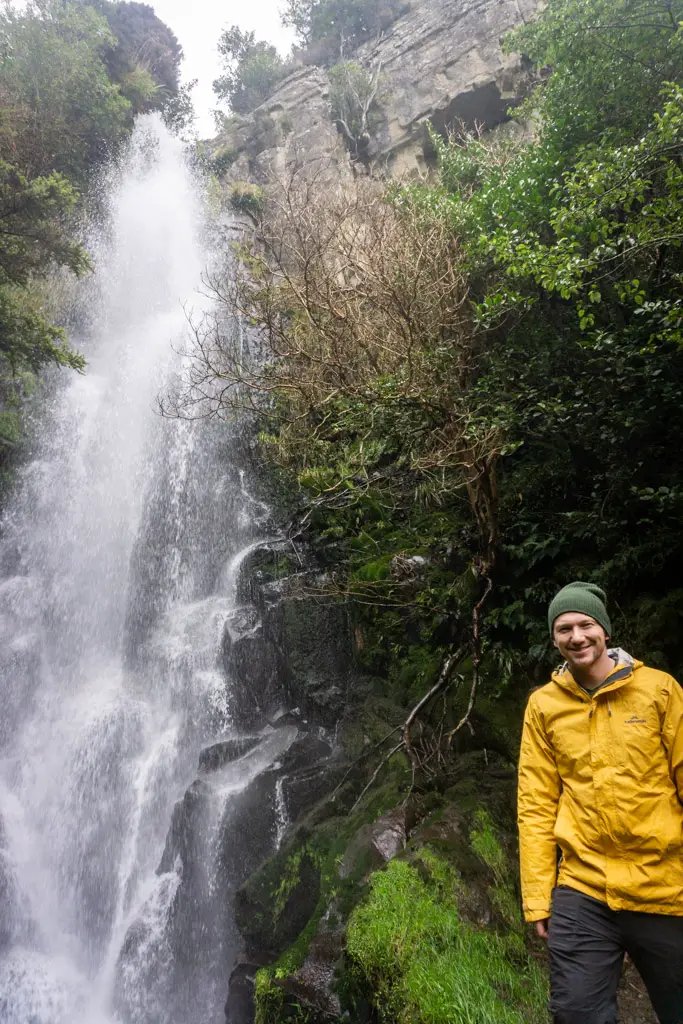
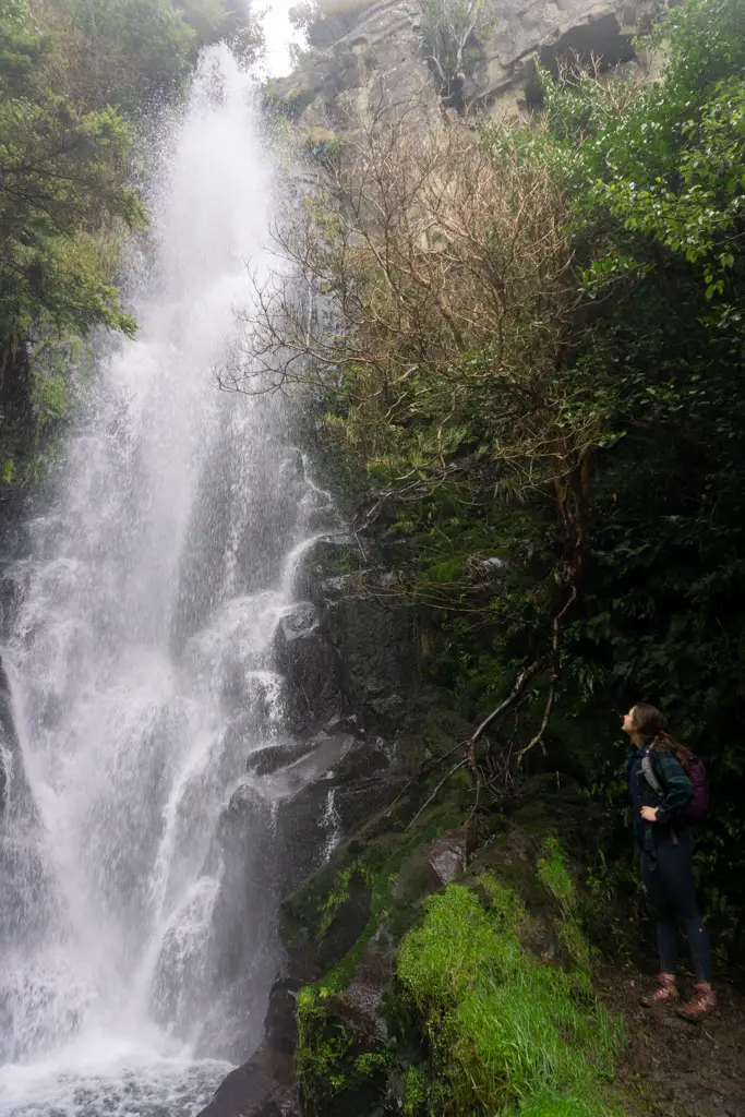
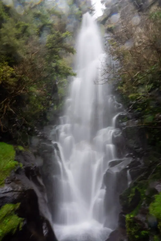
Makarewa Falls
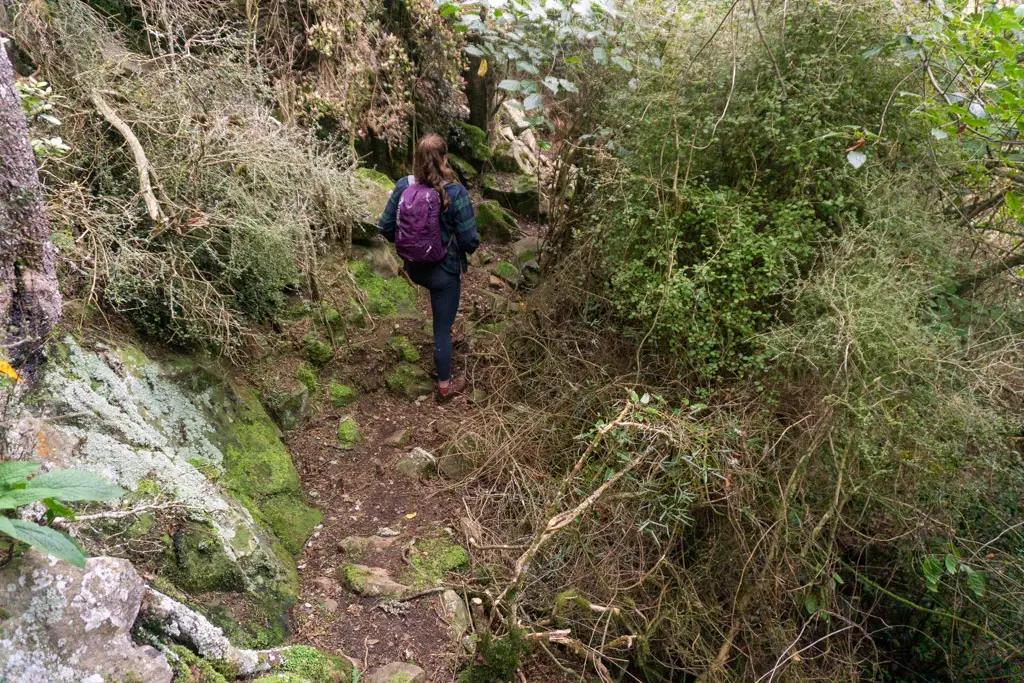
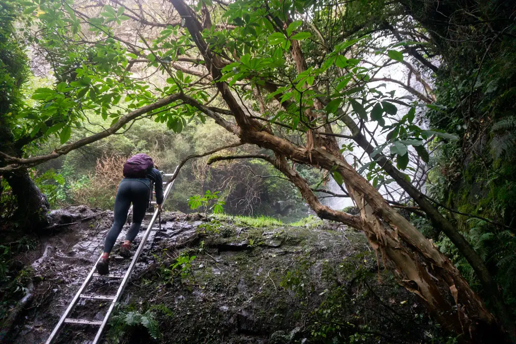
It was a steep traverse and then climb down to the base of the falls. The Winton Rotary Crew had bushbashed a steel ladder through to this point (still not quite sure how!), which was very much appreciated. We climbed up the ladder to the muddy base of the falls and marvelled up at the tallest waterfall in lowland Southland, all the while trying not to slip over.
When I spoke with Lindsay Middleton (the farmer who owns the land that the Makarewa Falls Track crosses before it reaches the Hokonui Forest Conservation Area), he said he’s known people who’ve swum in the pool at the bottom of the falls. I was getting chilly enough from the icy waterfall spray so wasn’t even tempted, but maybe on a nice summer’s day!
We climbed back up to the junction sign to have lunch, and met the first humans we’d seen on the track – three ladies out for a stroll. One of them said she’d bushbashed through here on a recce over a decade ago and abseiled down the falls. Pretty cool!
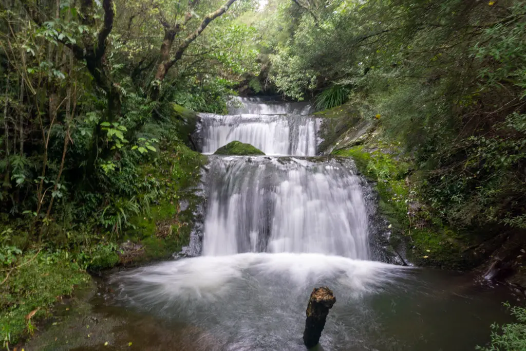
Staircase Falls
The Makarewa Falls Track boasts not just one waterfall, but two! Less than half an hour after leaving our lunch spot, we reached the turnoff to Staircase Falls. This was also a slippery slide down to the bottom, involving a well-placed rope. The staircase falls are smaller, but more picturesque than Makarewa Falls in my opinion.
Then it was back up the steep track to the main Makarewa Falls Track, and continue back to the loop track junction. Less than 10 minutes from the Staircase Falls sign, we came across a mossy boulder amphitheatre, which made me wish I knew more about rocks. I’m sure to someone in the know it would have been a classic example of some sort of geological process, but to me it just felt like trolls were going to leap out from behind the boulders to surprise us.
Once we’d descended back down into the lower valley proper, the track became quite wet / muddy in places. There were lots of little streams to cross (mostly you’d be able to just jump across without getting you feet wet). After rain this part would likely be a bit flooded.
I can’t quite remember how long it took us from Staircase Falls to the loop track junction. But looking back at the photos it was probably about 40 minutes. From there, it was another hour’s walking through the boggy trail to the paddocks and the car. All up including breaks, the Makarewa Falls Track took us just over six hours.
The secret’s out …
The Winton Rotary Club has put in so much work on the Makarewa Falls Track, and it shows. And I still don’t quite understand how they managed to bushbash that ladder in to the base of the falls!
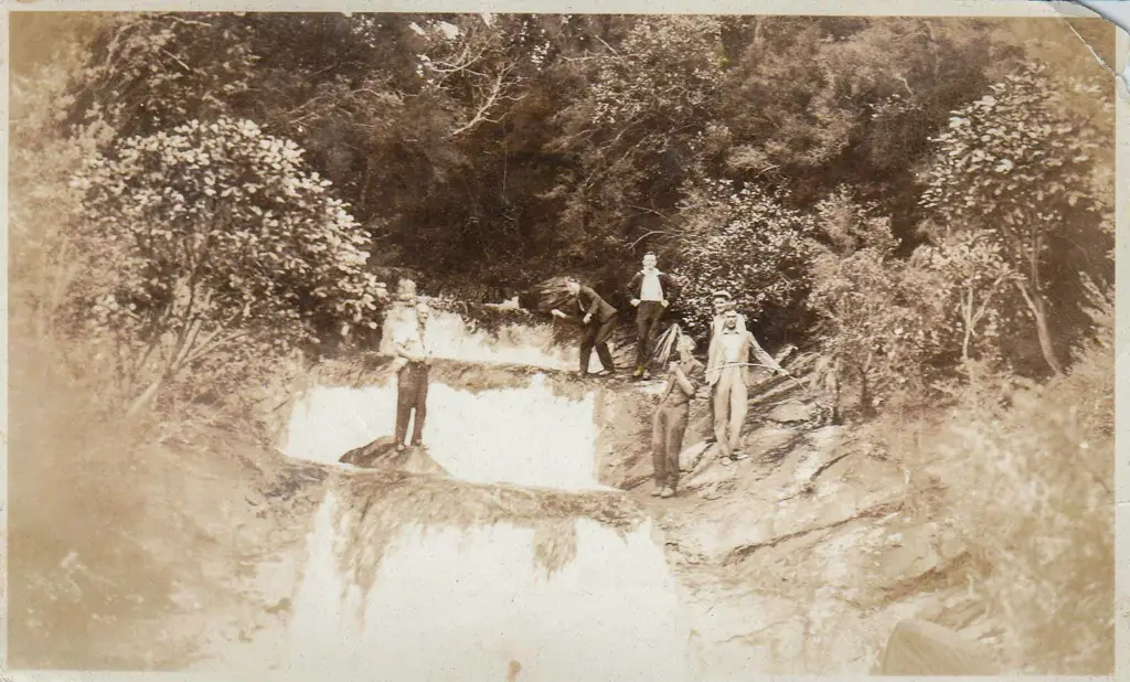
Lindsay Middleton was kind enough to speak with me over the phone about the process of building the track. He’s the farmer who owns the paddocks that the paper access-road crosses and a keen Rotarian. Lindsay and his family have been visiting Makarewa Falls for over 100 years. Almost five years ago he lead a Rotary trip to the falls, which sparked the idea of creating the track.
In conjunction with Winton Rotary, DOC (who manages the Hokonui Forest Conservation Area and flew in the track signs) and the Makarewa River Liaison Group (who paid for the track markings), the Makarewa Falls Track became a reality. Lindsay said that Winton Rotarians spent over 600 man-hours working on the track, sometimes having to walk several hours before they could even start work.
Lindsay says “we never imagined it would get as much use as it’s getting”. The mud has started to become an issue, but currently they are unable to put in additional infrastructure like boardwalks (due to DOC track regulations), which means, at least for now, the mud is unavoidable. You can reduce the impact you have by walking through the mud holes, rather than bush-bashing around them (and further enlarging the bogs). Lindsay did mention there might be some ideas about future developments on this and other tracks in the area, so watch this space!
Safety
As always, please stay safe when you’re out exploring. Follow the Outdoor Safety Code:
- Choose the right trip for you
- Understand the weather
- Pack warm clothes and extra food
- Share your plans and take ways to get help
- Take care of yourself and each other
The Hokonuis have notoriously changeable weather, so check the forecast and take gear for all conditions.
Stay safe and get outside!
Where to next?
LET ME KNOW WHAT YOU THINK! LEAVE ME A COMMENT OR MESSAGE ME OVER ON MY INSTAGRAM.
I love hearing from readers and helping them plan their own adventures!
Yay, the link from insta works 😊
Great story Alice, sounds like a fun adventure, and I’m sure I’d have never have heard about this place without your post. 👍
Thanks so much for commenting Bill. Glad the link works! So excited to be able to use that more. Hopefully you can get out and see these falls yourself! 🙂
Great post Alice! I remember seeing a stuff article about the opening, but this makes it look much more interesting.
Will definitely have to swing by when I head down to Invers for Christmas
Thanks Hugh! Hopefully it will have dried out a bit for you by then. It’s definitely a cool track! The Winton Rotary have done such a great job.
Thanks for the info and photos and stuff , have seen the sighn post on main rd and now I know .
Cheers
Nice! Hope you make it to the falls some time soon.
Hey Alice
It’s your workmate Kate here! Just saw a friend had visited these falls and thought “How have I never even heard of them previously!?” So a quick Google took me straight to your blog – such fantastic reading and answered all my questions about this! I’d love to do it but I’d love for the muddy boggy sections to be a bit less full on. If you ever find out that they’ve done anything more about reducing the boggyness, let me know! Thanks for the great read! 👍 🙂❤️ xxx
Hey Kate!! I don’t know if they’ll do anything in the short term unfortunately, I got the feeling from the farmer that there’s a lot of hoops they have to jump through in terms of maintenance etc. But if you want a buddy to come with you to do it I’m always game! It can be a muddy adventure haha. If we go middle-end of summer it hopefully wouldn’t be as bad. And bring some footwear you can wash afterwards?
Thanks for the blog Alice! There is very little information on the web about this track except for yours.
I walked this track yesterday with my Husband, can confirm it is very muddy and reasonably easy to get lost.
Yes it would be super muddy at the moment! Glad you found your way well. The waterfalls would have been pumping!
Very good information although it looks very easy to get lost (and people do get lost in there!)
Yes! I just went in with the Southland Tramping Club / LandSAR members and remarked the upper track to the waterfall. Hopefully that reduces the SAR callouts!