Gillespie Pass or the Wilkin-Young Circuit is a challenging tramp through some of the country’s best scenery, particularly the side-trip up to Lake Crucible.
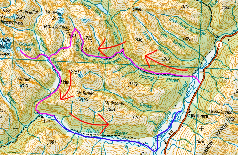
Start: 2.5 km north of Makarora on SH6 is a signposted carpark opposite the Young River. Starting here involves crossing the Makarora River via foot or jetboat. Alternatively, you can start at the Blue Pools carpark which involves no river crossings. This is 10km north of Makarora on SH6 and adds 1.5-2hrs / 3.5km to your day.
End: Wilkin Road (5km south of Makarora on SH6). This means there is a minimum 7.5 km difference between the start and end of the Wilkin-Young Track. If you use Wilkin River Jets or Southern Alps Air, your trip will start and end at their office in Makarora.
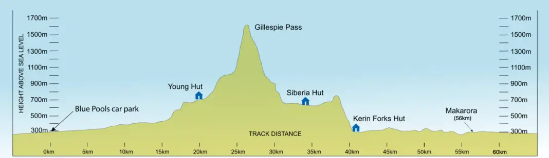
Length: 58km (43km for us as we took the jetboat down the Wilkin River). Plus an extra 8km (and 600m elevation gain/descent) side-trip up to Lake Crucible.
Difficulty: difficult
Time taken: 4 days, but could be completed in less depending on fitness
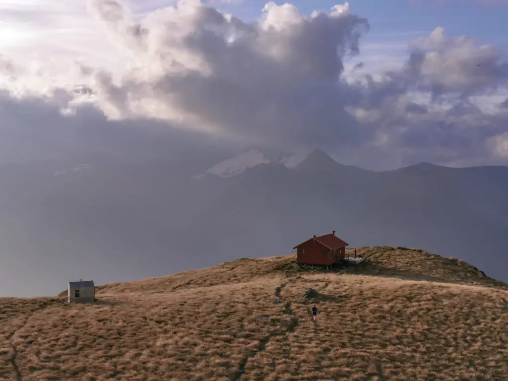
Facilities: There are no toilets at either trailhead. There is a long-drop toilet at Young Forks campsite (5 minutes off the main track). Young Hut is first-come, first-served, and costs $15 per night. Siberia Hut needs to be booked online between December – April and costs $20 per night. Both Young Hut and Siberia Hut have 20 bunk beds, running water, long-drop toilets, and a fire.
– Important: the Wilkin-Young Circuit involves several significant river crossings and multiple small stream crossings. There have been numerous fatalities from people drowning in these rivers. Our trip over Gillespie Pass was during a record breaking drought – but only a few days later these rivers had turned into brown raging torrents due to rain and were impassable. –
If in doubt, stay out.
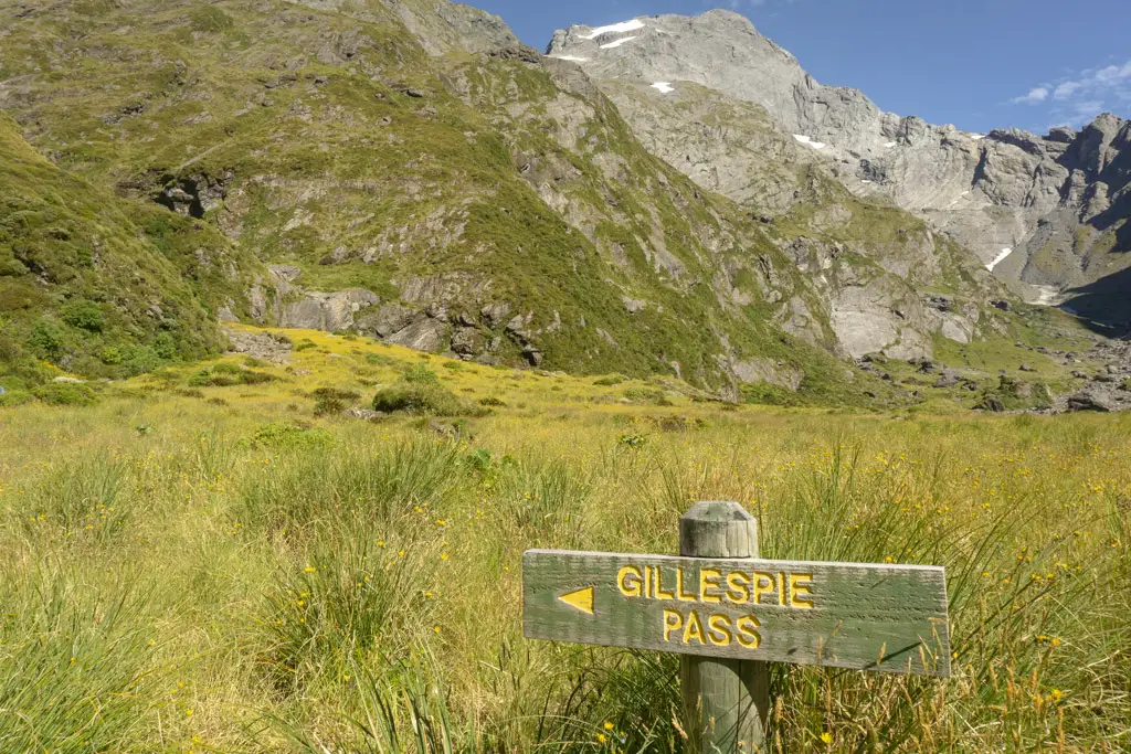
Which direction should I tackle Gillespie Pass?
I would highly recommend completing the Wilkin-Young Circuit in a counter-clockwise direction by going up the Young River (to the north), crossing Gillespie Pass, and then walking / jetboating down the Wilkin River (to the south). This means climbing UP the much steeper north-east side of Gillespie Pass, and DOWN the more mellow and longer south-west side.
I recommend this because a) the steep terrain on the north-east side of Gillespie Pass is easier to climb up than down. And b) the south-west side of the pass would be a looong day if you were climbing up. And then you’d still have the ridiculously steep descent to go, which would absolutely murder your knees. But obviously you do you! Plenty of people were doing the Wilkin-Young Circuit in the opposite direction to us without any issues.
IF YOU’RE LOOKING FOR OTHER ADVENTURES NEAR MAKARORA / GILLESPIE PASS:
Not far from Makarora, just over Haast Pass, likes the trailhead for Brewster Hut, aka the best spot to watch the sun set.
Soak away your worries in these natural hot pools not five minutes from Welcome Flat Hut on the West Coast.
Gillespie Pass: Wilkin-Young Circuit
The Wilkin-Young Circuit was an amazing tramp! It has easily become one of my firm favourites. I’m already planning our next trip back to Gillespie pass.
Disclaimer: As you’ll be able to see from the photos, I planned this trip around extremely fine weather in the middle of summer. It hadn’t rained in weeks and we knew the rivers would be very low due to the drought.
I feel the need to write that disclaimer as neither Matt nor myself are experienced with significant river crossings, of which there are several on the Wilkin-Young Circuit. I would not have attempted Gillespie Pass with my current level of experience in anything but nice weather, knowing the fatalities that have occurred in this area due to drowning.
Please be smart with your planning, and know your limits, particularly when it comes to river crossings. The Mountain Safety Council have a great video about the Wilkin-Young / Gillespie Pass Circuit you can watch here:
Day 1: Makarora to Young Hut
Our first day of the Wilkin-Young Circuit started at the Wilkin River Jets office in Makarora. I wanted to mitigate our inexperience with crossing large rivers by jetboating across the Makarora River instead of crossing it on foot. Added bonus: we would start and end in the same place, which was much easier than having our car stuck in a carpark several kilometres up the road.
However because it hadn’t rained in weeks, the Makarora River was so low that Wilkin River Jets weren’t even operating up it (which, if you’re familiar with jetboats, meant it was pretty freaking low). Instead, they shuttled us up the road and dropped us at the carpark opposite the Young River. Our adventure had begun!
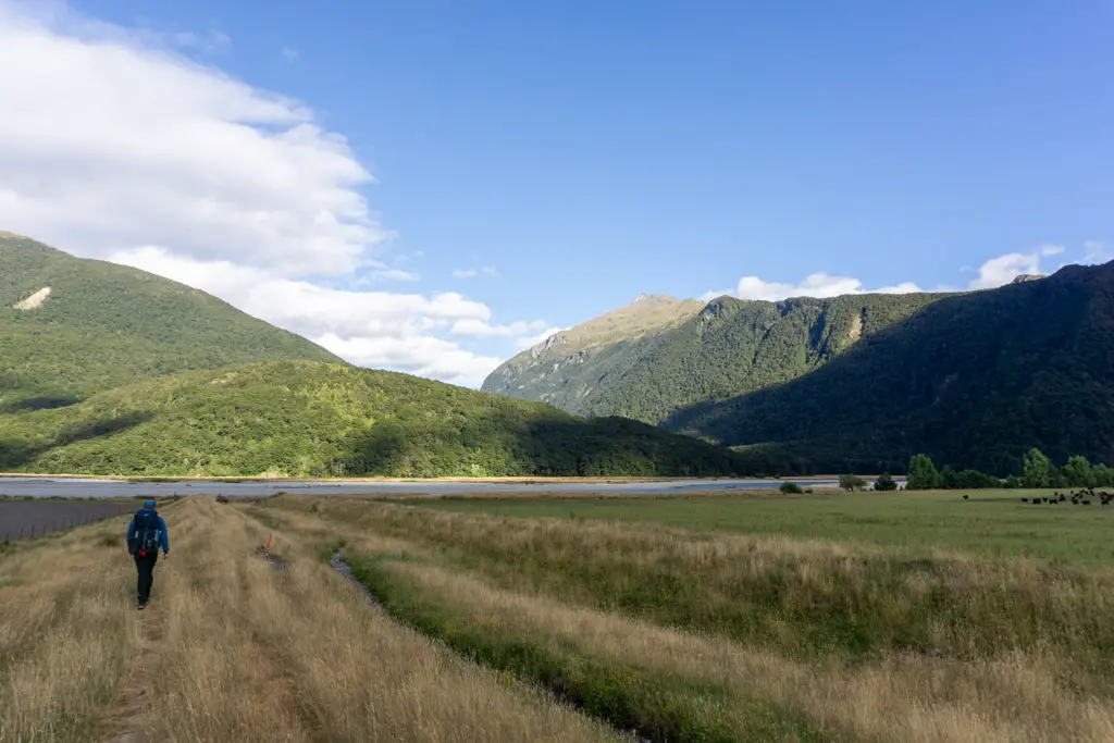
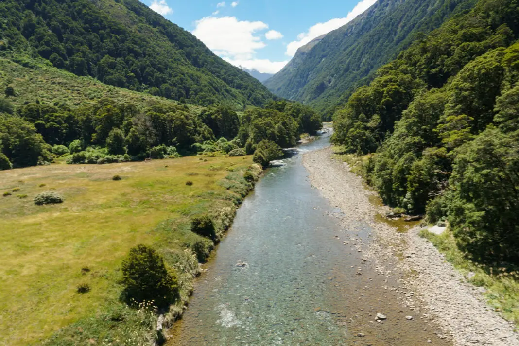
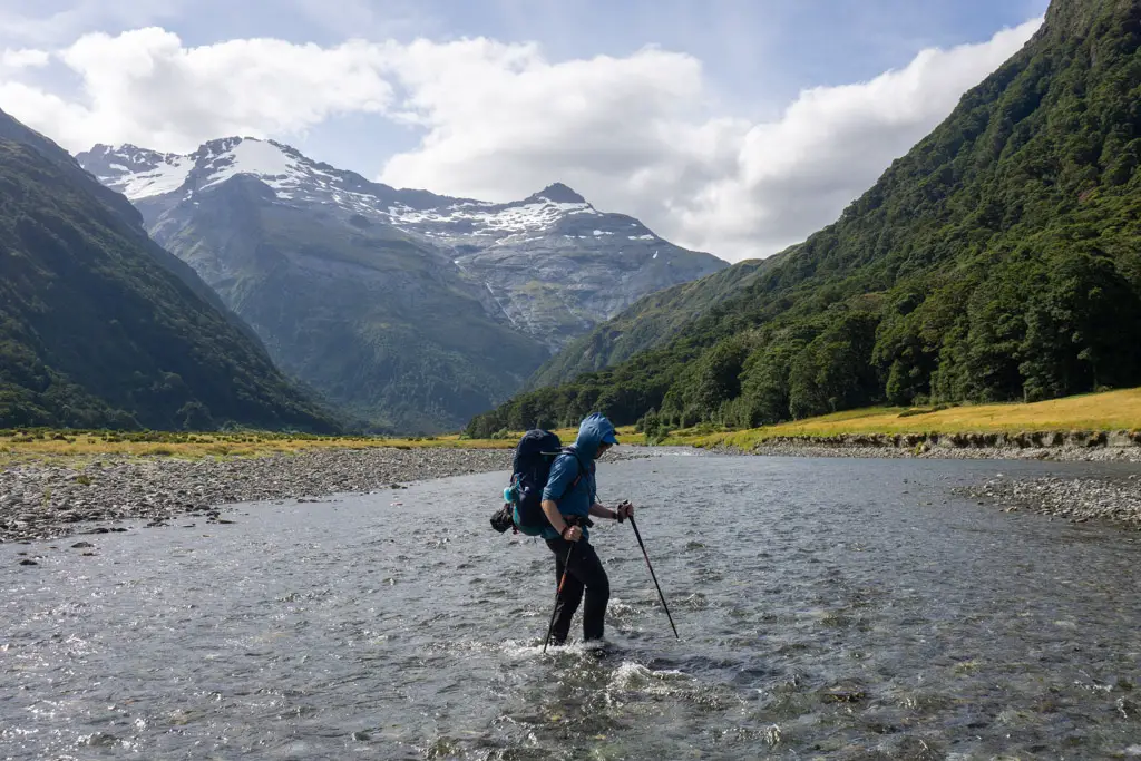
We climbed over the stile and followed a worn grass track through a farmer’s paddock down to the Makarora River, with some interested cattle running parallel to us. Once we reached the bank of the Makarora River, we turned to the right and followed the path upstream for 10 minutes. When we were above the confluence with the Young River, we surveyed the Makarora, looking for a good spot to cross.
Crossing the Makarora River
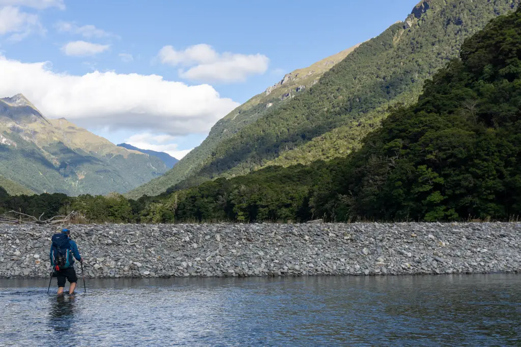
The Makarora River was extremely low, and we crossed its several braids without any issue. As expected, the water didn’t reach much above our knees, although it was fast-flowing in parts and ice-cold. I found it hard to imagine the river, with its clear, shallow waters sparkling in the morning light, in flood. However less than a week later, the Makarora River had risen by several metres; its powerful mud-brown flow eroding anything in its path.
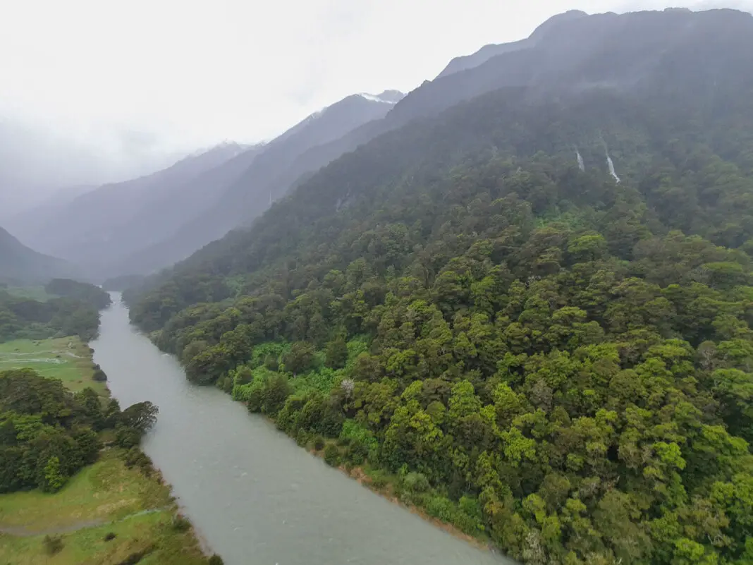
My friend Jono took that photo on the right of the Young River only three days after we’d jetboated back to civilisation. The river had gone from a sun-drenched trickle that wouldn’t come up over your knees, to a fast flowing brown torrent that stretched bank-to-bank, impassable.
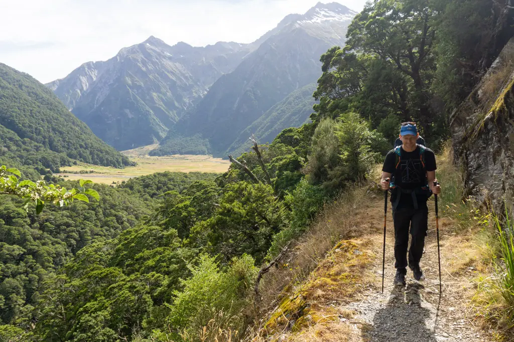
The track was easy to rediscover once we’d crossed the Makarora River. It meandered along the river bank, looking down at the ridiculously blue waters. At the confluence of the Young & Makarora Rivers there was a DOC sign with timings (6-7 hours to Young Hut).
Young Forks Campsite
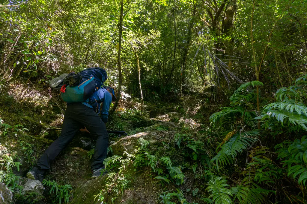
There was some tree-fall up-river from the DOC sign, but other than that the track up the Young River was much better maintained than I expected. But perhaps this was because my last tramping adventures had been backcountry routes like Lake Nerine, and my body was just happy to be following any established path rather than bush-bashing up steep snow grass.
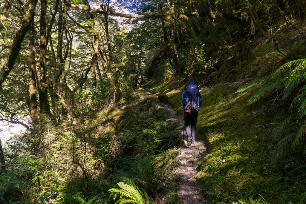
We even came across two DOC workers weed-wacking the long grass growing over the track! I’d only ever seen that before on the highway that is the Milford Track.
It took us 3.5 hours to reach the high swingbridge over the North Branch of the Young River. We dropped our packs at the sign and walked two minutes to the nearby Young Forks Campsite for lunch and a (long-drop) toilet stop. Up until now the going had been pretty easy and relatively flat; a mix of walking next to the river in the bush, and crossing dry tussock flats.
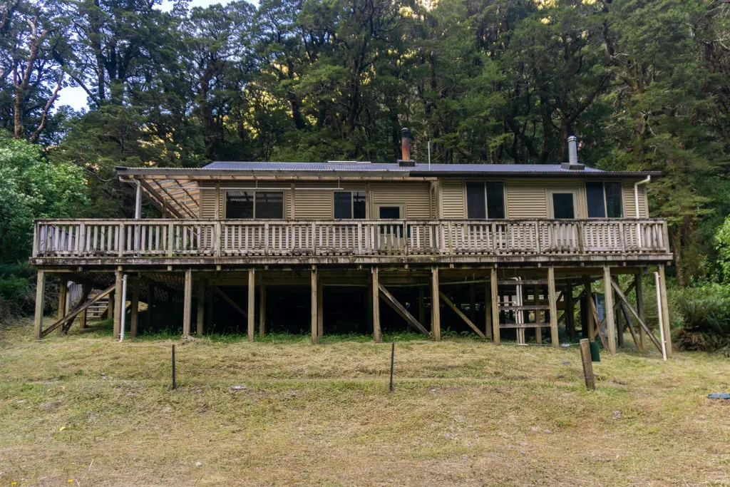
Young Hut
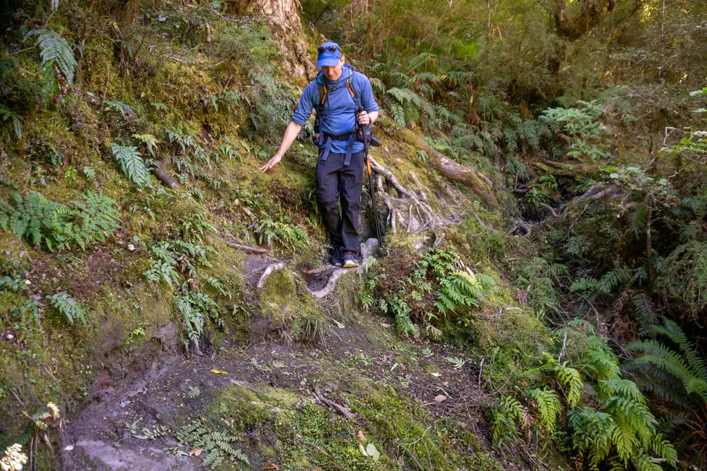
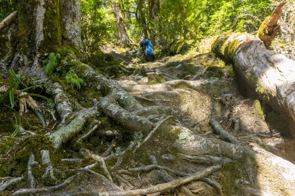
The next part of the track, however, was anything but flat. We doubled-back on ourselves briefly on the other side of the river. Then it was a steep climb up a slip next to the other (South) branch of the Young River.
This was obviously a newer slip, and slightly unstable in parts. But after that it was a very steep and stable climb up tree roots for about a hundred vertical metres or so. It was a punishing climb, but thankfully quite short.
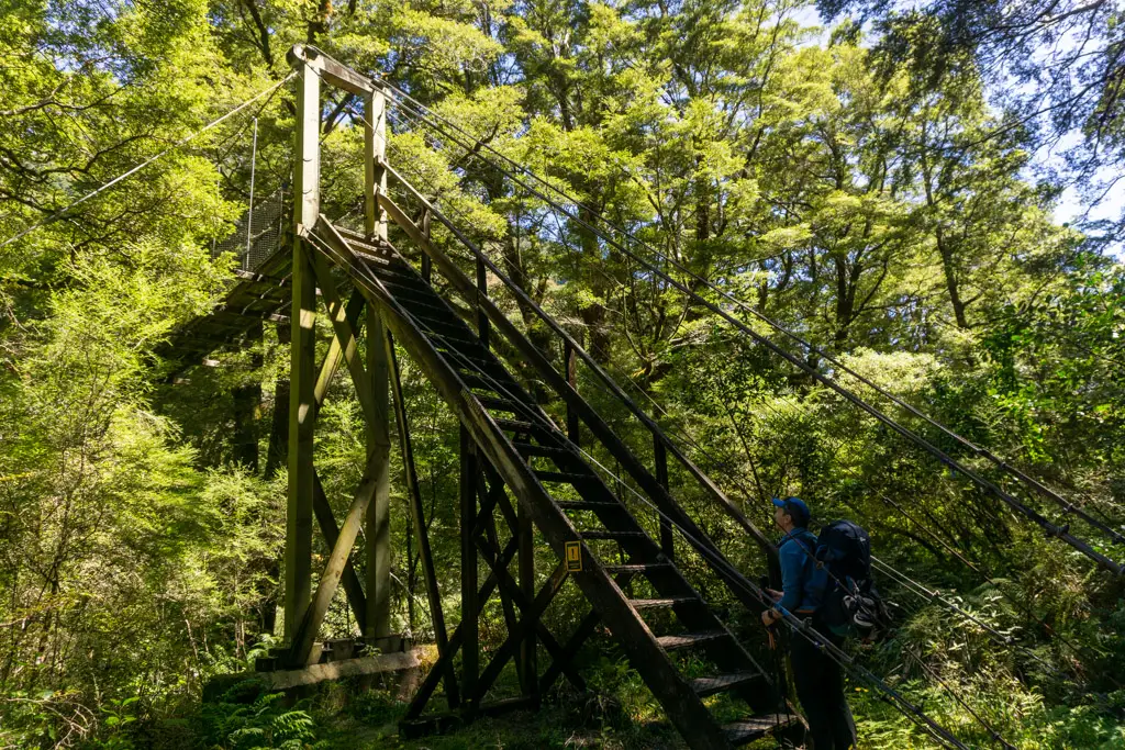
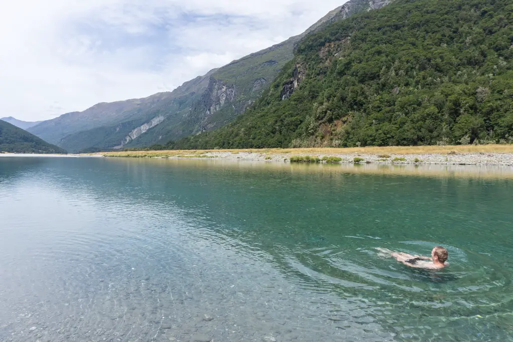
The track flattened out a little before Stag Creek (such a cool bridge) and then continued on close to the river. We stopped to skinny dip in a beautiful blue (but freezing) pool at one point, thankful it was a weekday and hoping no-one was coming up behind us. Once the track left the river it was only a few minutes’ walk until we reached Young Hut – it snuck up on us and suddenly appeared in the trees.
Day 2: From Young Hut over Gillespie Pass
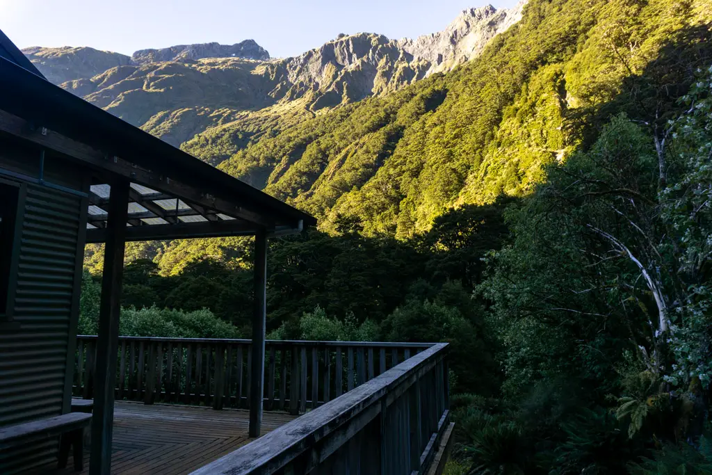
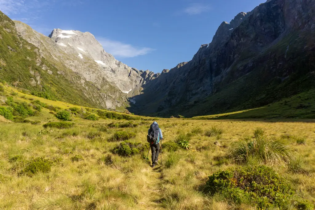
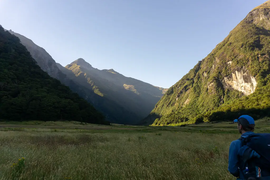
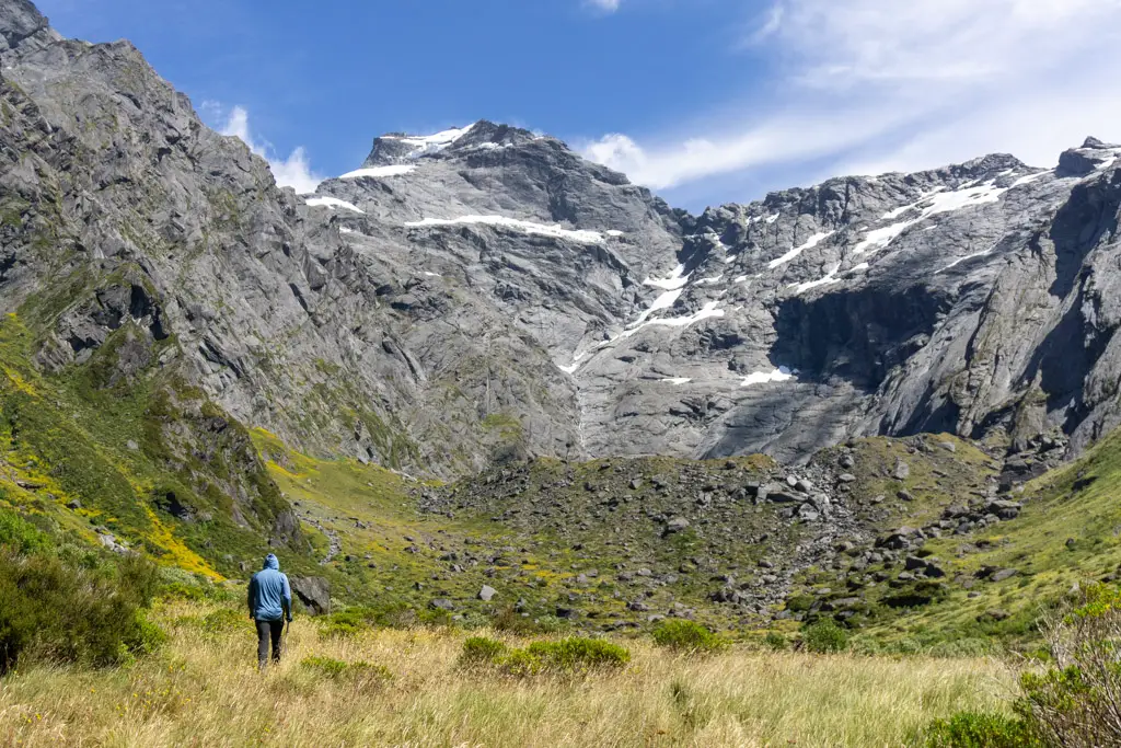
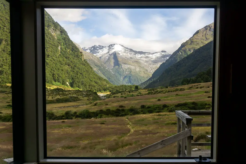
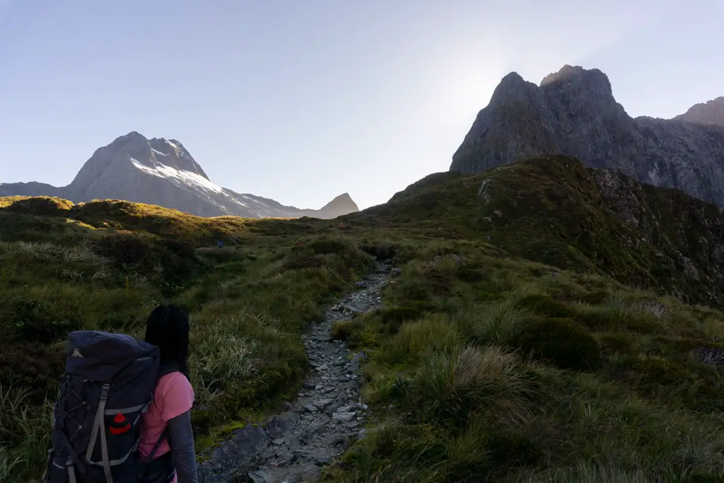
The next day dawned beautifully fine without a cloud in the sky. We set off early from Young Hut, climbing up above the hut as the bush came alive with birdsong. My first glimpse of the upper Young Basin as we reached the bush line was jaw-dropping. The dawn light shining onto the towering peaks, and softening the tussock-covered valley. Beautiful.
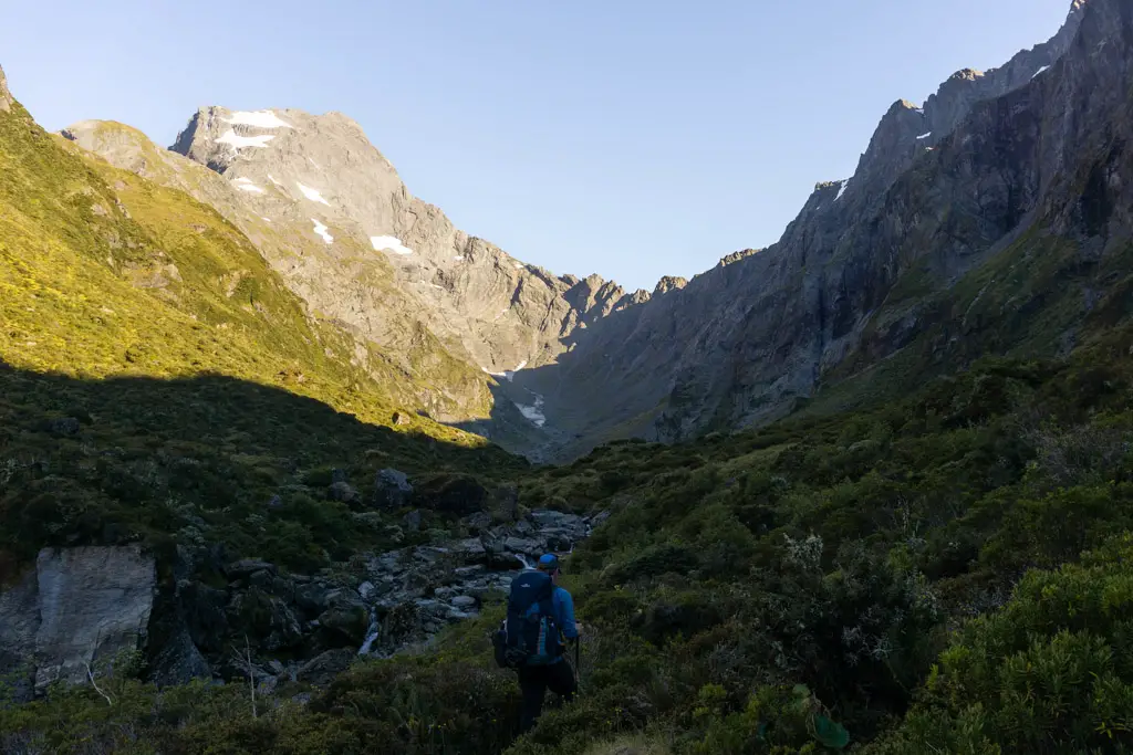
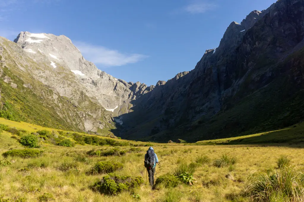
We crossed the bridge over the Young River and then followed its gurgling path to its headwaters at the base of an impressive mountain cirque. I thought often of an American exchange student who climbed over Gillespie Pass in the other direction, alone and battling the elements, before perishing in the Young River. I know she lives on in the thoughts of those she touched during her short time in New Zealand.
Above us on our left was a very steep looking spur. I eyed it suspiciously, surely there wasn’t a track up there? We gathered some water from the river, the last water source until the other side of Gillespie Pass. We’d been walking 1.5hrs from the hut. It was time to begin properly climbing.
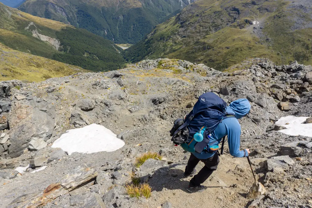
The climb
There was indeed a track heading up the steep spur. Although in parts, every step was only 10cm across (but easily 1m+ directly up). If you have auto-pause enabled on your smartwatch, I’d recommend turning it off for this section – it will think you’re walking on the spot for several hours. In terms of horizontal kilometres, you won’t be walking very far. But in terms of vertical kilometres? Well, you’re in for a treat.
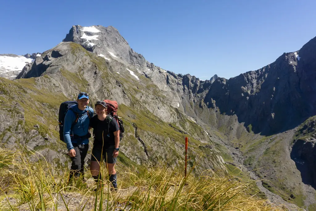
Matt had been worried about the climb and his fear of heights (which I optimistically think is improving every time his mean wife makes him do an adventure like this). It was extremely steep, but there was a track the whole time, quite a few places that were comfortable to sit down and rest, and only a few spots that involved 4-points of contact (which, after Emily Pass, is now my reference point for steepness).
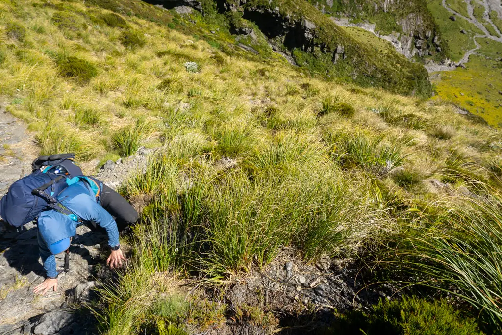
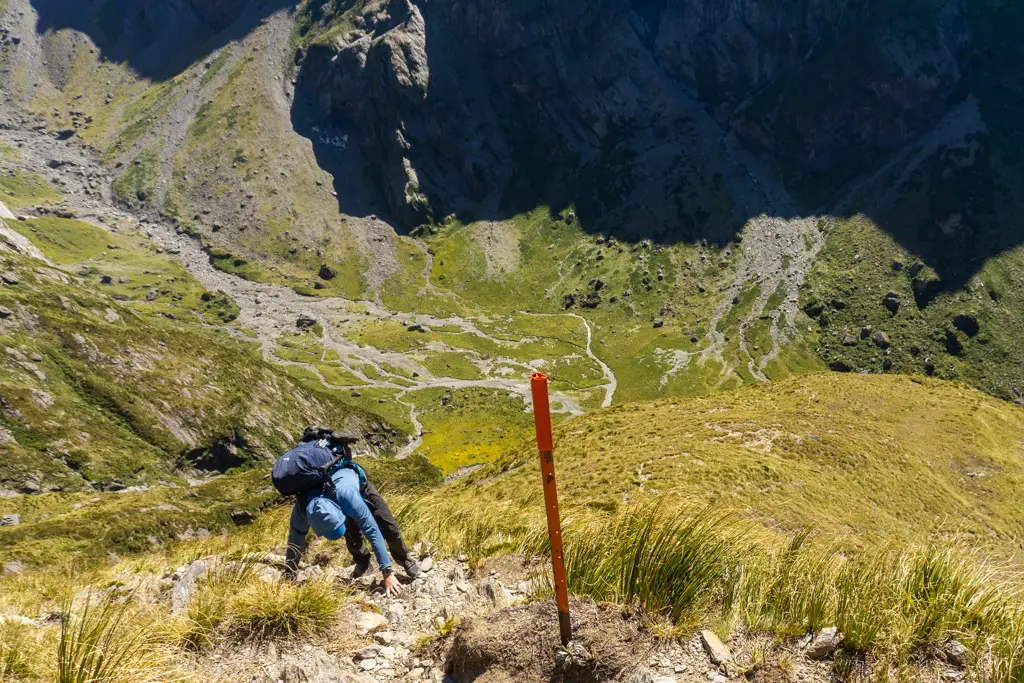
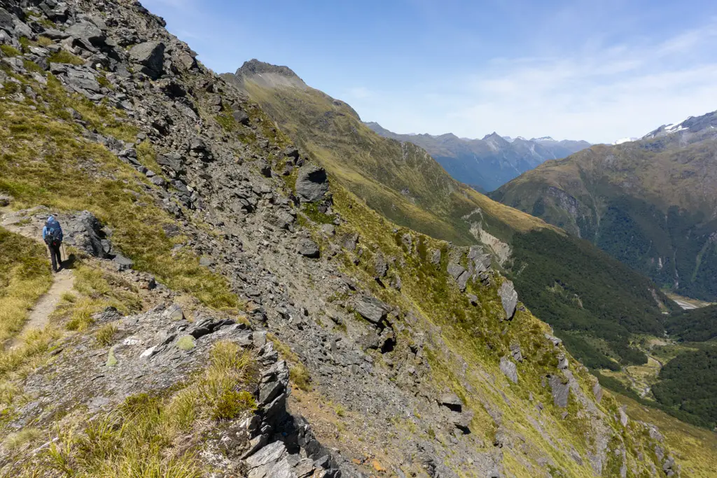
So I guess in summary: heading up the Wilkin-Young track on the east side of Gillespie Pass was probably one of the consistently steepest tracks I’ve ever done (other than Mt Fox). But it was still a track.
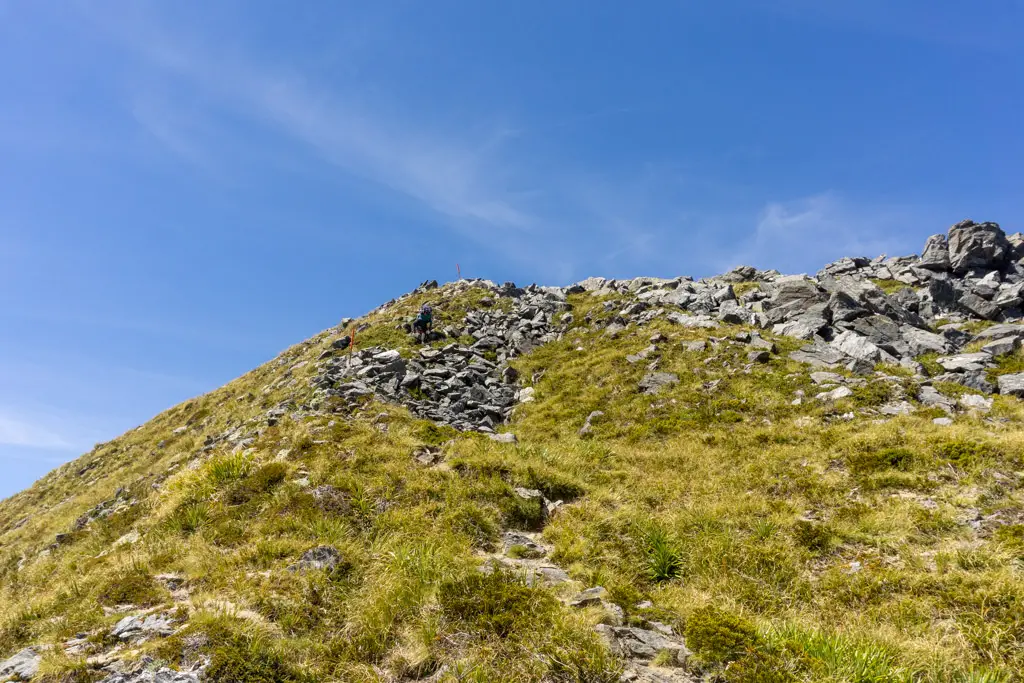
Gillespie Pass
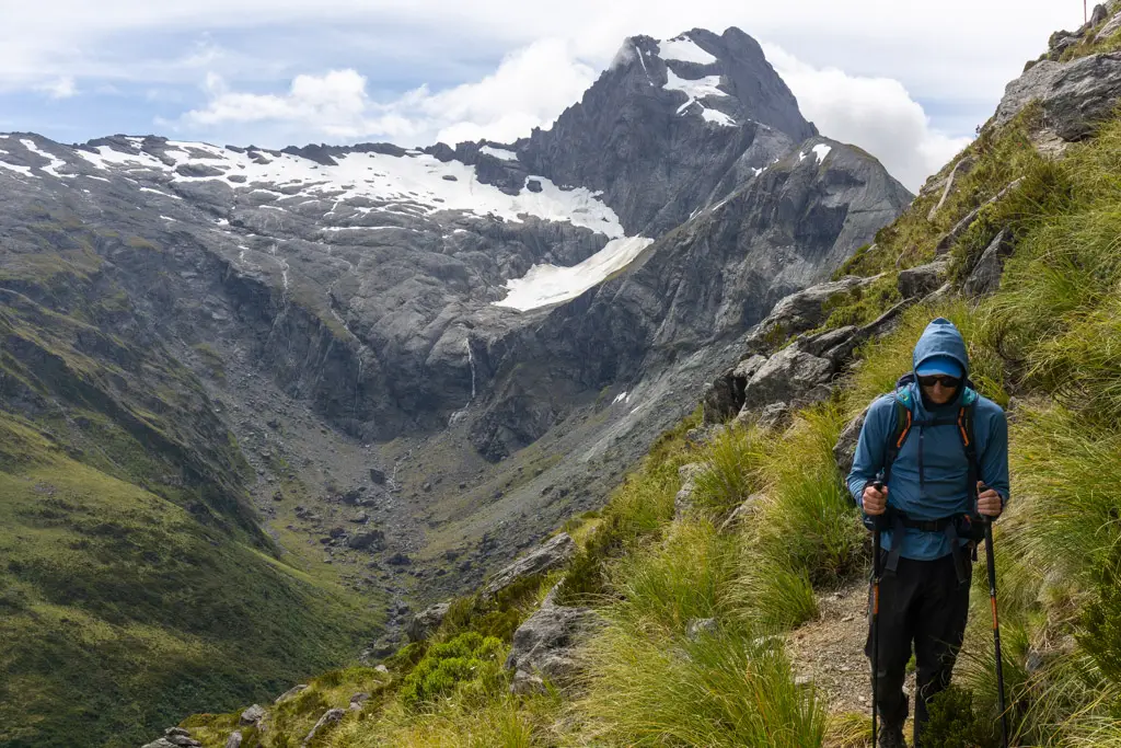
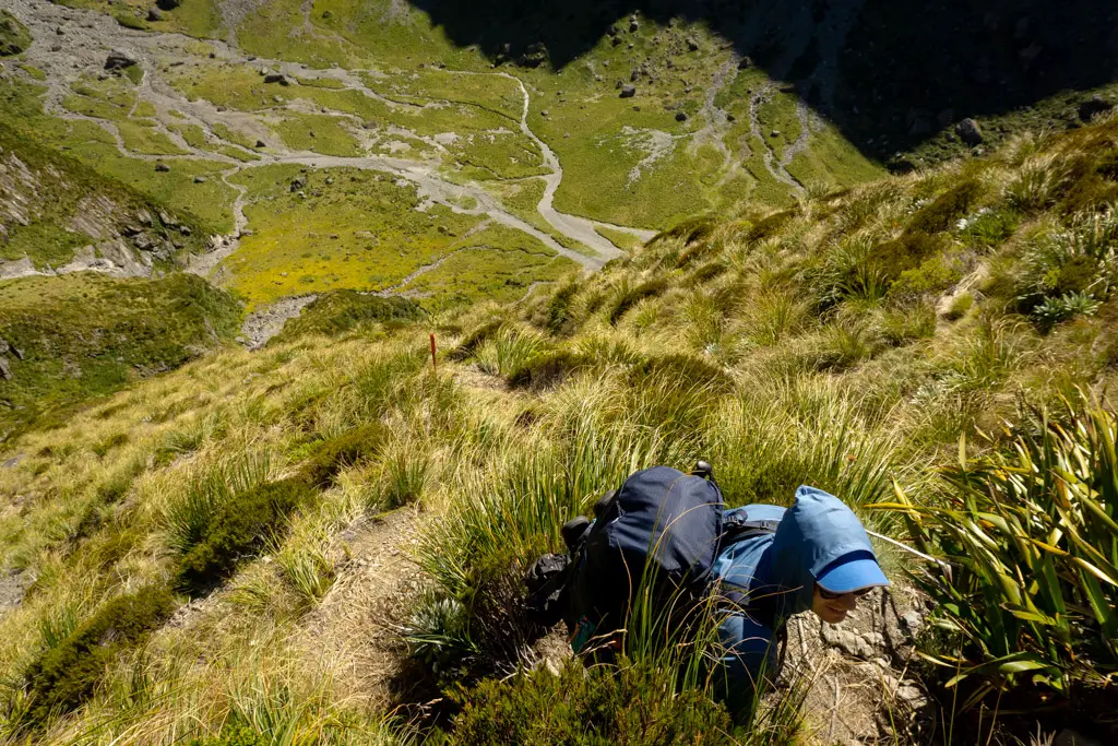
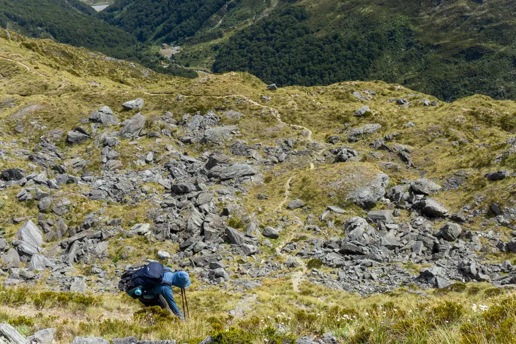
The climb up to Gillespie Pass took us just over two hours. It was very … efficient. We thought we’d reached the top once we had views down into the Gillespie Basin & Gillespie Stream on the other side, but the track kept climbing. Of course.
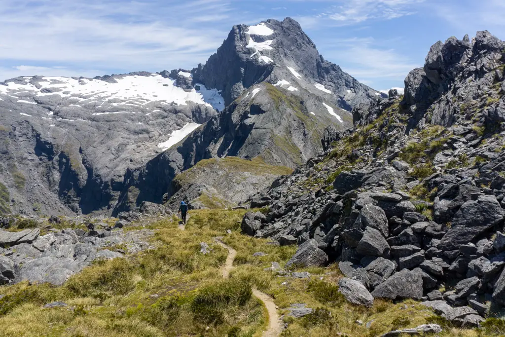
Because the elevation gain had turned us into crazy people by this point, we kept climbing slightly above the track to the 1629m elevation peak to have our lunch. Views of Mt Awful and both the Young and Gillespie basins filled the vista. It was beautiful.
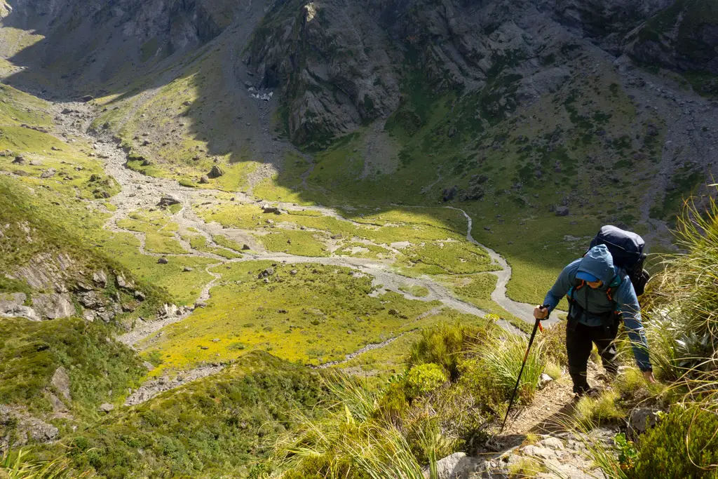
The descent
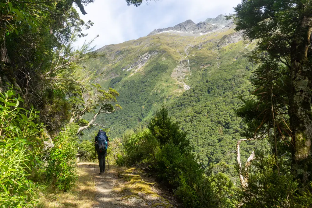
But we weren’t even halfway – the descent down the west side of Gillespie Pass towards the Siberia Valley is looong. But I was happier walking down this section than up, and my knees were already thanking me that I didn’t have to go back down the way we’d climbed up.
The views of Mt Awful kept me entertained, as did trying to spot where we were going to camp for the night. Thanks to the advice from the lovely Kate McDonald we planned to camp next to Gillespie Stream, cutting some time off this second day, but adding in some more the next day climbing down into Siberia Valley to reach Siberia Hut and the Lake Crucible track.
Some kea flew around us as we descended into the steep tussock section just above the bushline, and thanks to Penzy’s tutoring on our Mt Fox trip, I managed to call them down to us. Spoiler: it involves forgoing any sense of dignity and sounding like you’re trying to imitate a squealing donkey while maniacally smiling. But hey, it worked!
Some cloud cover had finally materialised, but instead of cooling us down, I felt like were were in a glasshouse. I was glad we’d taken lots of water from the Young River. It was a relief to finally reach the beckoning shade of bushline, although we had to say goodbye to our kea friends.
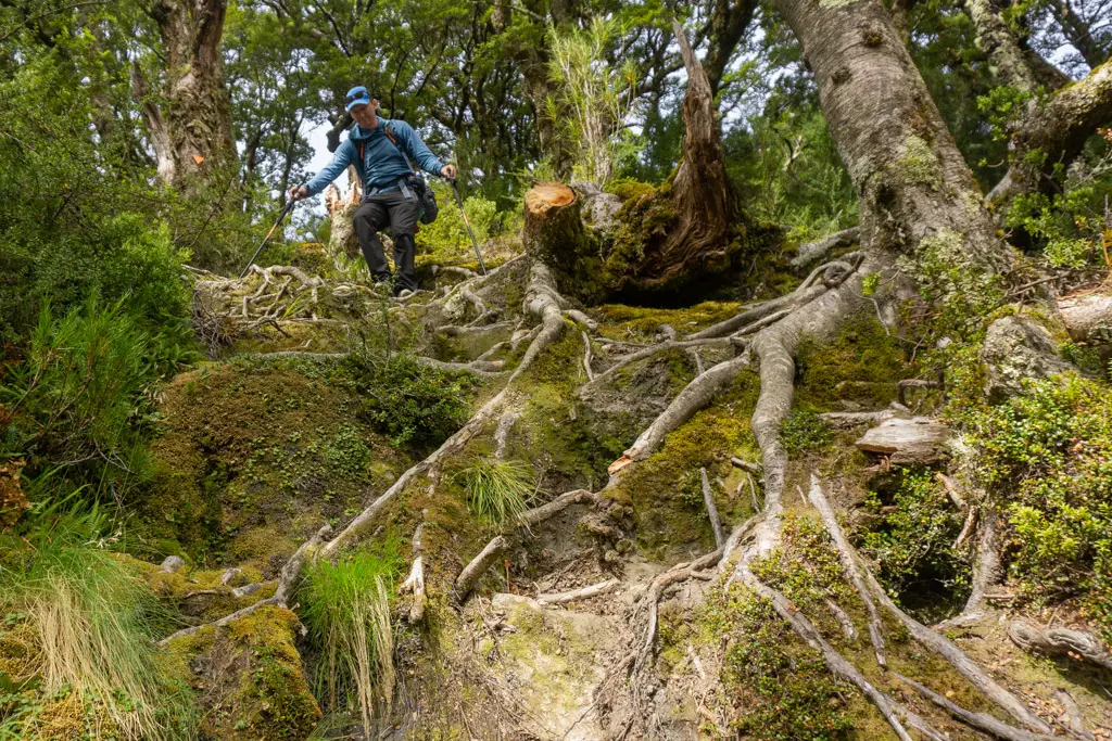
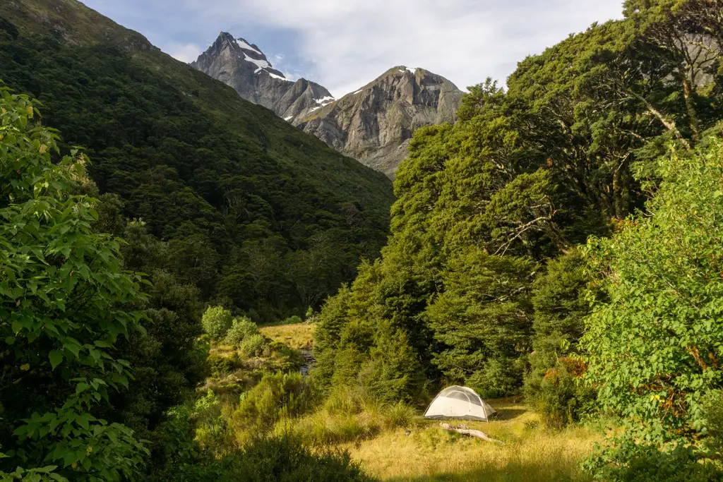
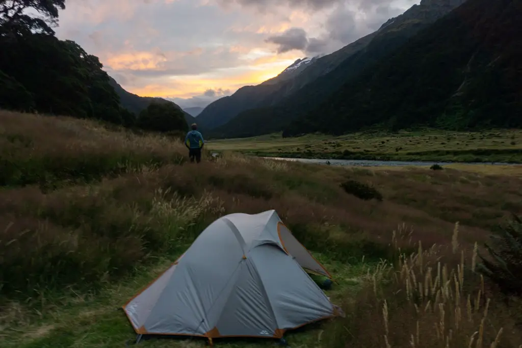
The track in the bush was steeper again, but the tree roots provided lots of handy steps. In what seemed like no time at all, we had reached Gillespie Stream and a beautiful spot that was obviously a popular site for tenting.
Our campsite
Matt and I dropped our packs with great relief. No sandflies materialised to bother us until the sun had set. It was bliss! We had another skinny dip in the stream to wash off the sweat of the day, and then a delicious meal before settling down for a well-deserved rest. Our second day on the Wilkin-Young Circuit had been a long day – 9 hours (including all our stops).
Day 3: Lake Crucible and Siberia Hut
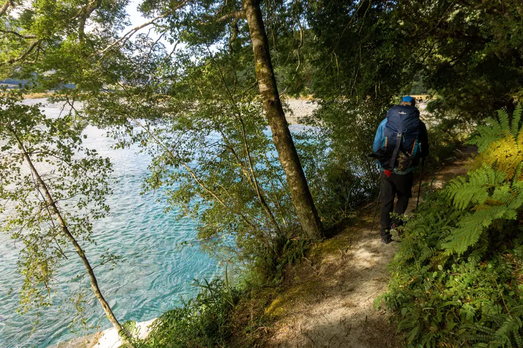
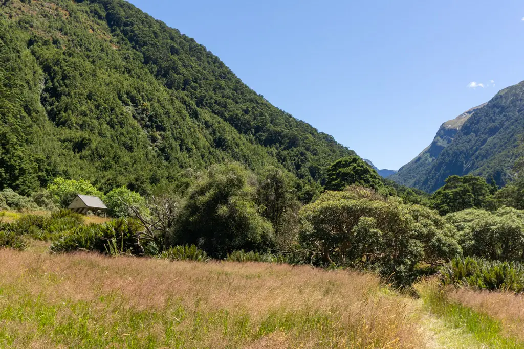
We woke early, packed up camp and followed the track down into the Siberia Valley. The last section through the beech forest down the valley floor was steep with never-ending switchbacks. I was very pleased we hadn’t had to climb down here the previous day. It took us about 1.5 hours from our campsite to Siberia Valley and then it almost another hour’s flat walking to Siberia Hut. I admire anyone walking from Young Hut directly to Siberia Hut – that’s a massive day.
Siberia Valley looked absolutely gorgeous in the morning light. We wandered through fields of wild flowers to the turn-off to Lake Crucible. Crossing Siberia Stream was easy with the water level so low. Matt and I dropped our packs where the track entered the bush – switching to just Matt’s lighter pack filled with food, water, extra layers, PLB and first aid kit.
More climbing
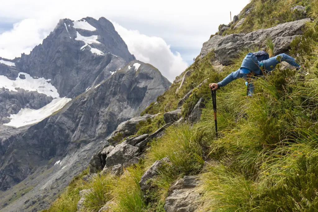
The first section of the Lake Crucible track was ridiculously steep. Perhaps steeper than the climb up Gillespie Pass the day prior? Either way, we were definitely getting our money’s worth out of our legs on this trip!
After 300m elevation gain in around 500m on the map (i.e. steep. Very steep), we finally reached flatter ground. The track levelled out above the stream, with steep drop-offs at times, until the stream rose to meet the track.
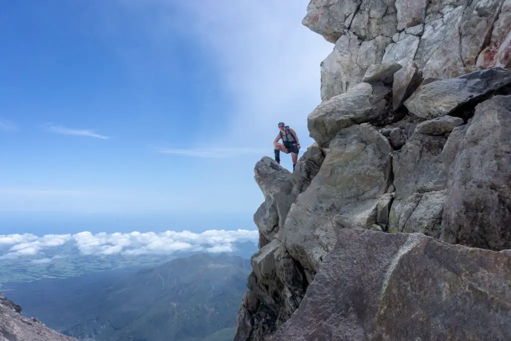
We crossed the stream to the other side out of the bush, and then continued climbing up through snow grass and alpine flower meadows. The last part of the track was a steep climb (quelle surprise!) up the crucible shaped moraine wall surrounding the lake.
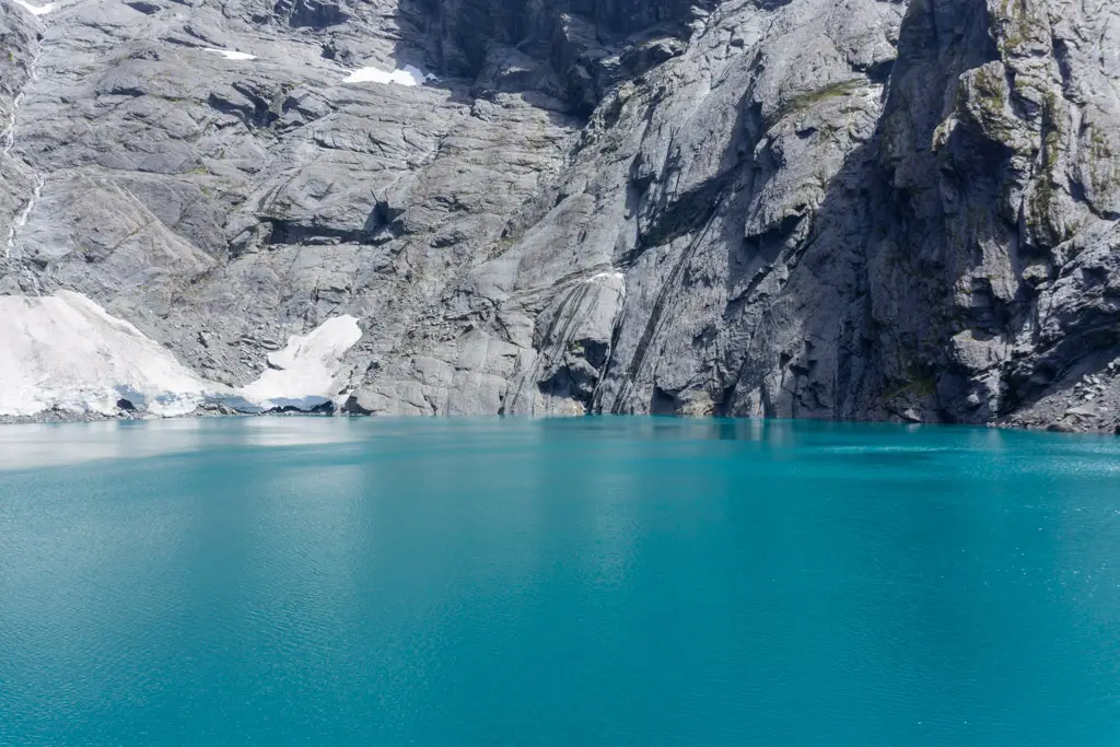
Crucible Lake
I’d seen countless images of Lake Crucible while planning this trip, so I turned to see Matt’s face as we crested the top to watch as he saw the ridiculously blue waters for the first time. I was not disappointed by the giant grin that spread across his face.
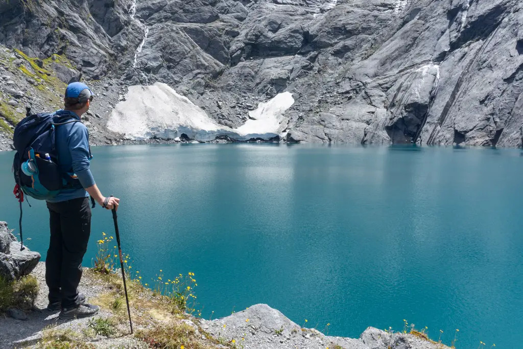
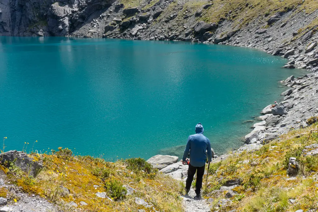
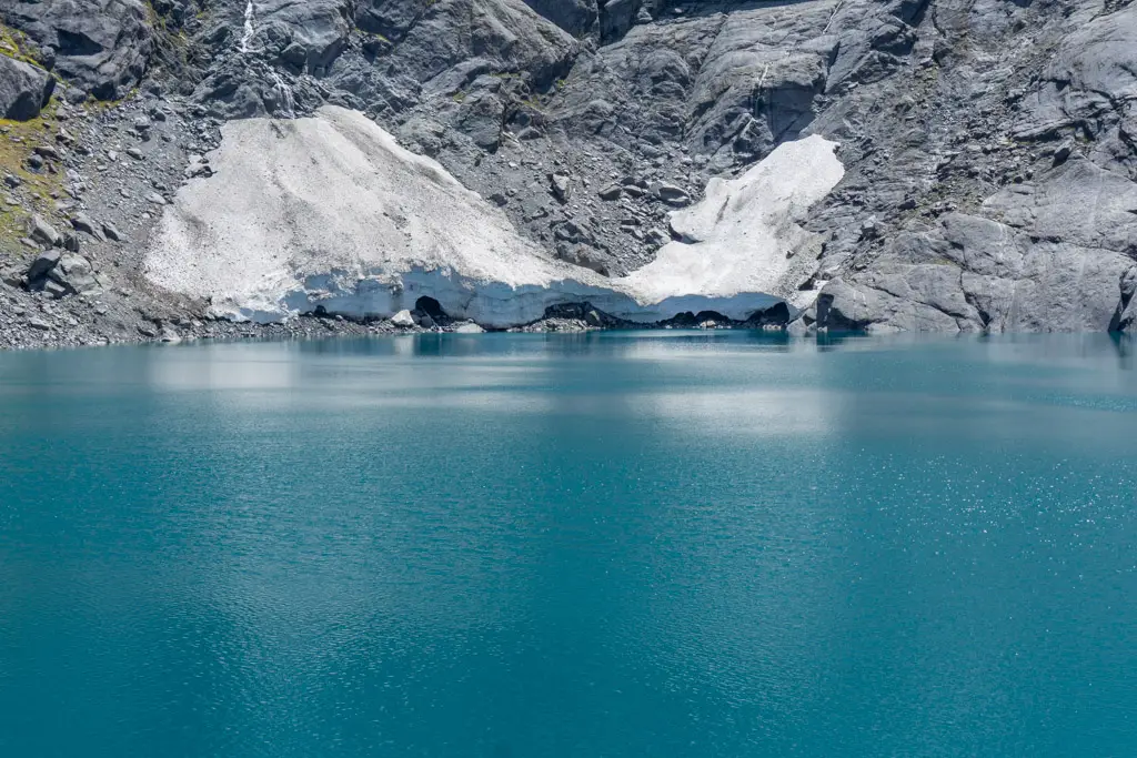
It was a steep scramble down to the edge of the lake to join a few others who’d made the trip up, including a lovely group from Christchurch who we’d shared Young Hut with two nights prior. We sun-bathed on rocks and gorged on a well-deserved lunch.
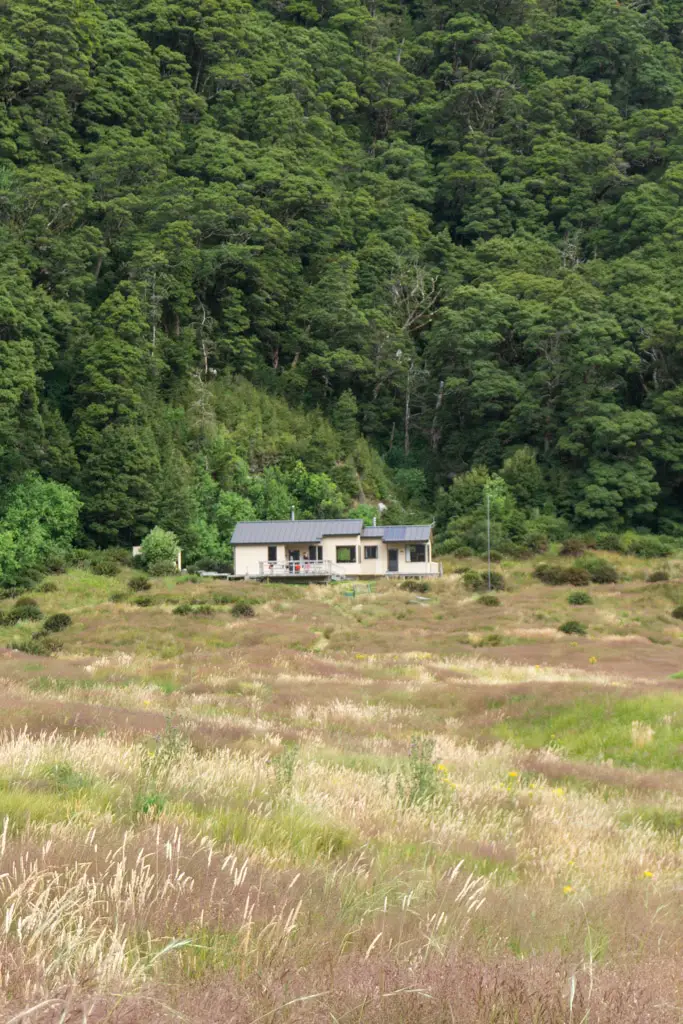
Siberia Hut
I very reluctantly left the lake, but it was time to head to Siberia Hut. We retraced our steps and flew down the very steep track. Before we knew it we were back at our packs. The next hour was a mostly flat walk down the Siberia Valley. After three bigs days, I was happy to glimpse the DOC hut in the distance. Civilisation (or almost) was in sight.
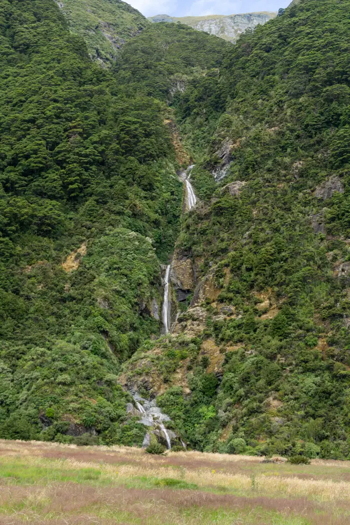
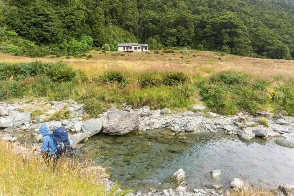
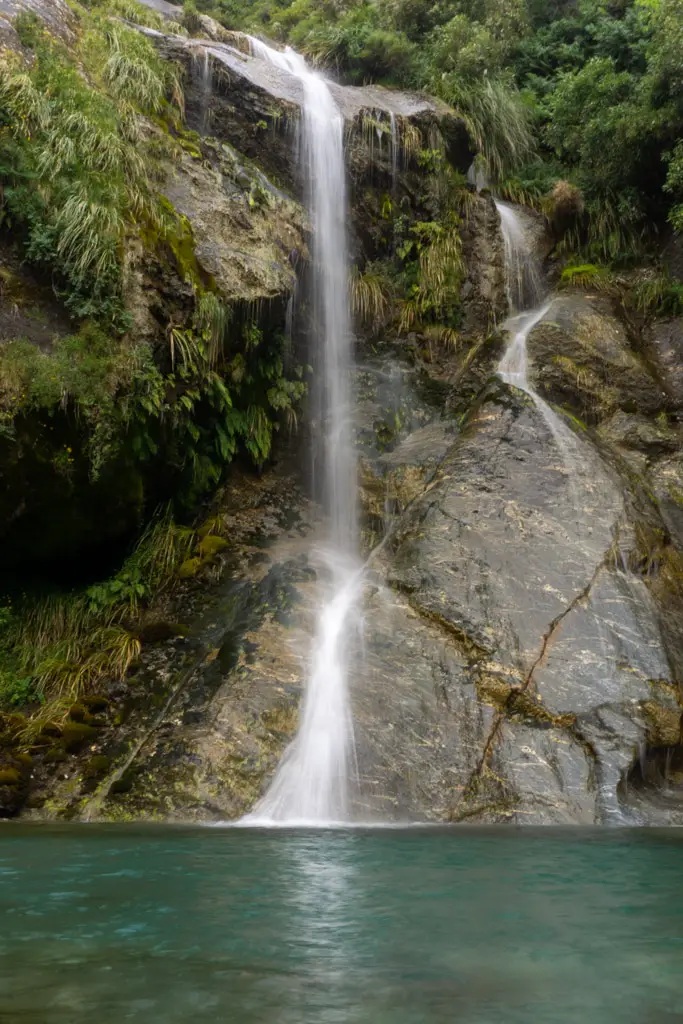
There were a few streams to cross along the valley. The largest was directly before Siberia Hut, fed by a waterfall behind the hut. At this point I’d well and truly given up on keeping my feet dry, so just walked straight through. The freezing water was lovely on my aching knees.
Siberia Hut ended up being quite full, so despite our booking we opted to tent on a flat space outside the hut instead. No snorers or midnight torchlight for us!
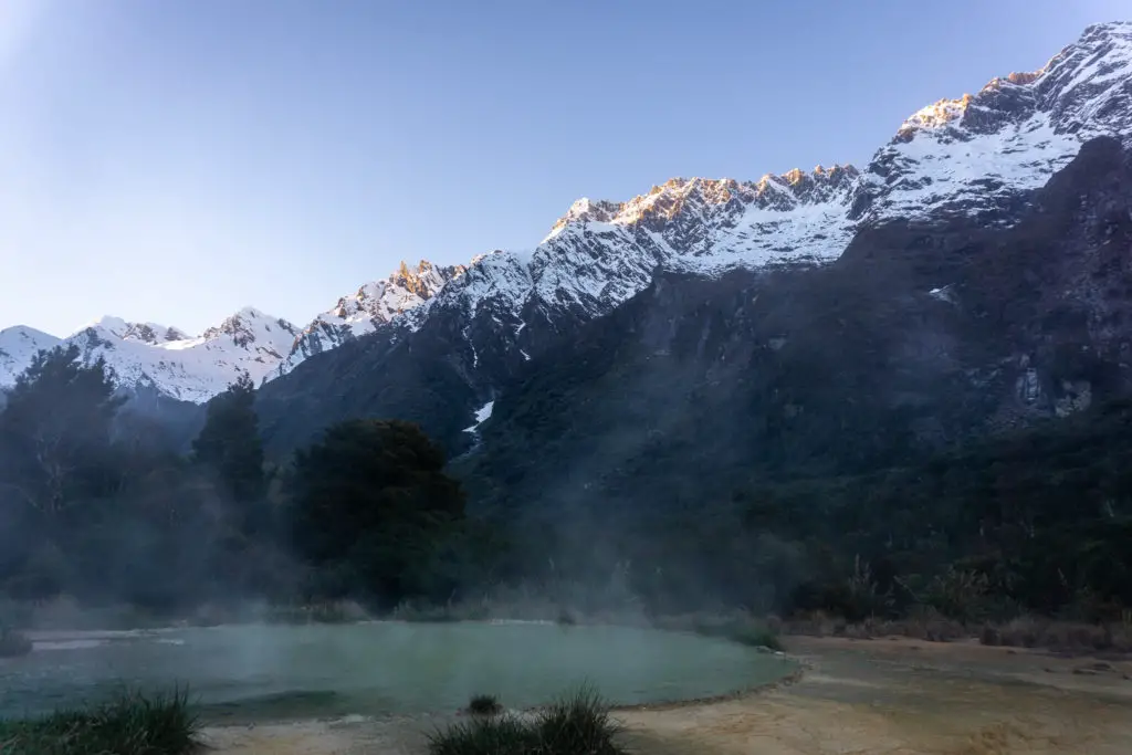
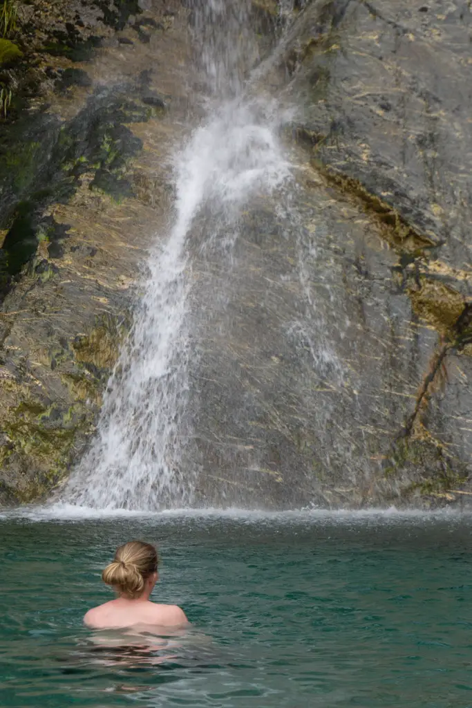
I took a swim in the waterfall pool next to the hut (follow your nose past the helicopter pad to reach it). The pool honestly felt like a wellness spa you’d pay money to experience (except for the water temperature, that left a little to be desired). But it was a luxury to feel so clean.
Day 4: Jetboat down the Wilkin River
The next day was an easy 2-3 hour walk out (which was very much needed as my legs were irrevocably done). We had a leisurely breakfast at Siberia Hut, and filled out the DOC Intentions book. Then it was time to slowly set off and say goodbye to the beautiful Siberia Valley.
We passed the grass airstrip on the other side of Siberia Stream (which felt more like a river at this point, even with the levels being so low) just as the 10am flight touched down. Such a busy airport.
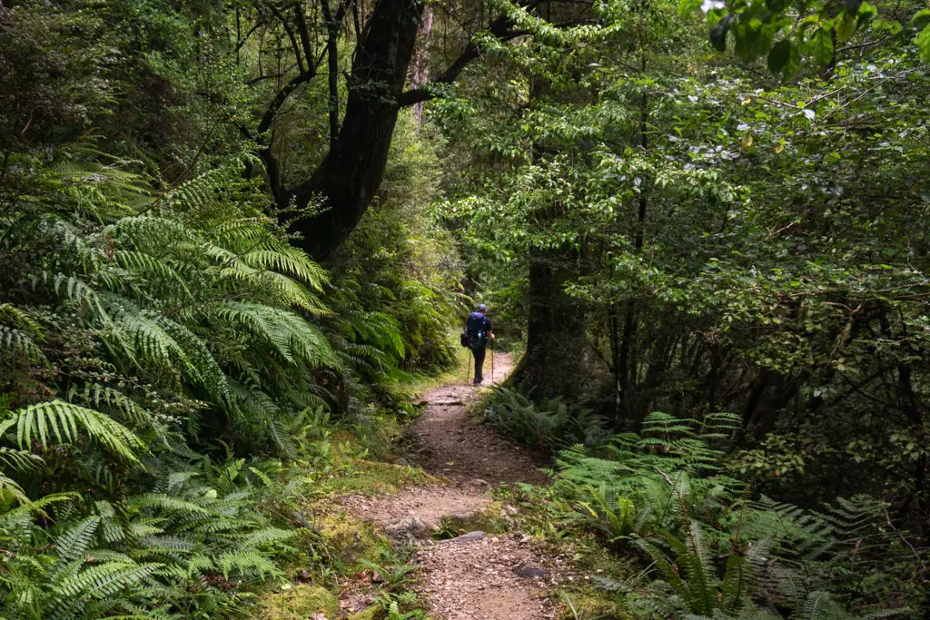
Instead of thumbing a lift with the pilot, we continued into the bush at the end of Siberia Valley. This part of the Wilkin-Young Circuit was to a Great Walk standard, which felt very odd after having scrambled up and down tree roots for the past three days.
The Siberia Experience
Wilkin River Jets and Southern Alps Air offer the Siberia Experience – a day trip flying in to Siberia and then walking to catch the jet boat down the Wilkin River. A lot of work has obviously gone into this part of the track to bring it up to day-walking standards. I felt both cheated and very relieved.
There was a short and very gradual uphill with some pretty views of waterfalls on the other side of the valley. Then it was a never-ending series of switchbacks down 300m+ of vertical descent. This normally would have been a breeze, but my feet were feeling the pressure of three long days. It was a relief to hear the river getting closer.
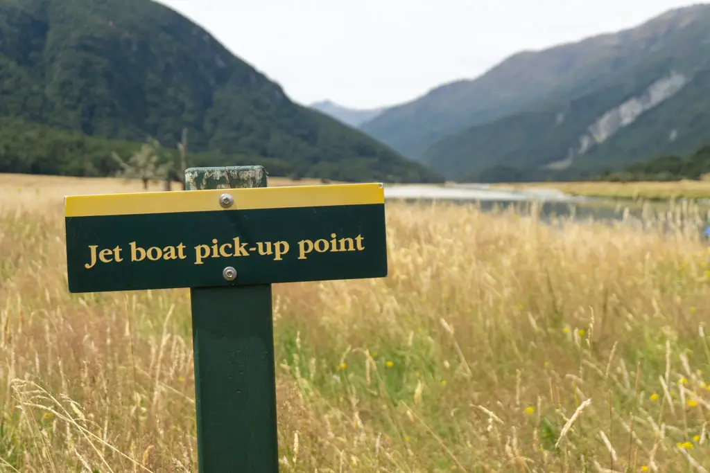
Jetboating down the Wilkin River
Once we reached the Wilkin River, it was a 20 minute walk downstream to the signposted jetboat pick-up point. The jetboat had already left (despite being scheduled to pick us up in 10 minutes’ time). But it was hard to be disgruntled when we were surrounded by such beautiful surroundings, and knew it would come back. I found Kerin Forks Hut on the other side of the valley (but didn’t cross the river to check it out), while Matt had a swim.
We made friends with another group who were waiting. How to tell you’re in New Zealand while the borders are closed? Everyone you meet is only two degrees of separation away from you: one of the ladies was in my mum’s waiata group.
The trip out along the Wilkin River, once our driver Danyel showed up, was ridiculously thrilling. I’ve been on a few jetboats before, but because of the ridiculously low river levels, this was hands down the most thrilling ride I’d ever experienced.
Many parts of the river were so low that I could have crossed without getting the inside of my (waterproof) boots wet, so less than 10cm of water! It was well worth the money for the ride itself, let alone skipping out a poorly maintained 14km+ along the banks of the Wilkin River.
Opting for the jetboat ride also cut out a second crossing of the Makarora River, which I appreciated, and we were deposited right at our car via a short shuttle ride from the riverbank.
Gillespie Pass is a challenging, beautiful multi-day tramp. It’s not one that you should underestimate, but with proper planning it’s an amazing 3 or 4 days in some beautiful parts of the New Zealand backcountry. the Wilkin-Young Circuit is now one of my all-time favourite tramps, and I’m already planning on when we’ll be back to the area.
Safety for the Wilkin-Young Circuit
As always, please stay safe when you’re out exploring. Follow the Outdoor Safety Code:
- Choose the right trip for you (check out the Mountain Safety video and the DOC brochure, read other blogs!)
- Understand the weather – choose a different trip if wet weather is forecast
- Pack warm clothes and extra food – you may be stuck on the wrong side of one of the rivers if water levels rise and have to wait it out.
- Share your plans and take ways to get help
- Take care of yourself and each other
Stay safe and get outside!
Where to next?
LET ME KNOW WHAT YOU THINK! LEAVE ME A COMMENT OR MESSAGE ME OVER ON MY INSTAGRAM.
I love hearing from you and helping you plan your own adventures!