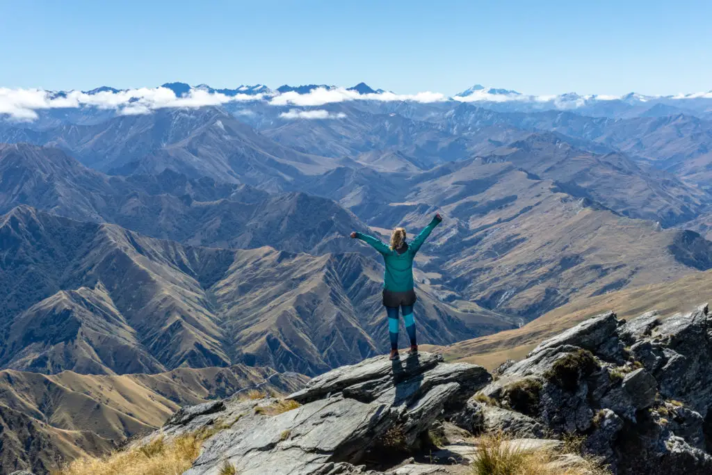
The Rees-Dart Track is up there as one of my all-time favourite tramps. It has it all – lush forest, beautifully blue rivers and waterfalls, glaciers, stunning mountains, flush toilets – what more could you ask for?
ALERT
The Dart Track is closed indefinitely due to a slip between Daley’s Flat Hut and Chinamens Bluff.
Check the DOC website for more details.
Length: 63km + optional 16km return side-trip to the Dart Glacier
Time taken: 5 days
Difficulty: moderate
Facilities: toilets at each of the carparks. Daley’s Flat (20 bunks), Dart (32 bunks) and Shelter Rock (22 bunks) are non-bookable, serviced huts. They cost $25 per adult (green ticket) and have non-filtered water, fireplace and (in summer, flushing!!) toilets.
Important: the Rees Dart Track isn’t recommended between late autumn and early spring (May – November) because of complex avalanche terrain. The bridge over Snowy Creek is removed due to avalanche danger over winter. It is a hazardous river crossing without the bridge.
The carparks for either end of the Rees Dart Track (Muddy Creek and Chinamans Bluff) are ~35km apart. There are multiple transport options that are explained in this great blog post. Both access roads to these carparks involve multiple fords, that may be impassable after rain. Rental cars are not always permitted on these roads – check your rental agreement.
Nearby trips you might like:
Cascade Saddle
At the upper end of the Dart Valley lies Cascade Saddle, with stunning views of the Dart Glacier and Mt Aspiring.
Why the Rees Dart Track?
So many people have told me that the Rees Dart is one of their favourite ever tramps. So (like most of the trips I write about) it had been on my to-do list for many years. I finally had an opportunity to complete it with my friend Simone in 2024, but alas it was not to be.
After sorting annual leave, child care and the weather (the equivalent to winning Lotto), I tore an ankle ligament only two hours into the first day. And to really rub salt in the wound, it was on what essentially amounted to the level of difficulty of a gravel carpark, not even one of the tricky sections.
BUT Simone and I returned for redemption in April 2025. This time we successfully completed the whole loop, including a side mission up to the Dart Glacier.
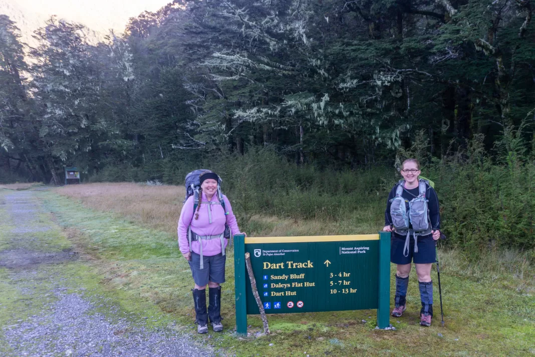
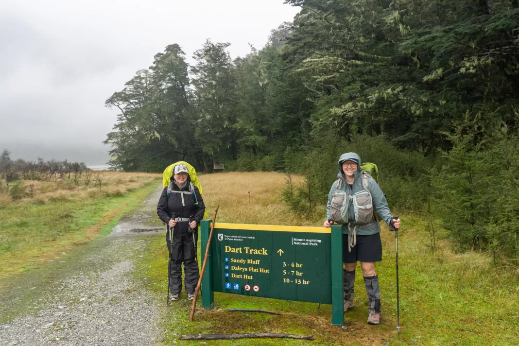
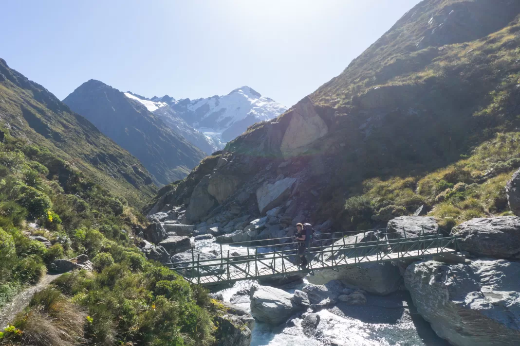
Rees Dart Track Day 1: Chinamans Bluff – Daley’s Flat Hut
Most people choose to walk the Rees Dart Track anti-clockwise (up the Rees Valley and down the Dart). But Simone and I went the opposite way; starting in the Dart Valley and walking clockwise. My Dad could 4WD up the Rees Valley and help us skip 10km of open valley walking (that I’d already done before on my Kea Basin trip). But the Rees River was too high when we started the tramp, so we hoped he’d be able to pick us up four days later on our way out.
As much as I enjoyed this trip, if you have the choice I’d recommend walking the Rees Dart anti-clockwise (the opposite to us). That way you’re walking towards the best views rather than having to keep turning around to see them.
The first time we tried this mission in 2024 we had an incredible weather forecast! But you’ll notice halfway through that the photos change to rain and pack covers from our 2025 trip …
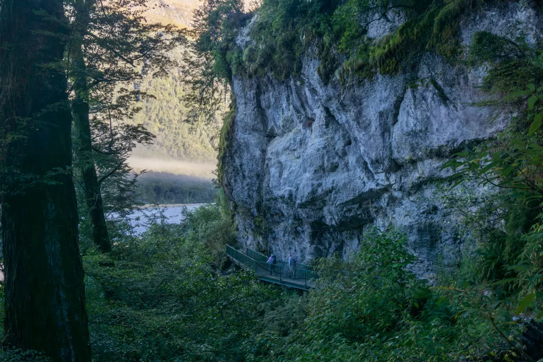
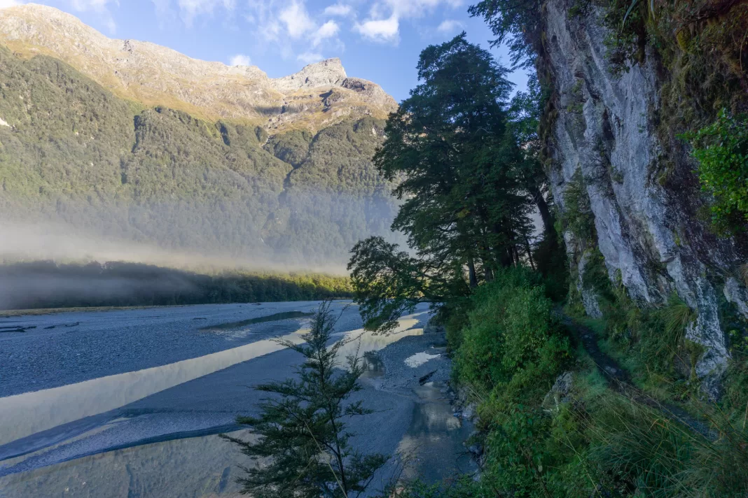
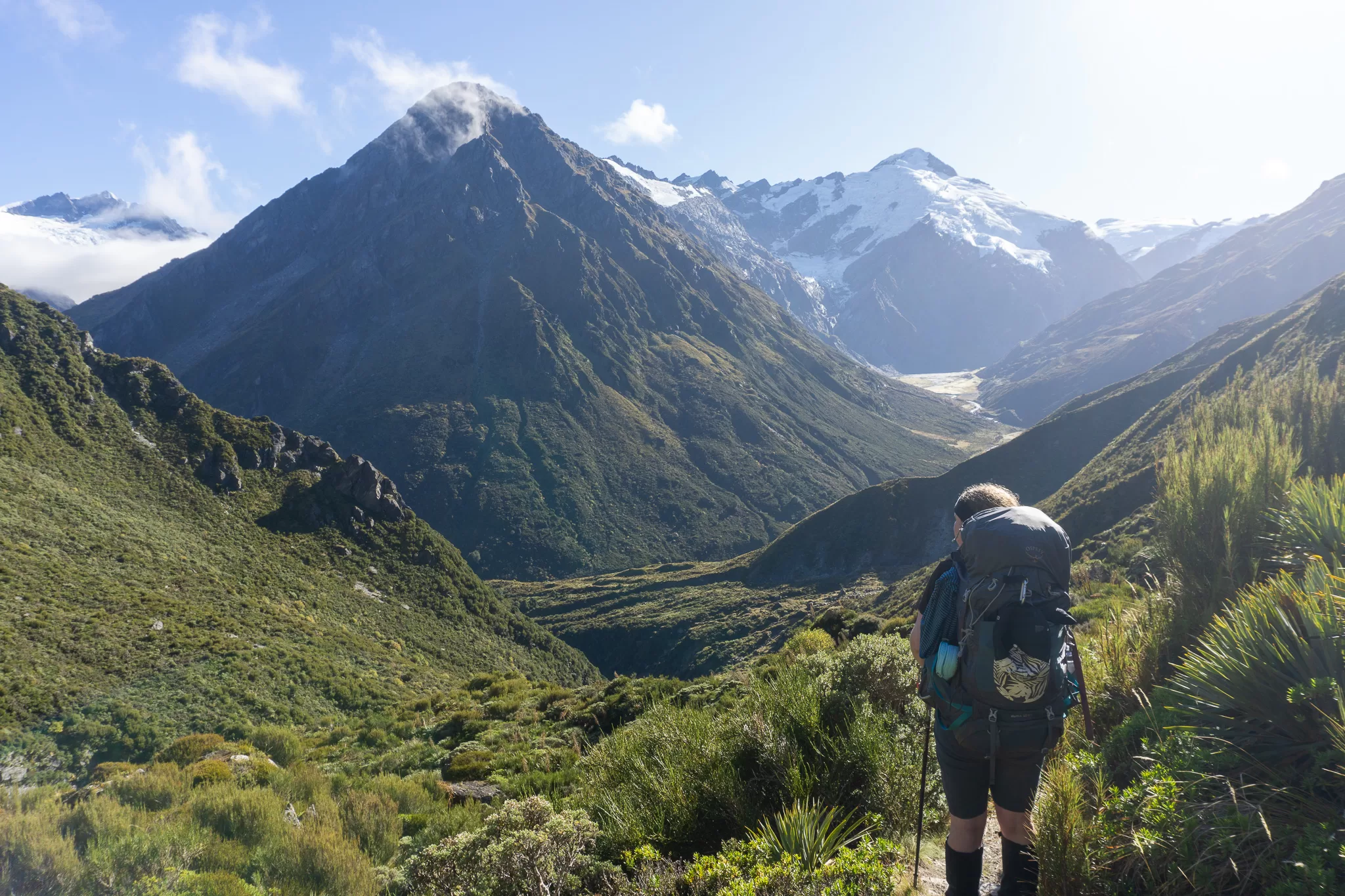
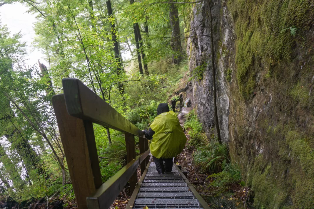
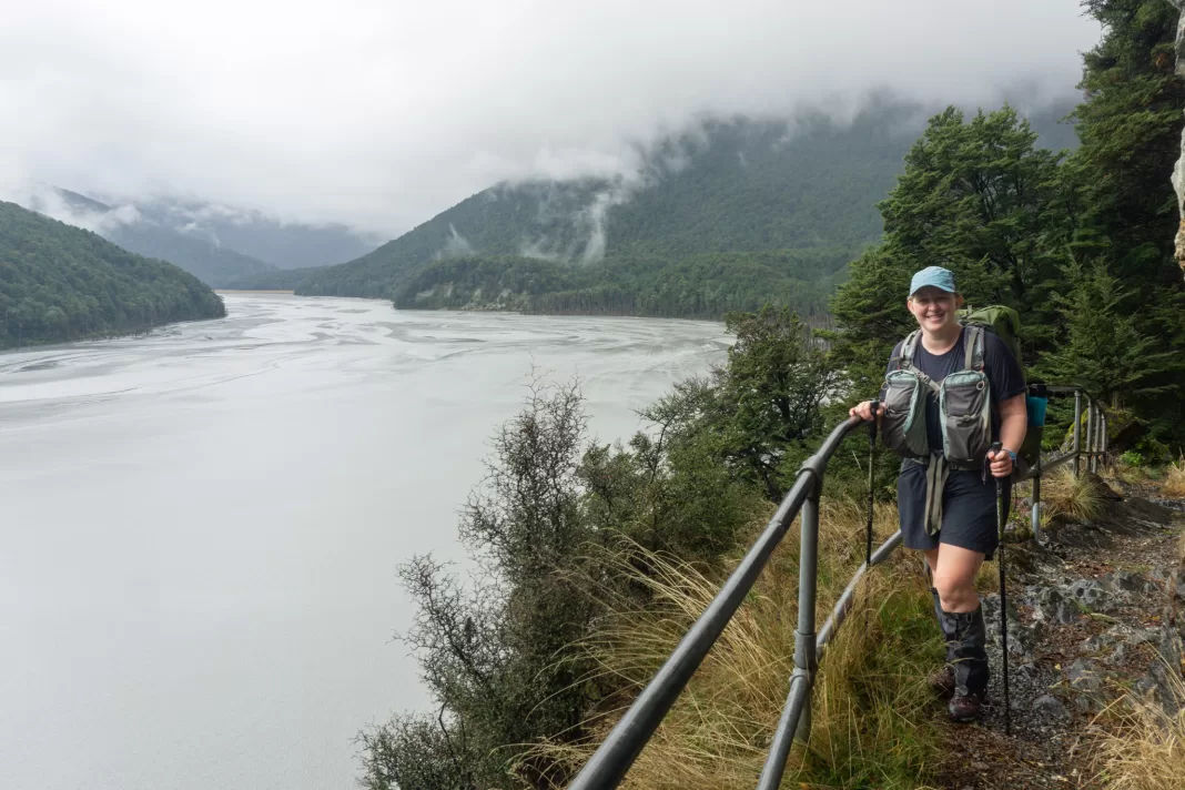
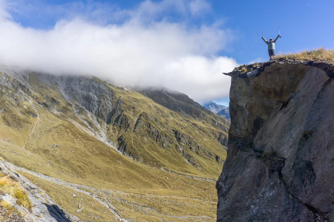
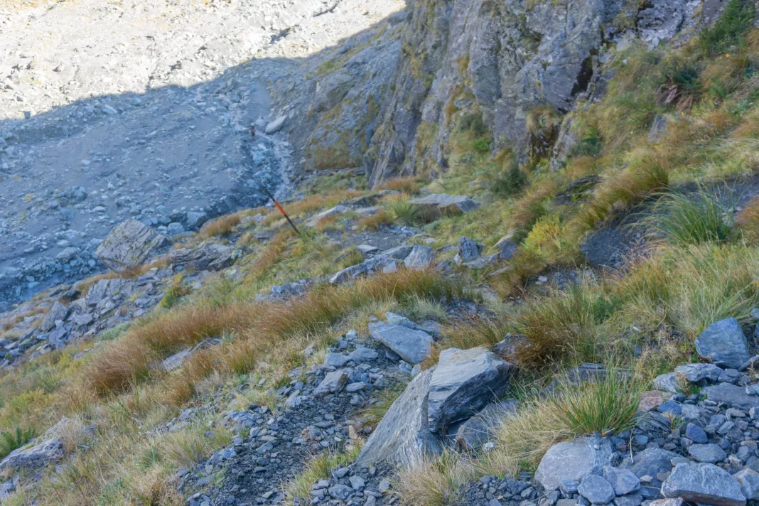
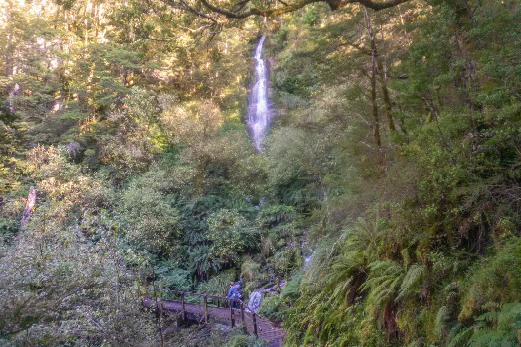
Chinamans Bluff
The first part of the Rees Track is an interesting day walk in itself. The track takes you around Chinamans Bluff with dramatic cliffs next to the Dart River and views of the surrounding peaks. On our first trip it was gorgeous, until I rolled my ankle. But on our second trip the following year, the peaks were clagged in – making for a very different moody, dramatic feeling landscape.
The first part of this section is relatively easy. Most of it is at the level of a Great Walk – wide, well levelled track. Ideal environment for someone to roll their ankle of course. But there are the occasional fords or cliff-sidling, where you have to watch your footing a little more.
That is, until you reach the sidle up and along to Sandy Bluff.
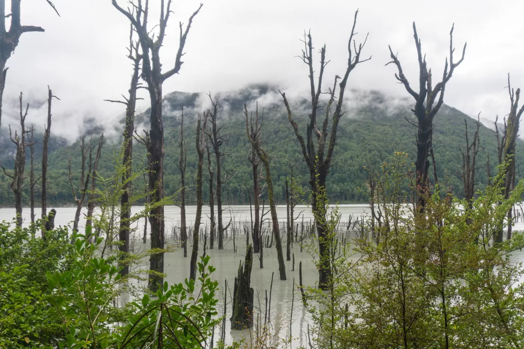
Sandy Bluff
This was probably Simone’s least favourite part of the entire trip. The track degenerates from Great Walk level to tramping track (read: walking under waterfalls on a track that is more tree root than path). With the rain, it felt like the entire hillside was covered in waterfalls cascading down on our heads. But at least it made filling up our drink bottles very easy.
Nobody rolled their ankles so after a miserable hour or two we reached Sandy Bluff. Well, miserable for Simone at least, I found this part kind of exciting – testament to the fact that if you punish yourself often enough, Type II fun becomes actually fun (or maybe just that I need to see a therapist).
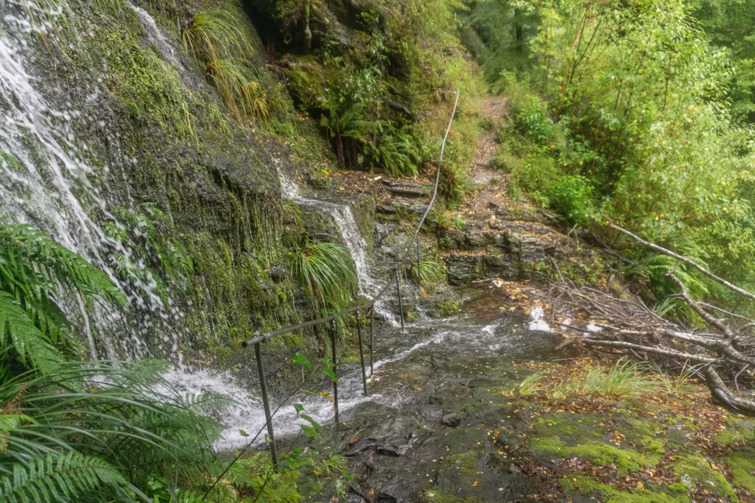
In January 2014, this section of the Dart River was dammed by a large slip from, get this, Slip Creek (click that link for some crazy photos). The Dart Track had to be re-routed and this section felt like it took us a while to get through. The views up the valley from the bluff were cool though, and seeing the drowned trees was pretty spooky.
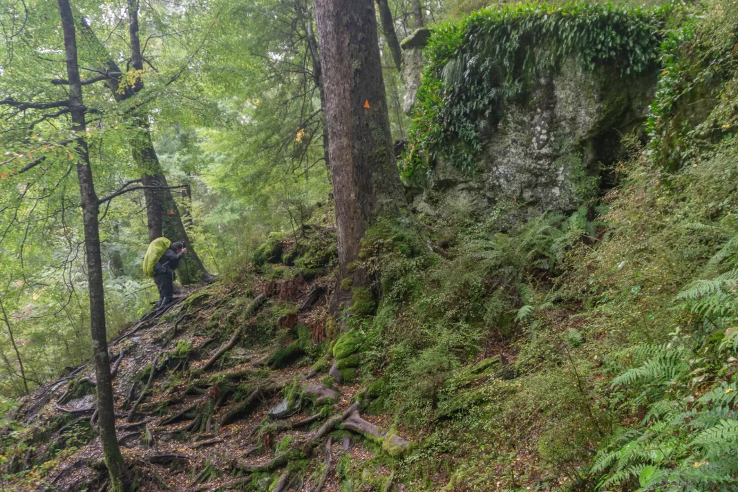
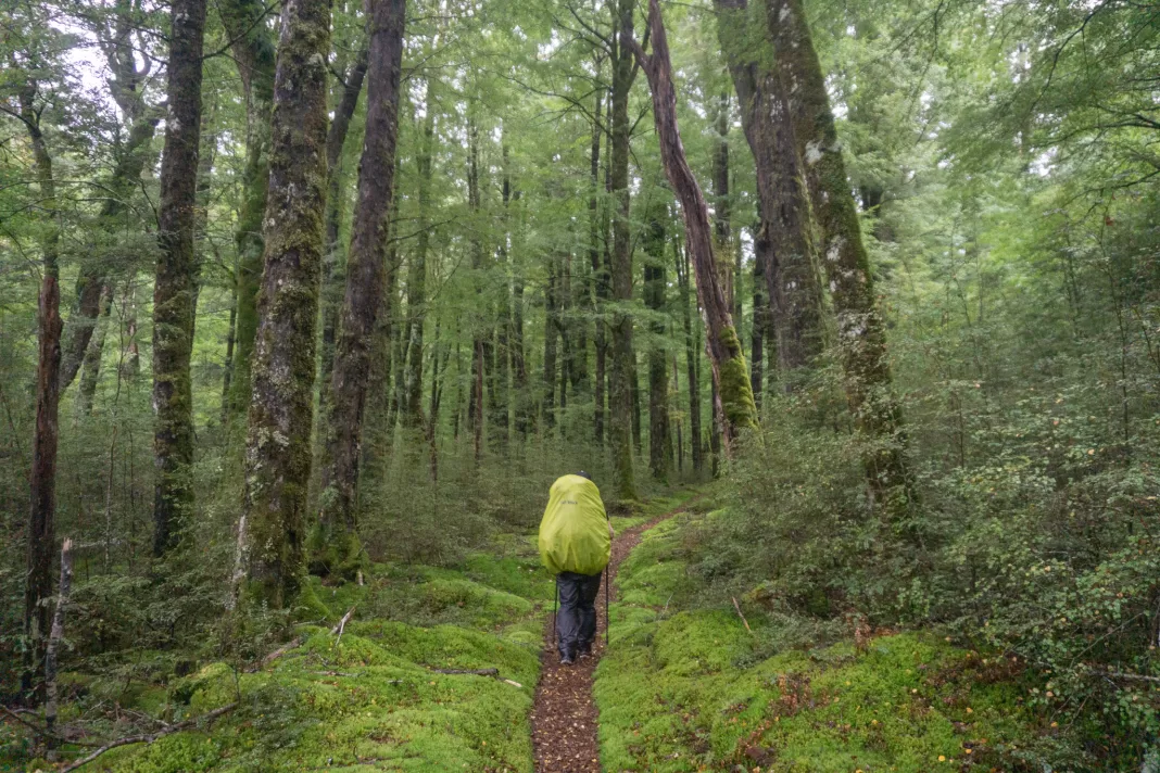
We managed to avoid the quicksand on Dredge Flat, courtesy of quick feet and a childhood spent training for this exact moment. Then it was a pretty forest walk to Daley’s Hut, which we shared with four other groups. Simone being a high school teacher, of course ran into one of her ex-students. You can’t escape them, even when you’re in the middle of nowhere.
Rees Dart Track Day 2: Daley’s Flat Hut to Dart Hut
The next day dawned gloomy with a few light showers, but it eventually cleared to the beautiful forecast that would hold for the rest of our five day trip. We farewelled Daley’s Flat Hut, as well as some of the lovely people we’d met who were either going the opposite way to us or skipping Dart Hut entirely (I said they were nice, I didn’t say they weren’t crazy).
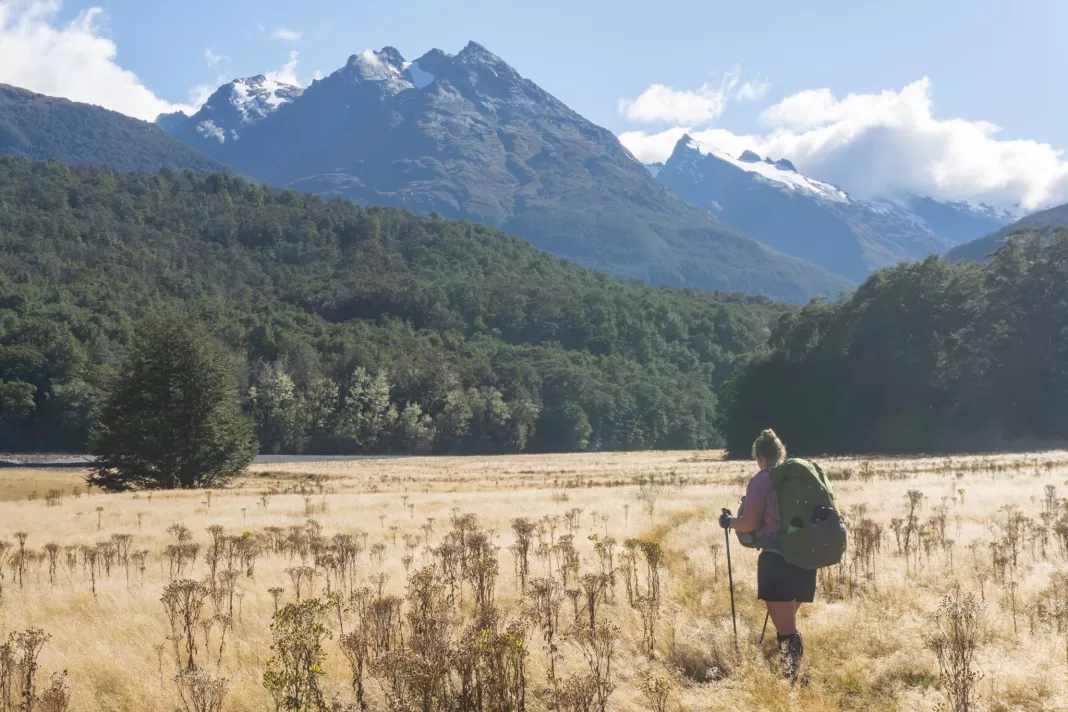
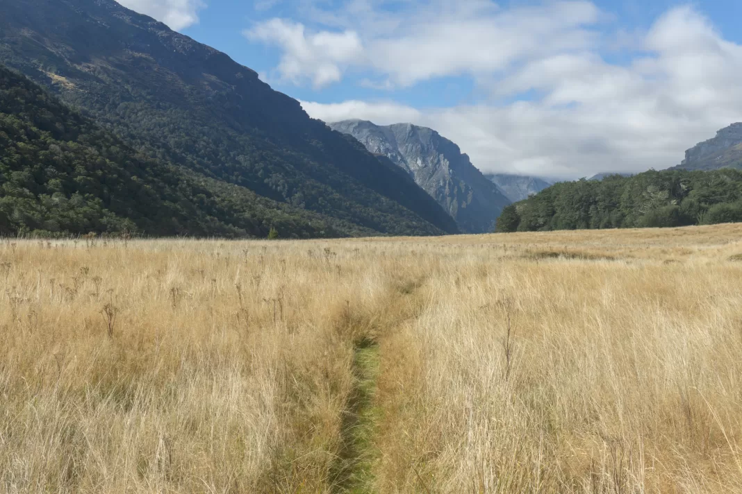
The first two hours was spent on a nice track in the bush, with a slight uphill climb right before we reached Cattle Flat. Cattle Flat is massive – it stretches for about 5km, and most of our day felt like it was spent walking across it.
Cattle Flat
Despite its name, Cattle Flat is made up of short but steep up and downs across river terraces. We played peek a boo with the couple in front of us in the far distance, while the end of the flat felt like it never got any closer. We stopped for lunch at the not quite halfway mark; a short side trip to the signposted rock bivy.
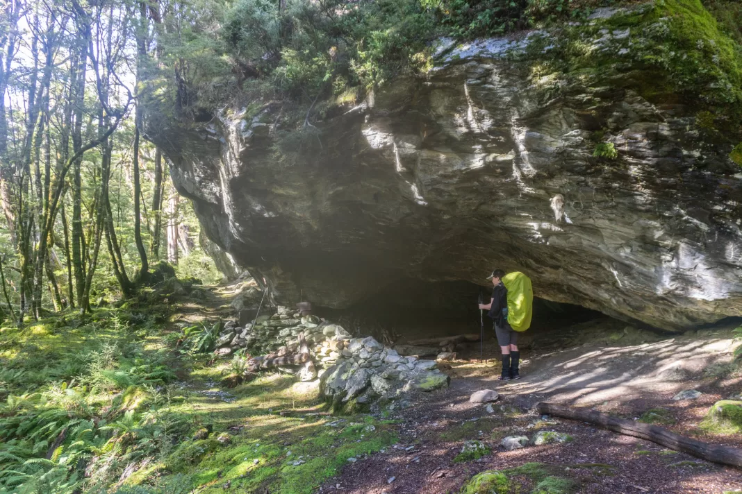
It was an impressive bivy; massive with an extra (smaller) bivy around to the side. A great place to shelter in a storm if needed (or camp on the cheap).
We ate lunch, then continued on across the never-ending Cattle Flat. I was glad we were tramping in April; this section would be an absolute heat trap in the height of summer. Eventually, after what felt like the entire day, we strolled up a gravel flood plain next to the Dart and entered the bush once more.
My brain has blocked out much of the next section; except for the fact it also just seemed to go on and on. I’d apparently underestimated the daily distances on the Rees-Dart. It felt like we should have arrived at Dart Hut an hour before we did.
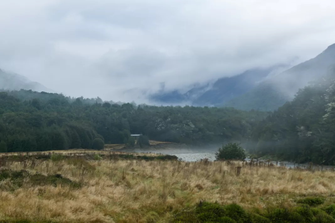
I told Simone we could have a quick sit-down break at the Whitbourn track junction … which never came into view. I know that bridge over the Dart was removed here, so perhaps the route isn’t signposted or even maintained anymore. But it meant that we just kept going; scrambling around a recent slip, before finally stumbling onto the hut’s veranda and absolute chaos.
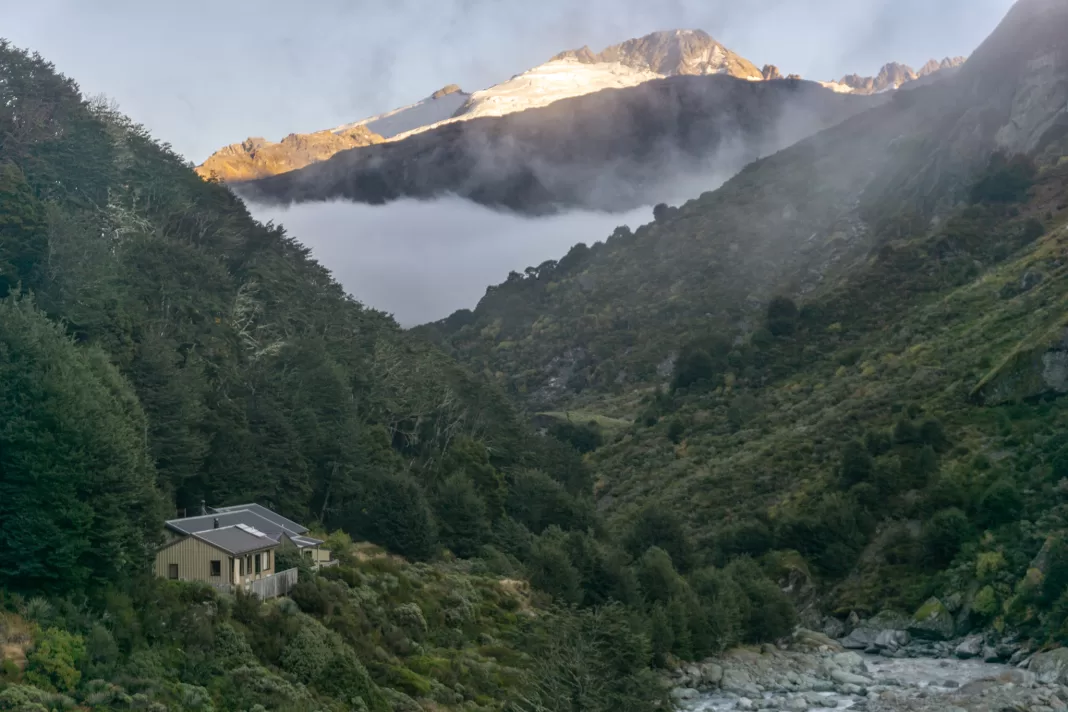
Dart Hut
I was very ready to change into non-sweaty clothes and eat some warm food by this stage. But what greeted us at the hut was 34 people trying to fit into a 32 bed hut. (Spoiler: it’s worse the next night). The lovely hut warden was doing a great job directing everyone and sourcing extra mattresses.
Simone and I had packed a tent with us just in case, but we ended up sleeping on double mattresses in the kitchen. Our fellow hut goers felt sorry for us, but it was actually a fantastic night’s sleep – comfy, warm and quiet, with no-one snoring next to us.
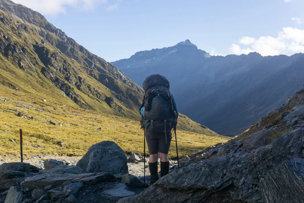
Rees Dart Track Day 3: Return trip to Dart Glacier
Well, it was a great night’s sleep. Until 5am, when someone decided they needed to bring their pack into the kitchen and scrunch every single one of the 150 plastic bags in it, for an hour. Eventually Simone and I gave up and started to get ready for the day.
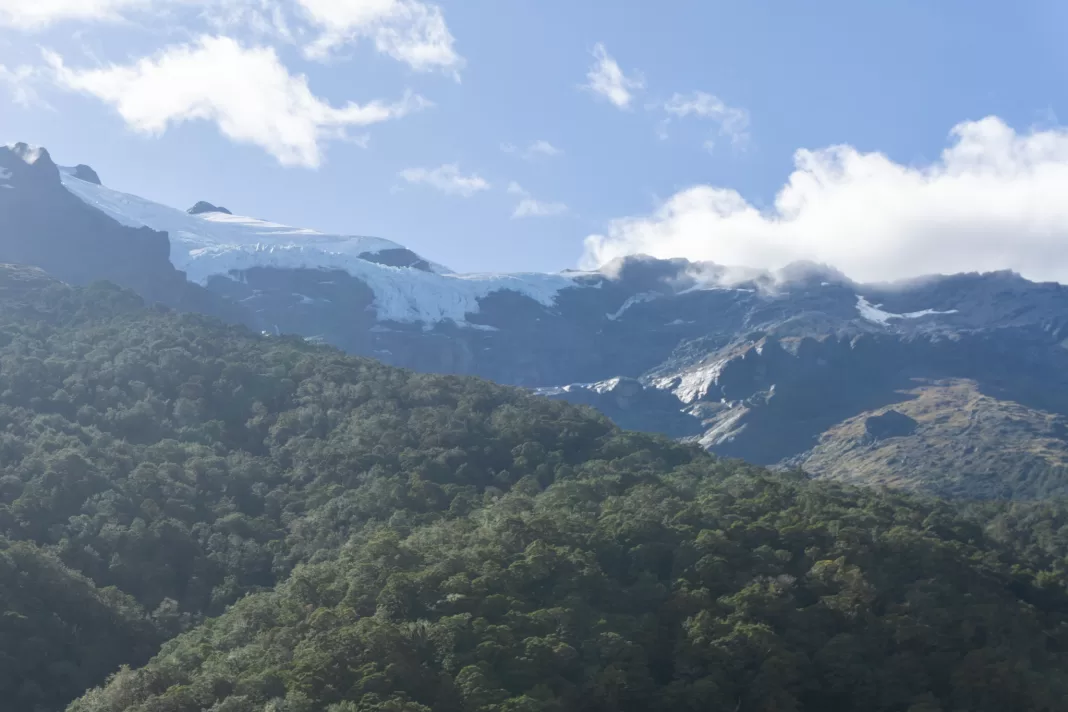
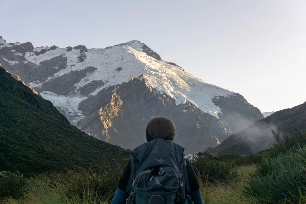
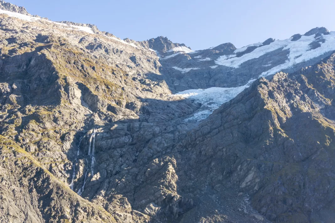
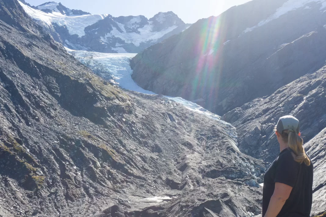
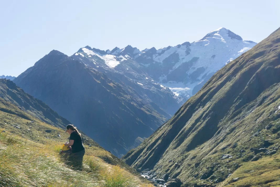
This middle day was our most anticipated day – the side trip to the Dart Glacier and Cascade Saddle!
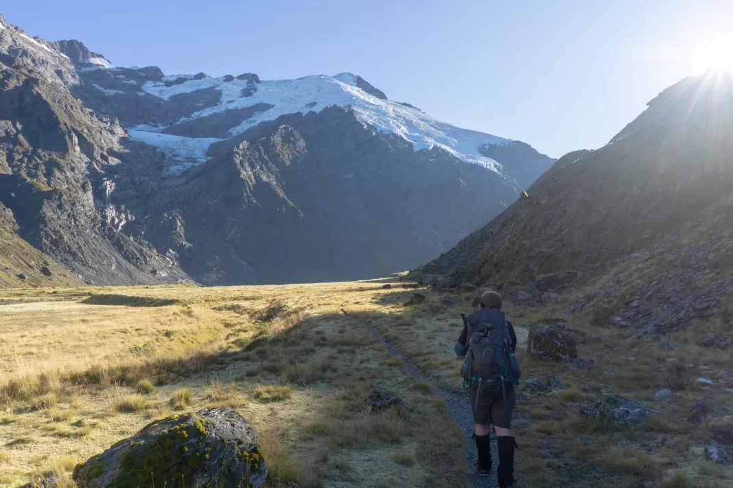
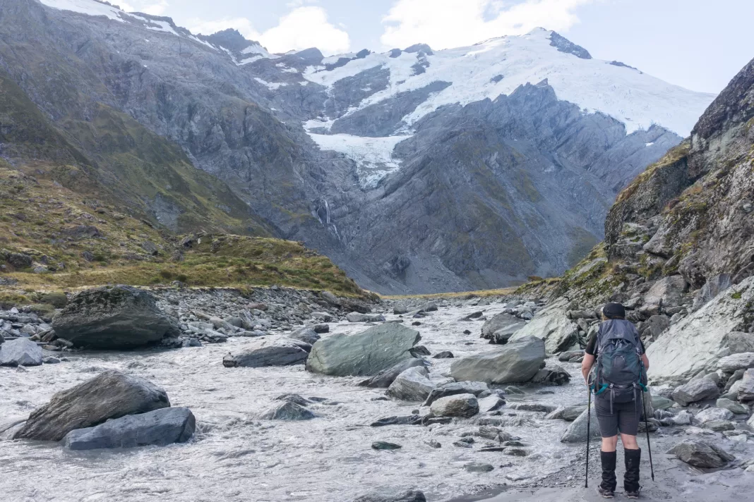
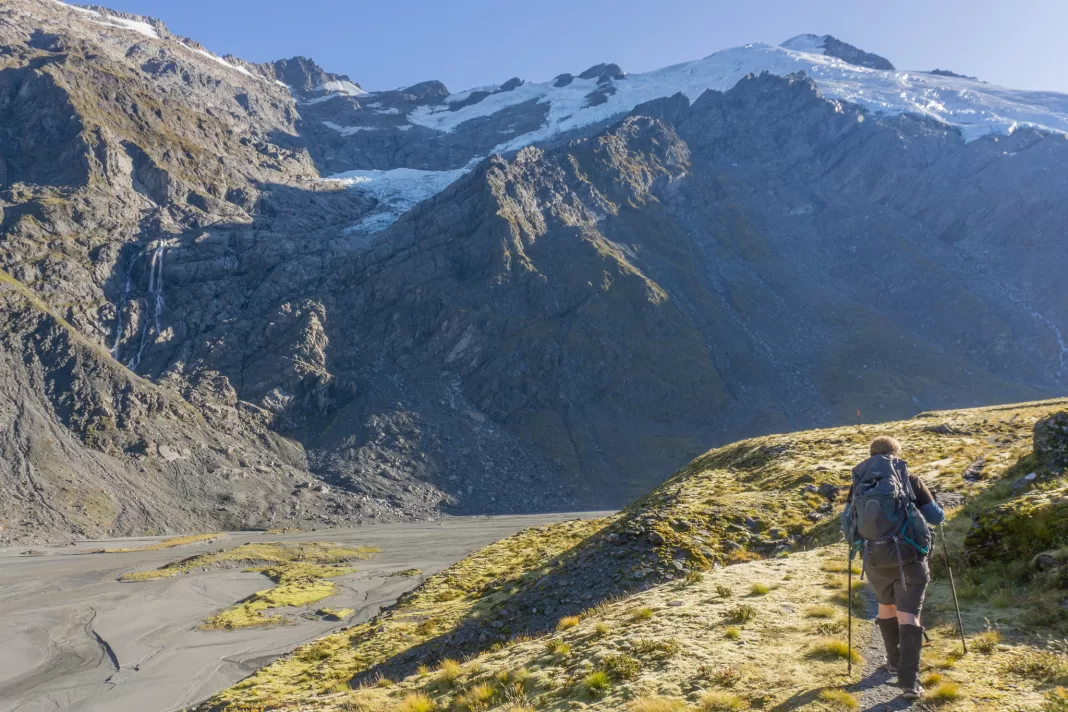
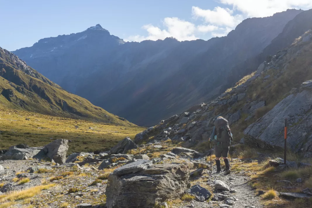
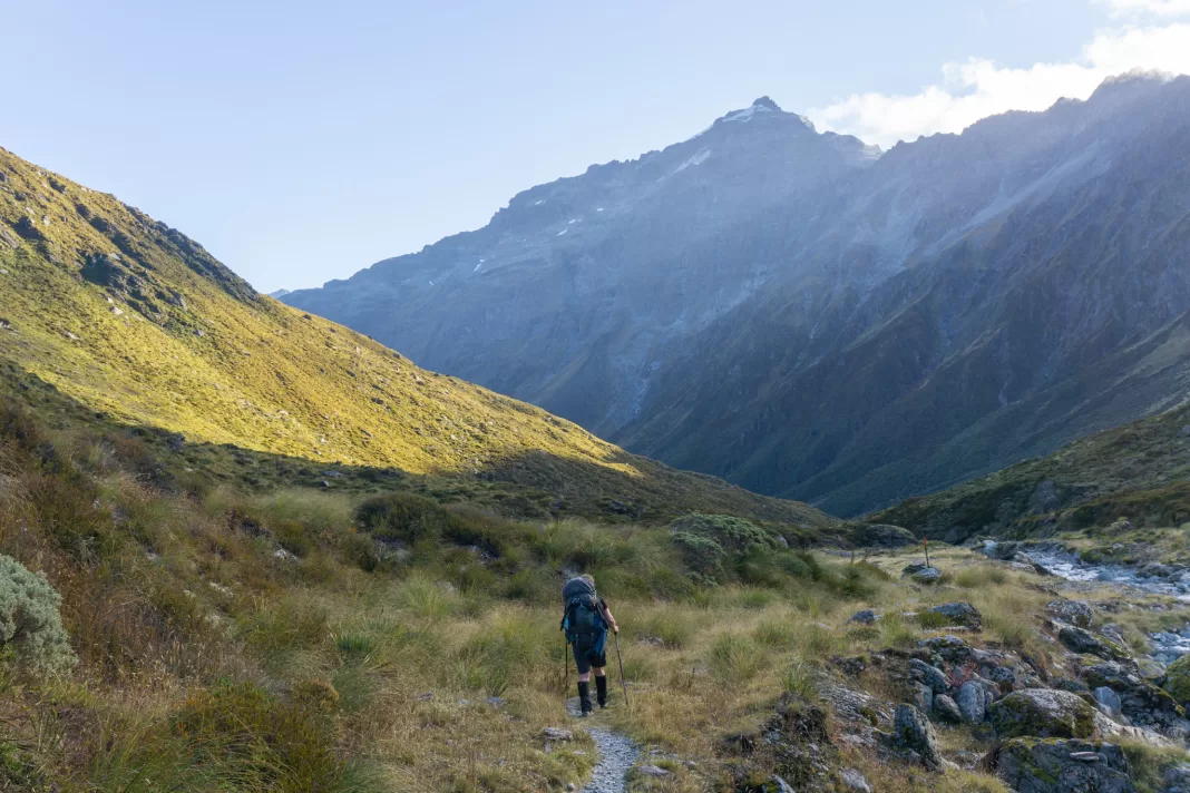
We waited until we could snap up a bunk for that night, then it was off to the head of the Dart Valley. The track was initially very easy going and the morning light was absolutely incredible. There were already stunning glaciers, snow-capped peaks, and waterfalls and we were only an hour in. I filled my camera with photos and had to delete some old ones from the SD card.
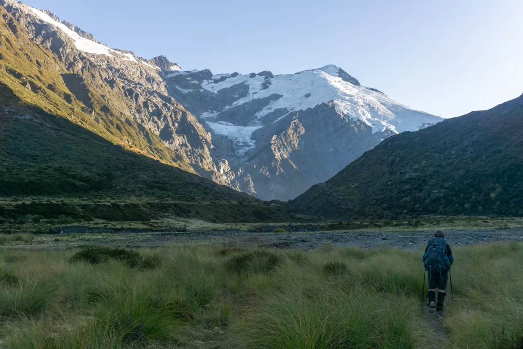
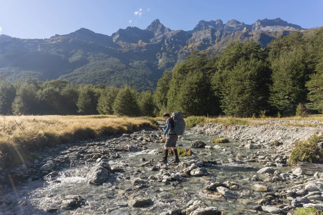
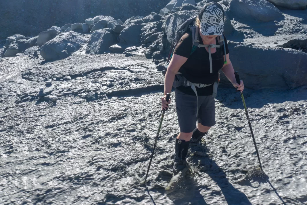
After about 2km, the valley narrowed and the track was squeezed between the Dart River and the hillside. We negotiated quicksand and boulders for a few hundred metres, trying not to fall into the menacing milky water of the Dart, before making it back out onto wide river flats. It wouldn’t be fun (or advisable) to attempt this section if the river level was high or flooding.
(photos taken later that day on our way back)
While easy going, it still felt like a decent distance until we rounded the corner and could see Cascade Saddle, although the Dart Glacier remained hidden from view. The track also had more ups and downs than I expected from looking at the topomap. A lot can hide between 20m contour lines!
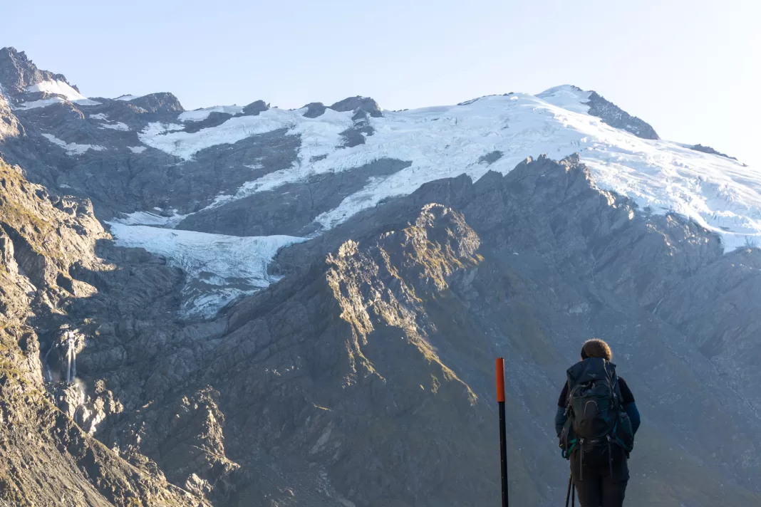
Dart Glacier Viewpoint
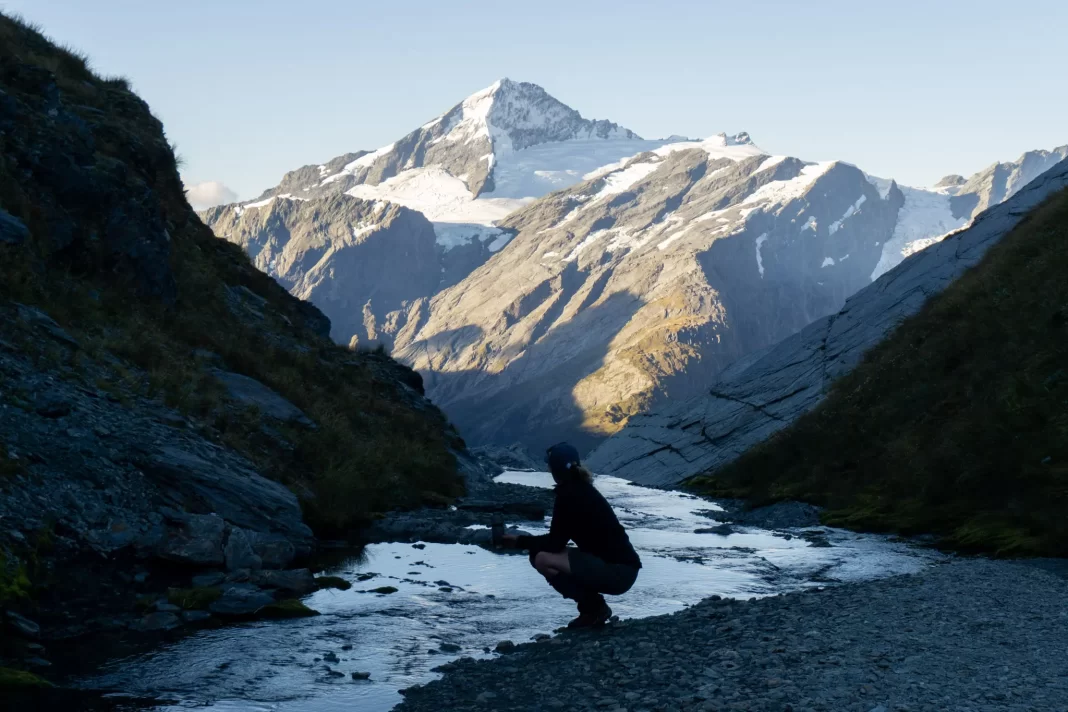
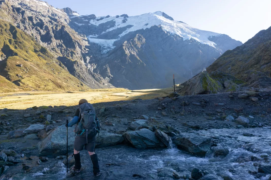
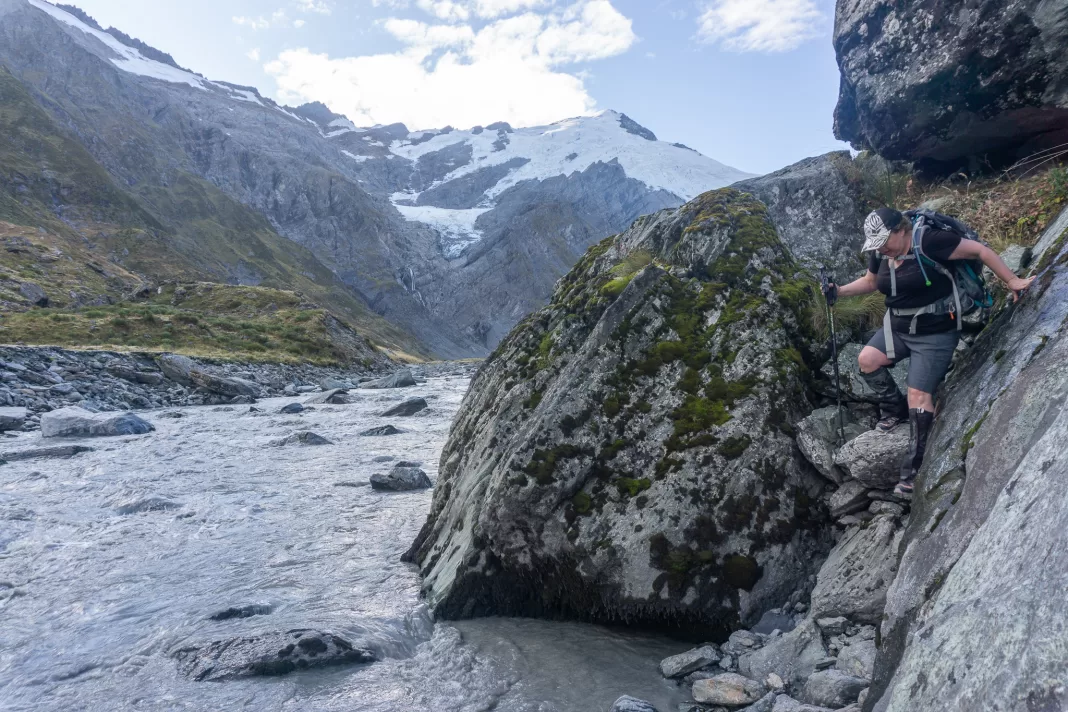
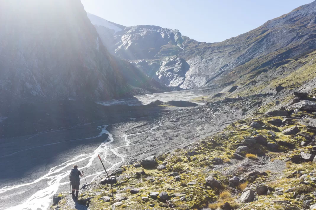
There were a few stream crossings this day (actually, every day – my feet were always damp by the time I reached each hut, despite waterproof boots), but the most .. impressive? was the one right before the climb up to Cascade Saddle.
I’d never crossed a stream or river with this much power and zero visibility, and before my river crossing course I probably wouldn’t have crossed it to be honest! I’m usually pretty risk averse. But equipped with that recent knowledge and experience, we crossed the incredibly fast-flowing and muddy stream without incident. I’d tested it with my pole and it was luckily super shallow as it wouldn’t have taken much more flow to knock us off our feet.
(we could have crossed it lower down where it was wider and slower, and others ahead of us did, but I was happy building on my skills in a spot where there was a good run-off)
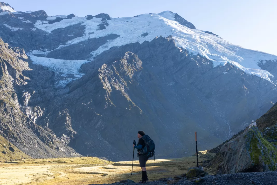
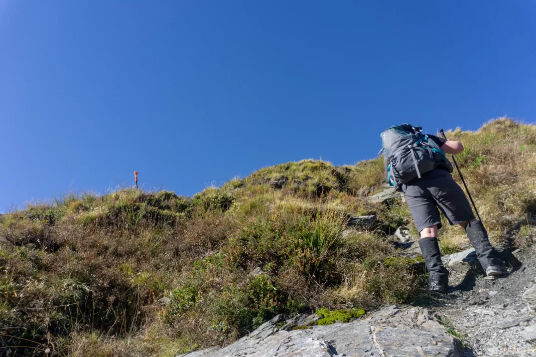
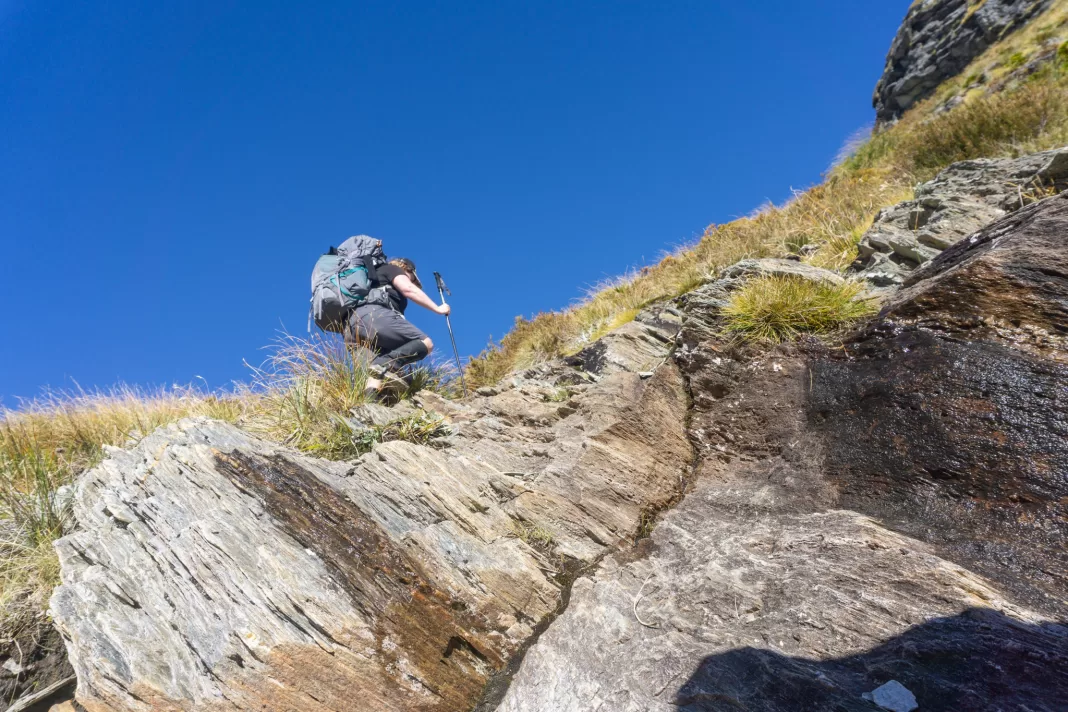
Then it was a steep climb up the hillside, following cairns and orange poles. We probably made it up about 200m up to the viewpoint of the Dart Glacier. It was getting closer to our turn-around time, and we reached a stream crossing where the access was a sidle across steep scree that Simone wasn’t so keen on (fair enough).
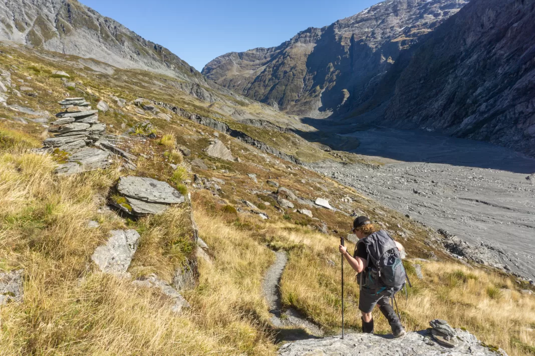
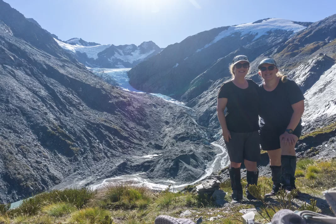
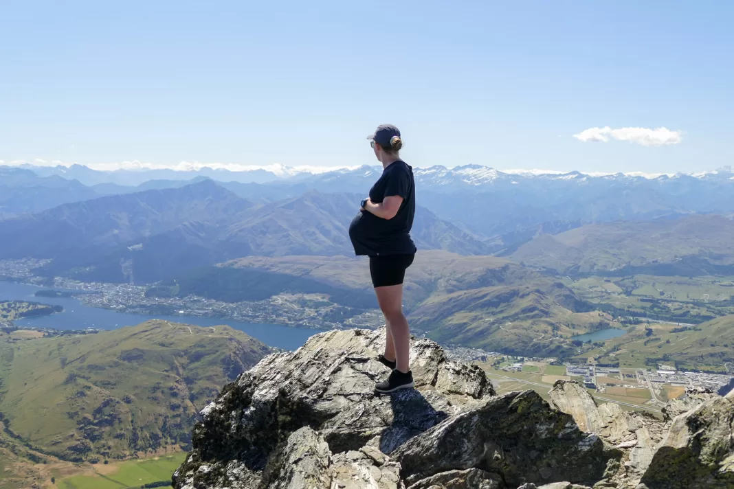
We stopped there and had our lunch, while gazing at the incredible Dart Glacier. A few people made it all the way up to Cascade Saddle that day from Dart Hut, but they were very fit and moving fast. I was happy where we reached. I’d been on Cascade Saddle a few years prior from the other side (you can read all about that trip here), and was happy not having to rush to reach that goal again.
Back to Dart Hut
After an hour, relaxing in the sun, chatting and snacking, we started to head all the way back down again, retracing our steps. By the time we got to the hut, it was even busier than the night before with multiple people having to sleep on spare mattresses.
(I have no idea where the DOC ranger kept finding more. There were at least 10 extra mattresses. He must have had a Mary Poppins style pack somewhere. Or perhaps they were left over because the hut had recently upgraded to the new thicker, dark blue mattresses? Whichever you think is most likely.)
The campsite was also completely full. Some people had to pitch their tent on the helipad (with the DOC ranger’s permission, and I’m assuming lots of warnings about a quick pack up in an emergency). Simone and I were just happy to have a bunk for the night! The ranger said it was the busiest night of the entire season.
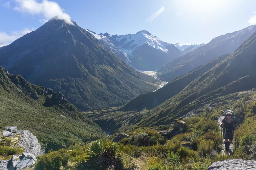
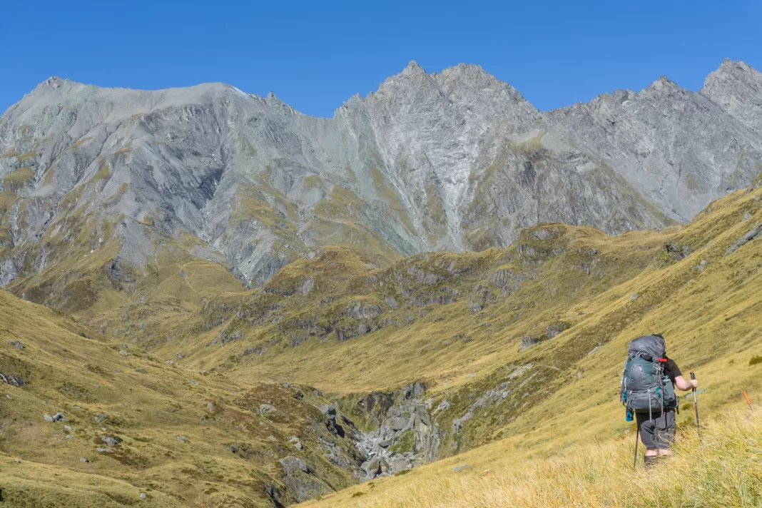
Rees Dart Track Day 4: Dart Hut – Shelter Rock Hut
If the previous day up to the Dart Glacier was our most anticipated day, then the day over the Rees Saddle was a close second. We started with a short but steep climb up towards the bridge over Snowy Creek. A helicopter flew overhead and landed at Dart Hut – picking up DOC staff. Simone and I joked about hitch-hiking home on it – little did we know the passengers who’d just arrived were her neighbours in Te Anau (who’d built the new bridge we’d crossed on Day 1). NZ is a small place!
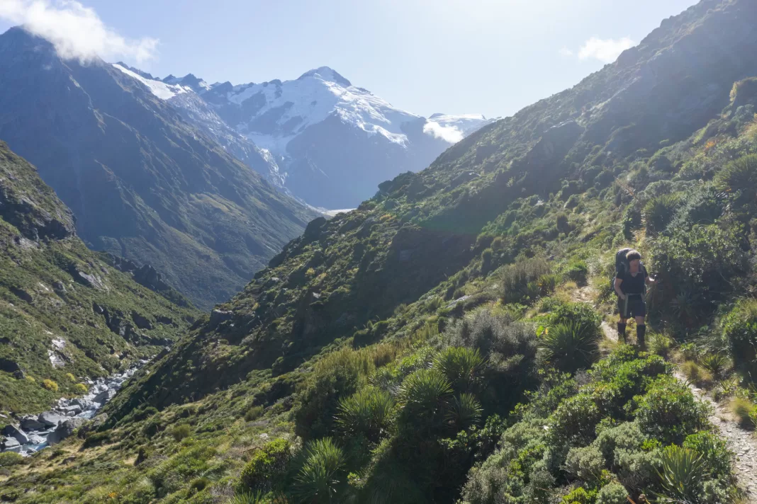
The views behind us were beautiful. We kept having to stop and turn around to take them in. Purely for the view, not because we needed breaks or because our breathing was out of control. Definitely not that.
We soon reached the bridge over Snowy Creek. This bridge is removed over winter due to avalanche risk. I was glad it was there, even with my river crossing course, I wouldn’t have liked to cross the deep and swirling Snowy Creek.
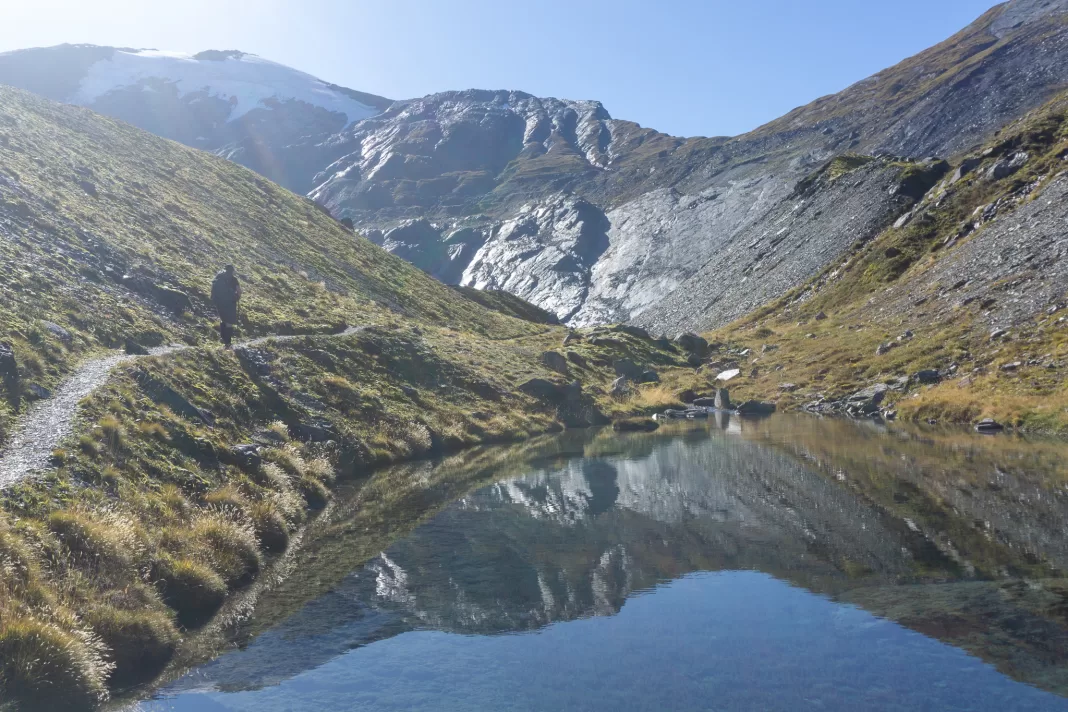
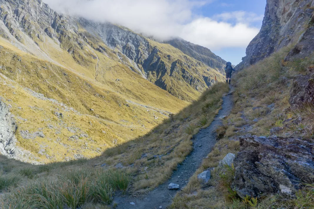
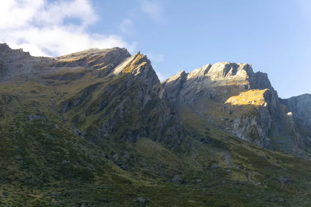
There was a very steep scramble up the other side of Snowy Creek after the bridge. But once that was over, we were in a different world. Golden tussock slopes, with the Rees Saddle in the distance.
We filled up our bottles in the tarns below the saddle, worrying about running out of water. Thankfully I had my Water to Go filter bottle (affiliate link) with me, so I didn’t have to stress!
There was a steep but short climb up tussocks and rocks to Rees Saddle. And we were there!
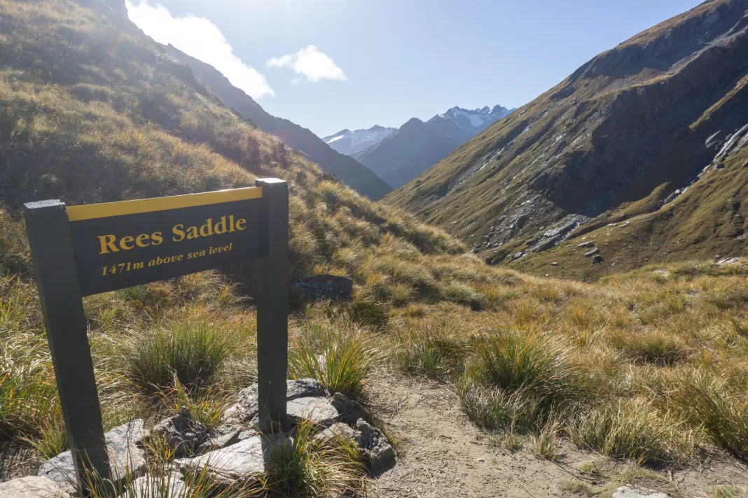
Rees Saddle
There were a few others stopped at the saddle too. We chatted with them, before taking their advice and continuing up to a better view-point. We climbed another 100m or so above the sign until we could see all of the valleys and mountains surrounding us. It was stunning and yet another highlight of this trip.
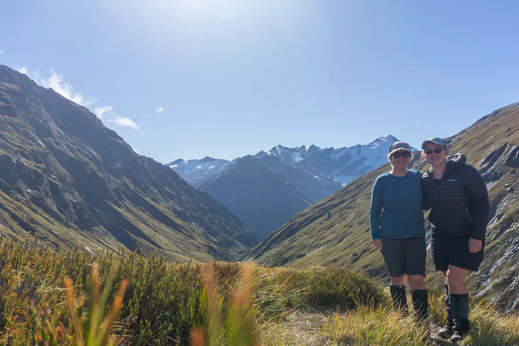
We ate our lunch back down at the saddle, where it wasn’t even blowing a breeze! There was a mixture of people coming and going, but we were the last ones to eventually leave and set off down into the Rees Valley. I stopped off the track to pee, and while looking around while I was squatting down (men have it so much easier), noticed there was a beautiful looking pair of sandals nestled in the tussock right next to me. Bit of an odd place to shop, but they were in my size, so I strapped them to the outside of my pack.
The climb down from the Rees Saddle was steeper and longer than the side we’d climbed up from Snowy Creek. The calls of rockwren kept us distracted from the gravel path that kept shifting under our feet, before we finally spotted them bobbing up and down on some nearby boulders.
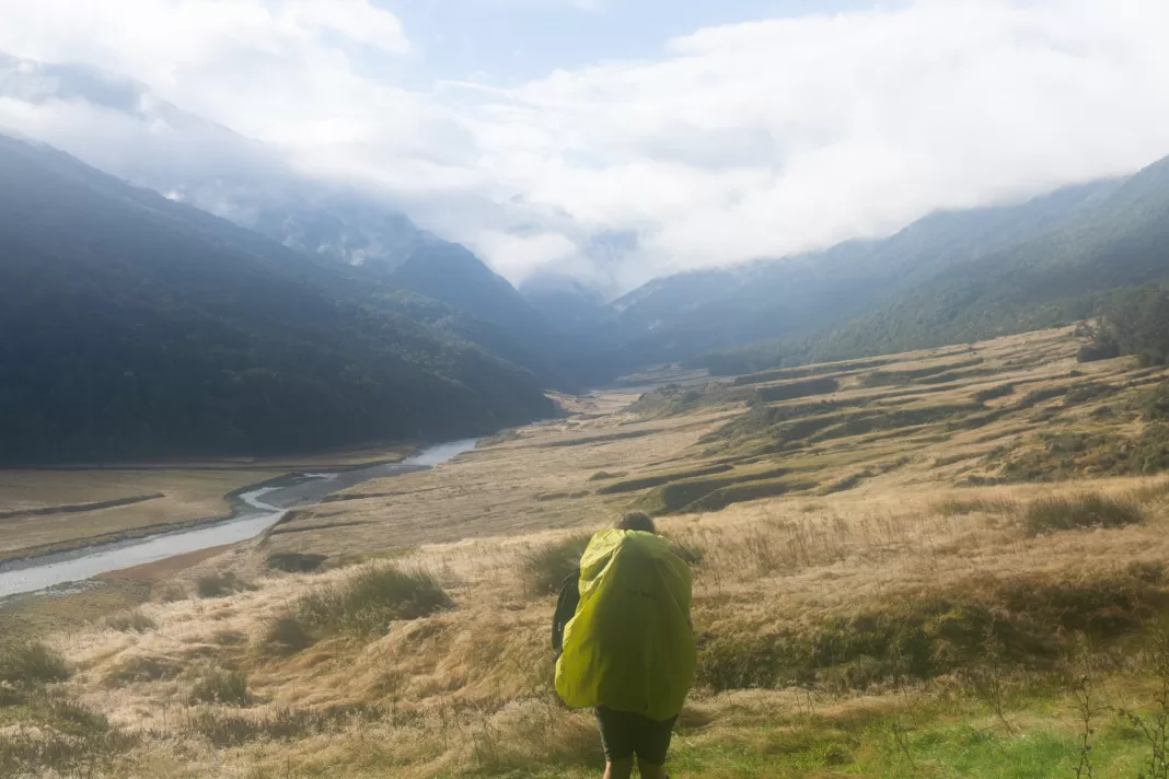
Upper Rees Valley
Once down the steep climb, we crossed over one of the small tributaries that eventually makes up the Rees River. A slip had come down from the saddle and taken out the path, but we recrossed the small creek past the small slip and found it again easily.
From here we trekked down the Rees Valley, once again revelling in the gorgeous low light rays similar to the day before, but this time heralding dusk. This section felt like a bit of a long trudge at the end of the day. I guess I just prefer shorter distances!
We stopped and chatted with some hunters who were scouting out the slopes across from the track. They were disappointed by how few animals they’d spotted, and how busy the area was. But it was great weather and a long weekend before the bridges would be taken out, so I wasn’t not quite sure what they’d been expecting. We reassured them we were the last ones through for the day, but we saw them again the next morning, 4WD’ing back out ahead of us in pursuit of quieter hills.
Shelter Rock Hut
The last section of the track before Shelter Rock Hut was right next to the Rees River. Again, not a fun one if it was in flood. We could see the smoke rising from the hut before we got there, but weren’t quite prepared for the number of people awaiting us.
The 22-bunk hut was fit to bursting. The large common room had a kitchen area, and then a fire with tables and chairs and a few bunks. Then two smaller bunk-rooms that were separate but connected by a boardwalk. All the bunks were already taken, as were many of the campsites, and people were preparing to sleep on the floor of all three rooms.
I set up my tent, but Simone opted to sleep on the floor of one of the bunk-rooms. By the time we had arrived at the hut, the sun had left the valley and the temperature was plummeting. We quickly changed into warm, dry clothes and started cooking our food (outside, because no way would we fit into the main room).
Other people were hanging about outside and told us they’d seen takahē where we’d just been – five minutes up the track from the hut! 18 takahē had been released by DOC just two months prior to our trip. I hadn’t seen one in the wild since visiting family friends caretaking at Maude Island as a kid. Very sadly we didn’t see any on this trip, but I hope they’re establishing themselves well.
I found the owners of my fancy new sandals, and returned them. Then karma / Dad sent me a message on my Zoleo – he was planning on coming and picking us up the next day. Yay! 10km less walking sounded very, very nice.
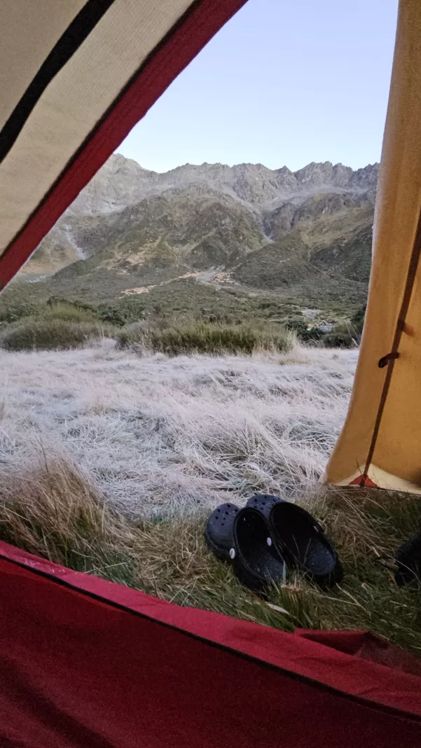
Rees Dart Track Day 5: Shelter Rock Hut – Park Boundary
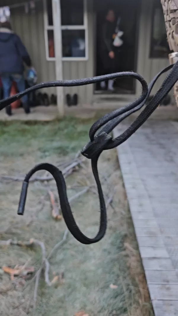
It was cold overnight and I slept like a baby (i.e. waking almost every hour). When I opened my eyes to daylight, wearing every single item of clothing I’d packed, the world had turned white. The grass outside my tent (and my tent fly) were coated in a solid layer of tiny white icicles. Even Simone’s bootlaces, which had been under shelter of the veranda, were frozen completely solid. (I’d learnt from our Earnslaw Burn misadventure and kept mine next to me inside the tent).
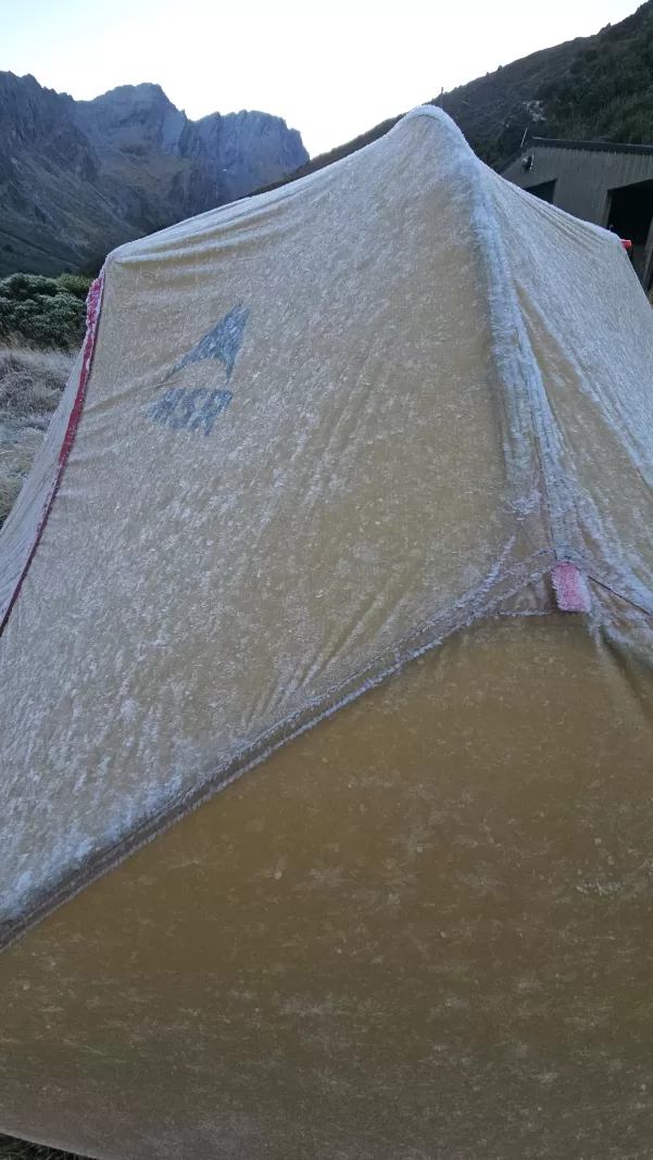
I flicked all the ice off my tent fly, cooked up a warm breakfast in the kitchen, and then we were off. The ground was completely frozen underfoot. We had to be careful not to slip as we crossed the swing bridge over the Rees River to the true left side.
I did try to keep my feet dry, thinking that surely with only an hour or so of walking to the park boundary this day, it would be possible. But I’d forgotten what track I was on. The streams on the Rees Dart have unionised and there was no possibility of crossing the picket line (aka the many streams) with dry feet. I would highly recommend taking several different pairs of quick-drying socks. I was glad I had one for each day.
Walking through the lush bush with the beautiful golden sunlight and waterfalls was beautiful. Simone and I still somehow had plenty to chat about even on day 5, as we traversed slips, clearings and forest.
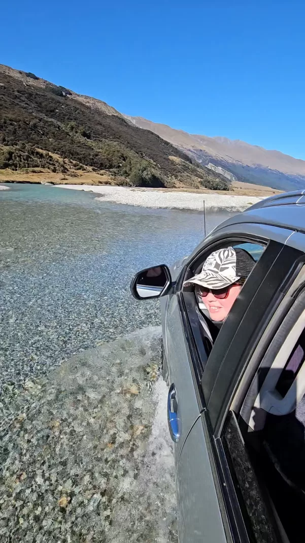
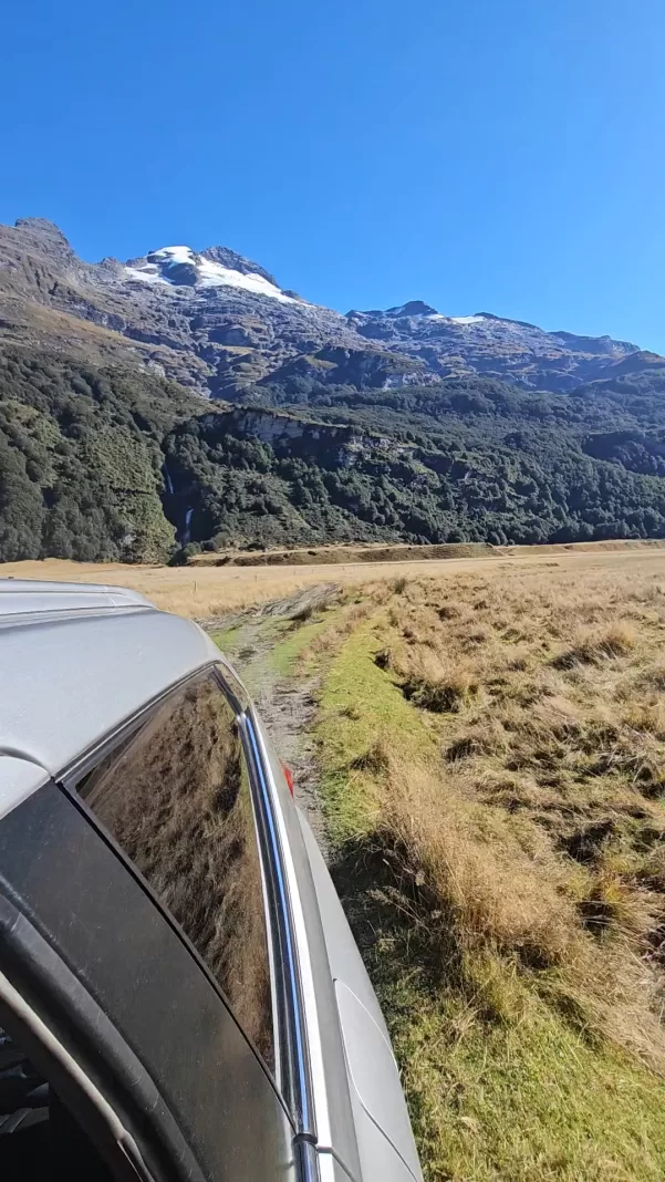
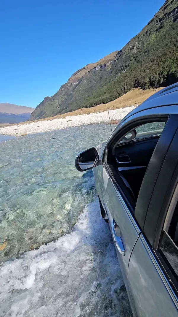
4WDing the Rees Valley
At the end of Slip Flat, the largest clearing, we were in for a surprise. My Dad walked into view, obviously having arrived early to the rendezvous-vous point and not wanting to wait with the sandflies. We greeted him enthusiastically (perhaps too enthusiastically for unshowered individuals) and he walked back with us to the park boundary where he’d parked the truck.
A delicious muffin from Mrs Woolly’s, easter eggs and cold drinks were awaiting us. So spoilt!
It was Simone’s first proper 4WD trip and what a trip to go on! The Rees Valley is very beautiful, especially when you’re not having to walk through it for 10km.
We forded the Rees River several times in the truck, reminding me of doing the exact same thing only a few months earlier on my Kea Basin trip back in January. It was a great end to our tramping trip. Simone and I were extremely grateful to Dad for coming all this way to pick us up.
If the river is low and you’re walking up or down the Rees Valley, then I’d recommend just following the 4WD track rather than the official walking track. It’s entirely flat, there aren’t any bogs or much mud, and it’s more direct. There are just multiple river crossings to contend with, while the only crossing on the track is bridged (Twenty Five Mile Creek).
We drove to Glenorchy and stopped at Mrs Woolly’s for some fresh food again. Then it was time to drive home and shower.
What an epic trip. I’d do it again in a heartbeat. The Rees Dart is certainly one of my top tramps of all time.
Safety
As always, please stay safe when you’re out exploring and follow Leave No Trace principles, especially when disposing of waste (human or otherwise).
Follow the Outdoor Safety Code:
- Choose the right trip for you (read my article on tramping safety, talk to DOC)
- Understand the weather
- Pack warm clothes and extra food
- Share your plans and take ways to get help (have an emergency beacon on your person)
- Take care of yourself and each other
If you have any questions then you can always get in touch with me here on the blog or on my Instagram. Or take a look at my Tramping 101 series which includes this post about how to stay safe in the outdoors.
Stay safe and get outside!
Where to next?
LET ME KNOW WHAT YOU THINK! LEAVE ME A COMMENT OR MESSAGE ME OVER ON MY INSTAGRAM.
I love hearing from readers and helping them plan their own adventures!