
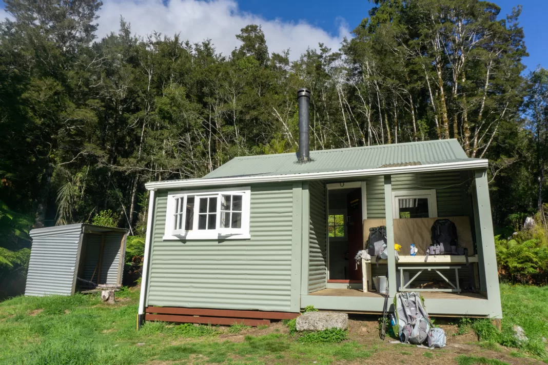
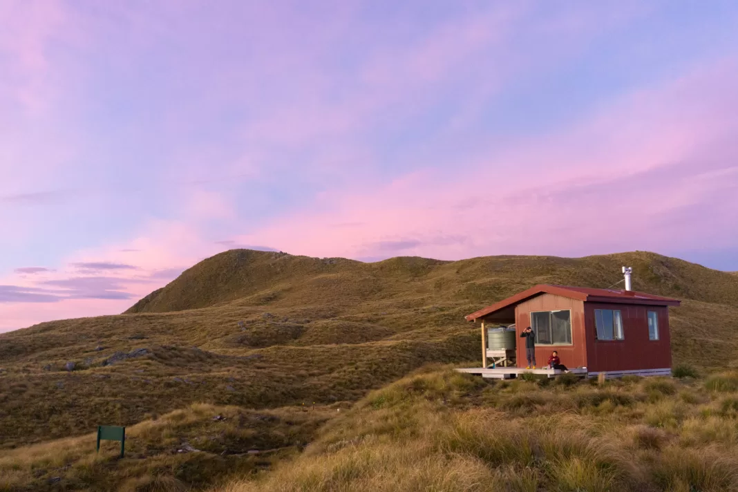
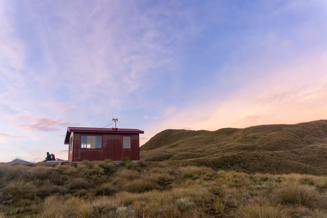
Built in 2021, this beautiful hut sits in prime position on the Mataketake Range. Gorgeous west coast sunsets, tarn swims, kea, and even a library!
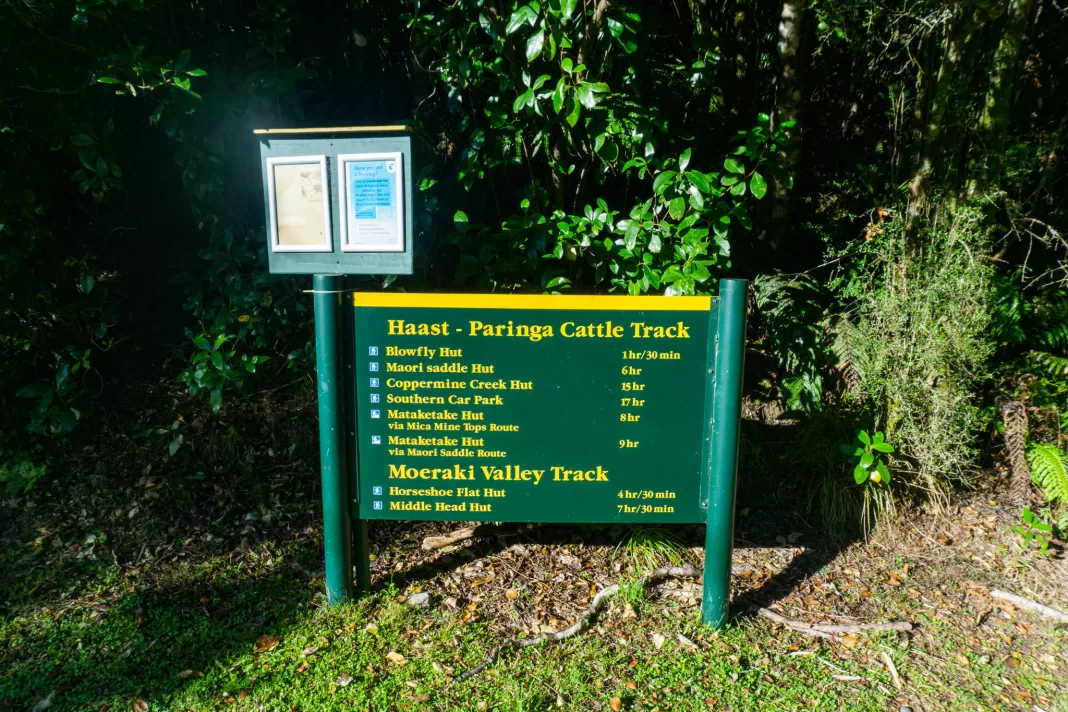
Length: Around 17km one-way with approx. 1,300m elevation gain
Time taken: 7 hours up from the northern Paringa Cattle Track carpark via Mica Mine Tops Route, 6 hours down via Maori Saddle Route
Difficulty: difficult
Facilities: small carpark off SH6 just past Moeraki Bluffs. No toilet.
Blowfly (Blue River) Hut is a cute 8 bunk historic hut about one hour from the carpark. $10 per person, first-come, first-served. Bunks, fire, long-drop and next to the river.
Maori Saddle Hut is a 10 bunk hut on the Paringa Cattle Track that you walk past if taking the Maori Saddle Route. $10 per person, first-come, first-served. Bunks, fire, long-drop, 3-tier bunks and water.
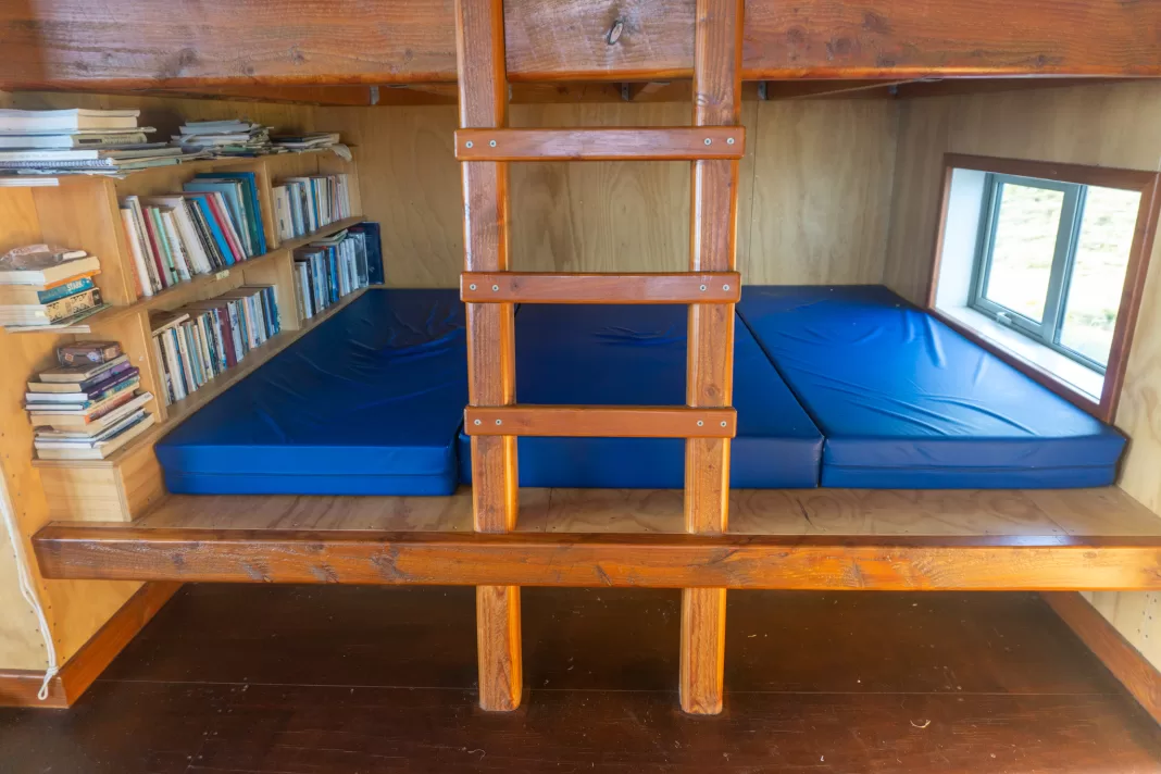
Mataketake Hut is an 8 bunk alpine hut that requires bookings year round. It is $25 per person and includes long-drop, bunks, water, fire and a library. Yes, a library!
– Important: Travel along the tops along the Mica Mine Tops Route is very exposed. It is not recommended in poor visibility or adverse weather. It is common for low cloud or fog to be present on the range. There are several stream crossings if taking the Maori Saddle Route that would become dangerous to cross after heavy rain. –
What makes Mataketake Hut so special?
Mataketake Hut was built in 2021 at the bequest of Andy Dennis, a Kiwi conservationist and author. Dennis was awarded the New Zealand Order of Merit for services to conservation. His activism included successfully campaigning for Te Wāhipounamu (South Westland) to be recognised as a UNESCO World Heritage site. So it seems only fitting that the Mataketake Range was chosen as the site for his hut.
The hut took two years to build, partly because of COVID lockdowns, but also because of the wild weather that hits this part of the country. It features a small library, including books by Andy Dennis.
Where is the trailhead for Mataketake Hut?
The closest trailhead to Mataketake Hut is the northern carpark on the Paringa Cattle Track. It’s a small carpark on the side of SH6 just past Lake Moeraki and Moeraki Bluffs, about a 40 minute drive north of Haast.
Day 1: Mica Mine Tops Route
I booked Mataketake Hut at 9pm, and by 8am the next morning my friend Penzy and I were out the door and on our way. Penzy was back in the country for a month between jobs (first aiding aboard a boat in Antartica and doctoring at Everest Base Camp (no, I’m not kidding)) so we had to make the most of our time.
We knew we wanted to fit in a tramping adventure together again while she was back. Our trip up Mt Fox is still one of my favourites, so we decided to stick with the West Coast and hit another trip that had been on my to do list for a long time – the elusive Mataketake Hut.
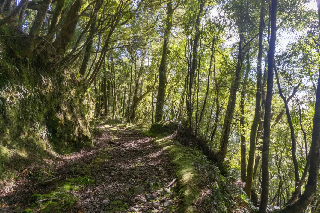
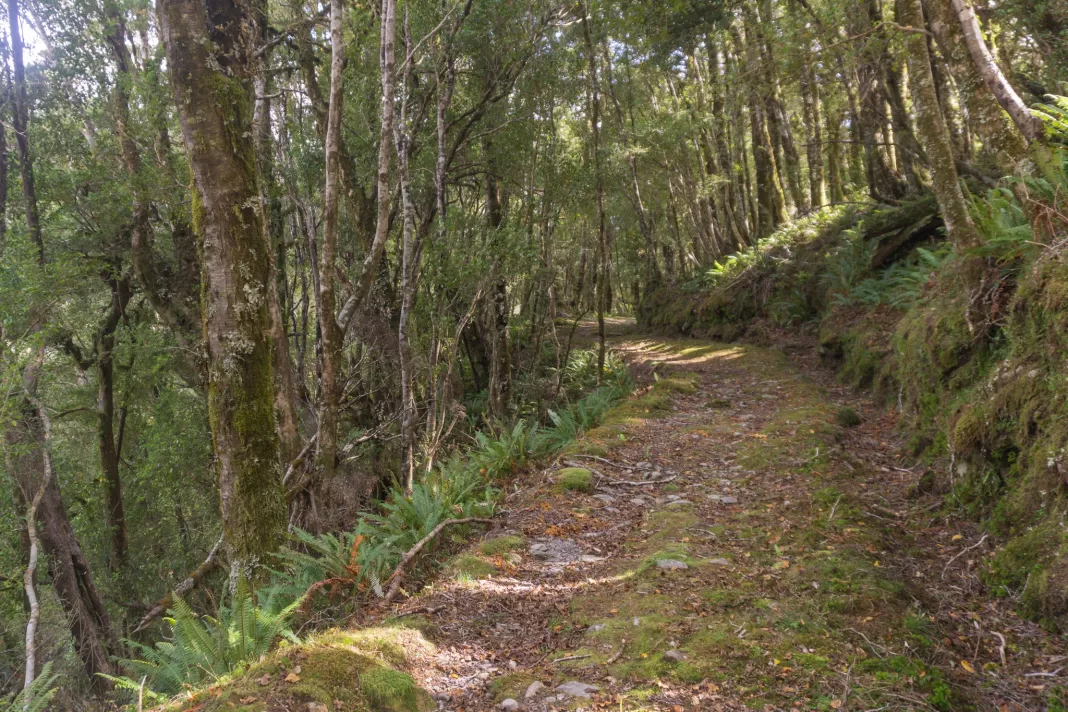
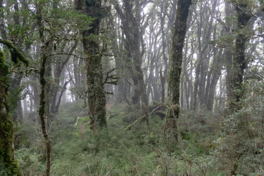
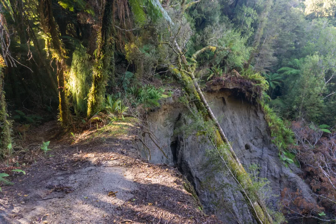
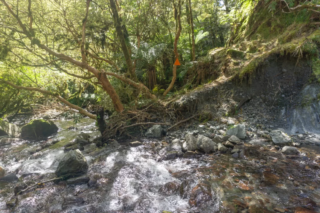
We reached the northern Paringa Cattle Track carpark by 10am. The track took us through forest that was violently green, luscious and dripping with moisture. Typical West Coast. The trail was easier going than I’d expected (from prior experience with tramping tracks along the Coast). Penzy and I spent most of the time chatting away, trying to keep our feet dry and out of the bogs / puddles.
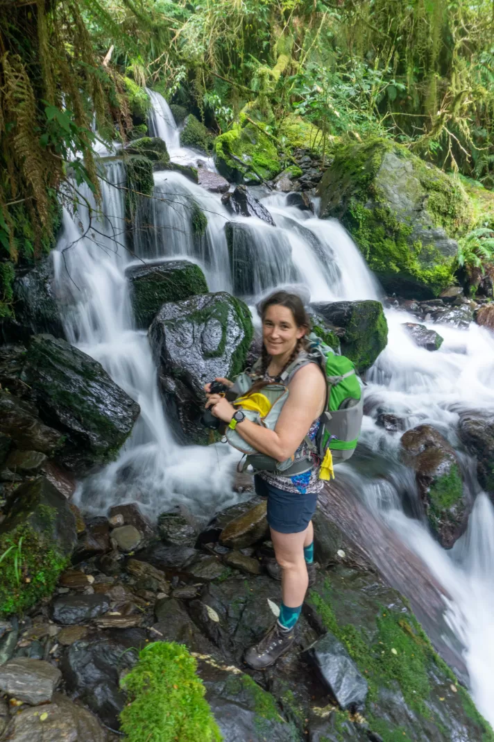
It took us less than an hour to reach the first track junction and the swing-bridge over the Moeraki River. We then quickly reached another track junction and took the five minute diversion to Blowfly (Blue River) Hut for a snack and toilet break.
Haast to Paringa Cattle Track
From Blowfly Hut, the historic Cattle Track climbed steadily upwards for almost 400m vertical. I didn’t really notice the elevation gain because the gradient was nice and manageable (i.e. not scrambling up vertical tree roots). In most places, Penzy and I could easily walk next to each other and chat. It was really not what I was expecting from a West Coast tramping track!
The Haast to Paringa Cattle Track was built by farmers in 1875 to herd stock between farms (like up the Lansborough) all the way to closest sale yards in Whataroa (north of the glaciers). This was an annual journey of over 200 kilometres, taking at minimum two weeks.
The cattle track followed an old Maori trail inland, avoiding the cliffs along the coast at Knights Bay. It was used until 1961, with up to 50,000 cattle passing along it. For a long time the cattle track was one of the main links between the settlements in Haast and Jackson Bay, and the rest of New Zealand.
In 1960, the road over the Haast Pass opened, meaning stock could be taken to Cromwell for sale. And in 1965, the main highway between Haast and Paringa was built, spelling the end of the cattle track (that is until it reopened in 1981 as a historic walkway).
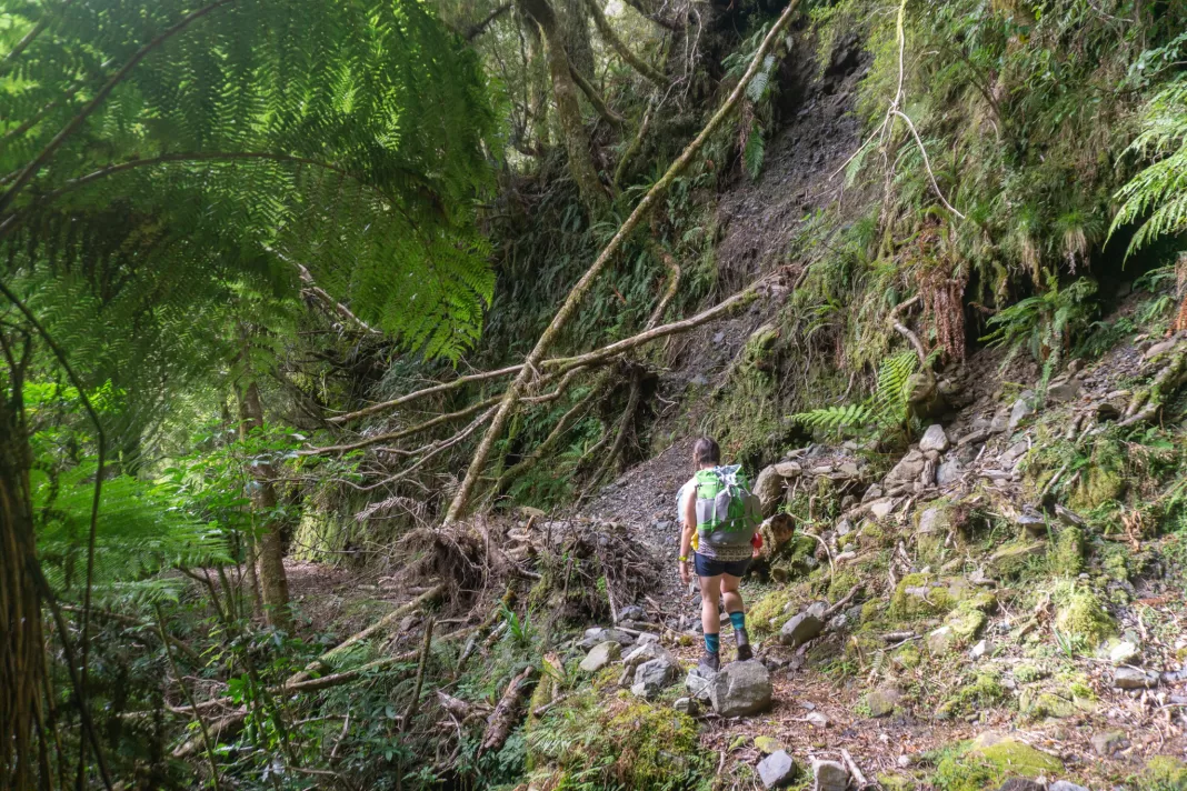
Mica Mine Tops Route
We reached the turn-off to the Mica Mina Tops Route in what felt like no time. This marked our decision point. DOC recommends going up Maori Saddle Route (further south along the Cattle Track) and coming down Mica Mina Route (because of how exposed it is to the weather along the tops).
However, we’d decided to do the opposite because of the weather. The forecast was great for our first day, with weather coming in from the souwest on our second day. So it made sense to head up the more exposed (but less steep) Mica Mine Tops Route while we had a chance of sunshine.
The track switchbacked up the hill, still steep but again not quite as steep as I was expecting. Which, if I’d thought beforehand, makes sense for an old mining track. Mica (which we saw a lot of, shining on the ground) was mined in the early 1940s for the war effort. There would have been horses trekking up and down to the mine, on the same track we were now walking.
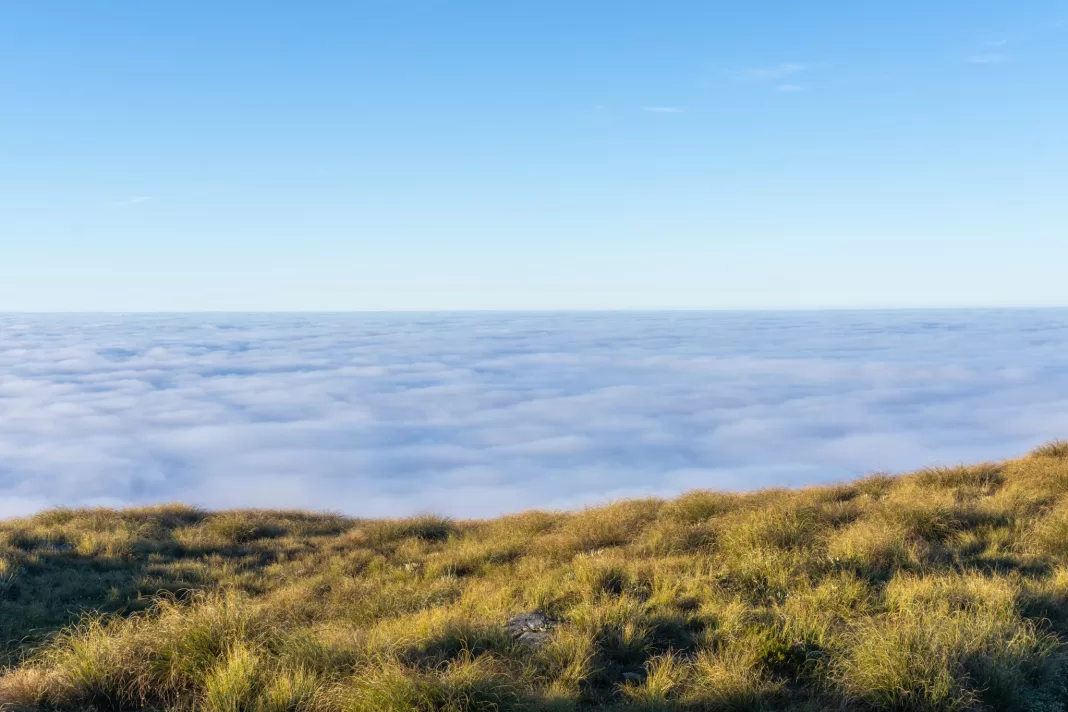
Inversion
The low cloud, which we’d thought would clear as forecast, was stubbornly hanging around. It was visible through the tree tops and made it feel like elves or goblins were behind each tree. As we climbed higher, it started to get foggy and I realised we were climbing through an inversion layer.
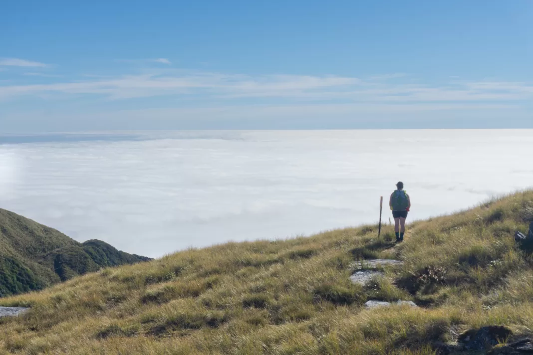
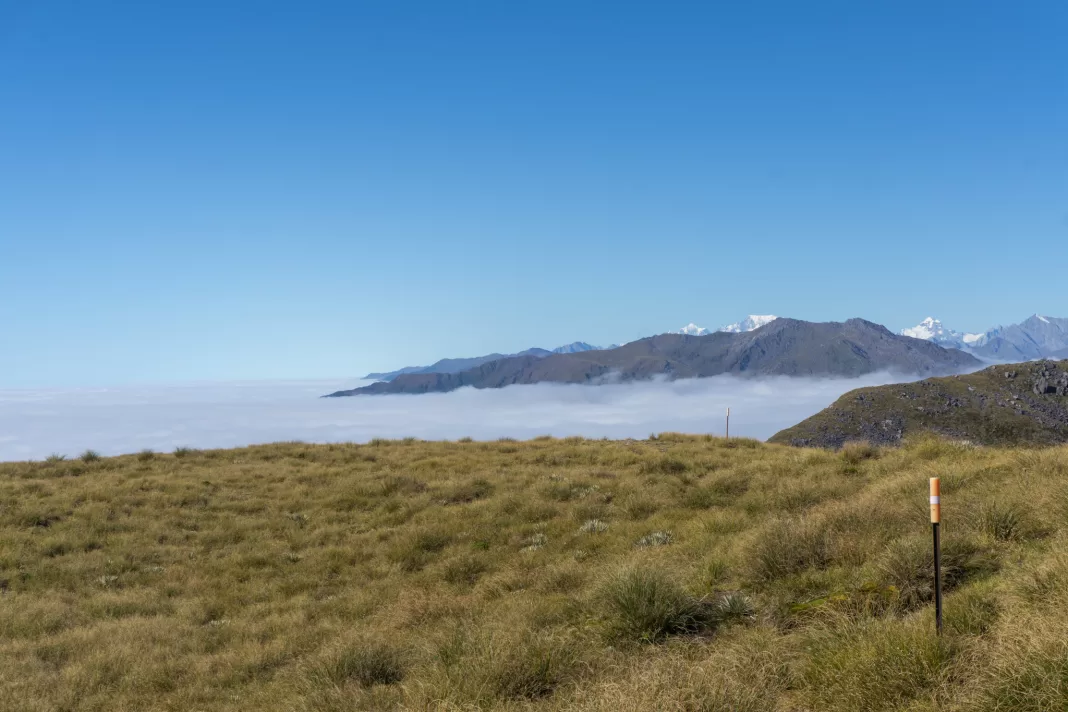
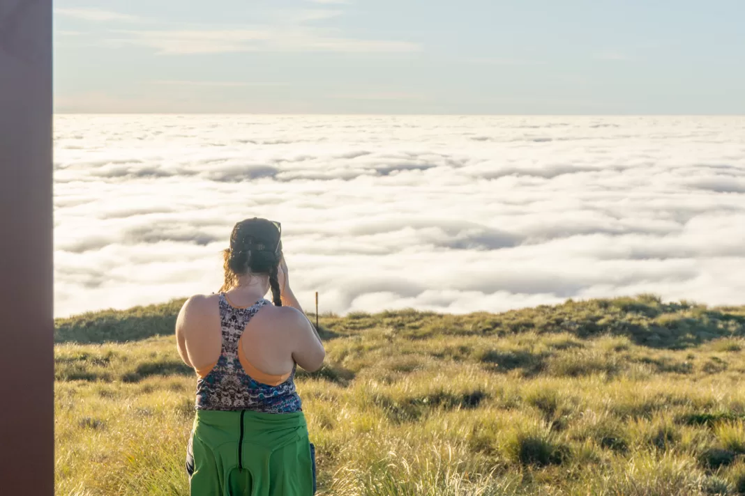
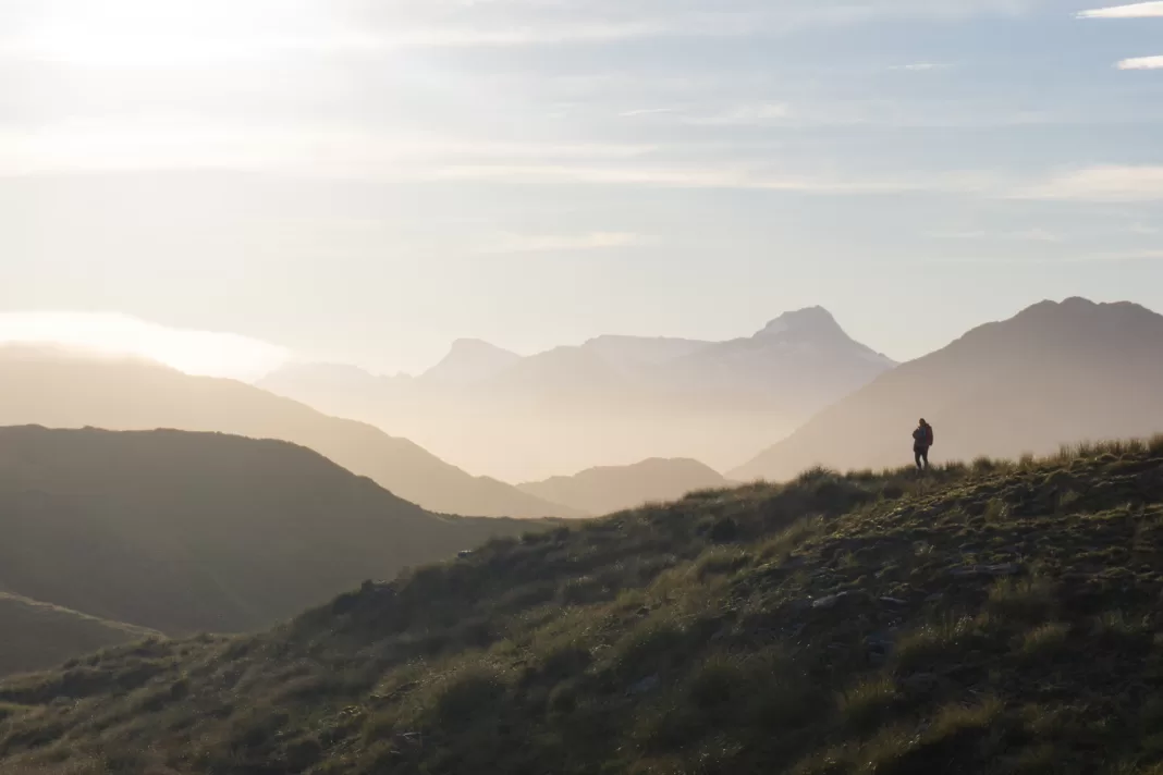
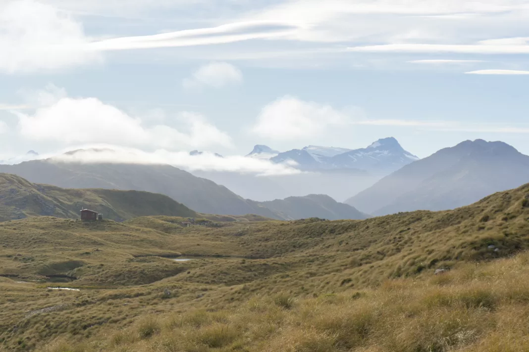
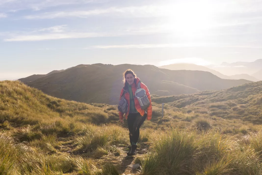
The tree-line marked the top of the inversion layer. We burst out into bright tussocks soaking in the sunshine. The last bit of the climb up was up a steep spur, but it wasn’t long until we reached the “tops”. Absolutely incredible views that awaited us. It felt like we were on top of the world.
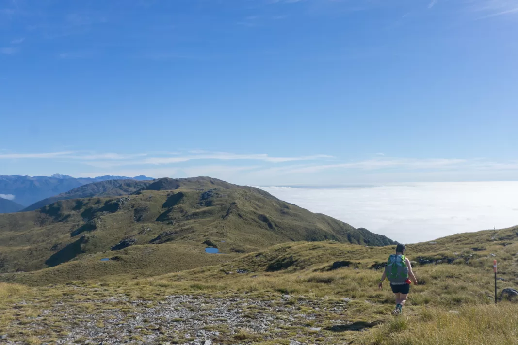
I was so happy to punch out of the cloud and see a beautiful day with such incredible views. The inversion layer stretched out across the sea, looking like a white unmoving ocean. It was the longest uninterrupted inversion layer I’d ever seen. On my other side lay mountain after mountain, including Aoraki the cloud piercer himself. I hugged Penzy and let out a squeal. This is precisely where my soul needed to be.
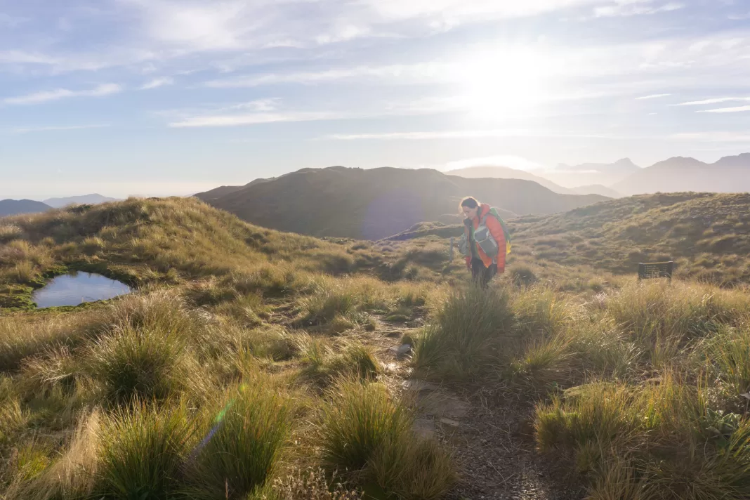
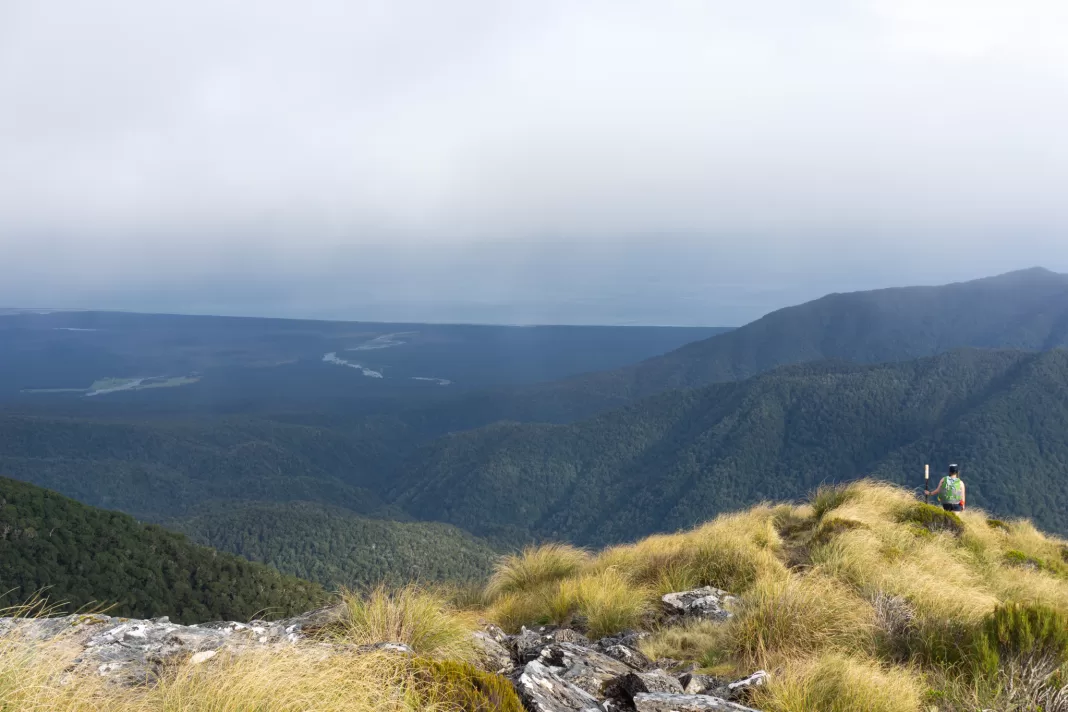
Travelling along the Tops
The route along the tops was more like a worn track. It wasn’t often that we came off it. We spent the two or so hours along the tops climbing up and down tussock slopes, passing still tarns reflecting the bluebird sky above us. Penzy hunted snowberries (successfully), while I walked more slowly, marvelling at the scenery and catching my breath.
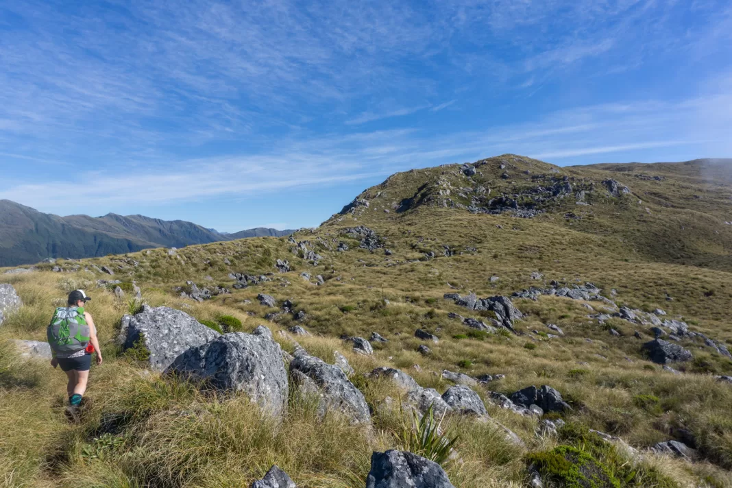
The weather was about as good as it possibly could have been: sunshine, absolutely no wind, warm. So while I found this route to be an easy track, I can still see why in poor weather or visibility it would be easy to lose your way or suffer from exposure. Some of the trampers as the hut that evening actually admitted they’d lost their way even in beautiful sunshine. So if the forecast is poor, I wouldn’t recommend the Mica Mine Tops Route.
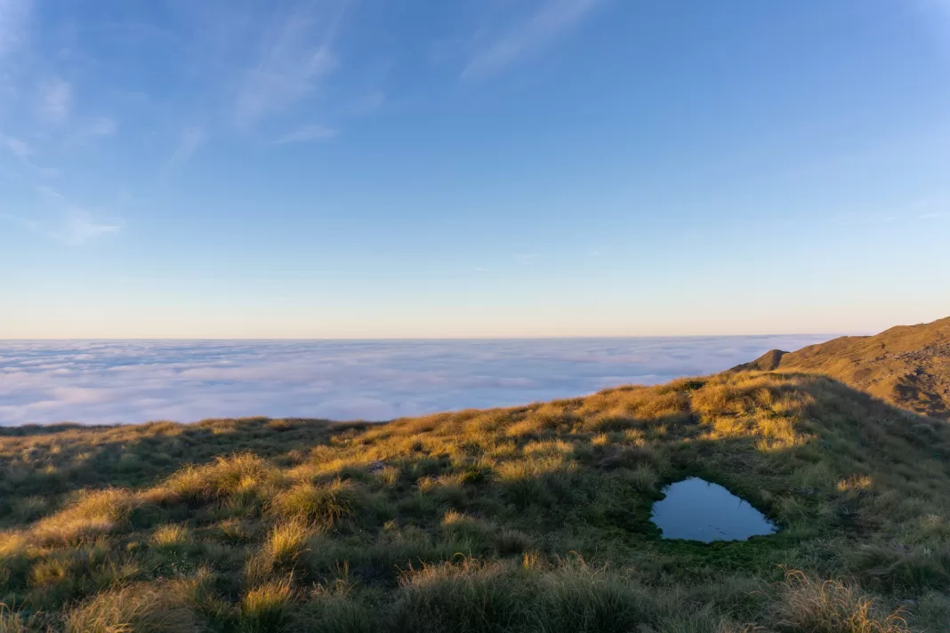
The Mica Mine Tops Route winds up and over a couple of hills, before a final short climb to Mataketake Hut. Penzy and I were glad to see the hut. I was even happier to see a few tarns I could take a dip in. The day was warm and humid enough that I’d worked up a sweat.
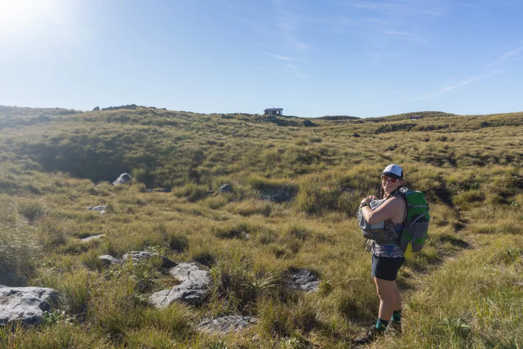
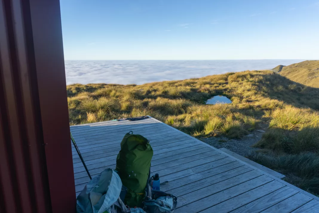
We spent a while exploring the surrounding area. Penzy went all the way to Lake Dime for a dip, while I just swam in one of the tarns near the hut. I couldn’t get over the inversion layer, it was incredible! We chatted with our hut mates, and I checked out the incredible hut library.
Day 2: Maori Saddle Route
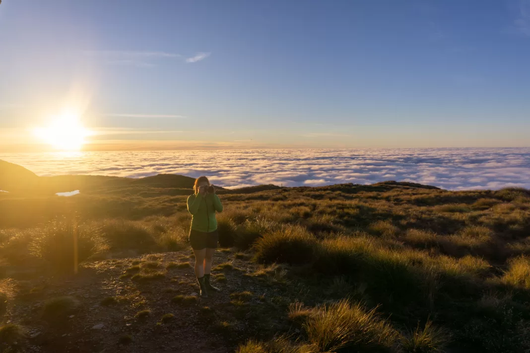
I woke up to a stunner sunrise, but by the time we got going the promised weather was moving in. We opted for the Maori Saddle Route down. While definitely steeper, it’s less exposed than the Mica Mine Tops Route.
I said a sad farewell to Mataketake Hut. It never feels like I get to spend long enough in these incredible places. One night just isn’t enough.
We followed the route past the tarns I’d swam in, had a glimpse of Lake Dime where Penzy had swam, then it was down, down, down the steep ridgeline, back to the Haast to Paringa Cattle Track.
I didn’t take any photos during the descent as Penzy and I were too busy chatting. It went by so quickly and before I knew it (but well after my knees knew it), we were back down in the valley and hit the Cattle Track. It was definitely a lot steeper than the Mica Mine Tops Route (think climbing up/down tree roots), but infinitely more direct.
Maori Saddle Hut
We diverted to Maori Saddle Hut for an early lunch. It had started to rain by this time so it was nice to sit down somewhere dry – we’d made the right decision to go against DOC advice and walk the route clockwise! Maori Saddle Hut was cute and it had three story bunks which are always fun to see.
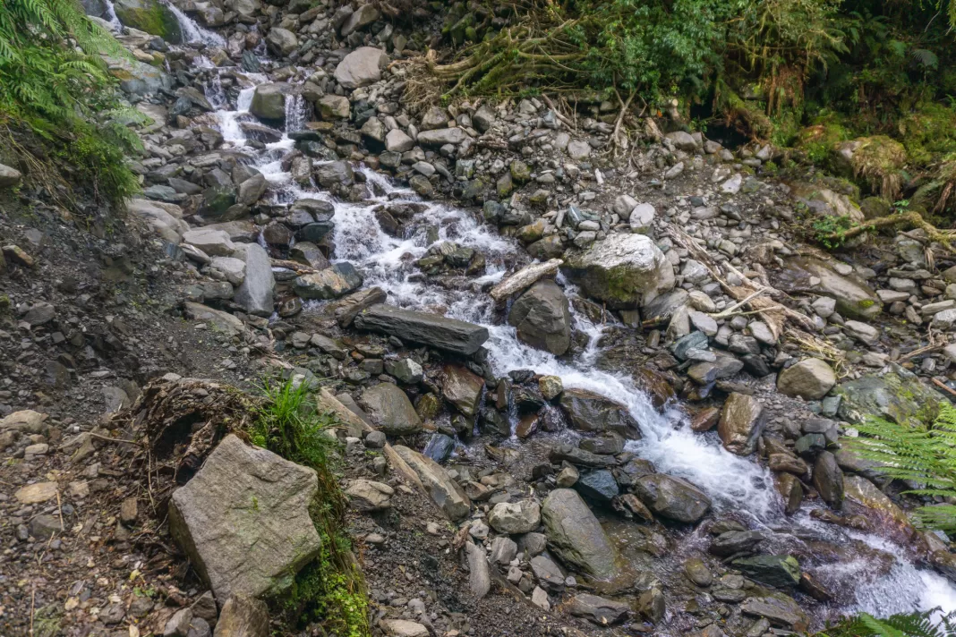
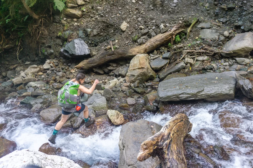
I was anticipating an easy walk out along the Cattle Track based on my experience the prior day, and while some sections were nice and benched, there were quite a few slips and streams to cross between Maori Saddle Hut and the Mica Mine Route turn-off. None of it was too bad in light rain, but I could see how the stream crossings would become trickier with heavy West Coast rain.
We eventually made it to sign pointing up the Mica Mine Route we’d climbed the day before. From here on out we knew it was an easy walk out to the car. We made a quick diversion on the way back to Blowfly Hut and skinny dipped in a lovely swimming hole near the hut. Then we powered out to the car and the chocolate eggs I’d stashed in it as our reward.
Thanks Penzy for another awesome trip. I hope you’re having an incredible experience up at Everest Base Camp x
Safety
As always, please stay safe when you’re out exploring. Follow the Outdoor Safety Code:
- Choose the right trip for you (read my article on tramping safety, talk to DOC)
- Understand the weather
- Pack warm clothes and extra food (check out my post here about what gear you need to take)
- Share your plans and take ways to get help (have an emergency beacon on your person)
- Take care of yourself and each other
If you’re not feeling super confident then you can always get in touch with me here on the blog or on my Instagram. Or take a look at my Tramping 101 series which includes this post about how to stay safe in the outdoors.
Also don’t be a dick, check out my guide to New Zealand tramping etiquette.
Stay safe and get outside!