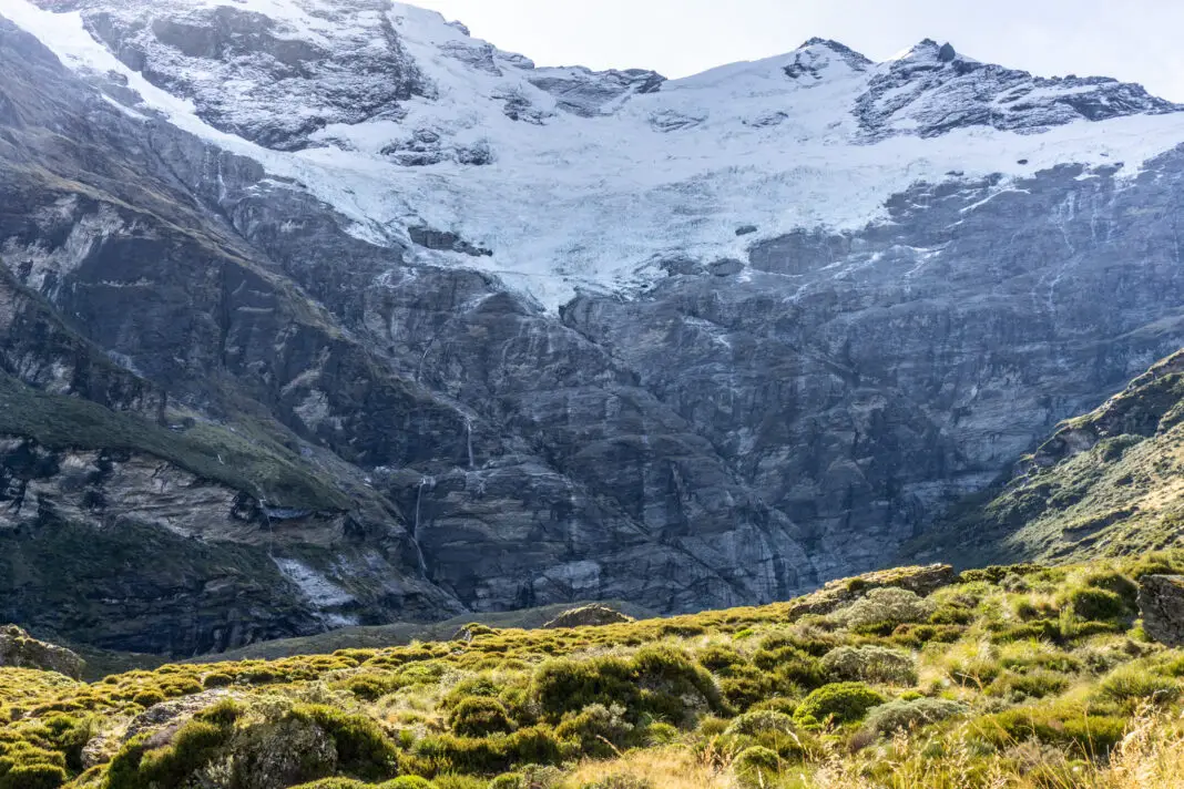
Kea Basin is a stunning spot below Mt Earnslaw / Pikirakatahi. Similar to its famous neighbour; Earnslaw Burn, Kea Basin is filled with lush sub-alpine meadows, waterfalls, and glaciers hanging on the peaks high above.
Length: 24km return with about 600m elevation gain
Time taken: DOC time is 8-10 hours return (if doing it in a single day)
Difficulty: moderate, involves river crossings
Facilities: Toilets at the trail head (Muddy Creek carpark).
– Earnslaw Hut (which you pass on the way up) is a very basic 4 bunk hut. Fireplace. Sagging beds. No mattresses. No toilet. Water from a nearby stream. (Matt: “it still feels like you’re overselling it)
– Kea Basin Bivy Rock just above the bushline can sleep at least four people. No toilet. Water from a nearby spring.
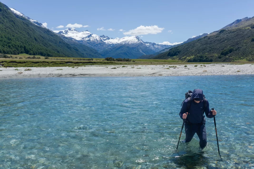
– Important: Before reaching the climb up to Kea Basin you will have to cross the Rees River at least once. In summer and good conditions, the river is often knee-mid thigh, but in flood it is impassable. River crossing experience is recommended. If in doubt, don’t cross.
Dispose of your waste appropriately following Leave No Trace principles. –
Why Kea Basin?
It was Christmas. I was feeling extremely burnt out after a year full of changes at work and parenting a busy toddler. It culminated in me spending several days in bed; mentally, physically and emotionally exhausted. It wasn’t a fun time.
My parents suggested that a New Years camping trip up to Kea Basin with Matt (while they looked after Little A) could be just the reset I needed. My parents knew the area well and had visited several times before. I didn’t even have the energy to do my usual research, but after checking out the topomap route and figuring out logistics, it was all go!
How to get to the Kea Basin trailhead
The Kea Basin Track starts partway up the Rees – Dart Track. You drive to Muddy Creak carpark, which is about 30 minutes from Glenorchy / 1.5 hours from Queenstown. The Rees Valley Road is gravel and contains several fords, so it might not be passable if it has rained or you’re driving a low 2WD vehicle.
If you’re confident driving through fords and Muddy Creek is low, it’s possible to keep driving for another 2km until you reach Arthur’s Creek (where the road fords the Rees River – only passable with appropriate 4WD vehicles and experienced drivers). This skips out 4km return of walking along the 4WD track, which I’d recommend if possible!
Important note: If you do leave your car past Muddy Creek, just be aware that it can flood very quickly, and even once the water levels lower, the ford can be impassable as it washes out easily. Only leave you car at Arthur’s Creek if you’re confident there will be no rain while you’re away adventuring.
Once walking up the valley you have two options: following the Rees-Dart Track, or taking the 4WD road up the centre of the valley.
- The Rees Track is well marked, although boggy with some short ups and downs. After walking for an hour or so, you’ll cross the swing-bridge over Twenty Five Mile Creek. After the swing-bridge is where you leave the track and ford the Rees River towards Kea Basin.
- The 4WD track is flat and more efficient to follow, but does involve crossing the Rees River three times instead of just once. Follow the 4WD track through the river flats until you are near level with Lennox Falls.
Read my trip report below for more details on how to not get lost before you even start on the Kea Basin Track (and how to avoid getting your feet wet in the bog at the end of the paddock).
Day One: climbing up to Kea Basin
Cheating our way up the valley
That’s right. We cheated.
Matt and I drove through the fords, passing the usual carpark at Muddy Creek and continuing all the way to Arthur’s Creek. And then we got into my Dad’s 4WD truck.
He forded the Rees River and drove us all the way to the edge of the paddock, skipping about 6km of walking up the valley.
It was fantastic.
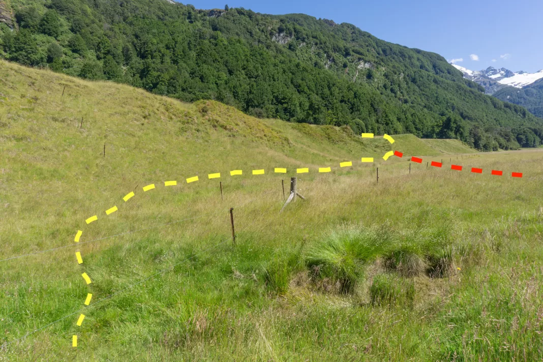
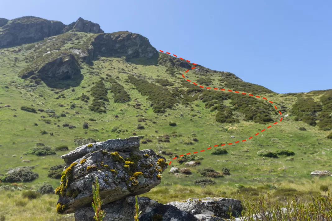
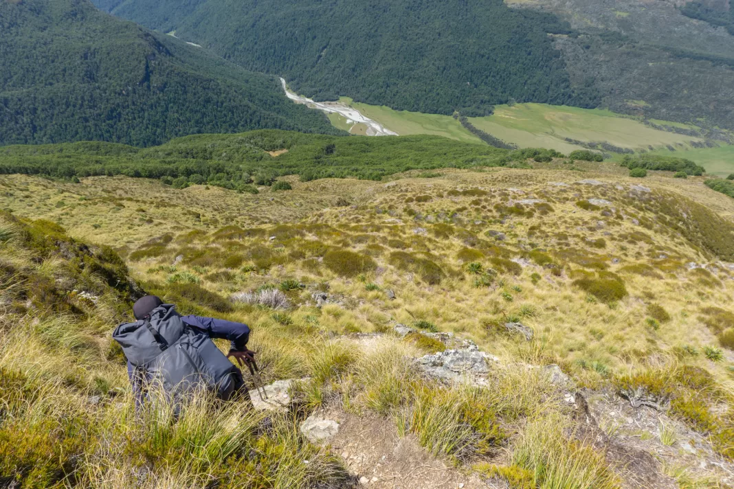
From the gate in the corner of the paddock, we set off on an angle towards the terraces we could see on the other side of the valley, above Lennox Falls. As we got closer we could make out orange poles and a DOC sign trying to hide in the trees.
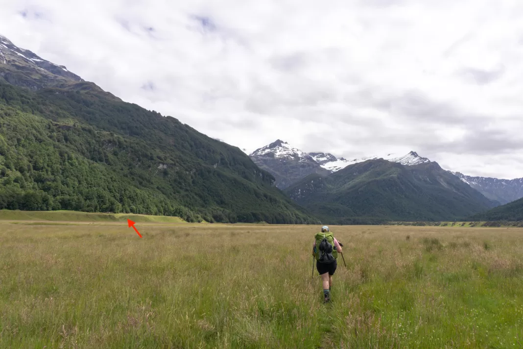
The paddock just before the terraces is a bit boggy and we got wet boots on the way in. On the way out we found a better route. Head to the left of the terraces when facing them and cross where the bog narrows, just below a fence heading up onto the terrace.
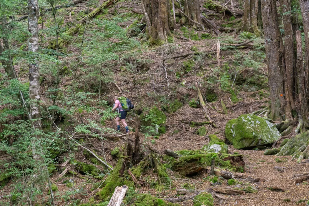
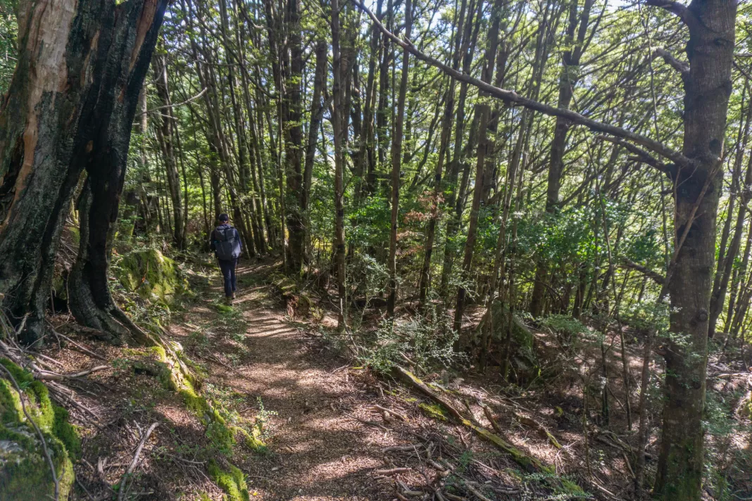
As we walked past the DOC sign and into cool shade of the bush, I was thankful most of the climb would be under the trees and not in the summer sun.
The climb up to Kea Basin
According to my parents, the track up to Kea Basin was made for tourists, back when you could easily drive to Twenty Five Mile Creek (making it a much easier day trip). While the track is more overgrown now, with a few old slips, it’s still a much easier track than I was expecting. Switchbacks (rather than straight up). A cut track. Barely any tree root climbing. How luxurious!
The track is sign posted as only taking 1h15 to Kea Basin, but it definitely took us longer than that. I wasn’t the fittest (as per), but even so, I feel like 1h15 is pretty fast! Maybe that’s for the speedy mountaineers who use this track to access the summit of Mt Earnslaw.
We were passed by two day walkers, but otherwise had the track to ourselves. Which surprised me, considering it was a beautiful forecast over New Years!
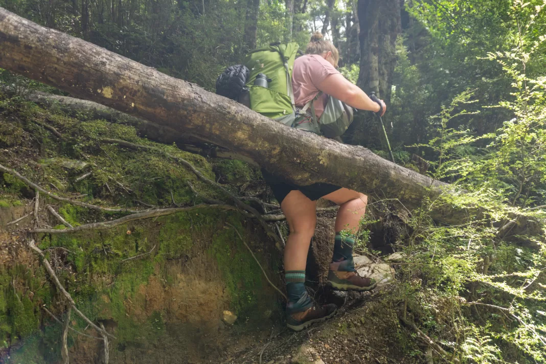
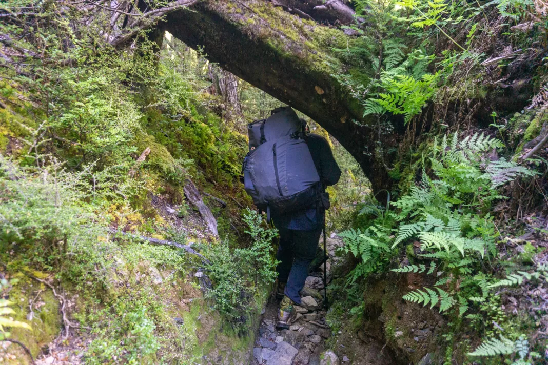
The first long switchback was a little painful – an old slip at the corner made footing a bit trickier (compared to the Great Walk level track at the start) and overgrown bracken made my legs bleed. I’m sure there’s a way to just go straight up from the start of the track (or down) and miss this first switchback out, but I couldn’t see an obvious path.
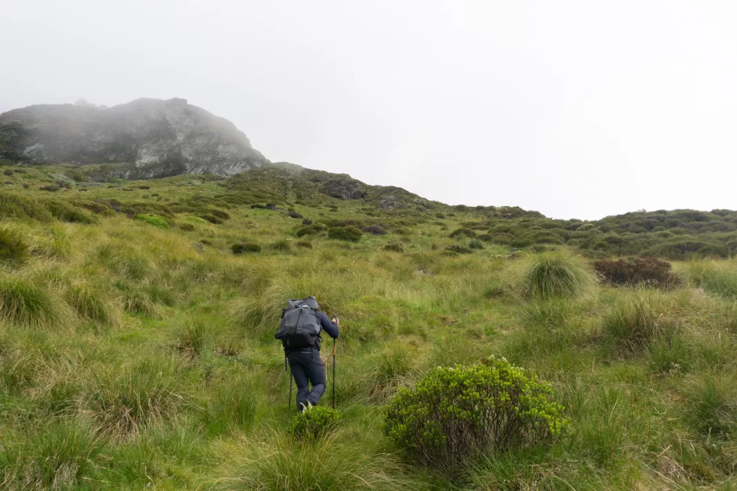
We kept climbing up, skirting around an interesting rock formation, and then clambering over a lot of tree-fall before coming out onto a flat, boggy section at about 770m elevation. From here the track alternated between bush and sun exposure, which wasn’t my favourite in the midday summer sun. But before long we’d made it to the turnoff to Earnslaw Hut.
Earnslaw Hut
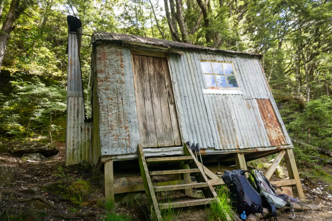
We walked the 50m off the main track. Earnslaw Hut is extremely basic, although it does have windows and a fireplace. There wasn’t a toilet. The bunks are sagging and have no mattresses. The water source is a short climb down to a stream.
Apparently the hut was built around 1900 for tourists higher up in the actual basin, but was moved down to its current site after being twice destroyed by avalanches. According to the hut book most people are just day visitors, many people staying in the more appealing bivy rock.
After a quick bite to eat we refilled our Water to Go filter bottles (affiliate link, use Alice20 for $$ off) in the nearby stream. I was conscious that there were campsites with no toilet facilities above us, so it was nice to use a filter and have confidence our water was safe to drink.
Exploring Kea Basin
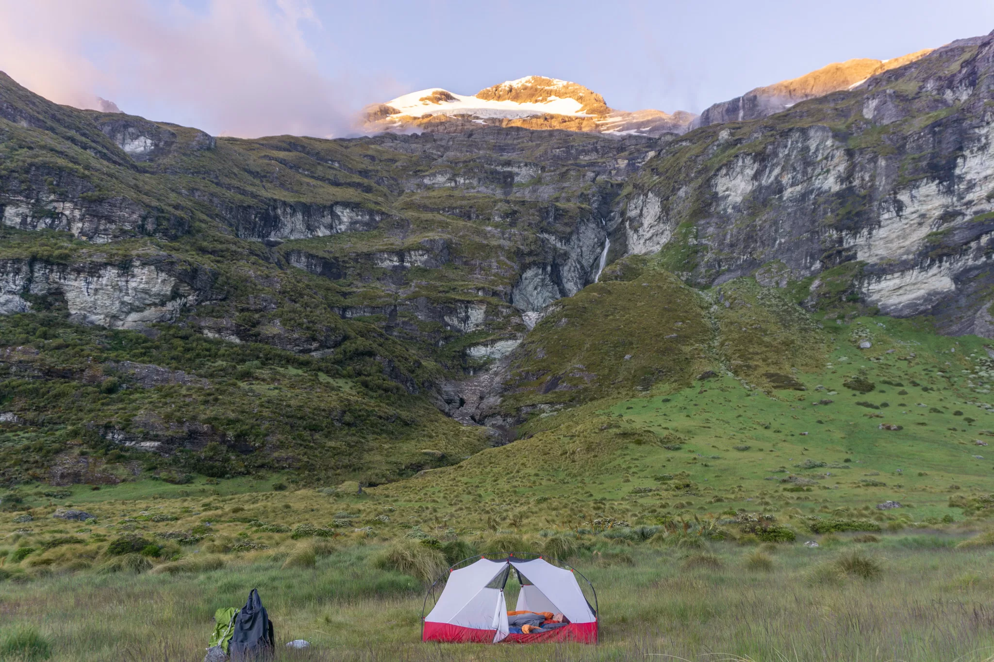
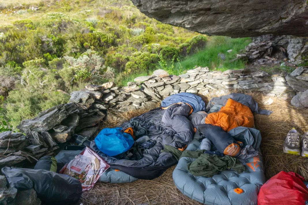
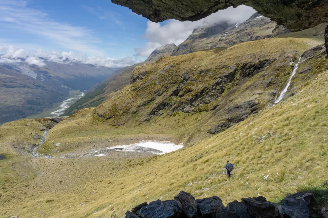
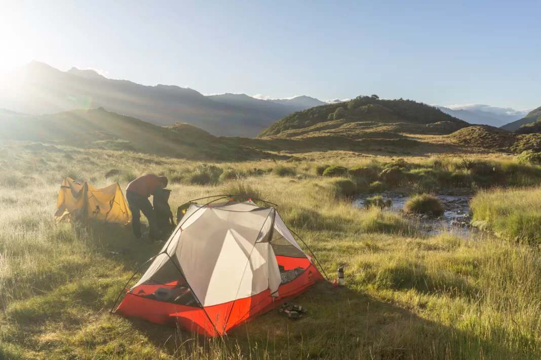
Twenty minutes after leaving Earnslaw Hut, we reached the tree-line. I caught sight of our accommodation for the night – a large rock bivy! It was to the left of the track, just after climbing up out of the trees. I’d never stayed overnight in a bivy before, so I was excited that nobody else had claimed it for the night.
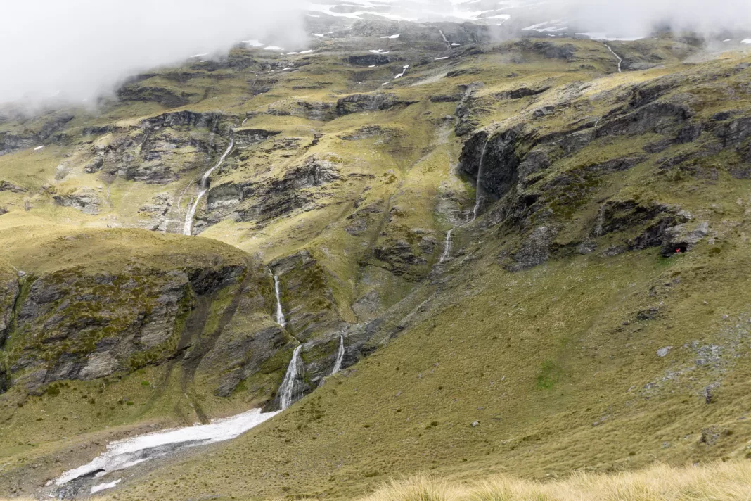
We dropped our packs in the bivy and climbed up into Kea Basin for the first time. I couldn’t help a massive grin stretching across my face as we topped the ridge. Photos don’t really do it justice (the light conditions were challenging). It felt like I’d just walked into a fairytale. It was exactly the break my brain and soul needed.
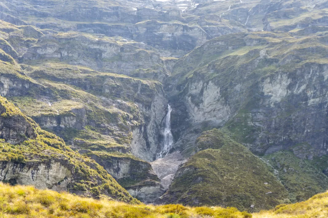
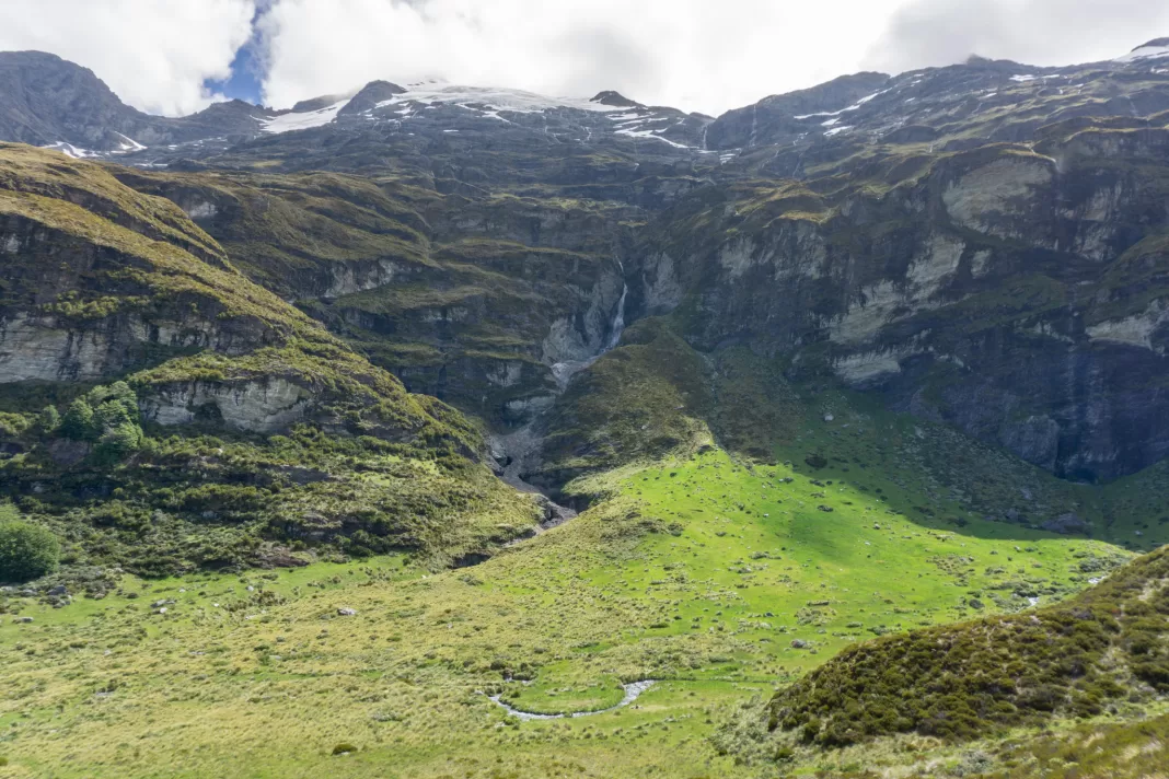
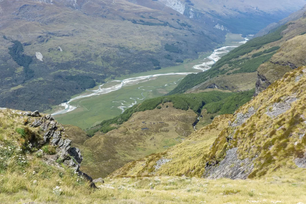
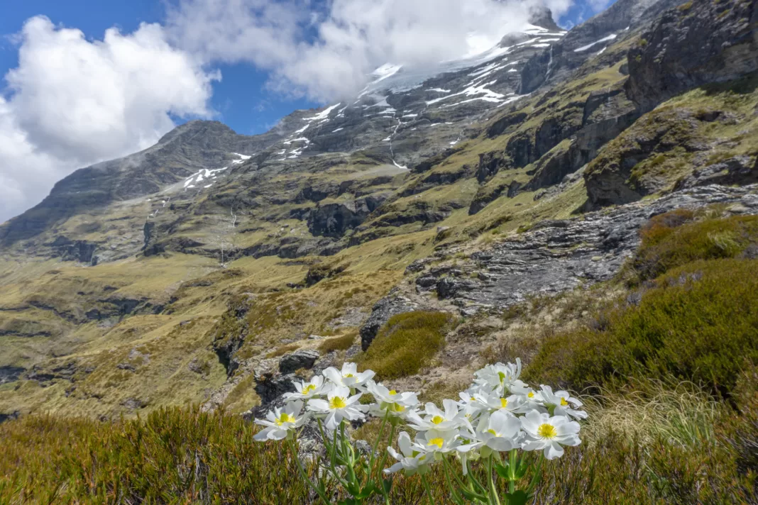
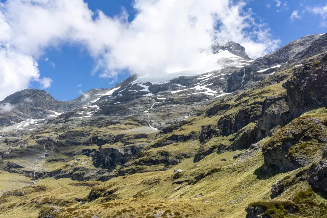
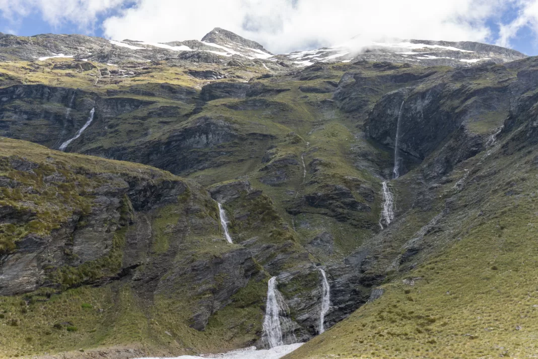
Clouds hid the summit of Mt Earnslaw, towering almost two kilometres(!) vertically above us. The sun filtered through the clouds, highlighting the most ridiculously green pasture above which waterfalls cascaded down steep, terraced cliffs.
The couple who had passed us on the way up were lounging down by a bend in the stream. They looked like they were in paradise, and I filed it away as a potential camping spot. We kept climbing up the ridge until the track petered out, and then followed a trapping line to around 1120m elevation.
Another group passed us as we made our way back down, heading to the upper bivy. They planned to summit Mt Earnslaw the next day. By the time the sun was setting and we were cooking dinner, Matt and I were the only people in the entire basin.
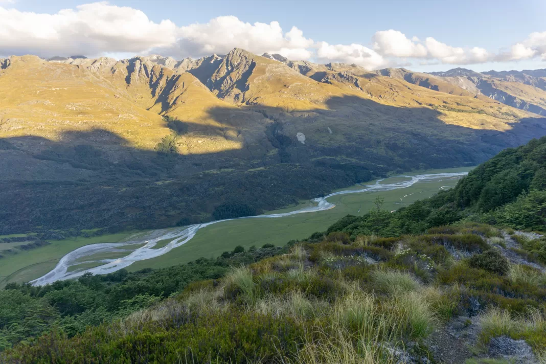
We watched the sun slowly farewell the river flats below us and creep its way up the Richardson Mountains, fending off the sandflies, before retiring to our accommodation for the night.
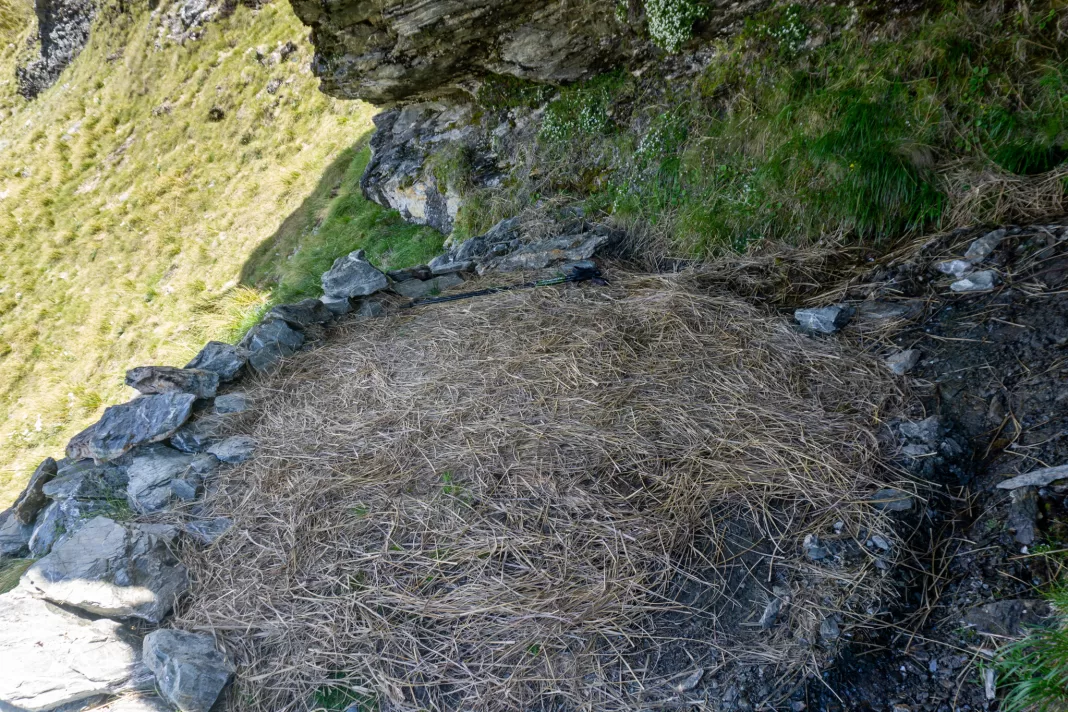
Kea Basin Rock Bivy
Watching the stars from my sleeping bag as my eyelids grew heavier and heavier was a new experience for me, but it felt very natural. The bivy was comfy – nice and flat, with dried tussock grass for extra insulation and comfort. I would have wanted a tent if it was windy or stormy, but on a summer’s night it was lovely just with sleeping mats.
Day 2: Exploring the upper bivy
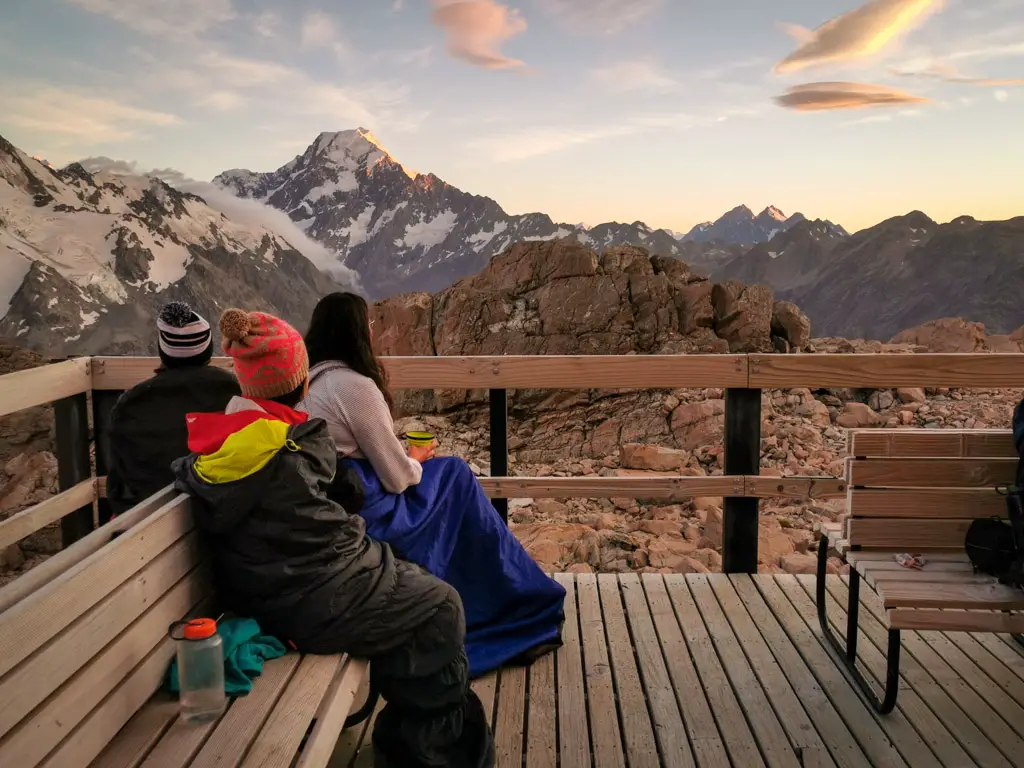
We woke to a lovely sunrise on the mountains and the best part was that we could admire it without moving from bed. How good!
Our aim for the day was the upper bivy marked on the topomap. We would follow the route that people take up to Esquilant Bivy and the summit of Earnslaw.
I wasn’t exactly too sure where the route went (not having done my usual research), but I’d spotted some cairns we could follow during out scouting the day before. Thankfully a group of older climbers were already descending and they gave us some pointers.
It was an easy climb across to the edge of the basin, then slightly steeper up a gut, then steadily steeper as we climbed up to the ridge. The path was easy to follow along the trapping line, then it disappeared for about one hundred vertical metres in the grass, before becoming obvious again closer to the ridge-line.
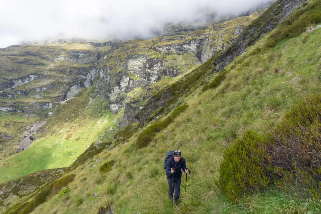
Clagged in
The clouds hadn’t burnt off as quickly as I expected, hugging the ridge and bluffs only 100m above us. We weren’t in a rush so we stopped below the ridge-line out of the wind. We had some food and rested, waiting for almost an hour. Eventually our cloud ceiling started to rise.
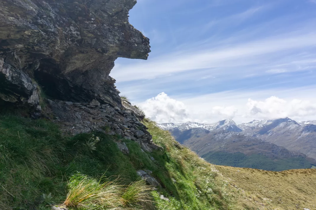
The last little climb up the ridge was the steepest / most exposed part. I didn’t mind it because it was short and minimal consequence, but Matt definitely wasn’t a fan. Once on the ridge there were immediately three short, but steep climbs (with flat breathing spaces in between), which once again weren’t fun for Matt (photos from when we were climbing back down in the afternoon).
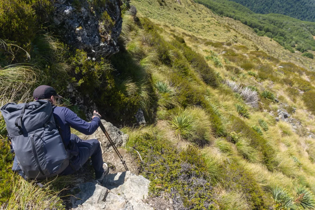
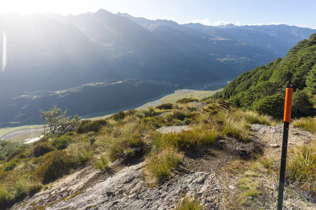
After the three short climbs, it was relatively easy travelling along the well trodden path. Still uphill, but not as steep. The views got more expansive as we climbed and the clouds cleared. We could see into Hunter Creek and across to Mt Clarke.
Kea Basin Upper bivy
As we neared where the upper bivy was marked on the map, we started to keep an eye out for it. But in the end it was very easy to spot. The group who had passed us the day before were standing up wearing bright colours, like they were trying to make it easy for us.
There wasn’t a clear path to the rock bivy. If you didn’t know where to look it could be quite easy to miss. We made our way across to chat with the group just as they left to head up Mt Earnslaw. We had lunch sitting in the bivy, admiring the amazing view. The upper bivy was smaller than the one in Kea Basin, but the view was definitely more impressive (being 500m high in elevation helps). Three people had slept there the night before, but it would have been fairly cosy.
This was as far as Matt and I wanted to go – the route up towards Mt Earnslaw involves glacier travel which neither of us are experienced in. We decided to explore this mini basin instead. We climbed down the steep tussocks to the stream, where we filled up our filter bottles again.
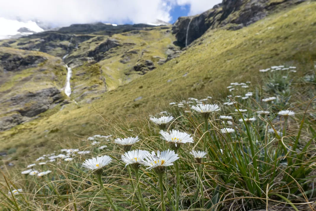
Then we hopped across and checked out the expansive view straight down over Kea Basin. The alpine flowers were in bloom and it was a beautiful day now that most of the cloud had burned off. Definitely soul restoring.
Camping in Kea Basin
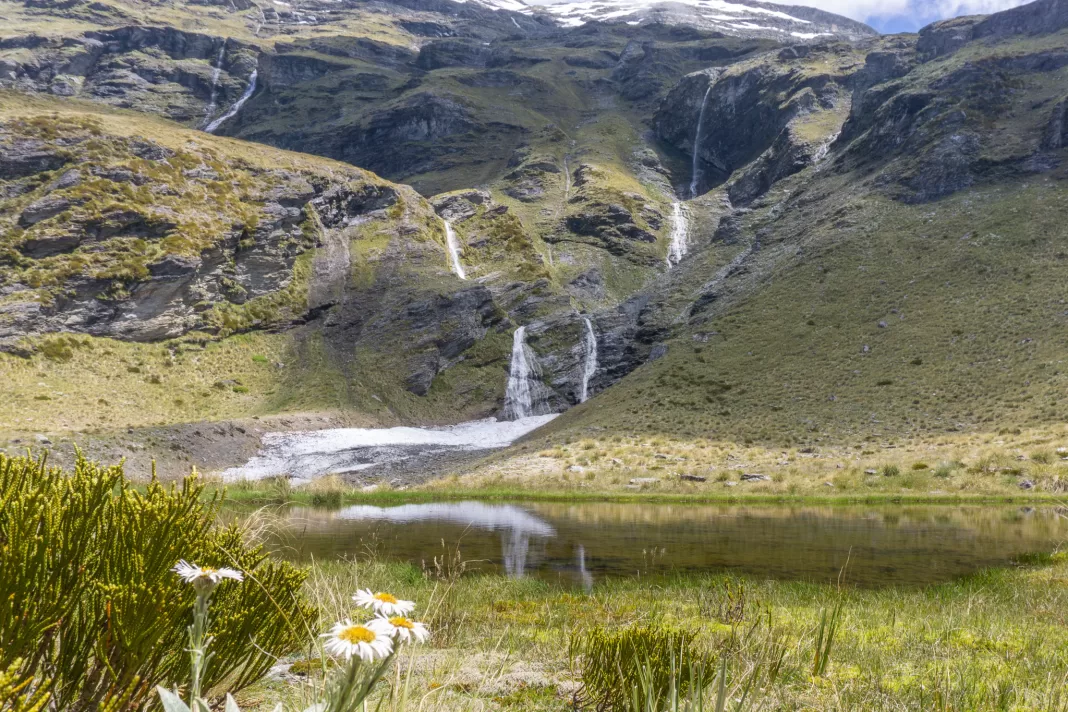
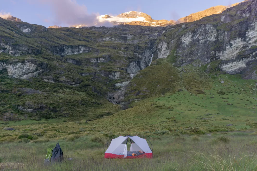
Our overnight gear was still where we’d stashed it in the trees. We made our way down to the stream meandering its way through the basin, finding the spot I’d seen the day before. It was one of the few flat pieces of non-boggy land in the area, despite being close to the stream. There was an old fire circle and flattened grass from others using it as a campsite.
We lay in the sun for hours, alternating being reading our books, chatting and just taking in the beauty surrounding us. It was so hot that the sandflies weren’t around. I even went for a quick dip in the freezing cold stream at 6pm. Ah summer. Matt and I walked up to explore some of the waterfalls once the day had lost some of its heat, then set up camp for the night.
Day 3: back to reality
I woke us up super early the next morning to catch the sunrise. We took off the tent fly and lay in bed, watching the sun rise over Mt Earnslaw (which sure enough, was clouded in only an hour later). It was quick work to pack up, make sure the only thing we’d left was flattened grass, and then head off.
The climb back down the track from Kea Basin was simple. I still couldn’t find a worn track skipping the first switchback, but not for lack of looking. We sun-blocked up at the edge of the trees, before climbing down the terrace and onto the river flats.
Not cheating the Rees Valley this time
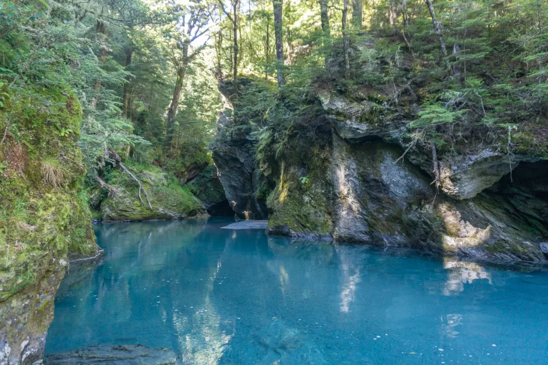
On Dad’s recommendation we walked across the valley to Twenty Five Mile Creek. The gorge was gorgeous (stop groaning). The water was such a deep blue! I was tempted to wade further upstream to find the waterfall I could faintly hear, but the sandflies and freezing water dissuaded me.
We could have continued down the Rees Dart Track from here. Instead we decided to cross back over the Rees River and take the 4WD track. It was a hot and bright 6km along the valley. My river crossing course came in handy, giving me the confidence to cross the Rees three times.
When our car came into view I was very thankful I didn’t have to walk another 2km uphill to Muddy Creek. We had lunch. I had a swim (while practicing my river crossing technique at varying depths). Then it was sadly time to leave.
I had to return to reality and face my burnout / mental health, which had not magically fixed itself. But Kea Basin was the perfect place to push pause on my life and take a break. I’d love to return and spend the night in the upper bivy, as well as complete the Rees Dart Track one day. Hopefully I’ll be writing a trip report on it some time this year!
Safety
As always, please stay safe when you’re out exploring and follow Leave No Trace principles, especially when disposing of waste (human or otherwise).
Follow the Outdoor Safety Code:
- Choose the right trip for you (read my article on tramping safety, talk to DOC)
- Understand the weather – although this is any “easy” walk, it’s still very exposed to bad weather
- Pack warm clothes and extra food
- Share your plans and take ways to get help (have an emergency beacon on your person)
- Take care of yourself and each other
If you have any questions then you can always get in touch with me here on the blog or on my Instagram. Or take a look at my Tramping 101 series which includes this post about how to stay safe in the outdoors.
Stay safe and get outside!
Where to next?
LET ME KNOW WHAT YOU THINK! LEAVE ME A COMMENT OR MESSAGE ME OVER ON MY INSTAGRAM.
I love hearing from readers and helping them plan their own adventures!