We’re really spoilt for choice in terms of day walks / hikes in Southland. From the Catlins, Longwoods, and Hokonui Hills, to the Eyre & Takitimu Mountains, we have a variety of terrain and tracks to explore. And that’s not even counting Fiordland! Check out my best Fiordland Day Hikes here.
Even concentrating on just day hikes and short walks, I had a hard time narrowing this list down so it would actually be a readable article! I’ve split the walks into short walks (less than 3 hours) and day hikes (4+ hours).
Best Southland Walks:
Short walks in Southland
Round Hill / Long Hilly Track
More’s Reserve
Clifden Caves
Mt Burn Tarns
Forest Hill
Forks Flat
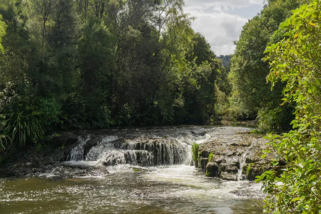
Waipohatu Falls
McLean Falls
Dolamore Park walks
Day hikes in Southland
Hauroko Lookout
Bald Hill
Aparima Hut
Makarewa Falls
East Peak
Mt Burns / Eldrig Peak
Titan Rocks
Southland Walks
Round Hill / Long Hilly track
1hr return – 2.7km – 100m elevation gain
This is one of my favourite short walks in Southland, about an hour’s drive from Invercargill. This was once the largest Chinese settlement in the entire southern hemisphere during the gold rush. Many gold mining relics still remain including dams, old shafts and carved out tramways.
Dogs are allowed on lead. Supervision is needed for young children due to open waterways, drop-offs and unmarked mining shafts. There is a long-drop toilet at the start of the track, and popular Orepuki Beach Cafe is nearby.
More’s Reserve
Multiple options from 10 minutes – 2hrs return
Just above Riverton sits More’s Reserve with some great Southland walks. There are a few walks to do from the carpark:
- short 10-20 minute Hilltop Lookout Track with beautiful views
- slightly longer 45 minute return More’s Lookout Track from the left / north of the carpark
- 10-20 minute walk along King’s Track (save for December when the track is filled with Christmas Doors)
- and the 2 hour More’s Coastal Walk which can be very muddy and slippery, but rewards you with closer views of the dramatic coast line and the famous balancing rock
Dogs are allowed on lead. There is a toilet at the carpark and the first three walks are family friendly.
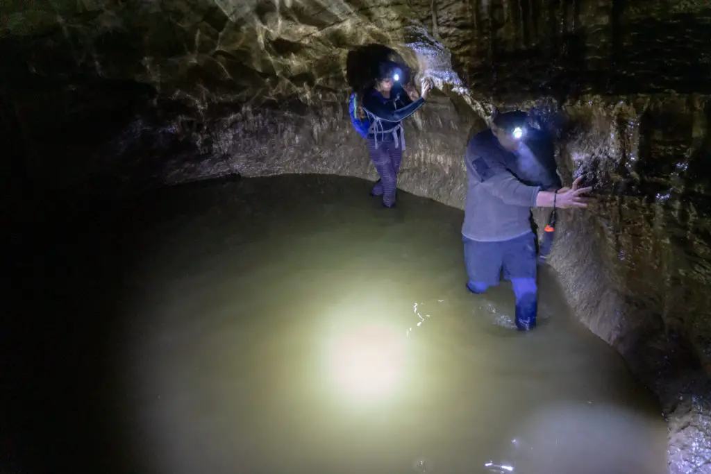
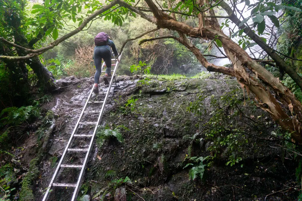
Clifden Caves
1-2 hours underground – your feet will get wet – some ladders involved
The Clifden Caves are a Southland must-do in my opinion (provided you don’t mind enclosed spaces underground). You’ll need a head torch, as well as clothes & footwear you don’t mind getting muddy, cold and wet. All the information on the Clifden Caves you need is over on this blog post.
Do not attempt the caves after or during heavy rain, as they can flash flood. Always check the weather forecast before going in. Not toddler, baby or dog friendly. Closest public toilets are in Tuatapere or Otautau.
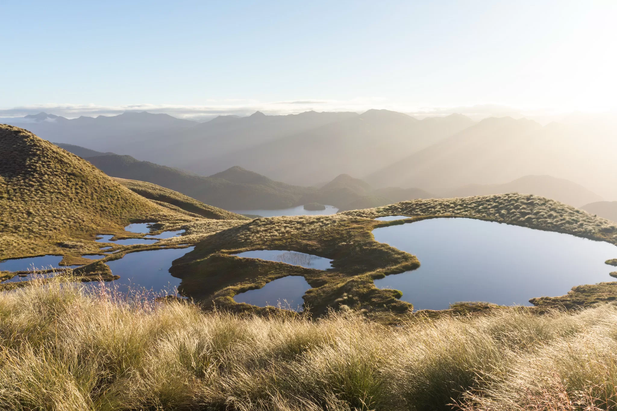
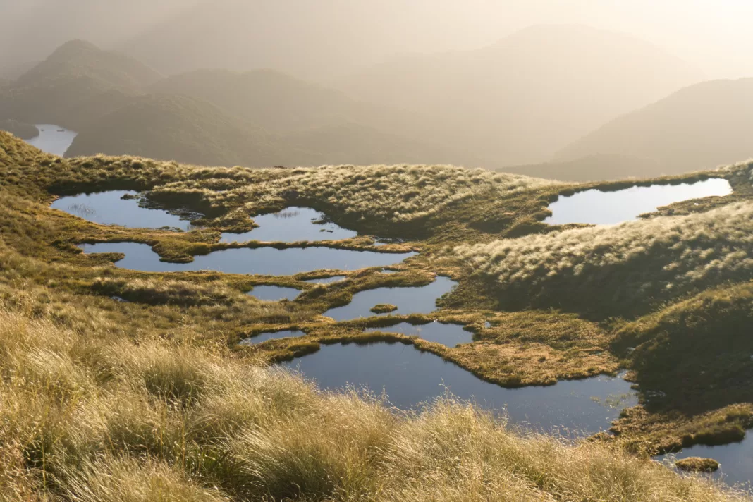
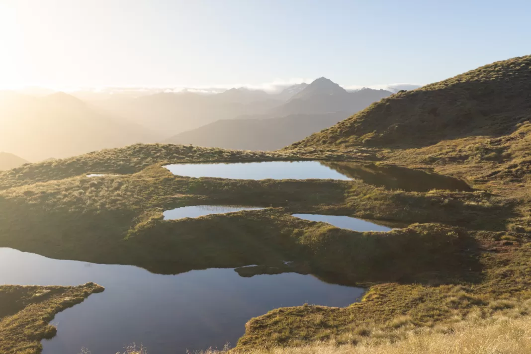
Mt Burns Tarns
1-2hrs return – 1.5km – 200m elevation gain
The Mt Burns or Borland Tarns are my absolute favourite Southland walk. The walk is such great bang for buck. You start from the second highest road in Southland, and within a short (but steep) climb, you’re above the treeline, surrounded by golden tussocks and mountains, not to mention the beautiful tarns.
There is a long-drop toilet at the carpark. Baby-carrying and kid friendly (so long as they don’t mind climbing uphill for 40+ minutes). Dogs are not permitted in Fiordland National Park. The carpark is up the Borland Road, a gravel road which shuts over winter.
Forest Hill / Derek Turnbull Track
Loop Track: 40-60 min return – 3.5km – 180m elevation gain
Derek Turnbull Track: 1.5-2hrs one-way – 10.5km – 300m elevation gain
Just 10 minutes’ drive south of Winton lies Forest Hill, a patch of beautiful native bush covering interesting limestone terrain. There are two carparks on either end of the reserve (Forest Hill picnic area and Tussock Creek picnic area) and two main tracks which can be muddy in winter / after rain.
From the Forest Hill carpark a track climbs steadily to a nice lookout over the plains to the east. There is also the longer Derek Turnbull Track, which connects the two carparks. The Tussock Creek end of this track has a gentler uphill/downhill.
Both carparks have toilets. Dogs are allowed on lead only. The walks are kid friendly so long as they can handle uphill and a few steep drop offs in the forest.
Forks Flat
40-60 min loop – 3.6km – minimal elevation gain
This is an easy loop track that is about a 40 minute drive from Invercargill (search “Dunsdale Scenic Reserve” in Google Maps for directions). The camping/picnic area is pretty, and there is also a small waterfall about 5 minutes up the track on the opposite side of the stream. A clearing at the halfway point is great for summer picnics.
Access to the camping area at the start of the track is through pine forests which can be closed for logging. Check the DOC website for up-to-date alerts. Dogs are allowed on lead. The Southland walk is baby-wearing and kid friendly, although follows a stream most of the way. There are toilets at the carpark / campsite.
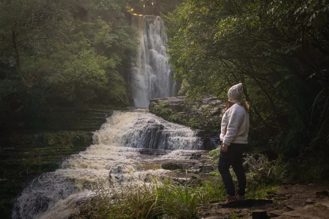
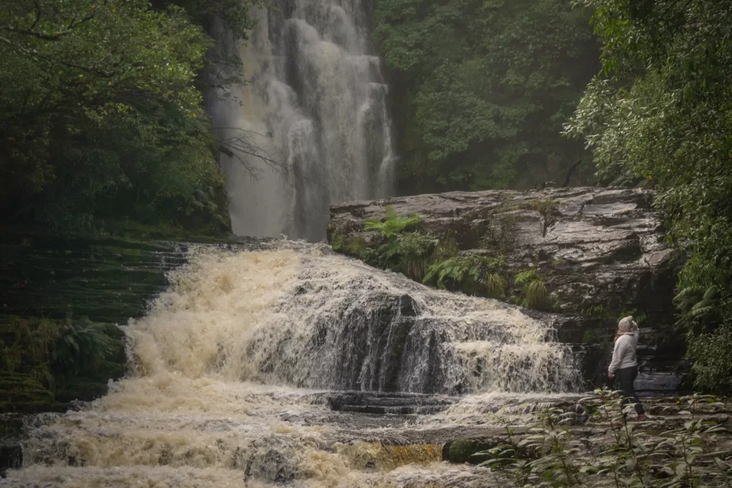
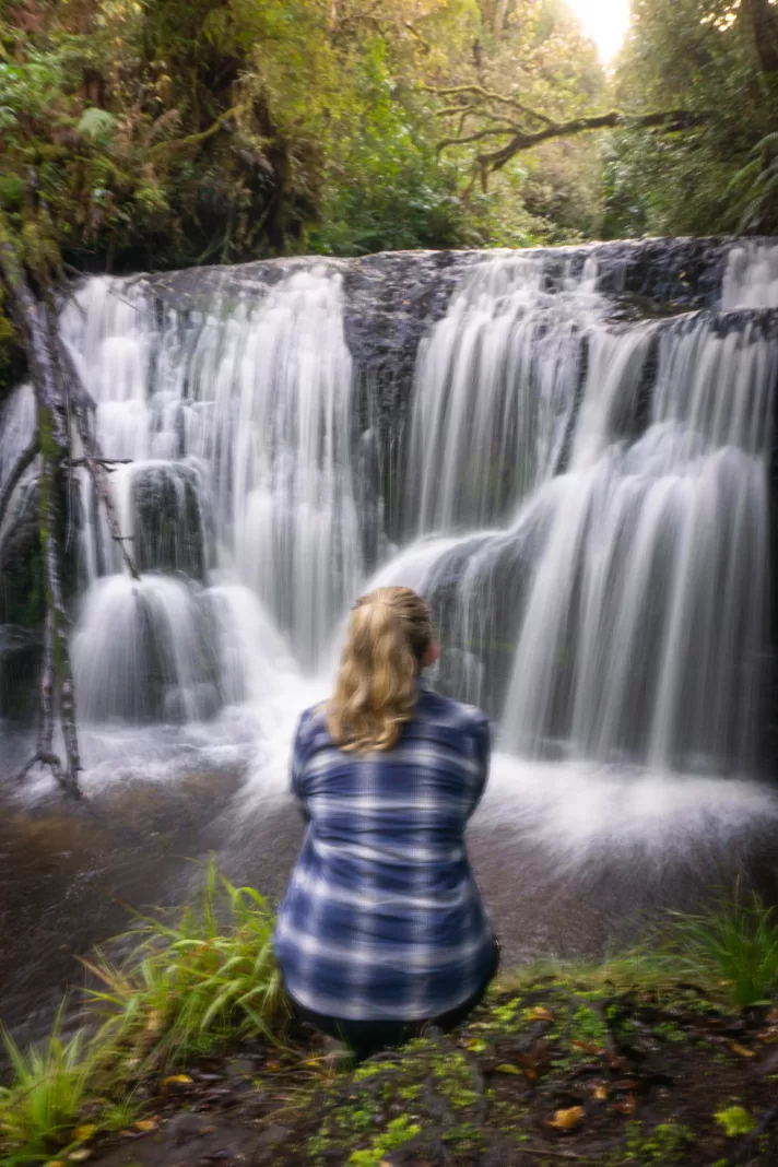
McLean Falls
40 min return – 2km – less than 100m elevation gain
McLean Falls are an iconic Southland walk in the Catlins. The walk itself is relatively easy, with a short but steep climb up to the waterfall at the very end of the track. Like many Catlins tracks, it can be wet and muddy underfoot. There are some drop-offs, but it’s otherwise a family friendly walk. Dogs are allowed on lead. There is a toilet at the carpark.
Waipohatu Falls
2-3hrs return – 7km – 550m elevation gain
This is a less popular track in the Catlins compared to McLean Falls, but with two waterfalls it’s worth the detour, especially if you’re wanting to encounter less people. The track itself can be very muddy, so bring boots and/or poles. Dogs are allowed on lead. There is a toilet by the carpark.
Dolamore Park Walks
Various options from 10min – 2hrs return
Dolamore Park, just 15 minutes’ drive from Gore, is a great family spot. There is a large playground, public toilets, free-to-use BBQs, campground (with power sites) and a disc golf course. No dogs are allowed in the park.
There are several trails to choose from. I’d recommend the Dolamore Loop Track (+ lookout, which can be a bit overgrown). This track takes 1.5 hours return with some uphill climbing. You can check out more Dolamore Park walks here.
Southland Day Hikes
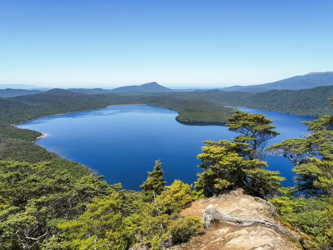
Hauroko Lookout
3hrs return – 5km – 400m elevation gain
This lookout track somehow flies under the radar, despite providing fantastic views out over Lake Hauroko and all the way out to Te Waewae Bay. The track is rough and steep, and, depending on the season, often has windfall.
Dogs are not allowed in Fiordland National Park. Not recommended for baby-carrying/young children due to rough/slippery track, steepness and drop-offs. There is a toilet at the carpark.
Bald Hill / Big Baldie
Bald Hill / Big Baldie is the highest point in the Longwoods range at 805m. There is a building + mast on the top, as well as patchy cellphone coverage. The Longwoods are a popular hunting area, so wear highly visible clothing / be careful if going off track. Dogs are allowed. Closest public toilet is in Otautau.
There are two ways to access Big Baldie:
- Easy way: take the forestry roads to a locked gate, then walk along the gravel access road for 20-30 minutes to the top. This way is family friendly. The forestry roads are like a maze and not always be open to the public. Message me for more info.
- Harder way: the Te Araroa (TA) trail runs through the Longwood Range, and walking a section of it takes you to the top of Big Baldie. Drive as far up Merrivale Road as your vehicle will allow (it quickly turns into a VERY rugged 4WD road). Continue on the road by foot until you reach an old carpark and a sign marking the start of the tramping track, which leads through forest to the summit. My watch read 16km return, taking 6.5 hours. Be prepared for mud (translation: this is one of the muddiest parts of the whole TA, which I will remind you spans the whole country).
Another more rugged, but shorter option is what my family call “Little Baldie” (or Pt 745 just to the south of Big Baldie). This is accessed from the same forestry road at an abandoned quarry a kilometre or so before the locked gate. My parents’ tramping club helped create the track which is now part of the Te Araroa. Be prepared for even more mud (translation: there are bogs up to your hips, ask me how I know).
Aparima Hut
4-5hrs return – 12km – minimal elevation gain
Popular with families and TA walkers, Aparima Hut is one of the most easily accessible huts in the Takitimu Mountains (of which there are many). Drive to the end of Dunrobin Valley Road (stop at the farm boundary at Pleasant Creek) to start the walk.
The track is rough underfoot with a few short but steep bank climbs, patches of mud and a couple of stream crossings. There is a swing-bridge over the Aparima River right before you reach the hut. No dogs allowed. Long-drop toilet at the hut, otherwise Mossburn has the closest public toilets.
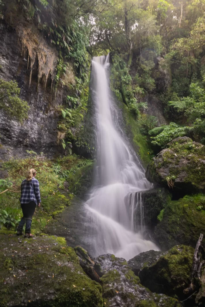
Makarewa Falls
6hrs return – 16km – 550m elevation gain
The Makarewa Falls Track leads to the tallest waterfall in Southland outside of Fiordland. It was developed by the Winton Rotary Club. The track is rough in parts, including a lot of mud, and it can be easy to lose your way in the forest.
The start of the track crosses private land (a working farm), so although dogs are allowed in the Hokonui Forest Conservation Area, please contact the farm owner to ensure they are allowed on the track. Closest public toilets are in Winton.
Check out my article on the Makarewa Falls Track for all the information you need.
East Peak, Croydon Bush
3-4hrs return – 6km – 440m elevation gain
East Peak provides 360 degree views and is worth the steep, rough climb up! Park at the end of Croydon Bush Road and then choose from the following options:
- Grant’s Track: the easiest and most worn track, but least direct
- Middle Track: steep and rocky ridge climb, but the most direct (best to go up rather than down)
- Richardson Track: not as steep as Middle Track, but can be quite muddy
All tracks are rough and can be particularly muddy over winter. Middle and Richardson Tracks involve some small stream crossings. Once above the treeline and on the summit you are exposed to the weather which can often be quite windy. No dogs allowed. Closest toilets are in Dolamore Park or Gore.
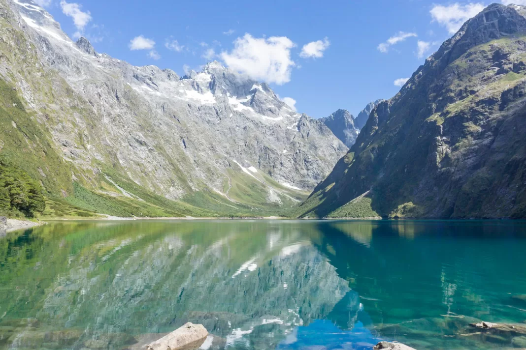
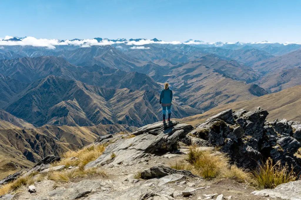
Mt Burns or Eldrig Peak
Both of these mountains are in Fiordland National Park with amazing 360 degree views for the adventurers who reach their summits. Each route is accessed from the Borland Road (same as the Mt Burns Tarns track mentioned above). The Borland Road closes over winter.
Eldrig Peak is a 1,300m climb over 6km one-way (i.e. very steep) and takes 10-12 hours return. This track is for experienced trampers only. The upper section can be very exposed / rough and should only be attempted by those who are comfortable with scrambling and who have a head for heights.
Mt Burns, despite being higher than Eldrig Peak, is slightly easier (since you start higher up the road). It is still a big day out with a 700m climb over 6km one-way, taking around 5-7 hours return. And there is still bit of a rocky scramble just before the true summit. Edward’s Hiking Scenery blog and Wilderness magazine both have great route descriptions.
Titan Rocks Track
7hrs return – 15km – 1,100m elevation gain
Starting from the popular Piano Flat campsite north of Waikaia, this is a steep and at times relatively unmarked trail. The first part in the forest is easy to follow (although often has treefall to navigate around), but becomes a lot harder to follow once above the treeline. I’d recommend using GPS/topomap to ensure you’re on the right route, and wearing gaiters for the mud/scrub. From the summit rocks there are amazing 360 degree views that make the effort worth it.
There are so many more Southland walks and day hikes that I could have included in this list, so please reach out if you want any other ideas for Southland walks and tramps.
Where should I explore next?
Best Fiordland / Te Anau Day Hikes
Fiordland and Te Anau have some amazing adventures to choose from. Here are the 12 best day hikes!
Best Queenstown Day Hikes
Queenstown is known for being surrounded by amazing hikes. Check out this list for all the best ones you need to explore!
Long hilly track is one of my favs
Me too! Can’t wait for my little toddler to be big enough to walk that one!